Appalachian Trail: Mohican Camp Road to PA State Line (Delaware Water Gap National Recreation Area & Worthington State Forest)
Hike Type: One-Way
Distance: 10.7 miles
Elevation: 899 feet
Time: 5 hours, 0 minutes
Hiking Challenges: New Jersey Appalachian Trail
The Hike
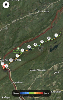
The first hike in a series of three to kick off the weekend! Gen came down from New England for a few days (three days spent hiking, one day for Great Adventure, and then most importantly, a Backstreet Boys concert) and she agreed to help me out with some hikes by car spotting and being another human. I had been really looking forward to this one. The plan was to drop a car at Kittatinny Point Visitor Center and then drive to Mohican Camp Road for the one-way hike. I had hiked in Worthington State Forest plenty of times, but never made it to Sunfish Pond before. I had also always wanted to walk out to the state border, so this was the day!

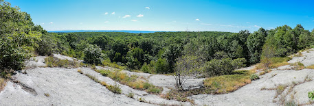
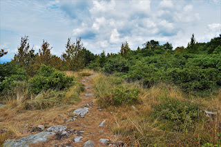
There is a small pull-off on Mohican Camp Road where we parked. Mohican Camp Road is a gravel road in ROUGH shape. Lots of deep potholes and ruts. My CRV was fine going slow, but I can foresee a car with lower clearance having troubles. The parking area is right at the Appalachian Trail at what appeared to be either a tentsite or a large clearing with room for tents, whether or not its allowed. This first part of the trail is mostly in the woods and climbs steadily and gently. The views start soon after, mimicking the gorgeous section of trail on the other side of Mohican Camp Road. After the junction with the blue-blazed Kaiser trail, the Appalachian Trail officially leaves the Delaware Water Gap National Recreation Area and enters Worthington State Forest, and the beautiful Racoon Ridge is soon after.

I'm still trying to figure out if the names Mount Mohican and Raccoon Ridge are interchangeable or if Raccoon Ridge is a section of Mount Mohican, but either way the views were beautiful and there was a large summit cairn to mark the area. According the NYNJTC Map #120, this area is also a birding hotspot. There was a thru-hiker sitting at the cairn, so I didn't take a photo of it, but we did enjoy the views of the river and valley in one direction and the ridge along Mt. Tammany in the other.

There was a power cut right after the main viewing area that offered more views, and then the trail returned into the woods towards Sunfish Pond. There was a good amount of bear evidence (read: poop) on the trails surrounding the pond, which makes sense considering the endless blueberry bushes all around. The trail gets very rough and rocky after the Sunfish Pond Natural Area sign, which slowed us down. There are a few areas to view the pond from the trail - we ended up taking a break about halfway along the pond on a rocky field surrounded with blueberry bushes that were probably just a week or two from being ripe. The pond water was still with the occasional bird or fish splashing about, but otherwise it was incredibly peaceful.

Closer to the western edge of the pond, the trail is right along the water and we had the opportunity to gawk at some beautiful frogs, fish, and tadpoles. The trail finally becomes more forgiving/less rocky at the western edge of the pond, where we took one last look before starting the next leg of our hike. Between Sunfish Pond and I-80, the trail appears to follow an old woods road that varies from lovely, rolling, and gentle, to rocky and disrespectful. The woods are generally beautiful and open, where you can hear the distant sound of Dunnfield Creek. We passed someone's homemade 1300-mile sign out of rocks (an AT milestone) and had to cross two blowdowns - one was a hop over and one had a herd path around.

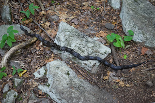
Toward the trail junction with the Dunnfield Creek Trail, a stick fell from the sky, nearly smacking Gen on the head. I looked up, expecting a rude squirrel to be giggling about, but instead found a porcupine at least 30 feet in the air munching on its dinner - first time I saw one in NJ! We also saw our only snake of the trip - an Eastern Ribbon Snake. The woods part of the trail terminates at the Mt. Tammany/Dunnfield Creek parking lot, and then the road walk begins!

The trail passes under I-80 and then follows the road leading to the Kittatinny Point Visitor Center. I noticed some raspberry-like berries along this route, so I took out the "Seek" app and found out that they were Wineberry bushes, and they were edible! Gen and I had a mini feast along this section. They tasted like raspberries, but more sweet than tart. The road in this section was rough - which reminded me about the "No National Park" group mentioned the deteriorating infrastructure in this park. Anyway, we made it back to Gen's car, dropped our bags, and got ready for the last bit of trail we had left for the day.

The walk to the NJ/PA border was along the road, and then on the I-80 bridge. Very straightforward, but our feet were feeling the burn from an afternoon hiking on rocks. The sun was setting, providing nice views of Mt. Tammany and Mt. Minsi, and it was fun to look down into the river from the bridge. We soon made it to the border, took a few photos, joked about not wanting to spend too much time in PA, and made it back to the car! We headed back to Mohican Camp Road to get my car, and then headed to the Hibernia Diner for a classic NJ dinner.
Step-By-Step
Start hike on the Appalachian Trail Southbound from Mohican Camp Road.
At junction with red-blazed Coppermine Trail, continue on AT Southbound.
Trail joins blue-blazed Kaiser Trail.
Trail leaves blue-blazed Kaiser Trail.
Trail enters Worthington State Forest.
Trail crosses Raccoon Ridge.
At junction with orange-blazed Garvey Springs trial, continue on AT Southbound.
At junction with blue-blazed Buckwood trail, continue on AT Southbound.
At western end of Sunfish Pond, continue on AT Southbound.
At junction with blue-blazed Douglas Trail, continue on AT Southbound.
At junction with yellow-blazed Fairview (Beulahland) Trail and red-blazed Holly Springs Trail, continue on AT Southbound.
Continue to follow white blazes to Dunnfield Creek Natural Area parking area and along road walk.
Follow blazes along road to I-80 bridge, and then to NJ/PA State Line.
Turn around, follow blazes back to car.
"Worthington State Forest" from NYNJTC Map #120
"Located within the boundaries of the Delaware Water Gap National Recreation Area, but administered separately by the State of New Jersey, Worthington State Forest contains some of the most rugged terrain in the state. Comprising the southern part of the Kittatinny Ridge, the state forest extends approximately seven miles along the ridge and includes 6,660 acres.
Worthington was once called Buckwood Park, a private deer preserve of engineer Charles Campbell Worthington. His retirement home, Shawnee-on-Delaware, was later developed as a resort. Buckwood Park was first leased to the state as a game preserve in 1916, and was purchased from the Worthington estate in 1954. Among the forest's features is a glacial lake, Sunfish Pond, which was restored to the state after a long fight by conservationists defeated a planned pumped-storage utility project there.
At the southern end of the forest is the Dunnfield Creek Natural Area. The creek tumbles over a waterfall on its way from Mount Tammany to the Delaware River, and it is one of the few in the state to support native brook trout. Overlooking this rocky stream are stands of hemlock, maple, and birch. Mountain laurel adds color to the area when in bloom.
For more information, contact Worthington State Forest, HC62, Box 2, Columbia, NJ 07832; (908) 841-9575; www.njparksandforests.org."
"Trails in Worthington State Forest" from NYNJTC Map #120
"The trails in Worthington State Forest are among the most heavily used in the entire state, with the summit of Mount Tammany and Sunfish Pond being popular destinations. The Appalachian Trail runs through the center of the forest, and many other trails connect with it, making possible a variety of loop hikes. One popular hike combined the Mount Tammany (Red Dot) and the Pahaquarry (Blue Dot) Trails to make a 3.8-mile loop to the summit of Mount Tammany from the Dunnfield Creek parking area - a strenuous hike, with an elevation gain of over 1,000 feet. [...]."
"Delaware Water Gap National Recreation Area" from Appalachian Trail Guide to NY - NJ, 18th Ed.
"The largest federal recreation area in the East, this 70,000-acre preserve extends along 40 miles of the Delaware River in Pennsylvania and New Jersey. It was originally planned as part of a hydroelectric dam project; the recreation area would have been along the shores of the lake. Many dwellings were destroyed and hundreds displaced in the farming country along the river before plans for the dam were shelved after intense opposition. Beginning in the 1980's, the National Park Service began developing beaches, roads, boat launches, picnic areas, and trails and preserving the remaining structures."
Excerpt from Guide to the Appalachian Trail from the CT-NY State Line to the Susquehanna River, PA, 4th Ed.
"The trail follows a general southwesterly direction over Mt. Mohican with good views to Sunfish Pond. From Sunfish Pond (1,378 ft.) picturesquely located near the summit of the ridge, trail descends to Dunnfield creek. This part is heavily wooded and affords no views.
In this section of the trail, many changes have occured. The land of the Rossiter Realty Company, which was known as the Worthing Estate, has been sold to the State of New Jersey and will be used as a hunting and fishing preserve. In addition, they plan to build a car and trailer campsite in the near future. It will not be necessary as in the pasat to be a member of a club associated with the NY-NJ Trail Conference to cross this land.
The old AT over Mt. Tammany and down the old macadam road has been abandoned due to the construction of the new Route 611. A high fence has been built on the boundary of Camp Weygadt but there still is a gate where the old trail emerges on the highway. The elimination of this trail and the rerouting of the AT over the new bridge saves an 8.3m. trip. Before one to go to Columbia, cross over the covered bridge (washed away) into Portland and back on the west shore of the Delawre.
Part of the old AT has now become the Mt. Tammany Trail (Indian Head) and it cannover be overpraised as a side trip. This trail, 2.4 m. long, reaches the top of Mt. Tammany where from the overlook a wonderful view of the Delaware River, the Pocono Mtns. and Mt. Minsi just across the river can be obtained. From the overlook, this trail descends steeply along the face of the mountain to Route 611 in about 200 yds. north of the Camp Weygadt fence.
DWGNRA Appalachian Trail Map
NJDEP Worthington State Forest Map
NJDEP Worthington State Forest Zoomed Map
NJDEP Worthington State Forest Map (Older)
NYNJTC Worthington State Forest Map
Photo Album


