Showing posts with label Trail Trace the Blue Hills. Show all posts

Thursday, June 19, 2025

Braintree Pass, Savoy, Streamside Edge, Branch Paths (Blue Hills Reservation)

Braintree Pass, Savoy, Streamside Edge, Branch Paths (Blue Hills Reservation)

Hike Type: Tracing Loop
Distance: 5.06 miles
Elevation: 581 feet
Time: 1 hours, 45 minutes
Hiking Challenges: Trail Trace the Blue Hills 

The Hike 
First hike in a while! At least in a while for me! After my busy week last week, I had Boston Pride Weekend, which is a hike in itself, and then I managed to get sick for the 1,000th time in 2025! (I had a tonsil stone that I apparently dug out too aggressively and subsequently infected my throat and then my ear... ridiculous). It was a humid 70 degrees and the trailhead was unfortuantely pretty full for 8:00am. I wasn't feeling 100%, but I wanted to do the best I could! My goal was to hit most, if not all the trails I needed to finish the Chickatawbut section.


I started by passing a super nice older man on the Braintree Pass Path, which was super lush with vegetation. I saw a dog poop covered in a fuzzy fungus as I made my way over to Bouncing Brook Path, making my way to the back half of Pipe Line, which was uncomfortably (but expectedly) grassy. There was also an impressive number of ant hills on the Pipe Line, which was interesting. 


I was high stepping like a fool near the end of Pipe Line, hoping to avoid brushing against too many blades of grass, dodging some nice deer prints, too. 30 minutes into my hike I put my bug spray on as I climbed up Savoy Path, which smelled strangely wonderful. I enjoyed the little view at the height-of-land on Hawk Hill Path near the terminus of Savoy, and did a quick out-and-back to 3011. 

Continuing on Hawk Hill Path heading toward Streamside Edge Path, I saw what I'm pretty sure was a pile of bear poop! I didn't know we had bears here, but I do remember when Sarah and I hiked Wood/Romari Paths I saw some scrapes on a tree that also looked bear-related... interesting!


Streamside Edge Path was not too wonderful. The closer I hiked toward I-93 the buggier and more overgrown the trail became, but at least I finished it! I described it in my notes as "remarkably unpleasant." Only plus side was that I saw my first ghost pipe of the year!


Once I closed the Streamside Edge/Branch loop I decided I'd start my return trip, leaving only one hike left in this section to close it out for my map. My return trip was nice and easy, and the sun even started to come out! Near the very end, I did almost get stampeeded by a running club, but thanfkully I escaped the hike un-trambled and with zero ticks!


Step-by-Step
- Start hike from Braintree Pass Path Trailhead.
- Follow Braintree Pass Path.
- After 3042, turn right onto Bouncing Brook Path.
- At MA-28, turn around.
- At 3011, turn left onto Pipe Line.
- At 3013, turn around.
- At MA-28, turn around.
- At 3005, turn right onto Hawk Hill Path.
- Immediately after, turn right again onto Pakomet Path.
- At terminus, turn right onto Savoy Path.
- At MA-28, turn around.
- At 3030, turn left onto Hawk Hill Path.
- At Pakomet Path, turn around.
- At 3072, turn right onto Streamside Edge Path.
- At terminus, turn left onto Branch Path.
- At 3066, continue right onto Streamside Edge Path.
- At 3072, continue straight onto Braintree Pass Path.
- Follow Braintree Pass Path back to car.

Tuesday, June 3, 2025

Great Dome, Ridge, Wood, Romari, Squamaug Notch, & Skyline Trails (Blue Hills Reservation)

Great Dome, Ridge, Wood, Romari, Squamaug Notch, & Skyline Trails (Blue Hills Reservation)

Hike Type: oo-o Loop
Distance: 5.08 miles
Elevation: 597 feet
Time: 2 hours, 18 minutes
Hiking Challenges: 52 Hike Challenge 2025, Trail Trace the Blue Hills, Blue Hills Grid

The Hike 
Sarah and I both decided we did NOT want to do a fitness hike after school, so she agreed to follow me around as I did some tracing in the Quincy and Chickatawbut areas! I had a CODE YELLOW drive, especially towards the end, but thankfully avoided any disaster. We got hiking at 4:00pm from the Chickatawbut Overlook parking area, first by following Chickatawbut Road and then following Great Dome Foot Path, where Sarah managed to roll her bad ankle twice! Boo!


We meandered down to Pine Tree Brook Path, Sassaman Path, and then Ridge Path, which brought us across Chickatawbut Road and over to the Chickatawbut Hill side of the reservation. We noticed an abundance of allegheny blackberry bushes and some baby baby blueberries! We continued over to Wood and Romari Paths, which were kind of underwhelming (as usual) and just buggy enough to be annoying. We did see FOUR frogs, though!


We slowly worked our way back to Squamaug Notch Path and decided to get some views on the Skyline Trail, which was an EXCELLENT move. Time felt slower than usual and I was mentally lagging, but following the Skyline Trail to Nahanton Hill brought me right back. The golden hour from the sun was stunning, and the views were wonderful. There were SO MANY baby blueberries, too!


We eventually made our way up and over Nahanton, down to the tower, and back to the car. A lovely afternoon!


Step-by-Step
- Park at Chickatawbut Overlook.
- Start by hiking east on Chickatawbut Road.
- At 4053, turn left and veer right onto Great Dome Foot Path.
- At 4073, turn left on Pine Tree Brook Path.
- At 4094, turn left onto Headquarters Path.
- At 4048, turn left onto Sassaman Path.
- At jct., turn right onto Ridge Path.
- At Chickatawbut Road, cross Chickatawbut Road and continue.
- At 3131, turn left onto Squamaug Notch Path.
- Before 3143, turn left onto Curve Path.
- At 3157, turn left onto Wood Path.
- At Wood Road, turn around.
- At 3174, veer left onto Romari Path.
- At 3152, turn right onto Curve Path.
- At 3143, turn right onto Squamaug Notch Path.
- At 3144, turn left onto Skyline Trail.
- At 3103, continue veering right.
- At Slide Notch Path, continue straight onto Tower Path.
- Return to car.

Monday, May 26, 2025

Cedar Rock & Pasture Run Paths, CCC Camp, Ridge Path, & Nahanton Hill (Blue Hills Reservation)

Cedar Rock & Pasture Run Paths, CCC Camp, Ridge Path, & Nahanton Hill (Blue Hills Reservation)

Hike Type: O-O Loop with Spurs
Distance: 5.32 miles
Elevation: 643 feet
Time: 1 hours, 48 minutes
Hiking Challenges: Trail Trace the Blue Hills

The Hike 
First hike in over a week! The weather had been dreadful for the past week and I had what I affectionately call "Chorus Week," where I had a field trip and an after-school concert, so it's been busy! Some friends from New Jersey came up for Memorial Day Weekend, which was wonderful, and the sun FINALLY came out once I dropped them off at the airport, so it was time to get back to the Blue Hills! The drive from Logan to the Chickatawbut Overlook was shockingly docile and easy. I ate like a KING this weekend, so I was looking forward to getting some exercise in. My only plan was to hike some trails I needed for tracing on the Quincy and maybe Chickatawbut side - really just let the wind take me! It was 61 degrees, mostly sunny, I forgot my camera at home, and just after 11:00am I began my hike!


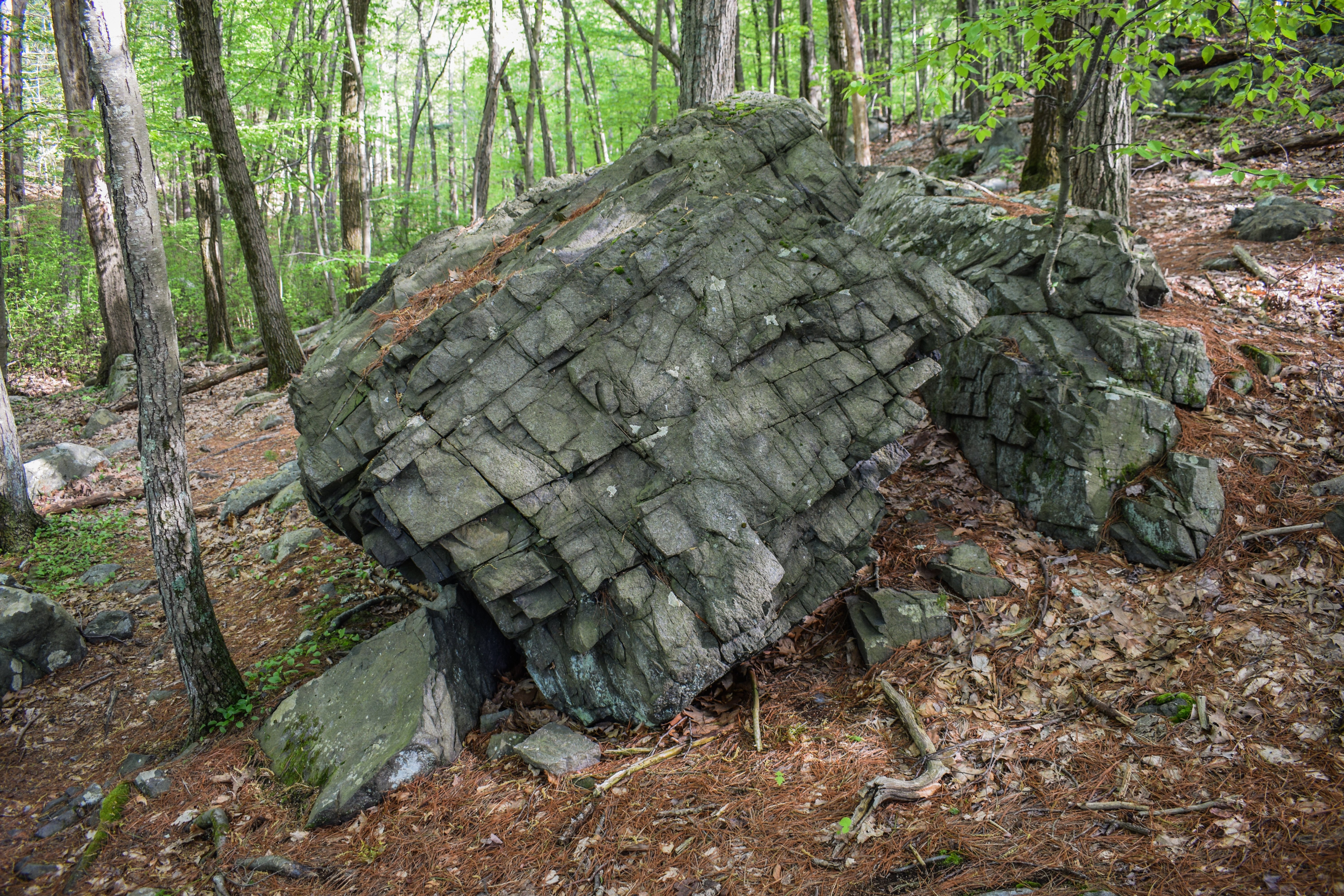
I started by descending along the Cedar Rock Path, which smelled wonderfully of summer. The ferns have officially unfurled and small flowers created a delightful aroma. There's a good number of criss-crossing trails around Cedar Rock Path, but the correct one is always the one that feels the most correct. I continued on Pipe Line for just a second before crossing a wet spot and climbing up Pasture Run, where I saw some Witch Hazel Cone Gall Aphids accoding to the Seek app. They looked like little red cones on the broad witch hazel leafs - pretty cool!


I kept looking at the map, trying to figure out how to most effectively hike this cluster of zig-zagging trails, and eventually got overwhelemd and decided to head to the CCC Camp instead. I had hiked a full mile before seeing other people, which was a huge win for lunchtime on Memorial Day! There were some unleashed dogs on the Pipe Line which annoyed me, but I got well ahead of them. 

I turned onto Sawcut Notch Path at a sign that indicated "CCC Camp 800 Yards" and I wondered if anyone actually knows what 800 yards feels like.. (according to Google's calculations, it's 0.45 miles). The undergrowth was strong in a wet area and it looked like an old culvert had finally failed (UPDATE: Yes, I am correct. I have a photo of the culvert from March 12, 2023 where it was still mostly in-tact). 


I next hiked Minuteman Path to the border of the reservation. The recent heavy rains effectively brushed the trail, which was nice. I turned around at the state land border and continued onto CCC Trail, which is always a favorite (even if becoming a bit overgrown). The old Sassaman Path was officially marked as closed and I couldn't help but wonder about how the CCC Camp would look without all of the new growth, but I understand why they are letting it grow in.


After the height-of-land on the CCC Trail, the path descended past endless wild geranium which smelled wonderfully. I continued onto Nike Ajax and back to Sawcut Notch Paths where I did some productive work (i.e., responding to emails, tallying up the Venmo charges from the weekend, and actually responding to texts I had forgotten about), eventually crossing an older woman who was holding some of the wild geranium and said "I come here once a year to identify plants, but every year I forget which one is which!" which gave me a laugh.

I had hoped to also get the Pipe Line to Little Dome loop, but the trail was grassy and flooded - not today, satan! I began to wiggle my way back to Chickatawbut Road, and just after getting onto Indian Camp Path, I passed a pink lady slipper! My favorite flower!

The trail got grassier once on Great Dome Foot Path, which soon crossed the outflow stream from the Blue Hills Reservoir (which may or not be Pine Tree Brook proper), climbed up a steep, grassy hill, and then turned onto Pine Tree Brook Trail, which I followed all the way to Chickatawbut Road. I crossed the brook again near the road, and the final bit of trail nearest the road was flooded and required a bit of bushwhacking.

From here, I crossed Chickatawbut Road on Ridge Path, climbed up to Squamaug Notch Path, and climbed up Nahanton Hill via Endicott Path and Skyline Trail. The view was wonderful, but the crowds of people were not. I had dreamt of following Skyline to Chickatawbut, but quickly bailed. There were even a good number of people on the backside of Nahanton, which solidified my decision. 

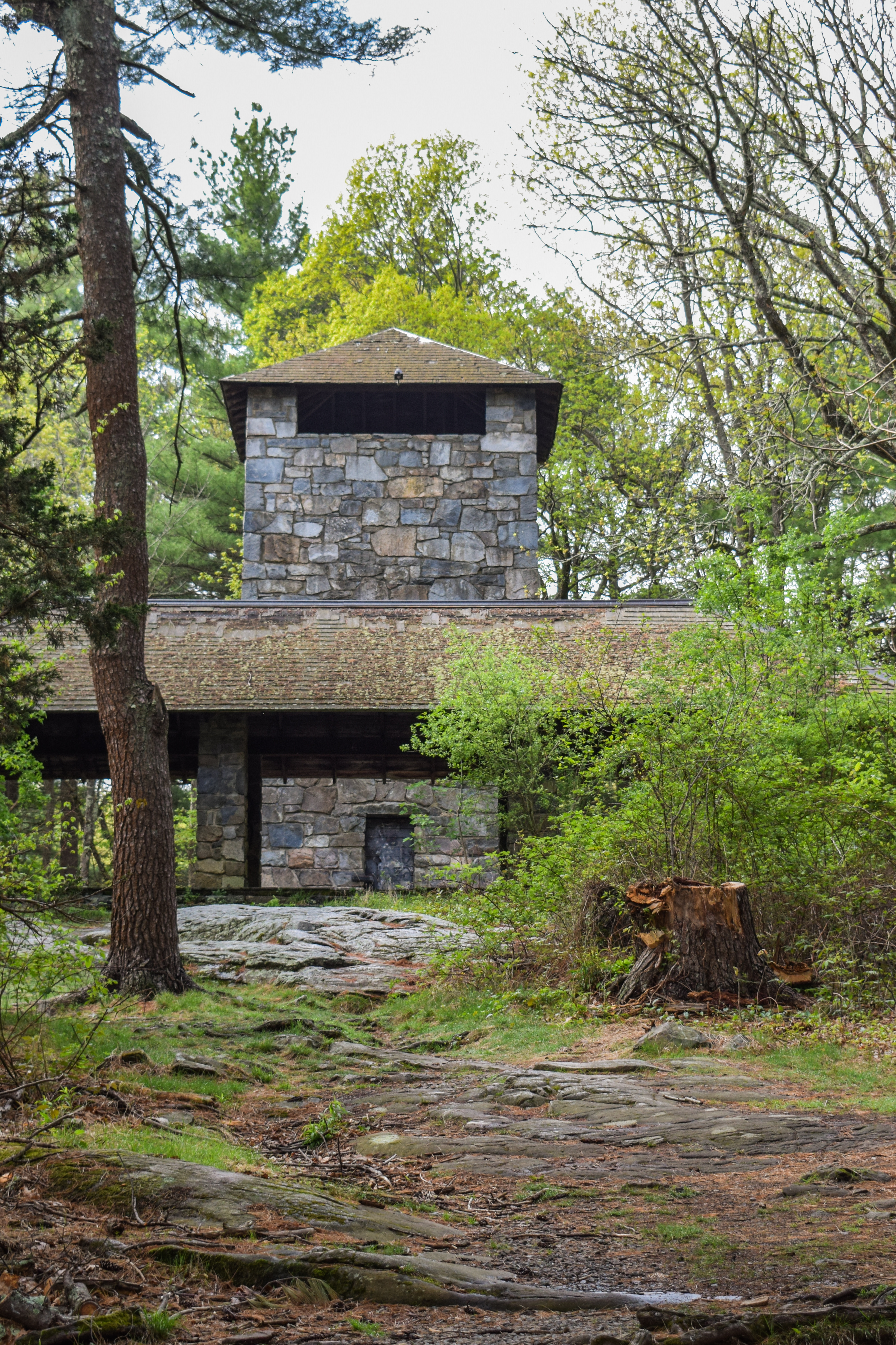
I made my way down to Tower Path on the back side of Nahanton (which showcased a nice view toward Mt. Monadnock) and followed the path to the Tower and back to the car. It felt good to be back and it felt even better to be outside under blue skies!


Step-by-Step
- Start hike on Cedar Rock Path from Chickatawbut Overlook.
- At 4012, turn right. 
- At 4030, turn right onto Pasture Run.
- At 4052, turn left onto Chickatawbut Road.
- At 4053, turn left onto path.
- At jct., continue right onto Pasture Run.
- At split, veer right onto Sassaman Path.
- At 4048, turn right onto Pipe Line.
- At 4066, turn left onto Sawcut Notch Path.
- Before 4042, turn right onto Minuteman Path.
- At Blue Hills Reservation boundary, turn around.
- At terminus, turn right onto Sawcut Notch Path.
- At 4042, turn left onto CCC Trail.
- At 4010, turn left onto Nike Ajax Path.
- At 4009, turn around.
- At 4010, continue onto CCC Trail.
- At 4014, turn left onto Sawcut Notch Path.
- At 4011, turn around.
- At 4066, turn left onto Pipe Line.
- In 30 feet, turn around when the trail is too wet.
- At 4066, turn left onto Sawcut Notch Path.
- At 4083, turn left onto Crags Foot Path.
- At split, veer right.
- At terminus, turn right onto Indian Camp Path.
- At 4086, turn right onto path.
- At 4082, turn left onto Pleasant Trail.
- At 4085, turn right onto Indian Camp Path.
- At 4090, turn left onto Great Dome Foot Path.
- At 4073, turn left onto Pine Tree Brook Path.
- At terminus, turn left onto Ridge Path.
- Cross Chickatawbut Road.
- Continue on Ridge Path.
- At 3131, turn left onto Squamaug Notch Path.
- At next jct., turn right onto Endicott Path.
- At 3132, turn right onto Skyline Trail.
- At 3103, continue straight onto path.
- At jct., turn right to descend.
- At jct., continue onto Tower Path.
- At Chickatawbut Tower, turn right and return to car.

Wednesday, May 7, 2025

Buck Hill via Bugbee, Dark Hollow, HQ, Buck Hill, Fells, Beech Hollow Paths (Blue Hills Reservation)

Buck Hill via Bugbee, Dark Hollow, HQ, Buck Hill, Fells, Beech Hollow Paths (Blue Hills Reservation)

Hike Type: Tracing Loop
Distance: 4.72 miles
Elevation: 525 feet
Time: 1 hour, 42 minutes
Hiking Challenges: 52 Hike Challenge; Trail Trace the Blue Hills

The Hike 
I had a slow, Wednesday drive to the Blue Hills and hardly a plan. I ended up in Houghton's Pond Parking Lot C, where I'd never been before! I figured I'd just trace some needed trails and see where that led me. It was a wonderful 70 degrees out with partly cloudy skies and a glorius breeze - really a beautiful afternoon! I did a quick pee in the porta potty and then suited up for my adventure. 


I started by following the path the edges the forest past the picnic area, enjoying the view of Great Blue Hill from the pond, and then made my way over to the pavement for an unpleaseant climb. Things improved once on Bugbee Path, and the trail smelled like summer! Only issue with that was that the pollen was also out and proud, and I was SNEEZING up a storm.


I ducked under an easy blowdown on Dark Hollow Path and did a little loop at 2112 to hit a couple spurs I needed. It was a little buggy on the Quincy Path, but not muddy! I continued past the old Buck Hill summit trail, which is clearly still in use, and then worked my way over to the Buck Hill Path.


The upper stretch of Buck Hill Path has burn evidence on the right, which was both pretty and eerie. Once at the Skyline junction, I braved the steepness and climbed up to beautiful Buck Hill! The climb really wasn't that bad. Steep, sure, but short. The view to Great Blue Hill and Hancock Hill were excellent, and Wachusett wasn't looking too shabby either. There was also a stunning breeze.


Some springtime observations I found: plenty of tent catepillars, black chokeberries had white flowers, black huckleberries had red buds, and Wooly Catkin Gall Wasps created these cotton-like puffs on some bushes, which I had never noticed before. I spent a decent amount of time on the Seek app while on Buck, which was super fun.


On my descent, I planned to just get needed trails that were roughly on the way back, which was primarily Fells Path and Beech Hollow Path, with a few spurs on either side. I was reflecting on my spring so far (and winter) and felt really proud of myself for making Wednesday hikes a semi-regular thing. I used to easily talk my self out of hiking on Wednesdays since I get out at 3:00pm, therefor get hiking later, but this year I've just... done it!

The bugs were getting more... friendly at this point in the day, and the clouds were rolling in. I felt like Old Route 128 was narrower than the last time I was there, which was definitely possible - it's a cool walk. I continued to sneeze up a storm as I hit a few final spurs, the last of which had a downed pine limb that smelled AMAZING. Soon enough I was back at the car and on my way home.


Step-by-Step
- Park at Houghton Pond Parking Lot C.
- Start hike on path that borders the woods along the picnic area.
- At halfway point, continue straight, veering right to 2053.
- At 2053, turn right to follow green blazes.
- At 2070, turn right onto Bugbee Path.
- At 2095, turn left onto Dark Hollow Path.
- At 2112, turn left onto Quincy Path.
- At jct., turn right onto Headquarters Path.
- At jct., turn right onto Dark Hollow Path and then immediately left onto Quincy Path.
- At terminus, continue onto Headquarters Path.
- At 2164, turn right onto Buck Hill Path.
- At 2181, turn right onto Skyline Trail.
- At 2141, turn left onto Doe Hollow Path.
- At jct., turn left onto Massachuseuck Trail.
- At 2152, turn right onto Fells Path.
- At 2149, turn left onto Pig Rock Path.
- At 2154, turn around.
- At 2149, turn left onto Fells Path.
- At 2140, turn right onto Bugbee Path.
- At 2135, turn left onto Beech Hollow Path.
- At 2132 , turn right onto Doe Holow Path.
- At jct., turn around.
- At 2132, turn right onto Beech Hollow Path.
- At jct., continue right. 
- At terminus, turn right onto Old Route 128.
- At 2100, turn right onto Angle Path.
- At 2092, turn left onto Burnt Hill Path.
- At 2085, turn right onto Old Route 128.
- Hike two spurs on right along Old Route 128, continue on Old Route 128.
- Return to car.


Monday, May 5, 2025

No Name, Prescott, Swamp, Ponkapoag Paths; Madden Road (Blue Hills Reservation)

No Name, Prescott, Swamp, Ponkapoag Paths; Madden Road (Blue Hills Reservation)

Hike Type: Loopty Loop
Distance: 4.81 miles
Elevation: 377 feet
Time: 1 hour, 48 minutes
Hiking Challenges: 52 Hike Challenge; Trail Trace the Blue Hills

The Hike 
After yesterday's achilles flare up, I planned to take this Cinco de Mayo Monday hike easy. It was a raw, misty, chilly 50 degrees out, and I just planned to hit the Madden Road corner of Ponkapoag with a bonus view of the pond from the cabins. Easy is the key word here! There was only one other car in the parking lot when I started my hike on Ponkapoag Trail, which was in it's green tunnel glory! Really beautiful start.


I noticed some orange blazes at 5322, I think marking the old Prescott Foot Path and whatever the long-distance trail was that traversed the entire park - I need to refresh my brain on the old maps. It was not raining out, but whenever a breeze hit the treetops, plenty of water fell on me. Once back on Ponkapoag Trail, I hiked past some flowering dogwood and some slugs munching on rotting logs. I continued onto Swamp and Duck Pond Foot Paths, the ladder of which had a narrower footbed and passed an EVIL looking road, which was super cool and extra spooky in this weather. 


I followed some horse prints over to Three Pines Path and Madden Road, where I also spooked a deer (thankfully he paused for a photo). My hands were chilly, but I was warm enough to take off my windbreaker after moving for a half-hour or so. The woods were super peaceful and calm, even with the sound of I-93 and MA-24.


Near the Three Pines Path/Madden Road corner, I noticed someone spray painted "I <3 TRUMP" on a tree, which gave me a lot of pause. One, don't paint trees, period. Two, why are we making the graffiti political? I also struggled with whether or not to take a photo of it, but I do like to take photos and write these entries as more or less a mini-history for the future, and it unfortunately is now a part of the parks history... I guess? I have the photo, and I don't like it, but also no one will probably ever see it because this is my echo-chamber. I don't know. Lots of thoughts!


I was also in a backpack strap crisis - I never know how tight each strap should be (waist, shoulder, chest). I feel like I have to CINCH my waist strap so tight to keep the weight off my shoulders. I'll figure that out someday. 

My crises aside, I found some northern starflowers! I did a little loopty loop, working my way over to Duck Pond Proper, which was very full. I wish there was a better viewpoint, but it was still nice. I hiked past a LOT of horse poop on Ponkapoag Path, and then made my way to the dock at the AMC Cabins, which provided a magnificent and spooky view of the pond shrouded in fog - I couldn't see the other side! It was so beautiful and spooky. I did a little victory lap to hit another trail I needed at the cabins and then started my return trip, passing the first and only person of the day!


I loved seeing the old blazes along the Prescott Foot Path. My ankle was feeling 99% fine, with only a short moment here and there of feeling a small sensation. I'm so curious what happened! I soon turned onto No Name Path, and then back onto Ponkapoag Trail to return to my car - it's chicken time!


Step-by-Step
- Park at Ponkapoag Trail (Exit 3).
- Start hike on Ponkapoag Trail.
- At 5322, turn left onto Prescott Foot Path.
- At 5330, turn left onto No Name Path.
- At 5344, turn left onto Ponkapoag Trail.
- At 5371, turn right onto Swamp Path.
- At 5380, turn left onto Duck Pond Foot Path.
- At 5383, turn left onto Three Pines Path.
- At terminus, continue left onto Madden Road.
- At 5374, turn left onto Ponkapoag Trail.
- At 5371, turn left onto Swamp Path.
- At 5380, turn left onto Duck Pond Foot Path.
- At 5383, turn right onto Three Pines Path.
- At 5382, turn right onto Jones Link.
- At 5381, turn around.
- At 5382, turn right onto Three Pines Path.
- At 5385, turn left onto spur.
- At Duck Pond, turn around.
- At 5385, continue left.
- At 5362, turn right onto Ponkapoag Path.
- At 5361, continue on path to shoreline.
- At Ponkapoag Pond, turn right.
- At 5364, turn right onto Swamp Path.
- At 5361, turn right on path.
- At next jct., turn right.
- Back at Swamp Path, turn left onto Swamp Path.
- At 5371, turn left onto Ponkapoag Trail.
- At 5343, turn right onto Prescott Foot Path.
- At 5330, turn left onto No Name Path.
- At 5311, turn right onto Ponkapoag Trail.


Sunday, May 4, 2025

Sassaman Notch, Braintree Pass Path, Chickatawbut Hill (Blue Hills Reservation)

Sassaman Notch, Braintree Pass Path, Chickatawbut Hill (Blue Hills Reservation)

Hike Type: Figure-8 Loop
Distance: 3.09 miles
Elevation: 402feet
Time: 1 hour, 9 minutes
Hiking Challenges: 52 Hike Challenge; Trail Trace the Blue Hills

The Hike 
'Twas the day after Black Mountain's closing day and... I wanted to sleep. My heart wanted big mountain, but my body (and also kind of my brain) wanted sleep. Sleep is what I received! Kind of, I was up at 6:30am naturally. ANYWAY. Plan was to hopefully wrap up, or come close to wrapping up the Chickatawbut area, but this hike would turn out to be cursed...


It was a LOVELY morning. I was at the trailhead just before 8:30am. It was in the mid-60s with a gentle breeze and some sun. There were SO MANY LEAVES. My body was tired from my six grueling runs at Black Mountain (actually was tired...). I had my map planned out, and off I went! I started without bug spray and followed Tower Path over to Slide Notch. The plan was to follow Slide Notch all the way down, but I apparently accidentally followed Sassman Notch instead... Whoops! It was a lovely walk, though. I passed a girl in nice tennis sneakers coming down Nahanton holding an iced coffee and I did get a bug up the nose at the height of land before descending.


It didn't realize my mistake until all the way down on Curve Path, but I figured I'd salvage the plan as best I could - heading over to the Hawk area to hit those trails. Only issue was that I started to have this random achilles pain that kept increasing until I was a little worried. I didn't do anything, and it seemed to come out of nowhere, which was surprising. I noticed that it went away on descents and flats but flared up on ascents.


I further modified my plan, and my new goal was to hit the section of Braintree Pass Path near Skyline that I needed and then head back via Skyline (for better or for worse...). The flat stretch of Lee felt completely fine, but the final uphill had the heel flare up again. The descent to Skyline was fine again, and I took it very slow going up Chickatawbut, which didn't feel great, but I managed without doing further damage.


Once on top of Chickatawbut I realized the third and final curse of the hike - my keys were IN MY CAR. I missed the AirTag notification that my keys weren't with me... ugh. At least the leaves were pretty! I went over Kitchamakin Hill to Slide Notch, which I followed down to Chickatawbut Road, hitting a spur I needed, and did the very short road walk back. I was bummed to have cut the hike short, but I definitely need my tendons working correctly, so time to rest!


Step-by-Step
- Park at Chickatawbut Tower.
- Start hike on Tower Path,
- At tower, turn left to continue on Tower Path.
- At terminus, turn right onto Slide Notch Path.
- At next jct., accidentally veer left onto Sassaman Notch Path.
- At 3135, turn right onto Curve Path.
- At 3130, turn right onto Bouncing Brook Path.
- After 3073, turn left onto Lee Path.
- At 3155, turn right onto Braintree Pass Path.
- At 3042, turn right onto Skyline Trail.
- At Slide Notch Path junction, turn left onto Slide Notch Path.
- Before Chickatawbut Road, turn left onto path.
- At Chickatawbut Road, turn left and return to car.

Wednesday, April 30, 2025

Great Blue Hill; Wolcott, Unquity, & Chestnut Run Paths (Blue Hills Reservation)

Great Blue Hill; Wolcott, Unquity, & Chestnut Run Paths (Blue Hills Reservation)

Hike Type: Figure-8 Loopty Loops
Distance: 6.64 miles
Elevation: 928 feet
Time: 2 hours, 10 minutes
Hiking Challenges: Great Blue Hill Summits; Trail Trace the Blue Hills

The Hike 
Day 3 in a row! I had a midly painful drive after school (Wednesdays are my later days, which is stinks). I was eventually hiking at 4:15pm on another hot day with a breeze and POLLEN. The goal today was to hit the summit and then trace around some trails in the Great Blue Hill area that I needed, hoping to hit all of the ones I needed!


I hiked the random paths near the north parking area at the Trailside Museum and then went up Eliot Path, which was again filled with more leaves than before! Bugs and families were out, but all were bearable to hike past. A morning dove cheered me on as I reached the summit, and I was surprised to see more cars than usual up top. 

On the initial descent, I used the Seek app to observe a Bear Oak, which was a scrubby oak with red leaves and danging pollen, which was really cool! I hiked past the Eliot Tower, where a child was having a meltdown, and then continued down Skyline North, which had some flowering trees that the app couldn't fully pinpoint. There were also tons of singing birds out and one screaming red squirrel.


The swamp near 1103 was at least two feet lower than last time I was over here, but still offering wonderful reflections. My Nalgene was warm, but bearable, and I continued to hike at a heightened pace to escape the bugs. This time of year I always catch myself daydreaming of hiking bigger mountains up north, but then I'm reminded about the miserable conditions up there right now with rotting monorails, and I'm brought back to reality.

I spun around the triangle at 1121, completing the Rotch Path, and headed up Wolcott Path towards Downtown Crossing. I continued to now descend on Wolcott Path, admiring the aggressively blue skies, and made an easy crossing of Hillside Street before turning left onto Headquarters Path on the Houghton side. This stretch of trail kind of stinks - following a busy road with loose gravel, but what must be done must be done!

Once back in the woods, I hiked past some lesser periwinkle and worked my way to Unquity Path, which is a hidden gem surrounded by loud, busy roads. I had to cross Unquity Road, which took a minute, and then turned right to find my next trail. The road walk was short, but stinky. The woods immediately after were cool and lovely. I did a loop around the trail ends in this area and then worked my way to Chestnut Run Path, which had a wonderful golden glow from the sun.


I made my way over to Border Path, which was the end of the thinking portion of the hike! I did stick out my tongue to habitually lick my lips at one point, and a gnat landed right on the tip, and then I unknowingly brought it into my mouth like a frog, which was a solid bummer, but other than that, it was a nice return! I played some Pokemon Go and did another test of the messed up trail distance signs:

1. "Trailside Museum 0.25 Miles" when my watch was at 5.78 miles.
2. "Trailside Museum 0.5 Miles" when my wach was at 6.26 miles.
3. Arrived at Trailside Museum when my watch was at 6.61 miles.
Findings: 0.25 sign is 0.83 miles away; 0.5 sign is 0.35 miles away.


I loved hiking past the old trees near the end of Wolcott Path, and soon enough I was back at the car and headed home for a shower, food, and some sleep!


Step-by-Step
- Start hike from Trailside Museum north parking on Wolcott Path (green dots).
- At jct., veer right.
- At jct., turn left and follow unnamed path to Summit Road.
- At Summit Road, turn right.
- At jct., turn left onto Canton Ave. spur path.
- At Canton Ave., turn around.
- At Summit Road, turn right.
- At spur to parking lot, turn left.
- At parking lot, hike back to Wolcott Path.
- A few feet into woods, follow herd path to trail around Trailside Musuem.
- At Eliot Path, turn left onto Eliot Path.
- At 1055, turn right onto Eliot Circle.
- At Summit Road, turn left onto Summit Road.
- At next jct., turn right and summit Great Blue Hill.
- From summit, follow path east toward 1066.
- At terminus, turn left onto Eliot Circle/Skyline Trail.
- At 1063, turn right onto Skyline Trail North.
- At 1092, turn left onto Wildcat Notch Path.
- At 1103, turn left onto Puddle Path.
- At 1105, turn right onto Samoset Path.
- At 1100, turn righ tonto Wolcott Path.
- At next jct., veer right.
- At next jct., turn left onto Wildcat Notch Path.
- At 1115, turn right onot Wolcott Path.
- At 1122, turn left onto Rotch Path.
- At 1121, turn around.
- At 1122, turn left onto Wolcott Path.
- At terminus, cross Hillside St.
- After crossing, turn left onto Headquarters Path.
- Hike spurs to road, then turn right onto White Pine Path.
- At next jct., turn right onto Tucker Hill Path.
- At terminus, turn left onto Headquarters Path.
- At next jct., turn right to cross road.
- Continue onto Unquity Path.
- Cross Unquity Road, turn left.
- Reenter woods on Pipsissewa Path.
- Hike past 1204, turn turn left onto Base Path.
- At 1203, continue onto spur to parking lot.
- Turn right onto Unquity Road.
- Turn right onto Hancock Trail.
- At 1217, turn left onto Chestnut Run Path.
- At terminus, turn right onto Unquity Road.
- At jct., turn right onto Pipsissewa Path.
- At second jct., turn right onto Hemenway Hill Path.
- At 1203, turn left onto Chestnut Run Path.
- At 1191, turn left onto Base Path Connector.
- At 1183, turn right onto Base Path.
- At terminus, turn left onto Chestnut Run Path.
- At 1175, turn left onto Border Path.
- At 1100, turn right onto Wolcott Path.
- Follow Wolcott Path back to car.

Tuesday, April 29, 2025

Great Blue to Hancock Hills; Border & Wolcott Paths (Blue Hills Reservation)

Great Blue to Hancock Hills; Border & Wolcott Paths (Blue Hills Reservation)

Hike Type: Loop
Distance: 4.17 miles
Elevation: 794 feet
Time: 1 hour, 53 minutes
Hiking Challenges: Great Blue Hill Summits; Trail Trace the Blue Hills

The Hike 
It's Tuesday and I was hiking with Sarah again! We met after school and did our usual zoom up Eliot Path. It was 78 degrees out, which felt HOT hot. The sun was shining strong and there was a nice breeze. There was also the classic yellow hue of springtime pollen in the air which was... fine. Sarah was feeling a bit gassed, so we decided we'd make our way over to Hancock Hill via the Skyline Trail and then assess if we wanted to continue on Skyline or pivot to something else!


Great Blue to Hancok was nice. Sarah and I yapped about skiing and weddings, and we were soon greeted with a wonderful breeze to dry off our sweat-soaked shirts on Hancock Hill. We decided to skip the second half of Skyline and head down Hancock Trail, which has my favorite views in the reservation. Someone had recently gone in and spray-painted new yellow blazes to mark the correct footpath, which was appreciated. There were some tent catepillars around and just wonderful views to Boston, the ocean, the islands, and other Blue Hills. We descended down, making our way to Base Path Connector (I told her if we're ditching the Skyline Trail we gotta get a few trail segments I needed for my map), where Sarah tragically stepped in dog poop! She washed it off in a brook with a stick, and then we continued on.


The return trip was along Border and Wolcott Paths, keeping it nice and easy. Only hinderance was the bugs! They were officially back out with a vengeance - mostly zooming into our ears, noses, and eyes. Brutal. We picked up the pace and soon made it back to the car! We ended the hike as any good friends would, with a limp-wrist handshake, since we were both wet with sweat, but a firm handshake was too formal.


Step-by-Step
- Start hike from Trailside Museum parking on Eliot Path (red dots).
- At terminus, turn right onto Eliot Circle. 
- At next jct., turn left onto Summit Road.
- At next jct., turn right onto spur trail to Summit.
- Descend summit towards Skyline Trail South.
- Turn left onto Skyline Trail, and then right onto Skyline Trail North.
- At Hancock Hill, continue left onto Hancock Trail.
- At terminus, turn left onto Hancock Hill Path.
- At terminus, turn left onto Base Path.
- At 1183, turn left onto Base Path Connector.
- At 1165, turn left onto Border Path.
- At 1100, turn right onto Wolcott Path.
- Follow Wolcott Path to north parking area. 
- Follow sidewalk on left back to car.

Thursday, April 17, 2025

Rattlesnake & Wampatuck Hills via St. Moritz Ponds (Blue Hills Reservation)

Rattlesnake & Wampatuck Hills via St. Moritz Ponds (Blue Hills Reservation)

Hike Type: -o-o-o Loop
Distance: 3.18 miles
Elevation: 384 feet
Time: 1 hour, 7 minutes
Hiking Challenges: Blue Hills Grid; Trail Trace the Blue Hills

The Hike 
Happy Thursday! This might be the first, if not definitely one of the first, times that I've hiked in the Blue Hills for four days in a row! What was extra great was that this was also my Friday - since it's officially April vacation! I was going to see HONK! Jr. at a middle school my friend works at that evening, so I had a little over an hour to kill in the Quincy area of the Blue Hills. It was a stunning 60 degree day (another beautiful day!) and it was fun to be back in the quarries area, where I hadn't been in at least six months.


My hike started at the eastern terminus of the Skyline Trail, hiking past some rotting pumpkins and a pile of random toys(?). I continued onto Minichiello Path on the boardwalk, which was in great condition (it was flooded last spring). Geese were honking me along from the pond as I turned onto the Firepit Path, which is a lovely path through the woods along the pond. From there, I hopped back on the Skyline Trail.


I crossed Wampatuck Road and made my way up Rattlesnake Hill, past the Sullivan Quarry. I always wonder how deep the quarry actually is, and I was surprised to see so many fish inside swimming about!


From the height-of-land on the Skyline Trail on Rattlesnake Hill, I followed a herd path on the left to the actual summit area, which looked like the former summit cairn had been partially dismantled.

I worked my way back to the Skyline Trail and ran into a person from the Crags viewpoint, where I found a person that spooked the life out of me. The descent from Crags is always horrible, rugged, and steep, but at least its short!


Continuing on, I passed a shallow pond after the Skyline Trail crosses the Pipe Line and ascended Wampatuck Hill, where I always look around for a former USGS Disc. I think I need to accept that it is no longer there... I caught a glimpse of Mt. Wachusett from the descent, and when I opened up Pokemon Go, I caught ANOTHER shiny Fuecoco! Right after, I caught a shiny event Pikachu! I guess the Blue Hills are my lucky spot for shiny Pokemon...


I started my way back along Crag Trail, the Pipe Line, and then the Quarry Trail - following green blazes for the ladder. The green blazes brought me back across Wampatuck Road and past some delightfully old trees - one of which was 200 years old! I noticed that somebody fixed the "4220" trail junciton sign (it used to read 4 20, which was objectively funny), and saw some small needle-shaped fish in the St. Moritz Ponds. The usually wet spot where the Skyline Trail traverses between the two ponds was significantly more dry than I had ever experienced - I wonder if they did work on the dam to help lower the levels? Or maybe we're just in a draught that I was unaware of? No idea, but I was soon back at the car and enjoyed some lovely tween artistry at HONK! Jr.


Step-by-Step
- Park at Shea Memorial Rink
- Start hike on Skyline Trail at 4234.
- At split, continue left on Minichiello Path.
- At jct., turn right onto Firepit Path.
- At terminus, turn left onto Skyline Trail.
- At 4134, turn right onto path.
- At 4131, turn right onto Crag Trail.
- At terminus, merge onto Water Pipe Line.
- At 4135, continue off of Pipe Line and onto path (still Crag Trail)
- At 4151, turn right onto Quarry Trail (green blazes).
- At terminus, turn right onto Skyline Trail. 
- At 4220, turn left onto path.
- At Wampatuck Road, turn around.
- At 4220, turn left onto Skyline Trial.
- Follow Skyline Trail back to car.

Tuesday, April 15, 2025

Great Dome & Hemlock Bound Trails; Chickatawbut Hill (Blue Hills Reservation)

Great Dome & Hemlock Bound Trails; Chickatawbut Hill (Blue Hills Reservation)

Hike Type: Lollipop Loop
Distance: 4.49 miles
Elevation: 801 feet
Time: 2 hours, 8 minutes
Hiking Challenges: 52 Hike Challenge 2025; Trail Trace the Blue Hills; Blue Hills Grid

The Hike 
Now this was one of my favorite Blue Hills hikes in a long time! Sarah texted me asking if I wanted to join her on a hike, which of course I said yes to! I asked if she wanted to do Skyline or something else, and when she picked "something else" I proposed this route! I had the Hemlock Bound Foot Path on my mind since I saw the old footpath yesterday, and she immediately accepted! My drive wasn't too horrible, which was a welcome reprive after yesterday's abomination of a commute. We met at the Chickatawbut Tower parking area, and soon were off!


We hiked up Tower Path, turned onto Sassaman Notch Path, and then onto Stowe Path, where Sarah officially got the first bug bite of the season! We wiggled our way over to the Skyline Trail, soon turning onto the Great Dome Foot Path - one of my favorites in the area. There was an amazing breeze one on the path as we continued through the beautiful woods and narrow footbed. The only downside was that we encountered a 5 or 6 FOOT long black snake - probably a Racer. It was likely the largest snake I'd ever seen in the while, and we were UPSET. Thankfully, that was the only one, and it quickly ran away as we approached. Definitely got the heart racing, though!


We continued down past the Bouncing Brook, onto Laurel Path, and then turned left onto the existing Hemlock Bound Foot Path. Once back at Laurel Path, it was time for the adventure to begin! We crossed Laurel Path, continuing on the old foot bed, over a blowdown, and up the hillside. The trail here was easy to follow with only a little bit of ducking and with many soft pine needles tickling the legs. Eventually, it topped out at an open, ledgy area, which was a bit difficult to follow, but we found the footpath after some searching, soon crossing over Braintree Pass Path.


After crossing Braintree Pass path, we began to descend in an area that was open and very geologically intereting. Old guidebooks mention an "obscure box gully" in this stretch, but we had no idea what we were actually looking for - we might have hiked right over it without knowing! 


We crossed Branch Path and Streamside Edge Path and entered my favorite stretch of the Hemlock Bound Foot Path. The trail climbed some more to an open canopy with grassy ledges on the right - it was beautiful! We circled the height-of-land before ultimately descending to the terminus at Hawk Hill Path - what a great adventure!

We continued on the Hawk Hill Path and turned at 3030 back onto the Hemlock Bound Foot Path to climb up and over Hawk Hill, which had a heavenly breeze. We noticed some dark clouds rolling in behind Buck Hill (my brain immediately said "oh not again" - since earlier this spring I got caught in some rain out here) as continued to descend to the trail's official terminus at MA-28. 


From MA-28, we continued onto the Slide Hill Trail and climbed back up Chickatawbut on Carve Path, ultimately descending on Stowe, Sassaman Notch, and Tower Paths. It had just started to rain once we hit Stowe, and the spring peepers began to sing! Skies were dark and the wind was howling back at the car - we escaped just in time!


Step-by-Step
- Park at Chickatawbut Overlook
- Start hike on Tower Path.
- At tower, turn right onto Tower Path.
- At 3075, turn left onto Sassaman Notch Path.
- At third jct., turn left onto Stowe Path.
- At jct., turn left onto Stowe Path.
- At terminus, turn right onto Slide Notch Path.
- At jct., turn left onto Skyline Trail.
- At jct., turn right onto Great Dome Foot Path.
- At 3111, turn right onto Laurel Path.
- At jct., turn left onto Hemlock Bound Foot Path.
- At jct., continue straight across Laurel Path onto former Hemlock Bound Foot Path.
- Cross Braintree Pass, Branch, and Streamside Edge Paths.
- At terminus, turn left onto Hawk Hill Path.
- At 3030, turn right onto Hemlock Bound Foot Path.
- At MA-28, turn around.
- At 3013, veer left onto Slide Hill Trail.
- Continue onto path.
- At terminus, turn left onto Bouncing Brook Path.
- At 3051, turn right onto Carve Path.
- At 3065, turn right onto Skyline Trail.
- At 2nd jct., turn right onto Stowe Path.
- At jct., turn left onto Stowe Path.
- At terminus, turn left onto Sassaman Notch Path.
- At 3075, turn right onto Tower Path.
- At tower, turn left and return to car.