Showing posts with label Adirondack Park. Show all posts

Friday, April 25, 2025

Hadley Mountain Fire Tower (Adirondack Park)

Hadley Mountain Fire Tower (Adirondack Park)

Hike Type: Out and Back
Distance: 3.44 miles
Elevation: 1,535 feet
Time: 1 hour, 38 minutes (1 hour, 30 minutes moving)
Hiking Challenges: ADK 29er, Adirondack Firetower Challenge, Operation Alaska Benchmark Challenge

The Hike
It was now the second weekend of April break, and I was in New Jersey, but had to end my day in northern Vermont. I spent some time looking at ways to break up the drive, and landed at the Hadley Mountain Fire Tower on the edge of the Adirondack Park! The drive from NJ to the trailhead was long but easy, and I made it to the empty trailhead just before 7:30am. It was a crisp 48 degrees with a few bugs hovering about, but overall all was good! The access road was dirt and narrow but in good condition. I took care of my Code Yellow just off the parking lot, feared a Code Brown, pulled it together, and got to my adventure!

I chose to be bold and start cold, which was a good move (as always), as I immediately started sweating as the trail got right to work. I had a bit of hip chafing from yesterday's hike in Harriman, but it wasn't burning too badly. Skies were overcast as I climbed up to the trail register that was missing a writing implemenet. 


The trail continued past the register on a wide, eroded trail. The dark, dense forest opened up to a young hardwood area where I noticed a #2 on a tree - maybe this is an interpretive trail? (Yes! You can download the brochure from https://hadleymtfiretower.org/). The #2 was in reference to bear marking on the trees. 

I enjoyed the smell of warm, wet forest as the trail began to climb more steeply. I misssed #3 (bedrock) but did notice marker #4 (natural sculptures). There were lots of small critters around the forest floor doing their morning chores and I enjoyed some hazy tree views behind me. The trail bends at a signed arrow, crosses a creek, and arrives at marker #5 (stream crossing). 

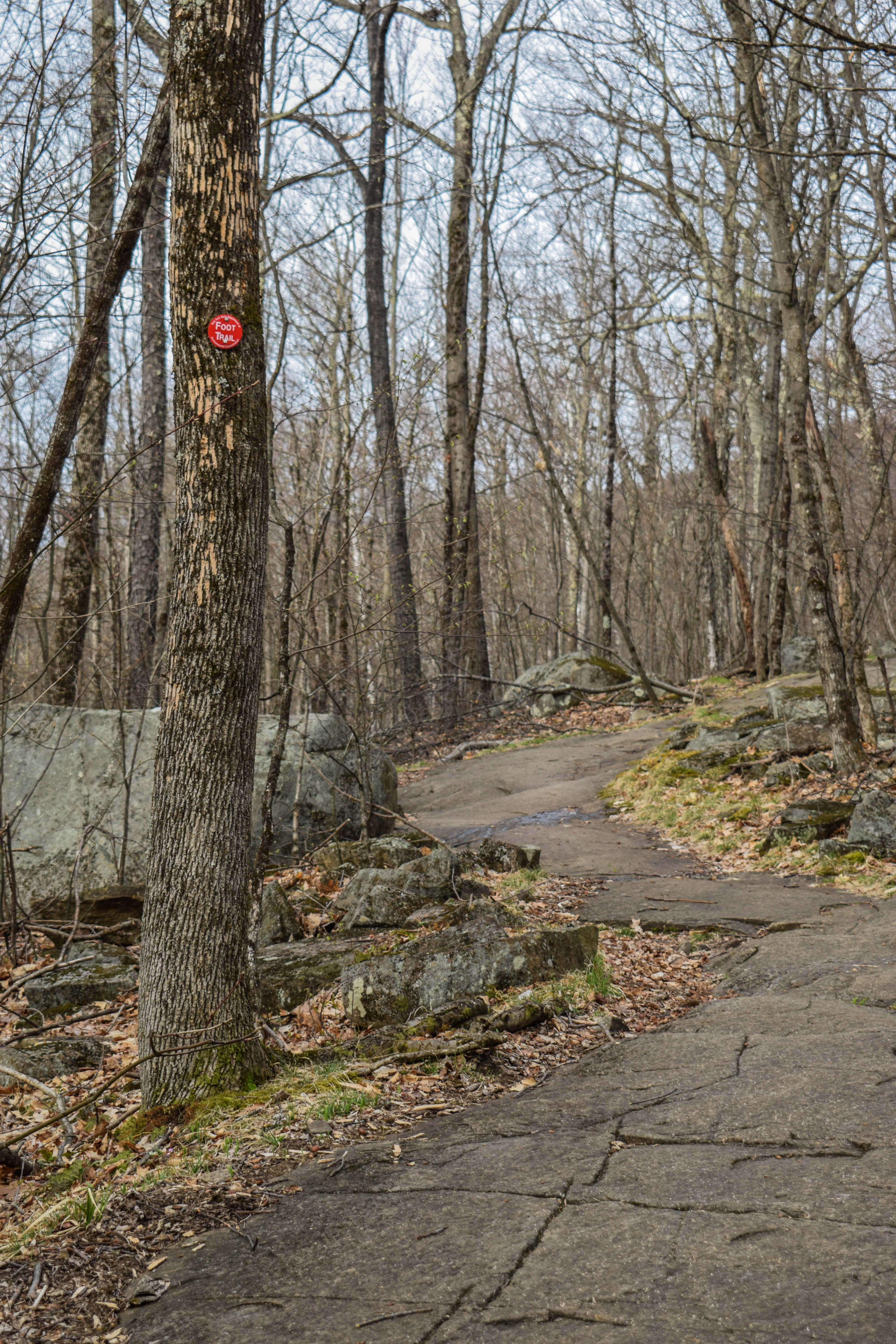
The trail was well-blazed in red and I was sweaty! I climbed up what was the beginning of MANY slabs, which at this moment were wet, but not slippery. I was worrying about the descent, but I'd let that be a later problem. I noticed a tree view to some undercast in the distance and also some early spring budding (as opposed to the almost-leaves of Harriman State Park). 


The slabs got a bit dicier and eventually, the trail turned off of the slabs and continued on steep, rocky footing (which was a welcome change). I zig-zagged through another ledgy spot and climbed up an adorable, ~3ft tall chimney. I felt one single rain drop as the trail continued to rise up to the col between Hadley Mountain and it's neighbor peak (#6 - The Resting Rock on Panther Pass). 


Once in the col, which I guess is also known as Panther Pass, I enjoyed a heavenly walking break before the trail narrowed and began to climb again. The climbing now was much easier as I collected spider webs and continued to fear what my stomach was capable of (remember the Code Brown scare from earlier? It's back!). I passed marker #7 ("Pioneer" White Birch - the first trees to grow after a forest fire) and enjoyed the sound of woodpeckers hard at work.

The trail climbed through a rocky notch and turned left at marker #8 ("Sharp Turn Left!") before steepening in a grassy, ledgy area, which led to a wonderful tree view to a lake. This was followed by another wonderufl walking break and another ledge view to nearby mountains. It even smelled like a pine candle up here - I was so happy.


The climbing became easy at this point as I soon arrived at the old warden's cabin and privy (with a spooky little cave, too). There was a quick scramble and push to the true summit, which was mostly open with wonderful views, the tower, a USGS disc, and a summit bolt. 


The tower climb wasn't too awful and the cabin was open with a small ladder that was terrifying, but worth the extra emotional push. The views north were exceptional, but I couldn't make out the Catskills due to clouds. The tower was marker #10 (Top and the Tower!) and I had missed #9, but it was at the cabin and cave. 

I took a bunch of photos and then started my descent right at the one-hour mark. I was thrilled to have encountered absolutely zero signs of winter, and I was back at Panther Pass in 15 minutes! On a side note, I really love hiking in New York specifically because you can tell which trail plackards are new and which are old - I find it super fun!


I significantly slowed down on the wet slabs further down and did NOT fall. I did my best to be good and avoid going off-trail, but a few stretches were too dangerous with the moss and moisture to go straight through. The lower slabs, which were dry, were an absolute dream! Soon enough I was back at the car, solidifying that this was a zero-person hike! It was now 60 degrees, and I was on my way to Vermont! I soon drove past a porcupine on the access road followed by some turkeys. Just after, on Eddy Road, I got a great view of Hadley Mountain. The rest of my drive to and over Lake Champlain was just beautiful.


Step-by-Step
- Start hike on Hadley Mountain Trail (red blazes).
- Summit Hadley Mountain, climb fire tower, return to car.

Thursday, August 11, 2022

Mt. Arab (Adirondack Park)

Mt. Arab (Adirondack Park)

Hike Type: Out-and-Back
Distance: 2.2 miles
Elevation: 784 feet
Time: 2 hours, 18 minutes

Hiking Challenges: Tupper Lake Triad, ADK Jr. 29er, Operation Alaska Benchmark Challenge, ADK Firetowers


The Hike 

The parking lot for Mt. Arab is a large pull-off tucked away from the main road in the incredibly named "Conifer Emporium Conservation Easement." The parking lot was rather full, but there were no other humans in the parking lot when I was getting set up. The trail starts across the street and there is a register and information kiosk a few steps into the woods detailing recent trail work and brochures about rehabilitating the fire tower. 


The trail was steady with one steep section that was aided with new wooden ladder steps. Very scenic forest, and overall very uneventful. I passed a few hiking groups that were coming down the mountain - a good sign for me! Uniquely, there were numbers on trees in ascending order the whole hike up. Some were closer to others, so I do not believe they were distance markers. Not sure. 


Toward the top, the trail splits, both directions are red-blazed. The left side goes up a short scramble to the tower and the right goes to a viewpoint with a bench. I did not go to that viewpoint due to a couple enjoying their time, so I headed right to the tower. On the theme of this trip, there was a large family on the tower at the time. There was a group waiting at the keeper's cabin, and the family was taking their sweet time on the tower, seemingly oblivious to anybody else. When they finally descended, the other group headed up (they offered to let me go first, but who knows how long they've been waiting for). While they were up, I found the benchmark and had a snack. The tower itself was nice and provided great views in all directions, and I was joined by another solo hiker who was equally as sweaty as I, which I always appreciate. I passed one other hiker who had a collection of patches on his pack who was debating if he wanted to go up or not - I encouraged him to climb it. There was a small view through the woods, and then I did my return trip!


I did not realize that 11:30am was officially family hour on Mt. Arab. I passed endless families who were starting their hikes on my way down, and the parking lot was packed. Cars were even circling. Either way, I did my quick change in my car and headed back to the hotel for a shower. Thunderstorms were going to be rolling in, so I used that as an excuse to be done hiking for the day. I spent the rest of the day at the Adirondack Experience Museum which was EXCELLENT. Highly recommend! This ended up being the final hike of my first trip to the Adirondacks, and I will absolutely be back. 


Bog River Complex (Horseshoe Lake Wild Forest) (NYDEC)

Bog River Complex (Horseshoe Lake Wild Forest) Map (NYDEC)


Photo Album

Goodman Mountain (Adirondack Park)

Goodman Mountain (Adirondack Park)

Hike Type: Out-and-Back
Distance: 3.3 miles
Elevation: 574 feet
Time: 1 hour, 37 minutes

Hiking Challenges: Tupper Lake Triad, ADK Jr. 29er


The Hike

Hike #2 of the Tupper Lake Triad! The parking area here was wide and spacious, and there is a great story about how the mountain got its name at the informational kiosk (in the photo album). The trail starts out on a refurbished road, which makes it accessible, and follows a nice stream. Further down, the road condition deteriorated and I passed an extremely friendly woman who, quite literally, screamed "good morning" to me. At the height of land on the road, the trail clearly turns left into the woods.


The trail was gentle, soft, and a little squishy/muddy. It quickly skirted around the mountain, similarly to Coney, and then climbed more steeply toward the end, where it got more slippery. The view from the top was lovely, but after the spectacular show provided on Coney, it was just fine (still quite nice though). I didn't stay up for too long, took a few photos, and started the return trip.


There were more crazy red squirrels screaming about, a few woodpeckers getting their breakfast, and an extremely loud nearby loon (which was my favorite). I didn't see anyone else in the woods, but did pass one hiking group and one trail running group that kept saying "wasn't this supposed to be easier?" which gave me a good kick. I was soon back at my car and heading to the final hike of the Tupper Lake Triad - Mt. Arab!


Bog River Complex (Horseshoe Lake Wild Forest) (NYDEC)

Bog River Complex (Horseshoe Lake Wild Forest) Map (NYDEC)


Photo Album

Coney Mountain (Adirondack Park)

Coney Mountain (Adirondack Park)

Hike Type: Out-and-Back
Distance: 2.4 miles
Elevation: 564 feet
Time: 1 hour, 24 minutes

Hiking Challenges: Tupper Lake Triad, ADK Jr. 29er, Operation Alaska Benchmark Challenge


The Hike

Day two in the ADK! I got up just before sunrise and did the quick drive from the Long View Lodge to the Coney Mountain Trailhead parking lot. The parking lot had space for 5-6 cars with an informational kiosk and trail register. I was all by myself, and was quickly reminded that the early bird gets the spiderwebs! The forest was calm and the trail elevation was gentle - the only thing that kept my heart rate up was those spider webs, and my digestive system telling me that it was time to christen these woods. 


As the trail circled around the mountain, the elevation intensified, but never getting too steep. Closer to the top, I was introduced to the mountain's main inhabitant, insane, screaming squirrels. They cheered me on as I made the final climb to the summit area and WOW. The view was lovely, but paired with the low hanging clouds on the neighboring lakes and sun shining through the fog made for truly a spectacular show. The high peaks were nearby, hiding in the clouds, and the smaller mountains were present in all directions. I took so many pictures (shockingly) and truly never wanted to leave. 


I got a photo of the USGS benchmark and started my return trip, which was quick and easy. I passed only one person on my way down - I cannot stress how lovely it was to start my morning on this mountain, just me and the crazy squirrels. Soon enough I was back at the car and getting ready to drive a minute down the street to the next trailhead for the Tupper Lake Triad challenge - Goodman Mountain!


Bog River Complex (Horseshoe Lake Wild Forest) (NYDEC)

Bog River Complex (Horseshoe Lake Wild Forest) Map (NYDEC)


Photo Album

Wednesday, August 10, 2022

Black Bear Mountain (Adirondack Park)

Black Bear Mountain (Adirondack Park)

Hike Type: Lollipop Loop
Distance: 5.25 miles
Elevation: 797 feet
Time: 2 hours, 18 minutes

Hiking Challenges: Fulton Chain Trifecta, ADK Jr. 29er, Operation Alaska Benchmark Challenge


The Hike

The trail for Black Bear Mountain starts at the lower end of the parking lot, paralleling the road for a short moment before dipping into the woods. The trail followed what felt like an old woods road for the first part, which was very gentle and scenic. I imagine in a wetter season this area could get very muddy, but it was mostly dry on this day. After some rolling "hills" (more like lumps), the trail divides at a fork, starting the loop of this lollipop loop hike. I took the right fork up the blue trail, which I recommend. It is easily the steeper trail, but I wouldn't want to descend this way. 


The trail passes a couple clearings - either logging or old camps? Not sure. Then, it begins to climb on a wide, wet, rooty trail following blue blazes. Confusingly, there were a few instances of yellow blazes as well. Maybe it used to be all yellow blazes and they recently switched to blue? Either way, there are no junctions, so it wasn't too confusing. This hike was quickly becoming my favorite because it had more of a wilderness, rugged feel to it, unlike the previous ones which were more family-friendly tourist hikes. The trail begins to pick up steepness, even having a rope to help guide at a certain point. As the trail climbs, the tree cover begins to diminish, hinting that the summit is nearby.


After some more heart-pumping hiking, a yellow arrow points to a turn and the summit area opens up, which is beautiful. It appeared that someone had stolen the benchmark, or maybe it was a bear. This was easily my favorite view of the day - and I had the whole summit to myself! The cloud cover was breaking up, exposing the beautiful blue sky, and the vista had rolling hills, distant high peaks, and plenty of lakes. A little past the first view there is a large meadow-esc area that has my favorite view of the nearby lakes and high peaks behind them. I couldn't believe I had all this to myself after the past two hikes!


After taking far too many photos I continued the hike back into the woods, which followed a very pretty mossy section. The trail started descending rather steeply (still not as steep as the ascent), and landed in a dark, moist area that was equal parts beautiful and spooky. It started as a narrow footpath and slowly opened up to a wider woods road, crossing a brook a few times. This part did feel a bit long, but when the previous two hikes were both shorter than two miles, it made sense that this felt longer. Once I reached the original fork with the blue trail things moved along more quickly and I was soon back at the car, but shockingly enough - there was no one else in the parking lot! I felt like I had missed a memo? I had the thought of heading back up Rocky now that I would be alone, but the thought of a shower compelled me. My first day in the ADK definitely had a rocky start with my crankiness, but a great ending!


Step-By-Step

  • Start hike on the downhill side of the Rocky Mountain Trailhead parking (Google Maps).
  • Follow path to "Black Bear Mtn" sign, turn left at sign to travel away from road.
  • Follow yellow-blazed trail towards southerly approach.
  • At fork, turn right onto the primarily blue-blazed trail (but sometimes yellow) to summit.
  • At summit, continue on yellow-blazed trail down mountain.
  • At junction, turn left and follow arrow toward Rt. 28 Parking Area/Black Bear Mtn. Trailhead.
  • At fork, continue straight and complete the loop.
  • Hike back to parking area.

Photo Album

Rocky Mountain (Adirondack Park)

Rocky Mountain (Adirondack Park)


Hike Type: Out-and-Back
Distance: 1.13 miles
Elevation: 456 feet
Time: 35 minutes

Hiking Challenges: Fulton Chain Trifecta, ADK Jr. 29er


The Hike

I took a quick drive to get to the shared trailhead for Rocky Mountain and Black Bear Mountain. This parking lot was less glamorous right on the main road, and it was also pretty filled up. The crankiness hit me again when I saw a family with three children starting the hike just before me, all in their pajamas, and the mother and middle child were barefoot. I realized that this trip was an exercise in self-regulation and getting over myself and my own crankiness at having to interact with a single human. Either way, I suited up and started the very short climb up to Rocky!


The trail gets right to the point right away - you climb right up. The trail was very wide and eroded in places, but always relatively straightforward. The first half is the steepest section, and then it mellows out as it approaches the view. Thankfully, the pajama-ed and barefooted family let me pass them, and many others passed me on their return trips too. I shared the summit area with a large hiking party of a few moms and their kids who were taking every permutation of a group photo imaginable. I sat to the side for a few minutes to drink some water, but eventually snuck behind them to get a photo of the great view before returning down the mountain. I was feeling a bit frustrated at what appeared to be obliviousness - they were giving off "this is our mountain now" energy, not caring that they were hogging the entire view. Maybe I was just extra cranky from the long drive?


The return trip, like Bald, was quick and straightforward. Not as fun as Bald, but still quick and to the point. I took a short pit stop back at my car to change my shirt and got ready for the final hike of the day - Black Bear Mountain!


Photo Album


Bald Mountain (Adirondack Park)

Bald Mountain (Adirondack Park)

Hike Type: Out-and-Back Loop
Distance: 1.87 miles
Elevation: 420 feet
Time: 46 minutes

Hiking Challenges: Fulton Chain Trifecta, ADK Jr. 29er, Adirondack Firetowers


The Hike

Finally getting around to writing this! It's been about a week and a half since my inaugural trip to the Adirondacks - I had hoped to journal about these next few hikes before I had to teach band camp, but life happens and here we are now! Just to clearly paint the picture, I'm currently laying in bed, exhausted, hiding from my landlord and the plummer. 


I had a long drive after my morning hike up Balsam Lake Mountain in the Catskills, so by the time I entered the Adirondack Park for the first time I was ready to get moving again. My first impressions were that it was much more tourist-y than the Whites, but I realized that was only because I drove through Old Forge, which reminded me more of Gatlinburg, TN. I remembered listening to the 46 of 46 Podcast in the past and there was an episode dedicated to the Fulton Chain Trifecta, so I put that on to get a preview of the day which I loved. The rest of the drive was very scenic and before I knew it I was pulling into the Bald Mountain parking lot, which to my dismay was extremely busy. I had my classic inner battle of "f this" versus "just go climb the mountain you'll be fine," and thankfully I got over myself and got hiking!


There were a lot of people on this hike, but it was equally my favorite trail of the six ADK hikes I ended up doing. It starts off steeply climbing up rooty slabs, but always with good footing. The rest of the hike is at a gradual incline over smooth rock with a good amount of viewpoints for a rest, especially for being such a short hike. My favorite view was of Fourth Lake with the high(er) peaks in the distance.


At the summit area there is the firetower and another great view of the Fulton Chain Lakes. I decided to not wait to climb the firetower because there were families everywhere and I was feeling satisfied with the view already. I'm sure it was nice up there - maybe another time! The return trip was very quick and fun - I found myself whispering "parkour" to myself as I quickly hopped down the sloping rocks. There were two clean porta-potties at the trailhead, so I did my quick change and got ready for hike #2 - Rocky Mountain!


Fulton Chain Wild Forest (NYDEC)