Pack & North Pack Monadnock via Raymond & Cliff (Miller State Park, Joanne Bass Bross Preserve, Wapack National Wildlife Refuge)
Distance: 9.22 miles
Elevation: 2,434 feet


Elevation: 2,434 feet
Time: 4 hours, 39 minutes (4 hours, 14 minutes moving)
Hike Type: Lollipop-Lollipop Loop
Hiking Challenges: 52 Hike Challenge 2024; Friends of the Wapack
Hike Type: Lollipop-Lollipop Loop
Hiking Challenges: 52 Hike Challenge 2024; Friends of the Wapack
The Hike
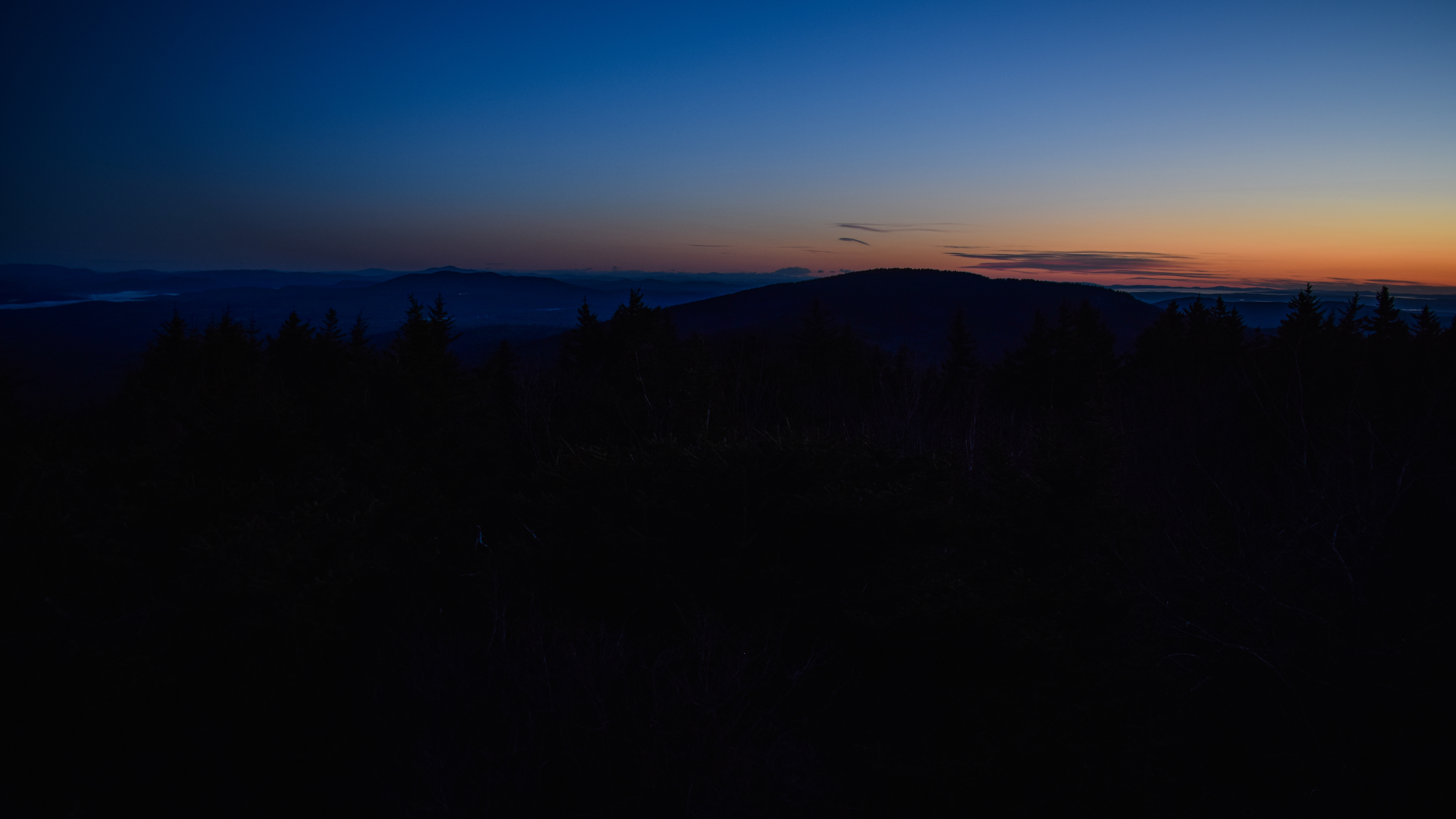
First hike of teacher summer, and during an almost-heat-wave! I had just gotten my blood drawn in the morning, so I didn't get my usual early-early start. I did eventaully make my way to the Raymond Trail of Pack Monadnock at 9:45am, and it was only 79 degrees (it was 87 on the roads, though). The skies were clear, but hazy, and the air was SOUPY. One thing that I did do well was fill my water bladder up halfway and put it in the freezer, making sure that it was laying flat so the hose was still free. Not only did I have cold water, I also had a cold back! Soon enough I was on the trail.

The Raymond Trail starts by immediately ascending and then descending a small hill, and I could already tell it was going to be a long-feeling day. I didn't bring my poles for who knows what reason and was not currently wearing bug spray, as it seemed to be too humid for even the bugs. There were PLENTY of spider webs, though. The trail dipped, crossed a small bridge, and then began to ascend again.

My legs were feeling HEAVY. The rocks looked wet from the dense humidity. It was not the most glamorous of days. The trail crossed a junction with the Cranberry Meadow Pond Trail sign that read:
"Welcome! This trail connects downtown Peterborough to Pack Monadnock Mountain through the grace of private landowners. Please respect these properties by staying on trail, leashing dogs, and carrying out all belongings and refuse. Overnight parking, camping, motorized vehicles, and fires are prohibited. Enjoy the trail!"


The Raymond Trail continued to climb with easy to rocky footing and descends again to cross a dried brook bed. I found myself wondering if I'd actually make it to the Cliff Trail with the heat and humidity. I decided I wouldn't make any decisions until after I summit Pack Monadnock and hit the Spruce Knoll Trail. There were some short steeper climbs that alternated with walking breaks - really a lovely trail - would be even better with a breeze!

The trail entered passed the NH State Land boundary and continued its moderate climb, now following a trickling brook on the right. The trail neared the stagnant brook and I spooked a deer just after crossing the brook bed.

After crossing, the trail became more steep and rugged, with an occasional life-changing breeze. The pathway became a little less clear in a boulder-y area, and my heart rate was HIGH. It had been a while since I last hiked in humidity like this!

After a bouldery climb, there was a restricted view of Mt. Monadnock, which was looking extra spooky through the humid haze. I was simply POURING sweat at this point, but at least the woods were beautiful after the boulders. I even got to see an excellent red eft!


There were a few stretches of trail that had young Christmas-tree-like-trees, and the flies were LOVING IT. I had to duck my head and just go through them. Thankfully, the flies were more interested in the trees than me. There were some slippery slabs to climb, a few gnats drowned in the sweat of my arms, and soon enough I made it to the junction with the Summit Loop!

I turned left onto the Summit Loop, briefly coinciding with the Wapack Trail, and then broke away and descended into the woods. For a "summit loop" trail on a mountain that you can drive up, I was surprised how unused this trail appeared. The land was part of the Joanne Bass Bross Preserve by the Nature Conservancy, and it was very wild feeling. Many bugs, many overgrown footbeds. On this stretch alone I had three bugs in my eye! My camera lens also fogged up from the humidity - we were not thriving!


Thankfully, this stretch of Summit Loop wasn't too long, and soon enough I was at the trailhead for the Spruce Knoll Trail, which was more enjoyable. It descended gently on a narrow grassy trail - I mentioned in my notes that I was nervous about ticks, but if they tried to bite me they'd likely drown. The trail was well-blazed and traveled through some lovely pine woods.

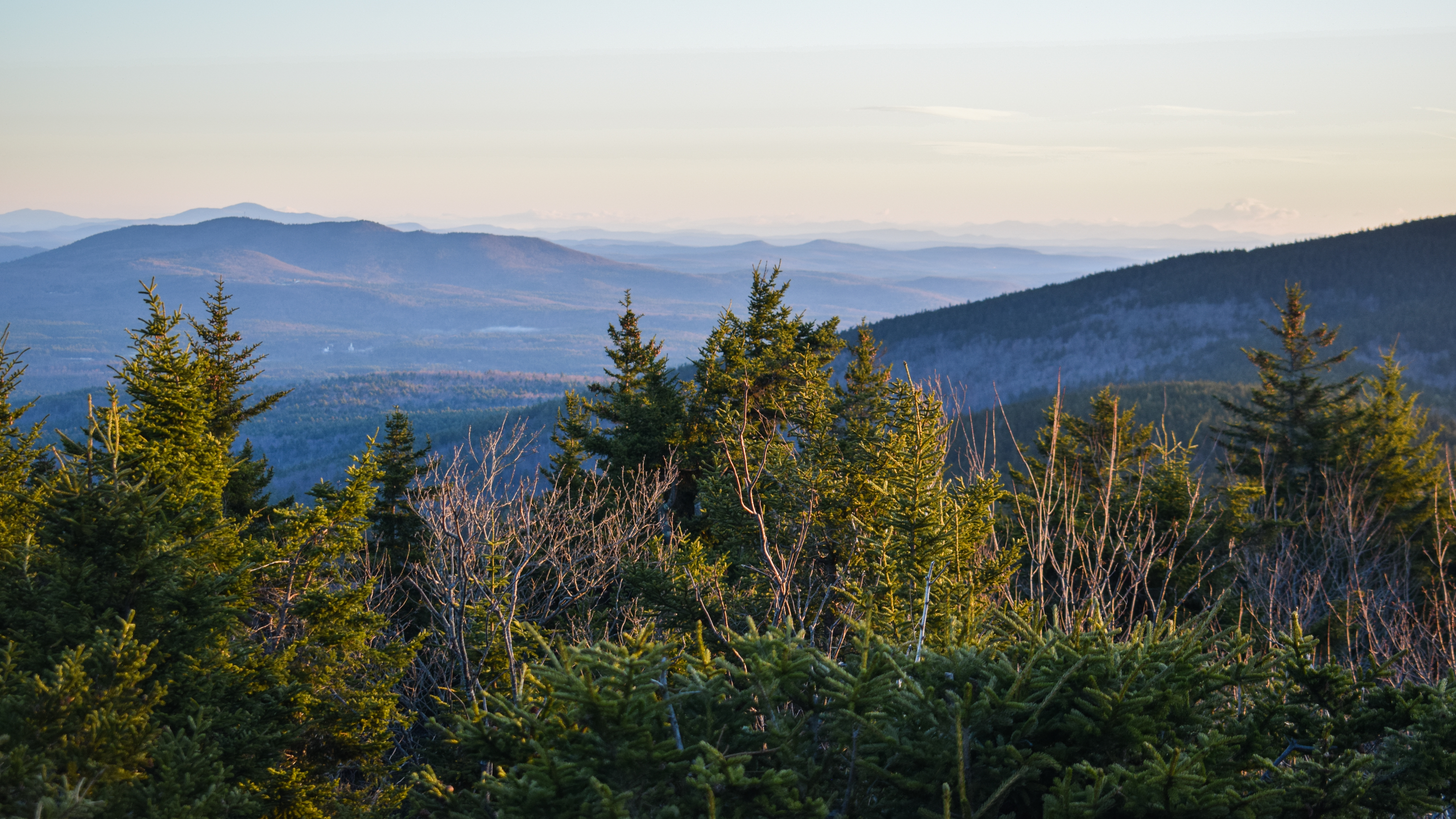
The trail splits momentarily before rejoining - I did this interim loop clockwise. The junction is well-signed, and begins right at a town line marker (granite stone). When the two splits rejoin, a single trail continues for just a little more on the "scenic spur" (sign). There was a hazy vista at the end of the trail, not featuring any prominent landmarks that I could make out on this hazy day. There were, however, MANY blueberry bushes starting to produce little green berries!

The return trip was quick and easy and I took a nice break at the "Boston View" on the Summit Loop where I wrung out my shirt and drank a ton of liquid. There was an occasional breeze that was so delightful I swear it could save lives. I even poured some icy water from my bladder onto my head - I was ALIVE. The anemometer said it was 80 degrees at the summit, but it was a HOT 80 degrees. I was cooking. Once I saw my heart rate was, in fact, going down after a sit, I decided I would continue on toward the Cliff Trail, and just continue to listen to my body.

"Miller State Park, New Hampshire
Miller State Park is located on the 2,290 foot summit of Pack Monadnock in Peterborough, New Hampshire. A winding paved road leading to the summit is open for visitors to drive from May to early November. A foot trail (red blazes) loops the open summit area and offers spectacular views of the surrounding countryside. Hikers are welcome at Miller year-round. Three trails provide access from the base to the summit.
General James Miller
James Miller was born in 1776 in Peterborough, NH. In 1804 he opened a law office in Greenfield where he practiced for four years. During this time, he joined the Hancock Artillery, a branch of the New Hampshire Militia. An efficient and discip lined drill master, young Miller attracted the attention of Brigadier General Benjamin Pierce who appointed him as a major in the 4th U.S. Infantry in 1808. Miller left his law practice and joined his regiment stationed in Boston. During the War of 1812 at the battle of Lundy's Lane near Niagara, New York, Miller was ordered by General Jacob Jennings Brown to storm a battery of seven British cannons positioned on a hilltop. Miller's reply to General Brown, "I'll try, sir", became forever linked with his name. On the night of the battle that would earn him a promotion to brigadier general, Miller secretly led his regiment of three hundred men up the hill. Shrubbery and a rail fence offered protection for Miller's planned attack. With quick action, he ordered his men to fire. Miller and his regiment successfully charged and overtook the battery. Miller wrote a letter to his wife, Ruth, describing the battle...
"We fought hand in hand for some time, so close that the blaze of our guns crossed each other, but we compelled them to abandon their whole artillery, ammunition, wagons, and all... General Brown told me, the moment he saw me, that I had immortalized myself."
In September of 1814, General Miller helped protect Fort Erie from British Invasion. For his accomplishments in this fierce battle, he received a gold medal from the United States Congress. This award was presented to him by Daniel Webster at City Hall Park in New York City. Miller was also honored with the gift of a dress sword from the state of New York. Miller resigned his army commission in 1819 and accepted the appointed position of Governor of the Treaty of Arkansas. By 1823, poor health forced him to return home to a farm he purchased in Temple, NH. A year later with his health restored, he became collector of customs for the ports of Salem and Beverly, Massachusetts, a position he held for the next twenty-four years. He retired to his farm in 1848, where he lived until his death in 1851.
New Hampshire's Oldest State Park
Established in 1891, Miller State Park is New Hampshire's oldest State Park. After Charles F. Melendy and Austin A. Spofford deeded a three-acre plot of land on the summit of South Pack Monadnock to the State of New Hampshire, it was dedicated to General James Miller of Peterborough, NH.
In the early years, all-day Sunday picnics at the summit were a popular pastime. Families arrived by horse and wagon with lunches packed to enjoy the views and the weather. In the winter months, people went skiing, sledding, and snowshoeing on the mountain. Until 1901, cattle were driven by foot from Massachusetts farms to the Pack for summer grazing on what was then open pasture extending close to the summit. In 1892, a hotel known as The Pioneer House was erected on the southwestern side of the mountain. Proving unprofitable for its first owner, George F. Baker, the business was sold three years after opening. The hotel burned in 1896 and a new, smaller structure replaced it. This building was anchored to the rocks by iron rods and chains. It was used as a hunting lodge until it was abandoned and fell into disrepair. A fire spelled its doom in 1924 when it burned to the ground, but the foundation remains visible today. In 1939, a twenty-seven foot steel tower was built with a wooden lookout cabin on top. Used as a fire tower for many years, the cabin has recently been restored and the tower opened to the public. Today, the fire tower is used during times of high fire danger in the area. Visitors can climb the tower to enjoy gorgeous views as far as the Boston Skyline, Mt. Washington and southern Vermont." - from summit area kiosk.

From the viewpoint along the Wapack Trail northbound, I could see the cliffs - I was excited to check them out! There was some new yellow paint on a few blazes and on the rockbed as the trail began to descend. I skipped the memorial outlook to preserve as many footsteps as possible, and started the long descent into the long col.


Now with all the ice melted, the col was filled with wonderful ferns. The Wapack Trail entered the Nature Conservancy land for just a moment before entering the Wapack National Wildlife Refuge, where apparently all the bugs had been hiding all day.

I was noticing some back pain as the trail began to slowly gain elevation between long walking breaks. There was a cairn that, from what I could tell, signaled nothing besides a semi-open ledge with no views. Eventually I did make my way to the junction with Cliff Trail at 4 miles. I put my visor on because I knew it would get sunny soon and I was tired of bugs. I transferred my phone to my hip belt to protect it from sweat, and started the initial descent by following the blue triangle blazes.


The trail continued to descend and then slightly ascend before descending again, crossing many dried streambeds (and one late-stage lady slipper). There were a few older orange blazes that maybe used to mark this trail? I have not been able to find an answer, but they were few and far in between and occurred throughout the whole trail.

Now, the Cliff Trail was climbing, steeply and scrambly at times, and eventually made it to a ledge with tree views to Pack Monadnock and Spruce Knoll. I managed to slip on a wet, humid rock, but thankfully caught myself (not without damage, though... my sunglasses pouch I have clipped to my pack whipped around and hit my cornea).

The Cliff Trail slightly descended yet again to cross a boggy area before skirting the bottom of the cliffs - with a neat view upward just off-trail. I feel like there simply must be people who like to climb/scramble these rocks.

Now climbing even more steeply, the Cliff Trial begins to make its roundabout journey to the best view. First by crossing a junction with Ted's Trail, and then by following a very short spur when the trail turns back into the woods. I took a nice sit break here and realized I left my food in the car! This was not a dire emergency, but more of a monumental bummer. I knew this meant that I will be HUNGRY at the end and possibly a little lightheaded, but it just meant I couldn't dilly dally for too long. I did enjoy this sweeping view of Pack Monadnock, Temple Mountain, and further Wapack Trail peaks. There was a very hazy Monadnock in the background with an INCREDIBLE breeze. I also noticed that my watch was doing a better job at tracking my heart rate - I wonder if its because it was on a bit looser today? Maybe it was too tight before? Eventually, I could feel every individual UV ray penetrating my skin, so I packed up and continued on.


This section in the woods was absolutely lovely, alternating with soft footbeds and ledgy walks. There were MANY baby blueberries laughing at me as I was completely food-less and they were not ready to be snacked on. There were "pockets of terrifying fly choruses," as I wrote - meaning there were small areas where it felt like there were hundreds of little loud flies screaming about.

There was a nice view just off the junction with Carolyn's Trail - it would be incredible on a clear day, though. It was feeling VERY hot now with just a few short breezes scattered about. The woods approaching the summit were just beautiful and soon enough I was on the open summit of North Pack Monadnock with its massive summit cairn, now at 88 degrees. The Cliff Trail sign was missing from here - it almost looks like it was broken off? Strange. I decided not to stay so I could get back to the car sooner for some food. The Cliff Trail definitely lived up to its reputation of being challenging but rewarding - but, that being said, it wasn't too strenuous. Definitely challenging in comparison to some of the easier trails around the Pack Monadnocks, but nothing too crazy.


It was cooler back into the woods but MUCH more humid. I couldn't tell if the spiders were working extra hard or if no one else has been crazy enough to hike on this nasty day? I also wondered how flies regulate their body temperatures - they must get warm? Do they sweat? Do they pant? I need to know!

After what felt like an eternity, I exited the Wapack National Wildlife Refuge and then the Nature Conservancy land, too. Now all that was left was the climb out of the col, which I knew would feel like a doozy, in both length and exertion.

About halfway back up Pack Monadnock I dubbed my butt as officially kicked - I was bonked. It was so hot. Thankfully, after zoning out for a moment (or making funeral arrangements), I saw the Joanne Bass Bross Memorial Outlook sign and IMMEDIATELY ran out of water. Thankfully, I was at the end of the climbing for the day, but good to note that if a hike is >8 miles, >2000 feet of gain, and >80 degrees with humidity, I need 6L of water, unfortunately.

Now back in Miller State Park, I couldn't help but notice some puffy storm clouds rolling in the distance. I double-checked the weather and the scattered storms for 6pm were moved up to 3:45pm - either way I'd be back at the car by then, but to be honest, I would love to get rained on at this point.

I made it back on to the spider web-by Raymond Trail (I guess they WERE hard at work...) and started my initial descent, enjoying a rare breeze. The really bad spot with flies was still really bad, and I managed to spook the deer again almost in the same spot. I hit the first short uphill section and my body was MAD. I got another bug in the eye at a second section of uphill. Sausage fingers were in FULL effect and the final uphill stretch nearly killed me, but then I was back at the car!

This was a lovely hike that would have been a treat in fine weather. My biggest takeaway from this hike is that 80 degrees with humidity is much hotter than I think it is. BUT, I had an unknown Nalgene full of Nuun in my car, and my car was in the shade so it wasn't hot! Everything was going to be okay.

Step-By-Step
- Park at Raymond Trail trailhead.
- Start hike on Raymond Trail (white).
- At terminus, turn left onto Wapack Trail/Summit Loop (yellow/red)
- At split, turn right to conitnue on Summit Loop (red).
- At next jct., turn left onto Spruce Knoll Trail (icon).
- At split, continue straight on Spruce Knoll Trail.
- When the two splits rejoin, continue straight on Spruce Knoll Trail.
- At view, turn around.
- At split, turn right onto other side of Spruce Knoll Trail.
- When the two splits rejoin, continue right on Spruce Knoll Trail.
- At terminus (trail sign), turn left then right to continue on Summit Loop.
- Summit Pack Monadnock.
- Continue to Wapack Trail (yellow).
- Follow Wapack Trail north.
- At jct. with Cliff Trail, turn right onto Cliff Trail (blue).
- At summit of North Pack Monadnock, turn left onto Wapack Trail south.
- At jct. with Raymond Trail, turn right on Raymond Trail to return to car.

“Raymond Trail" from Southern New Hampshire Trail Guide, 5th Ed. (2021)
This attractive, white-blazed trail ascends the west slope of Pack Monadnock from East Mtn. Rd.; on its upper section are several steep, rocky pitches. To reach this trailhead, follow NH 101 0.4 mi. west from the entrance to Miller State Park. Turn right onto Old Mtn. Rd., and at 1.0 mi. turn right again onto East Mtn. Rd. The trailhead, with parking space for several cars, is on the right at 1.2 mi. from the park entrance. A new, larger parking area, signed for Cranberry Meadow Pond Trail, is 0.2 mi. farther along the road, also on the right. A 0.2-mi. connecting path leads from here to Raymond Trail.
From its trailhead, Raymond Trail climbs over a small ridge and then ascends to a junction with the spur from Cranberry Meadow Pond Trail on the left at 0.3 mi. It continues straight and descends briefly to cross a brook at 0.6 mi. and then dips to a side path on the right at 0.8 mi. that descends 15 yd. to a view of a cascade. Raymond Trail ascends along the brook; turns left away from it; crosses a plateau; and climbs a steep, rocky pitch to a restricted outlook west at 1.3 mi. Then it continues up through woods, steeply at times, and emerges on ledges. Raymond Trail crosses Summit Loop Trail at 1.5 mi. and in a few steps ends at Wapack Trail, 0.1 mi. below the summit of Pack Monadnock.
“Summit Loop Trail" from Southern New Hampshire Trail Guide, 5th Ed. (2021)
This short trail (also known as Red Dot Trail or Red Circle Trail), marked with red spots, makes an interesting circuit around the summit of Pack Monadnock. From the summit’s high point on the west side of the fire tower, the trail crosses the automobile road and descends into the woods to the left of a shed. (Marion Davis Trail leaves the summit of the right of this shed.) Summit Loop Trail descends 35 yd. to a sign (“Boston View”), an eastern viewpoint is a short distance to the right. Here, the trail bears left, descends, and circles around the north side of the summit. It ascends and crosses northbound Wapack Trail and then Raymond Trail, continuing 50 yd. across ledges to meet Wapack Trail coming up from the south. Summit Loop Trail coincides with Wapack Trail back to the top of the summit road, completing its loop.
“Spruce Knoll Trail" from Southern New Hampshire Trail Guide, 5th Ed. (2021)
This short spur path marked by The Nature Conservancy descends east from the Boston View area near the summit. In 0.1 mi. it reaches a junction where branches of the path fork left and right. The two branches rejoin in 125 yd., and the path continues to a fine eastern outlook at 0.3 mi. from the Boston View area. This viewpoint is part of TNC’s Joanne Bass Bross Preserve on the east side of the mountain.
"Wapack Trail" from Southern New Hampshire Trial Guide, 5th Ed. (2021)
Section V. Pack Monadnock and North Pack Monadnock. This extended ridge culminates in two open peaks: Pack Monadnock (2.285 ft.) and North Pack Monadnock (2,264 ft.). (Pack is an American Indian word meaning "little.") The mountains stand between the towns of Peterborough and Temple and are well-known landmarks in southern New Hampshire and eastern Massachusetts. The summit and most of the southern slopes of Pack Monadnock are in a small state reservation, General James Miller Park. The entrance to the park (sign) is just off NH 101, 0.1 mi. west of the Temple Mtn. parking area. An admission fee is required. The road is gated when the park is closed; see nhstateparks.org for current fees and operating hours.
Wapack Trail continues north from the north end of the summit road, to the left of a stone lean-to (sign: "Wapack"), following a gravel path at first and then descending gradually over ledges. About 0.1 mi. from the summit, at an open ledge and picnic area with a fine view north and west, Raymond Trail (described below) diverges on the left. (The sign for this trail is a short distance downhill to the left, where Raymond Trail crosses Summit Loop Trail.) Wapack Trail bears right, soon crosses Summit Loop Trail, and descends over ledges. At 18.1 mi., at a left turn, a side path (sign: "Joanne Bass Bross Memorial Scenic Outlook") leads 35 yd. right to a viewpoint east and northeast. Wapack Trail moderately descends the wooded north slope past a spring and crosses a col at 18.6 mi. In 0.1 mi. it passes briefly through the Nature Conservancy's Joanne Bass Bross Preserve (sign), and in 100 yd. it enters the 1,672-acre Wapack National Wildlife Refuge (sign). Wapack Trail crosses another col and ascends through fine spruce woods over a knoll (sometimes called Middle Peak) at 19.2 mi. At 19.6 mi. it reaches the junction with Cliff Trail on the right. (Cliff Trail, described below, is a longer and rougher but more scenic alternate route from here to the summit of North Pack Monadnock.)
From its southern junction with Cliff Trail, Wapack Trail continues north along the ridge then swings right and ascends fairly steeply to the summit of North Pack Monadnock, marked by a large cairn, at 20.3 mi.; Cliff Trail rejoins from the right. (In the reverse direction, look carefully for yellow blazes where Wapack Trail descends southwest off the summit, to the left of a southwest outlook.) Ledges around the summit area provide partial views in several directions; the best views are at 0.2 mi. and 0.5 mi. down Cliff Trail.
“Cliff Trail" from Southern New Hampshire Trail Guide, 5th Ed. (2021)
This blue-blazed trail, steep and rough in places, offers some of the finest views in the Monadnock region. Use it and Wapack Trail to loop over the south side of North Pack Monadnock.
Cliff Trail diverges east from Wapack Trail 0.6 mi. south of the summit of North Pack Monadnock in a small, ledgy opening (the trail name is painted on a rock). It descends 0.2 mi., crosses a small brook, climbs briefly, and descends again to cross another brook. Then it swings left and ascends steeply to a ledgy area with restricted views. It reenters the woods, winds through some ledges, and then turns left at a ledge to climb steeply past a talus slope, swinging left higher up to the top of the South Cliff (the best viewpoint) at 0.7 mi. Here, Cliff Trail bears left at the junction with Ted’s Trail on the right (sign). In another 15 yd. Cliff Trail swings right; an unmarked path leads 30 yd. left to the widest view atop the South Cliff. The grade eases as Cliff Trail ascends north and then northwest along an undulating ridge with several ledgy knobs. At 1.0 mi., at the top of a steep pitch, Cliff Trail passes a signed junction with yellow-blazed Carylyn’s Trail on the right. Open ledges 20 yd. down Carolyn’s Trail provides excellent views north and east. Cliff Trail itself continues to climb easily and rejoins yellow-triangle-blazed Wapack Trail at the summit of North Pack Monadnock, at 1.1 mi.
In the reverse direction, at the summit of North Pack Monadnock, Cliff Trail diverges left (southeast) from Wapack Trail at a signed junction and a rock with “Cliff Trail” painted in blue.