Showing posts with label Middlesex Fells Reservation. Show all posts

Thursday, May 1, 2025

Rock Circuit Trail Loop (Mostly) (Middlesex Fells Reservation)

Rock Circuit Trail Loop (Mostly) (Middlesex Fells Reservation)

Hike Type: Lollipop Loop
Distance: 4.68 miles
Elevation: 558 feet
Time: 2 hours, 4 minutes
Hiking Challenges: Middlesex Fells Reservation, 52 Hike Challenge 2025

The Hike
As it is apparently now a springtime tradition, I had a school musical to see in the evening, so I went for a hike to kill some time! The show was Six! Teen Edition at the high school I teach marching band. The hike in question was the Rock Circuit Trail at the Middlesex Fells, one of my favorites! It was a chillier 60 degrees out with a breeze and plentiful sunshine. I suited up, carefully crossed Woodland Road, and I was off!


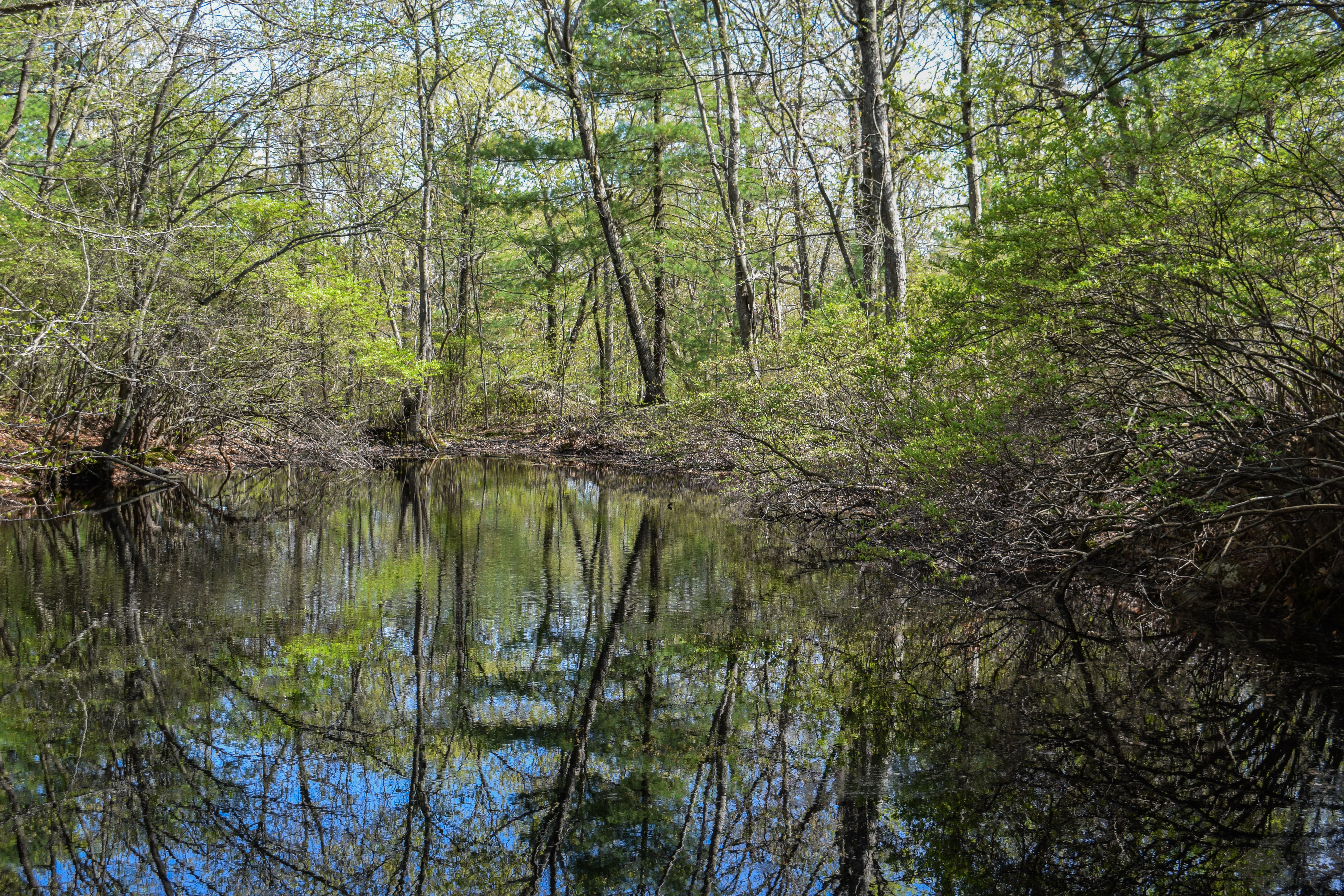
The hike began on the Cross-Fells Trail/Woodland Path, which featured a wonderufl early spring green tunnel. The trail circled a pond on the left and then I turned onto the Rock Circuit Trail just after, which passed another pond on the right, and later a larger one near E4-4. 


I had done this and variations on this loop numerous times, and I really didn't remember this stretch, which made it exciting! I passed a young shagbark hickory (thank you, Seek app) that had some really unique spring leafing/budding, and then the Rock Circuit Trail turned onto a road grade at the Fells Reservoir fence.

I realized I accidentally cut a corner when I turned onto the Melrose Path, which offically turned this into a tracing hike. Some men ran past me in sandals, and I worked my way up to the first open rock slab, which was delightfully warm with many singing birds all around.

Continuing on, I passed a baby garter snake in the leaves and worked my way to the crossing of the Fellsway. I scrambled up the next rocky knob after crossing the road and met some really neat harlequin flowers. 


I noticed a large fire ring on the left of trail just before it climbed up White Road, which had a brand new sign! I LOVE the sign, and I noticed Melrose Rock had one just in the distance, too! I also notice that someone's been kissing the white blazes with pink lipstick, which was a choice... I enjoyed the views from White and Melrose Rocks and continued my way over to the top of the Cascade, which was more of a dribble at this point, but still lovely from up high.


It was so nice to have leaves on the trees again. I caught up to a weridly silent duo as I climbed up the next nameless rock, followed by a few more nameless rocks with more harlequin flowers. There was a sign on view-less Black Rock, with many tent catepillars as well. From here until the next Fellsway crossing, the blazing became challenging to follow, and didn't always match up with the map. 

I wiggled my way over to Pinnacle Rock, which had a fantastic view and many survey holes. I kind of free-wandered off of Pinnacle, eventually following more white blazes (official-looking ones!) that weren't on the map. These blazes brought me to the communication towers and unmapped Ziggy's Rock, which had an excellent view of Boston and Great Blue Hill.


Eventually, the blazes brought me to Pinnacle Path, and then back onto the mapped stretch of the Rock Circuit Trail, which paralleled the Fellsway before crossing. The blazing and footbed were much easier to follow, now, too, and a kind driver stopped on the Fellsway to let me cross!

The Rock Circuit Trail continued through some wetlands before climbing again, passing some DCR "be kind" signs that I'd never seen before. The sun felt heavenly on a nameless rock, and I got a great view to Boston again from Boojum Rock. The new sign for Boojum was placed in a spot that had Boston directly behind the sign, which was a great touch.


From Boojum, I continued onto the MIT Observatory and then followed the Rock Circuit Trail almost all the way back to the Cross-Fells Trail, but I took a path I hadn't hiked before to cut a corner and get back to the car. I easily crossed Woodland Road, and made my way to Panera for some dinner before the show (the show was fantastic!).


Step-by-Step
- Park at Flynn Rink.
- Cross Woodland Road.
- Begin hike on Cross-Fells Trail/Woodland Path.
- At E4-8, turn left onto white-blazed Rock Circuit Loop.
- At F4-6, accidentally turn right onto Melrose Path.
- At F4-2, turn right back onto Rock Circuit Trail.
- After Pinnacle Rock, continue to follow white blazes to unmapped Ziggy's Rock, Pinnacle Path, and rejoin mapped section at F5-11.
- At F5-11, turn left onto Rock Circuit Trail.
- At E4-18, turn continue right onto path.
- At E4-7, turn left onto Cross-Fells Trail/Woodland Path.
- Cross Woodland Road, return to car.


Thursday, January 23, 2025

Cranberry Pool Path, B3-23, & Nearby Trails (Middlesex Fells Reservation)

Cranberry Pool Path, B3-23, & Nearby Trails (Middlesex Fells Reservation)

Hike Type: Figure 8-ish Loop
Distance: 3.05 miles
Elevation: 266 feet
Time: 1 hour, 1 minute
Hiking Challenges: N/A

The Hike
Back to the Fells to (unfortunately) continue to work on hiking all the trails! I never thought I'd get interested in actually doing it, and who knows if I'll ever finish, but it's nice to have a goal to work on while I'm waiting for the sunset to make it's way back to 5pm again so I can return to the Blue Hills after school. It was the day of my school's winter chorus concert, so I had a just a couple hours to kill. I went back to the Long Pond parking area, now with a traced map of trails I've hiked, and I was off!


There were more people out than on Tuesday, which made sence because it was sunny and 30 degrees with only a slight breeze. I made my way to the Cranberry Pool Path, which I was surprised to learn I hadn't hiked before. I hit the spur to basically somebody's back yard at B3-11, and then continued to follow the yellow-blazed path (feauturing some older pink blazes) to an unnamed trail.


I came across a few informational kiosks on Cranberry Pool Path that I had never seen before:

#12: Slickenside - Long Pond Nature Trail
On the large rock ledge in front of you, look for a patch of shiny, bottle-green rock at eye height and two by four feet in size. This is the slickenside. Pressure and movement resulted in [unclear] heat that the structure of the rock changed. The slickenside is an example of metamorphic rock, a type of rock which has been changed from one crystalline form to another. The green color in this clickenside comes from the mineral epidote.
From this final station, retrace your steps to the Long Pond Parking Lot where you began. If, instead of beginning at the Long Pond Parking Lot, you started the trail from Hillcrest Parkway and are halfway through your walk, now continue along this trail to Station #1 near the Long Pond Parking Lot.

#11: Vernal Pool - Long Pond Nature Trail
Please stay on the trail because these pools, and the areas around them, support fragile life forms.
Vernal pools are small ponds that usually dry up in summer, have no fish, and are used as breeding areas by creature that do not use permanent ponds. Another difference from permanent ponds is that most food chains of the vernal pool are based on dead leaves rather than green plants. Fairy shrimp, mole salamanders, and wood frogs require a vernal pool, where the absence of fish allows them to breed successfully. Before the pool dries up, wood frog tadpoles and salamander larvae must develop sufficiently to move to the surrounding woods where they spend most of their lives. Some creatures, such as dragonflies, caddisfly larvae, and mosquito larvae, are found in both vernal pools and year-round pools.

#10: Secret Woodland Garden - Long Pond Nature Trail
In the 1970s, this was an open rocky ledge with plant growth just beginning after a fire. Notice how many young pines have gained a foothold on the rocky ledge since the fire. Climb the rock ledge and part the young white pine branches to find the Secret Woodland Garden. 
On this shady knoll, you fill find rocks carpeted by lichens and soft green moss. Lichen, a plant which can grow on bare rock, is composed of two cooperating organisms: fungi, providing shelter, and algae, producing food by photosynthesis. The lovely green mosses reproruce by spores and absorb moisture and photosynthesize through their tiny leaves. Above the miniature green branches you may see small spires containing spores. As time passes, it will be harder and harder to find the lichen and moss which were the first plants to cologize this ledge after the fire.

I worked my way back to Wyman Path and then followed a long old road, which was well-packed up to B3-16, and then more like sand for the remainder. I hiked past what I believe is the Stoneham/Winchester town marker, and then made my way to the trail at B3-23, which was clearly less-traveled. 

I maneuvered back to Nanepashemet Road and followed the Mountain Bike Trail to B4-10, and then followed the trail around to B4-13, which was back to the sandy snow. At this point, I was moving faster becuase 1) I was starving and needed to pick up my food and 2) I needed to get back to school to set up. I followed the Mountain Bike Trail back to Molly's Spring Road, past a few dogs (with a human), and came across two older men metal detecting around the parking lot right at the end... fascinating!


Step-by-Step
- Park at Long Pond.
- Follow yellow blazes to Molly's Spring Road.
- At Molly's Spring Road, turn left.
- At B4-2, turn right onto Cranberry Pool Path.
- At B3-11, turn right onto path.
- At terminus, turn around.
- At Be-11, turn left onto Cranberry Pool Path.
- After B3-8, turn right onto Wyman Path.
- At B3-2, turn left onto path.
- At B3-1, turn right onot trail.
- At B2-1, turn righ tonto trail.
- At B3-3, turn left onto Wyman Path.
- At B3-4, turn right onto path.
- At B4-7, turn around.
- At B3-23, turn left onto trail.
- At B3-22, turn left onto Skyline Trail.
- At B3-21, turn left onto Nanepashemet Road.
- At B4-10, turn left onto trail.
- At B4-11, turn around.
- At B4-10, turn left onto trail.
- At B4-13, turn right onto Skyline Trail.
- At B4-12, turn right onto Mtn. Bike Trail.
- At B4-5, turn left onto Molly's Spring Road.
- Return to car.


Tuesday, January 21, 2025

Long Pond, Wyman Path, & Nanepashemet Road (Middlesex Fells Reservation)

Long Pond, Wyman Path, & Nanepashemet Road (Middlesex Fells Reservation)

Hike Type: Loop
Distance: 2.25 miles
Elevation: 187 feet
Time: 51 minutes
Hiking Challenges: N/A

The Hike
After my catostrophic week last week and lovely weekend, I am officially back! I wanted to get out and enjoy the snow after work so I drove over the Long Pond area of the fells for another free-wander. Well, what I thought would be a free-wander. I guess I'm officially trying to hike all of the trails in the Fells... I guess... I tried to follow paths and trails that I'd never hiked on before, so off I went!


It was a winter wonderland in these woods which was just delightful. It was cold, though. 19 degrees, but thankfully not too breezy. I did forget my buff and water, but I planned to keep this one short anyway. There were cross-country ski tracks all around, especially on the wider paths around Long Pond. Most of the trails were hard-packed with snow, but a few of the smaller connecting trails, or a wider path that was not a part of any blazed route, were more powdery. 


I got some nice tree views of Long Pond and then stumbled across a couple of benches overlooking the frozen water. Later on, I walked on the ice just far enough to get a nice photo fo the pond.


My return route mostly followed the Nanepashemet Road, which was again, lovely. There was a medium-large group of kids with one adult - I assume a scout group - hiking on the Skyline Trail at about the same pace as me, so we criss-crossed a couple of times. From there, I turned back onto Molly's Spring Road and walked back to the car, concluding a short, cold, but lovely time in the Fells.


Step-by-Step
- Park at Long Pond.
- Follow yellow blazes to Molly's Spring Road.
- At Molly's Spring Road, turn left.
- At Gate 14, turn around.
- At B4-1, turn left.
- At B3-18, turn right.
- At B3-21, turn around.
- At B3-20, turn right.
- At B3-1, turn left.
- Before B3-8, turn left.
- At B3-9, turn left.
- At B3-2, turn right onto Wyman Path.
- At B3-5, turn left.
- At Gate 16, turn around.
- At B3-15, turn right onto Nanepashemet Road.
- At B4-5, turn right onto Molly's Spring Road.
- Return to car.


Friday, January 10, 2025

Quarry, East Dam, & Middle Roads (Middlesex Fells Reservation)

Quarry, East Dam, & Middle Roads (Middlesex Fells Reservation)

Hike Type: Loop
Distance: 2.47 miles
Elevation: 187 feet
Time: 52 minutes
Hiking Challenges: 52 Hike Challenge 2025

The Hike
I had an hour to kill between the end of the school day and our staff "winter gathering," so back to the fells I went! I didn't have a change of clothes, so I opted for easy hiking with minimal elevation. I made my way over to Bellevue Pond, left all my gear in the car and started my lovely stroll! The afternoon light was shining beautifully as the squirrels were doing who knows what in abundance on Quarry Road. I passed many neat rock/boulder formations - I'm guessing that were once quarried, hence the name of the road? There were some old concrete posts near the end of the road proper, and then the trail turns into a footpath alongside I-93, and then up the side of a hill.


There were lots of criss-crossing paths on the hill, but I eventually found my way to the Skyline Trail, which I followed for a brief moment before taking a spur trail to Red Cross Path. I fear I'm leaning towards starting a redlining challenge in the Fells...


The Red Cross Path was a little wet from the melting needle ice, and then I worked my way on East Dam Road to the dam, and then the trek back via Middle Road. I crossed paths with some runners and bikers, but overall not many people at all. Middle Road traversed a higher, open area before gently descending down by the "Panther Caves," which, in my opinion, sound cooler than they are.


My hike ended by following a footpath from the end of Middle Road back to my car, which made for a lovely, easy loop hike. After, I was off the Great American Beer Hall in Medford, which resulted in a fun evening!


Step-by-Step
- Park at Bellevue Pond.
- Start hike on Quarry Road (Gate 5).
- Follow Quarry Road to its terminus and follow the footpath to D5-5. 
- At D5-5, turn right onto Skyline Trail. 
- At next jct., turn left.
- At terminus, turn right onto Red Cross Path.
- At C5-20, turn left onto East Dam Road.
- Cross South Reservoir Dam.
- At C5-2, turn left onto Middle Road.
- Follow Middle Road to Gate 6. 
- Turn left and follow footpath back to car.

Wright's Tower to Gerry Hill Loop (Middlesex Fells Reservation)

Wright's Tower to Gerry Hill Loop (Middlesex Fells Reservation)

Hike Type: Criss-crossing Lollipop Loop
Distance: 4.04 miles
Elevation: 531 feet
Time: 1 hour, 30 minutes
Hiking Challenges: 52 Hike Challenge 2025; Operation Alaska Benchmark Challenge

The Hike
It was conference night at school, which meant I had to work until 3 like normal and then come back from 6pm-8pm - gross. I filled that open time with a cold trip to the fells (and then some Sweetgreen afterwards). It was 27 degrees out but VERY windy, which made this a cold one! I drove over to Bellevue Pond, changed in the car, and got moving as quickly as possible to warm up!


Bellevue Pond was completely frozen over and I noticed a new trail leading up to the tower - the yellow-blazed Wright's Tower Trail. I followed that up, which had a winding path that was never too steep and pretty open. I came up to a tree that had a downy woodpecker just hanging out. It didn't move until I got within ~5 feet, and then it started chirping up a storm and scooting around.


Soon after the short trail came to a ledge with a lovely view toward Boston the Great Blue Hill, only partially obstructed by treetops. Up at the tower I was delighted to see no other souls, which made sense because the wind was blustery and it was frigid. That being said, the view was beautiful! I especially loved seeing the lit-up slopes of Blue Hills Ski Area, where I'm hoping to visit for the first time Monday night (they dropped a new $20 Monday night deal recently). 


Now, my plan was to hike on the Skyline Trail until my designated turn-around time of 3:45pm. My puffy came off becausse I was sweating (no surprise there), and I was off! A bit further down the trail, before the first descent, I located two USGS discs, but only one was one that I had seen before - could there really be three on this little hill (spoiler alert - yes!). 


I started the gentle rollercoaster of the Skyline Trail, delighted to see a drastic lacking of ice. That being said, any and every dirty patch was covered in needle ice, which created some fun and exciting "trap doors" and ankle-rolling moments throughout the hike. It was windy on the hills but much more tolerable in the woods. I passed someone's unique... cairn? Not sure what to call it, but they used nearby rocks on a boulder to create a monster's face (I kind of love it).


My alarm went off right at intersection C4-2 just past Gerry Hill, and now it was time for the great return! I worked my way to the Mountain Bike Loop and followed that for a while, past a super old sign detailing something about picnic areas.


I continued onto Silvermine Road once the Mountain Bike Loop turned away, worked my way across a big ice patch, and rolled my ankles a few more times due to the needle ice/frost heaves. Over half of Mud Road was covered in ice, so I stuck to the woods on the side, and made my way back to Quarry Road with enough sunlight for one more visit to Wright's Tower! I scooted up the Skyline Trail, saw my second person of the day (who was running down), and made it just in time to notice that there might be a nice sunset - there was a small gap in the clouds right on the horizon.


I set up camp right next to Wright's Tower and watched the beautiful show - the shadows on the clouds above were especially dramatic. I took a quick intermission to take a photo of the tower and find the third USGS disc that I knew existed, and then the sun began to poke through and I took at least 1,000 photos. It was cold and beautiful! 


I descended via the Wright's Tower Trail and the runner from before ran down past me again, and then turned around at the bottom and ran back up again! Back at the car, I changed back into dry, warm clothes, and made my way back to school for a long night of not doing much. Overall, it was a great way to spend the afternoon!


Step-by-Step
- Park at Bellevue Pond.
- Start hike on Quarry Road (Gate 5).
- After D6-5, turn right onto Wright's Tower Trail.
- At Wright's Tower, continue onto Skyline Trail. 
- At C4-2, turn right onto Gerry Hill Path.
- At D4-3, turn right onto Mountain Bike Trail.
- Continue to follow Mountain Bike Trail.
- At D5-2, continue on Silver Mine Path.
- At C5-20, turn left onto Red Cross Path.
- At C6-4, turn left onto Mud Road.
- At D6-2, continue onto Skyline Trail.
- At Wright's Tower, continue onto Wright's Tower Trail.
- At terminus, turn left onto Quarry Road and return to car.


Tuesday, December 3, 2024

Railroad Trestle to Bear Hill (Middlesex Fells Reservation)

Railroad Trestle to Bear Hill (Middlesex Fells Reservation)

Distance: 2.28 miles
Elevation: 243 feet
Time: 48 minutes
Hike Type: Loop
Hiking Challenges: 52 Hike Challenge

The Hike
Back to the Fells! I had to drop off the four tubas that I stole/borrowed for TubaChristmas, but had an hour to kill. With the limited sunlight this time of year, the Fells made the most sense! I drove over to a corner I had not been to before, near Bear Hill. The parking was right off the highway and felt very... wrong, but it was marked on the map and allowed during daylight hours!

I started my hike on Dike Road and then veering left toward the highway onto an unblazed path that is on the map. The trail was nice, even though it paralleled I-93. There was plenty of needle ice in the shady areas, which was fun! There were occasional unmapped criss-crossing paths, but I stuck to paralleling the highway to moderate success.


The trail passed below a large concrete cylinder on to of Bear Hill - I would investigate that later. Eventually, some older yellow blazes began to appear on top of even older blue ones. I continued along, immersed in the sounds of nature, which in this case were cars, police sirens, and helicopters. Eventually, the path steeply descended to a gravel road at D2-7.


This started a lovely, flat stretch that I believe was an old railway (based on being named "Railraod Trestle" on the map). It first traveled between two high rock walls, and then over a fenced-in trestle, which was very fun and unique. 


I turned off of the Railroad Trestle trail at a second, smaller bridge, and wiggled my way to the more rugged Skyline Trail. I enjoyed the variety of terrain on this small hike. There was a lot of needle ice going up Winthrop Hill, which had a newer bench at the top. Just after there was a nice view into the interior of the Fells. I descended the hill and zig-zagged over to Bear Hill Road, which climbed gently up to Bear Hill.


Bear Hill had a massive concrete water tower (the cylinder mentioned before) with a really unique open-faced observation tower that seems to be in early-stage decay. The water tower was heavily fenced-in, and the observation tower was surrounded by a fence with multiple human-sized holes. I may or may not have scoped the area for a possible USGS disc, but did NOT tempt fate by climbing up the tower, but it was clear that many have/do, as evidenced by the massive amounts of graffiti. It was a super interesting area, for sure!


After descending Bear Hill on Bear Hill Trail, I then joined the Reservoir Trail, where I passed my first human of the day, and meandered back to Dike Road, which had a large amount of locked up manhole covers. I finished my hike soon after, and I made a note that I need to remmeber that 45 minutes in the woods is significantly better than nothing. I'm setting a soft goal of getting into the fells once a week until the 5pm sunsets come back and I can get back to the Blue Hills after school.


Step-By-Step
- Park at Gate 20 off of Fallon Road.
- Start hike on Dike Road.
- At jct., veer left onto footpath paralleling I-93.
- At D2-4, continue on footpath paralleling I-93.
- At D2-7, turn right onto Railroad Trestle.
- At D3-2, turn right toward Skyline Trail.
- At D3-1, turn right onto Skyline Trail.
- At C2-6, turn right onto trail.
- At D2-5, turn left onto Bear Hill Road.
- Summit Bear Hill, turn around.
- At C2-4, turn right onto Bear Hill Trail.
- At C2-3, turn right onto Reservoir Trail.
- At C1-6, turn right onto Dike Road.
- Return to car.


Middlesex Fells Reservation Map

Tuesday, November 19, 2024

Partial Rock Circuit Loop (Middlesex Fells Reservation)

Partial Rock Circuit Loop (Middlesex Fells Reservation)

Distance: 4.23 miles
Elevation: 505 feet
Time: 1 hour, 26 minutes
Hike Type: Lollipop Loop
Hiking Challenges: N/A

The Hike
"Man Versus The Sun" - that could be the title of this one. I had a couple hours to kill after work so I headed back to the Fells for the first time in a while to tackle the Rock Circuit Trail. I knew I would be cutting it close. I zoomed over after school and got started by crossing the busy Woodland Road. It was sunny, a bit breezy, and a warm 55 degrees.


Once in the woods, I followed the Cross-Fells Trail to E4-8, curving around the dried-up Shiner Pool and turning onto the Rock Citcuit Trail. The Braintree police department put out a public safety notice joking that if you even look at a leaf the wrong way, it'll catch fire, and that was apparent up here, too. 


The Rock Circuit Trail joined a gravel road rounding another dry pool, passed over a dead mouse (RIP), and then crossed another gravel road that led to the Fells Reservoir. The trail neared an apartment complex and then turned further into the woods, where blazes were abundant.


At the first outcropping, I passed the terminus for the Crystal Spring Trail, and began to traverse up and down and up and down over many rock outcrops. There was an "almost-view" right before descending to cross the Fellsway East, and then ascends back up again toward Melrose Rock.

Melrose Rock provided a nice view. Notably, I could see a plume of smoke coming out of a nearby brush fire. A similar view from White Rock was up next, followed by a trickle of water heading down The Cascade. I wanted to investigate it further, but I was still racing against the setting sun.


There was another nice view from Black Rock, which included the ocean for the first time of the hike, followed by another view to some nearby athletic fields. The Rock Circuit Trail continued to wiggle up and down several more outcroppings, ultimately landing at the best view from Pinnacle Rock, overlooking Boston. 


I quickly backtracked and then continued over the loop, acknowledging that I might be losing this race against the sun. I made it over Boojum Rock and the MIT Observatory site, but later dipped off onto Hemlock Pool Road. I do think I could have made it, but the dimming light was making following the trail difficult, and I knew I would be fine on a wider road/trail. My return trip was nice and easy, the Hemlock Pool was also fully dried up, and I arrived at the Woodland Road crossing with perfect timing - no cars in either direction!


Step-By-Step
- Park at Flynn Rink.
- Carefully cross Woodland Road.
- Start hike on blue-blazed Cross-Fells Trail/Woodland Path.
- At E4-8, turn left onto white-blazed Rock Circuit Trail.
- Follow loop clockwise.
- After MIT Observatory, when Rock Circuit Trail nears Hemlock Pool Road, cut through woods to Hemlock Pool Road.
- Turn left onto Hemlock Pool Road.
- At E4-13, turn right onto Woodland Path.
- Return to car.


Map of Middlesex Fells Reservation (2024)