Showing posts with label Harriman Shelter Challenge. Show all posts

Thursday, April 24, 2025

Tom Jones & Dutch Doctor Shelters via R-D and Victory Trails (Harriman State Park)

Tom Jones & Dutch Doctor Shelters via R-D and Victory Trails (Harriman State Park)

Hike Type: Figure 8 Loop
Distance: 8.90 miles
Elevation: 1,601 feet
Time: 3 hours, 38 minutes (3 hours, 30 minutes moving)
Hiking Challenges: Harriman Shelter Challenge, Harriman Trail Challenge

The Hike
Time to (hopefully) finish the Harriman Shelter Challenge! Yesterday, I saw Boop! on Broadway, so no hiking, but now everyone in my New Jersey family was working, and I had a few hours to kill. I accidentally added 15 minutes to my drive by thinking I could skip my exit off of I-87 to use the bathroom at the new Sloatsburg Service Plaza, but that was clearly a mistake... The plaza was beautiful, though! I slowly worked my way to the Ramapo-Dunderburg Trail crossing parking on Kanawauke Road, got suited up, greeted the woman parked next to me who was finishing up her hike, and got right to work!


Unfortunately, the gnats were ABUNDANT. I guess that's just one of the joys of springtime! It was a warm-feeling 60 degrees out, and I soon applied my first helping of bug spray for the season. I climbed along a partial reroute of the Ramapo-Dunderberg Trail up Tom Jones Mountain, which then continued up some steep, open slabs with views behind. The trees had early spring buds, and I was catching plenty of spider webs.


Like much of Harriman State Park, the woods were wide open. This climb was short, but mighty, and I was soon out of breath and at the summit! There were views all around through the spaced-out trees. It felt like a wonderful summer morning.


After the summit, the Ramapo-Dunderberg Trail scrambled down and then I joined a short spur trail to the Tom Jones Shelter. I noticed a black snake about 20 feet off-trail in the grass, just slithering about. There was a wonderful view from the shelter (the second best, in my opinion, after West Mountain). The only sounds I could hear were the birds and I could make out part of a lake down below. What a beautiful morning!


Now I was back on the Ramapo-Dunderberg Trail for a while. I passed some catepillar tents as I descended Tom Jones Mountain. I noticed a stone living room-type structure through the trees on the descent, and I had a nice view to Parker Cabin Mountain, which was my next stop.


In the col, I passed the Victory Trail, which I would hike much later in the day. The Ramapo-Dunderberg Trail crossed an easy creek and began to gently ascend Parker Cabin Mountain, which had more characteristic, open woods. I caught a nice view back to Tom Jones from a false summit, and found two more snakes as I hopped off of the false summit. They were both black and I assume the same kind as the first. I thought rat snakes, but not 100% sure. 


The trail gently climbed and mellowed out at the summit, which was open and grassy with view through the trees - it was so pretty up here.


The Triangle Trail briefly joined in another open area and then split off - I followed the Ramapo-Dunderberg Trail on the left, which was now grassier and less defined as it descended. There was a heavenly breeze that added at least a year to my life, too. I caught some ledge views on the way down. 


I was enjoying the delightful weather as the trail began to steeply descend into the woods, where the white cross trail crossed. After meandering for a bit, the Ramapo-Dunderberg Trail next crossed the white bar trail, wiggled through some unproblematic mud in a Mountain Laurel grove, and then began to climb to Black Ash Mountain (#1?- it's unclear if this or the next peak was Black Ash Mountain, as the official NYDEC map labels both as such... kinda). 


The Ramapo-Dunderberg Trail arrived at a rugged summit followed by a small scramble down in a generally rugged area, but it soon chilled out and became wonderfully grassy. Something wet fell on my face here, but I chose to ignore it. The descent continued to be pretty, grassy, and rolling, and then crossed under some power/telephone lines that were a little too close to my head for comfort!


After crossing under the lines I came to my first new trail of the day! The Blue Disc Trail traversed over a really neat rock dam with a pond on the left (featuring some ducks and a goose) and a stream down below on the right. A steep ascent followed up Black Ash Mountain part two (I need to check the Harriman Trails book to figure out if they're both called Black Ash Mountain). There were nice tree views back towards Black Ash 1 and Parker Cabin, and after some huffing and puffing I made it to the top! The summit slabs were open and dry and provided wonderful views.


I began to descend with the humming of I-87 in the background while I got my first bug-in-eye of the season. The trail worked its way to another section of slabs with wonderful views - curiously named Claudius Smith's Dens. 


After the Blue Disc Trail turns left at the dens, I continued left and joined the Tuxedo-Mt. Ivy Trail, which gradually descended for a while. I was back in the woods, which was welcomed as I did not have on any sunscreen and I was feeling crispy! There were plentiful woodpeckers overhead and eventually the trail began to skirt around a swampy area.


In this area, I hit my 4 mile/halfway point for the day, entered a field of loose rocks, and got another bug in my eye. The trail began to slightly ascend, but I didn't even notice until I was out of breath. The trail climbed up and over a pretty knoll as I applied some more bug spray since I had a cloud of gnats overhead.


The Tuxedo-Mt. Ivy Trail crossed a few small streams, and soon I turned onto White Bar, where I was assaulted by more bugs. On the plus side, the final shelter of my challenge was on this trail! Yay! A short spur led to the shelter, but I didn't explore much, as someone was setting up their tent.


This started a long series of hiking through mountain laurel groves. White Bar went through one, I got covered in spider webs, and then there was more after I turned onto Triangle Trail. There was an unmarked path on the right (I assume it goes to a camp on Sebago), and then more mountain laurel. I began to feel a bit claustrophobic as critters scurried around on the leaves on the ground. The trail briefly opened back up, but then soon descended back into more mountain laurel!


I finally got a little reward as the trail neared Lake Sebago. There was another unmarked trail on the right, and later a little spur to the shoreline where I saw some fish! I also saw some turtles, but scared them off - sorry!


Another unmarked trail continued along Lake Sebago as the Triangle Trail turned up and away, rising up and over a low ridge, and then right back into a mountain laurel tunnel with fresh spider webs! On the plus side, this tunnel had some small purple flowers on the ground! The trail rose to a second knob and then Lake Skemonto came into view. 


The Triangle Trial soon came to a short spur to a great viewpoint of the lake. I could see a bunch of turtles enjoying the sun, a couple ducks swimming about, and a goose simply hanging out. I could hear bullfrogs, too. A little ways away there was another viewpoint of the same area, which was just delightful. I had also noticed a lot of dry, furry animal poop on rocks. Maybe it belonged to foxes or coyotes?


After the wonderful lake view... I was back into a mountain laurel tunnel. There was an easy rock hop across a swamp that drained into the lake, and then I was officially on the Victory Trail - my final trail of the day! I was greeted by a delightful breeze and many birds singing overhead. There were tree views to the lake on the right and an unmarked connecting spur trail to Triangle on the left. It also seemed like part of this trail used to be paved?


There were some wild sounds coming from the lake - I assume bullfrogs, and I soon came up to the overhead cables again! The Victory Trail followed these cables for a bit - acting like an access road (I think it is the access road). The trail crossed under the lines to turn and rise away from the lake before circling around a really pretty meadow where I saw another black snake! This one was wet, so I'm guessing a water snake? The gnats had also returned in this section, so I kept it moving.


The Victory Trail wound around the meadow, intersecting with a few other gravel and then paved paths, eventually leaving the meadow in an area with some fire damage. I noticed a building through the woods, I guess belonging to the camp. Next was an old foundation on the left as the Victory Trail crossed under the wires again, just before turning off of the access road and back onto a foot trail. 


The trail continued past some impressive rock formations on the right and then I crossed paths with my first person fo the day! It took 7.42 miles and 3 hours, 8 minutes - I was delighted to be alone for so long. I ventured into yet another mountain laurel grove, but thankfully a shorter one than before, and then it became more rugged in an area with a few wild turkeys. The Victory Trail crossed a few streams and then passed the Ramapo-Dunderberg Trail, officially concluding the larger part of this figure-8 loop. 

The final stretch of Victory Trail hopped along stone steps in a muddy section filled with black birds in the air and then went back into ANOTHER mountain laurel tunnel, and then soon enough I was back on Kanawauke Road!


The road walk was short but also a bit of a bummer, especially after having so much wonderful time in the woods. I counted 15 motorcycles on my short road walk. On the left, there was a wonderful beaver meadow, and soon enough I was back at the car! It was now a toasty 75 degrees, and I was so happy to be able to trust rocks again after my Monadnock hike. Oh, and I was also happy to have completed another challenge!


Step-by-Step
- Park at R-D Trailhead on Kanawauke Road.
- Start hike on Ramapo-Dunderberg Trail (south).
- At jct., turn left onto Blue Disc Trail.
- At jct., turn left onto Tuxedo-Mt. Ivy Trail.
- At jct., turn left onto White Bar Trail.
- At jct., continue onto Triangle Trail.
- At jct., turn right onto Victory Trail.
- At terminus, turn right onto Kanawauke Road.
- Follow Kanawauke Road back to car.

Saturday, March 1, 2025

West Mountain Shelter via 177W & Timp Torne (Bear Mountain State Park)

West Mountain Shelter via 177W & Timp Torne (Bear Mountain State Park)

Hike Type: Loop
Distance: 5.82 miles
Elevation: 1,178 feet
Time: 2 hours, 43 minutes (2 hours, 38 minutes moving)
Hiking Challenges: 52 Hike Challenge; Harriman Shelter Challenge; Bear Mountain Trail Challenge

The Hike
Finally, a weekend down in New Jersey to see the family (or apparently just Mom) and not skiing up north! To stay on theme, I hoped to ski Shawnee Mountain in PA while my mom was at a baby shower, but apparently they have blacked out Saturdays even into March! Boo! Instead of skiing, I decdied I'd head back up to Harriman/Bear Mountain for a hike and to knock off another shelter. I was up around 7am and was out the door around 8am. I was shocked and nervous at the crowds I saw at some of the more popular trailheads along the Seven Lakes Drive, but I was delighted to see that my parking area only had two other cars. It was 42 degrees with overcast skies. It smelled and felt like spring, and it was my first hike in shorts of 2025!


"The Historic 1777 & 1779 Trails" from Trailhead Kiosk
You are walking part of the 1777 historic trail that retraces as nearly as possible the routes taken by the British army during the Revolutionary War.
The 1777 trail represents the route taken by British General Sir Henry Clinton's forces on October 6, 1777. After landing 2,100 men at Stony Point, he marched north to capture Forts Clinton and Montgomery. At Doodletown, the trail splits. The east branch of the trail follows the march of the forces under Sir Henry Clinton and Major General John Vaughn that captured Fort Clinton. The west branch follows the route of Lieutenant Colonel Mungo Campbell's force, which captured Fort Montgomery
The 1779 trail trace the route taken by Brigadier General Anthony Wayne's Corps of Light Infantry in its assault on the British fortifications at Stony Point just after midnight on July 16, 1779. After a brief but fierce fight, Wayne's men captured Stony Point, achieving one of the Continental Army's most spectacular victories.


I was excited to get out 1) because I love to work on a hiking challenge, 2) I love hiking, but also 3) there's been a lot of... "drama" in the ski world, specifically with the vice president going skiing at Sugarbush, and the Sugarbush snow report went "rogue" and posted a really wonderfully written, heartfelt essay on what was happening, how current administration policies are hurting the parks and mountains we love, and her passion for Sugarbush. It was all weighing heavy on my mind (along with other things the administration is up to), so I was looking forward to just being outside to think it though and also physically move my body to help my mind settle. ANYWAY. I may have broken the rules and hiked on a closed section of the 1777W trail to start my day (rebellion!). I believed (and still do) that I am experienced enough to know that if a section is dangerous, or if I am contributing to trail damage, I could turn around. The trail was in great shape, though! The trail rose and fell, snowy at times, and grassy at times. It traversed a partial streambed and led to a lovely meadowy stream crossing.


My fleece came off at the junction with Timp-Torne Trail, which was right near the main road. Now following blue balzes, the Timp-Torne Trail felt more recently traveled with medium-new blazes. The sun was beginning to poke out and I was very glad that I was wearing shorts, as my heart was pumping! There were nice tree views over to Bear Mountain as the trail followed a spine of West Mountain - the terrain felt very similar to Norvin Green State Forest, a favorite of mine.


The trail descends and I learned this stretch of Timp-Torne was also closed (sorry!). I scooted around the fence and continued up, where the Timp-Torne Trail and the Appalchian Trail now coincided. There was some snow and slush in some nooks and crannies, but I did not need spikes. The trail climbed to a modest view and I could hear people behind me (also an insane amount of migrating geese). 

After the view, the trail climbed more moderately to steeply to another overlook that I chose to not fully investigate, as it was super icy and I didn't plan to fall off of a mountain on this day. There was a small bypass-able scramble followed by a trickier scramble. I crossed paths with a human for the first time! He warned me that I'd need microspikes ahead... sigh... okay. Thankfully, it was so delightfully warm out, I felt great!

From the height-of-land after the scramble, there was a great view down to the Anythony Wayne Recreation Area and the Long Mountain Traffic Circle. The trail then descended, with the blazed route and an "EZ" route. Both stretches were short. I descended the "EZ" way, came back up the blazed, and descended "EZ" again. The blazed way was fun! A narrow squeeze followed by a mini-chimney.


Climbing again, I could see a group of teenage boys ascending, so I picked up the pace to hopefully avoid any social interactions. I was successful, but definitely hit the gas a little too hard, because I was FIGHTING for air at the top of the climb, also while rock-hopping around snow. The Appalachian Trail left the Timp-Torne at this point, and signs indicated the shelter was further down Timp-Torne. I put spikes on here for a short bit and enjoyed a great view of Bear Mountain and a peek at the Hudson River. 


The trail turned onto a sunny ledge overlooking the other side now, and my spikes came back off. I was starting to worry about sunburn! I scrambled into a sag and then another lovely ledge. There was evidence of old AT blazes on the trees, now scraped off, too. Ascending again, I hit another icy patch that was not easily bypass-able, but I did it, and passed a few more views in both directions. Bear Mountain was looking exceptional on the left, and I'm pretty sure I could see Jackie Jones on the right. I was starting to flirt with heading to Bear Mountain after I descended West Mountain, but wasn't sure if I brought enough water... Time will tell.


The Suffern-Bear Mountain Trail joined the Timp-Torne Trail for a little bit, rambling on a plateau ridge with minor ups and downs. My tummy was actually behaving excellently on this hike, until a few scary flatulence emissions, but they qucikly subsided. The Suffern-Bear Mountain Trail left the Timp-Torne Trail, which continued forward just a bit further to the shelter! Unfortunately, there was a group of about 20 people at the shelter taking up all the space (and the view!). I did a quick lap, snapped a quick photo, and quickly got back on my way. I was briefly followed by someone's off-leash chihuahua, but eventually they got their dog. 


Back at the Suffern-Bear Mountain/Timp-Torne Trail junction, I turned right and started my descent on Suffern-Bear Mountain Trail. The trail was beautiful, wandering around a grassy plateau, followed by an icy descent that I did not descend gracefully. My spikes went on for the next bit, as the ice continued, and as I scraped my legs on some firm vegatation. The trail then got steeper and sketchier, solidifying my choice to put spikes back on. 


I followed some deer tracks as the variable trail conditions tortured my Kahtoolas, but I reminded myself that this is why I have a pair of rock spikes. I did take them off briefly, but had to immediately put them back on. The trail then ascends to a knob, which was bare, so spikes off, and just when I motioned to fully put them away, they had to go back on again for the longer descent. Comically, the song "I Hate This Part" by the Pussycat Dolls was stuck in my head.


The descent was now consistenly brutal, but at least I could keep the spikes on the whole time (with only a few rock-hits). Eventually, the Suffern-Bear Mountain Trail arrived at the Doodlekill (an INCREDIBLE name for a stream), and followed it briefly, past some cascades, and then crossed it. This area was very wet with streams flowing in all directions, but was very beautiful. I haven't heard or seen running water in quite some time! I did go off-trail for a quick bathroom break, and I soon learned that I was incredibly dehydrated - I wasn't used to warmth!


The Suffern-Bear Mountain Trail joined a road grade and got VERY squishy, but then left the road grade at the Fawn Trail junction. The trail descended into a mountain laurel grove (I still need to learn the difference between mountain laurel and rhododendron), crossed another stream which required 5% brain power, and then came to 1777W! There were some old "trail closed" signs stashed away.


1777W followed a road grade for this strech, which was absolutely delightful, flat, open, and just lovely. There were endless active drainages over on the left, which added a nice soundtrack to the end of this hike. I passed a cascade over a boulder on the left and some "wetland delineation" tape in wetter spots (I wonder what that's all about?). At this point, it was so warm out I was beside myself. I wanted a nice cocktail out on a patio overlooking water. SUMMER BRAIN. Don't worry though, my next adventure will snap me right back into winter mode. 


1777W came to an old sign with a #5 on it, and then joined the Appalachian Trail. After rising a little, the trail hit another brutal stretch of ice, snow, and slush, but I REFUSED to put spikes back on. The Appalachian Trail then left 1777W, and I returned to the parking lot!


This was a fantastic hike and I would 100% recommend it... once all the trails are open! For someone who wanted to prioritize hiking conditions, I'd recommend going clockwise (not what I did) to get the Suffern-Bear Mountain stretch over with early, but for someone who wanted to prioritize crescendoing views, I'd recommend my route. First views were peeks through trees, and the best views were at the end before the descent. To my surprise and delight, the lot was also basically full when I left! I had a tough time getting home at first, accidentally getting on the Palisades Interstate Parkway, turning around at Anthony Wayne, and then taking the wrong exit at the rotary, but I eventually made it home, showered, and got a SOLID nap in before mom got home from the baby shower. Back to New England tomorrow!

Step-by-Step
- Park at 1777W Trail parking off of Seven Lakes Drive.
- Start hike westbound on 1777W.
- At jct., turn left onto blue-blazed Timp-Torne Trail.
- Appalachian Trail joins Timp-Torne Trail, continue. 
- Appalachian Trail leaves Timp-Torne Trail. 
- Suffern-Bear Mountain Trail joins Timp-Torne Trail.
- Suffern-Bear Mountain Trail leaves Timp-Torne Trail.
- Arrive at West Mountain Shelter, then turn around.
- Follow Suffern-Bear Mountain Trail left, begin descent.
- At jct., turn left onto 1777W.
- Return to car.


"1777W Trail to Fort Montgomery" from Harriman Trails, 4th Ed. (2018)
[...]. At 0.5 mile, an intersection with the Suffern-Bear Mountain Trail (yellow) and Doodletown Road is reached. Here, 1777W turns left onto Doodletown Road, which it follows gently uphill towards the Seven Lakes Drive. At 1.05 miles, just before 1777W reaches the Seven Lakes Drive, it turns left, joining the Appalachian Trail (AT), which comes in from the right. Both trails climb the hillside on a footpath. At 1.2 miles, the AT departs to the left, while 1777W continues ahead, soon passing a parking area. The trail continues to run roughly parallel to the Seven Lakes Drive until, at 1.95 miles, it joins the Timp-Torne Trail (blue), and both cross the Palisades Interstate Parkway on an overpass. [...].

"Timp-Torne Trail" from Harriman Trails, 4th Ed. (2018)
[...]. After cross the Palisades Interstate Parkway on an overpass, 1777W departs to the left, while T-T goes up a bank to start the climb up West Mountain. 0.2 mile from the Parkway, the Anthony Wayne Trail (white) starts on the right. After climbing a small knob, with a good view, T-T crosses the Fawn Trail (red F on white). T-T now climbs more steeply, with more views along the way, to a junction with the Appalachian Trail (AT) at 5.4 miles. 
        Shortly after the junction with the AT, the trail arrives at a viewpoint over Bear Mountain and the Hudson River. T-T/AT then crosses to the west side of West Mountain, where there is an excellent view of Beechy Bottom and the Anthony Wayne Recreation Area. For the next 0.65 mile, the join trails run along the ridge, with a number of additional viewpoints. T-T then turns left as the AT continues straight ahead and begins its descent (that was the original "western leg" of T-T). At 6.3 miles, the Suffern-Bear Mountain Trail (S-BM) (yellow) comes in from the right and runs jointly with T-T for 0.3 mile. S-BM then departs to the left. At 6.7 miles, the trail passes the West Mountain Shelter. This shelter was built in 1928, with burros being used to carry up the lumber and cement. [...].

"Suffern-Bear Mountain Trail" from Harriman Trails, 4th Ed. (2018)
[...]. On the crest of West Mountain, the Timp-Torne Trail (T-T) (blue) joins for 0.3 mile. T-T then departs right to the West Mountain Shelter, while S-BM goes northwest to a knob, with views of the Perkins Memorial Tower on Bear Mountain. A rocky descent, soon followed by a steep ascent, leads to anothe rknob, a high point of West Mountain. From here, S-BM goes steeply down and continues to descend along an old woods road, following the gully of the Doodlekill. After crossing the brook, S-BM turns left onto the Doodletown Bridle Path at 21.5 miles, and both run together for 0.15 mile. S-BM then goes right, leaving the Bridle Path (the Fawn Trail, which begins here, continues ahead on the Bridle Path). S-BM goes over a low ridge, crosses two branches of a brook an dgoes up a bank to rejoin the Bridle Path at the old Doodletown Road. The 1777W Trail crosses here.

Tuesday, July 30, 2024

Stockbridge & Brien Memorial Shelters via Silver Mine Lake (Harriman State Park)

Stockbridge & Brien Memorial Shelters via Silver Mine Lake (Harriman State Park)

Distance: 9.90 miles
Elevation: 1,611 feet
Time: 4 hours, 4 minutes (3 hours, 53 minutes moving)
Hike Type: Loop 
Hiking Challenges: Harriman Shelter Challenge; Harriman Trail Challenge

The Hike
Time for my final hike in Harriman this summer! I would not be completing the shelter challenge this summer, and I was more than fine with that. I made my way to the Silvermine parking area, which is at the base of an abandoned ski slope! It had a massive dirt lot, porta potty, picnic structures, and a gate/toll house that was unmanned at this time. My body was still sore from AC/skiing/hiking, but again happy to be out. My watch charged weird so I wasn't sure how that would go, but soon enough I was off!


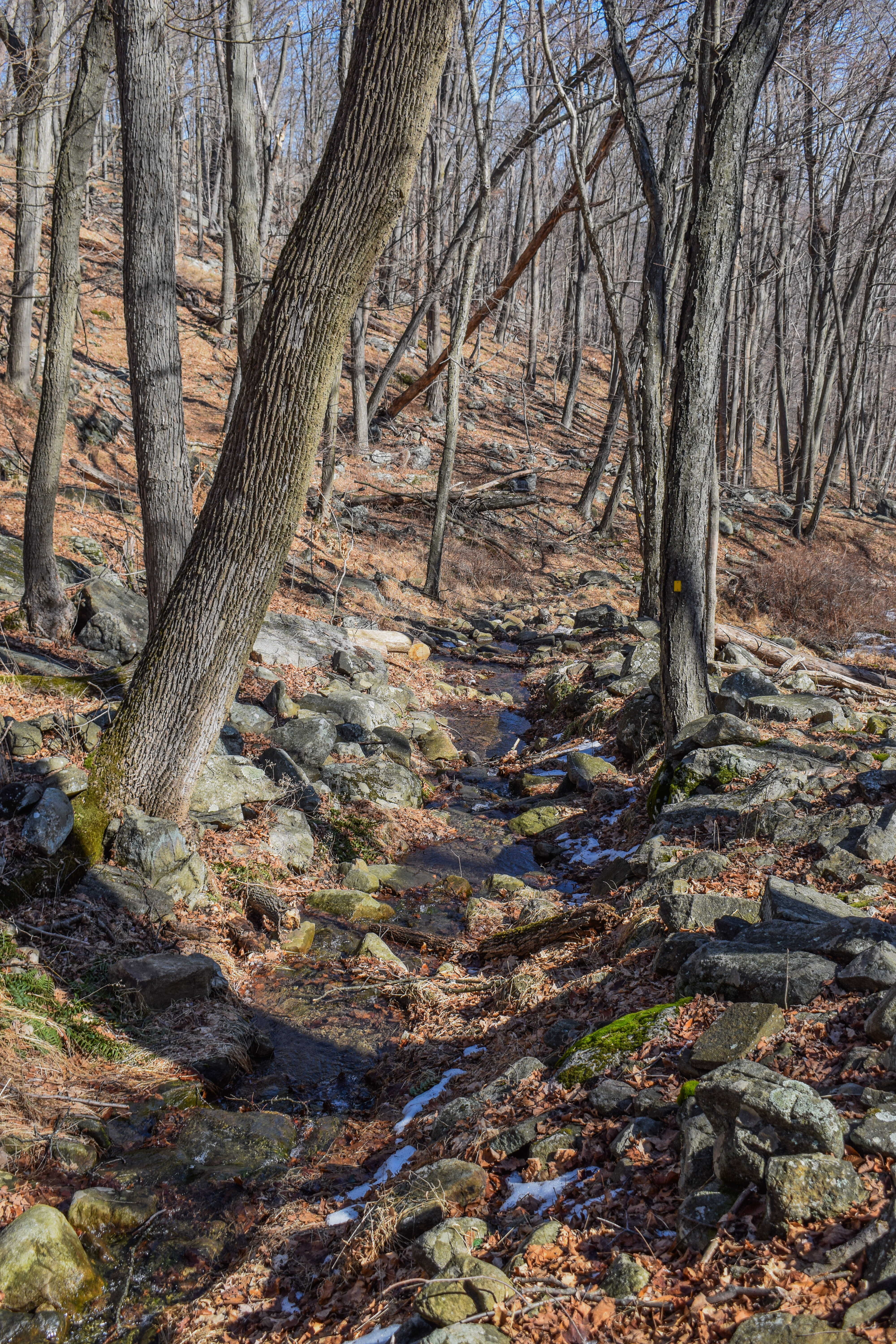
It was a VERY humid 72 degrees with mist in the air, but I was alone, so that was lovely. I started hiking on the Menomine Trail, blazed in yellow, which followed the lower parking area and then through the picnic area, where there were many crows/ravens (I always forget the difference). Behind the picnic areas was some erosion along a stream/pond outflow.


The trail passed an old gate, turned into a footpath, and then opened up at an abandoned parking area for the ski area. I saw a goldfinch! My camera was giving me troubles since the cleaning cloth was dirty and it was humid out, so my pictures were lackluster from this portion of the hike. There was a good amount of litter on the trail in this area, especially near the picnic area, but thankfully it began to fizzle out later on. 


The footbed switched to soft pine after the parking area as it passed by a memorial/grave site just before crossing Seven Lakes Drive and a sign warning of storm damage (which I never actively encountered). 


The Menomine Trail continued on a lovely old woods road and came up to the dam of Lake Nawahunta, where there was a nice view.


"Lake Nawahunta" from Harriman Trails, 4th Ed. (2018)
"Lake Nawahunta was created in 1915 by the construction of a dam across Lewis Brook, a tributary of Queensboro Brook. The land did not belong to the Park then, and it was built to be a trout hatchery. It is a small lake, 7 to 10 feet deep, visible from Seven Lakes Drive just south of the Silvermine Parking area. Beyond the lake is a grove of pines, planted after the lake was made.
        The lake bed was formerly a farm cultivated by several generations of the Lewis family. "Scobie" Jim Lewis' grave is on the knoll across Seven Lakes Drive from the entrance to the Nawahunta Fire Road. The Park purchased the land on January 22, 1917 from Isaac Lemmon. At first, the lake was known as Lemmon Lake. The name Nawahunta is Mohegan for "place of trout."
        A park fire road, built in 1954 (now the route of the yellow-blazed Menomine Trail), runs north along the east shore of the lake, on a bank above the lake. A cellar hole on that road marks the site of the Lewis farmhouse. Seven Lakes Drive, where it passes the site of the Lewis farm, was built on the old Greenwood Turnpike. That road came over the hill from the Greenwood Furnace (now Arden), went to Queensboro, and continued on to Fort Montgomery."


Just after the dam, the trail continued on the left on a footpath while the road grade turned right. It was extra humid near the lake, but at least it was pretty! The trail crossed a dry drainage (or inflow, I really couldn't tell) and entered a forest that smelled like christmas trees (and spider webs). Soon after, the trail rejoined a road grade, hopped across a couple of blowdowns, passed a swampy area, and then began to easily climb.


I was SWEATING the second the trail went up, but it was never too taxing. I could hear a breeze higher up through these beautiful open woods, but sadly it never reached me. The Menomine Trail eventually terminated in a col, where I turned onto the Long Path (and saw the first people of the day!). 


The Stockbridge shelter was on top of a slabby climb and featured a delightful breeze, even with the insane humidity. It smelled like smoke outside, and I wasn't sure if it was from the shelter, wildfires far away, or something nearby (I believe it was from distant wildfires). I took a short sit break to casually sweat here.


I went back down into the col where the Menomine Trail terminated and continued on the Long Path, which was familiarly overgrown with grass (but nowhere as bad as near the Cohasset shelter). I passed a neat overhanging rock named "Hippo Rock" and saw many little purple poops, assumedly from birds and other critters snacking on the abundant blueberries.


Little bits of sunlight were shining through the trees in these classic grassy woods. The ridge meandered up and down with no real strenuous spots, which was nice. The Long Path eventually reached a more open area that had no views besides to the sky, and I noticed the blueberry bushes had very few berries left. Next summer I need to remember to bring a bag with me, even on the hot days!


The Long Path began to descend gently, the more moderately after the open area as the sun continued to break through the clouds. The trail rambled gently along the contour line once off of the ridge and then climbed and descended to a beautiful, grassy woods road, which featured an old rusty shovel head? A bit of hazy blue began to appear overhead and I saw a hummingbird!


Once the Long Path reached the familiar Arden Valley Road, I turned left to ascend, and then left again to join the Ramapo-Dunderberg/Appalchian Trail at the hight of land. 


I immediately saw a mama and baby deer just off trail, neither of which wanted to move. I had to yell and clap a bit to get them to scoot away, I didn't want any problems, but I also wanted to keep it moving! The R-D/AT descended to a flat, brushy area with tall rhodondendron/mountain laurels (I WILL learn the difference one day!). 


There was another descent to a col then climbs up to an open, ferny area with blue skies! Here, the Ramapo-Dunderberg Trail splits off while the Appalachian Trail continues on. I followed the Appachian Trail, which featured a delightful breeze up on the ridge. I also saw a salamander! It moved way too fast for me to get a photo, but this might be the first time I've seen one since I was a kid!


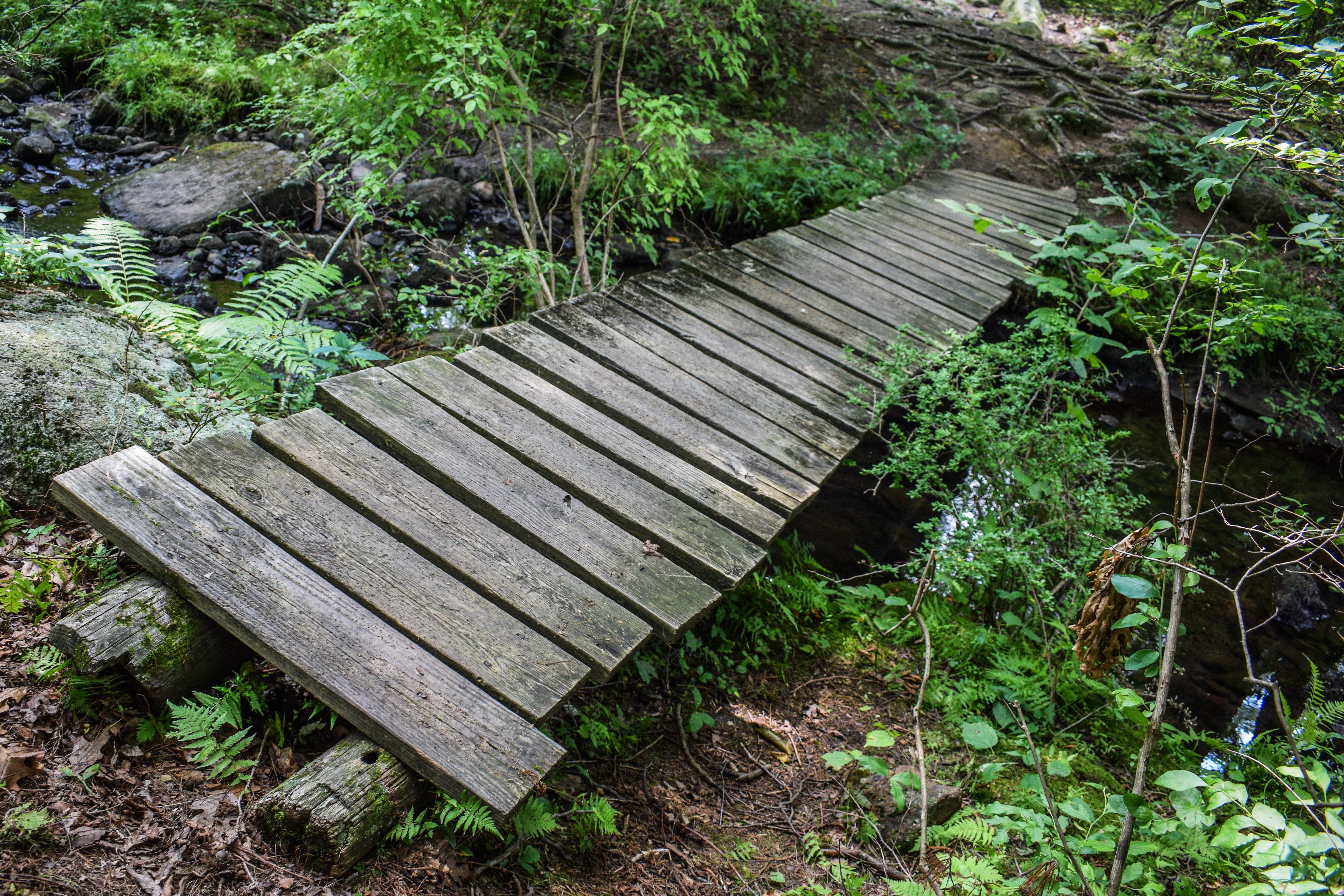
The Appalachian Trail crossed a dry stream bed with possible off-trail views (I did not investigate) and then had a long, gradual descent back to Seven Lake Drive through more grassy forest. The trail turned to descend more and then followed some flat wetlands before crossing a pond outflow on a sketchy footbridge and rising to Seven Lakes Drive.


I admired how this hike was well-segmented: Trailhead to Seven Lakes Drive, Seven Lakes Drive to Arden Valley Road, Arden Valley Road, to Seven Lakes Drive, Seven Lakes Drive to Trailhead. I was oficially on the final segement of the hike, so I stopped for a short electrolyte break before remembering I had another shelter to find! I almost forgot...


The amount of gnats increased throughout the morning but overall, bugs were relatively at bay. This stretch of the Appalachian Trail rose very gently, which was welcomed because my familiar hip pain was back. My shoes were, yet again, SOAKED with sweat, but thankfully I have a new pair at home and these will soon be retired!


I passed another deer, this time one with velvety antlers, and then the Ramapo-Dunderberg Trail rejoined in a grassy area. The R-D/AT winds and climbs to the next height-of-land at a sunny pleateau, which was much more overgrown, but with a discernable footpath (and obstructed views through trees). 


Descending from the plateau, the sun was shining and the blue sky was showing, I soon arrived at the Brien Memorial Shelter! There were two people high up on a rock above the shelter (no idea why), and they said hello to me. I took a quick sit before starting my return trip.


The final bit of trail was a two-mile walk back on the Menomine Trail (a different section!). It started steep and rocky on the descent at road-width, but soon eased up with much better footing. It turned out to be a lovely return route! Even if I did get a bug in my eye in the last mile...


The trail eventually flattened out with views of Silvermine Lake, first through the trees, and then right up on the water's edge.


"Silvermine Lake" from Harriman Trails, 4th Ed. (2018)
Silvermine Lake is on Seven Lakes Drive, 1.7 miles south of Long Mountain Circle and 2.0 miles north of Tiorati Circle. The Silvermine Ski Area (no longer operated as such) is adjacent to the lake, as are extensive picnic areas with ample room for parking. Swimming in the lake is not permitted. From the lake, hikers can start up Stockbridge, Black and Letterrock Mountains. The yellow-blazed Menomine Trail provides a convenient route north to Stockbridge Mountain or south to Letterrock Mountain. A woods road heads east along the nroth shore of the lake to the dam, from which the Silvermine Road goes up into the notch between Black and Letterrock Mountains, crossing the Appalchian/Ramapo-Dundergerg Trail. In 1989, the Park removed the wooden walkway across the dam. Hikers must now goes down and cross the brook on stepping stones, or they may use the bridge just a bit further downstream.
        When the Park was first created in 1910, this basket-shaped depression in the hills was called the Bockey Swamp. Bockey - a term peculiar ot this mountain region - refers to a wide-splinted woven basket used by charcoal burners. They were made and sold by mountain people, who were themselves sometimes called "bockeys."
        As easly as 1922, Major Welch planned to create a lake from that swamp (N.Y. Post, 1/2/23). In 1926, a 30-acre motor camp was built there, with a well, tables and restrooms. During these years, beavers (which had been introduced in the Park in 1920) built a dam that backed up the water in the swamp. As a result, many trees were killed. Park workers cleared the dead trees and planted rice, which they throught would attract birds. But deer ate the rice.
        Then, in the spring of 1934, Civilian Conservation Corps Camp SP-27 was set up at the Bockey Swamp. By Semptember, a 600-foot dam ha dbeen built and the new reservoir began to fill. The lake was named Menomine, meaning "wild rice." More picnic tables were installed. The old picnic area extended down the road from the present parking area.
        In the fall of 1936, a ski slope and rope-tow were built on the hill next to the lake. It was named the Old Silvermine Ski Area because of its proximity to the legendary Spanish silver mine on Black Mountain. R.H. Torrey related the story of the "Lone Tinker Mine" (N.Y. Post, 10/6/23): About 1735, a small ship visited Caldwell's Landing (now Jones Point) each year. The crew were Spanish. They made their way to Black Mountain and to a mine on its north side, near some houses of the Conklin family. They came out each time with heavy sacks. Once, in the tavern at the river, they boasted of the silver they were carrying. On their last trip, one of the crew did not return with the others. Local natives, searching for the mine, found his body in a cabin on the mountain. The crew never was seen again, and the silver mine was never found. There are two mine openings on the top of Black Mountain, but only a little iron ore came from them.
        In 1934, the TERA used a section of the old Black Mountain Trail to build a fire road past Bockey Swamp up through the notch between Black Mountain and Letterrock Mountain. It was intended to be a one-way loop, but the TERA was disbanded before it was finished. IN 1955, the lower end of the fire road near the lake was surfaced with gravel.
        During 1942, a second ski slope was built. In 1951, the lake was renamed Silvermine Lake. A large overflow parking area was created in 1968, but the ski area has been closed since 1986.


The final stretch meandered along the pond's shore, sometimes right up along and sometimes higher up, all of it was really beautiful. The Menomine Trail turned back into the woods near the very end and I ran into two people walking at least 5 puppies (leashed!), which was wild! 


Soon enough I was back at my car, my watch battery survived! It still said it was fully charged, so I will need to figure that out another time... This was a really nice way to wrap up my trips to Harriman for the summer. I have three more shelters to discover and many trails to explore!


Step-By-Step
- Park at Silver Mine Picnic Area.
- Start hike on Menomine Trail (yellow) toward Seven Lakes Drive.
- Cross Seven Lakes Drive, continue on Menomine Trail.
- At terminus, turn right onto Long Path (aqua).
- At Stockbridge Shelter, turn around.
- Continue on Long Path.
- At Arden Valley Road, turn left.
- At jct. with Appalachian Trail, turn left onto Appalachian Trail/Ramapo-Dunderberg Trail (white/red on white).
- At split, follow Appalachian Trail straight as Ramapo-Dunderberg Trail veers away on right.
- Cross Seven Lakes Drive, continue on Appalchian Trail.
- Ramapo-Dunderberg Trail rejoins Appalchian Trail, continue.
- At Brien Memorial Shelter, turn left onto Menomine Trail (yellow).
- Follow Menomine Trail (yellow) to car.


"Menomine Trail" from Harriman Trails, 4th Ed. (2018)
        The Menomine Trail connects the Silvermine parking area with the Appalchian/Ramapo-Dunderberg Trails (AT/R-D) at the William Brien Memorial Shelter on Letterrock Mountain, and with the Red Cross Trail. It also connects the parking area with the Long Path at the Stockbridge Shelter on Stockbridge Mountain. Since the Menomine Trail primarily serves as a means of accessing these two major trails from the parking area, we will describe the trail in two sections, beginning in each case from the parking area.
South to William Brien Memorial Shelter (AT/R-D)
        From the southern end of the Silvermine parking area, the Menomine Trail crosses a bridge and turns left. Just before it reaches the lake, ti turns right, an dthen it turns left and follows along the shore of the lake, passing through a very rocky area. At 0.45 mile, the trail joins a woods road which come sup from the lake. Before the lake was built, this road went along the edge of what was then known as the Bockey Swamp. Since the creation of the lake, the northern section of the road has been submerged, and the remaining portion of the road (now followed in part by the Menomine Trail) became known to hikers as the Brockey Swamp Trail.
        After reaching the end of the lake, the Menomine Trail goes up a valley along Brockey Swamp Brook. at 0.95 mile, it come sto an intersection with another woods road. (To the right, this road leads 0.8 mile to the Seven Lakes Drive). The Menomine Trail turns left on the road, crosses a stream, and begins a steady ascent. At 1.35 miles, it crosses the AT/R-D at teh William Brien Memorial Shelter. [...].
North to Stockbridge Shelter (Long Path)
        This part of the Menomine Trail begins just before the bridge at the southern end of the Silvermine parking area. It proceeds west along the guardrail at the edge of the parking area, then follows a dirt road leading through a picnic area. It turns right, uphill, at a cable barrier at the end of the picnic area, crosses a road which leads to an abandoned parking area, and enters an evergreen grove on a knoll above Seven Lakes Drive. To the right of the trail is the grave of "Scobie" Jim Lewis, whose farm was where Lake Nawahunta was created in 1915.
        After crossing Seven Lakes Drive at 0.4 mile, the Menomine Trail briefly follows the Nawahunta Fire Road, passing, on the left, the cellar hole of the Lewis family home. At 0.55 mile, near the end of Lake Nawahunta, the Menomine Trail turns down left and crosses the inlet of the lake (Nawahunta Brook) on stepping stones. It passes through a pine grove, crosses a causeway across a swamp, and follows an old wagon road up Stockbridge Mountain. At 1.1 miles, just beyond a bend in the road, a cairn on the right marks the start of a trail which leads 0.3 mile to the Stockbridge Cave Shelter. This trail, once blazed red, has been painted out with black paint, and the black blazes can still be followed (with care). Now the Menomine Trail begins to level off. At 1.35 miles, a road forks left to Stevens Mountain, and the Menomine Trail again begins to climb. The yellow Menomine blazes end at 1.5 miles, where the Long Path (aqua) crosses. The Stockbridge Shelter is about 0.1 mile up to the right.
        The Menomine Trail was created on Labor Day 1994 as a means of linking the AT/R-D and the Long Path with the convenient Silvermine parking area. For the most part, it follows the routes of two old woods roads - the Bockey Swamp Trail and the Nawahunta Trail - which had long been used by knowledgeable hikers to access these marked trails from the Silvermine parking area.
        The name of the trail, Menomine, was originally given by Major Welch to the lake south of Seven Lakes Drive that was created in 1934 by the Civilian Conservation Corps. Prior ot then, the area was a large swamp, known as the Bockey Swamp. In an attempt to attract birds, the Park planted wild rice in the swamp. But, instead, the rice was eaten by deer. When the lake was built, it was named Lake Menomine, an Indian name for wild rice. It was renamed Silvermine Lake in 1951.
        The section of the Menomine Trail that extends from the Brien Memorial Shelter to the Red Cross Trail was originally part of the unmarked Dean Trail. In 2002, the Menomine Trail was extended south from the AT/R-D at the shelter to the Red Cross Trail.

"Appalachian Trail" from Harriman Trails, 4th Ed. (2018)
[...], and at 9.9 miles reaches the William Brien Memorial Shelter. Here, the Menomine Trail (yellow) crosses. To the right, the Menomine Trail goes down to the Silvermine parking area on Seven Lakes Drive in 1.35 miles; to the left, it leads 0.85 mile to the Red Cross Trail.
        The shelter is named after William Brien, the first president of the New York Ramblers. In 1954, he bequeathed $4,000 for a shelter, which was built in 1957 at Island Pond. Because of vandalism, that shelter was demolished in 1973 and the name transferred to the former Letterrock Shelter, which was built in 1933 (N.Y. Post, 6/23/33).
        At 10.7 miles, AT/R-D comes down to the foot of Goshen Mountain, where the unmarked Brockey Swamp Trail crosses. To the right, the Brockey Swamp Trail follows the little brook down towards Silvermine Lake. The R-D departs to the left and begins to climb Goshen Mountain, while the AT goes right on a woods road. AT soon turns right, leaving this road. It goes down to another woods road, which it follows for a short distance, reaching the Seven Lakes Drive at 11.9 miles. The trail crosses the Drive, then a region with two brooks, and goes up Stevens Mountain. It then turns south, following an old woods road, known as the Youmans Trail. After leaving this road, the AT crosses a descending dirt road (the original Arden Valley Road). Here, the R-D comes in from the left and rejoins the AT. Then, at 14.05 miles, the AT/R-D crosses the present-day paved Arden Valley Road on Fingerboard Mountain. [...].
        The original route of the AT was over Goshen Mountain, joint with R-D. It came down west to cross an old woods road, where it parted from R-D, and continued over two knolls to Seven Lakes Drive, 100 yards north of Tiorati Circle. It then climbed Fingerboard Fire Tower (built 1922) and turned south to the R-D (N.Y. Post, 1/4/24). In November 1931, the AT was diverted through a tent camp on the knoll northeast of Tiorati Circle, and then went jointly with R-D up Arden Valley Road (N.Y. Post, 11/13/31). In 1934, the AT was made to coincide with R-D from Goshen Mountain to Tiorati Brook Road, which it followed for 0.35 mile to Tiorati Circle. The present route up Stevens Mountain was devised in 1978 by Chief Ranger Tim Sullivan.

"Long Path" from Harriman Trails, 4th Ed. (2018)
[...] Arden Valley Road, which it reaches at 14.9 miles. LP crosses the road and followed a woods road to the north.
        On the left as one starts up this woods road, a faint trail may be seen going northwest through the saddle between two summits of Bradley Mountain. That path - the Forest Lake Trail - was part of the first road, built in 1760, through the Highlands from Stony Point to Central Valley. It leads into the Harriman estate and should not be used without written permission. The woods road that carries the Long Path here for 0.2 mile was part of that old road, and of the Arden Valley Road before the park built the present paved road down to Tiorati Circle about 1917.
        After 0.4 mile on the woods road, LP diverges left and climbs to the summit of Stockbridge Mountain (named for Elisha Stockbridge, 1826-1916, who owned a hotel near Summit Lake in 1893). From the ridge, Arden House can be seen tot he west when there are no leaves on the trees.
        Arden House was the home of Edward Harriman. The plans were drawn by architects John Carrere and Thomas Hastings, who are best known for designing the New York Public Library. The house took three years to complete, and cost $2,000,000. Edward Harriman moved into his new home in August 1909 and, unfortunately, died of stomach cancer on September 9, 1909. Subsequently, Arden House was used as a conference center for Columbia University.
        At about 16.9 miles, a great overhanging boulder named Hippo Rock is on the left of the trail. In abother 0.15 mile, the Menomine Trail (yellow) leaves to the right. (The continuation of this trail, going west, is the unmarked Nawahunta Trail.) LP then climbs a ledge to reach Stockbridge Shelter (built in 1928) at 17.15 miles. [...].