Showing posts with label New England 50 Finest. Show all posts

Monday, August 22, 2022

Rowe, Gunstock, & Belknap (Belknap Range)

Rowe, Gunstock, & Belknap (Belknap Range)

"Can you please stop" - me, to the squirrels

Hike Type: Short Stemmed Reverse Lollipop
Distance: 6.31 miles
Elevation: 1890 feet
Time: 3 hours, 47 minutes

Hiking Challenges: Belknap Range Hiker, NH Fire Tower Quest, Operation Alaska Benchmark Challenge, Summit Beer Society, New England 50 Finest


The view just after Mt. Rowe's summit.

The Hike

The summer is quickly coming to a close and I've reached the "holding onto what I have left of my break" breaking points - off to the woods I go! I've been eyeballing the Belknaps for a while now, and there was rain coming around 12-1 today, so the shorter drive was a perfect fit! I had originally flirted with doing an extended reverse lollipop, hitting Rowe, Gunstock, Belknap, Piper, and Whiteface, but the incoming rain and my uncertain digestive system had me turn around at Belknap, which I maintain was the correct decision. Anyway, my 4:00am alarm went off, and up to New Hampshire I went!


I parked in the large Gunstock Mountain ski area parking lot. There were a few other cars around, but it was unclear where I was supposed to park. I landed next to a few trucks across from the main building and did not get towed or ticketed, so I'd say I did it correctly! I walked through the main building area toward the mountain coaster, checked a nearby porta potty due to the aforementioned uncertain digestive system (it did not have any toilet paper, and I then realized neither did I... yikes), and the white-blazed Ridge Trail starts at the mountain coaster up an access road. 


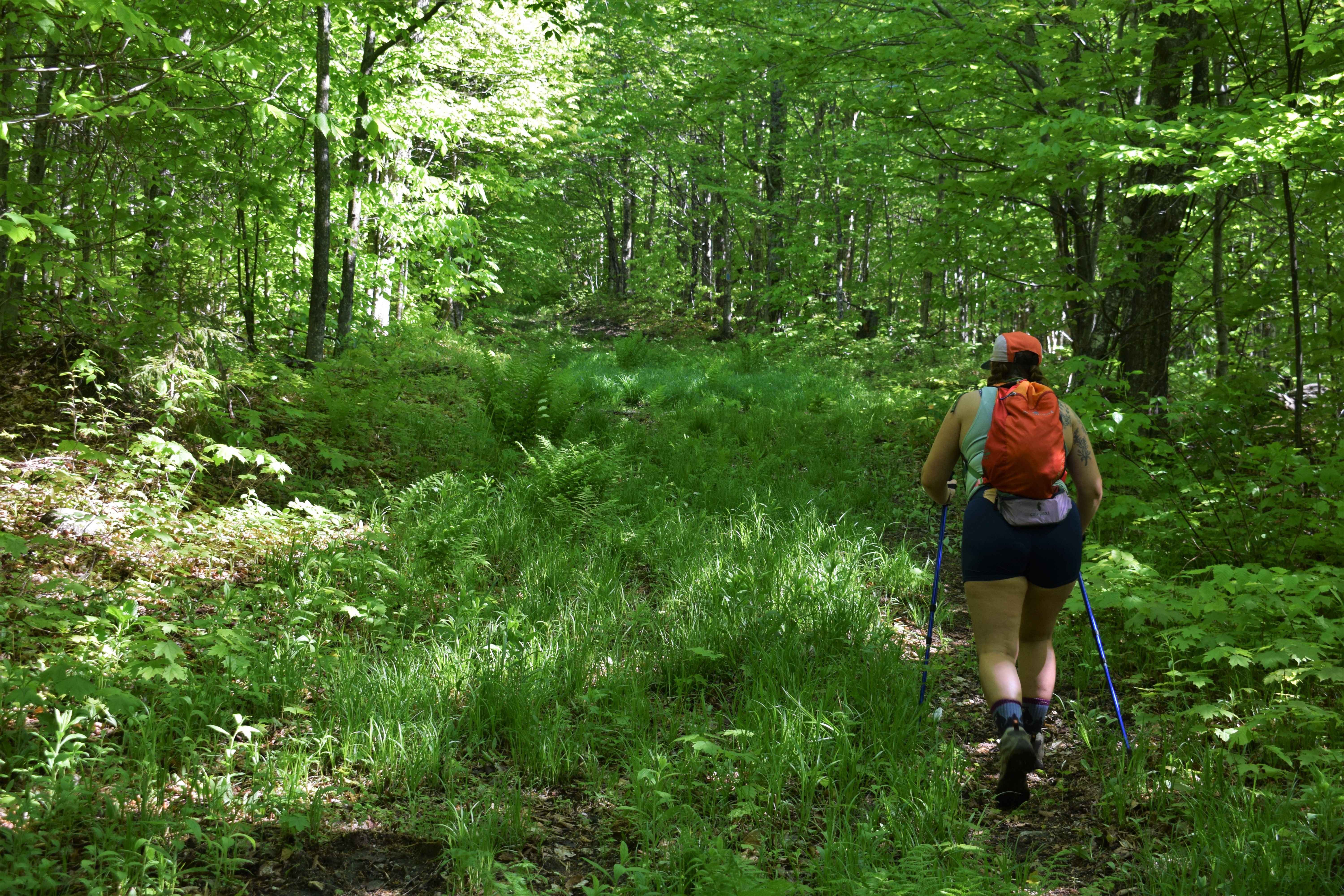
The Ridge Trail between the mountain coaster and Mt. Rowe was steep, covered in loose gravel, and generally unpleasant. It reminded me of the trail up Overlook Mountain in the Catskills, but this trail had significantly less flies and more rocks. There was a road bypass trail that I didn't have on my map that I'm very curious about. It probably would have been slightly longer than the Ridge Trail but more enjoyable. Through my arduous journey the sun tried to poke it's head through the clouds, but only succeeded for a short while. 


There is a large cell tower just before the summit of Mt. Rowe, which is where the access road terminates. The trail goes into the woods and I was immediately greeted by a gorgeous owl and what may have been a fisher cat running across the trail. It was long, dark, and short, whatever it was. There was a small sign and cairn indicating the summit, and the Ridge Trail follows the ridge (miraculously) for a short while until it opens up to an excellent view of Gunstock and Belknap mountains, the ski area below, Lake Winnipesaukee, and the Ossipees in the distance. The owl followed me for a while during this section, and I was really blown away at how quietly they fly from tree to tree (I'm used to the boisterous grouses). 


The Ridge Trail then dips into a col and begins to formally climb up Gunstock. The trail here is in some beautiful forest full of birds and rodents (notably one chipmunk who I swear was trying to hold a conversation with me). There are endless switchbacks that start off gentle but pick up steepness toward the summit. Just before the final push to the summit, the trail skirts around the mountain along some cliffs and provides a small view worthy of a look. Soon after the view, the Ridge Trail intersects with the green-blazed Winter Shortcut and then the orange-blazed Mt. Gunstock Trail, climbs slightly to join the yellow-blazed Brook Trail, and then leads to the summit/ski area. There were crews up top getting ready to open the mountain for summer recreation, so I did not stay long. Additionally, the whole summit was in a cloud now so there weren't any views. I ended up finding a picnic table just below the summit on the Brook Trail for a peanut butter sandwich, summit beverage, and nice sit.


The red squirrels were ACTIVE along the Brook Trail and very clearly were not fond of me. I felt like I was hiking through a minefield with all the pinecones that were being used as projectiles toward my head, accompanied by their famous scream. I followed the Brook Trail to the white-blazed Saddle Trail, and then the blue-blazed Blue Trail, which similarly to the Ridge Trail up Gunstock, started gently climbing but picked up steepness toward the summit of Belknap. At this point, I was very much in the clouds, and just for good measure, found the grouse population. At least four of them were flapping their wings and yelling at me. I do not care for the mountain chickens.


Soon after the last steep push and clanking my poles at the grouses, I reached the top of Belknap Mountain! The summit area is open and I think rather viewless? It seemed pretty wooded... maybe some partial views? Who knows! There was a USGS Benchmark right on the Blue Trail and there was another under the tower. The tower itself has seen better days. It was a cozy walk up, and by cozy, I mean terrifying and narrow. The tower was rickety, smelled like old pennies, and my child-bearing hips barely fit between the rails. The steps were steep and overlapping, which was unsettling. Shockingly enough, I did not get any surprise views through the clouds so I SLOWLY made my way down. I realize I sound very grumpy writing this and reflecting, but I promise I was in good spirits and really enjoyed the hike!


I thought about it, and I definitely had enough energy to go to at least Piper, but that digestive system had me worried, so I started my return trip. Blue to White/Saddle to Yellow/Brook, and then the Brook trail descends down the mountain for 1.6 miles. The trail started in lovely pine forests with that amazing christmas tree scent, and then became very reminiscent of the Old Indian Trail down Mt. Wachusett. The Brook Trail crossed the ski slopes, dipped in and out of the woods, and then followed a glade run (did I use that terminology correctly?!) which was gorgeous. My feet were feeling the steep descent toward the end, and there was loud machinery somewhere on the mountain (either crews working on the mountain or I read that there is logging somewhere in the Belknaps, those are my best guesses). The trail bottoms out at... a brook! Soon after the brook I landed back at the parking lot and was shocked at how busy the area was now. It wasn't packed, but I was surprised to see so many families out on a cloudy, rainy Monday. I did flirt with riding the mountain coaster, but decided to save it for another day. I couldn't change in the parking lot due to the endless families, but the ski lodge was open with it's shockingly nice bathrooms. Overall it was a great hike! Only saw a few other people and an endless amount of crazy red squirrels. 


Step-By-Step

  • Park at Gunstock Mountain Parking Lot.

  • Start hike on white-blazed Ridge Trail (BRT)

  • Summit Mt. Rowe, continue.

  • Hike on white-blazed Belknap Range Trail.

  • Summit Gunstock Mountain.

  • Hike on yellow-blazed Brook Trail.

  • Hike on white-blazed Saddle Trail (BRT).

  • Turn onto Blue Trail (BRT)

  • Summit Belknap Mountain, climb fire tower.

  • Retrace steps back to yellow-blazed Brook Trail.

  • Follow Brook Trail back to car.


Sunday, May 29, 2022

Gore Mountain (Silvio O. Conte National Wildlife Refuge)

Gore Mountain (Silvio O. Conte National Wildlife Refuge)

Hike Type: Out-and-Back
Distance: 5.2 miles
Elevation: 1237 feet
Time: 2 hours, 37 minutes
Hiking Challenges: Northeast Kingdom Mountain Challenge; Go North 9er; Summit Beer Society; New England 50 Finest


The Hike

I was super excited for the journey to this hike, and feeling lackluster about doing the hike itself. When Emma first moved to Vermont, I made it my life's mission to see a moose. We read that VT-105 and the NWR were two good moose spotting locations, so one evening we set forth onto one of the dirt roads in search for the giant northern mammals. Long story short, we failed in our search and only found a thousand frogs. When I saw that we could hike Gore Mountain from the NWR, I knew it was redemption time (evidently, it was not redemption time). Thankfully, the roads have recently been re-graded, and there were three boardwalks off the side of the road to break up the drive in, all of which were lovely. We started the hike from the famous Lewis Pond Overlook, which lived up to its reputation of having an incredible view (pictured above).


The trailhead is clearly marked and follows a wide woods road that doubles as a VAST snowmobile trail in the winter. It was MUDDY, which became a theme for this hike. After 0.4 miles, the Gore Mountain Trail turns right into the young forest while the woods road continues straight. The map shows a viewpoint at this junction, but we did not find it (we also didn't really look for it at all). It was clear that this trail was seldom used by humans (but frequently used by moose - poop galore!). At times we had to really concentrate on the blazes due to lack of trail definition, but thankfully there were plenty of blazes. 


After some nice hiking in the woods, the trail starts to climb what feels like a power cut/slide, and this is where the mud and bugs really kicked in. Most of this stretch of hike was spent looking down, swatting bugs, and dodging neverending mud pits. There were brief moments where we would get some relief when the trail would dip into the woods for a split second, but that rarely lasted for long. The most fascinating part of this stretch was how it was also covered in moose poop. At one point Emma shouted "do the moose just hike up and down this all day?!" The only redeeming quality of this stretch was the view when you turned around.


The trail levels out towards the summit, and the mud and bugs increase. It was pretty, but we did not spend too much time to enjoy it due to the aforementioned factors. The summit is marked by an old cabin with a new red roof and a summit sign on the outside. There were some trail maintainers seeking refuge in the cabin when we got there, and one of them thought to make what sounded like a baby bear call as were approaching, which was definitely in good fun, but definitely unsettling. We cheersed our summit beverages but waited until after the steep portion to indulge. We did check out the cabin and signed the register, and were on our way back soon after. 


The hike down went much faster than the way up, naturally. Continued dodging of moose poop and mud pits, and once we were at the bottom of the messiest section we cracked open our beverages to enjoy for the remainder of the hike. Our favorite moment was crossing paths with another hiker - we had our poles in one hand and beverages (in koozies, naturally), in the other, and this man says proudly "now THAT is civilized hiking!" which fully made our day. Merch drop soon? We'll see.


Once back at the car we spent a couple minutes enjoying the view again from Lewis Pond Overlook before hiding from the bugs in the car. We bought a bunch of cheese, crackers, and meats to indulge in, and I think I have a new favorite post-hike snack! The drive our of the refuge wasn't too bad, and before we knew it, it was nap time!


Step-By-Step
  • From parking lot at Lewis Pond Overlook, find trailhead for Lewis Pond Trail/Gore Mountain East Trail and begin hike.
  • At 0.4 miles, the trail will leave the woods road (VAST Trail) it has been following and head into the forest (follow blue blazes).
  • Continue on Gore Mountain Trail to the Gore Mountain summit cabin. After hiding from the bugs in the cabin, head back down to the car.


From Wikipedia:
"Gore Mountain is a mountain located in the uninhabited Avery's Gore in Essex County, Vermont, about 6 miles (10 km) south of the Canada–US border with Quebec. In Vermont, gores and grants are unincorporated portions of a county which are not part of any town and have limited self-government (if any, as many are uninhabited). Gore Mtn. is flanked to the northeast by Black Mountain, and to the northwest by Middle Mountain.

The north and northwest sides of Gore Mountain drain via several short brooks into the Coaticook River, thence into the Massawippi River, Saint-François River, and Saint Lawrence River in Quebec, and thence into the Gulf of Saint Lawrence. The southwest side of Gore Mtn. drains into Jim Carroll Brook, thence into the North Branch of the Nulhegan River, the Connecticut River, and into Long Island Sound in Connecticut. The southeast side of Gore Mtn. drains into the Logger Branch, and the east side into the Black Branch, of the Nulhegan River."

From Kingdom Heritage Trails Map:

"The Nulhegan Basin Division of the Silvio O. Conte National Fish and Wildlife Refuge is managed by the US Fish and Wildlife Service and protects 26,000 acres of lowland forest that supports rare species, extensive wetlands, and migratory songbird habitat. The lands are available for hunting, fishing, and contabile recreation."

"Gore Mountain once served as a forest fire lookout station- overlooking the vast timerlands of northern Essex County. Built in 1912, it was the second oldest lookout in Vermont. In 1934, the Civilian Conservation Corps (CCC) constructed a new fire tower that was in use until it was removed in 1973."