Showing posts with label Dunnfield Creek. Show all posts

Monday, July 28, 2025

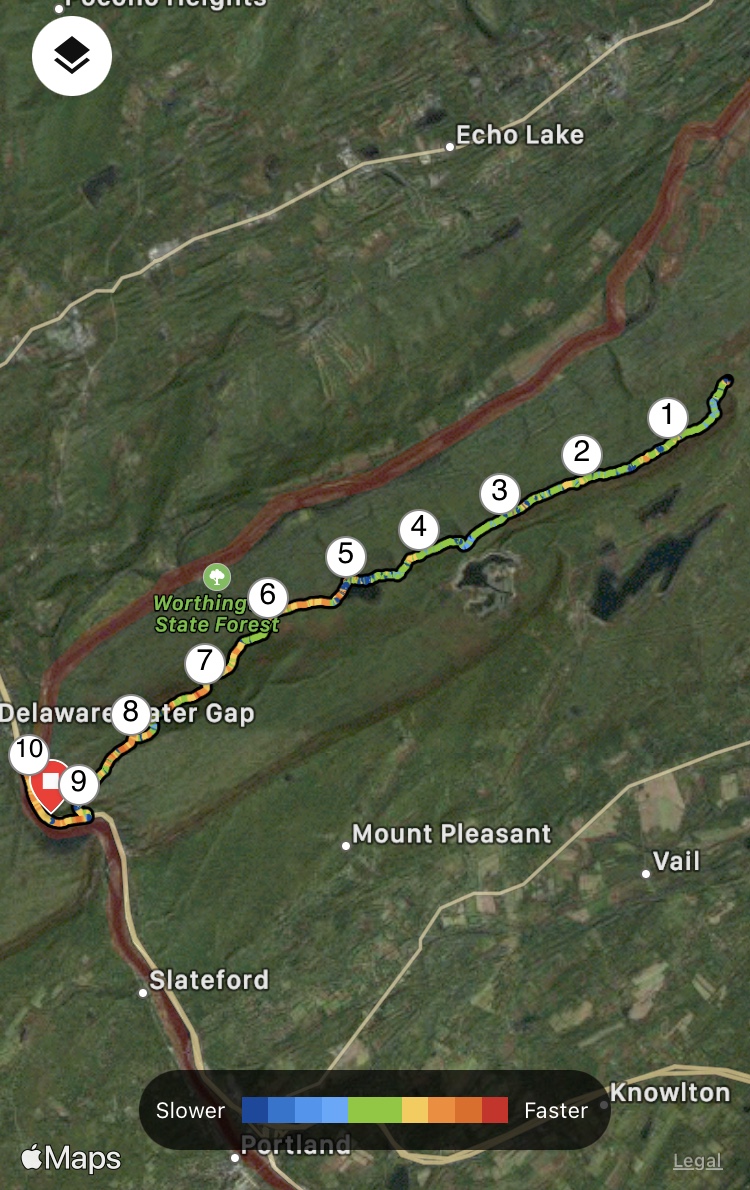
Mt. Tammany via Farview Trial (Worthington State Forest)


Mt. Tammany, Dunnfield Creek, Holly Springs, & AT (Worthington State Forest)

Hike Type: Lollipop Loop
Distance: 8.72 miles
Elevation: 2,215 feet
Time: 3 hours, 27 minutes (3 hours, 13 minutes moving)
Hiking Challenges: N/A

The Hike
A silly pattern in my hiking this summer is that I simply cannot be bothered to think about where to hike, so I've been very locked into repeats, which is not a bad thing! Naturally, this is mostly the Tourne, which is just a few minutes' drive from my Mom's house, but apparently it also applies to Mt. Tammany, becuase I could not stomach the mental faculties required to hike anything else (keeping in theme, I also flirted with Bear Mountain again, but wanted to limit time-in-car). ANYWAY, that being said, the plan was to do the same extended loop around Mt. Tammany as last Monday!

I was out the door just after 7:00am and drove past a wild backup on I-80 East (thank goodness I was driving west) - apparently a truck spilled over in the early hours of the morning and they had to shut down the interstate. I stopped at the Delaware Water Gap Service Plaza to use the bathroom and get an extra bottle of water (I only brought two, but with the humidity I was thinking one more couldn't hurt!). While sitting in the car, I decided I was feeling adventerous and was going to extend my already-extended hike by driving to the Farview Trail and adding on that trail to form a lollipop-loop (which would add 1.4 miles each way). I drove to Exit 1 off I-80, waited at the long light on Old Mine Road, and just after turned onto the Farview Trail parking area, which was a decently hidden gravel road that opened up to a large parking area for at least 20 cars. Across Old Mine Road is the former Karamac Trail parking area, but it has since been blocked off (making a deducation from maps and trail reports, I'm guessing it's been abandoned due to erosion). 

I saw a bunny at the trailhead as I got ready. Temperatures were in the low 70s but the humidity was other-worldly. It was wonderfully un-buggy, but I put bug spray on anyway. My camera lens immediately fogged up, which ended up being a literal and figuative uphill battle for the rest of the hike. I soon started my hike on the yellow-blazed Farview Trail (which apparently is also known as the Beulahland Trail according to the National Park Service), which entered the woods on a nice footbed with understory on either side. The trail soon split, with the blazes continuing on the right (I'm guessing this is a reroute, likely due to erosion). 


The Farview Trail zig-zagged through ferny woods and soon rejoined the older footpath, which felt like an old road. I was overjoyed with the surprisingly pleasant and easy climb up to the "Not-Kittatinny Ridge" (my name for the ridge the AT follows in Worthington, while the Mt. Tammany Fire Road traverses the main ridge). The trail split again, with both forks continuing parallel to each other as the trail made a very wide turn. I stayed to the right. There were no blazes indicating which way was "correct." There were some slippery slabs here, but they weren't steep so as long as I didn't walk like a fool I was completely fine!

Near an open area where the two forks rejoined, the humidity was so thick you could see the sun rays. My camera lens continued to be a mess, but I had gotten it to a point where I could take somewhat nice photos. The trail flattened out for a bit, which is apparently where all the bugs had been hiding out. I swatted at the bugs while the trail parallelled two parallel rock walls, occasionally running into some spider webs, which increased the futher along I hiked. At least I wouldn't have to swat them down on my return!

There was a walk-through blowdown right at a 1.0 mile mark and the Farview Trail soon traverses the trail's height-of-land, which had a piece of pink flagging tape on a bush. From here, the trail descended slightly past some impressive off-trail spider webs and then barely rose to the terminus with the Appalachian Trail!


I turned right onto the Appalachian Trail and I crossed paths with someone who appeared to be a thru-hiker. I could hear some voices through the woods, eventually passing two other hikers who did not appear to be backpacking. The trail here really is wonderful. A short, moderate, rugged descent followed by wonderful fern-lined walking followed by another, easier moderate descent and then easy walking for the rest of the way. 

I hiked past what looked like the numbers "1800" made out of sticks and rocks, which I assume was to indicate a mileage milestone for the AT, but in my head I'm pretty sure NJ is more than 400 miles from Kathadin, but maybe not? 

A bit further down, I passed a group of backpackers in the same spot that I saw the bear last week. Here, the trail briefly splits into two. The backpackers were on the right fork, which was a narrow footpath. I followed the left fork, which was much wider. I'm guessing the narrower side is a bypass for when the main trail is flooded after rain. From here, I could hear the creek and voices down below, and soon I could see the trail down below, too!

Now following Dunnfield Creek, I was wowed (as always) at the natural beauty, and I do understand why people (break the law and) go swimming here. I continued on until the sound of the creek flowing was slowly replaced with the sound of trucks zooming by on I-80. The massive blowdown near the AT's exit to the parking area had been cleared, and I took a quick bathroom break at the porta potty before emotionally getting ready for the climb!


I was curious how this climb would go after I had the best climb ever last week, and now I was doing it on tired legs in air that was made of soup. I had hardly started phase one of the climb when I was already fighting for my life - this would be a fun one! The air was THICK, and I was cursing the Earth by the time I made it to the views near the end of climb one. Thankfully, the view was wonderful as always! I was comically wet with sweat already, and it was only going to get worse! Only good thing was that the bugs were staying down low. 


I hiked past a family of turkeys as I approached climb two. I heard a few folks ahead of me, but I was hoping to not pass them as I was taking it SLOW. At this point, I was hiking directly into the sun and I was simply ready to pass away. I passed my first people since the AT early on in climb number two and my heart was PUMPING. I was simply not feeling great, but taking it slowly with many standing breaks.

Climb three was more physically sustainable but I was still fighting for any ounce of life I had left in my body. My hands were prunes from the constant inundation of sweat. Just as I thought all hope was lost, I heard voices, and then I was at the top! I visited the open area on the left before descending onto the viewpoint, which was lovely and full of vultures circling below. There were a few friendly people enjoying the view (AND BREEZE!), but I didn't stick around. I quickly retreated back into the shade.


I took standing break at the start of the Pahaquarry Trail and wrung out my shirt, which was somehow holding onto more liquid than all three of my water bottles combined (or at least it seemed...). My watch was comically telling me that I had climbed 10,000 feet, which was horribly incorrect, even if it felt like it. My iPhone was too sweaty to take notes, so I had to switch to using voice-to-text, and once I was feeling marginally better, I continued on!

There was a wonderful breeze on the ridge and it felt significantly cooler, which was just a wonderful treat. I nodded at the fire road, vowing to follow it one day to Sunfish Pond, but that day would not be today. Unfortunately, the descent was not any less rough or rocky, but in reality, it's only the one upper stretch that is rough, everything else is literally fine. I found myself wondering how long a true Kittatinny Traverse would be - following the high point on the ridge via trails from PA to NY (according to AllTrails, somewhere around 45 miles and under 7,000 ft of gain - legally doable in a 24 hour period)!


I slowly descended into a warm, humid, buggy hellscape (that's dramatic, it was fine). The sounds of Dunnfield Creek and people swimming began to fill the air, and then I turned right onto the green-blazed Dunnfield Creek Trail, which was a little wet at first but soon dried out. The trail is so pretty for the whole segment, but especially the first bit, where the trail gently follows the creek as it flows over mossy rocks and slabs. It even smelled like flowers!

The Dunnfield Creek Trail traversed a more open section where it was dreadfully hot and humid. I hopped over a frog on a super easy creek crossing and then slowly climbed up the stairs to the relocated stretch. I spent a decent amount of time trying to find information on the fire that went through this stretch and when it went through, but I couldn't find anything besides a fire off of Old Mine Road in the past year and a fire along the Red Dot Trail in 2020 - the mystery continues!


I did see a five-lined skink climbing a tree, though! It moved too fast for me to get a photo, but it was an exciting sight! I find it interesting how I didn't even know they existed until this year, but now I've seen three! Afterwords, I was back on the old trailbed with sausage fingers full present and soon I was getting ready to cross Dunnfield Creek. I wanted to dunk my head, but there were so many water bugs that I was quickly dissuaded.

I easily crossed the creek, continued along the trail, crossed another easy stream, and made it to the Holly Spring Trail. I took another short break here for water while I dreaded the next climb. Thankfully, the climb was actually quite easy and I was just being dramatic (what else is new). The woods here are so pretty, but after crossing a little trickle of a stream, the bugs were officially back. They had me hiking faster than I wanted to (and faster than my body allowed me to). 

I cruised (with a high heart rate) past the junction with the Appalachian Trail and back onto the Farview Trail. The bugs were pretty brutal here, but again, at least the woods were pretty! I hiked up and over the height of land and began my gentle descent. I stayed right when the trail split in the slabby area. The slabs were now dry which was a win! 

In the next stretch of trail, I saw a bear! This encounter was much less stressful and only exciting, as the bear was far down in the woods. I got a few photos with my camera but my sweaty fingers couldn't get my phone's camera open in time. It looked smaller, maybe a cub, but there were no other bears nearby (that I know of at least). Soon after, I hit the relocated zig-zag stretch, and then I could see my car!


I hurried myself out of the woods, as the bugs were the most brutal at the end. To my surprise, there were no bugs in the parking lot once I was out of the woods. There was one other car in the parking lot now, a Tesla with a sleeping woman in the passenger seat... I got my end-of-hike chores done, which included wrining out my clothes, putting dry clothes on, and trying my best to cool off. Naturally, the partner of the sleeping woman appeared just as I took my shirt off, but it wasn't an issue. I think he explored the Karamac Trail, since he came in with hiking gear from Old Mine Road. I was DEAD from the humidity, but it was a great loop!


Step-by-Step
- Park at Farview Trail Trailhead.
- Start hike on yellow-blazed Farview Trail.
- At terminus, turn right onto white-blazed Appalachian Trail.
- At parking area, turn left onto red-dot-blazed Mt. Tammany Trail.
- At terminus, turn left onto blue-blazed Pahaquarry Trail.
- At terminus, turn right onto green-blazed Dunnfield Creek Trail.
- At jct., turn left onto red-blazed Holly Spring Trail.
- At terminus, continue straight onto yellow-blazed Farview Trail.
- Return to car.

Monday, July 21, 2025

Mt. Tammany, Dunnfield Creek, Holly Springs, & AT (Worthington State Forest)

Mt. Tammany, Dunnfield Creek, Holly Springs, & AT (Worthington State Forest)

Hike Type: Loop
Distance: 6.01 miles
Elevation: 1,614 feet
Time: 2 hours, 18 minutes
Hiking Challenges: N/A

The Hike
Time to revisit a long-time favorite - Mt. Tammany! I hadn't been to the water gap area in a while, so I was excited to get back out there. I had a dreadfully sleepy 40 minute drive and eventually did stop at the rest area just before the NJ/PA border on I-80 to get some caffeine in me before the hike! The parking lots were medium-full and a few hiking parties were getting started as I slowly got set up. I dilly-dallied a bit on purpose to let them get some distance so we hopefully wouldn't have to interact.


Temps were in the low 80s with delightfully low humidity - this might be the first time in like a decade that I would be climbing this mountain in nice weather! I walked to the Mt. Tammany Trail (red dot) trailhead and noticed they had a "Wasps Ahead" sign - thankfully I never encountered the said wasps! Once in the woods I nearly immediately caught up to a group that was comprised of a couple that would NOT stop holding hands, a man in jeans and no shirt, and a fourth guy who just seemed happy to be there.

Phase 1 of the climb had a lot of people going in either direction, and the climb proper wasn't as awful as I had remembered (blah blah blah I'm in good hiking shape now blah blah). I passed a few people at the first viewpoint and enjoyed seeing paddlers down on the river from the cliffs. Sadly, I did not see a bear in the next flat stretch like I had a couple of summers ago - just many more people. 


I enjoyed the bone-dry trail, specifically the spot that is usually wet just before the second climb, and mentally was comparing this hike to any of the hikes in Franconia Notch - steep, rugged, and near a loud highway!

Climb #2 had me zig-zagging up a rugged rock pile with steep grades, past a few more hiking duos that did not appear to be having a great time. It was, as always, a bit of an ass-kicker, but the trail rewards afterwards with a mellower grade and eventually another walking break. 

Climb #3 was easier, but longer. I passed and crossed paths with many more people, with one dad in particular who simply refused to pull over as I was hiking directly behind him. There was one more walking break and one more (easy) final push, and then, voila! I had arrived!

The viewpoint was delightfully empty. I took a moment to wring out my shirt while a phenomeninal breeze brought me back to life. I was feeling surprisingly good, as this mountain usually beats the life out of me. I think this in part due to hiking in nice weather, but I should also give myself credit for being super consistent this year in my fitness hikes. 


Continuing onto the blue-blazed Pahaquarry Trail, I was flirting with the idea of extending the hike. I've always wanted to follow the fire road out to Sunfish Pond, but that would have added MANY miles and time - something I wasn't overly interested in. Another option would be to turn right onto the Dunnfield Creek trail and follow Holly Spring back to the Appalachian Trail... a decision for later.

The ridge walk was delightful and at the junction with the Mt. Tammany Fire Road, the trail turns left and begins to descent on a wide, dreadfully rocky trail. At least the woods were pretty! I eventually passed a group of 13ish 20-somethings clogging the entire wide trail and sharing a cigarette, which was... a choice! As per usual, the heat and humidity increased the further I descended and I began to mentally prepare for bugs.

Near Dunnfield Creek, I passed a wonderfully unbothered deer about 30 feet off trail simply munching on some vegetation. I could hear people jumping into the creek, and soon enough I was at the green-blazed Dunnfield Creek Trail!


For the first time ever, I turned right! I was feeling great, it was a wonderful day, and I was excited to hike for a bit longer. I hiked on this stretch of trail once a very long time ago, and it was... tumultuous. Tumultuous meaning VERY wet, and I fell into the creek. I was hoping for better hiking today!

The trail immedaitely felt more wild, less traveled, and paralleled the creek which was gently flowering over some mossy slabs. There were endless wine berry bushes along the trail and... the bugs were back, but I was just grateful for an bug-free climb! The canopy above was surprisngly open as the trail gained elevation so gently that I hardly noticed.

Later, the trail veered right onto a relocated section, ascending rock stairs into a old burned area that was hardly noticeable. The Dunnfield Creek Trail traveled high above the creek for a while, occasionally traversing some over grown-in stretches and soon gently descended to rejoin the old trail. I passed a little garter snake that was too quick for a photo. 

Continuing on the old trail cooridoor, I enjoyed walking on what felt like an old road through some beautiful woods. I got excited and nervous as the trail neared the crossing I fell into many, many years ago, and was delighted to see that the water level was literally at least two feet lower than that day! The crossing rocks were fully submerged the day I fell in, and they were exceptionally exposed this round - yay!


The Dunnfield Creek Trail continued to follow Dunnfield Creek, which was now on the right. I saw a human, too! This was the first and only human I'd see outside of the traditional Mt. Tammany loop. There was another easy creek crossing, a big blowdown, and then I was at the junction with the Holly Spring Trail! It was buggier here, but nowhere near as bad as my last few adventures at the Tourne. My heart wanted to continue along the Dunnfield Creek Trail to Sunfish Pond, but it still would add too many miles and minutes.

The Holly Spring Trail turned left, ascended moderately, and the continued to ascend on a wider trail that felt like another old road. The woods here were lovely and open, similar to the woods of Harriman State Park. The trail dipped gently to cross a trickle of a stream and then easily ascended to the trail's height-of-land in more lovely, open woods.

This final "push" led to the terminus and junction with the Appalachian Trail! I was delighted with how lovely that stretch of trail was from the end of Pahaquarry to here. The AT descended easily at first and then a bit more moderately with eroded footing, but soon mellowed out on a lovely fern-lined trail. This was followed by another moderate descent with better footing and then flattened yet again. This easy descent would continue for the rest of the trail!

I passed another wonderfully unbothered deer that was munching away on some plants. My shorts were soaked and saran wrapped with sweat, but I was still grateful for the weather! A very little breeze came through the woods and knocked a limb off of a tree, which felt dramatic, and later on I began to be able to hear swimmers in Dunnfield Creek!


Soon after the trail gently wound around a corner, I turned my head, and realized that I was no more than 10 feet away from a bear! My fight or flight kicked in and I went to run, but I remember every bear safety assembly I went to as a kid said to not do that! I calmed out, walked away, and then began to admire. The bear, who I believe was a female, was super chill. We looked at each other, she munched on some plants, I took some photos, and she eventually followed the AT north as I continued south. A wonderful encounter!


Just afterwards as my adrenaline began to settle I made my way to the terminus of the Dunnfield Creek Trail and I continued my easy descent, now with the creek running down below on the left. There were many folks swimming off of the many herd paths, which is clearly posted as not allowed. I crossed the footbridge near the parking lot and noticed an enormous blowdown on the AT proper, but thankfully it could be bypassed with the parking lot spur path.

Soon enough I was back at the parking lot and taking a "victory lap" around the lot to get my hike's mileage to a solid 6 (it was at 5.94 miles when I got to the parking lot). I loved this hike and how lovely my extension was! I will definitely be repeating this in the future.

A small epilogue...
I decided to take the scenic route home via Old Mine Road and the National Recreation Area. Last time I drove Old Mine Road, the traffic light was out and I had to back up a long distance to allow an RV to pass, but thankfully the light was up and running! I was listening to the "Death Becomes Her" soundtrack as I fought for my car's life while dodging massive potholes. The road condition improved once I entered the National Recreation Area, but only for a few miles. There was one particularly bad washout area after the new pavement ended, and when I passed the abandoned buildings I explored as a teenager I noticed some were beginning to collapse, which was expected but a little sad to see!


Step-by-Step
- Park at Dunnfield Creek parking area.
- Start hike on red-dot/Mt. Tammany Trail.
- At terminus, turn left on blue-blazed Pahaquarry Trail.
- At terminus, turn right onto green-blazed Dunnfield Creek trail.
- At jct., turn left onto red-blazed Holly Spring Trail.
- At terminus, turn left onto white-blazed Appalachian Trail.
- Follow Appalachian Trail back to car.

Saturday, July 6, 2024

Mt. Tammany Loop (Worthington State Forest)

Mt. Tammany Loop (Worthington State Forest)

Distance: 3.56 miles
Elevation: 1,191 feet
Time: 1 hour, 43 minutes (1 hour, 37 minutes moving)
Hike Type: Loop
Hiking Challenges: 52 Hike Challenge 2024

The Hike
Legally, I must hike Mt. Tammany at least once a summer when I'm in New Jersey. I chose an incredibly humid Saturday to fulfill that civic duty, which was... a decision! I drove out after waking up in the not-too-early morning, christened the service plaza bathroom next to a man who was truly fighting for his life, and made it to the parking lot around 9:00am. It was only 75 degrees, but it was almost comically humid. There was a storm that morning which had already cleared to reveal blue, sunny skies. The parking lot was regretably busy and there were trailhead stewards greeting each car. I got suited up and started my hike past a new trailhead kiosk and IMMEDIATELLY started sweating profusely.


Right away, my lens was fully fogged up. I wrote down "extra soupy dear god," to further paint the picture. I had to remind myself that hiking culture was different on touristy popular hikes outside of New England (basically, no one's saying "Good Morning" or following other trail etiquettes). Once I accepted that I was in an unfriendly hot tub - I was officially cruising!


Cruising is a strong word... I was slogging right away. The first bit of eroded climb humbles me every time, but thankfully it leads to a lovely view of Mt. Minsi and the Delaware River. 


On the shoulder that leads to the second part of the climb there were endless blueberries, which explains why I ran into a family of bears last year! I hydrated up at the bouldery wall that starts the second phase of the climb, and to no surprise, I was quickly humbled again. Thankfully, there were a few rhodondendron in bloom! I was reflecting on how I was able to do the whole Franconia Ridge with no mandatory breaks (only voluntary ones), but this little hike is what kills me (also acknowledging that I hiked the ridge with perfect weather and Mt. Tammany was in a can of soup). 

As I felt the will to live slipping away, I realized that this climb is structued like a good essay. The introduction is parking lot to the base of the first climb. Body #1 is the first climb. Body #2 is the second bouldery climb (aka the hardest conflict). Body #3 is the third climb and reaching the summit. The Conclusion is the view and the ridge. The Epiologue is the return.


Speaking of which, I survived stage 2 and was now on stage 3, which is gentler but always longer than I remember. Eventually, I hit a few walking breaks that allowed me to slightly recharge my failing body. This mountain always kills me, but in fairness, this is the only mountain that I hike in ridiculous heat and humidity. 

After questioning my very existence, I finally made it to the main view! Thankfully, there weren't many people up top and I got to enjoy a little alone time. The sun was shining and felt hot, so I took a short break just away from the view in the shade. To no surprise, my shirt was SOAKED. I'm glad that even though foliage has grown in in the past decade, the view is still lovely. 


Continuing on now, I followed the blue trail along the Kittatinny Ridge, which was lined in blueberry bushes full of either green or squishy blueberries... tragic. Thankfully, I did find one good bush and a breeze further down. 


From the junction with the Mt. Tammany Fire Road, I was officially on the descent, which had rough footing on a wide trail. I was grateful to see very few people on my epilogue, though. The further I descended, the more humid the air became (again) - to the point where I had sweat dripping off of the brim of my visor. 


Soon enough I was back at Dunnfield Creek, where the air must have been at 100% humidity, if not more. There was a light fog over the creek, and I did take a moment to splash my face. I miss cold mountain water - this was nice, but lukewarm. 


The final part of this hike, first on the green Dunnfield Creek Trail and then on the white Appalachian Trail, was beautiful and physically unpleasant, as I could feel the pools of sweat sloshing in my boots with every step. It felt almost as if I was hiking through warm peanut butter. Air bubbles were shooting up my ankle. 


I knew I was close to the parking lot when I got that classic smell of the porta potties... at least I was done! I was DELIGHTED that even though it was an air-swamp, there were no bugs! I quickly changed, blasted the air conditioning, and made my way back to Wawa for a sandwich.


Step-By-Step
- Start hike on Mt. Tammany Trail (red dot).
- After main viewpoint/terminus, continue onto Pahaquarry Trail (blue).
- At jct., with Mt. Tammany Fire Road, turn left to continue on Pahaquarry Trail (blue).
- At next jct., continue left on Pahaquarry Trail, now coinciding with Dunnfield Creek Trail (green).
- At next jct./terminus, continue straight onto Appalachian Trail (white).

Monday, August 8, 2022

Mt. Tammany (Worthington State Foreset)

Mt. Tammany (Worthington State Forest)

Hike Type: Loop
Distance: 3.5 miles
Elevation: 1211 feet
Time: 1 hour, 58 minutes
Hiking Challenges: 52 Hike Challenge


The Hike
We were in the middle of another heat wave, so I wanted to do a hike that I could complete by mid-day. I was thinking about doing the Stonetown Circular, but with the impending heat I chose to go shorter and something I know well, like Mt. Tammany. The parking lot was decently filled up around 8:30am on a Monday, but most, if not all the cars were there or Dunnfield Creek. I knew it was going to be a steamy one from the second I left my mom's house, and I had some colorful words to say when I got to the trailhead - no going back now! I geared up and started the immediate climb up.


Aside from the Tourne County Park, this is probably my most frequent hike in NJ, and for good measure! The red-dot trail is definitely the steep way up. I've only descended it once, and that was when I was probably 12 years old with my mom's ex boyfriend - so I'm glad I learned that mistake at a young age. The trail starts climbing up an eroded section that is moderately steep with some larger steps, and then briefly levels out at a large rock (the trail technically goes over the rock, but there is a herd path going around it). 


After that rock, it leads to an excellent view of the Delaware River and Mt. Minsi, and the trail begins to ascend again to other viewpoints. It's an excellent spot to catch your breath and question your life choices. I was definitely feeling gassed out here and I was aggressively soaked in my own sweat. I also noticed my heart rate was higher than usual for this level of a hike, so I took a second to chug some water and sit. 


Mt. Tammany from the viewpoint.


The Delaware Water Gap from the viewpoint.


Mt. Minsi from the viewpoint.

The trail gently climbs here for a moment before hitting the next steep section that is 95% rocks. I had to go really slow and steady during this party, and I had to take a long sit after climbing to take off my backpack, wring out my clothes, and drink liquids. In hindsight, I probably was showing the early stages of heat exhaustion. Thankfully I was listening to my body to slow the *f* down. The trail eases after that steep section, but continues to steadily climb.


You know you're getting close when the canopy begins to open up. In the past there used to be a rock that was painted "you're almost there!" but I didn't see it, although I could have missed it. There is a false viewpoint, and soon after is the main view of Mt. Minsi, which is very nice. I only stuck around for a moment to take a picture because I did not need the sun on me at all. I went a little past the viewpoint to take my break, which was well needed. The only plus of this dreadful, sweaty climb was that I was mostly alone. I only passed one other pair of hikers who were also gassed out. 


At the terminus of the red-dot trail, the blue trail begins. The blue trail follows the ridge of the mountain through some scenic terrain - never passing the true summit of Mt. Tammany. After some meandering the trail turns sharply left to descend the ridge, while the Mt. Tammany Fire Road continues straight. The fire road is unmaintained so in my experience, is usually overgrown at this time of year. It could be followed to make a large loop with Sunfish Pond, which is on my hiking bucket list. 


The blue trail starts steeply descending and then becomes more gradual. It's a nice recovery section after fighting for my life climbing up the red-dot trail. The only hurdle was a massive blowdown at the end of the trail, but it was easy to wiggle through it. The blue trail then joins the green-blazed Dunnfield Creek Trail, which is one of my favorite trails in the state. There was a large group of AT thru hikers swimming, and past that is a bridge that gives a great view of the creek. 


The trail from here to the car parallels the creek from up high. Some spots are wetter than others, but overall it's a really scenic section of trail. There were small groups of people swimming at different spots, which is apparently against the rules, but when the weather is the way it's been, who can be mad. Once back at the car, I quickly changed and BLASTED the air conditioning. I finished out my day with a great drive on Old Mine Road - I wanted to stay on it all the way to 206, but I missed the dirt road turn-off - whoops! I also stopped at Crater Lake for some more sightseeing. Minus almost dying, it was a great day!


Step-By-Step
  • Start hike on red-blazed Mt. Tammany Trail.
  • After main viewpoint on Mt. Tammany Trail, trail terminates and the blue-blazed Pahaquarry Trail begins.
  • At trail junction, turn left to continue on blue-blazed Pahaquarry Trail.
  • At trail junction, turn left to continue on blue-blazed Pahaquarry Trial, which now coincides with green-blazed Dunnfield Creek Trail.
  • At trail junction, blue and green trails terminate. Continue straight to follow the Appalachian Trail to the parking lot.

"Mount Tammany" from Wikipedia
        "Mount Tammany is the southernmost peak of the Kittatinny Mountains, in Knowlton Township, Warren County, New Jersey, United States. It is 1,526 feet (465 m) tall, and forms the east side of the Delaware Water Gap. Across the Gap is Mount Minsi, on the Pennsylvania side of the river. The mountain is named after the Lenni Lenape chief Tamanend. It lies along the Appalachian Trail in Worthington State Forest. The summit can be hiked by the Mount Tammany Trail ascending the western slopes. The trailhead is accessible from Interstate 80."

"Mt. Tammany Trail (Red-Dot)" from NPS.gov
        "The Mt. Tammany Trail (Red Dot) is one of two trails that lead to the outstanding view looking into the Delaware Water Gap from Mt. Tammany. This hike is one of the most challenging in the park. Combining the Mt. Tammany Trail (Red Dot) with the Pahaquarry Trail (Blue Blaze) makes a three-mile loop trail. If making a loop hike, consider hiking up the Red Dot Trail and down the Pahaquarry Trail (Blue Blaze), because most people find it to be an easier route. Over twenty miles of trail can be connected together in the Worthington State Forest area to fill the entire day."

"Pahaquarry Trail (Blue Blaze)" from NPS.gov
        "The Pahaquarry Trail (Blue Blaze) is one of two trails that lead to the outstanding view looking into the Delaware Water Gap from Mt. Tammany. This hike is one of the most challenging in the park. Combining the Pahaquarry Trail (Blue Blaze) with the Mt. Tammany Trail (Red Dot) makes a three-mile loop trail. If making a loop hike, consider hiking up the Mt. Tammany Trail (Red Dot) and down the Blue Blaze Trail, because most people find it easier to hike up the Mt. Tammany Trail (Red Dot), rather than up the Pahaquarry Trail (Blue Blaze). Over twenty miles of trail can be connected together in the Worthington State Forest area to fill the entire day."

"Dunnfield Creek Trail" from NPS.gov   
        "This trail is in the Dunnfield Creek Natural Area. Dunnfield Creek is a designated Wild Trout Stream and supports a healthy population of native brook trout. The trail follows the stream through a mature hemlock and mixed hardwood ravine. Numerous small cascades are seen along the creek. Be prepared for numerous stream crossings. The trail ends at Sunfish Pond, a natural glacial lake. Over twenty miles of trail can be connected together in the Worthington State Forest area to fill the entire day."


Friday, July 15, 2022

Appalachian Trail: Mohican Camp Road to PA State Line (Delaware Water Gap National Recreation Area & Worthington State Forest)

Appalachian Trail: Mohican Camp Road to PA State Line (Delaware Water Gap National Recreation Area & Worthington State Forest)

Hike Type: One-Way

Distance: 10.7 miles

Elevation: 899 feet

Time: 5 hours, 0 minutes

Hiking Challenges: New Jersey Appalachian Trail


The Hike

The first hike in a series of three to kick off the weekend! Gen came down from New England for a few days (three days spent hiking, one day for Great Adventure, and then most importantly, a Backstreet Boys concert) and she agreed to help me out with some hikes by car spotting and being another human. I had been really looking forward to this one. The plan was to drop a car at Kittatinny Point Visitor Center and then drive to Mohican Camp Road for the one-way hike. I had hiked in Worthington State Forest plenty of times, but never made it to Sunfish Pond before. I had also always wanted to walk out to the state border, so this was the day!


There is a small pull-off on Mohican Camp Road where we parked. Mohican Camp Road is a gravel road in ROUGH shape. Lots of deep potholes and ruts. My CRV was fine going slow, but I can foresee a car with lower clearance having troubles. The parking area is right at the Appalachian Trail at what appeared to be either a tentsite or a large clearing with room for tents, whether or not its allowed. This first part of the trail is mostly in the woods and climbs steadily and gently. The views start soon after, mimicking the gorgeous section of trail on the other side of Mohican Camp Road. After the junction with the blue-blazed Kaiser trail, the Appalachian Trail officially leaves the Delaware Water Gap National Recreation Area and enters Worthington State Forest, and the beautiful Racoon Ridge is soon after. 


I'm still trying to figure out if the names Mount Mohican and Raccoon Ridge are interchangeable or if Raccoon Ridge is a section of Mount Mohican, but either way the views were beautiful and there was a large summit cairn to mark the area. According the NYNJTC Map #120, this area is also a birding hotspot. There was a thru-hiker sitting at the cairn, so I didn't take a photo of it, but we did enjoy the views of the river and valley in one direction and the ridge along Mt. Tammany in the other.


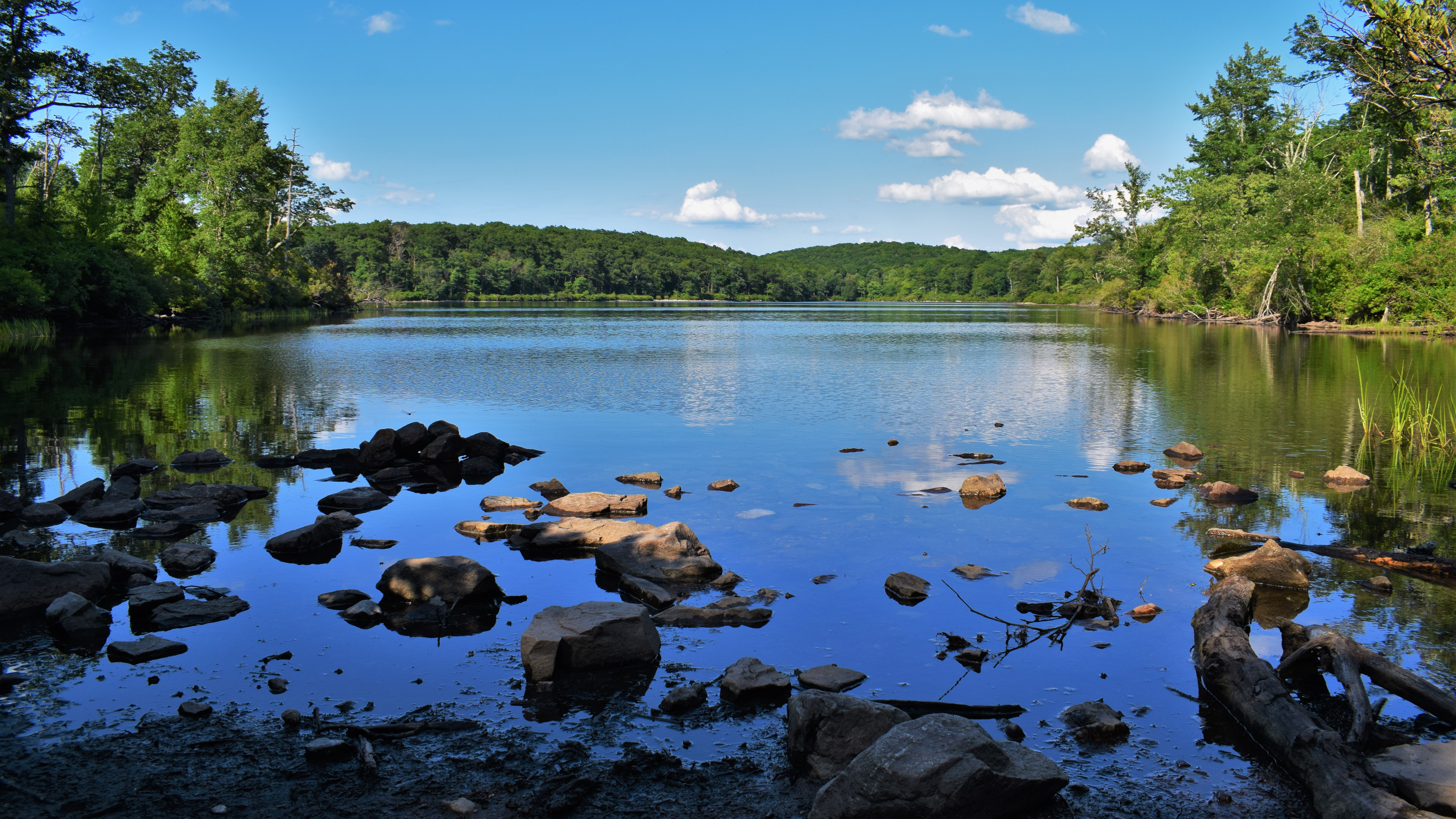
There was a power cut right after the main viewing area that offered more views, and then the trail returned into the woods towards Sunfish Pond. There was a good amount of bear evidence (read: poop) on the trails surrounding the pond, which makes sense considering the endless blueberry bushes all around. The trail gets very rough and rocky after the Sunfish Pond Natural Area sign, which slowed us down. There are a few areas to view the pond from the trail - we ended up taking a break about halfway along the pond on a rocky field surrounded with blueberry bushes that were probably just a week or two from being ripe. The pond water was still with the occasional bird or fish splashing about, but otherwise it was incredibly peaceful. 


Closer to the western edge of the pond, the trail is right along the water and we had the opportunity to gawk at some beautiful frogs, fish, and tadpoles. The trail finally becomes more forgiving/less rocky at the western edge of the pond, where we took one last look before starting the next leg of our hike. Between Sunfish Pond and I-80, the trail appears to follow an old woods road that varies from lovely, rolling, and gentle, to rocky and disrespectful. The woods are generally beautiful and open, where you can hear the distant sound of Dunnfield Creek. We passed someone's homemade 1300-mile sign out of rocks (an AT milestone) and had to cross two blowdowns - one was a hop over and one had a herd path around.


Toward the trail junction with the Dunnfield Creek Trail, a stick fell from the sky, nearly smacking Gen on the head. I looked up, expecting a rude squirrel to be giggling about, but instead found a porcupine at least 30 feet in the air munching on its dinner - first time I saw one in NJ! We also saw our only snake of the trip - an Eastern Ribbon Snake. The woods part of the trail terminates at the Mt. Tammany/Dunnfield Creek parking lot, and then the road walk begins!


The trail passes under I-80 and then follows the road leading to the Kittatinny Point Visitor Center. I noticed some raspberry-like berries along this route, so I took out the "Seek" app and found out that they were Wineberry bushes, and they were edible! Gen and I had a mini feast along this section. They tasted like raspberries, but more sweet than tart. The road in this section was rough - which reminded me about the "No National Park" group mentioned the deteriorating infrastructure in this park. Anyway, we made it back to Gen's car, dropped our bags, and got ready for the last bit of trail we had left for the day. 


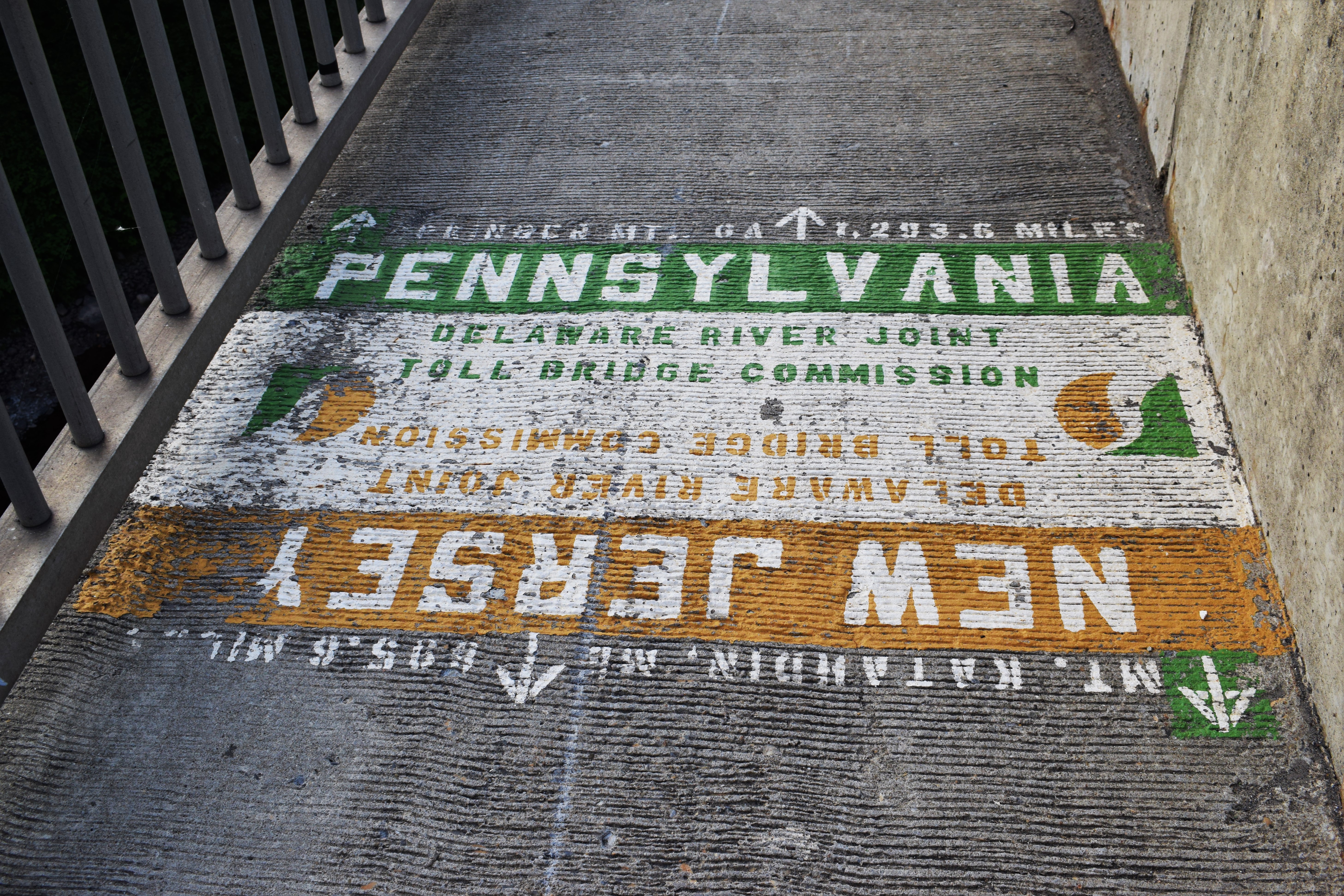
The walk to the NJ/PA border was along the road, and then on the I-80 bridge. Very straightforward, but our feet were feeling the burn from an afternoon hiking on rocks. The sun was setting, providing nice views of Mt. Tammany and Mt. Minsi, and it was fun to look down into the river from the bridge. We soon made it to the border, took a few photos, joked about not wanting to spend too much time in PA, and made it back to the car! We headed back to Mohican Camp Road to get my car, and then headed to the Hibernia Diner for a classic NJ dinner.


Step-By-Step

  • Start hike on the Appalachian Trail Southbound from Mohican Camp Road. 

  • At junction with red-blazed Coppermine Trail, continue on AT Southbound.

  • Trail joins blue-blazed Kaiser Trail.

  • Trail leaves blue-blazed Kaiser Trail.

  • Trail enters Worthington State Forest.

  • Trail crosses Raccoon Ridge. 

  • At junction with orange-blazed Garvey Springs trial, continue on AT Southbound. 

  • At junction with blue-blazed Buckwood trail, continue on AT Southbound. 

  • At western end of Sunfish Pond, continue on AT Southbound. 

  • At junction with blue-blazed Douglas Trail, continue on AT Southbound. 

  • At junction with yellow-blazed Fairview (Beulahland) Trail and red-blazed Holly Springs Trail, continue on AT Southbound.

  • Continue to follow white blazes to Dunnfield Creek Natural Area parking area and along road walk.

  • Follow blazes along road to I-80 bridge, and then to NJ/PA State Line. 

  • Turn around, follow blazes back to car.


"Worthington State Forest" from NYNJTC Map #120

        "Located within the boundaries of the Delaware Water Gap National Recreation Area, but administered separately by the State of New Jersey, Worthington State Forest contains some of the most rugged terrain in the state. Comprising the southern part of the Kittatinny Ridge, the state forest extends approximately seven miles along the ridge and includes 6,660 acres.

        Worthington was once called Buckwood Park, a private deer preserve of engineer Charles Campbell Worthington. His retirement home, Shawnee-on-Delaware, was later developed as a resort. Buckwood Park was first leased to the state as a game preserve in 1916, and was purchased from the Worthington estate in 1954. Among the forest's features is a glacial lake, Sunfish Pond, which was restored to the state after a long fight by conservationists defeated a planned pumped-storage utility project there.

        At the southern end of the forest is the Dunnfield Creek Natural Area. The creek tumbles over a waterfall on its way from Mount Tammany to the Delaware River, and it is one of the few in the state to support native brook trout. Overlooking this rocky stream are stands of hemlock, maple, and birch. Mountain laurel adds color to the area when in bloom. 

        For more information, contact Worthington State Forest, HC62, Box 2, Columbia, NJ 07832; (908) 841-9575; www.njparksandforests.org."


"Trails in Worthington State Forest" from NYNJTC Map #120

        "The trails in Worthington State Forest are among the most heavily used in the entire state, with the summit of Mount Tammany and Sunfish Pond being popular destinations. The Appalachian Trail runs through the center of the forest, and many other trails connect with it, making possible a variety of loop hikes. One popular hike combined the Mount Tammany (Red Dot) and the Pahaquarry (Blue Dot) Trails to make a 3.8-mile loop to the summit of Mount Tammany from the Dunnfield Creek parking area - a strenuous hike, with an elevation gain of over 1,000 feet. [...]."


"Delaware Water Gap National Recreation Area" from Appalachian Trail Guide to NY - NJ, 18th Ed.

        "The largest federal recreation area in the East, this 70,000-acre preserve extends along 40 miles of the Delaware River in Pennsylvania and New Jersey. It was originally planned as part of a hydroelectric dam project; the recreation area would have been along the shores of the lake. Many dwellings were destroyed and hundreds displaced in the farming country along the river before plans for the dam were shelved after intense opposition. Beginning in the 1980's, the National Park Service began developing beaches, roads, boat launches, picnic areas, and trails and preserving the remaining structures."


Excerpt from Guide to the Appalachian Trail from the CT-NY State Line to the Susquehanna River, PA, 4th Ed.

        "The trail follows a general southwesterly direction over Mt. Mohican with good views to Sunfish Pond. From Sunfish Pond (1,378 ft.) picturesquely located near the summit of the ridge, trail descends to Dunnfield creek. This part is heavily wooded and affords no views.

        In this section of the trail, many changes have occured. The land of the Rossiter Realty Company, which was known as the Worthing Estate, has been sold to the State of New Jersey and will be used as a hunting and fishing preserve. In addition, they plan to build a car and trailer campsite in the near future. It will not be necessary as in the pasat to be a member of a club associated with the NY-NJ Trail Conference to cross this land. 

        The old AT over Mt. Tammany and down the old macadam road has been abandoned due to the construction of the new Route 611. A high fence has been built on the boundary of Camp Weygadt but there still is a gate where the old trail emerges on the highway. The elimination of this trail and the rerouting of the AT over the new bridge saves an 8.3m. trip. Before one to go to Columbia, cross over the covered bridge (washed away) into Portland and back on the west shore of the Delawre.

        Part of the old AT has now become the Mt. Tammany Trail (Indian Head) and it cannover be overpraised as a side trip. This trail, 2.4 m. long, reaches the top of Mt. Tammany where from the overlook a wonderful view of the Delaware River, the Pocono Mtns. and Mt. Minsi just across the river can be obtained. From the overlook, this trail descends steeply along the face of the mountain to Route 611 in about 200 yds. north of the Camp Weygadt fence.


DWGNRA Appalachian Trail Map

NJDEP Worthington State Forest Map

NJDEP Worthington State Forest Zoomed Map

NJDEP Worthington State Forest Map (Older)

NYNJTC Worthington State Forest Map

Photo Album