Showing posts with label Fowl Meadow Area. Show all posts

Tuesday, February 27, 2024

Fowl Meadow (Blue Hills Reservation)

Fowl Meadow (Blue Hills Reservation)

Hike Type: Lollipop Loop 
Distance: 4,76 miles
Elevation: 23 feet
Time: 1 hour, 45 minutes 
Hiking Challenges: Blue Hills Winter Trace

The Hike
I landed at the Burma Road parking area after school on a Tuesday to a surprisingly full parking lot - there was just enough space for my CRV to squeeze in. I guess it made sense, because it felt like the first day of spring! It was 62 degrees at the car and I was getting ready for my first shorts-hike of the season. The warm air felt amazing on my skin, minus the existential dread that the world is ending... Sadly I forgot to bring my PeakDesign clip, so I had to carry my camera with me the whole time... boo.


I started by exploring the unmapped path that leads from the parking area to the Neponset, then along the Neponset, and then either turns back to Burma Road to continues to follow the Neponset all the way to Indian Path. I wasn't too excited about the unknown, so I followed the short loop back to Burma Road. There were a couple of dry crossings a la the Indian Path, which was a good omen. The trail turned at a blowdown.


Burma Road was beautiful as always, filled with the sound of birds. There were small bits of ice left in the swampy nooks and crannies, and my lungs were acting weird, but I guess that just comes with spring.


I made my way to 6005 and noticed that the bridge on the left got washed out in one of the monsoons we got over the past few months - bummer. 


I also noticed a big "BN" on the ground in orange paint/chalk... interesting. The orange markings continued along the Fowl Meadow Path (and then on Indian Path and the lower Burma Road) - I could never figure out what it meant, aside from maybe just marking a route?


The first crossing on Indian Path had a bit of water but was easily passable. I'm still not convinved all of the sticks at the crossing are actually helpful...


There was an impressive thicket of prickers and overall the trail was as expected - slightly overgrown but scenic. I passed two guys who warned me that they picked "like six ticks" off of themselves, which sent me into an emotional spiral, but thankfully I escaped unscathed. 


I eventually made my way back to Burma Road and had the loooooong walk back to the car. I think I only have a few more hikes left to finish my winter trace! A few orphans around the Summit Road, the circles around the Houghton's Pond Visitor Center, Ponkapoag East plus a few in the southeast corner of Ponkapoag Pond, and the St. Moritz area. I should finish by official springtime!


Step-By-Step
- Park at Burma Road parking area.
- Hike toward Neponset and on unmapped path along river.
- At junction, turn left.
- At terminus, turn right onto Burma Road.
- At 6005, turn right onto Fowl Meadow Path.
- At 6009 (not on map), turn left onto trail.
- Where path begins to fizzle out, turn around.
- At 6009, turn left onto Fowl Meadow Path.
- At terminus, turn left onto Indian Path.
- At terminus, turn right onto Burma Road.
- At terminus, turn around and hike Burma Road.
- At 6005, continue straight and return to car.


Saturday, April 8, 2023

Fowl Meadow (Blue Hills Reservation)

Fowl Meadow (Blue Hills Reservation)

Hike Type: Lollipop Loop & Spaghetti
Distance: 8.63 miles
Elevation: 226 feet
Time: 2 hours, 59  minutes 
Hiking Challenges: 52 Hike Challenge, Blue Hills 125 Mile Club


The Hike
A beautiful day with a light chill to the air, just under 50 degrees with plenty of sunshine, it was finally time to head back to Fowl Meadow and tackle the Indian Path! The parking lot displayed faint spring colors, which truly just made me eager for green, and I spent the beginning portion of my adventure reminding myself to have an open mind - the best case is that I get all of Fowl Meadow in one swoop, but also any day out in the woods is a good day. I was surprised to see so many cars at the parking lot, but then I noticed there was a soccer game going on across the street, so I think a few people were over there. I also applied my first coating of bug spray for the year! Thankfully either it worked well or there weren't any bugs out.


I wandered around the small trails near the parking area before starting my hike down Burma Road, where the birds were abundant and singing loudly! The weather had been pretty dry for the past few days, and the trail reflected that, which made me hopeful for easy water crossings! The beauty of Burma Road was only broken by two unleashed dogs running up to me at two separate times... why can't people either train their dogs or leash them?


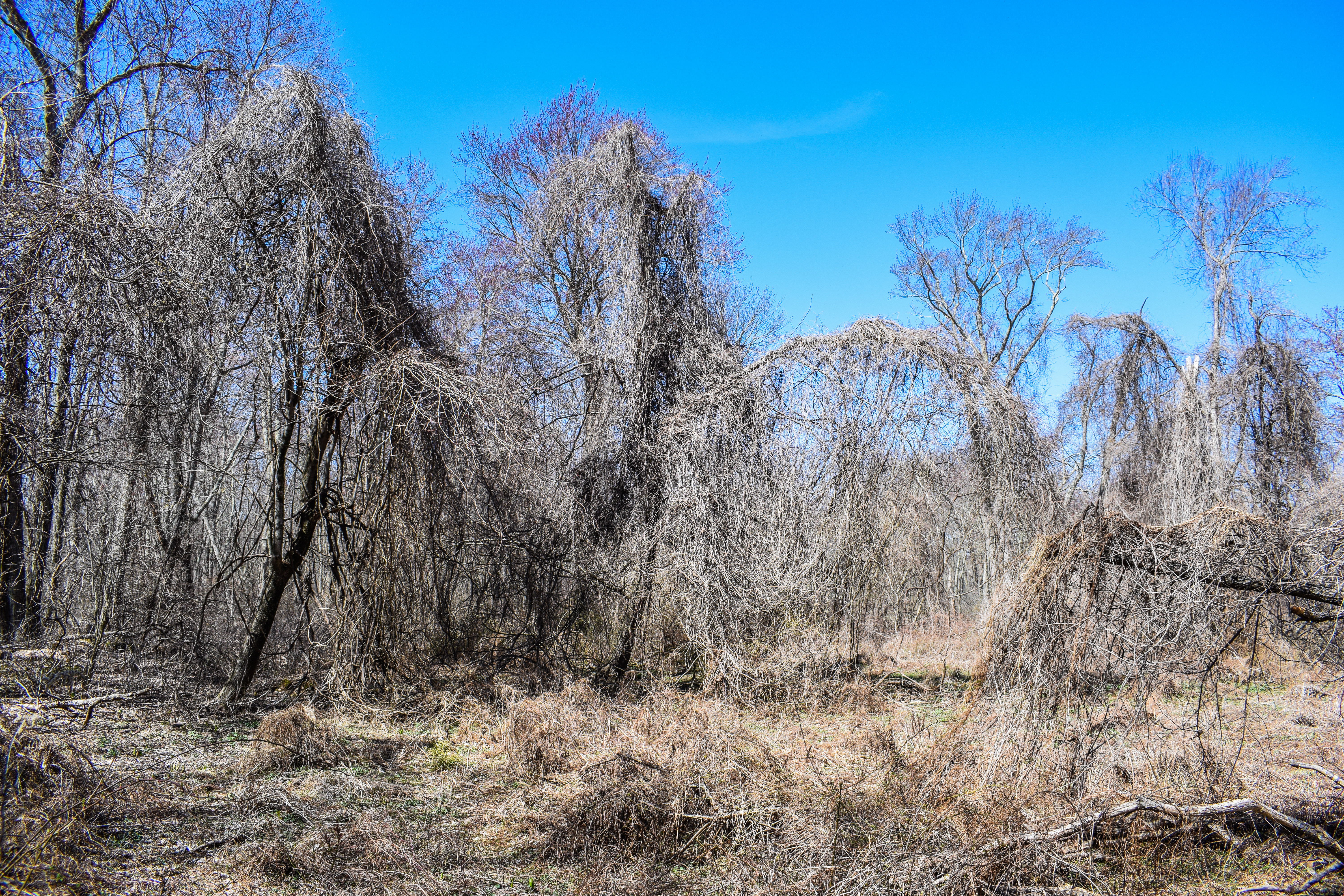
I am always in awe of the tall trees along the Fowl Meadow Path - feels almost like being back in time? I also always find humor that intersection 6009 isn't on the map, but that's just the child in me. I hiked that weird spur and continued on until I hit the Neponset River, and then started the schlep down Indian Path!


I was delighted to see that the first crossing was low and only had a few inches of standing water. The thousand sticks someone laid over this crossing might be helpful? If anything it just confused me - I tried to see which sections looked the strongest and shimmied my way across. The trail itself is actually quite nice - a little claustrophobic, but very scenic as it winds along the riverbank. The winding is occasionally interrupted by a high water outlet/inlet - I ended up counting ~12, and all were bone dry except for the first! There were two tricky blowdowns, the first was an "under" and the second an "over." The back half of the trail had a few eroded sections along the steep banks, but the ground felt solid. An piece or orange flagging tape marks where the trail veers back towards Burma Road (the Indian Path unofficially continues on, but I was on a mission!), and I was delighted to 1) check Indian Path off my list again and 2) escape the subtle claustrophobia of plants tickling my ankles!


I hiked to the end of Burma and then worked my way back toward the Fowl Meadow Path. The fleece came off here, but the wind was still chilly. I really apprecaited how the scenery continually changed along the road, and I saw my first snake of the season! Now onto the eastern side of Burma Road, I was delighted to see that the Swamp Trail was passable, and only a little prickly. The pollening was DEFINITELY getting started as the trees continued to bud and slowly add color back onto their branches. I was blown away by how many birds there were! I really wish that I had brought my zoom lens with me. 


The next and final main challenge was the Field Path... I'm really not sure why it's still even considered a trail. There were lots of bugs at ground level, but they never bothered me thankfully. I am forever grateful for the person who put the flagging tape along the Field Path - it's an awful trail, but now easier to follow! Just after passing under an old, large blowdown (like a tunnel), there are some old items (large barrel?) that I'm curious as to how they got there... maybe remnants of planned highway construction? Maybe someday I'll retire and write a book about Blue Hills curios. 


More fascinating, are the piles of garbage at the actual abandoned highway exit. There is a couch that has seen much better days off to the side, piles of ripped up concrete (why did they bother ripping up only some of the concrete? Maybe property reasons?), and a nice pile of old flooring with a few appliances. What? Interesting, nonetheless.


Now back into the woods, I found myself wishing there was a "Welcome to the Skyline Trail" sign, or something. The beginning feels very lackluster, and maybe that's just becasue of its inaccessibility, but I would still appreciate it! There is a very small cairn, at least. The first blaze is a little ways along the trail, and the trail in this area is pretty nasty with highway litter and runoff. Further in the woods, there is an impressive stone wall that acts as an intersection marker for the footpath to the end of Royall Street, the unnamed trail to Royall Street, the Skyline Trail toward Green Street, and an unmapped trail back toward Fowl Meadow (I think this used to connect to Orchard Trail, but not sure. 


Once I hit Green Street, I turned around and started the slog back to the car! I followed the Orchard Trail, hit the spur at 6106, and followed the unmapped trail that bypasses the Swamp Trail. Using the Seek app, I learned that the super sharp prickers that are now blooming are Japanese Barberries - evil! My feet were starting to get mad at me toward the end of this suprisingly successful hike. I only passed a few people on my exit via Burma Road, and almost forgot to get the spur toward the trailhead! That would have been a bummer. Fowl Meadow: complete!


Step-By-Step
- Park at Burma Road.
- Hike trails around trailhead, including flooded path of Burma Road.
- Hike Burma Road.
- At 6005, turn right onto Fowl Meadow Path.
- At 6009 (not on map), turn left onto trail.
- Where path begins to fizzle out, turn around.
- At 6009, turn left onto Fowl Meadow Path.
- At terminus, turn left onto Indian Path.
- At terminus, turn right onto Burma Road.
- At terminus, turn around and hike Burma Road.
- At 6005, turn right onto Fowl Meadow Path.
- At next jct., turn right onto Swamp Trail.
- At 6105, turn onto Green Hill Path.
- At 6103, veer right onto Field Path.
- At 6102, turn left onto Green Hill Path.
- At 6103, turn around. 
- At 6101, continue onto abandoned road, always veering left.
- Continue onto Skyline Trail.
- At 6600, turn around.
- At stone wall, turn left to hike spur to Royall St., turn around.
- At stone wall, turn left onto Skyline Trail.
- At terminus, continue  to retrace steps on abandoned road. 
- At 6101, continue into woods.
- At 6102, turn right onto Orchard Trail. 
- At 6104, continue right onto Green Hill Path.
- At 6106, turn right to hike trail.
- When close to back yards, turn around.
- At 6106, turn right onto Green Hill Path.
- At green trail marker, continue on path.
- At next junction, turn left onto continuation of Fowl Meadow Path.
- Continue straight onto Fowl Meadow Path.
- At 6005, turn right onto Burma Road, hike to car (hit spur to Brush Hill Road).


Tuesday, February 7, 2023

Burma Road to Field Path (Blue Hills Reservation)

Burma Road to Field Path (Blue Hills Reservation)

Hike Type: Loop

Distance: 5.00  miles

Elevation: 125 feet
Time: 1 hour, 49 minutes

Hiking Challenges: 52 Hike Challenge; Blue Hills Winter Trace


The Hike

With the sun finally setting past 5:00pm, I’m allowed to go back to the Blue Hills after work again! I have a soft rule that I need to spend more time hiking than I do in the car, so for how I’ll be in the Burma/Little Blue/Great Blue area. I made it down to the Burma Road parking area around 3:30, wedged my way in between two cars, and started my journey first by doing the small trails right around the parking area (and laughing at the sign that says to NOT eat any fish caught in the Neponset River), and then finally making my way down Burma Road. 


I was ushered in by the regal honks of at least 1,000 geese flying in every which direction overhead. The bridge over a small creek is in worse shape than last year, but thankfully it held me firmly (much appreciated). The temperatures were in the mid-30s, so the ground was slightly muddy with frozen patches in the surrounding wetlands. Near the junction with the Fowl Meadow Path I was charged at by a “friendly” dog and apologized at - why can’t people just leash their dogs? Is it truly that much of a hassle?


The Fowl Meadow Path is a really beautiful area with frozen swamps on the left and thick woodlands on the right. There area a bunch of old sewers labeled “MWRA Sewer” (https://www.mwra.com/index.html) which is interesting - they’re all elevated about 3 feet off the ground. I bet this area is beautiful in peak foliage, even with the comical amount of green prickers. There were also some old “artifacts” laying around the small spur trail, including a skateboard nailed to a tree. 


Finally at the Indian Path along the Neponset River, I saw that the ice-line was a foot above the water line, probably a good sign? Soon after I made it to the first water crossing and it was not a good sign. There were dozens of thin branches laid across the crossing with maybe thicker logs underneath? A topsheet of ice did not settle my nerves, and after starting it and randomly steeping for a few minutes, I put my tail in between my legs and turned around. I did not want to get wet today. I was really bummed, but such is life!


My redemption plan was to tackle the trails on the east side of Burma Road. I begrudgingly backtracked, passed another hiker heading north along the Neponset River on what appears to be a trail that’s not on the map, and at 6005, continued along the Fowl Meadow Path, over a wide bridge, and then to the Swamp Trail. The Swamp Trail has been flooded both times I’ve hiked it, but today it was frozen! Thank goodness. The trail itself is narrow, scenic, interesting, and painful (lots of prickers), with evidence of an old old boardwalk. There are also a lot of old rusted items littering the woods - are they a result of flooding? Abandoned homes? Someone going really out of their way to not pay dump fees?


Now turning right onto the Green Hill Path (who is Green Hill??), I wasn’t sure if the infamous Field Path would be on the docket for the day, but I’d hike that way just to see where the winds took me. The woods here were spooky - the sun was setting and I spooked a family of deer, which then spooked me. At one point my bag made a swishing sound and I thought it was the sound of a child screaming , but apparently I was not being possessed. I finally made my way to the unclear junction with the Field Path, heard at least one of the deer splash their way into water, and decided I was already planning to do one rite-of-passage trail today, so let’s go for it. I was delighted to see pink marking tape blazing the trail, and it was significantly less overgrown than last time. Whoever the patron saint of the Field Path is, thank you. There were still a couple of blowdowns, one was particularly tricky, but I made it out with only one visible scrape!


I took the Orchard Trail back, which was calm and featureless. The sun was about to set behind the clouds, so my goal was to pick up the pace and get back to Burma Road before it was too dark. I continued along the Green Hill Path once the Orchard Trail ended, hiked the spur to the east, and then followed the path as it continued outside of DCR park boundaries into “conserved private land” - or something like that. The terrain in this area was really interesting - almost like dirt canyons. I wonder if this is because of erosion, development, or just something else (aliens)? The trail continuation brought be back to the Swamp Path, and then to Burma Road. When I was about 0.5 mi. from the parking lot I passed someone with their dog walking in toward 6005, which was interesting (driving home from the next day’s hike I saw his same car in the dark, I guess he enjoys the solitude). Soon enough I was back at my car with just a smidge of daylight left - initially bummed because I wasn’t able to safely get the Indian Path, but happy I was still able to accomplish some trails.


Step-By-Step

  • Park at Burma Road parking area.

  • Start hike at “Fowl Meadow” granite marker, hiking along Burma Road.

  • At 6005, turn right onto Fowl Meadow Path.

  • At unmapped 6009, turn left to hike unnamed short path. Unclear when to turn around, so I turned around at a big tree. Retrace steps.

  • Continue along Fowl Meadow Path until terminus at Neponset River.

  • Turn left onto Indian Path along Neponset River, have a crisis at first crossing, and retrace steps all the way back to 6005.

  • Continue straight through 6005 onto Swamp Trail toward 6105.

  • At 6105, turn right onto Green Hill Path.

  • At 6103, turn right onto Field Path.  

  • Survive the field path onto junction 6102.

  • At 6102, continue onto Orchard Trail.

  • At 6104, continue onto Green Hill Path.

  • At 6106, turn right to hike spur trail and retrace steps.

  • Continue along Green Hill Path, leaving the Blue Hills Reservation, and then rejoining the Blue Hills Reservation on the Fowl Meadow Path.

  • Follow Fowl Meadow Path to 6005, and then follow Burma Road to car.


Monday, March 21, 2022

[BACKLOG] Fowl Meadow - Burma Road East (Blue Hills Reservation)

Fowl Meadow - Burma Road East (Blue Hills Reservation)

Hike Type: Spaghetti
Distance: 3.3 miles
Elevation: 194 feet
Time: 1 hour, 11 minutes
Hiking Challenges: Blue Hills 125-Mile Challenge; Toilet Paper Trio


The Hike
I was equally anxious and excited to cross this bunch of trails off of my list. I made a weak attempt to hike them when I hiked Burma Road and the trail along the Neponset River, but the Swamp Trail was flooded out so I went home. I parked at the end of Royall Street, which didn't seem the most legal but it's where I parked for a Skyline Trail traverse two falls ago so I risked it again to no issue!

There's an unmarked access trail to the Skyline Trail, and the Skyline Trail leads to abandoned pavement that was laid when I-95 was intended to go straight through Boston. The Skyline Trail over here is a bit messy with a lot of garbage, and the old pavement gives post-apocolyptic vibes. The pavement leads to an old rusted gate, and that's where this network of trails begins. 

I went straight at 6102 onto the Green Hill Path which was quite loveley. At 6103 I turned onto the Field Path which was anything but a field. The footpath was vauge but follow-able with baby thorns sticking out of the ground. The second half of the trail was dreadful. Someone on Facebook said if they ever returned he'd bring a machete and I firmly agree. I ended up getting spat back out at 6101, which does not line up with the trail on the map, but I'm pretty confident there was literally no other way to go as there were piles of thorns on all sides.

Anyway, once I survived I turked back onto the Green Hill Path and went back to the Swamp Trail, which was actually really cool. I hit the flooded section and did my best to rock-log-stick-mud hop to the other side, and I'll say I was definiteyl close enough! I then meandered to 6106 and hit up both spur trails. The sput that is an extension of the Green Hill Path was wide and easy and continued onto an unmarked network of trails (I believe it links up with extension of the Fowl Meadow Path that continues after the Swamp Trail, but not sure). I tured around at the border of the Blue Hills Reservation. It was hard to tell when the other spur trail stopped, but once I could clearly see into strangers' back yard I turned around, followed the Orchard Trail back, and made it back to the car!

Overall it was a nice afternoon. No desire to ever go back to the Field Path, but definitely curious about those other unmarked trails. 


Posted April 5th, 2022 at 6:35am.

Wednesday, March 16, 2022

[BACKLOG] Fowl Meadow - Burma Road and Neponset River (Blue Hills Reservation)

Fowl Meadow - Burma Road and Neponset River 

Hike Type: Lollipop
Distance: 5.1 miles
Elevation: 26 feet
Time: 1 hour, 50 minutes
Hiking Challenges: Blue Hills 125-Mile Challenge; Toilet Paper Trio


The Hike
This was a hike that I was wrongfully dreading. I've heard stories about how overgrown the trail along the Neponset River gets and how wet it always is. I put on my big boy shorts and went at it and was happily surprised! Burma Road was really a loveley walk. Always something to look at while walking on this wide path. There was a really cute bridge over a drainage that was something out of a children's book. At 6005 I turned right onto the Fowl Meadow Path that headed towards the Neponset River. I noticed a bunch of elevated sewers - I guess they were put in as infastructure when they planned to send I-95 through Boston? Not sure though. There was a very short spur path that went into the woods, formerly labaled 6009 as recently as the 2014 map, and the 1996 map shows a former trail that I assume is overgrown/flooded out. I followed the 6009 path until it became overgrown and then turned around.

From the 1996 map.

Then I landed at the Neponset River at a nice viewpoint. Across the river are the train tracks which reminded me that even though there was nobody around me, I was never alone. I was nervous starting this trek from everything that I've heard, and finding the trail took a second, and the first water crossing took a few more, but after that truly it was fine! Reports on Facebook say that I got it on a very dry day which I cannot be happier about. There were a few sections that were sketchy and I hit a few prickers, but truly it was fine. At the end of the path I even stumbled upon my first snake of the season!

Once getting back on Burma Road, I finished out that last portion towards I-95 and turned back around. I loved this section, even though it began to feel long. Lots of still water on the sides of the trail with plenty of ducks living their best lives. I had a good amount of energy left when I made it back to 6005, so I decided I would see how the trails on the Eastern side of Burma Road are. I followed the Fowl Meadow Path to the Swamp Trail, dodging some wet spots, and untimately turned around at the Swamp Trail beause it was flooded over. There were a few wide unmapped trails that stemmed out of this area but I decided not to explore as my after school hunger hit. I turned back and headed back to the car. I would definitely come back, but not in the summer and not in a wet season. 

Photo Album


Posted on April 8th, 2022 at 10:19 AM.