Bear & West Mtns. via AT, Timp-Torne, & Suffern-Bear Mtn. Trails (Bear Mountain State Park)
Hike Type: Loop w/ Spur
Distance: 10.58 miles
Elevation: 2,293 feet
Time: 4 hours, 32 minutes (4 hours, 15 minutes moving)
Hiking Challenges: Bear Mountain Trail Challenge, Operation Alaska Benchmark Challenge, New York Appalachian Trail
Hiking Challenges: Bear Mountain Trail Challenge, Operation Alaska Benchmark Challenge, New York Appalachian Trail

The Hike
I had an open morning, so I decided I'd head up to Bear Mountain State Park and work on my (actual) summer hiking goal - make some progress is connecting the dots with the New York Appalachian Trail (my goal has seem to shifted to getting/maintaining my local legend status at the Tourne, but I still want to make SOME progress). I figured it would be a busy day, so I was up and out at 6:20am, getting breakfast at Wawa at 6:25am, eventually getting to the main Bear Mountain State Park area around 7:15am. The area was a bit confusing to navigate as a first-timer, but I eventually landed out of the way in Lot 2. I didn't have to pay the parking fee due to getting there early (the toll booth said "TOLL BOTH CLOSED," which was a nice surprise. It was in the mid 70s with clouds and ample humidity. There were a group of trail runners also getting ready nearby and one shouted "ALL I REALLY WANNA DO IS GO TO THE ZOO," which made me laugh and also emphasize.
[7:30am - Start of Hike]
I was soon starting my journey by walking across the state park area - Lot 1 would have made more sense for me, but it was nice to be out of the way. My neck and shoulders were a bit crispy from my solo beach day yesterday, but overall I was feeling good! The Bear Mountain Inn was a really cool building, and I soon landed at the three-way trailhead for the Suffern-Bear Mountain Trail, Appalachian Trail, and Major Welch Trail.
[7:37am - Appalachian Trail]
This area was well-signed for naviation and for information. I was initially taking photos of the informational signs to transcribe below, but I soon realized that there were simply too many - I ultimately just got the ones that detailed the Appalachian Trail and Bear Mountain State Park:
"WELCOME TO THE APPALACHIAN TRAIL
You are standing on the Appalachian National Scenic Trail, the most famous hiking trail in the United States - maybe in the world! In 1921, Benton MacKaye, a Massachusetts forester and regional planner, hatched a big idea: a footpath from Maine to Georgia. The Appalachian Trail, he said, would be "a sort of backbone, linking wilderness areas to dwellers in urban areas along the Atlantic Seabord." Today, the Trail runs nearly 2,200 miles along the East Coast range known as the Appalchian Mountains.
BUILT AND MAINTAINED BY VOLUNTEERS
Inspired by MacKaye's vision, hikers and wilderness lovers soon began planning and building the Appalachian Trail (A.T.) with the assistance of the Palisades Interstate Park Commission. In 1921, New York-New Jersey Trail Conference volunteers completed the very first piece of the A.T. here at Bear Mountain. The A.T. is a unit of the National Park System, and is maintained primarily by volunteers who continue to keep the Trail open, safe, and enjoyable for all.
PATHWAY TO BEAUTY
Whether you walk just a short section or hike all the way from Maine to Georgia, the Appalchian Trail connects communities and offers people access to scenic beauty, quiet forests, and wildlife habitat along its entire length. The A.T. also links up with thousands of miles of connecting trails. Here in Bear Mountain and Harriman State Parks, you can explore more than 225 miles of trails." from trailside kiosk.
"PRESERVING A NATIONAL LANDMARK
CARING FOR A 2,200-MILE FOOTPATH
Managing a hiking trail that passes through 14 states and an even greater number of communities and parks along its 2,200-mile length is a complex responsibility shared by numerous, regional, and local agencies, as well as volunteer-based non-profit organizations. At the national level, the Appalachian Trail (A.T.) is the responsibility of the National Park Service, which oversees and safeguards more than 400 natural and historic places for the public, in partnership with the Appalachian Trail Conservancy, a private, not-for-profit organization dedicated exclusively to the preservation and management of the A.T.
APPALACHIAN TRAIL CONSERVANCY
The Appalachian Trail Conservancy (ATC) strives to ensure that the Appalachian Trail's "vast natural beauty and priceless cultural heritage can be shared and enjoyed today, tomorrow, and for centuries to come." ATC, founded in 1925, works with federal, state, and local agencies and 31 "maintaining clubs," such as the New York-New Jersey Trail Conference, to cooperatively manage the Appalachian Trail. ATC provides education, resources, and inspiration for hikers and trail volunteers from around the world.
BUILDING SUSTAINABLE TRAILS
In 2006, the Bear Mountain Trails Project was established to make Bear Mountain State Park's trails more sustainable for the high level of use they receive. This initiative has been made possible through a cooperative agreement between the National Park Service, Appalachian Trail Conservancy, New York State Office of Parks, Recreation, and Historic Preservation, Palisades Interstate Park Commission, and New York-New Jersey Trail Conference." from trailside kioks.
"BEAR MOUNTAIN STATE PARK: A LEGACY OF CONSERVATION
BUILDING NATURE PARKS FOR PEOPLE
Parks preserve and celebreate nature, but they are not entirely natural. Hundreds of workers - led by Major William A. Welch, the first general manager of Harriman-Bear Mountain - built roads, lakes, youth camps, and recreation facilities throughout these two parks. In 1913, the Palisades Interstate Park Commission (PIPC) formalized a group camp program - the first in teh nation - that introduced thousands of urban children to nature. In 1915, the Bear Mountain Inn opened and served over 100,000 guests in its first year. Bear Mountain and Harriman State Parks were a huge success, with hundreds of thousands of visitors arriving year after year, first by steamship from Manhattan and Yonkers, and later by bus and car. Today, 3.5 million people annually visit these parks, which are still managed by PIPC and the New York State Office of Parks, Recreation, and Historic Preservation.
BEAR MOUNTAIN: RESCUED JUST IN TIME
The fate of Bear Mountain could have been very different if not for the work of early conservationiists. In 1909, New York State purchased 740 acres on the mountain for the purpose of relocating Sing Sing Prison. The project outraged the environmentally concerned citizens who had helped form the Palisades Interstate Park Commission (PIPC), created to preserve land and provide opportunities for outdoor recreation, just years earlier. Mary W. Harriman, widow of railroad magnate Edward H. Harriman, offered the state a deal: She would donate $1 million and 10,000 acres of her private estate to PIPC if the state would discontinue work on the prison and provide money for further park expansion. Her parcel became Harriman State Park, while the state land became Bear Mountain State Park, inspiring a parks movement nationally - one where nature would be protected and people of all walks of life would be welcomed." from trailside kiosk.
"BUILDING A PARK FOR GENERATIONS TO ENJOY
CONNECTING PEOPLE TO THE BACKCOUNTRY
The Palisades Interstate Park system is a lasting monument to the conservation movement of the early 20th century. Hiking trails that offer public access to the backcountry of these parks are the work of generations of dedicated volunteers. This public-private trail-building partnership was conceived by Major William A. Welch, the first general manager and chief landscape engineer of the Palisades Interstate Park Commission (PIPC). In 1920, he encouraged volunteers from New York City hiking clubs to cooperatively form the Palisades Interstate Park Trail Conference, now known as the New York-New Jersey Trail Conference. Together, they built 100 miles of trails in seven years, including the historic first 20-mile section of the Appalachian Trail, across Bear Mountain and Harriman State Parks. In partnership with PIPC, New York-New Jersey Trail Conference volunteers today maintian more than 2,100 miles of hiking trails, including those in Bear Mountain and Harriman.
WHEN A MOUNTAIN IS LOVED TOO MUCH
Early trails tended to go straight up mountains, inviting erosion caused by rain and the impact of thousands of feet. Today, trails are designed to resist these destructive effects and to respect and preserve the environment through which they pass. Protecting our native habitats against foreign plants and insects unknowingly brought in by hikers is another challenge facing conservationists. New collaborations focused on controlling these damaging invasive species and protecting our natural resources continue to the legacy of successful public-private partnerships that have preserved precious wildlife habitats and built and maintained trails for people." from trailside kiosk.
I followed the signature white blazes of the Appalachian Trail into the woods on a ridiculously well-manicured and constructed trail, complete with stone steps, log railings, and cobblestone walkways. The trail was lined in wildflowers and seemingly endless wineberries. I put bug spray on 10ish minutes in (fresh can, too!). The trail began to gain elevation still on the maticulously built path through some nice rocks - the pathway made sense for a very busy park - I was wondering how old this edition of the trail was.
I passed an under-construction junction with a blue-blazed trail as I continued to climb what was now a stairmaster, soon passing a family trio that was not having a great time. The trail alternated climbing with walking breaks, hugging the mountainside. Overall, it was an enjoyable walk, but it just didn't have much of a "woodsy" feeling. I crossed paths with some trail runners coming down the mountain and one pointed at this buddy and told me joking to "get a picture of this guy falling," which was funny.
I passed a nice overlook toward the Hudson where there was a guy picking up some garbage, and it was at this point where I decided I wouldn't keep counting the people I saw, since it was already over a dozen.
The Appalachian Trail traversed a neat storm-damaged area - I was wondering if this area was ravaged by the storms that shut the park down a couple summers ago? After the storm-damaged area, there was another nice walking break that led to a nice, open area that continued on a crushed gravel pathway with some tree views. Soon, the Appalachian Trail crossed power lines and something that looked like an access or a service road that connected to Perkins Memorial Drive.
I saw some standing views over to the Timp and some blueberry bushes that were SO CLOSE to being ripe, or so I thought... Just a few more feet down the trail I got my first handful of wild blueberries! I was genuinely so happy! I truly only eat blueberries when they're free in the woods. I enjoyed another obstructed standing view to the Hudson while gobbling up the berries, also noticing what I assume is remnants of the old path from time to time.
Once near the top, I enjoyed some different wildflowers and could soon see the Perkins Memorial Tower through the trees, and soon enough, I had summited Bear Mountain!
[8:21am - Bear Mountain Summit]
I was very grateful to be at the summit before the road opened. There were plenty of ledges with views overlooking West/Dunderberg Mountains - I wandered about for a bit looking for a benchmark disc with no luck, oh well. There was fog rolling in over the Hudson now and I could notice lots of drill holes and what looked like old tower footings on these ledges. I circled the closed tower and eventually took a quick snack, water, and wring-out-the-shirt break where the Appalachian Trail reenters the woods.
[8:31am - Appalachian Trail]
From here, the Appalachian Trail continued back into the woods on an accessible trail (which could be bypassed by a shortcut trail). The accessible trail was on a wide crushed gravel path and went right past a large bouder that had some more old fire tower footings and TWO USGS discs! I was thrilled in the nerdiest way!
I continued along, crossing another (or the same) access/service road and traversing what appeared to be a burned area. The Major Welch Trail continued on the right while the Appalachian Trail turned left and soon landed at a foggy overlook with a concrete-and-stone chimney-like footing. The accessible path ended here, and I saw some reptilian or amphibious creature with a shiny blue trail run under a rock? (EDIT: I have discovered through the power of Google that it was a five-lined skink!).
Now on a narrower, grassier footpath, I could hear some blasting off in the woods - I'm guessing a gun range or a sportsmen's club or something along those lines. Thankfully, I did not encounter any riffraff. The trailbed continued to be well-maintained, but far less manicured than what I had been on all day today (this was not a bad thing). There were some lovely, twisting mountain laurel lining the trails (but not suffocating the trails) and I caught a deer who was only ~30ish feet from the trail!
[8:50am - Appalachian Trail/AT Shortcut lower end]
The Appalachian Trail circled a massive rock and soon came to the lower end of the AT Shortcut; the trail that bypassed the accessible trail.
[8:53am - Major Welch Spur]
Not much further down the trail was a really cool ledge that had a ton of little poles eroded into it. I said "good morning" to a presumable AT thru-hikers sitting on a bench as I turned to follow the faded blue blazes of what I guess is an distant extension of the Major Welch Trail (at least according to the NYSDEC map). The trail rambled over ledges with just a couple small scrambles, eventually terminating at an inconsequential ledge with a nice view over to West Mountain and Jackie Jones Mountain. I wouldn't necessarily recommend this side trip, but I guess it was nice for a solitude. I used this time to wring out my shirt again and fuel myself before easily returning to the pothole ledge, as I decided to call it. I did see a black squirrel, though!
[9:04am - Appalachian Trail]
From the better view back on the Appalachian Trail, I could identify Jackie Jones Mountain, which is always fun to see. The trail traversed an unfortunately overgrown stretch, but that was the only bummer (for now...). I crossed paths with a large but very friendly group of folks, felt some hip pain, and ate some more blueberries!
The AT descended on MANY stone steps, eventually steeply and narrowly winding down between some large boulders. The trail bottomed out on the old access road that I passed while ascending a while ago.
Following the deteiroating-but-paved access road, there was a steep drop off on the left and some really impressive stone work on the right, which I think serves the purpose of preventing further erosion/sliding on the ledges above - I wonder if this is CCC work? The pavement eventually ends with pleasant views into the woods below, and soon crosses Perkins Memorial Drive.
[9:22am - Appalachian Trail/Perkins Memorial Drive]
After crossing the road, the Appalachian Trail entered the classic open, grassy "Harriman Woods" - as I've begun to call it. The trail rose over a hump and continued to meander as I crossed paths with some more thru hikers - one notable duo was a southern couple who just seemed like the happiest folks in all the land! I crossed paths with another who was picking blueberries, descended on some more tight stairs, past some more thru hikers, and the trail flattened out before crossing the Seven Lakes Drive.
[9:36am - Appalachian Trail/Seven Lakes Drive]
[9:37am - Appalachian Trail/1777W]
After crossing Seven Lakes Drive, the Appalachian Trail continues a few feet before joing the 1777W trail. The two coincide for a few minutes - I was excited to had been here before! The trail wiggled through a mountain laurel tunnel for a bit before the Appalchain Trail turned left, leaving 1777W.
[9:40am - Appalachian Trail]
Back on a new-to-me stretch of trail, a continued along and was soon scared by a guy who camped on the side of the trail and was sitting up in his tent. I had been feeling some hip pain for the past mile-ish, but I noticed if I just don't take MASSIVE steps, I'd be fine. I came across a guy with a Poland Spring water bottle and over-the-ear headphones. We exchanged nods, went our seperate ways, but then he turned around and asked where the parking lot was. I asked him which one, and he had no idea. I told him the nearest one was the 1777W one and directed him there... hopefully that's where he wanted to go and not to Anthony Wayne... I never heard or saw any missing persons report, so I guess he made it back!
[9:48am - Appalachian Trail/Fawn Trail]
Just after my... encounter I landed at the Fawn Trail junction and the Appalachian Trail began to climb, soon entering an area of young birches. I was officially dripping in sweat again! I did a short snack-and-sit at a fantastic viewpoint of Bear Mountain. It was especially fun to see the ledges I was traversing not too long ago. I crossed paths with another hiker here who was playing motivational speeches on his phone...
I continued along, climbing more steadily, questioning my life choices, but soon made it to the junction with the Timp-Torne Trail.
[10:06am - Timp-Torne Trail]
I initially got confused at this junction, because the AT was turning right, but I was pretty sure I had to turn left. I had completely forgotten that I was leaving the AT! I turned left onto the Timp-Torne Trail to start a long stretch of familiar hiking. I passed some nice views down to Anthony Wayne as the sounds of cars on the Palisades Interstate Parkway ushered me along as I waved to Jackie Jones Mountain again!
My shoes were yet again soaked from my sweat as I passed a junction with an orange-blazed trail. I didn't get a photo/timestamp because a group of men were chilling there - at least they told me "you probably want to go left" (they were right!).
[10:27am - Timp-Torne Trail/Suffern-Bear Mountain Trail]
A few minutes after, the Suffern-Bear Mountain Trail joined the Timp-Torne Trail as the trail rambled around a rocky-slabby stretch. The trail(s) eventually came up to a confusing cairn that made it look like one of the two trails turned, but no, both trails continued straight. I felt validated by an older man at the same cairn who was also confused. I was rewarded by the world's weakest and shorest breeze that added a solid five minutes back to my life!
[10:35am - Suffern-Bear Mountain Trail]
The trailbed started to get a little grassy near the split of the Suffern-Bear Mountain Trail and the Timp-Torne Trail. I was nervous, because I remembered being a little miserable in this upcoming stretch when I hiked it in the spring. Thankfully, I didn't expect any lingering winter conditions. To my absolute dismay, I was about to hike on the most overgrown trail I'd ever been on.
The grass was so grown-in that I couldn't even see the rocks beneath my feet, which made for some slow hiking and interesting footing challenges. A dislodged rock eventually hit my shin, BUT there were plentiful blueberries, so I guess that's a win? I was nervous about ticks, but I was so sweaty that I'm pretty sure they'd drown upon first bite.
The Suffern-Bear Mountain Trail turned into a more shaded area and the trail conditions improved... for about a minute before getting bad again. It steeply descended on an eroded footbed before climbing over a knob and getting even grassier. The trail continued to ramble about with another pathetic breeze that still felt good, alternating between steep/eroded and flat/grassy.
A longer, steeper, awfully eroded pitch tragically felt amazing after pushing through the grass for a while, but not to worry, I was soon back in the grass again! I reminded myself to be grateful because I'd had great conditions all day...
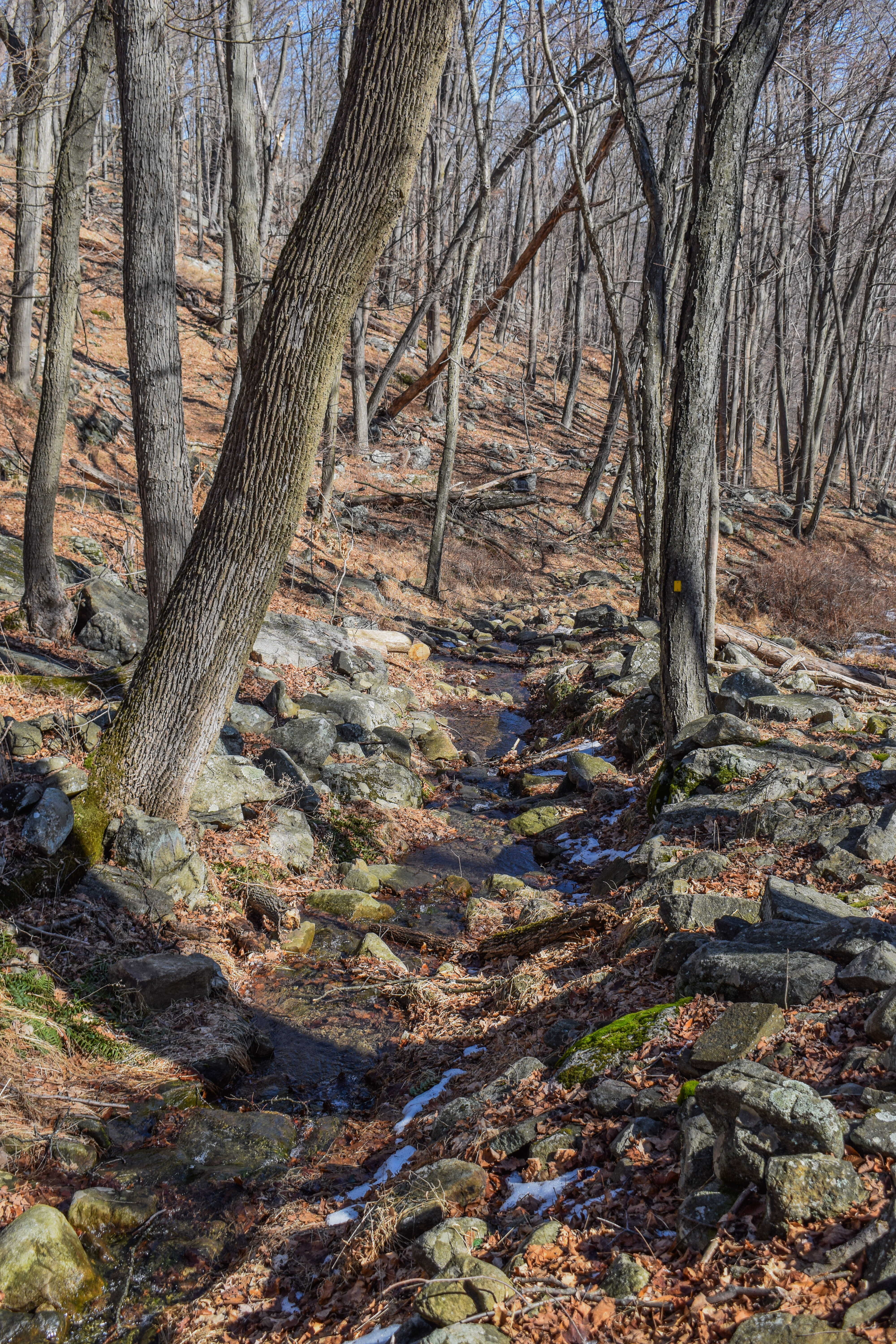
The Suffern-Bear Mountain Trail joined a stream in a familiar area, crossed the stream, and then continued through a grass-free eroded area. I remember this area had a lot of running streams in the spring, but it was mostly dry this time of year.
After leaving the dried wet area, the trail becomes only slightly grassy again and begins to follow an old road grade, which it left at the Fawn Trail junction to climb up and over a pud. The trail descended to cross a couple of mossy streams and then began to rise again with rough footing to the junction with 1777W - finally!
[11:18am - Suffern-Bear Mountain Trail/1777W]
I took a water and snack break at this junction while wondering if I actually even liked hiking anymore. Just as I got moving again, I almost stepped on a black snack that sent my 6 feet into the air! My camera lens was fogged up due to the thicker humidity in this area, and I was solidly cranky at this point.
I passed a sign for the "Doodletown Walking Tour" along the trail, which I'm sure has an interesting history.
"WALKING TOUR. Follow this map to the homesteads of the long-gone hamlet of Doodletown. Homes are numbered as they existed in 1957. Those circled in red have a sign-post on the trail with a photo of the house. A book, Doodletown: Hiking Through History in a Vanished Hamlet on the Hudson, by former resident, Elizabeth "Perk" Stalter, is available at the Park Visitor Center on the Palisades Parkway." from trailside sign.
There was a slight breeze and dash of sunlight, attempting to keep me alive. The Suffern-Bear Mountain Trail began to climb again, mostly easily but slowly due to tired legs, past some mid-stage spotted lantern flies (DEATH TO THEM!), past a couple of deer, and soon to Seven Lakes Drive - progress!
[11:36am - Suffern-Bear Mountain Trail/Seven Lakes Drive]
I was OFFICIALLY in the home stretch now! The Suffern-Bear Mountain Trail crossed Seven Lakes Drive onto an access that road that may or may not have connected to the one from before. The sun was HOT at this point in the day, and abundant now that the access road began to follow a power cut. I could hear a comical amount of motorcycles blasting "Low Rider" from the road down below as I climbed up the height-of-land, my final climb of the day!
At the height-of-land, the Suffern-Bear Mountain Trail veered right off of the power cut for the final descent, which closely paralleled the power cut with decent footing. I caught a small peek-a-view to the Bear Mountain Bridge from this area, and I could soon hear people down below at the state park!
I began to emotionally prepare for my reentry to society as the trail began to zig-zag down, crossing the power cut many more times. I came across a lone turkey, that was soon joined by another turkey and a BUNCH of babies, which was super fun to watch! I caught a glimpse of another five-lined skink before landing on another access road, where the trail turned left.
According to the lack of track on AllTrails, it looked like that stretch of trail was a relatively recent reroute. I veered right at a split and passed some overgrown stairs before finally exiting the woods and making my way to the trail's official terminus back at the junction with the Appalchain Trail and Major Welch Trail!
[11:57am - End of Trail at Bear Mountain State Park]
All that was left was my final walk through the state park, which was BUSTLING with people, cookouts, and overall energy. I was sweaty, tired, and stinky, which was in stark contrast to the 99% of people who were all around. The main parking lot was completely full, but the lot I parked in was only half full. My sausage fingers were full present, and I made it back to my car at the same time as the trail runners who I started the morning with!
[12:02pm - End of Hike]
There was a long line of cars trying to enter the parking lot at the toll booth, which was collecting payments now. Overall, this was a nice hike, and with a bit of trail maintenance, the whole trip would have been a blast!
Step-by-Step
- Park at Bear Mountain State Park.
- Start hike on Appalachian Trail.
- Follow Appalachian Trail to summit of Bear Mountain.
- Descend Bear Mountain on Appalachian Trail.
- At jct., hike out-and-back on blue-blazed Major Welch Trail to view.
- Continue to descend Bear Mountain on Appalachian Trail.
- Cross Seven Lakes Drive.
- Continue to follow Appalachian Trail.
- At jct., turn left onto blue-blazed Timp-Torne Trail.
- Suffern-Bear Mountain Trail joins on right.
- At split, turn left onto yellow-blazed Suffern-Bear Mountain Trail.
- Cross Seven Lakes Drive.
- Follow Suffern-Bear Mountain Trail back to car.
Map of Bear Mountain State Park (NYSDEC)
Photo Album