Showing posts with label Chickatawbut Hill. Show all posts

Sunday, May 4, 2025

Sassaman Notch, Braintree Pass Path, Chickatawbut Hill (Blue Hills Reservation)

Sassaman Notch, Braintree Pass Path, Chickatawbut Hill (Blue Hills Reservation)

Hike Type: Figure-8 Loop
Distance: 3.09 miles
Elevation: 402feet
Time: 1 hour, 9 minutes
Hiking Challenges: 52 Hike Challenge; Trail Trace the Blue Hills

The Hike 
'Twas the day after Black Mountain's closing day and... I wanted to sleep. My heart wanted big mountain, but my body (and also kind of my brain) wanted sleep. Sleep is what I received! Kind of, I was up at 6:30am naturally. ANYWAY. Plan was to hopefully wrap up, or come close to wrapping up the Chickatawbut area, but this hike would turn out to be cursed...


It was a LOVELY morning. I was at the trailhead just before 8:30am. It was in the mid-60s with a gentle breeze and some sun. There were SO MANY LEAVES. My body was tired from my six grueling runs at Black Mountain (actually was tired...). I had my map planned out, and off I went! I started without bug spray and followed Tower Path over to Slide Notch. The plan was to follow Slide Notch all the way down, but I apparently accidentally followed Sassman Notch instead... Whoops! It was a lovely walk, though. I passed a girl in nice tennis sneakers coming down Nahanton holding an iced coffee and I did get a bug up the nose at the height of land before descending.


It didn't realize my mistake until all the way down on Curve Path, but I figured I'd salvage the plan as best I could - heading over to the Hawk area to hit those trails. Only issue was that I started to have this random achilles pain that kept increasing until I was a little worried. I didn't do anything, and it seemed to come out of nowhere, which was surprising. I noticed that it went away on descents and flats but flared up on ascents.


I further modified my plan, and my new goal was to hit the section of Braintree Pass Path near Skyline that I needed and then head back via Skyline (for better or for worse...). The flat stretch of Lee felt completely fine, but the final uphill had the heel flare up again. The descent to Skyline was fine again, and I took it very slow going up Chickatawbut, which didn't feel great, but I managed without doing further damage.


Once on top of Chickatawbut I realized the third and final curse of the hike - my keys were IN MY CAR. I missed the AirTag notification that my keys weren't with me... ugh. At least the leaves were pretty! I went over Kitchamakin Hill to Slide Notch, which I followed down to Chickatawbut Road, hitting a spur I needed, and did the very short road walk back. I was bummed to have cut the hike short, but I definitely need my tendons working correctly, so time to rest!


Step-by-Step
- Park at Chickatawbut Tower.
- Start hike on Tower Path,
- At tower, turn left to continue on Tower Path.
- At terminus, turn right onto Slide Notch Path.
- At next jct., accidentally veer left onto Sassaman Notch Path.
- At 3135, turn right onto Curve Path.
- At 3130, turn right onto Bouncing Brook Path.
- After 3073, turn left onto Lee Path.
- At 3155, turn right onto Braintree Pass Path.
- At 3042, turn right onto Skyline Trail.
- At Slide Notch Path junction, turn left onto Slide Notch Path.
- Before Chickatawbut Road, turn left onto path.
- At Chickatawbut Road, turn left and return to car.

Friday, April 18, 2025

Chickatawbut Skyline Trail, Fox Hill, Little & Great Domes (Blue Hills Reservation)

Chickatawbut Skyline Trail, Fox Hill, Little & Great Domes (Blue Hills Reservation)

Hike Type: o-o Loop
Distance: 6.71 miles
Elevation: 758 feet
Time: 2 hours, 23 minutes
Hiking Challenges: Blue Hills Grid; Trail Trace the Blue Hills

The Hike 
Time for ANOTHER hike in the Blue Hills on ANOTHER beautiful day! It was my first day of April break and I was set on making my way over the Little and Great Domes (plus Fox Hill for some gridding). Temperatures were in the mid-50s when I started hiking in the morning and were set to climb. Originally, I had hoped to hike somewhere up north, but I NEEDED some sleep (and thank goodness I got it!). 


From the Braintree Pass Path trailhead, I started my hike along the Pipe Line just after 10:00am. I wore my waterproof boots for good measure, which paid off at the classically wet and muddy stretch. I passed a small bird's nest, scared the life out of some poor ducks, and admired the skunk cabbage that was growing in strongly. The mud started at the incline, which also featured some deer tracks. 


I made my way to the Hemlock Bound Foot Path, hiked to MA-28, and followed MA-28 for ~15 feet to the Skyline Trail, which had a normal blue but also an orange/brown blaze, which confused me. Maybe an old Great Dome Trail blaze? Not sure. 

Anyway, I followed the Skyline up the three distinct climbs up Chickatawbut Hill, which are steep and fun (and have herd paths around the steeps which I do NOT agree with). The temperature felt HOT now that I was climbing, but it was still delightful. I also included a note that I am, in fact, still mad about the fence around Chickatawbut Hill. 


I followed a faint herd path at the height-of-land to get to the true summit of Fenno Hill and continued down the well-crafted stairs up and over Kitchamakin and Nahanton Hills, the ladder of which features just beautiful views. I did notice a dad and child basically free-climbing up the rocky ledges of Nahanton which seemed wildly dangerous? To each their own, I guess... 


I was enjoying the beautiful walk across the Broken Hills when I got my first bug bite of the season followed by being charged at by a giant spider! Horrible. I also crossed paths with another large back snake - smaller than the one on Kitchamakin - but this one shook its tail to pretend it was a rattlesnake, which I did NOT like. 


Eventually, I escaped the cursed Broken Hills, crossed Wampatuck Hill, and made my way to Fox Hill. There was a vulture circling overhead, and with my luck, I was stressed, but thankfully I escaped unharmed. I descended via Fox Hill Path and began my drip to Sawcut Notch Path, where I turned onto a herd path at the height-of-land to summit Little Dome, which was LOVELY! There was a tree view of Hancock Hill and some daffodils (I think) next to a fire ring.


I retraced my steps back to Sawcut Notch Path, hiked alongside some spooky orange mud, and started on the herd path/old Great Dome Foot Path to the summit of Great Dome. The foot path was just discernable enough to follow it mostly without question, and the summit is just beautiful! It features a very unique view with Fox Hill's open forest, the Broken Hills behind it, and Hancock to the right. This summit also had daffodils and some purple flowers that I did not identify. 


I wandered around the summit for a bit, hoping to find an old blaze or foot path to continue along the old Great Dome Foot Path (Great Dome Trail?), but eventually fell short and gave up. I did see a goldfinch, though! I retraced my steps, noticed some golfers through the trees, and continued along Satcut Notch and then Short Path past a comical amount of robins.


I looked hard for any evidence of the old Great Dome Foot Path/Trail, but did see anything clear in my return... oh well. I followed the appropriately named Pleasant Trail to the Pipe Line, which started my long walk back to the car! It was wetter one near Chickatawbut Road, but overall not too bad. This was a seriously fun, unique loop!


Step-by-Step
- Park at Braintree Pass Path trailhead.
- Start hike on Braintree Pass Path.
- At 3022, continue right on Pipe Line.
- At 3013, turn right onto Hemlock Bound Foot Path.
- At terminus, turn right onto MA-28.
- At jct., turn right onto Skyline Trail.
- Cross Chickatawbut Road.
- At 4134, turn left onto path, staying left.
- At Pipe Line turn left.
- At terminus, turn right onto Fox Hill Path.
- At 4102, turn left onto Indian Camp Path.
- At 4091, turn left.
- At 4083, turn right onto Sawcut Notch Path.
- At height-of-land, hike herd path on left to Little dome, then continue on Sawcut Notch Path.
- Beofre height-of-land, hike on former Great Dome Foot Path to Great Dome on right, then continue on Sawcut Notch Path.
- At 4133, turn right onto Short Path.
- At 4124, turn right onto Crags Foot Path.
- At 4091, turn left onto Indian Camp Path.
- At 4086, turn right onto path.
- At 4082, turn right onto Pleasant Trail.
- At 4046, turn left onto Pipe Line/Headquarters Path.
- Follow Pipe Line/Headquarters Path to Chickatawbut Road.
- Cross Chickatawbut Road, follow Pipe Line/Headquarters Path back to car.


Tuesday, April 15, 2025

Great Dome & Hemlock Bound Trails; Chickatawbut Hill (Blue Hills Reservation)

Great Dome & Hemlock Bound Trails; Chickatawbut Hill (Blue Hills Reservation)

Hike Type: Lollipop Loop
Distance: 4.49 miles
Elevation: 801 feet
Time: 2 hours, 8 minutes
Hiking Challenges: 52 Hike Challenge 2025; Trail Trace the Blue Hills; Blue Hills Grid

The Hike 
Now this was one of my favorite Blue Hills hikes in a long time! Sarah texted me asking if I wanted to join her on a hike, which of course I said yes to! I asked if she wanted to do Skyline or something else, and when she picked "something else" I proposed this route! I had the Hemlock Bound Foot Path on my mind since I saw the old footpath yesterday, and she immediately accepted! My drive wasn't too horrible, which was a welcome reprive after yesterday's abomination of a commute. We met at the Chickatawbut Tower parking area, and soon were off!


We hiked up Tower Path, turned onto Sassaman Notch Path, and then onto Stowe Path, where Sarah officially got the first bug bite of the season! We wiggled our way over to the Skyline Trail, soon turning onto the Great Dome Foot Path - one of my favorites in the area. There was an amazing breeze one on the path as we continued through the beautiful woods and narrow footbed. The only downside was that we encountered a 5 or 6 FOOT long black snake - probably a Racer. It was likely the largest snake I'd ever seen in the while, and we were UPSET. Thankfully, that was the only one, and it quickly ran away as we approached. Definitely got the heart racing, though!


We continued down past the Bouncing Brook, onto Laurel Path, and then turned left onto the existing Hemlock Bound Foot Path. Once back at Laurel Path, it was time for the adventure to begin! We crossed Laurel Path, continuing on the old foot bed, over a blowdown, and up the hillside. The trail here was easy to follow with only a little bit of ducking and with many soft pine needles tickling the legs. Eventually, it topped out at an open, ledgy area, which was a bit difficult to follow, but we found the footpath after some searching, soon crossing over Braintree Pass Path.


After crossing Braintree Pass path, we began to descend in an area that was open and very geologically intereting. Old guidebooks mention an "obscure box gully" in this stretch, but we had no idea what we were actually looking for - we might have hiked right over it without knowing! 


We crossed Branch Path and Streamside Edge Path and entered my favorite stretch of the Hemlock Bound Foot Path. The trail climbed some more to an open canopy with grassy ledges on the right - it was beautiful! We circled the height-of-land before ultimately descending to the terminus at Hawk Hill Path - what a great adventure!

We continued on the Hawk Hill Path and turned at 3030 back onto the Hemlock Bound Foot Path to climb up and over Hawk Hill, which had a heavenly breeze. We noticed some dark clouds rolling in behind Buck Hill (my brain immediately said "oh not again" - since earlier this spring I got caught in some rain out here) as continued to descend to the trail's official terminus at MA-28. 


From MA-28, we continued onto the Slide Hill Trail and climbed back up Chickatawbut on Carve Path, ultimately descending on Stowe, Sassaman Notch, and Tower Paths. It had just started to rain once we hit Stowe, and the spring peepers began to sing! Skies were dark and the wind was howling back at the car - we escaped just in time!


Step-by-Step
- Park at Chickatawbut Overlook
- Start hike on Tower Path.
- At tower, turn right onto Tower Path.
- At 3075, turn left onto Sassaman Notch Path.
- At third jct., turn left onto Stowe Path.
- At jct., turn left onto Stowe Path.
- At terminus, turn right onto Slide Notch Path.
- At jct., turn left onto Skyline Trail.
- At jct., turn right onto Great Dome Foot Path.
- At 3111, turn right onto Laurel Path.
- At jct., turn left onto Hemlock Bound Foot Path.
- At jct., continue straight across Laurel Path onto former Hemlock Bound Foot Path.
- Cross Braintree Pass, Branch, and Streamside Edge Paths.
- At terminus, turn left onto Hawk Hill Path.
- At 3030, turn right onto Hemlock Bound Foot Path.
- At MA-28, turn around.
- At 3013, veer left onto Slide Hill Trail.
- Continue onto path.
- At terminus, turn left onto Bouncing Brook Path.
- At 3051, turn right onto Carve Path.
- At 3065, turn right onto Skyline Trail.
- At 2nd jct., turn right onto Stowe Path.
- At jct., turn left onto Stowe Path.
- At terminus, turn left onto Sassaman Notch Path.
- At 3075, turn right onto Tower Path.
- At tower, turn left and return to car.


Monday, April 14, 2025

Chickatawbut Hill, Braintree Pass Path, Squamaug Notch (Blue Hills Reservation)

Chickatawbut Hill, Braintree Pass Path, Squamaug Notch (Blue Hills Reservation)

Hike Type: Figure 8-ish Loop
Distance: 5.53 miles
Elevation: 722 feet
Time: 1 hour, 58 minutes
Hiking Challenges: 52 Hike Challenge 2025; Trail Trace the Blue Hills; Blue Hills Grid

The Hike 
Back to work and reality after another fun weekend! I had a rough drive from school, especially for a Monday. It was a warm, summery, 67 degree days. I tweaked my knee over the weekend so decided to stick to the Chickatawbut Area to avoid any hiking that was overly strenuous. There were more cars than usual at the trailhead, and I was officially in the woods at 4:00pm!


I realized I had forgotten to lock my car once I climbed up to Chickatawbut Tower, but thankfully my key worked from that distance! More unfortunately, I forgot to start both my watch and AllTrails until the tower as well, which was a bummer. There were some butterflies out and the trails were a little wet from yesterday's rain, but overall not a problem. 

I wiggled my way form Tower Path to Sassaman Notch Path to Thayer Path to Stowe Path to Slide Notch Path to etc., eventually coming up the back side of Nahanton Hill, which is a short, beautiful stretch of trail. I passed a pink-haired family, continued through a swarm of bugs (they're baaacckkkk...), and began to descend via Slide Notch Path, which had a wonderful stream flowing alongside.


I continued down toward the Great Cedar Swamp and into the little grove on the old Hemlock Bound Foot Path, which had a mixture of brown rectangle and white dot blazes. Back at Laurel Path, I did notice the old footpath that continued up the hill, but wasn't feeling brave enough to explore it (yet...). I ascended via Barberry Bush Spring Trail and continued along Braintree Pass Path, which is one of my favorite trails on this side, especially this "deep" stretch. Near I-93, I could see tree views to Braintree's Great Pond, and then I had to dodge some pricker bushes as I descended back down to Laurel Path. 


I crossed the outflow of the Great Cedar Swamp on a creaky, wobbly footbridge, trampled along many fallen red buds from the trees above, scooted along I-93, and then worked my way over to Swuamaug Notch Path at 3163. This stretch began to feel long, as it is pretty flat and featureless, but I was glad to have completed it.


Squamaug Notch Path is nice a long, but in a more interesting way than the previous trails. After climbing up through the notch on the old road, I walked direclty into the sun for a bit before wiggling my way back to Tower Path - a lovely afternoon hike!


Step-by-Step
- Park at Chickatawbut Overlook.
- Start hike on Tower Path.
- At tower, turn left and continue on Tower Path.
- At 3075, turn left onto Sassaman Notch Path.
- At jct., turn right onto Thayer Path.
- At fence, turn left and continue on Thayer Path.
- At Skyline Trail, turn around.
- Turn right onto Stowe Path.
- At jct., continue right on Stowe Path.
- At terminus, turn left onto Slide Notch Path.
- At 3094, turn right onto Sassaman Notch Path.
- At jct., turn left onto path.
- At jct., turn right onto Slide Notch Path.
- At jct., turn right onto path up Nahanton Hill.
- At split, turn right and continue.
- At terminus, continue to descend on Skyline Trail.
- At jct., turn left onto Sassaman Notch Path.
- At 3135, turn right onto Curve Path.
- At 3130, turn right onto Bouncing Brook Path.
- At split, veer left onto Laurel Path.
- Before 3121, turn left onto Hemlock Bound Foot Path.
- At terminus, turn right onto Laurel path.
- At 3132, turn left onto Barberry Bush Spring Trail.
- At 3090, turn left onto Braintree Pass Path.
- At terminus, turn right onto Laurel Path.
- At terminus, turn left onto Cochato Path.
- At terminus, turn left onto Hemlock Path.
- At 3151, turn right onto Bouncing Brook Path.
- At 3163, turn left onto Squamaug Notch Path.
- At terminus, continue onto Slide Notch Path.
- At jct., turn right onto Tower Path.


Blue Hills Reservation Map

Thursday, March 6, 2025

Chickatawbut & Hawk Hills via Chickatawbut Overlook (Blue Hills Reservation)

Chickatawbut & Hawk Hills via Chickatawbut Overlook (Blue Hills Reservation)

Hike Type: Figure 8-ish Loop
Distance: 4.40 miles
Elevation: 981 feet
Time: 1 hour, 31 minutes (1 hour, 29 minutes moving)
Hiking Challenges: Blue Hills Winter Trace (2x); Blue Hills Grid

The Hike
First accidental rain hike of the year! This would also be the last hike of my March-Marathon, as I needed a day of rest or my knees and a potential trip to the Whites on Saturday (tbd - update 10 minutes after writing this, we opted to not hike Carter Dome because winds are forecasted to be actively insane). I made my way, somewhat easily again (traffic has been very easy this week), to the Chickatawbut Tower parking, and got right to work! The plan was to get to Hawk Hill, and everything else would just be random at my discretion. I hiked up to the tower in the warm, humid, 61-degree air while accidentally wearing short shorts, and then made my way over to Thayer Path.


I hiked past the old MDC "No Tresspassing" signs, crossed the road, lamented about how the true summit isn't accessible, and then encountered my only patches of ice as I started my descent. I hit the water tower road via an unmarked spur that kind of followed the power cut, and then meandered my way down to the Braintree Pass Path trailhead. So far I had only passed two people: one guy staring into the void in the pavillion at the Chickatawbut Tower, and now another who was staring at his own reflection on the flooded section of the pipe line. 


There was some pink flagging tape on the right side of Braintree Pass Path, I hiked the Headquarters Path spur, and then made my way over to the Stokes Foot Path, one of my favorites in this area of the reservation - for no other reason than it hikes like a bigger mountain trail. The rocks were slippery, though! Once on the Skyline Trail, I continued to climb back up Chickatawbut Hill, past a burned area, and then followed at least a dozen large cairns down Carve Path. I can't imagine they were built for navigation. Maybe for building the pathway/old road?


I noticed some dark clouds in the near distance, but my weather app said there was a SMALL chance of LIGHT rain at 5pm (it was around 4:15 at this point) and then actual rain at 7pm. I continued down Bouncing Brook Path and Slide Hill Trail down to the Hemlock Bound Foot Path, where it smelled like wet forest, which was just wonderful. It was super dark in here because of the clouds which gave it a neat spooky vibe! I followed the mysterious yellow blazes and carefully scrambled up Hawk Hill (super slippery). There were just a few drizzles of rain at the lookout to Buck Hill, but it soon subsided. I passed an old orange blaze on a rock, made it to the summit, and carefully made my way down.


A light drizzle started up again on my descent - I really love the gentle pitter-patter of the rain in the woods. Only issue, is that once I was on the Hawk Hill Path, the drizzle turned to rain. I stood under a tree for a bit, but the rain turned to RAIN. Oof. This was NOT light rain. After a couple minutes of contemplating my life choices and laughing at how I'm at the furthest point from my car, I eventually just started moving again, accepting my fate as a wet dog. 


I made the decision to skip Kitchamakin Hill because of the wet slabs, which was a good call because it kept raining harder and HARDER. It downpoured for the entirety of the Glover Path. I put my camera in my pack to keep it as safe as possible. The good news was that my body temperature was still good - only the skin on my triceps were cold. I was getting a little chilly at the end of Glover, but I warmed back up as I climbed back up Chickatawbut via Carve Path. I also got a FaceTime call from Elizabeth and Emma here, which was fun and silly. 


FINALLY, the rain started to settle once I was back on Chickatawbut Hill, and I made my way down Stowe to Tower Paths and back to the car. I couldn't see Boston from the viewpoint because of the rain and clouds, but on the bright side, at least 99.9% of the hike was snow/ice-free!


Step-by-Step
- Park at Chickatawbut Overlook.
- Hike to Chickatawbut Tower (yellow blazes).
- At tower, turn right onto Tower Path (yellow blazes).
- At 3075, turn left onto Sassaman Notch Path.
- At next jct., turn right onto Thayer Path.
- At Water Tower, follow power cut and footpath to water tower road.
- Follow power cut down to 3024.
- At 3024, turn left onto Braintree Pass Path.
- After 3022, turn left onto Stokes Foot Path.
- At terminus, turn left onto Skyline Trail.
- At 3065, turn right onto Carve Path.
- At 3051, continue onto Bouncing Brook Path.
- At jct., turn right onto Slide Hill Trail.
- At 3013, turn left onto Hemlock Bound Foot Path.
- At 3030, turn left onto Hawk Hill Path.
- At 3044, turn left onto Glover Path. 
- At 3040, turn right onto Slide Hill Trail.
- Follow paths to 3051. 
- At 3051, turn right onto Carve Path.
- At 3065, turn right onto Skyline Trail.
- After Skyline Trail turns, turn right onto Stowe Path.
- At jct., turn left on Stowe Path.
- At terminus, turn left onto Sassaman Notch Path (yellow).
- At 3075, turn right onto Tower Path (yellow).
- At Chickatawbut Tower, turn left to return to car.

Tuesday, May 7, 2024

Hawk, Kitchamakin, & Chickatawbut Hills (Blue Hills Reservation)

Hawk, Kitchamakin, & Chickatawbut Hills (Blue Hills Reservation)

Hike Type: Lollipop Loop
Distance: 4.26 miles
Elevation: 709 feet
Time: 1 hours, 36 minutes
Hiking Challenges: 52 Hike Challenge, Trail Trace the Blue Hills

The Hike
A long day at school followed by a very sleep drive landed me at the Braintree Pass Path trailhead truly questioning my sanity. The trailhead was very buggy and it was HOT outside! Like, actually hot! 80 degrees! The skies were completely blue and I found some will to live, get suited up, and start my afternoon adventure.

The Braintree Pass Path was delightfully green - probably my favorite part about this time of year. Without stick season, I wouldn't have such an appreciation for the "great rebirth." I hiked the little spit that connects with Headquarters Path and continued on with wobbly legs from "leg day" (I exercize now) and past little balls of white fuzzy fungus.


I made my way onto the Hemlock Bound Foot Path, dawned with the illegal yellow blazes that I truly appreciate, and fought my way through a never-ending series of gnats. I guess it's officially bug-spray season... The trail splits with an easy and hard way - I've always done the hard way - some of the most fun (albeit, short) scrambling in the Blue Hills. I also found that I needed to take multiples of the same photo in hopes one of them would be bug-free.


I continued on, up and over Hawk Hill, covered in sweat and dead bugs. My forearms were beginning to chafe from my hip belt pockets. I went through another rough pocket of bugs at 3090 and shockingly was relieved once down at the Great Cedar Swamp, where there was a semblance of a breeze. I continued onto the Great Dome Foot Path, through spider webs and was HORRIFIED at how many bugs there were hovering along the Bouncing Brook (noticing a theme?). At least there were some flowers blooming.


I started the steep, slightly confusing and unclear climb up Kitchamakin Hill, which provide nice views and more bugs. I guess I was just grateful the bugs weren't biting! The plateau of Kitchamakin Hill is COVERED in soon-to-be flowering blueberry bushes, which may just require a re-visit in a month or so. I continued on the just-clear-enough footpath, past some views toward Braintree, and eventually came to a split. One half went straight forward and looked more used, and one turned left. The DCR and AllTrails maps showed that the left was the "correct" one, so off I went! It was more over-grown, but I made it out fine. 


Now on the Skyline Trail, I worked my way up and over the burnt-but-regrowing Fenno Hill and then up to Chickatawbut. I realized that I like the order I did this hike in (counter-clockwise), but the sun's angle made it subpar for photos - oh well! It was better for mental stamina to go this way. I had my usual bout of anger that the top of Chickatawbut Hill is closed to the public, enjoyed a view off-trail to Great Pond further down, and then began my return trip. 


I took a moment to realize and appreciate how these hills used to feel so much bigger than they do now. It's a bummer, but apparently regular exercise is "good for you" blah blah blah. I was rewarded with a nice breeze coming down Stokes Foot Path, and was soon enough back on the Braintree Pass Path and at my car, still covered in bugs, though.


Step-By-Step
- Park at start hike at Braintree Pass Path Trailhead (MA-28 and Chickatawbut Road).
- Take the first right after 3042 onto Bouncing Brook Path.
- At unmarked intersection, turn left onto Hemlock Bound Foot Path.
- At 3030, turn left onto Hawk Hill Path.
- At 3072, continue straight onto Braintree Pass Path.
- At 3090, turn left onto Barberry Bush Spring Trail.
- At 3121, turn left onto Laurel Path.
- At 3111, turn left onto Great Dome Foot Path.
- At 3085, continue straight onto Great Dome Foot Path.
- At terminus, turn left onto Skyline Trail.
- Partway down Chickatawbut Hill, turn right onto Stokes Foot Path.
- At terminus, turn right onto Braintree Pass Path and return to car. 

Monday, May 22, 2023

Chickatawbut Hill & Eastern Trails (Blue Hills Reservation)

Chickatawbut Hill & Eastern Trails (Blue Hills Reservation)

Hike Type: Loopty Loop
Distance: 8.76 miles
Elevation: 1,093 feet
Time: 3 hours, 9 minutes
Hiking Challenges: Blue Hills 125-Mile Challenge (2x)


The Hike
This hike is brought to you by a disgusting, homophobic, transphobic email by a parent that I led me to either 1) exercizing the rage away or 2) taking up a new career path similar to Beatrix Kiddo. Thankfully, it worked! I had a handful of trails to wrap up the Chickatawbut Hill area, and I thought I finihsed after this one, only to find I missed about 50 feet near the tower, which is OKAY. ITS OKAY. This didn't help my rage, but it's okay. 


Anyway, I made my way to the Blue Hills Reservoir to start my hike by following the path around. I was greeted by a few barn swallows, with their beautiful blue/orange plumage, gathering twigs for their nests, and a Great Carmorant, which was fun to see! The carmorant had its wings wide while swimming around, and I was glad I finally started bringing my zoom lens. The penninsula was getting very overgrown, but was still passable. 


After I finished my loop, it was time to dip into the woods. First mission: Ridge Path to Squamaug Notch Path to Endicott Path. The flagging along the Endicott Path has truly saved the day - there is a solid footbed how and its significantly clearer than it has been. The trip up Nahanton Hill was nice - I realized I have only ever gone this way on the Skyline Trail once or twice, so it was a nice change of pace. I wiggled around the Stowe Path, and then descended via the slide notch path, which had a lovely stream following the drainage off to the side. 


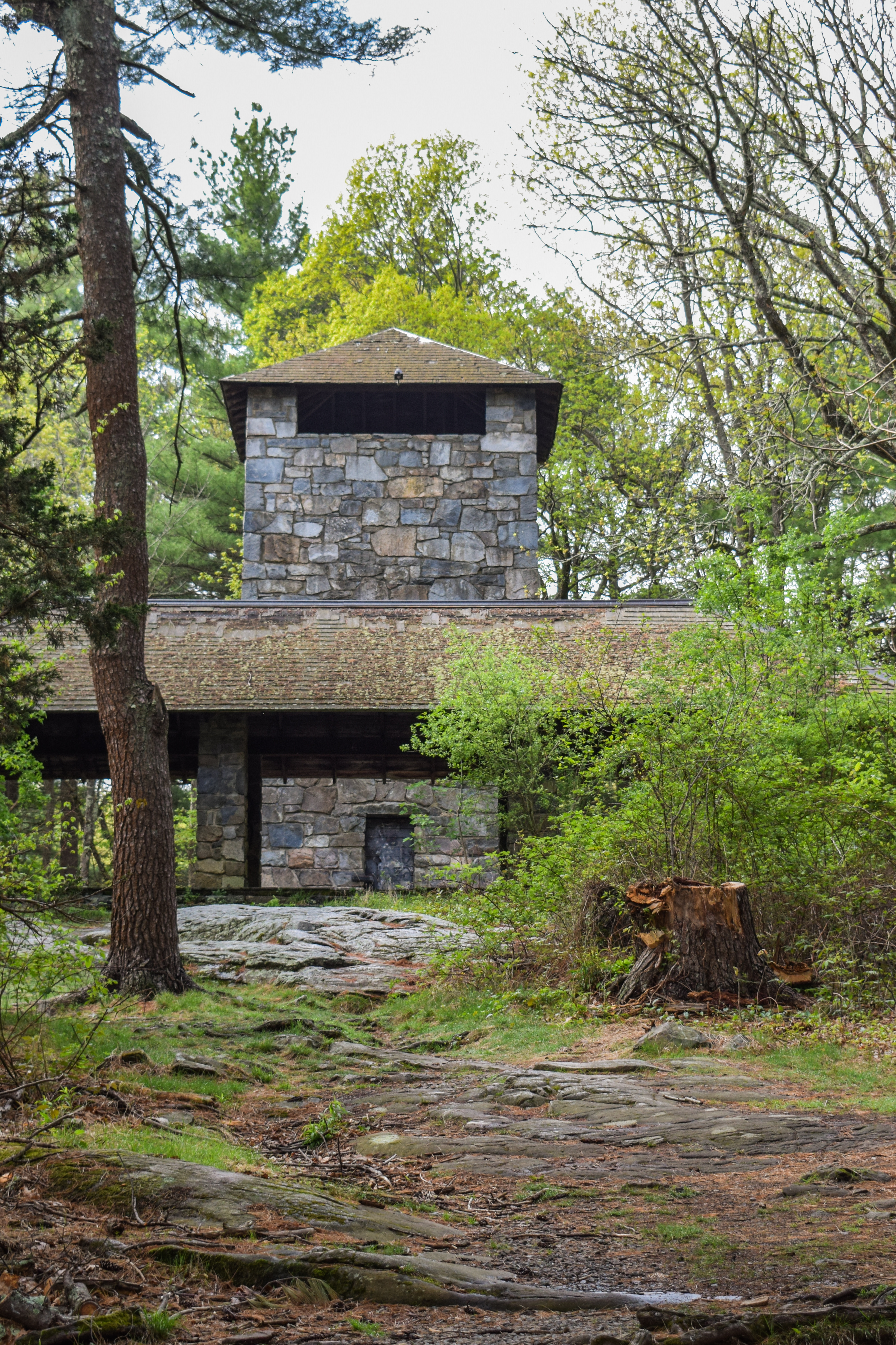
Once down on the Braintree Pass Path I looped around all the way to the Stokes Foot Path, which I'm still a big fan of! Less-trodden and more rugged than usual - it's fun! I followed Stokes to its terminus up on the Skyline Trail just below Chickatawbut Hill, and then did a Traverse from Chickatawbut Hill to Chickatawbut Road, which is truly a lovely stretch! Nothing too challenging, and plenty of nice views. There are some lovely green patches growing in through last season's burn in the Fenno Hill area. I particularly enjoy the view from the final broken hill - it's like a last hurrah! The view itself isn't spectacular, but its just a nice spot after a fun scramble.


Once I hit Chickatawbut Road, I follwed the unmapped Pocapawmet Path to Wampatuck Road and then a LOT of wiggling to hit all the trails in this area. There was a very fragrant unfamiliar smell on the Curve Path, and when I made my way to the Romari Path I realized that it was from the industrial area and it was actually fumes. I really dislike this area, one for the fumes, but also now close it gets to the industrial area (I believe "Consildated Precision Products" - from Google Maps).

"Consolidated Precision Products (CPP) manufactures highly complex components for the commercial aerospace market including engine housings, gear boxes, front frames, shrouds, panels, fairings, blades and vanes. Consolidated Precision Products (CPP) manufactures multiple components for the defense market including engine housings, gear boxes, front frames, shrouds, panels, fairings, missile bodies and various other structural components to support munitions. Consolidated Precision Products (CPP) manufactures multiple components for the industrial gas turbine market in support of both oil exploration and power generation. Parts include vanes, blades, shrouds and diffuser casings." from https://www.cppcorp.com/. 

I realized I would be doing more miles than origianlly planned... whoops... I also ran out of water... oops! The good thing about the Blue Hills is that you're never too far from civilization, so even if I start to cramp it's not like I'm deep in a wilderness. I'm curious about the history of Wood Path - there was a bug catcher (maybe?) and a lot of stone piles - maybe this was planned to become a paved road? Not sure. 


When my wiggling was finished I hiked back up Squamaug Notch and enjoyed an early golden hour through the Canadian Wildfire smoke, which turned the sun into a dark orange orb in the sky - a really unique view. I made my way home, and got into bed just in time to wake up early the next morning!


Step-By-Step
- Park at Blue Hills Reservoir.
- Start hike around Blue Hills Reservoir clockwise.
- Back at car, turn left onto Chickatawbut Road.
- Turn left into woods at Ridge Path.
- At 3131, turn left onto Squamaug Notch Path.
- At pink flag tape, turn right onto Endicott Path.
- At 3132, turn right onto Skyline Trail.
- Follow Skyline Trail until Sassaman Notch Path, then veer right onto Sassaman Notch Path.
- At Thayer Path, turn around. 
- At next junction, hike all three forks of Stowe Path.
- Turn right onto Slide Notch Path.
- At 3073, turn right onto Braintree Pass Path.
- Before 3022, turn right onto Stokes Foot Path.
- At terminus, turn left onto Skyline Trail.
- Follow Skyline Trail to Chickatawbut Road.
- At Chickatawbut Road, turn right onto Pocapawmet Path (not on map).
- At terminus, turn left onto Wampatuck Path.
- At 3177, turn around.
- At 3153, turn left onto Curve Path.
- At 3135, turn around. 
- At 3160, turn left onto Squamaug Path.
- At 3163, turn left onto Romari Path.
- At 3174, turn right onto Wood Path.
- At road, turn around.
- At 3157, turn left onto Wampatuck Path.
- At 3152, turn left onto Bouncing Brook Path.
- At 3163, turn left onto Squamaug Notch Path.
- At 3131, turn right onto Ridge Path, return to car.