Showing posts with label Belknap Range Grid. Show all posts

Sunday, May 3, 2026

Mt. Major & Straightback Mtn. via Old Stage, Jesus Valley & Blueberry Pasture (Belknap Range)

Mt. Major & Straightback Mtn. via Old Stage, Jesus Valley & Blueberry Pasture (Belknap Range)

Hike Type: Lollipop Loop
Distance: 7.82 miles
Elevation: 1,745 feet
Time: 3 hours, 56 minutes (3 hours, 32 minutes moving)
Parking: Limited parking for a few cars on Alton Mountain Road ("Straightback Trailhead" on Google Maps)
Hiking Challenges: Belknap Range Redliner, Belknap Range Grid, Operation Alaska Benchmark Challenge, 52 Hike Challenge 2026


The Hike 
Time to drag Christien up north again! Naturally, I wanted to spend the day in the Whites. Naturally, it was going to be cruddy weather (with snow on the highest of peaks, NATURALLY). Instead, I decided to take him to Mt. Major via the south side (really just to mix things up for me). The plan was to leave at 5:30am, so he got up at 3:30am to get ready (which was WILD). I got up at 5:00. We slowly got our lives together, and we were off!

Skies were crystal clear in Boston, but there were going to be clouds in the Belknaps, which was fine - I assumed Mt. Major would be low-elevation enough to still give us a nice view. Christien was pretty nauseous for the drive - I felt bad for him. He was a tropper, though! We took a longer break at Hooksett for some food and not-driving, and we eventually made our way up to the parking area on Alton Mountain Road to start our adventure! Parking was nice and easy with space for just a few cars (and plenty of signs telling you NOT where to park). I booted up at the car - he came in his full hiking attire - and then we were off!

[8:21am - Blueberry Pasture Trail]
The Blueberry Pasture Trail starts about 20 feet away from the parking area kiosk on the right and is clearly signed. The Trail follows an old road to a very interesting area with... t-shirts on crosses? According to the Belknap Range Trails map on belknaprangetrails.org, they are Finnish Scarecrows (Silent People), and I can't find much information on them - WAIT. I found a Reddit thread that linked an article in the Laconia Daily Sun (found here). In essence, the landowners visited Finland and saw the original Finnish Scarecrows/Silent People, which were erected as a memorial to lives lost during a Russian/Finnish war in the late 1930's. The landowners were inspired to recreate it in this old field, partly as hommage to the original, but also to protest the 2003 war in Iraq. Kind of interesting that we stumbled upon them for the first time as the U.S. is dealing with another controversial war, now in Iran.

Anyway, here, the Blueberry Pasture Trail is joined by Old Stage Road, which is a colonial-era road with a neat history, detailed also at belknaprangetrails.org. Information below:
"The Old Stage Road (blazed red/blue) through Griswold Scout Reservation has a complicated history.  In colonial times the now Old Stage Road was an extension of the now Manning Lake Road and went east and ended at the farmstead, now a cellar hole, in the center of the Reservation, at what is called the logging camp outpost.   On the east side of the property, Alton Mountain road extended northwest to the farmsteads on the eastern boundary of the property in the area where the red trail crosses the now Old Stage Road and ended there.  So in the era of Stage Coaches, that road never went through.  Around the 1940’s a logging company punched a rough road through what is now the Reservation to move their portable sawmill and connected the then abandoned portions of the two roads.  That old road then became the red/blue trail for the boy scouts, but was flooded by beaver in one section east of West Brook and was quite wet in another section between that beaver swamp and the eastern boundary.  In 1977, the Scouts built a road from the Hidden Valley camp to the eastern portion of the now Old Stage Road and made it passable to trucks easterly to West Brook.  In the mid 1990’s, I set up a timber sale in the West Brook valley and along the red/blue trail.  As part of that sale, the loggers built a new road easterly across West Brook and around the north side of the beaver swamp and by-passed the other wet spot and ended the road where the gate is now located.  There was only a hiking trail between the gate and the eastern boundary.  The Gilmanton snowmobile club soon discovered the improved road and widened the hiking trail at the end of the road to accommodate their groomer and to connect with the old Alton Mountain Road section.  I have not been easterly beyond the old gravel pit on the east boundary of the Reservation for many years and do not know what has happened in that area of late. (I was able to drive a VW Rabbit to the red trail-Old Stage Road junction in 1995)  If the Alton section was once a public road, it is still the legal Right-of-Way to the Reservation.  I do not know when and if that section of Alton Mountain Road was abandoned, but I assume it was around the same time the farmsteads were abandoned.  Research on the history of now abandoned section of Alton Mountain Road may uncover something of further interest."

The two trails coincide, hiking past yet another curiosity - a sign that reads COUGAR IN AREA. I immediately rolled my eyes. I know there's a group of Mountain Lion enthusiasts that believe they're in New England. It wasn't until I read the fine print that my attitude changed...
"PLEASE STAY ON TRAILS. TRAVEL IN SMALL GROUPS AND DO NOT ALLOW MEN UNDER 30 TO TRAVEL ALONE."
Excellent. No notes, truly!

A bit further down the trail/road we saw a bright orange "Trail Information" sign, likely from snowmobile season signing "Little Avery Hill Loop" and "Secret View" - we mentally pinned this for later.

There was a light pitter patter of rain (IT WAS NOT SUPPOSED TO RAIN!) as we continued this easy stretch of our hike. We passed a sign (there are so many signs in the Belknaps) saying "TRAIL USERS. This trail is on private land is being made available through the cooperation of: Elise Arry... and has been developed through the efforts of: THE Mt. Major Snowmobile Club. Do not litter. Drive with Care. Respect Private Proeprty," followed by another sign for the other end of the Little Avery Hill Loop.

[8:32am - Old Stage Road]
Just after, we hit the intersection where Old Stage Road leaves Blueberry Pasture Trail. Old Stage Road continued on the right, while Blueberry Pasture Trail turned left. This officially began our lollipop loop! Christien had pivoted from feeling nauseous to having a bit of vertigo, he said "the trees are moving," and the trees were in fact not moving. I felt so bad for him! We were passing the time with me guessing the names of his family members, which I got most of within a few minutes, but there was one that really kept me occupied (well over an hour of guessing) - hopefully he didn't find it too annoying!

We hiked past a few pools with frog eggs, past a few wonderful glacial erratics, and then hit a junction with an unblazed trail that helped us avoid private property at the end of Jesus Valley Road.

[8:46am - Unblazed Connector]
The unblazed connector, signed with a wooden arrow pointing towards Mt. Major and Straightback, rose steeply with typical "road" footing, meaning it was calf steep. This is the first time we actually were hiking, so naturally I was immediately out of breath.

[8:49am - Jesus Valley - Beaver Pond Trail]
The Unblazed Connector came to a junction with the Jesus Valley - Beaver Pond Trail, which we turned right onto to descent back onto the lovely, flat corridor we'd been enjoying! We hiked through an open yard of sorts and turned left into the woods, continuing along over snowmobile bridges and eventually coming up Beaver Pond! 

[9:02am - Jesus Valley - Beaver Pond Trail/Beaver Pond]
I'm guessing Beaver Pond is named for the beavers that clearly had formed the pond - their lodge was a wonderful centerpiece on the pond! The pond was a nice spot to "stop and stare." It was delightfully quiet and still with grey skies above and just a few bits of drizzle falling. We each took sepearate excusions into the woods to take care of personal businesses, and then we continued on! The trail followed the pond for a bit before contuing through a beautiful birch-lined corridor. We even saw an eft!

[9:28am - Boulder Trail]
We took a quick break at the Boulder Trail junction, and Christien had some of my tums-coated Advil - he was thinking he was dealing with a sneaky migrane, which truly sounded likely. We had some water, he had his drugs, I took a quick potty break, we crossed paths with the first person du jour, and it was time to FINALLY climb up Mt. Major!

I was a big fan of the Boulder Trail. I had only ever hiked down it, and let me tell you it was MUCH nicer going up than down! Last time I came down this trail it was after a rain storm, I was grossly dehydrated, and I took a pretty hard fall onto my back, which was caught by my pack, but gave me some intense whiplast for the next few days. The trail alternated steep, rocky climbs with mellower stretches. This is also where I learned that Christien likes to mountain goat up the rocks with his long legs - my god! I had NO problem letting him get ahead, as I was plugging along slow and steady.

Salvation was near after a gravelley, scrambly pitch. We came to the first "DO NOT DISTURB THE CAIRNS!!" sign, and from this point on the trail was absolutely delightful. Mostly flat, trending upward, and walking along beautiful slabby, scrubby woods with moss-lined trails. We started to catch preliminary views towards Alton Bay.

[10:23am - Mt. Major Summit]
"Wow"s soon began, as we reached the summit! The view from here is always spectacular. Lake Winnipesaukee is really something cool to see. We could see Mt. Moosilauke in the clouds (turns out it was snowing!), the peaks of the Franconias and the Sandwich Range, and of course the Ossipees (where Sarah was apparently hiking! I told her on Strava that I waved to her!). There were showers rolling through the area, but thankfully they were staying above and north of the lake, with only wind and a few small drizzles hitting us at the top. We took a bunch of photos and meandered around the summit for a bit. I found two discs! There were two groups of hikers taking refuge from the cold wind in the old foundation, but once they left I jumped in. There were two friendly solo hikers chatting nearby - it was one's first solo hike ever, and she just ran a marathon. The other one was a chatty guy who read as a local and just happy to meet people. Very fun to eavesdrop!

We then sat for a bit and bundled back up. I got some tortellini pasta salad from Hookset, which felt silly but was a WIN! I paired that with an Almond Joy and we both shared adult beverages (a Nutrl hard lemonade and this Blackberry Bramble canned cocktail, both were... fine) and enjoyed being out, even if it was cold!

Christien said he was feeling better (I bet it was the nasty Bramble), we finished up our break, enjoyed the view for just a bit longer, and then started hiking again!

[10:54am - Blue/Yellow Trail]
We followed the confluence of a blue and yellow-blazed trail, which I think was the Mt. Major Trail and Brook Trails. They continued along wonderful open slabs (similar the upper reaches of the Boulder Trail) before descending a bit steeply to a junction where the yellow-blazed Brook Trail turned right to descend and the blue-blazed Major-Straightback Link turned left to start the journey up to Straightback. We briefly crossed paths with the woman who was on her first solo hike, who was also playing music loudly, so we blasted off.

[11:04am - Major-Straightback Trail]
The Major-Straightback Link rose through pretty, mossy forests with occasional open spots at easy to moderate grades. There were a few older wooden blue diamond blazes guiding the way, but the footbed was always clear. The trail later evened out and opened up to the summit of Straightback Mountain!

[11:24am - Straightback Mountain Summit/Straightback Mountain Trail]
Mentally, I didn't realize that Straightback was higher up than Mt. Major, but my legs felt it! From the summit, we turned left and followed the sign for "to Jesus Valley Rd 1.5 mi," which was the Straightback Mountain Trail. 

The upper Straightback Mountain Trail was an absolute joy to walk across. It was very open with a small discernable footpath through occasional patches of dirt with occasional views - it reminded me of sections of Monadnock along the Pumpelly Ridge. I only wish there were blazes or cairns! The trail turned a corner and descended along a slightly wetter stretch before ocming to the junction with the Blueberry Pasture Trail.

[11:37am - Blueberry Pasture Trail]
The Blueberry Pasture Trail was a wonderfully pleasant old road with mostly good footing, save for a few wobbly rocks here and there. We descended with a few turns here and there, and lower down hiked across some snowmobile bridges and past some old artifacts. Some wheel/pulley thing and a few barrels. It was simply a lovely descent from Straightback down!

[12:01pm - Blueberry Pasture Trail/Old Stage Road]
[12:02pm - Little Avery Hill Loop]
Soon we were back on Old Stage Road and after a bit of waffling we decided to hit the Little Avery Hill Loop to check out the "Secret View." This was clearly a snowmobile trail with blegh footing, and it was a steep one at that! Christien was NOT pleased with our decision, but I was suffering along excited for a view1There wre a couple of old orange blazes, but this trail is not on either map on belknaprangetrails.org. We turned a corner, suffered up some more, and came to a grassy clearing with a view!

[12:10pm - Little Avery Hill]
There was a lovely view up to straightback, and it was really fun to see the open slabs up there, where we were not too long ago! Christien was NOT having it, he officially hated Little Avery Hill after that steep climb! There was a tree view behind to normal Avery Hill, which does have a trail in the old Dave Robert's map on the aformentioned website, but nothing on the current map.

The descent was quick and easy down a narrower snowmobile trail, and soon we were back on the Blueberry Pasture Trail to finish out our hike!

[12:13pm - Blueberry Pasture Trail]
We did forget about the Silent People, though. We had a quick, uneasy hike past them, but then soon enough we were back at the parking area, which had about four cars now.

[12:17pm - End of Hike]
We did it! Christien was feeling much better compared to the start of the hike, and was just wishing he felt fine for the whole thing. I'm really glad and grateful that he rallied - I had a wonderful time on these trails and hiking with him! I got changed in the parking area and then we set our sights on getting lunch on the lake, so we drove down Alton Mountain Road to Alton Bay and landed at Shibley at the Pier in Alton, and it was a great, easy lunch! Except for the fact that I basically drenched myself in my cocktail...

The drive home was nice and easy. I got BOGO popcorn from the Common Man and Christien had a nice nap. Best part - we were home by 3:00pm so I could keep delaying my Sunday scaries!

Step-by-Step
- Start hike on Blueberry Pasture Trail from trailhead.
- At jct., turn right onto Old Stage Road.
- Near terminus, turn left onto unblazed trail.
- At jct., turn right onto Jesus Valley - Beaver Pond Trail.
- At terminus, turn left onto Boulder Trail.
- At terminus, continue onto Blue/Yellow blazed trail.
- At jct., continue to follow Blue blazes.
- At summit of Straightback Mountain (S. Peak), turn left onto Straightback Mountain Trail.
- At jct., turn right onto Blueberry Pasture Trail.
- After jct. with Old Stage Road, turn left onto snowmobile path to "Secret View."
- At "Secret View," continue to follow path down to Blueberry Pasture Trail.
- Turn left onto Blueberry Pasture Trail, return to car.

Saturday, April 25, 2026

Whiteface, Swett, and Piper Mountains (Belknap Range)

Whiteface, Swett, and Piper Mountains (Belknap Range)

Hike Type: H
Distance: 7.74 miles
Elevation: 1,998 feet
Time: 3 hours, 4 minutes
Hiking Challenges: Belknap Range Redliner; Belknap Range Grid
Parking: "Whiteface Trailhead" on Google Maps. Parking on side of road for a few cars at the end of Belknap Mountain Road.
 

The Hike 
After a wonderful day yesterday celebrating Linnea's birthday as a gaggle of Hannah Montanas, I was on my way home from Jay a little after 7:00am with the intention of stopping back in the Belknaps for a little more exploring! My drive was nice and easy on a bluebird morning. I was a little sleepy, a little sore, and probably a little hungover, but in great spirits! It took exactly one Hamilton soundtrack plus seven more minutes of driving to make it from Jay to the Whiteface Trailhead, which was a win! I was at the trailhead at 9:30am. It was 44 degrees and mostly sunny, and I was ready to go!

[9:35am - Start of Hike]
The hike starts at the end of Belknap Mountain Road, at a Class VI road sign. On the Belknap Range Trails map, it looks like the Class VI road goes for a while and can actually link up with Whiteface via another Class VI road or even an unmaintained trail, but I've never seen much info online about it. I walked past a home and the official trailhead is between that home and another private propery. It is WELL signed!

[9:37am - Whiteface Mountain Trail]
My favorite sign reads "Private Property. Quiet Zone. Dogs on Lead" - I assume they meant leash. The trail follows a TALL fense with "no tesspassing" and "area under video surveillance" signs and soon comes to a more official looking trailhead with an informational kiosk.

"Piper Mountain Conservation Area
This 84 acre woodland was generously donated to the Lakes Region Conservation Trust in loving memory of Bud and Doe Slusher by their daughter and son-in-law, Vicky and Chuck Brox. The trail leads to the public lands on Whiteface Mountain and to the open ledges of Piper Mountain and its trail connecting to Belknap Mountain. We hope you enjoy the well-maintained trails, spectacular views, vegetation and wildlife available here"
"Welcome
This conservation property is open to the public for low-impact activities during daylight hours. Help us protect this property: Camping, overnight use, fires, biking, and motor vehicles are not permitted. Please carry out what you carried in"
from the Trailhead Kiosk

There was also an information sheet about the Belknap 12 patch, one of my earlier patches!

A bunch of little songbirds and a morning dove sun to me while I climbed up the reasonable grade, which felt like an old road with leafy footing, with occasional blue blazes. The trail turned onto a flat spot onto another old road, continued to climb, crossed a small stream, and then continued to climb again. The forest began to change from deciduous trees to coniferous trees as the trail eased up and got slabbier, flattening out before the junction with the Piper-Whiteface Link.

[9:52am - Whiteface Mountain Trail/Piper-Whiteface Link]
I turned right to continue on the Whiteface Mountain Trail and gently descended past a trail runner into lovely, sunny, open area. The trail is joined by a snowmobile/ATV trail (I assume) here, and with that came muddy ruts and grass, but thankfully the grass was still flat from the winter (ticks are always on my mind). Thankfully, the muddy ruts were all avoidable with well-beaten side paths.

Climbing again, the trail split for a moment - I went right to follow the AllTrails map, but it would turn out that both sides rejoined just a few yards further down the trail. It looked like I might have missed a view, but I'll check that out on the way back! From here, the trail descended again, passed a few more muddy ruts, offered a tree view to piper, and started the final, super rocky climb up Whiteface Mountain. The trail split again, and I stayed right again, leading me to the summit area!

[10:10am - Whiteface Mountain Summit]
There are two summit areas on Whiteface - the lower with the MUCH better views, and the upper with obstructed views. Both are in the open and wonderfully sunny! The lower summit was occupied by a group of four women having a wonderful time (we exchanged quick "hellos") as I passed on to the higher summit area, which had a few views towards low-lying hills and through the trees to Piper. It looked like the ATV trail continued down the far side of the mountain, while a slightly beaten footpath descends the back side.

Back at the lower s ummit, there was a stunning view out to Moosilauke, which had just a coating of snow left on its open summit. Franconia Ridge was on the right, with the Sandwich Range poking out just before the shoulder of Piper/Belknap. It was especially fun to see the 4000-Footer Whiteface from this Whiteface! And of course there was a lovely view to Piper ahead. The women asked me if I was doing "the three" today, and I paused, not sure which three until they said "Swett and Piper?," to which I said "yes!" They said "well we'll see you again!"

[10:15am - Whiteface Mountain Trail]
Now heading towards Piper Mountain, I took the other half of both splits. The higher one was just a rocky, gravelley trail, and the second had a slightly obstructed view towards the Sandwich Range. I noticed one of the muddy ruts had gelatenous frog eggs bobbing about, but it also looked like they might dry up soon. I made it to the low point and climbed up, past the nice open area and some older "PIPER FOOT TRAIL" and "NO MOTORIZED VEHICLES" signs to the Piper-Whiteface Link, with LRCT signs welcoming hikers to their land (I wonder whose land I was just on?).

[10:30am - Piper-Whiteface Link]
I crossed paths with a few other hikers as I started my journey up Piper, which started in relatively flat, open woods. The sun felt just wonderful. The trail was now a footpath instead of an old road, which was also a nice change. I crossed a few markers for the "Town of Gilford Conservation Area - No Motorized Vehicles" and began to climb!

The climb up Piper is mostly slabby with a few thigh-steep stretches. Thankfully, the slabs were super dry and had wonderful grip. The forest gradually began to change over to conifers and it became shadier and cooler, but now that I was huffing and puffing, the change was welcomed!

There were views opening up behind me as I slogged up, but I was going to save them for my return trip. I crossed paths with a couple and their three insane dogs that they might have been trying to train? hard to tell. The trail continued to get prettier and prettier, and soon enough I was at the junction with the real target for today - the Vista Trail! I decided to do this before summiting Piper just in case I ran out of gas. Onward! 

[10:45am - Vista Trail]
I had a vauge memory of exploring the upper part of the Vista Trail at some point in the past becuase it sure looked familiar, but if I did I didn't go far. The trail starts mostly in the open with cairns and blazes on rocks marking the trail - it felt much less traveled. I caught up to and passed a friendly couple as I easily descended along the open slabs with occasional wooded patches in between - it was really quite lovely! There was a final longer (still short) wooded stretch before the trail really staretd to descend down the shoulder.

From the top of the shoulder, there were some wonderful views to nearby ponds and the interior Belknaps and the views continued to reveal Belknap Mountain as well. The trail descended steeply on slabs (thankfully with dry, good grip) before reentering the woods and descending even steeper on dirt, soon entering land owned by the Society for the Protection of New Hampshire Forests. 

The footpath had pretty leafy footing and I managed to roll my ankle pretty hard (thankfully I have strong ankles, becuase if I didn't this roll would have been a PROBLEM). I noticed some older dark green blazes, too? (UPDATE FROM THE FUTURE: This stretch of trail used to be the "Swett Mountain Trail" and blazed green according to old maps).

The descent momentarily mellowed in an open area with tree views before STEEPLY descending again, scrambling down a rock pile before hitting the long, flat col betweel Piper and Swett. I passed what looked like an exploded bird (with some yellow feather, Seek said it was from a northern flicker). I meandered for a bit, passing an unmapped, unblazed trail on the right that descended off the ridge, and later entered the Sweet Mountain Conservation Area. A sign read:
"PRIVATE PROPERTY. Welcome to the Swett Mountain Conservation Area. Access for day trips has been made available to the public by the owners. Please treat the property with care and respect. Pedestrian Access Only - Hikers Welcome. No vehicles allowed. Discharge of firearms by permission only. NO CAMPING. NO FIRES. Please help keep this land open to the public. Report any violations to Charlie Mitchell, PO Box 11, Gilmanton NH 03237 - 603-581-2696."

Following the sign, I rambled along the ridge a bit longer and then hit the final push, which really wasn't much of a push. There were rocky slabs bordered with moss - it was super pretty! There was an obstructed view to what I think was Suncook Mountain and Belknap Mountain from a different angle.

[11:20am - Swett Mountain Summit]
The trail continued up, past what might have been a summit cairn? (no signs or anything else to indicate the high point, but it sure looked it!). The trail continued past to another area with views south towards Pack Monadnock, I believe. I took a few photos here, but had a quick turn around to continue my journey!

The best part of the return trip was simply that I was hiking away from the sun instead of into the sun - for both my eyes and my photos. The flat part of the return went very quickly and I was feeling the BURN on the scramble! Thankfully, the trail mellowed out after the scramble, providing some relief. I continued my climb, exiting the SPNHF land steeply and eventually hitting the lovely stretch that was similar to the Pumpelly Trail on Monadnock. I passed the same duo from before, now on their return trip, and just after I ran into the quartet of women from Whiteface! We exchanged "hello agains!" and moved along. I also crossed paths with two dirt bikes? It sure felt like they shouldn't have been there, but maybe I was being judgemental...?

Regardless, the rest of the return trip was an absolute delight, and I was even more thrilled to make it back to the Piper-Whiteface Link!

[11:59am - Piper-Whiteface Link]
I turned right to hike towards Piper's North summit, never knowing if that or the south one is the actual high point. I crossed paths with a trail runner as I enjoyed the views towards the lake and Belknap Mountain. I loved how pretty this stretch was and also how not difficult it was!

[12:06pm - Piper-Whiteface Link/Piper Mountain Trail]
I booped the top of Piper's North Summit, and started my return trip! I passed the same duo from before for a third time, they comically said "didn't we JUST see you?" - yes, I'm just crazy!

[12:14pm - Piper-Whiteface Link/Vista Trail]
I passed the junction for the Vista Trail and started to descend on the scenic slabs with wonderful grip. Apparently, I didn't spend time getting many photos of the views, but I sure did enjoy them! The last bit of slabs were slightly covered in pine needles, but they were completely fine in terms of grip. The trail left the Town of Gilford Conservation Area, mellowed out, and then came to the junction with the Whiteface Mountain Trail!

[12:25pm - Whiteface Mountain Trail]
I hit the 7-mile mark right when I got to the Whiteface Mountain Trail junction - I was HUNGRY. I zoned out for a bit and blasted off on my descent, only blacking back in to see a collapsed shed of sorts in the woods maybe 100 yards before the trail kiosk? I didn't remember seeing it before when I visited in 2022, but according to my photos it's been like that since! I again giggled at the "dogs on lead" and was soon abck at the Class VI Road!

[12:37pm - Class VI Road]
[12:39pm - End of Hike]
The road walk was short and sweet and I made it back to my car feeling great! There were five cars total now (two that were there before, mine, and two new ones). I did a quick change into dry clothes, and I was on my way home! I made it a goal to get at least two new Belknap trails in 2026, and I accomplished both this weekend - yay!

Step-by-Step
- Walk along Class VI section of Belknap Mountain Road.
- Turn left onto blue-blazed Whiteface Mountain Trail.
- At summit, turn around.
- At jct., continue straight/right onto light-green blazed Piper-Whiteface Link.
- At jct., turn right onto yellow-blazed Vista Trail.
- At Swett Mountain/terminus, turn around.
- At jct., turn right onto Piper-Whiteface Link.
- At North Piper Mountain, turn around.
- At jct., turn right onto blue-blazed Whiteface Mountain Trail.

Thursday, April 23, 2026

Mt. Rowe & Gunstock via Bypass, Rowe's Revenge, Overlook (Belknap Range)

Mt. Rowe & Gunstock via Bypass, Rowe's Revenge, Overlook (Belknap Range)

Hike Type: Figure-8 Loop
Distance: 8.53 miles
Elevation: 2,228 feet
Time: 3 hours, 7 minutes
Parking: Park at main parking area at Gunstock Mountain Resort.
Hiking Challenges: Belknap Range Redliner; Belknap Range Grid


The Hike 
I was hoping to go hiking with Christien yesterday (the day after Lafayette), but New England weather said "you can, but you'll be soaking wet and cold," so we opted for a day home. Now it's Thursday of break, and I was heading back up to Jay Peak to celebrate Linnea's 30th birthday (Hannah Montana themed, naturally). Emma and I were going to see Pattie Gonia at the Higher Ground tonight, so I decided I'd leave at a moderately reasonable hour and get a hike in in the Belknaps on my way up!

My drive was relatively sleepy but I did the best I could! Thankfully, the weather was back to lovely with sunny skies, minimal clouds, and temperatures in the 50s. It felt weird to park at Gunstock Mountain Ski Area, especially post-season when the only folks there appeared to be doing spring maintenance, but it was all valid! My boots were still wet from Tuesday's hike up Mt. Lafayette, so I threw on the hiking shoes (Merrell Moab 3s) that I hadn't worn since last fall - apparently I have a big hole in one that I forgot about... Anyway, I got started just after 10:00am!

"GUNSTOCK MOUNTAIN RESORT
Formerly Belknap Mountains Recreation Area
Gunstock Mountain Resort opened in 1937 as the Belknap Mountains Recreation Area. It was the largest WPA project in New Hampshire, putting many men back to work and believed to be the largest four-season recreation area in the East. It featured one of teh first fully developed ski trail systems in the country, the first chairlift in the Northeast and a unique group of four graduated ski jumps; the longest was used for Olympic tryouts in 1938. The Main Lodge was the costliest WPA-funded building project built in the state. In the summer, the resort hosted national motorcycle competitions.
Listed on the State Register of Historic Places"
From Historical Marker in the parking lot.

I started my hike by walking the road around the pond, which had a duo of wood ducks swimming around. My true hike began across from the treetop course on the Ridge Trail, which doubled/tripled/quadrupled as the uphill ski route, cell tower access road, and the mountain coaster access road (oh, five-tupled, it is also the Belknap Range Trail).

The Ridge Trail crossed underneath the mountain coaster, which was cool, and started a gravelly climb up to Mt. Rowe. I took off my fleece now that I was climbing and turned left a fork near the top of the coaster (it was clearly signed). Just after, there was a smaller sign indicating the Road Bypass Trail was ahead on the left - my first goal du jour!

The Bypass Trail looked recently brushed and was quite lovely, especially compared to the gravel access road. It was nicer to be in the woods even if I had a heavier pack with moderate grades. The Bypass Trail soon crossed the access road and continued a truly lovely meander through the woods. 

I had a nice walking break through a denser forest and passed a small sign indicating the former Fletcher Hale Ski Trail, which was mostly grown in with young trees - still looked like a fun glade! With a rough Google search, it seems the Fletcher Hale Ski Trail was a part of the abandoned Alpine Ridge Ski Area, but still medium-used today? Definitely curious!

The Bypass Trail climbed through some steeper switchbacks, eventually revealing the cell tower through the trees. There was an older sign pointing to a view through the trees, but after a brief walk I did not see anything.

The trail came to a junction soon after with Rowe's Revenge, which I think is an old ski trail for Alpine Ridge, but now a mountain bike trail for Gunstock? The signage and online information is minimal. Just further down, there was a sign saying 'TRAIL MAINTAINED BY GUNSTOCK XC NO SNOWMOBILES" - so maybe it's part of Gunstock, but not on the cross country ski map? A mystery!

There was an unsigned spur to a view that was simply beautiful! I think was the signed view from the Bypass Trail that I missed. A handwritten sign said "FORMER WARMING HUT, ALPINE RIDGE SKI AREA." The view was to Lake Winnipesaukee and the Ossipees. 

I worked my way back to Rowe's Revenge, which was mostly flat and beautiful. I passed a junction for the "Alpine Slide Trail" by another big concrete footing, which created more questions for me. Rowe's Revenge followed a stone wall on the left with seasonal tree views to the lake and warm sun shining down. Eventually, it turned a corner and began to descend more steeply with gravelley footing, but nothing ever too horrible. 

Lower down, I did see an official Gunstock Mountain sign for Rowe's Revenge with a black diamond, but that was truly it for "official" looking signs. There were a few rusty artifacts of times past in the woods. Rowe's Revenge eventually dumped out at a large parking/maintenance area with a few trucks and old busses and large piles of dirt. I think this was the former base area for Alpine Ridge Ski Area? It's hard to find much information, but I'm so curious!

My initial plan was to out-and-back Rowe's Revenge, but I crossed paths with a guy hiking down from the Alpine Slide Trail, which I remembered met with Rowe's Revenge up top, so I decided to go for it!

To no surprise, the climb up started moderately steep and simply did not relent. Everytime there was a junction, it was well signed with the handwirtten signs. I wonder how official these trails area? Someone is for sure keeping them maintained? The trail got steep steep for a bit and then another trail branched off left to the "FORMER Alpine Ridge Double Chair Mid Station," which was cool to see. 

The Alpine Slide Trail climbed steeply again with occasional artifacts off-trail and occasional bolts sticking out of the ground on-trail. The climb was brutal, but much better than the road walk I was considering. The trail had a hairpin turn at a neat cliff wall and then finally flattened out with lots of artifacts, possible the high point of the slide? I passed the view spur to the warming hut site and noticed the footings for the old chairlift! I was really glad I took this side quest - I never even knew about the old ski area until this!

Finally getting back on the Bypass Trail, after my adventure, I continued my climb up Mt. Rowe. The Bypass trail skirted around the fenced-off cell tower complex in the woods and rose gently to the summit, which was marked by a hand-written sign and a cairn. 

Just after the summit was the beginning of a stretch of wonderful views of the Ossipes, Lake Winnipesaukee, Gunstock Mountain, and Belknap Mountain. I crossed paths with a few people here, including a mountain biker truly fighting for his life and another hiker with their dog. Along the first view, there were two fenced-in items of machinery that read:
"EarthScope Plate Boundary Observatory Station
This station is part of a network of over 875 stations installed across the western United States to study movement of the Earth's crust. The receiver and antenna are used to track signals from satellites that are part of the Global Positioning System (GPS). Data recorded here are used to calculate the position of this antenna to within a few millimeters (1/8"). Because the antenna is attached to the earth, the change in its position records movement of this plate which makes up part of the Earth's crust.
EarthScope project scientists are studing: * How and where the Earth's crust changes shape, * where and when earthquakes occur, * ho wmagma moves in the Earth and erupts in volcanoes, * how to reduce hazards from earthquakes and volanoes."

Funny enough, the photo also only pictures the western united states - no mention of New Hampshire at all!

The Ridge Trail descended back into the woods and then I took another smaller detour onto the Mt. Rower Trail and then North Spur Trail. The North Spur Trail was clearly less-used than anything else I had been on, but still a nice, descending walk. This brought me to the Benjamin Weeks Trail, which climbed back up to join the Ridge Trail. I had a fever dream of also hiking the trails up Mt. Rower from the Gilford Elementary School side, but I still had a lot of hiking to do and I wanted to get a nap in before the show tonight - onward!

The Benjamin Weeks Trail terminated near a ski trail with a sign indicating 1.1 miles to the summit of Gunstock Mountain! The Ridge Trail continued to parallel the ski trail with occasional switchbacks in steeper spots - the ski trail still had some larger disconnected snow patches. After the junction with Marge's Trail, the Ridge Trail began to steepen and get rougher, wiggling up the ridge and eventually hugging the back side of Gunstock Mountain.

It was colder, shadier, and windier on the back side of Gunstock with some cool iciles uphill. I came to a surprise wonderful view to Moosilauke, Franconia Notch, and the Sandwich Range with a little bit of South Presidentials - I was in awe!

Soon after was the Ledges-Iron Mine Trail and a cute little bird that was posing for me - a red-breasted nuthatch according to Seek! Things started to pick up afterwards. I soon hit the Bypass Trail, the Gunstock Mountain Trail, the viewpoint (not as good as the one between Marges and Ledges), and then just a little wiggle to the summit - Yay! There were a few people doing work at the top, so I took a quick photo and started my descent down. 

The woods along the Brook Trail are always super pretty and I almost always lose the trail because of some unmarked glades (I think). There was a slight breeze, but I was back to being very comfortable. The trail got muddier once on the Saddle Trail, but thankfully it was short-lived. I later turned left onto the orange-blazed Overlook Trail, which marked a long 3.2 mile walk back to the car!

The Overlook Trail was clearly less-used than the other trails I had hiked today, with a footway of mostly just leaves. It started by descending on leaves and zig-zagging across a dry drainage that turned into a trickle as I descended further. I veered away from this drainage and crossed another lightly flowing stream and admired extremely obstructed tree views to the lake. There were some logging road cuts a bit further down again, and the trail later paralleled a larger section of logged forest. 

I passed by a little cascade off of a tiny ledge and then climbed up a little before turning a corner and hitting the overlook that I assume this trail is named after - it was lovely! Scrubby understory with views to the northern slopes of the Belknap Mountains. I had a nice flat walk around this area as the trail mellowed for a while. All good things do have to come to an end, sadly, and the trail then dipped back into the woods and descended a bit more ruggedly, meandering down to cross a lovely brook.

The hike got a little confusing in this lower section, which was entirely on wide dirt and gravel roads (a part of the cross-coutnry skiing network). The orange blazes continued, thankfully, because it was a bit confusing. I followed the Oak Trail and eventually the Maple Trail, which is where the Round Pond Trail joined in on the fun. There were tree views to nearby hills on this basically flat walk. There was one medium-steep descent near the Maple Birch Cutoff, but then it flattened again. After one final slightly confusing intersection, I followed the orange and red blazes back to the parking lot, which was full of gusty wind and a sense of satisfaction! I only have one more hike to close out the Rowe side of the Belknaps, which comically has an enormous amount of trails. Now, time to get back to Vermont!

Step-by-Step
- Park at main parking area at Gunstock Mountain Resort.
- Walk along pond clockwise, then continue on road.
- At mountain coaster, turn left onto Ridge Trail.
- At jct., turn left onto Ridge Trail Road Bypass.
- At jct., turn right on Rowe's Revenge.
- At terminus, turn right onto Alpine Slide Trail.
- At terminus, turn left onto Rowe's Revenge.
- At jct., turn right onto Ridge Trail Road Bypass.
- At terminus/summit of Mt. Rowe, turn right onto Ridge Trail.
- At jct., turn left onto Mt. Rowe Trail.
- At jct., turn left onto North Spur Trail.
- At terminus, turn left onto Benjamin Weeks Trail.
- At terminus, turn right onto Ridge Trail.
- Follow Ridge Trail to summit of Gunstock Mountain.
- Start to descend via Brook Trail.
- At jct., continue straight/right on Saddle Trail.
- At terminus, turn right onto Overlook Trail.
- Follow Overlook Trail to road and car.

Saturday, May 10, 2025

Gunstock Mountain via Ledges-Iron Mine and Marges Loop (Belknap Range)

Gunstock Mountain via Ledges-Iron Mine and Marges Loop (Belknap Range)

Hike Type: Lollipop Loop
Distance: 3.64 miles
Elevation: 1,545 feet
Time: 2 hours, 11 minutes (1 hour, 54 minutes moving)
Hiking Challenges: Belknap Range Redliner; Belknap Range Grid

The Hike 
Last ski weekend of the season :-(. Also, it had been raining for what has felt like 40 days and 40 nights. I had a SUPER slow morning due to the rain and some decision paralasys. I was originally going to join Emma's family for dinner in VT, but I wanted to hike too, but it was raining. Her day got hectic and she told me it's easier if I just go to her house, which was the update I needed because then I checked the weather for Gilford and saw rain was ending around 1:00pm, so I decided I'd hike in the Belknaps and then find Emma later! I felt insane wearing my glitter cros and "even Jesus said Jesus when he saw me ski" hoodie in Hooksett, which was super crowded, but I got some food and continued onto the trailhead, landing around 1:20pm. It was still drizzling, so I read a chapter in The Lions of Winter: Survival and Sacrifice on Mount Washington, Ty Gagne's newest book (it's so good!) as the pitter-patter faded into quiet. 


I got suited up with the mountains in the clouds and very small bits of mist falling from the sky. The bugs and birds immediately came out, and thankfully only the birds stuck around. It was chilly in the upper 40s, but I decided to be bold and start cold (always the right move for me) and got hiking at 1:35pm!


The trail left the parking area over a chain gate, through a grassy area and then enters the woods at a neat kiosk littered with artifacts from who knows what, like old wheels, an old stove, an old kettle, etc. The kiosk read:
"This area is open daily from dawn to dusk. No camping, campfires, overnight parking or motorized vehicles are allowed. Please keep our trails clean and pack out everything you pack in. While we welcome dogs, they must be under your control at all times and their waste removed from trails."
"Welcome to the John M. and Eileen R. Weeks Conservation Area. This 65-acre property was protected by a collaborative effort by the Town of Gilford and the Lakes Region Conservation Trust (LCRT). The Town purchased the land through its Conservation Land Fun, and LRCT purchased a conservation eastment, which adds an additional layer of protection. In the past, the Weeks Conservation Area was used as sheep pasture, a blueberry farm, and for timber harvesting. Today, the property is conserved for wildlife habitat and public recreation. Follow the Ledges-Iron Mine Trail to a ledgy vista, the remains of a historic Iron Mine, and the other trails in the Belknap Mountain Range.

I continued up the blue-blazed Ledges-Iron Mine Trail, past more tired down on the left, and up the road-graded trail. It was wide and surprisingly dry! My left achilles was a little fired up, but that soon waned. It was no longer raining out, but water was still falling on my head whenever a tree shook. The trail paralleled two parallel stone walls on the right as it gently climbed through a forest of light green leaves. I was a little thirsty, but realized my only Nalgene was in my pack, not in the side pocket where it belongs, so I decided I'd just dehydrate myself (dummy). 


My sleeves went up after 10 minutes and the trail continued through a flat stretch that smelled wonderfully. It then turned a corner and became comically wet, which made complete sense. I climbed through the running water, which led to a surprise WONDERFUL view! I guess this is the namesake ledge. The cloud ceiling was low, but the early spring colors were abundant at this almost-180-degree vista. According to my PeakFinder app, I would have been able to see Monadnock, Kearsarge South, Stinson, and Moosilauke - I'll have to come back some time! The ledge did invite some exploring, but it was wet and slippery and I was NOT going to f- around and find out. 


After the ledge, the trail was now blazed in blue AND yellow, and turned back into the forest before resuming a climb on a footpath, soon coming to a split where yellow-blazed Marge's Trail departs on the left and blue-blazed Ledges-Iron Mine Trail continues on the right. I had officially arrived at the cloud ceiling! I got my water finally and continued hiking in this spooky, open forest. The trees were covered in moss and lichen and were frequently blazed. The foliage was a bright, lime green, and the cloud ceiling began to rise as I hiked.


The trail begins to steepen as it approaches the first of to Iron Mines, which were VERY cool! Basically, they found a vein of iron and mined it out, leaving what looks like a box canyon in it's place. A trailside sign read:
"The Gunstock Iron Mine
For a short time in 1827 this spot was the site of an iron mine. During the previous year an ore-bearing vein was discovered and entrepreneur Branch Harlow saw an opportunity to produce iron commercially. Althought the ore recovered was of excellent quality, so little of it was found that it eventually proved too costly to mine. Toward the end of the mining operation, a deadly accident occured when a charge of blasting powder exploded prematurely, killing one man and injuring two others.
Some of the ore that was recovered from the mine was of such high quality that it could be worked into useful products without being smelted. Gilford blacksmiths made nails from this "Gunstock Iron." It is reported that some of the older structres in Gilford still contain nails made from the ore taken from Gunstock Mountain.
The remains of this mining operation consist of two shallow cuts that contain a variety of minerals including magnetite which will affect a compass. In various places in the cuts, a magnet will stick to the rock. The section of trail immediately below this spot follows the original mine haul road built to transport ore down the mountain by oxen.

The first mine was smaller than the longer second one, both of which were super neat! There was another, identical sign at the top of the second mine that had been knocked down by a tree, but someone propped it up to still be enjoyed by hikers.


After the mines, the trailbed felt less-used and became very soft and STEEP. Water continued to fall off the trees onto me as I passed some kind of chipmunk-sized rodent with a small tail at a steep switchback - some kind of mouse. The climb continued steeply up until entering a ferny, bouldery area, which turned out to be the end!


I was now on the Ridge Trail heading towards Gunstock Mountain, but to make things ~interesting~ I decided to descend the Winter Shortcut and hike the remaining stretch of the Gunstock Mountain Trail that I still needed. I remembered this trail being steep, so I (worked a little too hard) took out my poles, which turned out to not really be necessary. The trail was wet, but not too slippery. There were a few slabs, but they really weren't a problem. I was at the end faster than expected!


Now I was on the Gunstock Mountain Trail, which I think would be fair to rename the Gunstock River. It was so comically loud and wet with flowing water literally everywhere! This was when I was actually glad to have my poles out! I kept hearing the words "so much wetter!" in my head to the tune of "So Much Better" from Legally Blonde the Musical - it was comical, but eventaully came to a nice ledge toward Piper and the sunny valley to the south (I was still at the edge of the cloud ceiling). 


There was a walking break through what was essentially a small pond after the outlook, which was followed by a steep, slippery climb with a scrambly chute near the end, but this brought me back to the Ridge Trail and another nice viewpoint!


There was a little bit of boot-sucking mud on the final push to Gunstock's summit, and soon enough I was there! It was nice to be up here with nobody else, and there were very hazy views down to the lake and Ossipees. 


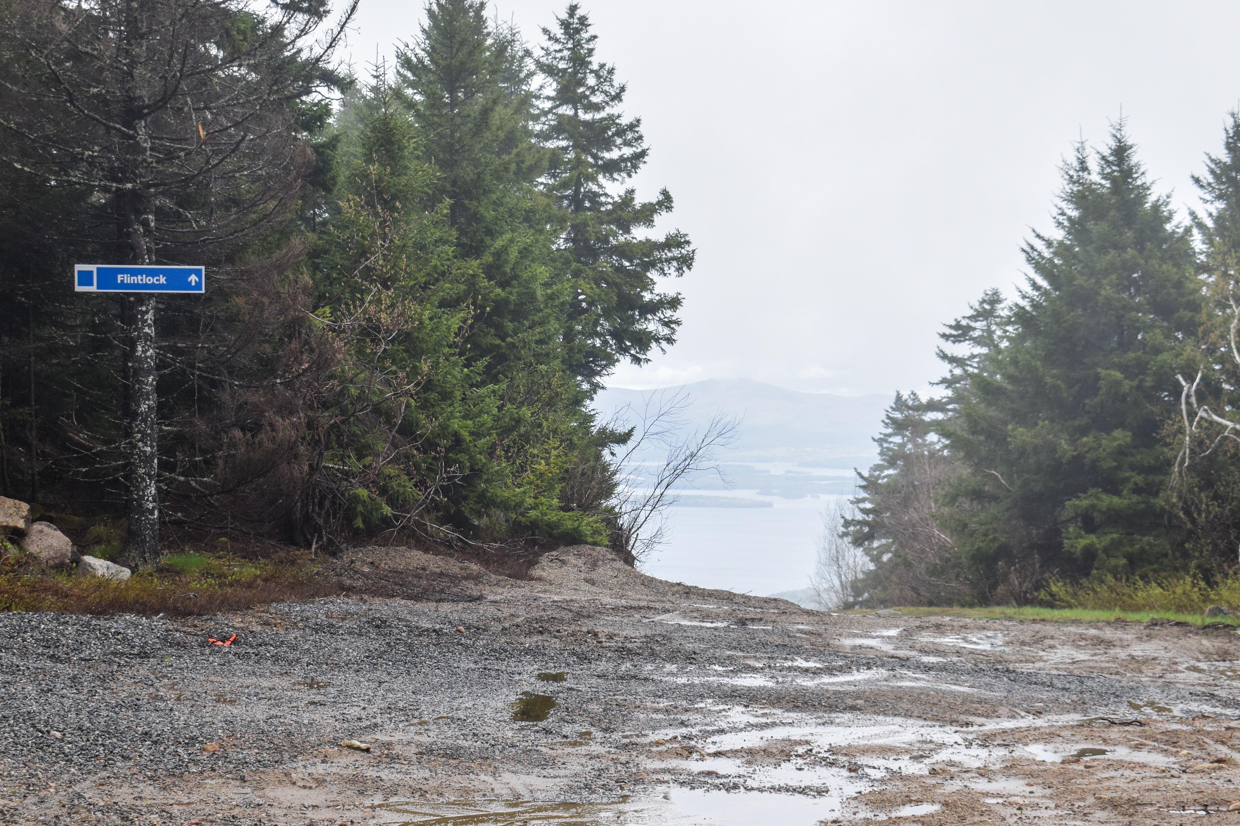
I made the executive decision to follow the Flintlock ski trail down, as it connected with Marge's Trail. It felt a bit like I wasn't supposed to be there, but worst case someone yells at me and they make me turn around. The view was EXCELLENT from this trail, which had awful, wet footing. The view kept improving as I descended out of the cloud, featuring Mt. Rowe in the foreground followed by the lake and further peaks. I passed the only bit of remaining snow, some fiddleheads, and then turned onto Marge's Trail, marked by a piece of orange flagging tape.


Marge's Trail crossed the Ridge Trail and was now blazed with yellow diamonds. I flirted with going to Rowe, but I still had a three hour drive to Emma's and I wanted pizza, so another time! Marge's Trail was a little car wash-y up top and then began to steeply descent with soft, wet, stream-like footing. I paused at a wonderful overlook to respond to a text I forgot to respond to a month ago (typical for me), and then continued on past a couple of red efts!


The trail crossed an unblazed trail corridor, which I believe is the old Gunstock Ski Hoist rope tow line! It was well-defined, so I imagine people choose to hike it. Afterwards, the trail became even more ridiculously wet, with at least a dozen streams running right over the trail. I was back in a lime green forest, and came to a final stream crossing that looked more permanant than the ones from before.

I passed another eft as the trail gently rollercoastered up and down and reentered conservation land, soon turning to coincide with the Ledges-Iron Mine Trail again. I enjoyed the view from the ledge again, but the cloud ceiling had only risen slightly, so not much had changed.


From here on out, I noticed I was following mountain bike tracks that I hadn't seen before... hmm... I continued down through the final wet section, which had my socks fully soaked at this point (my waterproof boots might be at the end of their lives), eventually making it onto the final straightaway, which was wonderfully dry.


Afterwards I had a long drive to Emma's, got some pizza from Stone's Throw, and learned I placed 10th on Strava for the Ledges-Iron Mine ascent - how fun! Tomorrow is the last day of the ski season, though :-(.


Step-by-Step
- Park at Ledges-Iron Mine Trailhead.
- Start hike on blue-blazed Ledges-Iron Mine Trail.
- At ledge, yellow-blazed Marge's Trail joins.
- At split, turn right to stay on Ledges-Iron Mine Trail.
- At terminus, turn right onto white-blazed Ridge Trail.
- At next jct., turn right onto green-blazed Winter Shortcut.
- At terminus, turn left onto orange-blazed Gunstock Mtn. Trail.
- Summit Gunstock Mountain.
- From summit, follow Flintlock ski trail.
- At orange flag, turn left onto Marge's Trail.
- Cross Ridge Trail, continue onto yellow-blazed Marge's Trail.
- Before ledge, Ledges-Iron Mine Trail joins.
- At ledge, continue right on Ledges-Iron Mine Trail back to car.

Saturday, April 19, 2025

Belknap Mountain via Carriage Road Trails (Belknap Range)

Belknap Mountain via Carriage Road Trails (Belknap Range)

Hike Type: Lollipop Loopty Loop
Distance: 7.54 miles
Elevation: 2,339 feet
Time: 3 hours, 30 minutes
Hiking Challenges: Belknap Range Redliner, Belknap Range Grid

The Hike 
Continuing on my adventures of April break, it was time to drive to Vermont! I decided to break up the drive by stopping in the Bleknaps for some redlining. I had a nice easy drive up at a reasonable hour (not what I affectionately call "balls o'clock"), and was at the trailhead a little after 7:30am! The lot itself was full (3 whole cars), but there is decent roadside parking. I was very nervous about having to christen the woods, but I am happy to report that my body stayed behaved for the entire hike. There were a couple of hikers a minute ahead of me, but thankfully I saw them head up Gunstock instead of the Carriage Road, so I had the road to myself!

[7:52am - Start of Hike on Carriage Road]
The Carriage Road, which was still gated for this hike, initially descends on pavement to cross a brook over a culvert - last time I was here the brook was mostly frozen, so it was fun to see it in its springtime glory! I crossed the Old Piper Trail trailhead and started a moderate-to-steep climb. There were a few piles of horse poop on this lower stretch of road, and the road itself followed some lovely cascades. There was occasional stonework that looked reminiscent of CCC work - the whole lower road was surprisingly scenic...


...until it got comically steep for a paved road. I'd take a steep trail over a steep road any day! This push was rough, but thankfully conditions got better afterwards. The steep incline led to a turn where the road began to switchback, crossing a brook on a bridge near the halway point. After this bridge, the road turned to dirt and continued to zigzag up the mountainside, crossing the brook numerous more times.

I was surprised again by the grade of this road - I couldn't believe that cars drive up this! I was thrilled to be hiking up instead, even if it hurt my calves. I noticed a few signs of winter in drainage ditches, but the road proper was completely snow, ice, and slush-free! I crossed paths with my first person partway up who had an off-leash dog that charged at me. Not even an ounce of concern from the owner... Ugh.


Soon enough I came upon the junction with the White Trail, which joined the road and gently led to the upper Carriage Road parking area, a gate with a spooky shed, and a trail kiosk in the parking lot.


[8:23am - Wayne's Way]
From the parking lot, the trail kiosk led to Wayne's Way - a short trail that led to a lovely overlook of a few distant hills, mountains, and lakes. I could see Ragged Mountain, which was fun! The path continued to the old spooky shed, which served as the trailhead for the green, red, and blue trails.


[8:27am - Green/Red/Blue Trailhead]
[8:28am - Red Trail]
From the trailhead, my adventure officially began! The three trails were aggressively signed in numerous ways, so it was clear which was which. I started my first climb on the Red Trail, which was comically well blazed and had some excellent stone work. I caught some tree views to Gunstock Mountain on the left as I climbed along the countless (but not relentless) stone steps. 


Eventually, the Red Trail climbed to a denser forest, and I was thrilled to find minimal mud on the few stretches without rock work. The trail crossed a stream and descended slightly before climbing via switchbacks, which were ridiculously well signed. There was a partial view from a slab, but there wasn't much to see with the clouds and humidity in the air.


Eventually, I did encounter my first patch of ice, followed by a few more ice flows higher up, but all were easy to bypass. The woods up high were beautiful, spooky, cozy, and mossy. The trail got a bit rougher near the end, but soon enough I made it to the summit! 


[8:56am - Belknap Mountain Summit]
I had created a narrative in my head that there was a second USGS disc I had missed the first time I was up here, but I couldn't find it (still might not exist - unclear. I found the actual summit marker disc, but I've seen photos of an arrow disc that says "GUNSTOCK," so I'm not sure if that photo was misplaced or if I need to look harder...). 


[8:58am - Blue Trail]
I opted to skip the tower since there were people on it, so as soon as I hit the top I started my trip down the Blue Trail! Once I was descending, I passed the duo I originally saw in the parking lot, and then I noticed that rock with an "L" painted on it. I meant to research the plane crash in this area, but completely forgot until this point - oops!


The trail was a bit squishy with some slushy spots, but overall it was fine. There were nice tree views to Lake Winnipesaukee, and one tricky patch of ice. I made my way to the open meadow and the view of the summit knob of Gunstock, my tummy made some ALARMING sounds, and then I was at the junction with the Saddle Trail.

[9:13am - Junction with Saddle Trail]
The summit to this point was all repeat trail, now I was on new-to-me trail! The forest was now pretty open and the trail was descending with leafy footing. It was a bit confusing in this area, since the NH State Land boundary was also blazed in blue, but I was able to follow the trail without much of a problem. There were again many stone steps, and there was one stream crossing near the end. So far, I was thrilled with my decision to ascend Red and descend Blue, we'll see what Green has in store!


[9:27am - Green (Warden's) Trail]
I continued onto the Green/Warden's Trail and picked up the pace because I was being trailed by two women and their dogs. The trail felt like a classic firetower trail, which was a bit of a bummer. It was much wider than Red and generally eroded footing and a moderate grade. I did appreciate, however, how all three trails were all so different from each other. 


The trail meandered on and off a power cut with slippery, ledgy footing. I caught a partial glimpse of Piper through the trees, and higher up there was a great view over to Ragged Mountain. I think the trail had been partially relocated over the years, since the sections that were not on the power cut felt relatively new. Eventually, the trail dipped into the woods and came to an icy, wet, mossy, slippery, glacial section that was pretty awful, but I imagine would be really pretty when dry.


Eventually, the trail began to calm down and cross some more glaciers in a forest that smelled like a delicious bottle of gin and eventually arrived near the summit plateau. There were some old cabins just off-trail, maybe this used to be a camping area? Or maybe just a part of the warden complex. A mystery!


[9:51am - Belknap Mountain Summit]
The final stretch of trail was narrow and snowy which made for some interesting footing but soon opened up at the tower! I somehow crossed paths with the same duo from the parking lot, which was the same duo I passed up here almost an hour ago? I guess they were also doing multiple laps. I climbed up the narrow-stepped tower, enjoyed some views, and then kept it moving!


[9:55am - White/East Gilford Trails]
I continued to follow the power cut along the White/East Gilford Trails, which enter some beautiful forests. The trail leaves the flat power cut as the power cut nears some communication towers (where I noticed the duo that was trailing behind me on the Warden's Trail, which was confusing). After some gentle descending, the White Trail turns right while the East Gilford Trail continues to descend on slabs on a beautiful, open area.


[9:59am - East Gilford Trail]
This stretch of trail was lovely! It alternated between open, dry slabs with nice views and mossy woods. I was feeling a little nervous about descending on a trail called "Boulder Trail," but so far conditions had been pretty sweet, minus some ice up high. This turn marked a long stretch of trail where I was completely by myself, which was also a delight.


[10:08am - Boulder Trail]
The Boulder Trail turn was well-signed and immedaitely became less-traveled and more rugged, passing a comical stone throne at the beginning. This trail had three-ish distinct, steep slab sections (only the lowest of which was wet and tricky), each with a fantastic view of the interior Belknaps. I heard the thump-thump-thmp-thmp-tp-tp-tp sound of a grouse smacking it wings on the ground (I believe some mating dance type thing) and I could hear wood frogs making their silly croaks and peepers making their high calls from either a vernal pool down low or Round Pond, unsure of which. 


After the third section of slabs, the Boulder Trail arrives at the namesake boulders. They were medium-challenging to navigate around and descend on, but I think they would have actually been very fun to climb up! After a first ridiculous section, the trail flattened for a moment and then continued the steep, bouldery descent, but slightly less brutal in the later half. 


[10:27am - Piper-Round Pond Link]
The second bouldery descent led me to my last longer segment for the day - the Piper-Round Pond Link! It was leafy and quiet in these woods, and the trail sign was delightfully unique. It was nice to hike on relatively flat land, even if the trailbed wasn't super clear and footing super leafy. There was one wet spot that wasn't to difficult to bypass. The trail later turned and climbed to enter into Lakes Region Conservation Trust land.


Further down, I enjoyed the obstructed tree views towards Round Pond and Swett Mountain, and then I saw people! They nearly scared the life out of me, as I had gotten used to my solice. The trail follows a section of sidehill walking, which angered my ankle, and then entered a more open area with tree views over to Piper and its various ledges. Up and down I continued along the trail as I began to get hungrier and hungrier. The trail descended to a tricky to follow section, ascended past a boulder field, and then continued a more moderate to steep ascent to the Piper-Belknap col, where my stomach was NOT feeling good. I was also tired at this point, so my footing was more clumsy.


[10:54am - Old Piper Trail]
[10:55am - White Trail]
For a brief moment, I was in familiar territory on the Old Piper Trail, and then continued onto the White Trail for my last bit of new trail for the day. The footing was still pretty bony but MUCH better than the Piper-Round Pond Link. The air smelled like a cloud, and soon enough I was back on the Carriage Road!


[11:00am - Carriage Road]
My brain turned off for most of the Carriage Road walk. I did notice that the bridges along the road were all marked with "E-2 POSTING," I wondered what that meant? (EDIT: Okay I found this quote online: "The E-2 designation is to exclude all combination and single unit certified vehicles from crossing a specific bridge." - there is more information that I don't fully understand here). Eventually, I arrived back at the pavement, crossed paths with two folks heading uphill, and just when I was really starting to feel the effects of boredom settle in, I saw the Piper Trail! Two folks were just ahead of me, but thankfully the final rude uphill slowed me so we never had to interact.

[11:21am - End of Hike]
Back at the car, it was now 67 degrees out and hinting at rain. This was a great hike! I'm glad I chose to hike the Carriage Road instead of drive it, even if it was boring. Ascending on Red and Green were absolutely the right choices, and my only small regret was descending on the Boulder Trail, but even that wasn't so bad. Time to continue my drive up to Vermont for Easter Sunday!


Step-by-Step
- Park at Lower Carriage Road.
- Start hike on Carriage Road.
- At parking lot, hike to kiosk and hike Wayne's Way to viewpoint.
- Follow spur to trailhead.
- Follow Red Trail to Belknap Mountain.
- From summit, turn left onto Blue Trail.
- Follow Blue Trail to trailhead.
- At trailhead, turn onto Green (Warden's) Trail.
- From summit, continue onto White Trail/East Gilford Trail.
- At split, continue onto East Gilford Trail.
- At jct., turn right onto Boulder Trail.
- At terminus, turn right onto Piper-Round Pond Link.
- At terminus, continue onto Old Piper Trail.
- At jct., continue left onto White Trail.
- At terminus, turn left onto Carraige Road, return to car.