Showing posts with label Delaware Water Gap National Recreation Area. Show all posts

Monday, August 8, 2022

Mt. Tammany (Worthington State Foreset)

Mt. Tammany (Worthington State Forest)

Hike Type: Loop
Distance: 3.5 miles
Elevation: 1211 feet
Time: 1 hour, 58 minutes
Hiking Challenges: 52 Hike Challenge


The Hike
We were in the middle of another heat wave, so I wanted to do a hike that I could complete by mid-day. I was thinking about doing the Stonetown Circular, but with the impending heat I chose to go shorter and something I know well, like Mt. Tammany. The parking lot was decently filled up around 8:30am on a Monday, but most, if not all the cars were there or Dunnfield Creek. I knew it was going to be a steamy one from the second I left my mom's house, and I had some colorful words to say when I got to the trailhead - no going back now! I geared up and started the immediate climb up.


Aside from the Tourne County Park, this is probably my most frequent hike in NJ, and for good measure! The red-dot trail is definitely the steep way up. I've only descended it once, and that was when I was probably 12 years old with my mom's ex boyfriend - so I'm glad I learned that mistake at a young age. The trail starts climbing up an eroded section that is moderately steep with some larger steps, and then briefly levels out at a large rock (the trail technically goes over the rock, but there is a herd path going around it). 


After that rock, it leads to an excellent view of the Delaware River and Mt. Minsi, and the trail begins to ascend again to other viewpoints. It's an excellent spot to catch your breath and question your life choices. I was definitely feeling gassed out here and I was aggressively soaked in my own sweat. I also noticed my heart rate was higher than usual for this level of a hike, so I took a second to chug some water and sit. 


Mt. Tammany from the viewpoint.


The Delaware Water Gap from the viewpoint.


Mt. Minsi from the viewpoint.

The trail gently climbs here for a moment before hitting the next steep section that is 95% rocks. I had to go really slow and steady during this party, and I had to take a long sit after climbing to take off my backpack, wring out my clothes, and drink liquids. In hindsight, I probably was showing the early stages of heat exhaustion. Thankfully I was listening to my body to slow the *f* down. The trail eases after that steep section, but continues to steadily climb.


You know you're getting close when the canopy begins to open up. In the past there used to be a rock that was painted "you're almost there!" but I didn't see it, although I could have missed it. There is a false viewpoint, and soon after is the main view of Mt. Minsi, which is very nice. I only stuck around for a moment to take a picture because I did not need the sun on me at all. I went a little past the viewpoint to take my break, which was well needed. The only plus of this dreadful, sweaty climb was that I was mostly alone. I only passed one other pair of hikers who were also gassed out. 


At the terminus of the red-dot trail, the blue trail begins. The blue trail follows the ridge of the mountain through some scenic terrain - never passing the true summit of Mt. Tammany. After some meandering the trail turns sharply left to descend the ridge, while the Mt. Tammany Fire Road continues straight. The fire road is unmaintained so in my experience, is usually overgrown at this time of year. It could be followed to make a large loop with Sunfish Pond, which is on my hiking bucket list. 


The blue trail starts steeply descending and then becomes more gradual. It's a nice recovery section after fighting for my life climbing up the red-dot trail. The only hurdle was a massive blowdown at the end of the trail, but it was easy to wiggle through it. The blue trail then joins the green-blazed Dunnfield Creek Trail, which is one of my favorite trails in the state. There was a large group of AT thru hikers swimming, and past that is a bridge that gives a great view of the creek. 


The trail from here to the car parallels the creek from up high. Some spots are wetter than others, but overall it's a really scenic section of trail. There were small groups of people swimming at different spots, which is apparently against the rules, but when the weather is the way it's been, who can be mad. Once back at the car, I quickly changed and BLASTED the air conditioning. I finished out my day with a great drive on Old Mine Road - I wanted to stay on it all the way to 206, but I missed the dirt road turn-off - whoops! I also stopped at Crater Lake for some more sightseeing. Minus almost dying, it was a great day!


Step-By-Step
  • Start hike on red-blazed Mt. Tammany Trail.
  • After main viewpoint on Mt. Tammany Trail, trail terminates and the blue-blazed Pahaquarry Trail begins.
  • At trail junction, turn left to continue on blue-blazed Pahaquarry Trail.
  • At trail junction, turn left to continue on blue-blazed Pahaquarry Trial, which now coincides with green-blazed Dunnfield Creek Trail.
  • At trail junction, blue and green trails terminate. Continue straight to follow the Appalachian Trail to the parking lot.

"Mount Tammany" from Wikipedia
        "Mount Tammany is the southernmost peak of the Kittatinny Mountains, in Knowlton Township, Warren County, New Jersey, United States. It is 1,526 feet (465 m) tall, and forms the east side of the Delaware Water Gap. Across the Gap is Mount Minsi, on the Pennsylvania side of the river. The mountain is named after the Lenni Lenape chief Tamanend. It lies along the Appalachian Trail in Worthington State Forest. The summit can be hiked by the Mount Tammany Trail ascending the western slopes. The trailhead is accessible from Interstate 80."

"Mt. Tammany Trail (Red-Dot)" from NPS.gov
        "The Mt. Tammany Trail (Red Dot) is one of two trails that lead to the outstanding view looking into the Delaware Water Gap from Mt. Tammany. This hike is one of the most challenging in the park. Combining the Mt. Tammany Trail (Red Dot) with the Pahaquarry Trail (Blue Blaze) makes a three-mile loop trail. If making a loop hike, consider hiking up the Red Dot Trail and down the Pahaquarry Trail (Blue Blaze), because most people find it to be an easier route. Over twenty miles of trail can be connected together in the Worthington State Forest area to fill the entire day."

"Pahaquarry Trail (Blue Blaze)" from NPS.gov
        "The Pahaquarry Trail (Blue Blaze) is one of two trails that lead to the outstanding view looking into the Delaware Water Gap from Mt. Tammany. This hike is one of the most challenging in the park. Combining the Pahaquarry Trail (Blue Blaze) with the Mt. Tammany Trail (Red Dot) makes a three-mile loop trail. If making a loop hike, consider hiking up the Mt. Tammany Trail (Red Dot) and down the Blue Blaze Trail, because most people find it easier to hike up the Mt. Tammany Trail (Red Dot), rather than up the Pahaquarry Trail (Blue Blaze). Over twenty miles of trail can be connected together in the Worthington State Forest area to fill the entire day."

"Dunnfield Creek Trail" from NPS.gov   
        "This trail is in the Dunnfield Creek Natural Area. Dunnfield Creek is a designated Wild Trout Stream and supports a healthy population of native brook trout. The trail follows the stream through a mature hemlock and mixed hardwood ravine. Numerous small cascades are seen along the creek. Be prepared for numerous stream crossings. The trail ends at Sunfish Pond, a natural glacial lake. Over twenty miles of trail can be connected together in the Worthington State Forest area to fill the entire day."


Saturday, July 16, 2022

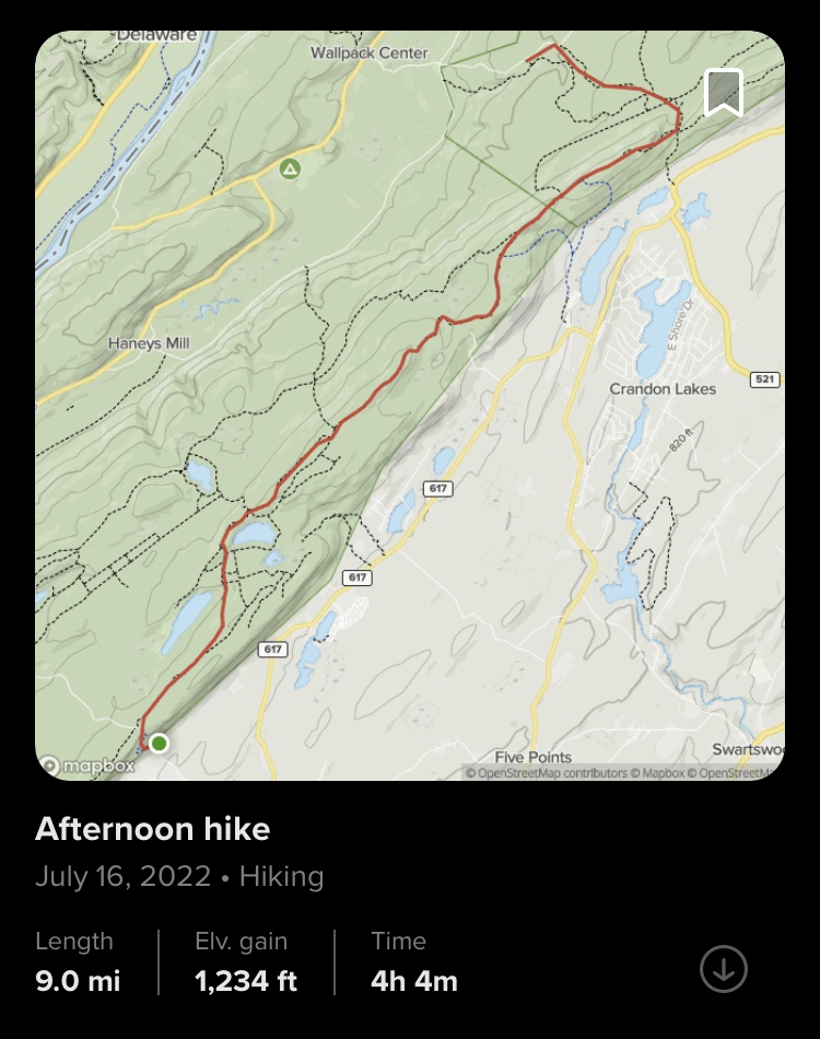
Appalachian Trail: Route 624 to Tillman Ravine (Delware Water Gap National Recreation Area & Stokes State Forest)

Appalachian Trail: Route 624 to Tillman Ravine (Delaware Water Gap National Recreation Area & Stokes State Forest)

Hike Type: One-Way
Distance: 9 miles
Elevation: 1234 feet
Time: 4 hours, 16 minutes
Hiking Challenges: New Jersey Appalachian Trail; 52 Hike Challenge


The Hike
Day two of our AT-palooza hiking weekend! I went back and fourth a few times on how to most effectively do this hike - we ended up dropping a car the upper Tillman Ravine parking lot and started the hike at the end of Fairview Lake Road, where there is a gate and the former road steeply climbs up the ridge via switchback. Getting there was a longer journey. Gen and I drove separately to do the car spot, but I didn't know she was stopping for gas so I was slightly panicked when she wasn't at the parking lot, but she eventually landed. I then decided to take the scenic route to Blue Mountain Lakes Road by taking Mountain Road past Buttermilk Falls, which is one of the most beautiful spots in the state. The road leading up to the falls was rough, but not nearly as bad as Mohican Camp Road. At the falls, however, the rest of the road was gated and closed apparently from storm damage this past April. At least we got to see the falls! We then continued to drive to Blue Mountain Lakes Road and found out that it was gated at the Blue Mountain Lake parking lot. I had read that Skyline Drive was closed on weekends, but that didn't start for another two miles! I thought we'd be able to drive to Skyline Drive and park there, but nope. After using those composting toilets, we took another half hour drive around the ridge to Fairview Lake Road, a place where I spent years of my life attending band camp, and parked at the bottom of the abandoned road leading up the ridge (in the past, Fairview Lake Road and Blue Mountain Lakes Road connected via a hairpin turn. Not sure when this closed). After about two hours of driving - it was finally time to start hiking!


We walked up the gated/washed out road to the top of the ridge, which was about as eroded as I remembered, but a little more grown in. There's a nice stream that parallels the upper half after the hairpin turn. The top of the road has a very partial view of the valley below through a power cut, and there is a short road walk to where the AT crosses Blue Mountain Lakes Road. There were some cars in the AT parking lot, which made me curious. Maybe they were park workers? Maybe backpackers? Who knows! The trail is clearly marked in white paint where it crosses the road, so we headed into the woods and officially officially got the day started.


The trail here was very nice and mellow with rolling ups and downs through open woods. The rocks were still present, but not as deadly as the day before. There was one steep descent, but other than that this section was generally uneventful. At the end of the descent there is what appears to be a dried up swamp/pond near Long Pine Pond. It was a very interesting area, I wondered if it is usually like that in July or if it was because of the drought. Soon after this area, the trail officially enters the Crater Lake area with a short scramble, intersecting old woods roads from the Tocks Island Dam controversy, and a view of the surrounding area. We ran into a thru-hiker right before the scramble who we realized we had seen the previous day which was fun. I didn't realize that the AT never actually provides a view of Crater Lake. If I had known this (aka done research) before, I probably would have added a side trip to the main parking area. I recognized the area once the Hemlock Pond Trail appeared, and this section of trail was very forgiving with its terrain. 


The trail continues on towards Rattlesnake Mountain, but first passes the trail junction with the Buttermilk Falls Trail and another series of old woods roads. I had originally thought I hiked to the top of Mt. Paradise, but now looking at the map I haven't! There used to be a NJ1K hiking list, but it seems its no longer maintained. Maybe I'll make my own... Someday! Either way, we climbed moderately and steadily to Rattlesnake Mountain where there were nice views. It was very humid this day (like all of my AT hikes this summer...) so I was SOAKED (also as per usual...). We had a nice break and pretended we weren't overheated beyond belief. Had a nice meat stick break and Gen surprised me with a rice krispy treat which probably saved my life. 


The final stretch of new trail was a descent down Rattlesnake, a short climb up the viewless Bird Mountain, and then crossing the boundary back into Stokes State Forest to the top of Blue Mountain, which had beautiful views just like last time. I was a little bummed that the day's haziness prevented views into the Catskills, but I got over myself and enjoyed what I could. At this point, I had already been on this stretch of trail so it was smooth sailing down to the junction with Brink Road, which we turned onto to slowly make our way back to Tillman Ravine. The road was wide and well traveled, passed what appeared to be a really nice elevated shelter area, and then made it to a junction with another woods road. The NYNJTC Map has parking areas labeled on this road which makes me wonder if/when the gate is ever open. The NJDEP map does not have any parking areas there, which makes me even more curious.


Anyway, we continued on Brink Road which immediately crossed a beautiful meadow and then reentered the woods for the remainder of the hike. The rest of the road was gentle, eroded, and overall featureless. I was delighted to see that it was not overgrown. We could have taken the Red Maple Trail, but this way saved us some miles and terrain, which we needed because we had an even longer hike planned for the next day. Brink Road terminates back at Dimon Road, which led right to the parking area. Hike #2 done!


"Crater Lake Trails" from Kittatinny Trails, 2004
        "Local mythology claims that Crater Lake was created by a meteorite sometime during the 19th century. It seems more likely this beautiful mountain feature is another glacial lake like nearby Sunfish and Catfish ponds, despite its crescent shape and the high bluffs on the northwest side.
        Crater Lake is far off the beaten track. Its large parking area and picnic grounds are at the end of a 2.4 mile long gravel road (Skyline Drive) which starts at the end of Blue Mountain Lakes Road. These roads dead end 5.5 miles from Old Mine Road.
        The AT crosses at the point where Blue Mountain Lakes Road turns into Skyline Drive.
        Buttermilk falls is the highest falls in New Jersey, about 200 feet high. It is best viewed in spring since at other seasons the water volume is quite low. The falls are at the western end of the Buttermilk Falls Trail, which is several miles from Walpack on the gravel Mountain Road."

Step-By-Step
  • Drop car at upper Tillman Ravine parking lot.
  • Drive to the end of Fairview Lake Road and park other car.
  • Walk past gate and up the road to Blue Mountain Lakes Road.
  • At top, follow Blue Mountain Lakes Road for short distance to Appalachian Trail.
  • Turn right onto Appalachian Trail northbound. 
  • Be sure to follow blazes throughout this whole section as there are many old woods roads. I will note junctions with blazed trails, but there are many more intersections than just these.
  • At junction with orange-blazed Crater Lake Trail, continue straight onto AT.
  • At second junction with orange-blazed Crater Lake Trail, continue right onto AT/Orange trail.
  • Orange trail leaves toward Hemlock Pond, AT continues on.
  • At junction with blue-blazed Buttermilk Falls Trail, continue on AT.
  • Summit Rattlesnake, Bird, and Blue Mountains.
  • Descend Blue Mountain, turn left onto Brink Road toward AT shelter.
  • At shelter, continue on Brink Road.
  • At gate, cross woods road and continue on Brink Road.
  • Cross meadow on Brink Road, continue to gate at Dimon Road.
  • Turn left onto Dimon Road to Tillman Ravine parking lot.


Friday, July 15, 2022

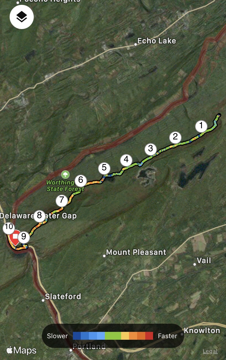
Appalachian Trail: Mohican Camp Road to PA State Line (Delaware Water Gap National Recreation Area & Worthington State Forest)

Appalachian Trail: Mohican Camp Road to PA State Line (Delaware Water Gap National Recreation Area & Worthington State Forest)

Hike Type: One-Way

Distance: 10.7 miles

Elevation: 899 feet

Time: 5 hours, 0 minutes

Hiking Challenges: New Jersey Appalachian Trail


The Hike

The first hike in a series of three to kick off the weekend! Gen came down from New England for a few days (three days spent hiking, one day for Great Adventure, and then most importantly, a Backstreet Boys concert) and she agreed to help me out with some hikes by car spotting and being another human. I had been really looking forward to this one. The plan was to drop a car at Kittatinny Point Visitor Center and then drive to Mohican Camp Road for the one-way hike. I had hiked in Worthington State Forest plenty of times, but never made it to Sunfish Pond before. I had also always wanted to walk out to the state border, so this was the day!


There is a small pull-off on Mohican Camp Road where we parked. Mohican Camp Road is a gravel road in ROUGH shape. Lots of deep potholes and ruts. My CRV was fine going slow, but I can foresee a car with lower clearance having troubles. The parking area is right at the Appalachian Trail at what appeared to be either a tentsite or a large clearing with room for tents, whether or not its allowed. This first part of the trail is mostly in the woods and climbs steadily and gently. The views start soon after, mimicking the gorgeous section of trail on the other side of Mohican Camp Road. After the junction with the blue-blazed Kaiser trail, the Appalachian Trail officially leaves the Delaware Water Gap National Recreation Area and enters Worthington State Forest, and the beautiful Racoon Ridge is soon after. 


I'm still trying to figure out if the names Mount Mohican and Raccoon Ridge are interchangeable or if Raccoon Ridge is a section of Mount Mohican, but either way the views were beautiful and there was a large summit cairn to mark the area. According the NYNJTC Map #120, this area is also a birding hotspot. There was a thru-hiker sitting at the cairn, so I didn't take a photo of it, but we did enjoy the views of the river and valley in one direction and the ridge along Mt. Tammany in the other.


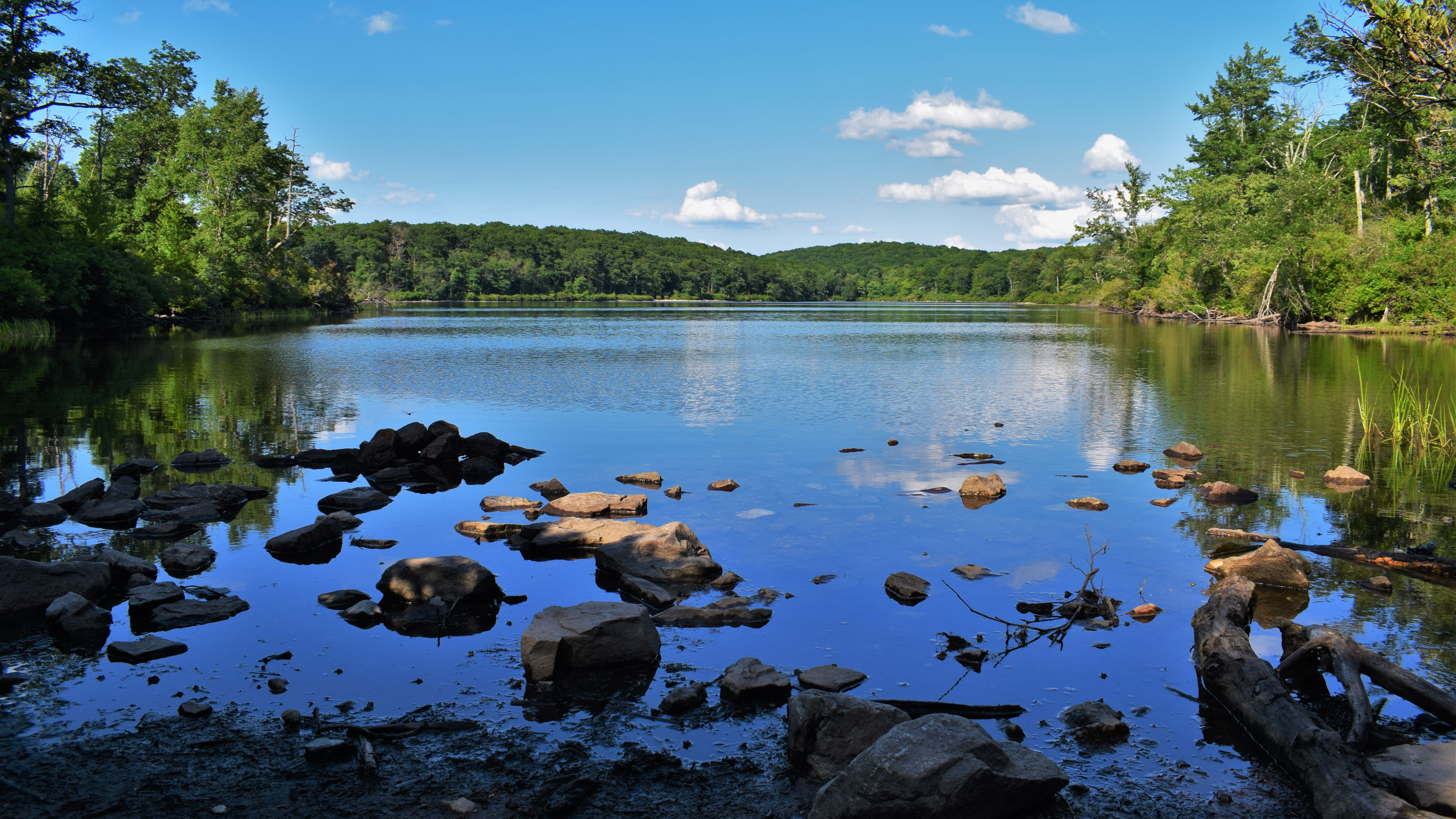
There was a power cut right after the main viewing area that offered more views, and then the trail returned into the woods towards Sunfish Pond. There was a good amount of bear evidence (read: poop) on the trails surrounding the pond, which makes sense considering the endless blueberry bushes all around. The trail gets very rough and rocky after the Sunfish Pond Natural Area sign, which slowed us down. There are a few areas to view the pond from the trail - we ended up taking a break about halfway along the pond on a rocky field surrounded with blueberry bushes that were probably just a week or two from being ripe. The pond water was still with the occasional bird or fish splashing about, but otherwise it was incredibly peaceful. 


Closer to the western edge of the pond, the trail is right along the water and we had the opportunity to gawk at some beautiful frogs, fish, and tadpoles. The trail finally becomes more forgiving/less rocky at the western edge of the pond, where we took one last look before starting the next leg of our hike. Between Sunfish Pond and I-80, the trail appears to follow an old woods road that varies from lovely, rolling, and gentle, to rocky and disrespectful. The woods are generally beautiful and open, where you can hear the distant sound of Dunnfield Creek. We passed someone's homemade 1300-mile sign out of rocks (an AT milestone) and had to cross two blowdowns - one was a hop over and one had a herd path around.


Toward the trail junction with the Dunnfield Creek Trail, a stick fell from the sky, nearly smacking Gen on the head. I looked up, expecting a rude squirrel to be giggling about, but instead found a porcupine at least 30 feet in the air munching on its dinner - first time I saw one in NJ! We also saw our only snake of the trip - an Eastern Ribbon Snake. The woods part of the trail terminates at the Mt. Tammany/Dunnfield Creek parking lot, and then the road walk begins!


The trail passes under I-80 and then follows the road leading to the Kittatinny Point Visitor Center. I noticed some raspberry-like berries along this route, so I took out the "Seek" app and found out that they were Wineberry bushes, and they were edible! Gen and I had a mini feast along this section. They tasted like raspberries, but more sweet than tart. The road in this section was rough - which reminded me about the "No National Park" group mentioned the deteriorating infrastructure in this park. Anyway, we made it back to Gen's car, dropped our bags, and got ready for the last bit of trail we had left for the day. 


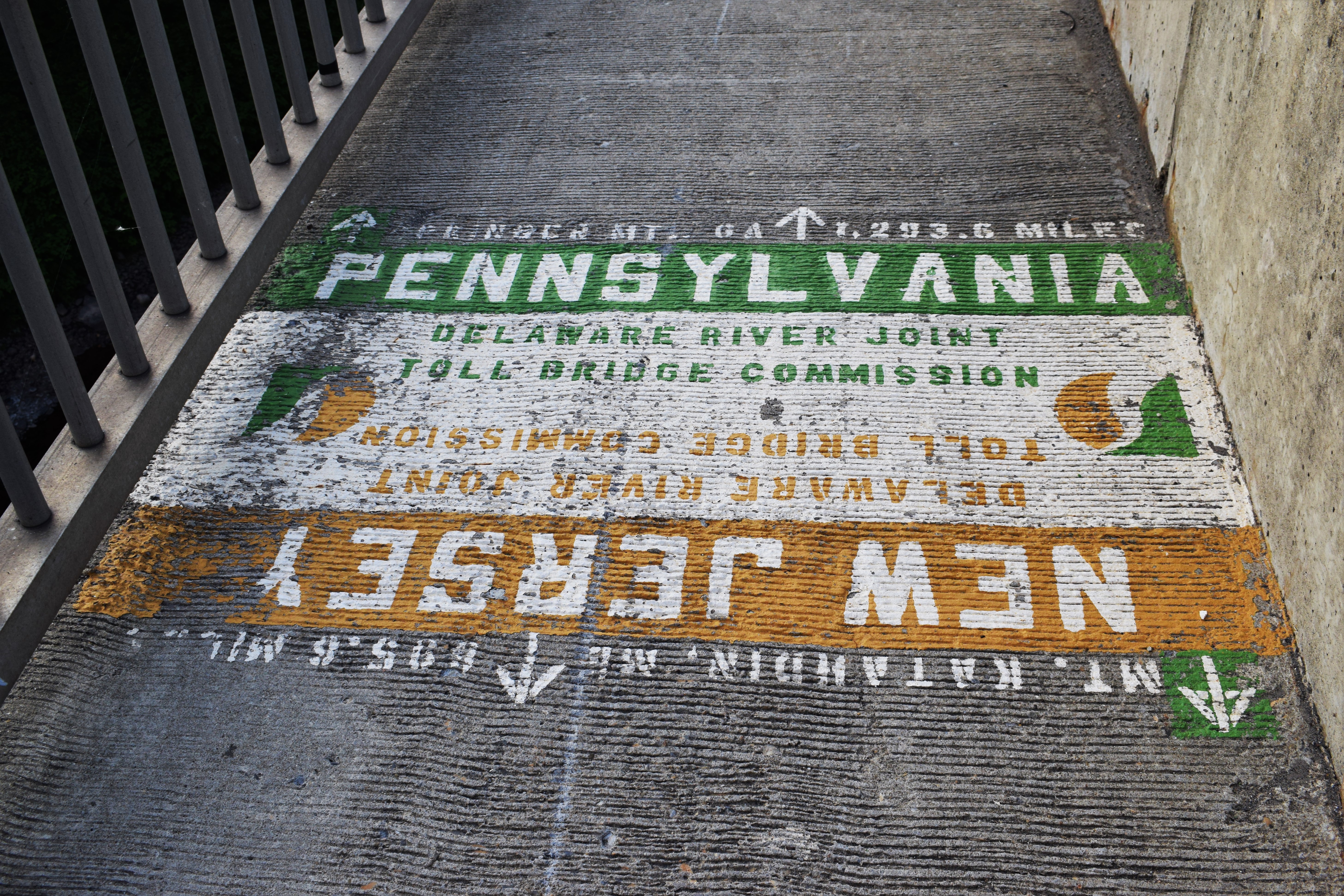
The walk to the NJ/PA border was along the road, and then on the I-80 bridge. Very straightforward, but our feet were feeling the burn from an afternoon hiking on rocks. The sun was setting, providing nice views of Mt. Tammany and Mt. Minsi, and it was fun to look down into the river from the bridge. We soon made it to the border, took a few photos, joked about not wanting to spend too much time in PA, and made it back to the car! We headed back to Mohican Camp Road to get my car, and then headed to the Hibernia Diner for a classic NJ dinner.


Step-By-Step

  • Start hike on the Appalachian Trail Southbound from Mohican Camp Road. 

  • At junction with red-blazed Coppermine Trail, continue on AT Southbound.

  • Trail joins blue-blazed Kaiser Trail.

  • Trail leaves blue-blazed Kaiser Trail.

  • Trail enters Worthington State Forest.

  • Trail crosses Raccoon Ridge. 

  • At junction with orange-blazed Garvey Springs trial, continue on AT Southbound. 

  • At junction with blue-blazed Buckwood trail, continue on AT Southbound. 

  • At western end of Sunfish Pond, continue on AT Southbound. 

  • At junction with blue-blazed Douglas Trail, continue on AT Southbound. 

  • At junction with yellow-blazed Fairview (Beulahland) Trail and red-blazed Holly Springs Trail, continue on AT Southbound.

  • Continue to follow white blazes to Dunnfield Creek Natural Area parking area and along road walk.

  • Follow blazes along road to I-80 bridge, and then to NJ/PA State Line. 

  • Turn around, follow blazes back to car.


"Worthington State Forest" from NYNJTC Map #120

        "Located within the boundaries of the Delaware Water Gap National Recreation Area, but administered separately by the State of New Jersey, Worthington State Forest contains some of the most rugged terrain in the state. Comprising the southern part of the Kittatinny Ridge, the state forest extends approximately seven miles along the ridge and includes 6,660 acres.

        Worthington was once called Buckwood Park, a private deer preserve of engineer Charles Campbell Worthington. His retirement home, Shawnee-on-Delaware, was later developed as a resort. Buckwood Park was first leased to the state as a game preserve in 1916, and was purchased from the Worthington estate in 1954. Among the forest's features is a glacial lake, Sunfish Pond, which was restored to the state after a long fight by conservationists defeated a planned pumped-storage utility project there.

        At the southern end of the forest is the Dunnfield Creek Natural Area. The creek tumbles over a waterfall on its way from Mount Tammany to the Delaware River, and it is one of the few in the state to support native brook trout. Overlooking this rocky stream are stands of hemlock, maple, and birch. Mountain laurel adds color to the area when in bloom. 

        For more information, contact Worthington State Forest, HC62, Box 2, Columbia, NJ 07832; (908) 841-9575; www.njparksandforests.org."


"Trails in Worthington State Forest" from NYNJTC Map #120

        "The trails in Worthington State Forest are among the most heavily used in the entire state, with the summit of Mount Tammany and Sunfish Pond being popular destinations. The Appalachian Trail runs through the center of the forest, and many other trails connect with it, making possible a variety of loop hikes. One popular hike combined the Mount Tammany (Red Dot) and the Pahaquarry (Blue Dot) Trails to make a 3.8-mile loop to the summit of Mount Tammany from the Dunnfield Creek parking area - a strenuous hike, with an elevation gain of over 1,000 feet. [...]."


"Delaware Water Gap National Recreation Area" from Appalachian Trail Guide to NY - NJ, 18th Ed.

        "The largest federal recreation area in the East, this 70,000-acre preserve extends along 40 miles of the Delaware River in Pennsylvania and New Jersey. It was originally planned as part of a hydroelectric dam project; the recreation area would have been along the shores of the lake. Many dwellings were destroyed and hundreds displaced in the farming country along the river before plans for the dam were shelved after intense opposition. Beginning in the 1980's, the National Park Service began developing beaches, roads, boat launches, picnic areas, and trails and preserving the remaining structures."


Excerpt from Guide to the Appalachian Trail from the CT-NY State Line to the Susquehanna River, PA, 4th Ed.

        "The trail follows a general southwesterly direction over Mt. Mohican with good views to Sunfish Pond. From Sunfish Pond (1,378 ft.) picturesquely located near the summit of the ridge, trail descends to Dunnfield creek. This part is heavily wooded and affords no views.

        In this section of the trail, many changes have occured. The land of the Rossiter Realty Company, which was known as the Worthing Estate, has been sold to the State of New Jersey and will be used as a hunting and fishing preserve. In addition, they plan to build a car and trailer campsite in the near future. It will not be necessary as in the pasat to be a member of a club associated with the NY-NJ Trail Conference to cross this land. 

        The old AT over Mt. Tammany and down the old macadam road has been abandoned due to the construction of the new Route 611. A high fence has been built on the boundary of Camp Weygadt but there still is a gate where the old trail emerges on the highway. The elimination of this trail and the rerouting of the AT over the new bridge saves an 8.3m. trip. Before one to go to Columbia, cross over the covered bridge (washed away) into Portland and back on the west shore of the Delawre.

        Part of the old AT has now become the Mt. Tammany Trail (Indian Head) and it cannover be overpraised as a side trip. This trail, 2.4 m. long, reaches the top of Mt. Tammany where from the overlook a wonderful view of the Delaware River, the Pocono Mtns. and Mt. Minsi just across the river can be obtained. From the overlook, this trail descends steeply along the face of the mountain to Route 611 in about 200 yds. north of the Camp Weygadt fence.


DWGNRA Appalachian Trail Map

NJDEP Worthington State Forest Map

NJDEP Worthington State Forest Zoomed Map

NJDEP Worthington State Forest Map (Older)

NYNJTC Worthington State Forest Map

Photo Album

Monday, July 11, 2022

Appalachian Trail: Millbrook Road to Camp Road (Delaware Water Gap National Recreation Area)

Appalachian Trail: Millbrook Road to Camp Road (Delaware Water Gap National Recreation Area)

Hike Type: Out-and-Back
Distance: 6.6 miles
Elevation: 915 feet
Time: 3 hours, 3 minutes
Hiking Challenges: New Jersey Appalachian Trail; 52 Hike Challenge


The Hike

Another day and another section of the Appalachian Trail in New Jersey! I have hiked to Catfish Firetower before, but never the remaining section to Camp Road. The original plan today was to park on Millbrook Road, take the AT to Camp Road, walk to Mohican Outdoor Center, and then to take the Rattlesnake Swamp Trail back. Naturally, I changed my mind during the hike, but we'll get there. I parked right at where the AT Southbound reenters the woods, and got to it!


The trail alternates between a fire road, footpath, fire road, footpath, and one more fire road leading up to Catfish Firetower. The road first passes a stream that was covered in beautiful blue dragonflies (or dragonfly looking insects) and then a bunch of campsites before turning right to begin the climb. The road got wet here, and right after the wet area is where the AT first goes onto a rocky footpath (and the first time I questioned going on a trail with the word "swamp" in the name). This was the steepest part, but the climb never got to be too much. The trail turns back onto the road, then back into the woods, and finally ends on the road that leads to the firetower (this was all the same road, and I imagine the trail was cut to save time and mileage). There were some deep mud divits in the road toward the top. I had wondered if the trail used to follow the road all the way or if the short footpaths have been there a long time. I have the 16th Edition of the guidebook from 2007 and the 7th from 1972 (in addition to others including the current edition). Everything here was as-is in 2007, but (not surprisingly) it appears to be different in 1972.

        "Delaware Water Gap Bridge to Millbrook (Blairstown Road). [...]. This entire Section of the Trail is destined to be a part of the Delaware Water Gap National Recreation Area, with Worthington State Forest being the initial tract. [...]. Continuing along the crest, the Trail leads to Catfish Fire Tower 12.11 m. The ridge line is followed until descent is made to wood road which leads to hard-surfaced Blairstown Road. Oak forests predominate in this Section. Some chestnut oak and spruce may be seen in the area near Sunfish Pond, as well as some white pine and other conifers. Mountain laurel is also prevalent in this section."

        "[...]. Beyond outlet of Catfish Pond reach dirt Camp Mohican Road, at 9.77m. (When parking cars on this road, obtain permission from Camp Ranger, 1/8m. left of Trail)"

        "North from dirt road, ascend steadily on word trails. At 10.97 m. Trail comes out on southeast side of ledge and continues for short distance along rim. Worn trail comes in, left, on open ledge, with sheer cliffs at 11.14m. (leads .71m. across ridge to Camp Mohican, where campers may obtain emergency assistance. To right faint trail leads down over cliffs to farm road)." (The worn trail on open ledges is, I believe, the Rattlesnake Swamp Trail).

        "Beyond, enter woods, follow narrow trail with rough footway and occasional views over south rim of mountain to reach 60ft. steel Catfish Fire Tower and small wooden buildings at 12.11m. where tower affords splendid panoramic view. Turn sharp left here on well-worn trail with rough footway. After .13m. of steep descent, turn right along base of ridge and at 12.93m. turn right again in dense rhododendron where wood road comes in on left from Catfish Pond. (To left, 50 ft. on this road is dependable spring). Road reaches hard-surfaced Blairstown Road at 13.05 m."


The 2004 book "Kittatinny Trails" shows that previously, the trail only coincided with the fire road twice instead of three times.


My main takeaway from those excerpts is (1) that I should have read it earlier in the book where the directions start from where I parked my car (oops) and (2) it sounds like there used to be a different trail that led to the top. I can't be certain, but it seems like one came up the backside of the ridge versus along the gap. Maybe I'll find out later.


Back on topic - there is a partial view from the firetower area, and the firetower is a view in itself. Stark contrast of white and red paint. The tower is apparently 100 years old this year - happy birthday! I was trying to see if I was allowed to climb, and it was very confusing. There was a forest service truck at the top, there was a no trespassing sign, but no gate at the stairs (which I vaguely remember there being when I went last time). Most peculiarly, there was a voice from the cabin up top saying "hello, hey, can you hear me, yes I'm here" over and over and over and over again. Eventually I said "hi" back, but to no response. I later learned through the internet that when staffed, it is okay to climb the tower, and that was likely the watchman trying to make a phone call.


The trail dips into the woods and is truly some of my favorite bits of trail I've hiked recently. Obviously it's not the alpine climb to Mt. Eisenhower, but the trail here meanders through the forest, closely hugging the edge of the ridge with endless partial views, and occasionally opening up to larger views. I passed a few thru hikers, but overall did not see many people. I passed one older hiker and said my classic "hey how's it going" and he said "fantastic, just dancing through rocks” which was truly poetic. I also passed a group of thru hikers that truly had the famous thru hiker scent to them, which truly caught me off guard.


The best vista of this section is from the intersection with the Rattlesnake Swamp Trail where the world opens up. Truly breathtaking. From there, the trail turns into the woods and makes its descent to Camp Road, which eventually leads to the Mohican Outdoor Center. I made it about 10ft. to Camp Road, but turned around because there was a large group just off the road and I didn't want to intrude (or worse, have to be social). I paused to see if I had any service to check for info on the Rattlesnake Swamp Trail, and the two most recent trail reports on AllTrails talk about how muddy the trail was, so I quickly made the decision to turn around and retrace my steps. The climb back to the ridge did hurt a bit, but as usual it was nothing too steep for too long.


The return trip was very calm and uneventful. I took in some of the views again and admired the near-rip blueberries (and possibly blackberries?). The only moment of excitement was when I stumbled upon a truly gorgeous looking snake. Different hues of brown in a near hourglass shape, small dark tail, and truly uninterested in me. I haven't seen a snake like this one before, so I took some photos naturally. I wanted it to get off trail, so I did a little stompy stomp, but it didn't care about it. I then scuffed my feet a little, but still nothing. My last effort was to nudge some dirt and rocks towards it, but still nothing. Like any adult, I did a fully olympic gymnastics-style leap over the snake and continued on my way. It wasn't until I got home that I learned it was a copperhead - one of two venomous snakes in NJ! Glad it was unbothered by my true annoyance.


The rest of the return trip went smoothly and I was back at the car before I knew it! It was nice to do a hike on the shorter side for a change. The weather was classic humid NJ summer but there was constantly a phenomenal breeze that kept me from being as sweaty as I usually am (don't worry, I was still soaked, just not pruny). Interestingly enough, near the beginning/end of the hike, there were pockets of chilled air that hung out in the rhododendron tunnels that were like air conditioning. One major highlight of this hike was hearing some of the thru hikers talk about how impressed they were with NJ - while almost all NJ stereotypes are deadly accurate, the state is also gorgeous. 


My drive home had two interesting moments - first I noticed a sign that said "tour busses this way only." Do tour buses come to the water gap? I feel like aside from hiking and other physical recreation, there isn't much sightseeing to be done, but who knows. The second was a few yard signs that said "No National Park - Join us on FaceBook" - naturally I joined. Apparently there is a proposal to turn the National Recreation Area into a National Park. I need to read the proposal, but this group has been working tirelessly to campaign against a transition like that. 


Step-By-Step
*This whole hike is exclusively on the Appalachian Trail, first southbound, then northbound.*
  • Park along Millbrook Road at AT Trailhead.
  • Follow AT on fire roads and trails, following blazes, to Catfish Firetower.
  • Continue on a very scenic stretch of the AT that closely hugs the cliffs of the Kittatinny Ridge, occasionally offering views.
  • At junction with Rattlesnake Swamp Trail, enjoy excellent views, and continue on AT Southbound. 
  • Descend into Catfish Pond Gap and turn around at Camp Road. Retrace steps back to car. 

Excerpt from NYNJTC Trail Map 121: Delaware Water Gap & Kittatinny Trails
"The A.T. follows the road for 500 feet and soon resumes its climb of the ridge, reaching the Catfish Fire Tower (elevation 1,565 feet) in 1.2 miles. There are panoramic views not only from the fire tower, but from an east-facing viewpoint along the A.T. another mile to the south at an intersection with the orange-blazed Rattlesnake Swamp Trail. About 3.5 miles from Millbrook-Blairstown Road, the A.T. crosses Camp Mohican Road, which leads west 0.3 miles to the Mohican Outdoor Center at Catfish Pond (limited parking is available at the road crossing)."