Showing posts with label High Point State Park. Show all posts

Saturday, July 30, 2022

Appalachian Trail: Deckertown Tpke to NJ-23 (High Point State Park)

Appalachian Trail: Deckertown Tpke to NJ-23 (High Point State Park)

Hike Type: Out-and-Back
Distance: 10.25 miles
Elevation: 1322 feet
Time: 4 hours, 30 minutes
Hiking Challenges: New Jersey Appalachian Trail


The Hike 

I was going to attempt this hike a few days ago after work, but I wasn't in the mood for a 10+ mile jaunt that day, and I am so glad that I waited. The weather on this day is absolutely beautiful. The day started without a cloud in the sky, low-mid 60s, low humidity, and a constant breeze. By the end of the day we were in the 70s with Pixar-style clouds in the sky. Just amazing! Anyway, when I got to the parking area off the Deckertown Turnpike I was the only car in the lot, got suited up, and hopped into the woods!


The trail was classically rocky, first dipping down and then climbing back up. There was a hiker log box soon after the trail entrance, and some magnificently orange mushrooms soon after. The AT then crosses the Iris Trail and climbs a little bit higher near private property signs to an overgrown spur path to a view, which was fine. Soon after, though, the trail crossed a clear-cut pipeline area which provided an excellent view of the neighboring farmland of Sussex County. The breeze up there was incredible. 


Heading back into the woods, the AT continues to follow the ridgeline, dips down and climbs back up to another junction with the Iris Trail, and then the blue-blaze trail to the Rutherford Shelter (which shockingly, then connects with the Iris Trail. The original plan was to make a loop hike with the Iris Trail, but I had read on njhiking.com that the Iris trail is not mowed on the pipeline and that was enough for me to do an out-and-back (and trend with these hikes). 


The trail then continues to follow the ridge line to a couple more great views, the second better than the first. According to the NYNJTC map there is also a rock called "Dutch Shoe Rock" that I must have missed - next time! There are a few more viewpoints noted on the NYNJTC maps, but they are mostly grown-in. The trail makes a very steep descent (I believe the steepest I've encountered on the trail in NJ, maybe except for the climb to Pinwheel Vista?) into a wet area, which was dry due to the rain-less summer. I checked my phone here for a moment, and when I looked up I was started by a juvenile bear running away from me about 30 feet away. It was cute but scared me! The bear stopped to check on me about 60 feet away, but I was clanking my sticks together at that point so it peaced out. I wish I wasn't looking at my phone so I could have gotten a photo! Or maybe it was for the better... 


The trail then climbs up a rocky section and slowly levels out, climbing to a view towards Sawmill Lake. There was a nice view of the sky and the neighboring ridge, but the lake was hardly visible. There were some tents pitched up down at the lake, and I believe one person down there brought their dog that barked for what felt like 15 hours straight. 


At this point, the trail starts a gentle descent down to where the Iris and Mashipacong trails intersect, which was my turn-around point for the day. Back in February, I had hiked from the AT parking lot on 23-south to this point, and then down to route 519. I had a quick snack of peanut butter crackers, and started my return trip!


The return trip, like most in this journey, was fairly uneventful. I passed a few thru hikers who I chatted with about bears and snakes (the bear was not back for my return trip). When I was climbing back up the steep section, I pulled over for a hiker who was coming down, and he very proudly told me that I need to keep coming up since it's hiker etiquette that the person descending pulls over. In my head I said "I know this thank you for explaining it to me I pulled over because I am TIRED and do not need a lecture by a stranger" but my mouth said "ha thank you." Deep breaths got me through that (I was also mildly dehydrated at this point which made me crankier than usual. 


One more bout of crankiness set over me when I passed a family of at least 20, who were traveling in 4-ish groups about 100 feet apart. I get wanting quality family time, but geeze. Anyway, the rest of the return trip was quite lovely. I checked out the views again and took a few more photos. I liked the lighting at this point of the day a little more, and the clouds added a nice feature in the photos. I was delighted and surprised to see a tan praying mantis at the pipeline cut! I passed a few more day and thru hikers, and right before I was back I saw the hiker log box with a memorial photo of a passed hiker on the other side with a mini backpack which was really sweet. The photo had words that read "may your love of the outdoors help the weary hiker and the slightly confused find their way" which made me chuckle and smile. Cheers! Back at the car I did my quick change and headed to the brand new Augusta Wawa for lunch!


Step-By-Step
  • Park at AT parking lot on Deckertown Turnpike.
  • Start hike on Appalachian Trail northbound.
  • At junction with red-blazed Iris Trail, continue on AT northbound.
  • Enjoy view from pipeline cut.
  • At junction with Iris Trail, continue on AT northbound.
  • At junction with blue-blazed trail to Rutherford Shelter, continue on AT northbound.
  • At junction with blue-dot-blazed trail, continue on AT northbound.
  • At junction with red-blazed Iris Trail and yellow-blazed Mashipacong Trail, turn around and retrace steps back to car.


Wednesday, July 27, 2022

Appalachian Trail: Deckertown Tpke to Sunrise Mountain (High Point State Park & Stokes State Forest)

Appalachian Trail: Deckertown Tpke to Sunrise Mountain

Hike Type: Out-and-Back
Distance: 7.9 miles
Elevation: 845 feet
Time: 2 hours, 53 minutes
Hiking Challenges: New Jersey Appalachian Trail; 52 Hike Challenge


The Hike 

The original plan today was to hike from the Deckertown Turnpike parking to NJ-23, but I didn't have a 10 mile hike in me and wanted to be back in time for dinner, so I hit the other side of Deckertown Turnpike and did the shorter hike to Sunrise Mountain! I had been to sunrise mountain in 2020, so this was a hike to connect some of the dots that I had previously missed. There was a pile of water jugs in the parking lot, assumingly for thru-hikers, and only one other car in the lot. I crossed the road to start my hike, took a few photos, and I was off!


The trail gently climbs for the first bit of trail and soon pops out at a nice clearing at a shelter. The trail turns right here, and just in case that blaze is missed there is a large sign saying "NOT THE AT" where an access road travels. The trail climbs for a little longer before generally leveling out. I noticed immediately this section of trail is much gentler than the other sections have been. I noticed a side path that could lead to a pond/lake/swamp, so I took the overgrown path and got a very partial view of a grassy wetland area. It looked like I could have searched further for a better view, but I wasn't feeling it.


Continuing on, the trail meanders through some beautiful open forest with stone walls and the works, and before I knew it I was back at the spot I've already hiked! I could have turned around here, but this hike has been relatively featureless so I decided I earned a good view. I continued on towards Sunrise Mountain and was very happy I did. There is a short section through a clearing that is mostly grown-in with lots of flowering plants that the butterflies love. I was able to get a truly excellent photo of a Tiger Butterfly here (and I love that I knew it was a Tiger Butterfly - thank you Animal Crossing!). 


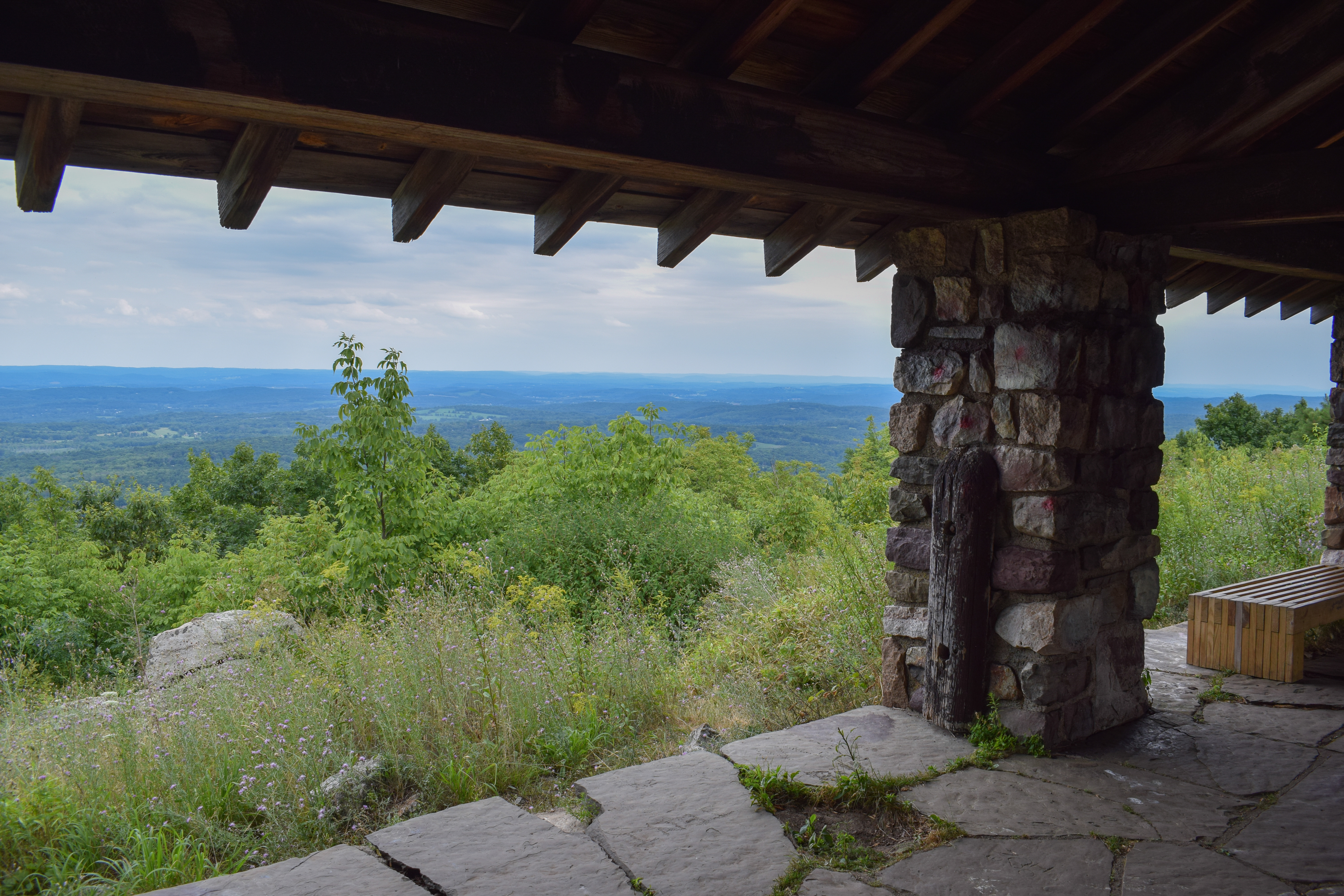
Soon after the butterfly garden there is a spur path to the Sunrise Mountain Road parking lot, and a very short climb to the Sunrise Mountain summit pavilion! I was lucky enough to have the whole area to myself, so I put my stuff down, took a bunch of photos, and had a nice snack break. I noticed there were storm clouds over PA with rain, but the radar SWORE it wasn't coming my way (thankfully it was correct). 


The return trip was more of the same. I noticed a bunch of millipedes again which was cool, but what truly stopped me in my tracks was a long Black Rat Snake chilling in the middle of the trail! It was very content just chilling there, so I made my way around it. I noticed an unblazed path near the Lincroft Farm Trails, and there was another sign clearly stating that it was not the AT. I always appreciate reminders like that, as someone who has been lost on the trails in NJ numerous times. Soon after I was back at the car in dry clothes and ready for dinner!


Step-By-Step
  • Park at Appalachian Trail parking on Deckertown Turnpike.
  • Cross Deckertown Turnpike and enter Appalachian Trail Southbound.
  • At junction with blue-blazed Lincroft Farm Trails, continue on AT Southbound. 
  • At junction with blue/black-blazed trail, continue on AT Southbound.
  • At pavillion, take a break and enjoy the view. 
  • Turn around, and retrace steps.
    • NOTE: There are unmarked trail junctions not listed here. I only listed blazed trail junctions.

Saturday, February 26, 2022

[BACKLOG] High Point State Park (Appalachian Trail)

High Point State Park (Appalachian Trail)

Hike Type: Out-and-Back
Distance: 7.4 miles
Elevation: 1263 feet
Time: 3 hours, 18 minutes
Hiking Challenges: New Jersey Appalachian Trail


The Hike

I realize at this point I start posts all the same: "another great day in the woods" - or something of that sorts. Thankfully, this day was no different! The weather was going to be much chillier than my near-summer hike just a few days prior, and the snow was back! I had originally planned to park at the AT Trailhead on Route 519, but the pull-off was made up of hard, rutted ice so I turned around and parked along the Appalachian Trail parking at High Point State Park on Route 23 South.


My stubborn self bare-booted along the crusty snow from the blue-blazed AT spur leaving the parking lot, turning right onto the red-blazed Iris trail, and then turning right one more time onto the white-blazed Appalachian Trail. I made it to the crossing on Route 23, and then finally put on my microspikes to get the party started!


At this point the hike was calm and lovely. A few short climbs along the Kittatinny Ridge, but nothing too strenuous. There was a beautiful platform that overlooked the surrounding vistas and the High Point monument further down the trail. At the junction with the Monument Trail the Appalachian Trail turns into the forest to slowly descend the ridge.


The forest coming down the ridge was still and beautiful. Short descents followed by long walking breaks that seemed to follow old woods roads. I did not check out the shelter, but it was clearly indicated where to turn off. There was one water crossing that was a little sketchy with the melting snow and ice, but nothing too terrible. The area by the water was also beautiful and the water formed a mini-ravine as it cut through the mountainside. 


From the shelter spur to Route 519 was gentle and uneventful. The blood started pumping as I turned around the started to climb up to the ridge again, but nothing was too strenuous. Back at the junction with the Monument Trail, I followed the red-and-green-blazed Monument Trail that ran concurrent with the light-blue-blazed Shawangunk Ridge Trail. I have driven to the top of High Point numerous times, but never hiked! The trail was a quick detour that shot right up to the beautiful top of New Jersey. I didn't spend too much time at the top due to wind, but it was nice to be up there again!


The return trip was just as beautiful. The snow was starting to melt so some of the descents got dicey, but my butt never touched the ground which is a success! I passed a large group of teenagers hiking in street clothes and sneakers which was interesting. One kid was blown away by my spikes which was one of the nerdiest ego boosts I've gotten in a while. They asked how far away the monument was, and I told them it was probably over a half hour. I hope they made it in one piece!


I'm super excited to continue my journey tackling the NJ section of the Appalachian Trail this summer!


Step-By-Step
  • Park at Appalachian Trail Parking along Route 23.
  • Start on blue-blazed spur trail out of parking lot.
  • Turn right onto red-blazed Iris Trail.
  • Turn right onto white-blazed Appalachian Trail.
  • Cross Route 23.
  • Continue on Route 23 to junction with light-blue-blazed Monument Trail.
  • Turn right to continue on Appalchian Trail.
  • At Route 519, turn around and retrace steps.
  • At junction with light-blue-blazed Monument Trail, turn right onto Monument (light blue)/Shawangunk Ridge (red and green) Trails.
  • Cross paved park road.
  • Continue to High Point Monument and turn around.
  • Cross paved park road.
  • Follow Monument/Shawangunk Ridge Trail until AT junction.
  • Follow AT southbound.
  • Cross Route 23.
  • Continue on Appalachian Trail.
  • Turn left onto red-blazed Iris Trail.
  • Turn left onto blue-blazed spur trail.
  • Return to parking lot. 


Originally posted May 8th, 2022.