Showing posts with label Belknap Mountain. Show all posts

Saturday, April 19, 2025

Belknap Mountain via Carriage Road Trails (Belknap Range)

Belknap Mountain via Carriage Road Trails (Belknap Range)

Hike Type: Lollipop Loopty Loop
Distance: 7.54 miles
Elevation: 2,339 feet
Time: 3 hours, 30 minutes
Hiking Challenges: Belknap Range Redliner, Belknap Range Grid

The Hike 
Continuing on my adventures of April break, it was time to drive to Vermont! I decided to break up the drive by stopping in the Bleknaps for some redlining. I had a nice easy drive up at a reasonable hour (not what I affectionately call "balls o'clock"), and was at the trailhead a little after 7:30am! The lot itself was full (3 whole cars), but there is decent roadside parking. I was very nervous about having to christen the woods, but I am happy to report that my body stayed behaved for the entire hike. There were a couple of hikers a minute ahead of me, but thankfully I saw them head up Gunstock instead of the Carriage Road, so I had the road to myself!

[7:52am - Start of Hike on Carriage Road]
The Carriage Road, which was still gated for this hike, initially descends on pavement to cross a brook over a culvert - last time I was here the brook was mostly frozen, so it was fun to see it in its springtime glory! I crossed the Old Piper Trail trailhead and started a moderate-to-steep climb. There were a few piles of horse poop on this lower stretch of road, and the road itself followed some lovely cascades. There was occasional stonework that looked reminiscent of CCC work - the whole lower road was surprisingly scenic...


...until it got comically steep for a paved road. I'd take a steep trail over a steep road any day! This push was rough, but thankfully conditions got better afterwards. The steep incline led to a turn where the road began to switchback, crossing a brook on a bridge near the halway point. After this bridge, the road turned to dirt and continued to zigzag up the mountainside, crossing the brook numerous more times.

I was surprised again by the grade of this road - I couldn't believe that cars drive up this! I was thrilled to be hiking up instead, even if it hurt my calves. I noticed a few signs of winter in drainage ditches, but the road proper was completely snow, ice, and slush-free! I crossed paths with my first person partway up who had an off-leash dog that charged at me. Not even an ounce of concern from the owner... Ugh.


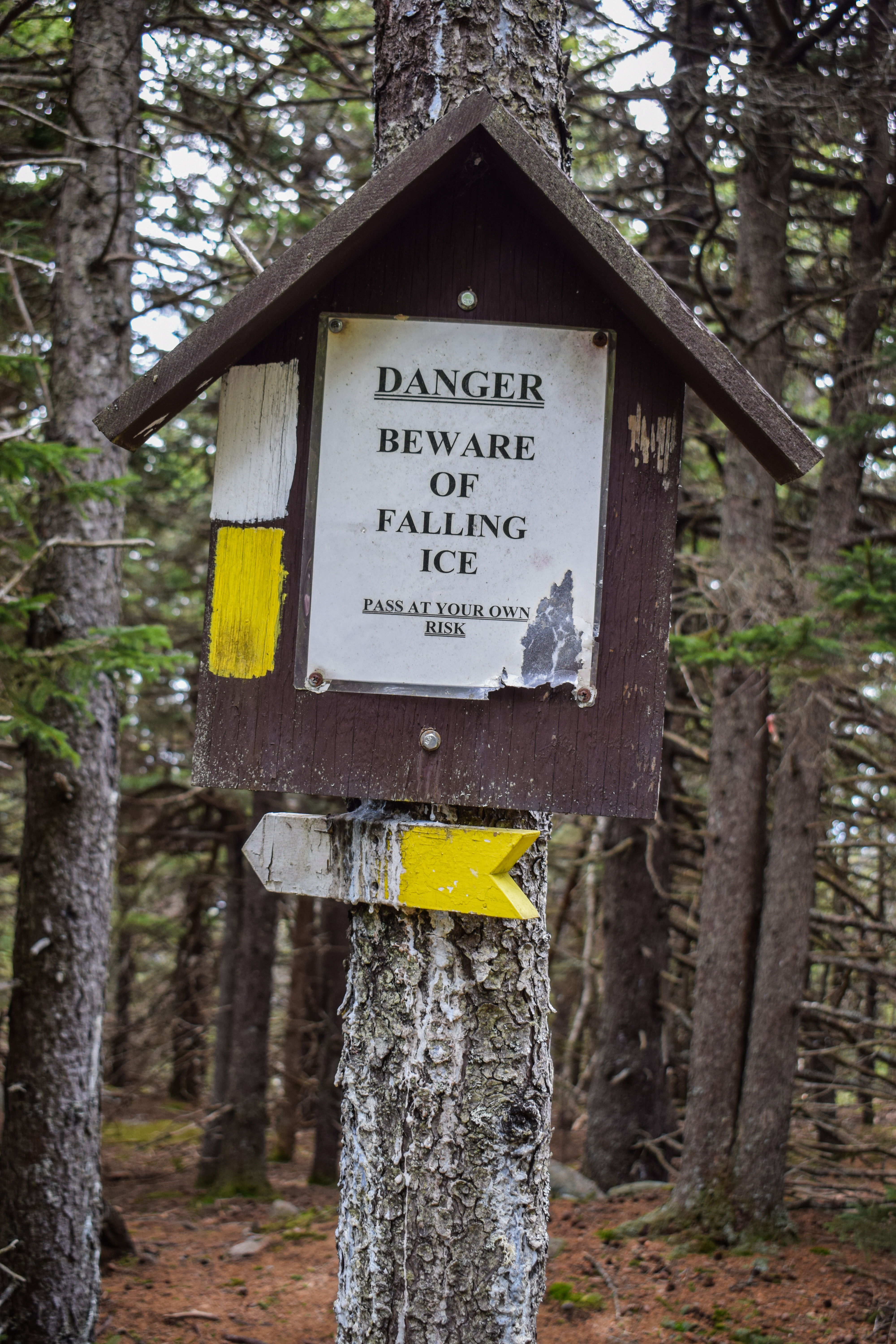
Soon enough I came upon the junction with the White Trail, which joined the road and gently led to the upper Carriage Road parking area, a gate with a spooky shed, and a trail kiosk in the parking lot.


[8:23am - Wayne's Way]
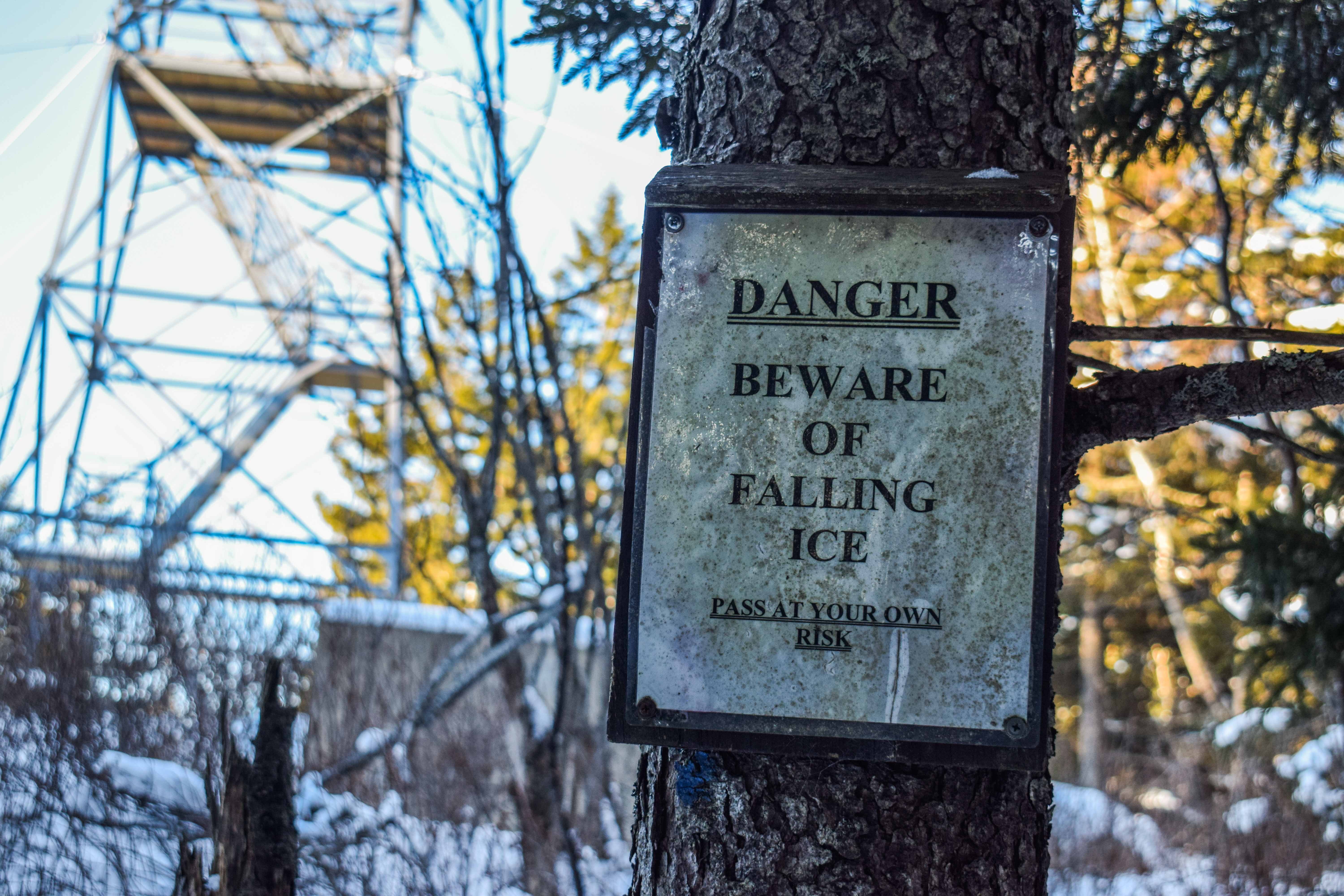
From the parking lot, the trail kiosk led to Wayne's Way - a short trail that led to a lovely overlook of a few distant hills, mountains, and lakes. I could see Ragged Mountain, which was fun! The path continued to the old spooky shed, which served as the trailhead for the green, red, and blue trails.


[8:27am - Green/Red/Blue Trailhead]
[8:28am - Red Trail]
From the trailhead, my adventure officially began! The three trails were aggressively signed in numerous ways, so it was clear which was which. I started my first climb on the Red Trail, which was comically well blazed and had some excellent stone work. I caught some tree views to Gunstock Mountain on the left as I climbed along the countless (but not relentless) stone steps. 


Eventually, the Red Trail climbed to a denser forest, and I was thrilled to find minimal mud on the few stretches without rock work. The trail crossed a stream and descended slightly before climbing via switchbacks, which were ridiculously well signed. There was a partial view from a slab, but there wasn't much to see with the clouds and humidity in the air.


Eventually, I did encounter my first patch of ice, followed by a few more ice flows higher up, but all were easy to bypass. The woods up high were beautiful, spooky, cozy, and mossy. The trail got a bit rougher near the end, but soon enough I made it to the summit! 


[8:56am - Belknap Mountain Summit]
I had created a narrative in my head that there was a second USGS disc I had missed the first time I was up here, but I couldn't find it (still might not exist - unclear. I found the actual summit marker disc, but I've seen photos of an arrow disc that says "GUNSTOCK," so I'm not sure if that photo was misplaced or if I need to look harder...). 


[8:58am - Blue Trail]
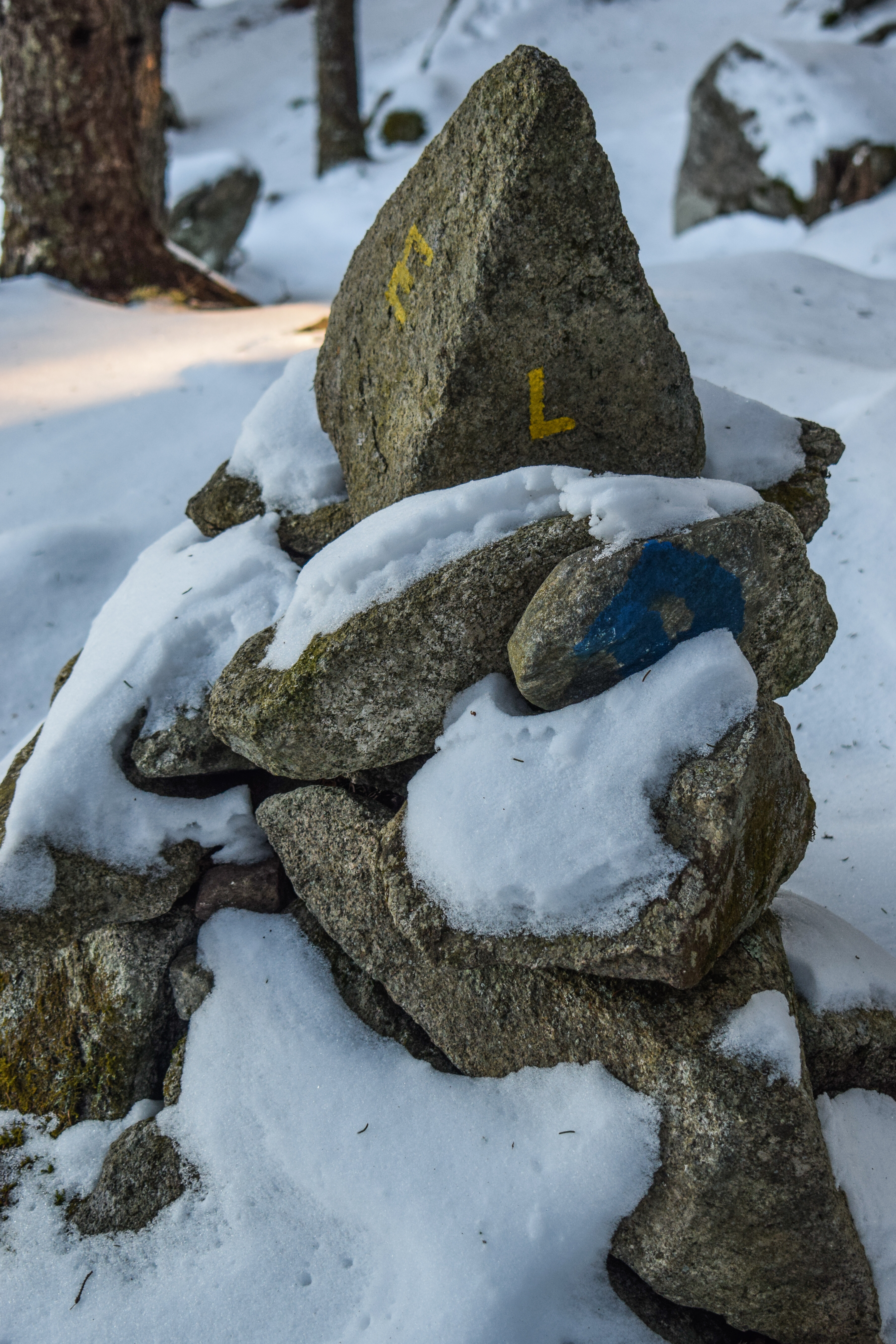
I opted to skip the tower since there were people on it, so as soon as I hit the top I started my trip down the Blue Trail! Once I was descending, I passed the duo I originally saw in the parking lot, and then I noticed that rock with an "L" painted on it. I meant to research the plane crash in this area, but completely forgot until this point - oops!


The trail was a bit squishy with some slushy spots, but overall it was fine. There were nice tree views to Lake Winnipesaukee, and one tricky patch of ice. I made my way to the open meadow and the view of the summit knob of Gunstock, my tummy made some ALARMING sounds, and then I was at the junction with the Saddle Trail.

[9:13am - Junction with Saddle Trail]
The summit to this point was all repeat trail, now I was on new-to-me trail! The forest was now pretty open and the trail was descending with leafy footing. It was a bit confusing in this area, since the NH State Land boundary was also blazed in blue, but I was able to follow the trail without much of a problem. There were again many stone steps, and there was one stream crossing near the end. So far, I was thrilled with my decision to ascend Red and descend Blue, we'll see what Green has in store!


[9:27am - Green (Warden's) Trail]
I continued onto the Green/Warden's Trail and picked up the pace because I was being trailed by two women and their dogs. The trail felt like a classic firetower trail, which was a bit of a bummer. It was much wider than Red and generally eroded footing and a moderate grade. I did appreciate, however, how all three trails were all so different from each other. 


The trail meandered on and off a power cut with slippery, ledgy footing. I caught a partial glimpse of Piper through the trees, and higher up there was a great view over to Ragged Mountain. I think the trail had been partially relocated over the years, since the sections that were not on the power cut felt relatively new. Eventually, the trail dipped into the woods and came to an icy, wet, mossy, slippery, glacial section that was pretty awful, but I imagine would be really pretty when dry.


Eventually, the trail began to calm down and cross some more glaciers in a forest that smelled like a delicious bottle of gin and eventually arrived near the summit plateau. There were some old cabins just off-trail, maybe this used to be a camping area? Or maybe just a part of the warden complex. A mystery!


[9:51am - Belknap Mountain Summit]
The final stretch of trail was narrow and snowy which made for some interesting footing but soon opened up at the tower! I somehow crossed paths with the same duo from the parking lot, which was the same duo I passed up here almost an hour ago? I guess they were also doing multiple laps. I climbed up the narrow-stepped tower, enjoyed some views, and then kept it moving!


[9:55am - White/East Gilford Trails]
I continued to follow the power cut along the White/East Gilford Trails, which enter some beautiful forests. The trail leaves the flat power cut as the power cut nears some communication towers (where I noticed the duo that was trailing behind me on the Warden's Trail, which was confusing). After some gentle descending, the White Trail turns right while the East Gilford Trail continues to descend on slabs on a beautiful, open area.


[9:59am - East Gilford Trail]
This stretch of trail was lovely! It alternated between open, dry slabs with nice views and mossy woods. I was feeling a little nervous about descending on a trail called "Boulder Trail," but so far conditions had been pretty sweet, minus some ice up high. This turn marked a long stretch of trail where I was completely by myself, which was also a delight.


[10:08am - Boulder Trail]
The Boulder Trail turn was well-signed and immedaitely became less-traveled and more rugged, passing a comical stone throne at the beginning. This trail had three-ish distinct, steep slab sections (only the lowest of which was wet and tricky), each with a fantastic view of the interior Belknaps. I heard the thump-thump-thmp-thmp-tp-tp-tp sound of a grouse smacking it wings on the ground (I believe some mating dance type thing) and I could hear wood frogs making their silly croaks and peepers making their high calls from either a vernal pool down low or Round Pond, unsure of which. 


After the third section of slabs, the Boulder Trail arrives at the namesake boulders. They were medium-challenging to navigate around and descend on, but I think they would have actually been very fun to climb up! After a first ridiculous section, the trail flattened for a moment and then continued the steep, bouldery descent, but slightly less brutal in the later half. 


[10:27am - Piper-Round Pond Link]
The second bouldery descent led me to my last longer segment for the day - the Piper-Round Pond Link! It was leafy and quiet in these woods, and the trail sign was delightfully unique. It was nice to hike on relatively flat land, even if the trailbed wasn't super clear and footing super leafy. There was one wet spot that wasn't to difficult to bypass. The trail later turned and climbed to enter into Lakes Region Conservation Trust land.


Further down, I enjoyed the obstructed tree views towards Round Pond and Swett Mountain, and then I saw people! They nearly scared the life out of me, as I had gotten used to my solice. The trail follows a section of sidehill walking, which angered my ankle, and then entered a more open area with tree views over to Piper and its various ledges. Up and down I continued along the trail as I began to get hungrier and hungrier. The trail descended to a tricky to follow section, ascended past a boulder field, and then continued a more moderate to steep ascent to the Piper-Belknap col, where my stomach was NOT feeling good. I was also tired at this point, so my footing was more clumsy.


[10:54am - Old Piper Trail]
[10:55am - White Trail]
For a brief moment, I was in familiar territory on the Old Piper Trail, and then continued onto the White Trail for my last bit of new trail for the day. The footing was still pretty bony but MUCH better than the Piper-Round Pond Link. The air smelled like a cloud, and soon enough I was back on the Carriage Road!


[11:00am - Carriage Road]
My brain turned off for most of the Carriage Road walk. I did notice that the bridges along the road were all marked with "E-2 POSTING," I wondered what that meant? (EDIT: Okay I found this quote online: "The E-2 designation is to exclude all combination and single unit certified vehicles from crossing a specific bridge." - there is more information that I don't fully understand here). Eventually, I arrived back at the pavement, crossed paths with two folks heading uphill, and just when I was really starting to feel the effects of boredom settle in, I saw the Piper Trail! Two folks were just ahead of me, but thankfully the final rude uphill slowed me so we never had to interact.

[11:21am - End of Hike]
Back at the car, it was now 67 degrees out and hinting at rain. This was a great hike! I'm glad I chose to hike the Carriage Road instead of drive it, even if it was boring. Ascending on Red and Green were absolutely the right choices, and my only small regret was descending on the Boulder Trail, but even that wasn't so bad. Time to continue my drive up to Vermont for Easter Sunday!


Step-by-Step
- Park at Lower Carriage Road.
- Start hike on Carriage Road.
- At parking lot, hike to kiosk and hike Wayne's Way to viewpoint.
- Follow spur to trailhead.
- Follow Red Trail to Belknap Mountain.
- From summit, turn left onto Blue Trail.
- Follow Blue Trail to trailhead.
- At trailhead, turn onto Green (Warden's) Trail.
- From summit, continue onto White Trail/East Gilford Trail.
- At split, continue onto East Gilford Trail.
- At jct., turn right onto Boulder Trail.
- At terminus, turn right onto Piper-Round Pond Link.
- At terminus, continue onto Old Piper Trail.
- At jct., continue left onto White Trail.
- At terminus, turn left onto Carraige Road, return to car.

Saturday, January 25, 2025

Gunstock, Belknap, & Piper Mtns. via Lower Carriage Road (Belknap Range)

Gunstock, Belknap, & Piper Mtns. via Lower Carriage Road (Belknap Range)

Hike Type: Loop
Distance: 5.53 miles
Elevation: 1,791 feet
Time: 3 hours, 18 minutes (2 hours, 59 minutes moving)
Hiking Challenges: Belknap Range Redliner, Belknap Range Grid

The Hike
It was going to be a cold, but beautiful weekend! I knew I was going to ski on Sunday, but I wasn't sure how I wanted to spend my Saturday. It was going to be COLD cold up in the Whites, so I ended up decided to make my grand return to the Belknap Range! I was excited for a few reasons: 1) I hadn't hiked in the Belknaps since I finished the Belknap 12 a couple summers ago, 2) the range is MUCH closer than the Ossipees and the Whites, 3) I've been flirting with actively working on the Belknap Grid/Redlining patches, and 4) I could sleep in until my normal weekday alarm! I made it to Hooksett at 5:45am, immedaitely and violently christened the bathroom, got a couple breakfast sandwiches, and made it to the Lower Carriage Road trailhead at 6:45am, joined by no other cars. The last bit of the drive was absolutely beautiful, with the silhouettes of Gunstock, Belknap, and Piper Mtns. greeting me. It was just a little too dark to start hiking when I parked, so I enjoyed the heated seats in my new-to-me car for a little longer before suiting up.


[6:56am: Start of Hike on Gunstock Mtn. Trail]
Eventually, it was time to begin! The temperature was a chilly -1 degree with still air and clear skies. I started in my Nano Puff, Outdoor Research microgrid fleece, and merino wool base layer from Backcountry. There was a thin snow cover on the trail, from 1-3", and besides the sounds of my spikes, it was delightfully quiet. Grades were easy down low, winding through orange and occasional old white blazes. 

My puff came off after 10 minutes as I was desperately trying, as per usual, to regulate my sweat, which has never quite been a skill of mine. A good thing about the loop I chose is that there are multiple bail-out points, all leading back to where I parked my car, just in case I got too cold. I thought I heard a new critter rusling about in the trees making some sound I was unfamiliar with, but it turned out to just be a classic red squirrel cat-calling me. 


My legs were definitely feeling it as the grade gradually steepened - I realize I hadn't worn this pack in a while! The snow was a bit sandy, too, which made for some challenging hiking (I also realized post-mortem that the trail was, in fact, steep, and I was doing absolutely fine). My fleece came off at the 25 minute mark as I enjoyed the beautiful morning light through the trees... and then the grade steepened again, but provided nice tree views over to Piper Mountain.

[7:34am: Winter Shortcut]
I soon made my way to the spot where the trail split - the Gunstock Mtn. Trail turning right, and the Winter Shortcut turning left. I noticed it said the Gunstock Mtn. Trail led to an "overlook," but since it was winter, it felt appropriate to follow the Winter Shortcut! I was immediately greeted by a slab of boilerplate ice hiding under a thin dusting of snow, but I did not fall!


A kind owl cheered me on as I climbed the now steeper trail, which eventually entered a lovely softwood forest. The grade calmed down briefly before continuing the steep climb. There were a few more ice flows, but my Kahtoolas worked fine for all of them. I was glad I brought my Kahtoolas instead of my newer Hillsounds since I was still hitting rocks.


[7:47am: Ridge Trail]
[7:48am: Gunstock Mtn. Trail]
Before I knew it I was on the Ridge Trail, followed immediately by rejoining the Gunstock Mtn. Trail. The trail coincided and led to a beautiful overlook with a slight breeze and the sun! 


[7:55am: Gunstock Mtn. Summit]
I put my fleece back on before following the path to the Gunstock summit, which featured the early morning lift check and one uphiller putting on his downhill equipment. I will say, I've been getting more and more interested in uphilling as of recent... I didn't get too far to the slope to not interfere with the morning ops and not wanting to chew up the fresh cordurory. The sun felt DELIGHTFUL, but I didn't stay long, as it was now -3 degrees and breezy outside of the woods. 


[7:56am: Brook Trail]
I was now following the Brook Trail, which had a thin cover of snow and ice and many ski tracks. There were also many picnic tables scattered about, each far enough away from the previous that you couldn't see one from the other.  


[8:03am: Saddle Trail]
Next up was the Saddle Trail, which rightfully leads to the saddle/col between Gunstock and Belknap Mountains. It was beautiful, too!


[8:07am: Blue Trail]
The Saddle Trail was short, through, and soon led to a junction with the Blue Trail, which led to Belknap Mountain's summit. The trail also enters Belknap Mountain State Forest, here. The trail was wonderfully laid out, interspersing climbs with flats, all through some really beautiful forest. I could hear the main summit lift of Gunstock Mountain while enjoying some seasonal tree-views to Lake Winnipesaukee. 


I was wishing I had my anemometer when I reentered some denser forest and met with a COLD breeze. I can't imagine the temperature has risen much since my hike began at this point. I snapped out of my frozen climb when I noticed footsteps leading off-trail - I remembered that there was a plane crash somewhere on the mountain, but it turns out these footsteps just led to a rock with an "E" and "L," which I initially thought might be a town marker, but I'm not sure what the letters would stand for (the "L" could be Laconia, but no idea!). 


The final bit up to the summit was covered in bunny tracks, but no bunnies. I soon saw a cabin off in the woods, and made it to the summit!


[8:28am: Belknap Mtn. Summit]
The summit of Belknap Mountain itself is uneventful, but a climb up the tower reveals some nice views toward mountains near and far, notably the White Mountains. The climb up the tower itself was steep and narrow, which overall made me feel super uncomfortable, but I've never passed up a fire tower view and I wasn't about to start!


[8:33am: White Trail]
After a brief visit and a few photos on the tower, I was continuing on, now on the White Trail. I realized I kept forgetting to take one second videos for my "1 Second Everday" app, but hopefully I'd remember on Piper Mountain. After the visit to the fire tower, my camera battery was officially dead. In a case of desperation, I put the battery in my chest pocket, took some photos on my phone, and continued on.


The White Trail split in a very open area that nearly gave me snow-blindness (let this be a memo to remember to pack sunglasses!), but soon went back into the woods. Now descending, the trail was a bit steep and dicey at spots, as there was bare ledge and ice underneath the snow. I switched my camera battery from my chest pocket to inside of my mitten, and it worked! My battery was now "charged" to 50%!


Continuing to descend, I arrived at a sunny area with young trees, which allowed the sun to touch my frozen body and warm my soul. This led to a lovely ledge with a great view of Piper Mountain, and then dipped back into the woods for a spectacular stretch of sketchy boilerplate ice. Thankfully, this led to another view!


[9:03am: Old Piper Trail]
I met the Old Piper Trail in the Belknap-Piper Col, which I followed up and over to begin a gradual ascent of Piper Mountain. I passed the Round Pond-Piper Link trail, which was not broken out (I thought about extending the hike some pending trail conditions - not today!). The Old Piper Trail was beautiful the whole way, and I found my first person of the day after 2+ hours! He was Civilized Hiking with a coffee in hand, which brought me joy. 


The Old Piper Trail passed a few ledges with a view into the Moulton Brook Valley and steepened - my hat officially came off for this climb (and revealed a couple strands of hair that had an impressive round icicle about 0.5" in diameter. I passed another person about 5 minutes later who said to me "yay you're only wearing spikes!" which also made me chuckle. I eventually made my way to the terminus, which was Piper Mountain's North Peak. There were two people there, and one said something to me after I said "good morning!" I didn't hear what he said, and he didn't look away from me, so I just said "beautiful day!" and got more blank stares... that was strange.


[9:19am: Piper Mtn. North Summit/Piper-Whiteface Link]
From here, I was definitely going to hit the south peak of Piper Mountain to connect the dots from a previous hike, but I was also flirting with hitting Swett and/or Whiteface, too. That flirting was quickly extinguished when I realized the trail was much less traveled at this point, and snowshoes would have been a better option. 


[9:26am: Piper Mtn. South Summit]
I made it to the south summit, snapped a few photos, and decided to save the other trails for another day. At this point, it was lovely out - still cold, in fairness, but sunny and beautiful. I was enjoying the view when I realized that the sweat on the rear end of my pants was officially frozen... time to get moving again!


[9:36am: Piper Mtn. North Summit/Piper Mtn. Trail]
Back at the North Summit, I admired the view towards Belknap Mountain before starting my descend via the Piper Mountain Trail. It was ledgy up top, with a nice view of Kearsarge (south) ahead. Overall, with spikes, footing was good! Further down, the trail left Lakes Region Conservation Trust Property, and eventually paralled the New Hampshire State Forest boundary. At this point of the day, I was HUNGRY. I had another sandwich in my pack, but I was too close to the car to stop (this is not true, and I should have ate it when I was at the viewpoint, but I was stubborn as per usual). 


Down low, the trail crosses a brook on a bridge. The brook was frozen over, but I could hear the running water underneath, which was fun!


[10:09am: Carriage Road]
The Piper Mountain Trail terminates at the Carriage Road, which leads back to the parking area, first over a bridge and then uphill to the gate. 


[10:12am: End of Hike]
Back at the car, I changed my clothes and reflected on what a lovely hike that was! Although shorter than I had initially planned/flirted with, it was an excellent loop that I would absolutely do again (after I hike all the trails in the range, of course). It was now a toasty 15 degrees! I flirted with skiing the second half of the day somewhere, but Sarah and I had plans to ski at Ragged Mountain the next day, so I headed home for a nice, relaxing afternoon.


Step-by-Step
- Park at Lower Carriage Road parking.
- Start hike on orange-blazed Gunstock Mtn. Trail. 
- At jct., turn left onto green-blazed Winter Shortcut.
- At terminus, turn right onto white-blazed Ridge Trail.
- Follow signs to Gunstock Mtn. Summit, continue on yellow-blazed Brook Trail.
- At jct., turn right onto white-blazed Saddle Trail.
- At jct., continue onto blue-blazed Blue Trail.
- From summit of Belknap Mountain, turn left onto white-blazed White Trail.
- At jct., turn left onto orange-blazed Old Piper Trail.
- At jct., continue onto green-blazed Piper-Whiteface Link.
- At South Peak of Piper Mountain, turn around.
- At jct., turn left onto red-blazed Piper Mtn. Trail.
- At terminus, turn left onto Carriage Road and return to car.


"Gunstock Mtn. Trail" from Southern New Hampshire Trail Guide, 5th Ed. (2021)
This orange-blazed trail leads from the lower end of Carriage Rd. to the summit of Gunstock Mtn. and makes possible a loop hike including Gunstock, Belknap, and Piper Mens. with descent via Piper Mtn. Trail. Grades are steady and occasionally steep. Gunstock Mtn. Trail departs Carriage Rd. at a sign on the left (north) side, 0.3 mi. from Belknap Mtn. Rd. and 60 yd. beyond the gate; parking is available on the left just before the gate.
        Leaving the road, the trail climbs steadily northeast and then north up a minor southwestern ridge of Gunstock Mtn., passing through a stone wall at 0.3 mi. It rises into ledgy oak woods, bearing right (northeast) at 0.6 mi. At 0.7 mi. it bears right again where green-blazed Winter Short Cut diverges left. (This alternate route, less ledgy than the main trail, ascends steeply for 0.3 mi. to Ridge Trail, 35 yd. below that trail's junction with Gunstock Mtn. Trail.) [...]. Just above, an obscure path leads 20 yd. right to a ledge with an improved view south, and then white-blazed Ridge Trail joins from the left (sign). Blazed in both white and orange, the combined trails pass an outlook to the east and climb steadily to a junction with Brook Trail on the right and turn left; in another 40 yd. the three combined trails, now marked in orange, white and yellow, emerge at the summit beside the Safety Services building of Gunstock Mtn. Resort's ski area. The top of the ski slopes a short distance ahead offers fine views. To the right, a ski trail leads 30 yd. down to the upper terminus of Brook Trail.
        Combined Gunstock Mtn. Trail and Ridge Trail, and Brook Trail begin the descend behind the left side of the Safety Services building and adjacent restroom (signs; orange, white, and yellow blazes).

"Saddle Trail" from Southern New Hampshire Trail Guide, 5th Ed. (2021)
This very short, white-blazed trail, also a segment in Belknap Range Trail, connects the col between Belknap Mtn. and Gunstock Mtn. with Brook Trail. Leaving the junction with Overlook Trail and Blue Trail in the col, it crosses the flat sag and climbs moderately to the junction where Brook Trail enters on the right.

"Blue Trail" from Southern New Hampshire Trail Guide, 5th Ed. (2021)
This blue-blazed trail runs from the upper parking lot on Carriage Rd. to the summit of Belknap Mtn. It follows the extension of the carriage road past the warden's garage and the junctions with Warden's (Green) and Red trails on the right, descends slightly to cross a brook, and then diverges right and climbs to the Belknap-Gunstock col at 0.6 mi. Here, orange-blazed Overlook Trail continues straight while white-blazed Saddle Trail diverges left for Gunstock Mtn. Blue Trail, now coinciding with Belknap Range Trail, turns right and climbs, crossing a meadow with a limited outlook to Gunstock Mtn. at 0.7 mi. It passes a cleared outlook north on the left at 1.0 mi. and continues at easier grades up through coniferous woods to the summit. Descending, Blue Trail starts near the northeast side of the summit's fire tower. 

"White Trail" from Southern New Hampshire Trail Guide, 5th Ed. (2021)
This white-blazed trail ascends to the summit of Belknap Mtn. via the Belknap-Piper col. It begins on Carriage Rd. about 0.2 mi. below the upper parking area, just below the highest bridge; there is no parking here. White Trail ascends 0.2 mi. to a point about 50 yd. below the pass between Belknap Mtn. and Piper Mtn. and turns left where orange-blazed Old Piper Trail continues straight to the pass and then turns right to Piper Mtn. White Trail winds up a relocated section to an outlook to the south and west on the right at 0.6 mi. from the upper parking area. Here, the trail turns sharply left and reaches an excellent outlook to the southeast, where it turns left again. White Trail soon swings right and climbs steadily, passing through some beautiful, shady coniferous woods, to the junction with East Gilford Trail, which enters from the right on the ledges at 1.1 mi. The two trails, which also coincide with Belknap Range Trail in this segment ascend together (now blazed in both white and yellow) at na easy grade leading north. They soon swing right onto a relocated section around a communications tower and then rejoin the original route and follow it under a power line to the summit and fire tower.
        Descending, White Trail and East Gilford Trail begin at the summit ledge on the south side of the fire tower, they follow a power line for 70 yd. and then diverge left onto the relocation.

"Old Piper Trail" from Southern New Hampshire Trail Guide, 5th Ed. (2021)
This orange-blazed trail ascends Piper Mtn. from White Trail 0.4 mi. from the upper parking area on Carriage Rd. and 50 yd. below the Belknap-Piper col. It turns right upon reaching the col, and in 30 yd. it passes a junction on the left with the green-blazed Round Pond-Piper Link, which joins Belknap Range Trail at the bottom of Boulder Trail and continues onto Round Pond. Old Piper Trail ascends at easy grades for 0.2 mi. and then climbs moderately through woods and over ledges, passing an excellent outlook east over the Moulton Brook valley at 0.3 mi. It emerges on open ledges by an east-facing rock throne at the north summit of Piper Mtn., where it meets Piper Mtn. Trail and Piper-Whiteface Link.

"Piper Mtn. Trail" from Southern New Hampshire Trail Guide, 5th Ed. (2021)
This red-blazed trail provides direct access to Piper Mtn. from the lower end of Carriage Rd. Grades are mostly moderate. The trailhead on the right (south) side of Carriage Rd. is 0.4 mi. from Belknap Mtn. Rd., just beyond a bridge over Gunstock Brook. Parking is available 0.1 mi. below the trailhead (on the left, just before the gate) or 0.1 mi. above it (a pull-off on the right); parking is not permitted at the trailhead itself. 
        Leaving Carriage Rd., Piper Mtn. Trail soon swings left and crosses a footbridge over a brook; then it ascends rather steeply along the blue-blazed boundary of Belknap Mtn. State Forest. At 0.2 mi. the grade eases as the trail enters private land that has been selectively logged. At 0.6 mi. the trail crosses a muddy logging road (go straight across, following signs and blazes), leaves the logged area, and ascends through mixed forest. At 0.8 mi. Piper Mtn. Trail swings left and climbs through a ledgy area, passing a restricted outlook northwest. It continues climbing over ledges and through patches of oak woods, with several turns; follow blazes and cairns carefully. Passing a good view southwest to Mt. Kearsarge at 1.1 mi., the trail continues up through spruce forest and emerges on open ledges at the north summit of Piper Mtn. A stone chair here offers a view seat. The trail continues another 25 yd. across open ledges to a second rock throne, with an excellent view east. Orange-blazed Old Piper Trail joins from the left (north) and green-blazed Piper-Whiteface Link joins from the right (south). Descending, Piper Mtn. Trail drops northwest into the woods from the west-facing rock throne; look for a fingerline cairn with a red blaze.