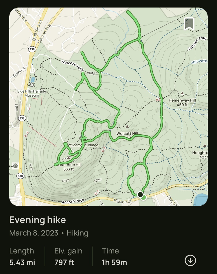
Great Blue, Accord, Halfway, Houghton, Puddle (Blue Hills Reservation)
Hike Type: Loop with Spaghetti
Distance: 8.96 miles
Elevation: 1673 feet
Time: 3 hours, 38 minutes (3 hours, 34 minutes moving)
Hiking Challenges: 52 Hike Challenge, Blue Hills 125 Mile Club, Sunset Six, Summit Beer Society, Great Blue Summits, Blue Hills Grid
Hiking Challenges: 52 Hike Challenge, Blue Hills 125 Mile Club, Sunset Six, Summit Beer Society, Great Blue Summits, Blue Hills Grid

The Hike
A big afternoon in the Blue Hills! Weather was supposed to be beautiful, so I planned a long hike that would hopefully get me back up top for sunset - completing my Sunset Six challenge (it worked!). I drove to the Trailside Museum/Ski Area parking area after school, got suited up, and started my afternoon hike soon after.
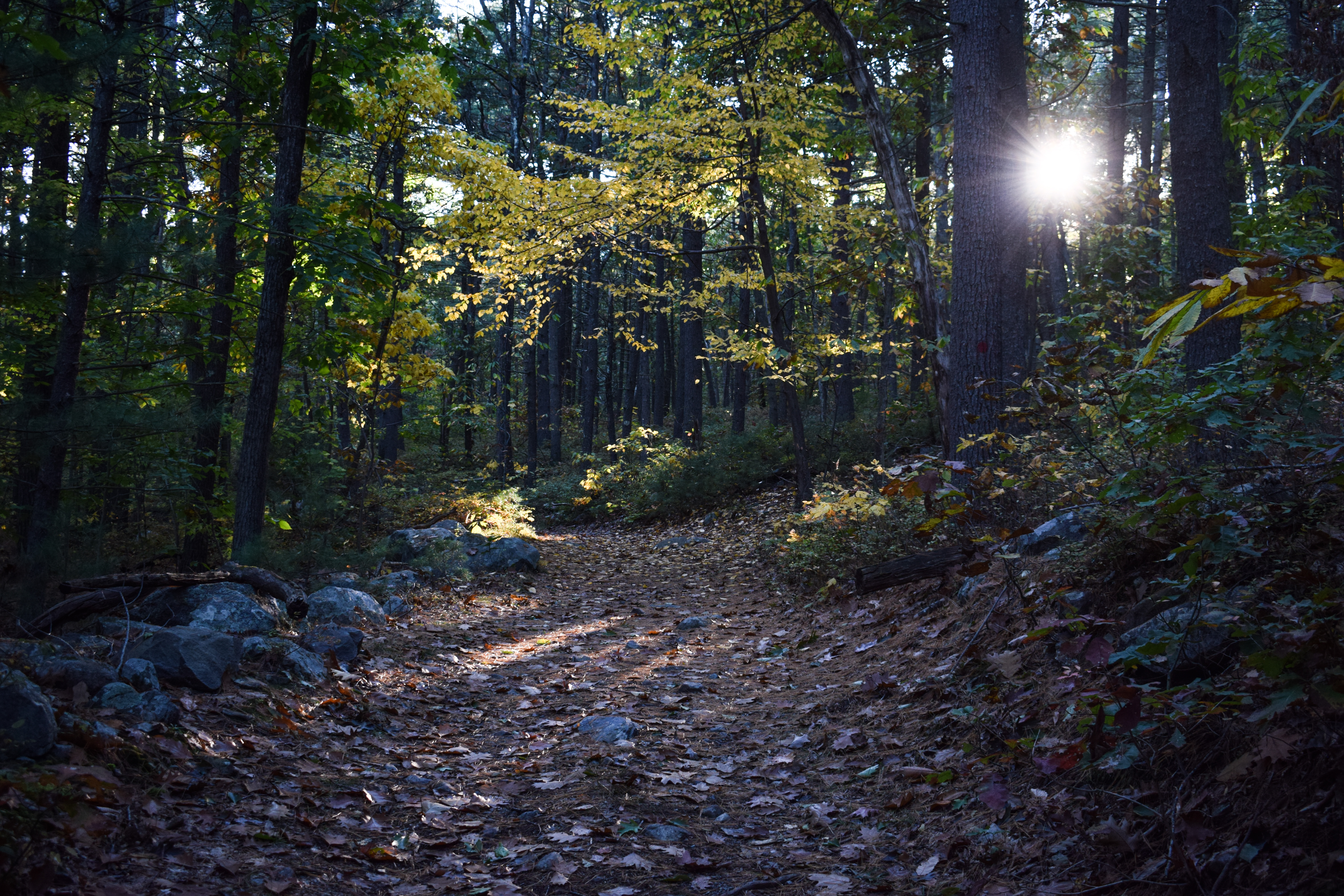
I kept going back and forth with my plan, originally involving going up Eliot Path, down Skyline to 138, and then hitting the west side of Accord via out-and-back, but then I thought to start the hike on Accord and go up Skyline, but then I saw the "Accord Path Closed for Winter" sign, but winter was over, but then I saw workers at the ski area and finally decided to stick to the original plan - up Eliot Path I go! I'm always a big fan of this trail. Just steep enough to get the heart pumping, but not as ridiculous as the Skyline Trail(s). My legs were a bit tired from my jaunt around Wachusett, but the beautiful weather - warm sun, cool breeze - kept me going. I passed a few people and one LARGE group of children, and before I knew it was back up top! I followed the Eliot Circle counter clockwise to the summit road to hit the true summit and noticed the scaffolding was off of the weather observatory - yay!

From the summit I continued down the gravel path to the Skyline Trail and descended the comically steep trail all the way to MA-138. I realized if I descended via Skyline after sunset I could hit the final stretch of Accord Path without doing an out-and-back, so the first change of plans was officially in effect! I followed the Accord Path around the base of Great Blue Hill, making my way to the Brookwood Trail. The Accord Path would be a beautiful hike if there were less leaves at the curve. I'm also very curious about the old Cliff Trail - there were a few herd paths leading up - I'm sure it was a beautiful, strenuous hike. I passed the mysterious granite marker along the Accord Path and realized that it's in-line with an old stone wall... maybe it's a town boundary?

The next section of my hike involved a LOT of wiggling steeply up and down with the Accord Path, Brookwood Trail, Halfway Path, Five Corners Path, Raccoon Hollow Path, and a few no-name spurs. I surprisingly passed my only other person on the Brookwood Trail of all place, and he had headphones in so he did not hear me say hello. I may have spooked him when I passed him - he loudly said "HELLO" I gave a smile and a wave... a bit strange but I'm glad he was enjoying his hike!
I could help but appreciate how nice the dry(er) trails felt compared to my last two hikes at Wachusett - it was revitalizing! There were some slippery leaves at the steeper areas, but overall trail conditions were great. I always wonder what cars think when they see me walk up to the road and immediately turn around - especially at the spur to the stop sign with Blue Hill River Road/Hillside Street when I had a cut up leg from all the prickers. I was DELIGHTED to see that the ever-flooded area where the Accord Path connects to Raccoon Hollow was easy to cross.
Now my main wiggling was finally complete, I turned onto the Raccoon Hollow Path to start ascending up near Houghton Hill, took the rest of the Halfway Path to meet Skyline, and then found the summit of Houghton Hill without too much difficulty. My lungs were PUMPING, but it was still a beautiful day. I couldn't help but notice some a**hat decided to spraypaint the blue blazes a different shade of blue, which is just icky. It's not like the blazes have been neglected or they were unclear. I'm sure they were just trying to help, but it's irritating. ANYWAY, I made my way over to Times Square (1141), and thought I was taking the Five Corners Path, but accidentally took the Raccoon Hollow Path. Thankfully, I've hiked here enough now to realize when I've messed up, and to also have solutions. I took Rotch Path to the unnamed trail at 1121, and then hit the final section of Five Corners Path that I needed.

I made my way onto the Border Path, hiked a small bit I had left of Wolcott Path, and then took the Samoset Path up to meet the Puddle Path for my "final ascent." My legs were for sure beat at this point, but I was nearing 8 miles, so I was definitely feeling good about myself. I continued along, decided to skip the Eliot Tower just so I would definitely make the sunset, got a few pictures at the top of the ski area, hit the true summit, and then stationed myself ~10 before sunset along the Skyline Trail. It was COLD now, but peaceful and gorgeous. I was completely alone, I enjoyed a beef stick and a summit beverage (my favorite, pumpkin mule), and saw the sun reappear from behind the clouds. It was beautiful. As the sun got lower while still behind, the horizon began to light up, starting with the ground and then the horizon filled it. There was almost a flash when the sun finally dipped below the clouds, and then it peacefully set. I can't get over how beautiful it was! I'm so lucky I get to do this. I'm also so grateful for the Sunset Six challenge for inspiring me to take my time and actually watch the sunsets.

My return trip was quick and easy (the drink probably helped a little...). I scooted my way down Skyline with minimal knee pain, and Accord Path was straightforward. There was a beautiful almost-full moon above the ski slopes, and some folks still working on the chair lift (thankfully no one yelled at me!). There were traces of ice left on the snow, but it was almost fully melted at this point. What a great afternoon!
Writing this a couple days later, I will say that my power hiking did bite me back a little - I had activated some plantar fasciitis I haven't dealt with in a while the following morning. Thankfully I'm already doing much better.

"The beautiful thing about the Blue Hills is that the trail system mimics the Boston Streets... a complete beautiful mess."
Step-By-Step
- Park at Trailside Museum/Ski Area Parking.
- Start hike by walking to Accord Path, but don't be sure if its open or not, so go up Eliot Path instead.
- At 1055, turn right onto Eliot Circle.
- At Summit Road, turn left onto Summit Road.
- Summit Great Blue Hill.
- Descend via Gravel Road.
- Turn right onto Eliot Circle/Skyline Trail.
- At 1030, turn left onto Skyline Trail.
- At 1001, turn around.
- At 1003, turn right onto Accord Path.
- At 1062, hike to road and back.
- At 1062, turn right onto Accord Path.
- At 1081, turn around.
- At 1062, turn right onto Brookwood Trail.
- At terminus, turn left onto Wildcat Notch Path.
- At jct. with Raccoon Hollow Path, turn around.
- At 1093, turn right onto Half Way Path.
- At 1081, turn left onto Accord Path.
- At 1086, turn right and hike spurs to parking areas - then retrace steps.
- At 1086, continue right onto Wildcat Notch Path.
- At 1093, turn right onto Half Way Path.
- At jct. with Raccoon Hollow Path, turn left onto Raccoon Hollow Path.
- At 1120, turn left onto Five Corners Path.
- Hike mini loop to and from parking area.
- Follow Accord Path toward Raccoon Hollow Path.
- At jct. with Raccoon Hollow Path, turn left onto Raccoon Hollow Path.
- At next jct., turn right onto Half Way Path.
- At 1143, turn left onto Houghton Path.
- Immediately after, turn right onto Skyline Trail.
- Summit Houghton Hill.
- Hike western side of Houghton Hill Path.
- At terminus, turn left onto Wolcott Path.
- At 1141, continue straight onto Wolcott Path.
- At 1122, turn right onto Rotch Path.
- At 1121, turn right onto trail.
- At 1140, turn left onto Wolcott Path.
- At 1135, turn left onto Border Path.
- At 1100, turn left onto Wolcott Path.
- At next jct., turn around.
- At 1100, turn left onto Samoset Path.
- At 1105, turn left onto Puddle Path.
- At 1103, turn right onto Wildcat Notch Path.
- At 1092, turn sharply right onto Raccoon Hollow Path.
- At summit plateau, turn right onto Eliot Circle.
- At jct. after crossing Summit Road, turn left to summit Great Blue Hill again.
- Follow gravel road down.
- Turn right onto Eliot Circle/Skyline Trail.
- At 1030, turn left onto Skyline Trail.
- Watch sunset, then descend.
- At 1003, turn right onto Accord Path.
- At 1050, hike to 1002 and turn around.
- At 1050, turn sharply left and hike Accord Path.
- At terminus, hike across ski area and to parking lot.