Showing posts with label Fox Hill. Show all posts

Sunday, April 26, 2026

Fox Hill, Old Furnace Brook, Sawcut Notch, Pine Tree Brook Paths (Blue Hills Reservation)

Fox Hill, Old Furnace Brook, Sawcut Notch, Pine Tree Brook Paths (Blue Hills Reservation)

Hike Type: Loop w/ Spurs
Distance: 4.96 miles
Elevation: 469 feet
Time: 1 hour, 30 minutes
Parking: Pull-off on side of Chickatawbut Road where the Skyline crosses before climbing Wampatuck Hill.
Hiking Challenges: Trail Trace the Blue Hills (2x)


The Hike 
The final day of April Vacation! Instead of mourning the loss my beloved or panicking about returning to school, I decided to get a nice hike in the Quincy area of the Blue Hills before Ray and I do a big spring clean of the house. I made it to the trailhead at 4134 at 8:15am already suited up. It was 47 degrees, so I had a long sleeve on with shorts, and it was cloudy and chilly. I was feeling dreadfully unmotivated, but I knew I would feel better onc emoving. The goal was to get some trails around Fox Hill and Little Dome for my Trail Trace the Blue Hills map!

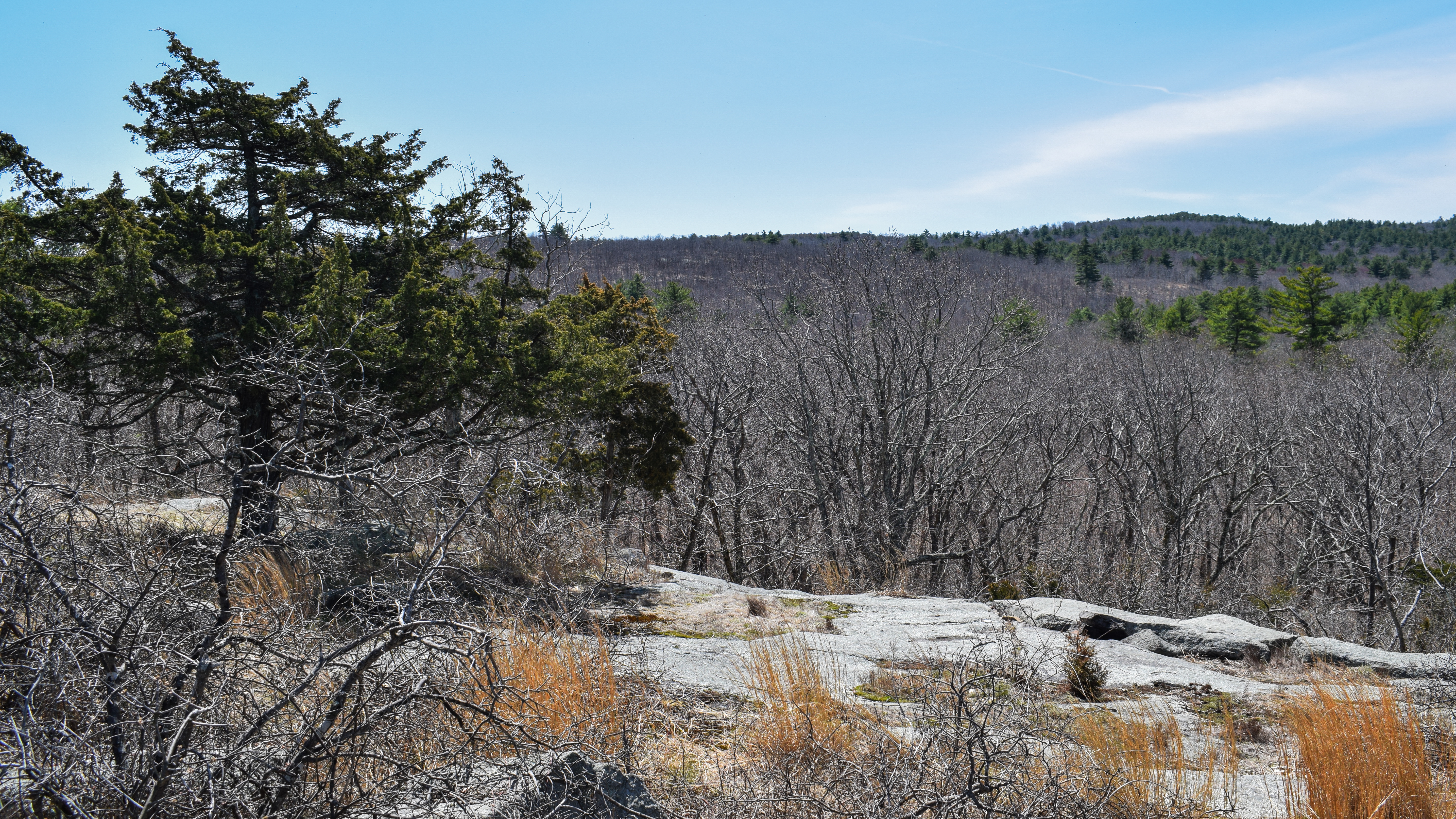
I started by hiking the series of trails around the Pipe Line, which was starting to come back to life (not too quickly, though, thankfully). I then worked my way over to Fox Hill, where my puffy came off, and I was passed by a tiny yellow bird that refused to stay still for a photo. There were actually SO MANY birds around Fox Hill, but none of them would pose for photos. I almost got one robin, but it kept moving, and another Eastern Towhee (thank you, Merlin Bird ID) did it's best to smile. The trail down the north side of Fox Hill was MUCH easier to follow when there isn't snow on the ground, and it looks like it's even been brushed recently!

After Fox Hill, I continued onto the Furnace Brook Trail, which was fully of vibrant skunk cabbage. I continued again onto the Old Furnace Brook Path, following horse prints and and many Eastern Towhees working on their nests. 

I eventually made my way onto the Sawcut Notch Path, where I sadly began to run into people. There were many cardinals singing (again, thank you Merlin) as I hiked to the road and turned around to walk all the way down to Little Dome, walking through the Sawcut Notch and the weird, vibrant, rust-colored mud that simply must be an ecological hazard. 

At the corner of Sawcut Notch, there was a relatively new arrow plackard pointing where the trail turns, but I stayed right to hike towards the Pipe Line plant place - which I could soon hear through the woods. I passed the first tent catepillars of the season, and I felt a sense of dread because the non-trail stretch of the Pipe Line from the plant was VERY flooded.

I continued around the plant and hiked the Pipe Line section that's always awful, and it was... awful. Not like, god awful, but pretty bad. I made it through with only a wet toe, so I'll take that as a win! I made a wiggly return back over Fox Hill and back to the car in time for spring cleaning! I wanted to add on the reservoir, but I needed to grocery shop before cleaning, so time to be an adult!

Step-by-Step
- Park at 4134.
- Start hike on path, veering left.
- At 4131, turn right onto Crag Trail.
- At jct. with Pipe Line, turn sharply left.
- At jct., turn left.
- At terminus, turn right.
- At Pipe Line, turn right.
- At jct., turn around.
- At terminus, turn left onto Fox Hill Path.
- At Fox Hill summit, turn right onto path.
- At 4120, continue onto Furnace Brook Trail.
- At 4142, turn right onto Crags Foot Path (green).
- At 4145, turn left onto Old Furnace Brook Path.
- At 4180, turn right onto Sawcut Notch Path.
- At Skyline Trail, turn around.
- At jct. near Little Dome, continue straight/right.
- At gas plant, turn left onto Pipe Line.
- At 4094, turn left onto Pine Tree Brook Path.
- At 4084, turn left onto White Tail Path.
- At 4096, turn right onto Fox Hill Path.
- Return to car via Pipe Line and nearby trails.

Tuesday, February 10, 2026

Furnace Brook, Short Path, Fox Hill Loop (Blue Hills Reservation)

Furnace Brook, Short Path, Fox Hill Loop (Blue Hills Reservation)

Hike Type: Tracing Loopty-Loop
Distance: 5.30 miles
Elevation: 551 feet
Time: 2 hours, 35 minutes
Hiking Challenges: Blue Hills Winter Trace (2x), 52 Hike Challenge 2026; Blue Hills Grid


The Hike 
The plan for today was to ski at Magic Mountain, but with ambient temperatures of -10°F and forecasted wind, we decided we didn't want to drive three hours both ways to freeze. Instead, I have a lovely introverted day and made way back over to the Blue Hills, where it was a balmy 6°F! I had already completed the St. Moritz Area, so I planned to finish the trails east of Fox Hill/Little Dome today. Based on my last hike, I started in snow shoes, which were beyond necessary. There were no clouds, abundant sun, a fresh coating of 2-3" of snow, and just a slight breeze.

I am getting a sick joy in packing down a choppy trail, which is just what I did with the Shawmut Path and the connector to the Skyline Trail along Rattlesnake Hill (even though I tripped on myself and went down into 2' of unconsolidated snow). 

My Nano Puff came off in the Rattlesnake/Crags col. The only cold part of me were my toes, which warmed up after about 20 minutes. I did buy the snow gaiters, but they hadn't come in yet, so my ankles where already coated in snow. I also think I might buy some earmuffs...

There was a cold headwind on the Old Furnace Brook Trail but there was no breeze on the Short Path, which actually had me almost breaking a sweat! I found myself really enjoying these last few snowshoe hikes. I feel like they're helping build my confidence for when I get back up to the Whites (more on that soon...). Also, these COLD temperatures we've been getting in the Boston area have also been conditioning me.

There were MANY deer tracks all around Fox Hill, and it looked like the path descending off the summit was not yet broken out... I might go for it later... I passed the first people of the day at 11am and they were three snowshoers who were really cruising. Once I made it to the Great Dome Foot Path I noticed that it was 100% unbroken (well, 99%, one deer had traveled the path in the past week). I decided it was time to truly break trail for the first time!

I sunk about a foot with each step, but the snowpack was at about two feet, so the snowshoes were doing their job! To my delight, the single deer actually followed the foot path perfectly, which is crazy to me. I stumbled over a few logs and rocks, but otherwise it was smooth, slow sailing. I was starting to break a sweat, though! I descended to the Pine Tree Brook, carefully crossed it, and then truly stumbled up the embankment on the other side with my televators (and following the deer tracks still!). I was HUFFING and PUFFING at this point, but feeling good! It felt really cool to be surrounded by just a blanket of snow. 

There was one set of old tracks on the Pine Tree Brook Path, or I thought there were... it was another deer! More breaking out! Thankfully the snow wasn't too heavy. The White Tail Path was also untraveled, and I think I truly did a horrible job following the trail up. I basically zig-zagged up the shoulder and then did my best to follow the dotted line on AllTrails. I felt a huge relief once on the Fox Hill Path, which had a dusting of snow on a firmer trench. 

But don't worry, I was back to only deer tracks for my descent. I made it to the little knob before truly descending, and saw one of the deer in question! After that knob, the deer tracks fully disappeared and I was on my own. Again, I did the best I could, but definitely did not thrive. For the final steep descent I felt like I was basically moon walking down the hill! I did get a cool view of the Crags, which was nice.

The last stretch of trail I needed for the day was the little loops near the Pipeline between Wampatuck and Fox Hills, which were also mostly unbroken... I was tired! It was good to know how breaking trail felt and how it impacted my body. I did a little bit of retracing my steps at the end to avoid the Skyline Trail up and over the Crags, and then I was back at the car! My socks were soaked and snowballs were frozen to the tops of my boots. It was a toasty 19°F once back at the car, and I was feeling tired, but good!

Step-by-Step
- Park at Shawmut Path trailhead.
- Start hike at Shawmut Path.
- At Crags Foot Path (green), turn around.
- At jct., turn right toward Rattlesnake Hill/Skyline Trail.
- At terminus, turn left onto Skyline Trail. 
- In col between Crags and Rattlesnake Hill, turn right.
- At terminus, turn left onto Crags Foot Path (green).
- At jct., turn left onto Crag Trail.
- At 4135, turn left onto Indian Camp Path.
- At 4155, turn left onto Skyline Trail.
- After, continue left onto Crags Foot Path.
- At 4145, turn right onto Old Furnace Brook Path.
- At 4180, turn left onto Sawcut Notch Path.
- At 4133, turn left onto Short Path.
- At 4124, turn left onto Crags Foot Path (green).
- At 4142, turn right onto Furnace Brook Trail.
- At 4120, turn right onto Indian Camp Path (green).
- At 4090, turn left onto Great Dome Foot Path.
- At 4073, turn right onto Pine Tree Brook Path.
- At 4080, turn left onto White Tail Path.
- At 4096, turn right onto Fox Hill Path.
- At Fox Hill Summit, turn left and descend on path.
- At 4120, turn right onto Indian Camp Path (green).
- At 4135, turn right onto Pipe Line.
- Hike network of trails around the southern Pipe Line, then turn around and return to 4135.
- At 4135, continue off of Pipe Line onto Crag Trail.
- At terminus, turn right onto Crags Foot Path (green).
- At next jct., turn right.
- At terminus, turn left onto Skyline Trail.
- At next jct., turn right.
- At terminus, turn right onto Shawmut Trail.
- Follow Shawmut Trail to car.

Sunday, January 25, 2026

Quincy Hills Loop via St. Moritz Ponds (Blue Hills Reservation)

Quincy Hills Loop via St. Moritz Ponds (Blue Hills Reservation)

Hike Type: oo-O Loop
Distance: 5.13 miles
Elevation: 600 feet
Time: 1 hour, 52 minutes
Hiking Challenges: Blue Hills Grid, Blue Hills Winter Trace (2x)


The Hike 
Although I still wanted to be skiing, the ridiculous cold up north and impending snow storm kept me local. It was a balmy 10 degrees and I forced myself out the door to explore some of the Quincy area of the Blue Hills for my second winter map. The storm was slated to start around noon, so I figured a 9:00am start would be good! 

I started with spikes on after walking the sidewalk past the Shea Memorial Rink and the plan was roughly a wide loop hitting all the hills on this side of the park, Skyline Trail to Fox Hill to Sawcut Notch. Even with it being 10 degrees, the Nano Puff came off soon into the hike. I followed the Firepit Path around the totally frozen St. Moritz Pond and I was still feeling warm with two pairs of leggings on under my pants. 

I crossed Wampatuck Road and took my fleece off at the Quarry before hitting Rattlesnake Hill (which had one persons' footprints) and The Crags before a rough descent down with not enough snow for spikes, but I had already committed. 

After working my way up Wampatuck Hill, I giggled at seeing the mall, since I had just stopped there to grab a few things from Target before the storm. There was a bit of a breeze near Chickatawbut Road so I began to pick up the pace to stay warm as I climbed up Fox Hill, and I was rewarded with a lovely tree view to Boston as I descended. I put my fleece back on once at the bottom and continued on!

I wiggled my way over to Sawcut Notch Path and took a quick bushwhack to Little Dome, which only had deer tracks. I continued on to Great Dome, which similarly only had deer tracks (but also some orange flagging tape?). I love these two little trail-less hills - they both have humble views and feel very remote for being in the Blue Hills. I also felt wildly satisfied hitting all five hills in this stretch of the park in one hike!

After descending Great Dome, I began to hear the pitter-patter of falling snow, and then it increased! Seemed like the storm was starting a couple of hours early! I passed my first and only person near Wampatuck Road, and I made it back to my car in time to see all of the salt trucks congregating in the Shea Memorial Rink parking lot. The drive home was a little slippery, but I made it back in time to hunker down and do some Legos!

Step-by-Step
- Park at Shea Memorial Rink.
- Turn left onto Willard Street.
- Turn left onto path.
- At jct., turn left onto Skyline Trail.
- At jct., turn right onto Winter Carnival Path.
- At terminus, turn right onto Minichiello Path.
- At jct., turn right onto Firepit Path.
- At terminus, turn left onto Skyline Trail.
- Cross Wampatuck Road, follow Skyline Trail to 4134.
- At 4134, turn right onto path.
- At terminus, turn left onto Water Pipe Line.
- At terminus, turn right onto Fox Hill Path.
- At 4102, turn left onto Indian camp Path.
- Before 4091, turn left onto path.
- At 4083, turn right onto Sawcut Notch path.
- Hike unmapped spur to Little Dome, then continue on Sawcut Notch Path.
- Hike unmapped spur to Great Dome, turn conitnue on Sawcut Notch Path.
- Merge with Skyline Trail.
- Follow Skyline Trail back to car.

Friday, April 18, 2025

Chickatawbut Skyline Trail, Fox Hill, Little & Great Domes (Blue Hills Reservation)

Chickatawbut Skyline Trail, Fox Hill, Little & Great Domes (Blue Hills Reservation)

Hike Type: o-o Loop
Distance: 6.71 miles
Elevation: 758 feet
Time: 2 hours, 23 minutes
Hiking Challenges: Blue Hills Grid; Trail Trace the Blue Hills

The Hike 
Time for ANOTHER hike in the Blue Hills on ANOTHER beautiful day! It was my first day of April break and I was set on making my way over the Little and Great Domes (plus Fox Hill for some gridding). Temperatures were in the mid-50s when I started hiking in the morning and were set to climb. Originally, I had hoped to hike somewhere up north, but I NEEDED some sleep (and thank goodness I got it!). 


From the Braintree Pass Path trailhead, I started my hike along the Pipe Line just after 10:00am. I wore my waterproof boots for good measure, which paid off at the classically wet and muddy stretch. I passed a small bird's nest, scared the life out of some poor ducks, and admired the skunk cabbage that was growing in strongly. The mud started at the incline, which also featured some deer tracks. 


I made my way to the Hemlock Bound Foot Path, hiked to MA-28, and followed MA-28 for ~15 feet to the Skyline Trail, which had a normal blue but also an orange/brown blaze, which confused me. Maybe an old Great Dome Trail blaze? Not sure. 

Anyway, I followed the Skyline up the three distinct climbs up Chickatawbut Hill, which are steep and fun (and have herd paths around the steeps which I do NOT agree with). The temperature felt HOT now that I was climbing, but it was still delightful. I also included a note that I am, in fact, still mad about the fence around Chickatawbut Hill. 


I followed a faint herd path at the height-of-land to get to the true summit of Fenno Hill and continued down the well-crafted stairs up and over Kitchamakin and Nahanton Hills, the ladder of which features just beautiful views. I did notice a dad and child basically free-climbing up the rocky ledges of Nahanton which seemed wildly dangerous? To each their own, I guess... 


I was enjoying the beautiful walk across the Broken Hills when I got my first bug bite of the season followed by being charged at by a giant spider! Horrible. I also crossed paths with another large back snake - smaller than the one on Kitchamakin - but this one shook its tail to pretend it was a rattlesnake, which I did NOT like. 


Eventually, I escaped the cursed Broken Hills, crossed Wampatuck Hill, and made my way to Fox Hill. There was a vulture circling overhead, and with my luck, I was stressed, but thankfully I escaped unharmed. I descended via Fox Hill Path and began my drip to Sawcut Notch Path, where I turned onto a herd path at the height-of-land to summit Little Dome, which was LOVELY! There was a tree view of Hancock Hill and some daffodils (I think) next to a fire ring.


I retraced my steps back to Sawcut Notch Path, hiked alongside some spooky orange mud, and started on the herd path/old Great Dome Foot Path to the summit of Great Dome. The foot path was just discernable enough to follow it mostly without question, and the summit is just beautiful! It features a very unique view with Fox Hill's open forest, the Broken Hills behind it, and Hancock to the right. This summit also had daffodils and some purple flowers that I did not identify. 


I wandered around the summit for a bit, hoping to find an old blaze or foot path to continue along the old Great Dome Foot Path (Great Dome Trail?), but eventually fell short and gave up. I did see a goldfinch, though! I retraced my steps, noticed some golfers through the trees, and continued along Satcut Notch and then Short Path past a comical amount of robins.


I looked hard for any evidence of the old Great Dome Foot Path/Trail, but did see anything clear in my return... oh well. I followed the appropriately named Pleasant Trail to the Pipe Line, which started my long walk back to the car! It was wetter one near Chickatawbut Road, but overall not too bad. This was a seriously fun, unique loop!


Step-by-Step
- Park at Braintree Pass Path trailhead.
- Start hike on Braintree Pass Path.
- At 3022, continue right on Pipe Line.
- At 3013, turn right onto Hemlock Bound Foot Path.
- At terminus, turn right onto MA-28.
- At jct., turn right onto Skyline Trail.
- Cross Chickatawbut Road.
- At 4134, turn left onto path, staying left.
- At Pipe Line turn left.
- At terminus, turn right onto Fox Hill Path.
- At 4102, turn left onto Indian Camp Path.
- At 4091, turn left.
- At 4083, turn right onto Sawcut Notch Path.
- At height-of-land, hike herd path on left to Little dome, then continue on Sawcut Notch Path.
- Beofre height-of-land, hike on former Great Dome Foot Path to Great Dome on right, then continue on Sawcut Notch Path.
- At 4133, turn right onto Short Path.
- At 4124, turn right onto Crags Foot Path.
- At 4091, turn left onto Indian Camp Path.
- At 4086, turn right onto path.
- At 4082, turn right onto Pleasant Trail.
- At 4046, turn left onto Pipe Line/Headquarters Path.
- Follow Pipe Line/Headquarters Path to Chickatawbut Road.
- Cross Chickatawbut Road, follow Pipe Line/Headquarters Path back to car.


Wednesday, October 25, 2023

Fox Hill, Short, Old Furnace Brook Paths (Blue Hills Reservation)

Fox Hill, Short, Old Furnace Brook Paths (Blue Hills Reservation)

Distance: 4.18 miles
Elevation: 358 feet
Time: 1 hour, 15 minutes
Hike Type: Loopty Loop
Hiking Challenges: 125-Mile Club (2x); Blue Hills Grid


The Hike
This Wednesday afternoon hike was brought to you by annoyingly slow roads and a generalized crankiness. It took be over an hour to get from Arlington to the Skyline Trail crossing on Chickatawbut Road, and then I had to sit and wait for a bit to change since a mother and her child were arguing on opposite sides of the road (each with a dog in hand) right in front of my car. I forgot to bring shorts so I had to hike in my sweatpants on an obsurdly hot day (78 degrees in late October!), but eventually I snapped out of my rage and got moving.

I had to shorten my goals for the day since I was starting about 45 minutes later than anticipated, so my new goal was to finish up the trails on the western half of the Quarries section. My brain was able to turn off for much of this hike, which was more than appreciated, and honestly, quite needed. I made my way to the Pipe Line and then to the Fox Hill Path (the connection was comically overgrown, but the footbed was still clear), and made my way up and over Fox Hill, which was truly covered in crickets!


Once back down, my next goal was to head toward Little Dome and hike the trails around it (for time, I decided I could summit another day), which thankfully were all open this time! There were a good amount of leaves on the ground which made for some satisfying walking as I wiggled to the Short and Old Furnace Brook paths, quickly, I might add, since the head had also woken up the mosquitos. 


From there I made my way to the Furnace Brook Trail, which was longer than I had mentally expected, but very lovely. From there, I continued my oblong wiggle back to my car, and then sped home. Not my finest day in the woods, but I do maintain that any day spent in the Blue Hills is better than sitting at home!

Step-By-Step
- Park where the Skyline Trail crosses Chickatawbut Road.
- Enter woos along Skyline Trail and veer left onto unnamed path.
- At 4131, turn left onto Crag Trail.
- At turn, continue straight onto Pipe Line. 
- Turn left onto Pipe Line.
- At second junction, turn left onto unnamed path and hike toward 4131. 
- At 4131, turn around. 
- Back at Pipe Line, turn left.
- Continue to follow path to the Fox Hill Path.
- At 4102, turn left onto Indian Camp Path (green dot).
- At 4091, turn left onto Crags Foot Path.
- At 4066, turn right onto Pipe Line.
- At gas plant, walk in between the fenced-in pipes, turning right, and reenter woods.
- Follow unnamed path.
- At terminus, turn right to Sawcut Notch Path. 
- At 4083, turn left onto Crags Foot Path.
- At 4124, turn left onto Short Path.
- At 4133, turn right onto Sawcut Notch Path.
- At 4180, turn right onto Old Furnace Brook Path.
- At 4145, turn right onto Crags Foot Path.
- At 4142, turn left onto Furnace Brook Trail.
- At 4120, turn left onto Indian Camp Path.
- At 4135, turn right onto Pipe Line.
- At next junction, veer left onto Crag Trail.
- Return to car.


Thursday, September 21, 2023

Fox Hill, Great Dome Trail, Wampatuck Hill (Blue Hills Reservation)

Fox Hill, Great Dome Trail, Wampatuck Hill (Blue Hills Reservation)

Distance: 5.44 miles
Elevation: 640 feet
Time: 1 hour, 56 minutes
Hike Type: Tracing Loop
Hiking Challenges: 125-Mile Club (2x); Blue Hills Grid


The Hike
Time for an after school hike! My brain is my biggest enemy when getting down to the Blue Hills after work. First, I didn't want to sit in the car for that long (an hour, versus the 50ish minutes to get home). Then, I compromised and said I would just go to the trailside museum to save some time in the car, but then I eventually came through and decided to stick to my plan and hit the Fox Hill area. It was a hungry drive, but thankfully I had my snack bag with me (that I thought I left at home) to save the day! It was in the low 70s and truly lovely outside. I got started at the Skyline Trail just below Wampatuck Hill.


I lamented how there are very few good pee spots in the Blue Hills and got my hike started. I meandered the middlest route to the Pipeline, and nearly passed away when I unclipped my camera and found a full, living spider between the clip and my pack's strap. After causing a whole scene and murdering the intruder, I whacked through the overgrown connection onto the grassy pipeline. 


The Pipeline was a bit rough with its tall grasses, and I eventually turned off at 4135 onto Indian Camp Path, thinking at first I was going straight, then thinking I would hit this as an out-and-back, but then remembering that I had already hiked this section, and then unltimately changing my entire plan for the day! Thankfully I hadn't hiked this section too much for my 125-Mile Club 2nd round, so I could choose my own adventure. 


I followed Indian Camp Path to Fox Hill Path, where I ascended Fox Hill and took the side trip to the summit for my grid. The vibes up there were grassy and lovely, with many a chirping insect. I really do love Fox Hill. I inhaled a meat stick once on the White Trail Path as a hellicopter zoomed overhead, eventually working my way to Pine Tree Brook Path, which is just a lovely trail. Wider than a footpath, but not as wide as an old road or a pipeline. Just lovely! I followed that all the way to the Pipeline/Headquarters Path, which was a much more lovely pipeline - short grassy with well established footbed. 


Next up was a long meander around the Sassaman Path/Pasture Run trails, performing a loopty loop. It was so peaceful with the afternoon sun and no other people, my brain was able to fully turn off for a white. It turned off so well that I fully went on auto pilot and forgot to turn onto the Great Dome Path until I was halfway back to the Pipeline... whoops! I turned around and made my way back to 4053.


Now on the Great Dome Foot Path, the trail was more obscure and rugged, and with a good amount of garbage as it parallels Chickatawbut Road. Once veering away, its a nice, off-the-beaten-path trail. I followed deer prints in the mud for a while and then had a grassy descent to a brook.

I eventually landed back on the green dot loop which I followed for a good long while. There were bugs out near the wetlands, but nothing too bad. I always giggle to myself when someone walks past me smelling like a fresh shower and perfume, while I smell like a rotted possum. I always wonder if they notice how horribly I smell...


Continuing on, there was a beautiful golden sunshine painting the treetops, which helped me self-regulate and cope with my "the sun it setting earlier" emotions. The pinnacle of my time on the green dot loop was passing a couple and their dog, who was unleashed. Once I was about 100 ft. ahead of them I heard the dog run off into the woods and the humans SCREAM, which fully scared the life out of me. Leash your dogs, kids!

I worked my way to the Skyline Trail up and over Wampatuck Hill, where I had the distinct pleasure of watching a couple argue about which way to go. Typically, the man was sure he was right going in one direction, but the woman said "I was literally here yesterday, it's this way" (she was right, I minded my business) - he checked his phone and realized he was wrong... hehe...


Once up on Wampatuck I enjoyed the obstructed views but on my way down I noticed a few herd paths and accidentally followed one to a... stunning out look I never knew existed?? There was a view from Chickatawbut Hill to Boston with the sun setting behind, I'm thrilled but surprised this isn't on the map! I enjoyed some time here before making my way down the eroded path of Wampatuck and back to my car. 


Step-By-Step
- Park at the Skyline Trail crossing on Chickatawbut Road.
- Start hike on Skyline Trail.
- At 4134, veer left.
- At 4131, continue left.
- Soon after, turn right onto path. 
- At terminus, turn right onto Pipe Line.
- At 4135, turn left onto Indian Camp Path (green dots). 
- At 4102, turn left onto Fox Hill Path.
- Summit Fox Hill, then turn around.
- At 4096, turn left onto White Tail Path.
- At 4084, turn right onto Pine Tree Brook Path.
- At 4049, turn left onto Headquarters Path/Pipe Line.
- At 4048, turn left onto Sassaman Path.
- At terminus, turn sharply right onto Pasture Run.
- At 4030, turn right onto Headquarters Path/Pipe Line.
- At 4048, turn right onto Sassaman Path (again). 
- At terminus, continue straight/left onto Pasture Run.
- At split, hike right fork to 4052, then retrace and hike left fork to 4053. 
- At 4053, turn left onto Great Dome Foot Path.
- At terminus, turn left onto Pine Tree Brook Path/Great Dome Foot Path.
- At 4073, turn right onto Great Dome Foot Path.
- At 4090, turn left onto Indian Camp Path (green dots).
- At 4091, turn right onto Crags Foot Path (green dots). 
- At 4151, continue right.
- At 4155, turn right onto Skyline Trail.
- Follow Skyline Trail back to car.


Tuesday, August 22, 2023

Sawcut Notch, Rattlesnake Hill, Fox Hill (Blue Hills Reservation)

Sawcut Notch, Rattlesnake Hill, Fox Hill (Blue Hills Reservation)

Hike Type: Loop 
Distance: 4.59 miles
Elevation: 456 feet
Time: 1 hour, 47 minutes
Hiking Challenges: 52 Hike Challenge; 125-Mile Challenge (2x); Blue Hills Grid


The Hike
My first through steeping into the woods for this hike was "its good to be back." It's been almost two months since I was last in the Blue Hills and it was an absolutely beautiful day outside. I have plans to hike Mts. Whiteface & Passaconaway tomorrow, so the goal is to take it easy on this one. I also am finally breaking in my new shoes that I bought two months ago!


A few steps into my hike on the Pine Tree Brook Path I realized that I'm slightly chafing from my Monadnock ramble yesterday... whoops. Soon after, on the Ridge Path, I passed 3 people with 7-8 large dogs? Thankfully one of them asked where I was headed so they could get out of my way... but I can only imagine their story. I hiked to the Pleasant Trail and then started my long walk along the Sawcut Notch Path, where I passed what looked like two seperate piles of bear cub poop? I've never seen a bear in MA, so I'm curious if I'm right or not in my guess.


I planned to summit Little and Great Domes on this hike, but they were both pretty grown in (I guess that happens in summer...), so I decided to keep it easy and stick to Sawcut Notch. The area nearet the landfill smelled like stale cigarettes, which was wildly paired with beautiful wildflowers in an open area near the actual notch. All in all, I was delighted to be back somewhere I knew well where my brain could just go "into the void" for a bit. I didn't need to think about where I was or each individual steps, just existing in the woods, and it was lovely!


I made my way onto the Skyline Trail which brought me to Sullivan's Quarry. I realized I have no idea how deep it is, but I was not about to find out. The water was a thick brown/green. I continued along the Skyline Trail, realized I forgot to put on deodorant (whoops), and carefully looked for a former trail/herd path to Rattlesnake Hill - the second to last hill I've never been on. I was able to find it behind a few small trees just past the height-of-land on the Skyline Trail. A narrow footbed that dissipates just before a clearing, which was the summit! To my surprise, there was a fire ring and a tall/skinny cairn right where the woods opens up, apparently I'm not the only genius to come up here!


I took some photos and continued onto the crags which has a lovely view toward Chickatawbut Hill, and then scrambled steeply down. There is about 10 feet of overgrown trail just before the Pipeline/Indian Camp Path, and then I began to follow a dad, infant, and dog. I let them decide where I was going to go, and when they continued on the Pipe Line, I turned to stay on Indian Camp Path and decided to climb Fox Hill from the northeast side (aka the trail I can never figure out). 


The trail up Fox Hill climbs steeply and unclearly, but somehow I followed the trail right to the summit! All of Fox Hill was decently grown-in at this point in the summer, and I was delighted to escape without any ticks. The White Tail Path was also tough to follow, but with some guessing and checking, turned out fine. Soon enough I was back at the car and headed to Costco to get some pizza for my summit snack tomorrow!


Step-By-Step
- Park near Blue Hills Reservoir/Pine Tree Brook Path.
- Enter woods at unmarked spur to Pine Tree Brook Path.
- Turn left onto Pine Tree Brook Path.
- At terminus, turn right onto Ridge Path.
- At 4047, continue straight on Ridge Path.
- At terminus, turn left onto Sassaman Path.
- At terminus, turn right onto Pipe Line.
- At 4046, turn right onto Pleasant Trail.
- At 4086, turn left onto Indian Camp Path.
- At 4091, hike toward 4083.
- At 4083, turn right onto Sawcut Notch Path.
- Follow Sawcut Notch Path to Wampatuck Road.
- At Wampatuck Road, turn around.
- At next jct., turn right onto Skyline Trail.
- After quarry, follow unmarked unmapped spur to Rattlesnake Hill Summit, turn around.
- Continue to follow Skyline Trail.
- At 4155, turn right onto Indian Camp Path.
- Just after 4120, turn left onto trail that ascends northeast side of Fox Hill.
- At terminus, turn right onto Fox Hill Path.
- At 4096, turn left onto White Tail Path.
- At 4084, turn left onto Pine Tree Brook Path.
- Return to car.


Sunday, March 12, 2023

Pipe Line, Fox Hill, CCC Camp (Blue Hills Reservation)

Pipe Line, Fox Hill, CCC Camp (Blue Hills Reservation)

Hike Type: Spaghetti
Distance: 7.07 miles
Elevation: 692 feet
Time: 2 hours, 26 minutes
Hiking Challenges: Blue Hills Winter Trace; Blue Hills Grid


The Hike
We've officially sprung forward with Daylight Savings Time, so I woke up late and slowly made my way over to the Blue Hills to finish out the western edge of the Quarries section. It was a chilly, breezy, sunny morning. I parked at the parking area at Chickatawbut Road and MA 28, carefully crossed the road, and started my hike on the Pipe Line/Headquarters Path. The usually soaked ground was partially frozen, which was welcomed. I slowly worked my way up, getting my joints gently moving, before picking up the pace when I turned onto Pasture Run at 4030, where I spooked a couple deer who has the FLUFFIEST tails I've ever seen!

I did some zig-zagging on Pasture Run, Ridge Path, and the Great Dome Foot Path, and just spent some time reflecting on how much I love the woods (and how much I loved actually seeing the sun!). The Great Dome Foot Path fizzle out for a bit between 4072 and 4073, but I was able to find it and stay on track. I really want them to recomission the Great Dome Trail - I love its rugged feel. It was also in this moment where I realized that I really miss mountains. The snows got to melt soon! (As I'm writing this, Wachusett got about 3 feet of snow...). 

I took the obscure White Tail Path up Fox Hill, which had some mysterious yellow blazes, but was hard to follow. I hit the summit of Fox Hill, then backtracked to descend on the Fox Hill Path, with a nice peek-a-boo view of Boston through the trees. My zig-zagging then continued on the Pine Tree Brook Path (with a slightly tricky water crossing), where I realized I ran out of water (whoops), then took the Pleasant Trail, which was appropriately named, and then eventually linked up with the Sawcut Notch Path, which leads all the way to the CCC area.

There was a beefy blow down halfway to the CCC camp, which was tricky to either get around or go over, but I managed. This area could be referred to as "the land of 1,000 prickers" - they're everywhere! The CCC area is truly fascinating, and I'm so grateful for the informational kiosk at the old foundations. I hit the rest of the trails in the area, and saw a pair of old rusty shears that someone found! I'm curious to find where the foundations of the old ampitheater is currently located (if at all). 

The final stretch of my hike was along the long Pipe Line, which I am truly never a fan of. The hill from the lowest point is a bit painful and unenjoyable, but I survived nonetheless! Eventually, I made my way back to my car, with 7 more miles under my belt! I definitely won't finish the winter trace this winter, but I'll definitely be able to next winter.


Step-By-Step
    - Park at Braintree Pass Path parking area. 
    - Start hike along Headquarters Path.
    - Cross Chickatawbut Road, continue along Headquarters Path.
    - At 4030, turn right onto Pasture Run.
    - At split, turn around and hike toward 4047.
    - At 4047, hike to end and take the loop, return to this spot.
    - Hike along Ridge Path to 4072. 
    - At 4072, turn left onto Great Dome Footpath.
    - At next junction, turn right onto Pine Tree Brook Path.
    - At 4084, turn left onto White Tail Path.
    - At 4096, continue to summit of Fox Hill.
    - Turn around and hike back to 4096.
    - At 4096, turn right onto Fox Hill Path.
    - At 4090, turn left onto Great Dome Foot Path.
    - At 4073, turn right onto Pine Tree Brook Path.
    - At 4049, turn right onto Pipe Line.
    - At 4046, turn right onto Pleasant Trail.
    - Hike to 4082, 4086, 4091, and then 4083.
    - At 4083, turn left onto Sawcut Notch Path.
    - Just before 4042, turn right to hike Minuteman Path.
    - Retrace steps, hike to 4042.
    - At 4042, turn left onto CCC Trail.
    - At 4010, turn left onto Nike Ajax Path.
    - At 4009, turn around.
    - At 4010, continue straight onto CCC Trail.
    - At 4041, turn left onto Sawcut Notch Path and hike to terminus at MA-28.
    - Turn around, hike Sawcut Notch Path to 4066.
    - At 4066, turn right onto Pipe Line, hike to car.

Saturday, January 21, 2023

St. Moritz Pond to Fox Hill Loop (Blue Hills Reservation)

St. Moritz Pond to Fox Hill Loop (Blue Hills Reservation)

Hike Type: Spaghetti Loop 

Distance: 5.64  miles

Elevation: 577 feet
Time: 2 hours, 28 minutes

Hiking Challenges: Blue Hills Winter Trace


The Hike

It finally stopped raining and snowing after what seemed like 1000 day. Today brought me to the St. Moritz/Quarries area of the reservation. I parked at the Shea Rink and started on the Skyline Trail. The woods were snow-covered and the ground was muddy. I followed the green dot blazes counter clockwise for the first part of this hike. The weather was just below freezing and the views were lovely. The green dot blazes then brought me to the infamous Pipe Line, which was just as dreadfully wet as I remembered!


I turned onto Murphy Path which led me to the Skyline Trail. It’s been about a year since I’d last been on this section, and it was great to be back! I crossed Wampatuck Road and followed the blue blazes. There was one tree labeled with its species and age which was really cool to see - I wonder if there are any more of these in the reservation? The dusting of snow was absolutely beautiful on the trails and trees. 


The trail goes around an old quarry that was beautiful in the snow (curious the history of this area), and then curves around the pit up the side of Rattlesnake Hill. I meant to find the abandoned side path to the summit of Rattlesnake Hill, but didn’t realize I was there until it was too late! The trail climbs a little more up to the Crags, which I realized I’ve never taken the spur to the view. It was breathtaking! The nearby hills covered in snow were beautiful. There were also remnants of an old fence at the view - which of course I’m now curious about. 


The trail is sketchy getting down from the Crags, but I made it unscathed! The trail at the bottom (4155) was fully inundated with water, and I tried to rock hop, but hit a loose rock and landed right in the stream. Thankfully my waterproof boots saved the day! The trail gently climbs up Wampatuck Hill and provides some more views. I saw on a map there is (or used to be) a USGS marker at the summit, but I couldn’t find it (the snow didn’t help) - I’m sure there would at least be a drill hole somewhere. 


Coming down Wampatuck was the moment where I remembered that I’m supposed to be working on sweat regulation - I was not doing a good job. My whole body was steaming! The steam turned into condensation, which then froze on my shoulders. Thankfully, I was feeling warm and fine. I hiked the loops of trails around the Pipe Line and then made my way up the gentle trail to Fox Hill, and turned at the summit to hike down the north side.


This trail was similar to that around Hawk or Kitchamakin Hills - unclear and blazed with mysterious yellow dots (which I was delighted to see). The trail was easy to follow with the dots, and it opened up to a nice view north (with a bit of Boston behind the trees). The trail was harder to follow after the view, especially in the final ~25 feet, but I made it!


The rest of my hike was long but uneventful. The green dots led me through very wet and wide trails, with a few afternoon folks out and about. I decided, while on the theme of wet, to take the Old Furnace Brook Path, which has been flooded every time I’ve hiked it (it was today too!). My final stretch of new trail was on the Sawcut Notch Path, which led me to Wampatuck Road, and the Skyline Trail back to the car. The ponds were beautiful, but the trail between them was a muddy disaster. Either way, it was a lovely morning and my lungs were feeling good!


*Edit to add: the old quarry the Skyline Trail skirts around is called “Sullivan Quarry.” The fence posts atop the Crags used to have a horizontal bar connecting them as a barrier to ideally prevent falling. There are likely no USGS discs in the Blue Hills (sad).


Step-By-Step

  • Start hike on Skyline Trail from Shea Rink.

  • At first junction, turn left and follow green dot blazes. 

  • At 4205, turn left onto Pipe Line and continue following green dot blazes.

  • At 4202, turn right onto Murphy Path.

  • At 4220, turn left onto Skyline Trail.

  • Follow Skyline Trail to 4134.

  • At 4134, hike area trails around Pipe Line.

  • Where Pipe Line reaches Chickatawbut Road, turn right onto Fox Hill Path.

  • At summit of Fox Hill, turn right to follow trail down to 4120.

  • At 4120, turn left and follow green dot blazes.

  • At 4145, turn left onto Old Furnace Brook Path.

  • Rejoin Skyline Trail, cross Wampatuck Road, and follow Skyline Trail back to car.