Distance: 9.90 milesElevation: 1,611 feetTime: 4 hours, 4 minutes (3 hours, 53 minutes moving)
Hike Type: Loop
Hiking Challenges: Harriman Shelter Challenge; Harriman Trail Challenge
The Hike
Time for my final hike in Harriman this summer! I would not be completing the shelter challenge this summer, and I was more than fine with that. I made my way to the Silvermine parking area, which is at the base of an abandoned ski slope! It had a massive dirt lot, porta potty, picnic structures, and a gate/toll house that was unmanned at this time. My body was still sore from AC/skiing/hiking, but again happy to be out. My watch charged weird so I wasn't sure how that would go, but soon enough I was off!
It was a VERY humid 72 degrees with mist in the air, but I was alone, so that was lovely. I started hiking on the Menomine Trail, blazed in yellow, which followed the lower parking area and then through the picnic area, where there were many crows/ravens (I always forget the difference). Behind the picnic areas was some erosion along a stream/pond outflow.
The trail passed an old gate, turned into a footpath, and then opened up at an abandoned parking area for the ski area. I saw a goldfinch! My camera was giving me troubles since the cleaning cloth was dirty and it was humid out, so my pictures were lackluster from this portion of the hike. There was a good amount of litter on the trail in this area, especially near the picnic area, but thankfully it began to fizzle out later on.
The footbed switched to soft pine after the parking area as it passed by a memorial/grave site just before crossing Seven Lakes Drive and a sign warning of storm damage (which I never actively encountered).
The Menomine Trail continued on a lovely old woods road and came up to the dam of Lake Nawahunta, where there was a nice view.
"Lake Nawahunta" from Harriman Trails, 4th Ed. (2018)
"Lake Nawahunta was created in 1915 by the construction of a dam across Lewis Brook, a tributary of Queensboro Brook. The land did not belong to the Park then, and it was built to be a trout hatchery. It is a small lake, 7 to 10 feet deep, visible from Seven Lakes Drive just south of the Silvermine Parking area. Beyond the lake is a grove of pines, planted after the lake was made.
The lake bed was formerly a farm cultivated by several generations of the Lewis family. "Scobie" Jim Lewis' grave is on the knoll across Seven Lakes Drive from the entrance to the Nawahunta Fire Road. The Park purchased the land on January 22, 1917 from Isaac Lemmon. At first, the lake was known as Lemmon Lake. The name Nawahunta is Mohegan for "place of trout."
A park fire road, built in 1954 (now the route of the yellow-blazed Menomine Trail), runs north along the east shore of the lake, on a bank above the lake. A cellar hole on that road marks the site of the Lewis farmhouse. Seven Lakes Drive, where it passes the site of the Lewis farm, was built on the old Greenwood Turnpike. That road came over the hill from the Greenwood Furnace (now Arden), went to Queensboro, and continued on to Fort Montgomery."
Just after the dam, the trail continued on the left on a footpath while the road grade turned right. It was extra humid near the lake, but at least it was pretty! The trail crossed a dry drainage (or inflow, I really couldn't tell) and entered a forest that smelled like christmas trees (and spider webs). Soon after, the trail rejoined a road grade, hopped across a couple of blowdowns, passed a swampy area, and then began to easily climb.
I was SWEATING the second the trail went up, but it was never too taxing. I could hear a breeze higher up through these beautiful open woods, but sadly it never reached me. The Menomine Trail eventually terminated in a col, where I turned onto the Long Path (and saw the first people of the day!).
The Stockbridge shelter was on top of a slabby climb and featured a delightful breeze, even with the insane humidity. It smelled like smoke outside, and I wasn't sure if it was from the shelter, wildfires far away, or something nearby (I believe it was from distant wildfires). I took a short sit break to casually sweat here.
I went back down into the col where the Menomine Trail terminated and continued on the Long Path, which was familiarly overgrown with grass (but nowhere as bad as near the Cohasset shelter). I passed a neat overhanging rock named "Hippo Rock" and saw many little purple poops, assumedly from birds and other critters snacking on the abundant blueberries.
Little bits of sunlight were shining through the trees in these classic grassy woods. The ridge meandered up and down with no real strenuous spots, which was nice. The Long Path eventually reached a more open area that had no views besides to the sky, and I noticed the blueberry bushes had very few berries left. Next summer I need to remember to bring a bag with me, even on the hot days!
The Long Path began to descend gently, the more moderately after the open area as the sun continued to break through the clouds. The trail rambled gently along the contour line once off of the ridge and then climbed and descended to a beautiful, grassy woods road, which featured an old rusty shovel head? A bit of hazy blue began to appear overhead and I saw a hummingbird!
Once the Long Path reached the familiar Arden Valley Road, I turned left to ascend, and then left again to join the Ramapo-Dunderberg/Appalchian Trail at the hight of land.
I immediately saw a mama and baby deer just off trail, neither of which wanted to move. I had to yell and clap a bit to get them to scoot away, I didn't want any problems, but I also wanted to keep it moving! The R-D/AT descended to a flat, brushy area with tall rhodondendron/mountain laurels (I WILL learn the difference one day!).
There was another descent to a col then climbs up to an open, ferny area with blue skies! Here, the Ramapo-Dunderberg Trail splits off while the Appalachian Trail continues on. I followed the Appachian Trail, which featured a delightful breeze up on the ridge. I also saw a salamander! It moved way too fast for me to get a photo, but this might be the first time I've seen one since I was a kid!
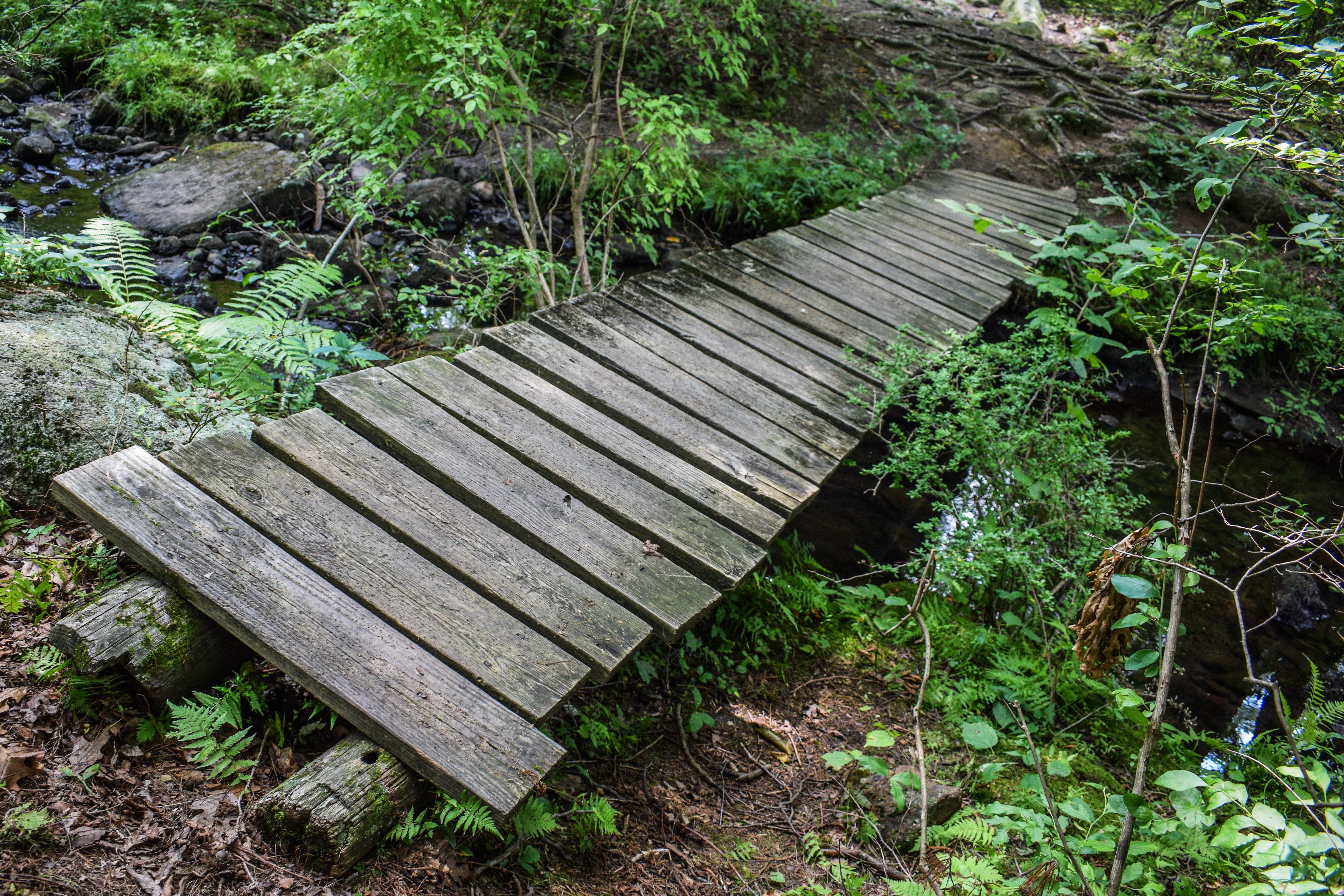
The Appalachian Trail crossed a dry stream bed with possible off-trail views (I did not investigate) and then had a long, gradual descent back to Seven Lake Drive through more grassy forest. The trail turned to descend more and then followed some flat wetlands before crossing a pond outflow on a sketchy footbridge and rising to Seven Lakes Drive.
I admired how this hike was well-segmented: Trailhead to Seven Lakes Drive, Seven Lakes Drive to Arden Valley Road, Arden Valley Road, to Seven Lakes Drive, Seven Lakes Drive to Trailhead. I was oficially on the final segement of the hike, so I stopped for a short electrolyte break before remembering I had another shelter to find! I almost forgot...
The amount of gnats increased throughout the morning but overall, bugs were relatively at bay. This stretch of the Appalachian Trail rose very gently, which was welcomed because my familiar hip pain was back. My shoes were, yet again, SOAKED with sweat, but thankfully I have a new pair at home and these will soon be retired!
I passed another deer, this time one with velvety antlers, and then the Ramapo-Dunderberg Trail rejoined in a grassy area. The R-D/AT winds and climbs to the next height-of-land at a sunny pleateau, which was much more overgrown, but with a discernable footpath (and obstructed views through trees).
Descending from the plateau, the sun was shining and the blue sky was showing, I soon arrived at the Brien Memorial Shelter! There were two people high up on a rock above the shelter (no idea why), and they said hello to me. I took a quick sit before starting my return trip.
The final bit of trail was a two-mile walk back on the Menomine Trail (a different section!). It started steep and rocky on the descent at road-width, but soon eased up with much better footing. It turned out to be a lovely return route! Even if I did get a bug in my eye in the last mile...
The trail eventually flattened out with views of Silvermine Lake, first through the trees, and then right up on the water's edge.
"Silvermine Lake" from Harriman Trails, 4th Ed. (2018)
Silvermine Lake is on Seven Lakes Drive, 1.7 miles south of Long Mountain Circle and 2.0 miles north of Tiorati Circle. The Silvermine Ski Area (no longer operated as such) is adjacent to the lake, as are extensive picnic areas with ample room for parking. Swimming in the lake is not permitted. From the lake, hikers can start up Stockbridge, Black and Letterrock Mountains. The yellow-blazed Menomine Trail provides a convenient route north to Stockbridge Mountain or south to Letterrock Mountain. A woods road heads east along the nroth shore of the lake to the dam, from which the Silvermine Road goes up into the notch between Black and Letterrock Mountains, crossing the Appalchian/Ramapo-Dundergerg Trail. In 1989, the Park removed the wooden walkway across the dam. Hikers must now goes down and cross the brook on stepping stones, or they may use the bridge just a bit further downstream.
When the Park was first created in 1910, this basket-shaped depression in the hills was called the Bockey Swamp. Bockey - a term peculiar ot this mountain region - refers to a wide-splinted woven basket used by charcoal burners. They were made and sold by mountain people, who were themselves sometimes called "bockeys."
As easly as 1922, Major Welch planned to create a lake from that swamp (N.Y. Post, 1/2/23). In 1926, a 30-acre motor camp was built there, with a well, tables and restrooms. During these years, beavers (which had been introduced in the Park in 1920) built a dam that backed up the water in the swamp. As a result, many trees were killed. Park workers cleared the dead trees and planted rice, which they throught would attract birds. But deer ate the rice.
Then, in the spring of 1934, Civilian Conservation Corps Camp SP-27 was set up at the Bockey Swamp. By Semptember, a 600-foot dam ha dbeen built and the new reservoir began to fill. The lake was named Menomine, meaning "wild rice." More picnic tables were installed. The old picnic area extended down the road from the present parking area.
In the fall of 1936, a ski slope and rope-tow were built on the hill next to the lake. It was named the Old Silvermine Ski Area because of its proximity to the legendary Spanish silver mine on Black Mountain. R.H. Torrey related the story of the "Lone Tinker Mine" (N.Y. Post, 10/6/23): About 1735, a small ship visited Caldwell's Landing (now Jones Point) each year. The crew were Spanish. They made their way to Black Mountain and to a mine on its north side, near some houses of the Conklin family. They came out each time with heavy sacks. Once, in the tavern at the river, they boasted of the silver they were carrying. On their last trip, one of the crew did not return with the others. Local natives, searching for the mine, found his body in a cabin on the mountain. The crew never was seen again, and the silver mine was never found. There are two mine openings on the top of Black Mountain, but only a little iron ore came from them.
In 1934, the TERA used a section of the old Black Mountain Trail to build a fire road past Bockey Swamp up through the notch between Black Mountain and Letterrock Mountain. It was intended to be a one-way loop, but the TERA was disbanded before it was finished. IN 1955, the lower end of the fire road near the lake was surfaced with gravel.
During 1942, a second ski slope was built. In 1951, the lake was renamed Silvermine Lake. A large overflow parking area was created in 1968, but the ski area has been closed since 1986.
The final stretch meandered along the pond's shore, sometimes right up along and sometimes higher up, all of it was really beautiful. The Menomine Trail turned back into the woods near the very end and I ran into two people walking at least 5 puppies (leashed!), which was wild!
Soon enough I was back at my car, my watch battery survived! It still said it was fully charged, so I will need to figure that out another time... This was a really nice way to wrap up my trips to Harriman for the summer. I have three more shelters to discover and many trails to explore!
Step-By-Step
- Park at Silver Mine Picnic Area.
- Start hike on Menomine Trail (yellow) toward Seven Lakes Drive.
- Cross Seven Lakes Drive, continue on Menomine Trail.
- At terminus, turn right onto Long Path (aqua).
- At Stockbridge Shelter, turn around.
- Continue on Long Path.
- At Arden Valley Road, turn left.
- At jct. with Appalachian Trail, turn left onto Appalachian Trail/Ramapo-Dunderberg Trail (white/red on white).
- At split, follow Appalachian Trail straight as Ramapo-Dunderberg Trail veers away on right.
- Cross Seven Lakes Drive, continue on Appalchian Trail.
- Ramapo-Dunderberg Trail rejoins Appalchian Trail, continue.
- At Brien Memorial Shelter, turn left onto Menomine Trail (yellow).
- Follow Menomine Trail (yellow) to car.
"Menomine Trail" from Harriman Trails, 4th Ed. (2018)
The Menomine Trail connects the Silvermine parking area with the Appalchian/Ramapo-Dunderberg Trails (AT/R-D) at the William Brien Memorial Shelter on Letterrock Mountain, and with the Red Cross Trail. It also connects the parking area with the Long Path at the Stockbridge Shelter on Stockbridge Mountain. Since the Menomine Trail primarily serves as a means of accessing these two major trails from the parking area, we will describe the trail in two sections, beginning in each case from the parking area.
South to William Brien Memorial Shelter (AT/R-D)
From the southern end of the Silvermine parking area, the Menomine Trail crosses a bridge and turns left. Just before it reaches the lake, ti turns right, an dthen it turns left and follows along the shore of the lake, passing through a very rocky area. At 0.45 mile, the trail joins a woods road which come sup from the lake. Before the lake was built, this road went along the edge of what was then known as the Bockey Swamp. Since the creation of the lake, the northern section of the road has been submerged, and the remaining portion of the road (now followed in part by the Menomine Trail) became known to hikers as the Brockey Swamp Trail.
After reaching the end of the lake, the Menomine Trail goes up a valley along Brockey Swamp Brook. at 0.95 mile, it come sto an intersection with another woods road. (To the right, this road leads 0.8 mile to the Seven Lakes Drive). The Menomine Trail turns left on the road, crosses a stream, and begins a steady ascent. At 1.35 miles, it crosses the AT/R-D at teh William Brien Memorial Shelter. [...].
North to Stockbridge Shelter (Long Path)
This part of the Menomine Trail begins just before the bridge at the southern end of the Silvermine parking area. It proceeds west along the guardrail at the edge of the parking area, then follows a dirt road leading through a picnic area. It turns right, uphill, at a cable barrier at the end of the picnic area, crosses a road which leads to an abandoned parking area, and enters an evergreen grove on a knoll above Seven Lakes Drive. To the right of the trail is the grave of "Scobie" Jim Lewis, whose farm was where Lake Nawahunta was created in 1915.
After crossing Seven Lakes Drive at 0.4 mile, the Menomine Trail briefly follows the Nawahunta Fire Road, passing, on the left, the cellar hole of the Lewis family home. At 0.55 mile, near the end of Lake Nawahunta, the Menomine Trail turns down left and crosses the inlet of the lake (Nawahunta Brook) on stepping stones. It passes through a pine grove, crosses a causeway across a swamp, and follows an old wagon road up Stockbridge Mountain. At 1.1 miles, just beyond a bend in the road, a cairn on the right marks the start of a trail which leads 0.3 mile to the Stockbridge Cave Shelter. This trail, once blazed red, has been painted out with black paint, and the black blazes can still be followed (with care). Now the Menomine Trail begins to level off. At 1.35 miles, a road forks left to Stevens Mountain, and the Menomine Trail again begins to climb. The yellow Menomine blazes end at 1.5 miles, where the Long Path (aqua) crosses. The Stockbridge Shelter is about 0.1 mile up to the right.
The Menomine Trail was created on Labor Day 1994 as a means of linking the AT/R-D and the Long Path with the convenient Silvermine parking area. For the most part, it follows the routes of two old woods roads - the Bockey Swamp Trail and the Nawahunta Trail - which had long been used by knowledgeable hikers to access these marked trails from the Silvermine parking area.
The name of the trail, Menomine, was originally given by Major Welch to the lake south of Seven Lakes Drive that was created in 1934 by the Civilian Conservation Corps. Prior ot then, the area was a large swamp, known as the Bockey Swamp. In an attempt to attract birds, the Park planted wild rice in the swamp. But, instead, the rice was eaten by deer. When the lake was built, it was named Lake Menomine, an Indian name for wild rice. It was renamed Silvermine Lake in 1951.
The section of the Menomine Trail that extends from the Brien Memorial Shelter to the Red Cross Trail was originally part of the unmarked Dean Trail. In 2002, the Menomine Trail was extended south from the AT/R-D at the shelter to the Red Cross Trail.
"Appalachian Trail" from Harriman Trails, 4th Ed. (2018)
[...], and at 9.9 miles reaches the William Brien Memorial Shelter. Here, the Menomine Trail (yellow) crosses. To the right, the Menomine Trail goes down to the Silvermine parking area on Seven Lakes Drive in 1.35 miles; to the left, it leads 0.85 mile to the Red Cross Trail.
The shelter is named after William Brien, the first president of the New York Ramblers. In 1954, he bequeathed $4,000 for a shelter, which was built in 1957 at Island Pond. Because of vandalism, that shelter was demolished in 1973 and the name transferred to the former Letterrock Shelter, which was built in 1933 (N.Y. Post, 6/23/33).
At 10.7 miles, AT/R-D comes down to the foot of Goshen Mountain, where the unmarked Brockey Swamp Trail crosses. To the right, the Brockey Swamp Trail follows the little brook down towards Silvermine Lake. The R-D departs to the left and begins to climb Goshen Mountain, while the AT goes right on a woods road. AT soon turns right, leaving this road. It goes down to another woods road, which it follows for a short distance, reaching the Seven Lakes Drive at 11.9 miles. The trail crosses the Drive, then a region with two brooks, and goes up Stevens Mountain. It then turns south, following an old woods road, known as the Youmans Trail. After leaving this road, the AT crosses a descending dirt road (the original Arden Valley Road). Here, the R-D comes in from the left and rejoins the AT. Then, at 14.05 miles, the AT/R-D crosses the present-day paved Arden Valley Road on Fingerboard Mountain. [...].
The original route of the AT was over Goshen Mountain, joint with R-D. It came down west to cross an old woods road, where it parted from R-D, and continued over two knolls to Seven Lakes Drive, 100 yards north of Tiorati Circle. It then climbed Fingerboard Fire Tower (built 1922) and turned south to the R-D (N.Y. Post, 1/4/24). In November 1931, the AT was diverted through a tent camp on the knoll northeast of Tiorati Circle, and then went jointly with R-D up Arden Valley Road (N.Y. Post, 11/13/31). In 1934, the AT was made to coincide with R-D from Goshen Mountain to Tiorati Brook Road, which it followed for 0.35 mile to Tiorati Circle. The present route up Stevens Mountain was devised in 1978 by Chief Ranger Tim Sullivan.
"Long Path" from Harriman Trails, 4th Ed. (2018)
[...] Arden Valley Road, which it reaches at 14.9 miles. LP crosses the road and followed a woods road to the north.
On the left as one starts up this woods road, a faint trail may be seen going northwest through the saddle between two summits of Bradley Mountain. That path - the Forest Lake Trail - was part of the first road, built in 1760, through the Highlands from Stony Point to Central Valley. It leads into the Harriman estate and should not be used without written permission. The woods road that carries the Long Path here for 0.2 mile was part of that old road, and of the Arden Valley Road before the park built the present paved road down to Tiorati Circle about 1917.
After 0.4 mile on the woods road, LP diverges left and climbs to the summit of Stockbridge Mountain (named for Elisha Stockbridge, 1826-1916, who owned a hotel near Summit Lake in 1893). From the ridge, Arden House can be seen tot he west when there are no leaves on the trees.
Arden House was the home of Edward Harriman. The plans were drawn by architects John Carrere and Thomas Hastings, who are best known for designing the New York Public Library. The house took three years to complete, and cost $2,000,000. Edward Harriman moved into his new home in August 1909 and, unfortunately, died of stomach cancer on September 9, 1909. Subsequently, Arden House was used as a conference center for Columbia University.
At about 16.9 miles, a great overhanging boulder named Hippo Rock is on the left of the trail. In abother 0.15 mile, the Menomine Trail (yellow) leaves to the right. (The continuation of this trail, going west, is the unmarked Nawahunta Trail.) LP then climbs a ledge to reach Stockbridge Shelter (built in 1928) at 17.15 miles. [...].