Showing posts with label 52 Hike Challenge 2024. Show all posts

Tuesday, December 24, 2024

Pyramid Mountain Loop via Boonton Ave. Field (Pyramid Mountain Natural Historic Area)

Pyramid Mountain Loop via Boonton Ave. Field (Pyramid Mountain Natural Historic Area)

Distance: 5.59 miles
Elevation: 712 feet
Time: 2 hours, 28 minutes
Hike Type: Lollipop Loop
Hiking Challenges: 52 Hike Challenge

The Hike
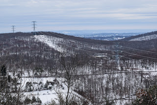
Merry Christmas Eve! No skiing today, but it was a perfect morning to head out to Pyramid Mountain for a snowy stroll through teh woods. It snowed just over an inch overnight and it was beautiful out! 26 degrees with a small breeze in open areas. I parked at the Boonton Ave Field and followed the green blazes over to the official trailhead, which featured yet another new map!


I was setting first tracks on the Green Trail once in the woods, with a few critter prints here and there. I remembered a slippery section near the end of the Green Trail from previous excursions, and just as I was wondering where that spot was... SPLAT. The spot was an ice-coated slab hidden my snow... ouch! I didn't bruise, but I felt that one for a few days!


My humbling fall hed to the Orange Trail, which I followed clockwise. I didn't mess around with the ledge view based on my previous tumbling, but it was still very pretty. There were also a few sets of footprints too, which was nice. There were a few sketchy spots with slippery footing near the reservoir, but slow and steady was all that was needed. That, and some calls of encouragement from a daunting amount of crows.


The Orange Trail ends at the Blue Trail, which I followed through the power cut, turned the sharp corner, crossed the power cut again, and then noticed another reroute of the Blue Trail! Instead of the steep, eroded pathway up, it now follows a much longer route (little less than a half mile extra) that is much gentler. Eventually, I did made it to the summit with a nice view, and then continued on.


On the Blue Dot Trail, I saw something I hadn't seen in a while - snow fleas! Lots of them, too. Some blue sky was starting to pop out once near Tripod Rock, and then I continued my way back to the Orange Trail and then onto Green.

The sun was shining, I was STARVING, and I followed my sole footprints back to the car on green. I did pass a duo near the end of my hike, but overall it was delightfully quiet. The sun felt like a lovely reward on my final way out!


Step-By-Step
- Start hike on Green Trail via Boonton Ave. Field.
- Enter woods, continue to follow Green.
- At terminus, turn left onto Orange Trail.
- At terminus, continue straight onto Blue Trail.
- At cairn, turn sharply right to continue on Blue Trail.
- Follow Blue Trail's new route via signage to the top of Pyramid Mountain.
- At summit, continue on Blue Trail.
- At jct., continue left on Blue-Dot Trail.
- Continue past Tripod Rock on Blue-Dot Trail.
- At terminus, turn right onto Orange Trail.
- At next jct., turn let onto Green Trail, return to car.


Monday, December 23, 2024

Shelburne Fire Tower via Halligan Ave (Shelburne State Forest)

Shelburne Fire Tower via Halligan Ave (Shelburne State Forest)

Distance: 3.37 miles
Elevation: 1,050 feet
Time: 1 hour, 57 minutes (1 hour, 36 minutes moving)
Hike Type: Reverse Stemmed Figure-8 Loop
Hiking Challenges: 52 Hike Challenge; Operation Alaska Benchmark Challenge

The Hike
Day 3 in my little outdoor adventure weekend! After skiing at Jay and Ragged, my plan for today was to head to NJ for the holidays via a hike up to the Shelburne Fire Tower followed by some more skiing at Berkshire East. I was up at 3:45am and out the door at 4:00am. The drive out west was nice and easy, aided with an Egg McMuffin and a brutal gas station christening near Turner's Falls. 

Just after 6:00am I made it to the confusing trailhead. There were turn around signs on Halligan Ave about 50 feet from Route 2 telling hikers to turn around at the sign (in a tricky spot) to park. I did a 30-point turn and parked on the side of Halligan Ave. near the trailhead, which seemed to be okay! It was a crystal clear morning and there were no degrees outside, off we go!


There was a dusting of snow and a few sets of footprints on this well-blazed white trail. My puffy came off five minutes in and heard the classic sound of a twig snapping in the distance - spooky! The snow on the ground sparkled like glitter in my headlamp's light and my buff was freezing, but it was so wonderfully peaceful. 


My second puffy came off at the junction with the yellow-blazed Big Trees Trail junction, and the trail climbed moderately to the junction with an orange-blazed trail. After crossing with Big Trees Trail again, the trail went through a power cut, showing some light on the horizon. I hit the final terminus of the Big Trees Trail at 0.66 miles while my eyelashes were freezing together. 


There was some avoidable ice near the top and as per usual, I was sweating. Thankfully, my layering system was working well! I did wish I brought a second shirt, but oh well... Just before the top there was some impressive needle ice, and then voila! The top had a picnic table, a nice clearing, and the very unique stone fire tower. 


There was no door to the tower and it was DARK in side. With my headlamp, I carefully and cautiously climbed up. There were a few windows on the way up followed by three at the top level of the tower, just below the locked cabin. This was by far the most unique fire tower that I've climbed! I took some photos - the town of Shelburne Falls, the cloud of Berkshire East's snowmaking, and Mt. Greylock out of one, Mt. Monadnock and surrounding hills out of another, and the Pioneer Valley, including the Holyoke Range and UMass, out of the third. Once the sun broke the horizon I headed down to make some hot chocolate!


I made the hot chocolate with my JetBoil down at the picnic table, where I also found a survey disc nearby. I climbed back up with cocoa in hand and a nip of Pumpkin Spice Rum Chata, which was LOVELY. I enjoyed the views and the unique solitude in this cold tower.


After a nice break, I finished my cocoa and started my return trip. I passed a guy near the top with a little dog wearing the BIGGEST coat - what a trooper! I followed the Big Trees Connector Trail down, and TECHNICALLY broke trail, as I was the first human to hike it since the last snow, even if it was only coated in an inch. Either a bobcat or coyote got ahead of me, though! Footing was a little slippery, but I went slow and had no problem.


It seems like the Big Trees Trail and connector are new trails, as its hard to find information on them, and even the trailhead info was outdated. 


On this trail and the actual Big Trees Trail, many of the trees had ID tags naming the type of tree and how to ID them, which I genuinely had a fantastic time reading and guessing. I saw a hawk/falcon at the power cut and followed some bunny tracks for a while, and later saw a deer near the end of the Big Trees Trail.


Once back on the white trail, I was soon at the car. What a lovely hike! I would absolutely come back, especially for a sunrise before Berkshire East. All of my clothes were basically frozen solid at this point, but I did a FAST change and zoomed over to the mountain!


Step-By-Step
- Park on side of the road on Halligan Ave.
- Start hike on white-blazed Tower Trail.
- Follow Tower Trail to summit.
- Turn around and retrace steps.
- At junction with Big Trees Trail Connector, turn right onto yellow-blazed Big Trees Trail Connector.
- At next jct., cross Tower Trail and continue onto yellow-blazed Big Trees Trail.
- At terminus, continue descend on Tower Trail to car.

"The Fire Tower Trail" from brochure (outdated)
The trail climbs 1.25 miles to the stone fire tower at the top of Mt. Massaemett. It is rated strenuous. Begin at the culvert at Rt. 2 and Halligan Avenue, just west of the South Maple Street entrance to Shelburne Falls. Park on the uphill side of Halligan Avenue. The trees on the first part of the trail are blazed with white paint. The trail continues across a power line. Coming to a junction with a wide trail (orange blaze), turn right and follow, bearing left uphill to the tower. You can climb the tower for a tree state view. Return the way you came or continue down the road to the cell tower (3rd structure). Turn left and follow the fence on the left side to link up with The Ridge Trail to the High Ledges Sanctuary). 

"Fire Tower Trails, Shelburne, MA" from brochure (updated)
THE HIKE: The 1.3-mile Fire Tower Trail and the Big Trees Trail provide many educational panels and tree identification stops along the way to the summit of Massaemett Mountain. A rigorous hike up these trails leads to the Shelburne State Forest Fire Tower, with scenic views in all four directions.
THE HISTORY: There had been two wooden, recreational, observation towers on the summit during the late 1800's. One burned down and the other blew down. A more durable stone & cement tower was constructed in 1909, from stone quarried near the summit of the mountain. In 1911, the tower also began to be used as a fire lookout to watch for forest fires. Currently, during periods of high fire danger, the glass "cab" on top of the tower is staffed by Mass Dept. of Conservation and Recreation. This historic tower is one of only two stone fire towers still in use in New England.

Tuesday, December 3, 2024

Railroad Trestle to Bear Hill (Middlesex Fells Reservation)

Railroad Trestle to Bear Hill (Middlesex Fells Reservation)

Distance: 2.28 miles
Elevation: 243 feet
Time: 48 minutes
Hike Type: Loop
Hiking Challenges: 52 Hike Challenge

The Hike
Back to the Fells! I had to drop off the four tubas that I stole/borrowed for TubaChristmas, but had an hour to kill. With the limited sunlight this time of year, the Fells made the most sense! I drove over to a corner I had not been to before, near Bear Hill. The parking was right off the highway and felt very... wrong, but it was marked on the map and allowed during daylight hours!

I started my hike on Dike Road and then veering left toward the highway onto an unblazed path that is on the map. The trail was nice, even though it paralleled I-93. There was plenty of needle ice in the shady areas, which was fun! There were occasional unmapped criss-crossing paths, but I stuck to paralleling the highway to moderate success.


The trail passed below a large concrete cylinder on to of Bear Hill - I would investigate that later. Eventually, some older yellow blazes began to appear on top of even older blue ones. I continued along, immersed in the sounds of nature, which in this case were cars, police sirens, and helicopters. Eventually, the path steeply descended to a gravel road at D2-7.


This started a lovely, flat stretch that I believe was an old railway (based on being named "Railraod Trestle" on the map). It first traveled between two high rock walls, and then over a fenced-in trestle, which was very fun and unique. 


I turned off of the Railroad Trestle trail at a second, smaller bridge, and wiggled my way to the more rugged Skyline Trail. I enjoyed the variety of terrain on this small hike. There was a lot of needle ice going up Winthrop Hill, which had a newer bench at the top. Just after there was a nice view into the interior of the Fells. I descended the hill and zig-zagged over to Bear Hill Road, which climbed gently up to Bear Hill.


Bear Hill had a massive concrete water tower (the cylinder mentioned before) with a really unique open-faced observation tower that seems to be in early-stage decay. The water tower was heavily fenced-in, and the observation tower was surrounded by a fence with multiple human-sized holes. I may or may not have scoped the area for a possible USGS disc, but did NOT tempt fate by climbing up the tower, but it was clear that many have/do, as evidenced by the massive amounts of graffiti. It was a super interesting area, for sure!


After descending Bear Hill on Bear Hill Trail, I then joined the Reservoir Trail, where I passed my first human of the day, and meandered back to Dike Road, which had a large amount of locked up manhole covers. I finished my hike soon after, and I made a note that I need to remmeber that 45 minutes in the woods is significantly better than nothing. I'm setting a soft goal of getting into the fells once a week until the 5pm sunsets come back and I can get back to the Blue Hills after school.


Step-By-Step
- Park at Gate 20 off of Fallon Road.
- Start hike on Dike Road.
- At jct., veer left onto footpath paralleling I-93.
- At D2-4, continue on footpath paralleling I-93.
- At D2-7, turn right onto Railroad Trestle.
- At D3-2, turn right toward Skyline Trail.
- At D3-1, turn right onto Skyline Trail.
- At C2-6, turn right onto trail.
- At D2-5, turn left onto Bear Hill Road.
- Summit Bear Hill, turn around.
- At C2-4, turn right onto Bear Hill Trail.
- At C2-3, turn right onto Reservoir Trail.
- At C1-6, turn right onto Dike Road.
- Return to car.


Middlesex Fells Reservation Map

Sunday, December 1, 2024

Mt. Wachusett via West Side, Echo Lake, Mountain House (Wachusett Mountain State Reservation)

Mt. Wachusett via West Side, Echo Lake, Mountain House (Wachusett Mountain State Reservation)

Distance: 6.70 miles
Elevation: 1,755 feet
Time: 4 hours, 34 minutes (3 hours, 42 minutes moving)
Hike Type: Lollipop-Lollipop Loop
Hiking Challenges: 52 Hike Challenge; Operation Alaska Benchmark Challenge

The Hike
Rewinding a few days before this hike, Sarah and I were talking about going for a hike! She mentioned she wanted to hit Moriah, I wanted to hit the Belknaps (in hopes that they weren't as snow-blanketed as the Whites), but we eventually landed on our hanging chad, Carter Dome, pending trail conditions. Now fast-forward to the day before this hike, neither of us spoke, but little did we know the other was constantly checking New England Trail Conditions hoping that SOMEBODY would post Carter Dome, and they did! Only, they made it sound miserable. To my delight, Sarah initiated plan B, and we pivoted to a classic morning on Mt. Wachusett!

We made it to the West Side Trail parking lot just after 7:30am. I was HURTING after Boston TubaChristmas the day before (apparently if you only play the sousaphone once a year your body doesn't get used to it...). It was 19 degrees outside and I was running a few minutes ahead of Sarah, then I got a call...


"How did you get to the trailhead? The gate is closed!" said Sarah. I had no idea what she was talking about, as I simply drove to the trailhead gate-free. I checked her location, and her GPS was trying to take her onto the summit road and then over North Road, the first of which is closed for the season, and the second of which I believe is always closed to vehicular traffic. Thankfuly, due to the powers of modern technology, I was able to watch her location and navigate her around the north side of the mountain to the correct spot unscathed! She arrived a few minutes later and then we were off!


I really enjoy hiking the West Side Trail - it has a more rugged "mountain" feel to it than the Mountain House Trail, it's not as steep and miserable as Pine Hill, and it doesn't cross any ski runs like Old Indian. It also splits up short steep bits with nice walking breaks. We hiked up, crossed Up Summit Road for a first time, and then as we approached the Semuhenna Trail we heard a unique sound... snow guns! We hopped off-trail to peek at the top of the Minuteman Express Quad and enjoy the pre-winter sights and sounds.


Continuing onto the Semuhenna Trail now, it was a little bit icy, but not enough to warrant any traction. A large group of trail runners passed us (and we would end up seeing them a few more times throughout our hike), and then at the terminus we turned onto Harrington for the steepest climb of the day. Thankfully, the trail was mostly ice-free, and the viewpoint part-way up makes for a great stopping point. It was cold, though!


Soon enough we popped out of the trees and we had made it to the summit for the first time today! I also found a USGS disc that I had never seen before, near the Harrington Trail sign - yay! We did a quick drive-by summit, since we knew we'd be back in an hour or so. It was cold and windy, but now a balmy 23 degrees. Sarah had a quick snack up on the platform, but it was too cold for my sweaty body. I put on a fleece and hid out of the wind. If we were staying I would have fully layered up to enjoy the view, but I knew I'd be sweating again very soon.


We descended via Mountain House, popping over near Pine Hill first to find another USGS disc I had read about on Facebook, and then to Jack Frost - which was as beautiful as ever. The Hemlock Grove is just stunning, and the neat bridge-area after the steep descent is neat. We continued through the Mountain Laurel to Lower Link, and then had a nice, easy walk on Administration Road to the Echo Lake Trail trailhead, where there were a good number of cars.


We circled around Machias Pool and started up the Echo Lake Trail, which was quiet and dusted in snow. At the height-of-land, we found a cell phone on a tree stump! Sarah picked it up, and it had frozen to the mossy stump, but it was still on... and unlocked! She opened up the messaging app and texted the most recent person, Carol, who the owner sent a photo of the summit to. We told Carol where the phone was and left it there, hoping that the hiker would return to get it (versus us taking it with us back up the summit and down to the other side of the mountain). 


We joined Echo Lake Road, circled Echo Lake, enjoyed the old fireplace there, and then made our way onto the High Meadow Trail. At the viewpoint, we turned onto Bicentennial and followed it to Mountain House (this is the nice stretch of Bicentennial Trail - the stretch between Mountain House and Loop is a rocky mess that I am not the greatest fan of). 


I remembered why I'm not overly fond of the Mountain House Trail - its moderate grade continues almost the whole climb and its featureless, so it feels like it goes on for much longer than it actually does (in all reality, it's completely fine). We were crossing paths with more and more people until popping out at the top - time for a nice break!


We sat beneath the tower to avoid the cold wind. It was now 32 degrees and the sun felt heavenly. I "cooked" us up some hot chocolate and Sarah surprised me with apple crisp!! It was truly a lovely break. I walked up to the tower for a couple of photos, but the wind was too cold to enjoy for long. 


Eventually, we packed up and started down the Old Indian Trail, to the top of the Polar Express Quad, where there was a lovely view and some lovely piles of snow. I wanted so badly to throw my body onto them, but I remembered to #RespectTheSnowmakers. We continued through the beautiful flat stretch and then started the steep descent, which was about as sketchy as I expected it to be. Thankfully, we made it down no problem, and then had an easy final return to the cars via West Side Trail.


Step-By-Step
- Park at West Side Trail trailhead.
- Start hike on West Side Trail.
- At second crossing of Up Summit Road, cross road and continue on Semuhenna Trail.
- At terminus, turn left onto Harrington Trail.
- Summit Mt. Wachusett.
- Continue onto Mountain House Trail.
- Turn right onto Jack Frost Trail.
- At terminus, turn left onto Lower Link Trail.
- At terminus, turn left onto Administration Road.
- At terminus, turn left onto Echo Lake Trail.
- At terminus, turn right onto Echo Lake Road.
- Soon after, turn left onto High Meadow Trail.
- At jct., turn right onto Bicentennial Trail.
- At jct., turn left onto Mountain House Trail.
- Summit Mt. Wachusett.
- Continue onto Old Indian Trail.
- At jct., turn left onto West Side Trail.
- Follow West Side Trail to car.


Monday, November 11, 2024

Mt. Flagg & Mt. Shaw via Camp Merrowvista (Ossipee Range)

Mt. Flagg & Mt. Shaw via Camp Merrowvista (Ossipee Range)

Distance: 6.99 miles
Elevation: 2,402 feet
Time: 4 hours, 41 minutes (4 hours, 4 minutes moving)
Hike Type: Out-and-Back
Hiking Challenges: 52 Hike Challenge; Ossipee 10

The Hike
Last day of the three day weekend and time for REDEMPTION! My 3:45am alarm went off and I was out the door at 4:00am to head back to Camp Merrowvista to actually get to the summit of Mt. Flagg (and maybe Mt. Shaw?). It was misting/raining in Boston, but the forecast was partly cloudy for the Ossipees. My drive was realtively easy with a quick christening at the NH Visitor Center on I-95 and the Circle K in Ossipee. I grabbed a couple of breakfast sandwiches from Ossipee as the sun was beginning to rise.

The sky slowly began to lighten on the final stretch of my drive, landing me back at Camp Merrowvista at 6:30am. The welcome sign to the camp said "Welcome Hikers - Park at Farmhouse," which was nice to see (it still felt like I wasn't supposed to be there, though!). Skies were dark and gloomy, and it clearly had rained overnight/into the morning. All of the peaks were in the clouds which was... a bummer! I told myself I'd decide if I'm going to add Mt. Shaw when I hit the summit of Mt. Flagg based on how brutal the hike up was. 


[6:37am - Start of Hike on Class VI Road]
My hike started on the class VI road heading toward the Mt. Flagg trail. It was on the warmer side of chilly out, at 50 degrees and windy. I really have hiked in all four seasons the past week (Wednesday was summer, Saturday was winter, yesterday was spring, and today we're back in fall)! 


[6:42am - Mt. Flagg Trail]
My puffy came off once in the woods and my fleece soon after, as typical. I know the advice is to "be bold and start cold," but I find it so much easier to "deal with it later." Skies overhead were varying from light to dark grey with loud wind overhead. I made it past the junction with the green blazed trail and rose steadily to the Dave Green Trail junction.


[6:51am - Mt. Flagg Trail & Dave Green Trail jct.]
Just past the junction I saw another trail that I didn't notice on my last visit - a trail blazed in a salmon-pink. It's not on AllTrails or the Trail Bandit map - I wonder where it could go? Maybe to the brook? Or a different way to loop back to the camp? A mystery for sure!


The climb from Dave Green to the Canaan Mountain Trail junction is a doozy - steep and generally unrelenting with rough footing (and very leafy). Up above, the sky was starting to show some hints of blue, but the hints were alternated with a DARK grey. 


[7:13am - Mt. Flagg Trail & Canaan Mountain Trail jct.]
After the Canaan Mountain Trail junction was the boulder field, which I took slower than last time, which did my legs good. Someone on Facebook described this stretch of trail more treacherous than trails in the Whites, which I think is a bit of an exaggeration. Sure, its more technical than the well-manicured trails of the Castle in the Clouds Conservation Area, but its very manageable if you watch your footing. 


Higher up, where the beautiful slabs begin, I noticed that I was officially ascending into a cloud... oh well! One thing I am good at is hiking in clouds! The scenery of the trail and woods was still beautiful, and nice to see in this different light. The howling winds added a bonus layer of spook, too. I did get one view toward Lake Ossipee, just below the cloud ceiling.


The cloud ceiling was about 50 feet below the view ledges, so I had a fantastic view of a whole lot of nothing! Thankfully, I had already been here, and now I needed to find my way to the actual summit. I located the painted rock that points to Mt. Shaw, which is where the Gorilla Trail officially begins, blazed in yellow with a red center.


[7:48am - Gorilla Trail]
The Gorilla Trail initially scrambles off of the ledges into a beautiful, mossy forest. The footpath was narrow, but it was easy to follow. The sun even made its first appearance (still very cloudy, though). I was feeling good, and even though Mt. Shaw was in the clouds, I decided to continue on, knowing that the Gorilla Trail is seldom-used and has been labeled as tough to follow.


[7:54am - Mt. Flagg Summit]
The summit was marked with a cairn and a partial view (of clouds). I did get one partial view through teh clouds, but didn't wait around for long. The descent of the summit was the most challenging part of the Gorilla Trail - very overgrown (like, trees in the way overgrown), mossy, and bouldery (and slippery!). I slipped a few times on this descent, but never fell! I took it nice and slow and eventually made it down to the first col between the two peaks.


[8:06am - Gorilla Trail enters Lakes Region Conservation Trust]
The Gorilla Trail enters the Lakes Region Conservation Trust in the first col and then goes over a hump to a second. From here, the trail traversed a tricky bouldery stretch with a few PUDS. There wasn't always a clear footbed, but there was frequent blazing, even though it was mostly faded. While researching for this hike, I found the following history (on AllTrails, so we can take it with a grain of salt):
"I was a member of the Merrowvista group that blazed the Gorilla Trail in 1971. A group of 15 year-old-kids, dubbed "Gorilla Village" by our two counselors because we had a few real hulking dudes in our group. I spent 10 summers at Merrowvista, first as a camper, then as a staffer, and knew these trails quite well. Last visited in 2018. The Flagg summit is a lot more overgrown than when I was a kid, because then it was still pretty bare from a 1954 fire. Much of the lower part of the trail to Flagg is the fire road from that year." Paul Menser, November 20th, 2023 on AllTrails


The boulders eventually led into a cloud which was... fine. The woods were definitely spooky! Wind was still howling up high, but it was pretty tame in the trees. The trees themselves were mostly birch, and I was delighted to discover that the leaves hardly covered the trail - overall it was in much better condition than I anticipated!


There was a really lovely stretch of relatively flat trail after the boulders, and I even stumbled upon a pile of old moose poop. This hike had been pretty devoid of wildlife, so I was thrilled with this llittle bit of excrement!


Eventually, the Gorilla Trail began to climb more moderately, but thankfully never too steeply. The path became a bit more obscure once the climbing resumed, but as long as I took it slow, followed the logical pathway, and always double-checked for blazes, I was fine. There were some intense gusts of wind, and just when things got quiet... FLAP FLAP FLAP! A grouse genuinely scared the living daylights out of me. Horrid creatures. I also noticed a few little poops on a few rocks that had a white "cap" - which apparently are also from the grouses!


Continuing to climb, the trail got a bit more challenging to follow as the trail hit a few meadowy stretches (and another pile of moose poop). Some of the bushes were whipping my shins with impressive might. 


After the meadow, the Gorilla Trail climbs to a narrow ridge where the trail is even more challenging to follow, but overall it stays on the ridgecrest. The wind was blowing hard and water droplets were pelting me in the face. Thankfully, the ridge leads to the summit of Mt. Shaw!


[8:58am - Mt. Shaw Summit]
...which was still in a cloud. I guess I expected it at this point... I took a seat for some food and hydration and stared into the void for a while. In reflection, the Gorilla Trail was in much better shape than I had anticipated! I actually enjoyed the trip, and was not dreading the return. Visually, it was a stunning trail. 


It was super windy all around me, but the viewpoint was well-sheltered. It was 43 degrees out now, and just when I was packing up the clouds parted for truly no more than three seconds. I THREW my Nalgene out of excitement to grab my camera, but the view closed up before I had a chance. I INCHED away back toward the trail, hoping a view would open up again. I think if I stayed for another 20 minutes, I would have had an excellent view, but it was a school night, and I needed to start me return trip. With my tail between my legs, I got back to the Gorilla Trail.


[9:17am - Gorilla Trail]
Immediately, I noticed there was much less fog on my return trip. I got off-trail a few times on the initial descent through the aformentioned tricky areas, but I was able to get back on on my own accord (i.e., not needing to use my phone for GPS). As the trail descended, the sky began to open up to a big, beautiful blue. Oh well!


The forest had an insanely different vibe now that the sun was proudly shining. Even though I was lamenting not getting that amazing view from Mt. Shaw, I was still happy to be in the woods. From the walking break area, there was an incredibly rude tree view of Mt. Shaw, completely cloud-less, though.


I traversed over the bouldery PUDS, which were much dryer and easier now, eventually landing in the coniferous cols, existing the Lakes Region Conservation Trust.


[10:08am - Gorilla Trail exits Lakes Region Conservation Trust]
The climb back up to Flagg was still a bit slippery and dicey, but much easier than the descent. I quickly made my way back up to the summit, excited to hopefully get a view this time! I was a little too excited, though, becuase I went too fast and fully gassed out my lungs... oops.

[10:16am - Mt. Flagg Summit]
I was delighted to get views back to Mt. Shaw and up to the White Mountains from the summit. The views are by no means panoramic, but they were nice nonetheless, and unique! I had never seen Mt. Chocorua from this angle before, which made it look more like a single Tripyramid, rather than the mountain the Grinch lives on. There was also a highly impressive view to Carrigain Notch, which looked incredibly dramatic. From the top, I continued on back to the ledges.


[10:24am - Mt. Flagg Trail]
Winds were going strong on the ledges, reading at 15-20 mph. The sun was shining brightly, which kind of felt like an reward for finishing the Ossipee 10 (and hitting a bonus peak!). My descent was slow and steady with a few sketchy slips, but mostly becuase I was excited to be all done. Once I slowed down I was completely fine. This bit of trail was so pretty in the sun!


[10:50am - Mt. Flagg Trail & Canaan Mountain Trail jct.]
I made it to the shelter at the Canaan Mountain Trail junction and started the steepest part of my descent - SLOW and steady, especially in the spots with thick leaf cover. I also passed a very hair poop. I think it was a coyote?

[11:07am - Mt. Flagg Trail & Dave Green Trail jct.]
At the junction with the Dave Green Trail, I noticed that the "WELCOME" sign had another sign beind it, it read:
"Trails Closed. Due to improper use and damage to the property's natural resources all trails are closed until further notice. All public access onto this land is by writter landowner's permission ONLY."


I think this posting was in reference to the famous Ossipee Mountains drama regarding the Trail Bandit. A great write-up of this can be found on https://www.franklinsites.com/hikephotos/Ossipee/. 

The hike from here to the car was quick and easy, taking just over 10 minutes.

[11:14am - Class VI Road]
[11:18am - End of Hike]
There were a few other cars in the parking area when I wrapped up and I saw one person working, but besides that it was a completely human-free day! The only other bit of excitement left was driving through two brush fires on I-95 in Massachusetts near Topsfield (I think). Ossipee 10 = Complete!


Step-by-Step
- Park at Camp Merrowvista.
- Follow Class VI road to trailhead.
- Enter woods on yellow-blazed Mt. Flagg Trail.
- Follow Mt. Flagg Trail to Mt. Flagg's eastern ledges.
- At ledges, continue onto yellow/red-blazed Gorilla Trail.
- Summit Mt. Flag, continue on Gorilla Trail.
- Summit Mt. Shaw, retrace steps back to car.

"Gorilla Trail" from A. M. C. White Mountain Guide, 20th Ed. (1972)
         This trail leads from Mt. Shaw to Camp Merrowvista, located about 1/2 m. NE (beyond) the sharp R turn in the road mentioned in the beginning of the Thunderbird Trail description. The section from Mt. Shaw to Mt. Canaan is blazed with orange and green surveyers paint, frequently in the shape of a gorilla. Beyond, the blazes (1971) are less distinct, but the trail is well-used. It is suggested for the descend because of the confusion of trails near Camp Merrowvista.
        The trail leaves the carriage turn-around on the summit and descends generally to the SE. Soon it heads more to the E. It is a rough trail, passing through the burn of 1953. There are fine views as it passes over Gorilla Mtn., near the summit of which a short side trail L leads to Gorilla Leap. There are also fine views from the ledges of Canaan Mtn. Descending from the latter, it passes a trail L to Bean Pond, and soon leaves the burn. Some distance beyond it passes a shelter L and picked up a wood road. It passes a large pile of slash lumber R. As the wood road approaches Bodge Brook, a trail crosses it at a sign "Vesper Trail." Turn R, descend to and cross the stone bridge, and continue straight (uphill) along another wood road, soon passing through Camp Merrowvista. Continue straight 1/2 m. to the bottom of the Thunderbird Trail. 

"Gorilla Trail" from AMC White Mountain Guide, 23rd Ed. (1983)
        This trail runs about 4.5 mi. from the summit of Mt. Shaw to Camp Merrowvista. The trail starts east of the old carriage road turnaround on the summit of Mt. Shaw and follows the ridge eastward. It is well blazed but rather rough in places, with many boulders. The trail ends at Camp Merrowvista, which is located about 2.3 mi. from NH Rte. 171, 0.5 mi. beyond the start of the Thunderbird Trail.