Pyramid Mountain Loop via Boonton Ave. Field (Pyramid Mountain Natural Historic Area)
Distance: 5.59 miles
Elevation: 712 feet
My humbling fall hed to the Orange Trail, which I followed clockwise. I didn't mess around with the ledge view based on my previous tumbling, but it was still very pretty. There were also a few sets of footprints too, which was nice. There were a few sketchy spots with slippery footing near the reservoir, but slow and steady was all that was needed. That, and some calls of encouragement from a daunting amount of crows.
Elevation: 712 feet
Time: 2 hours, 28 minutes
Hike Type: Lollipop Loop
Hiking Challenges: 52 Hike Challenge
Hike Type: Lollipop Loop
Hiking Challenges: 52 Hike Challenge
The Hike
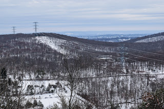
Merry Christmas Eve! No skiing today, but it was a perfect morning to head out to Pyramid Mountain for a snowy stroll through teh woods. It snowed just over an inch overnight and it was beautiful out! 26 degrees with a small breeze in open areas. I parked at the Boonton Ave Field and followed the green blazes over to the official trailhead, which featured yet another new map!
I was setting first tracks on the Green Trail once in the woods, with a few critter prints here and there. I remembered a slippery section near the end of the Green Trail from previous excursions, and just as I was wondering where that spot was... SPLAT. The spot was an ice-coated slab hidden my snow... ouch! I didn't bruise, but I felt that one for a few days!
The Orange Trail ends at the Blue Trail, which I followed through the power cut, turned the sharp corner, crossed the power cut again, and then noticed another reroute of the Blue Trail! Instead of the steep, eroded pathway up, it now follows a much longer route (little less than a half mile extra) that is much gentler. Eventually, I did made it to the summit with a nice view, and then continued on.
On the Blue Dot Trail, I saw something I hadn't seen in a while - snow fleas! Lots of them, too. Some blue sky was starting to pop out once near Tripod Rock, and then I continued my way back to the Orange Trail and then onto Green.
The sun was shining, I was STARVING, and I followed my sole footprints back to the car on green. I did pass a duo near the end of my hike, but overall it was delightfully quiet. The sun felt like a lovely reward on my final way out!
- Start hike on Green Trail via Boonton Ave. Field.
- Enter woods, continue to follow Green.
- At terminus, turn left onto Orange Trail.
- At terminus, continue straight onto Blue Trail.
- At cairn, turn sharply right to continue on Blue Trail.
- Follow Blue Trail's new route via signage to the top of Pyramid Mountain.
- At summit, continue on Blue Trail.
- At jct., continue left on Blue-Dot Trail.
- Continue past Tripod Rock on Blue-Dot Trail.
- At terminus, turn right onto Orange Trail.
- At next jct., turn let onto Green Trail, return to car.


No comments:
Post a Comment