Showing posts with label Mt. Grace. Show all posts

Saturday, October 10, 2026

Mt. Grace via Around-the-Mountain Trail and NET (Mt. Grace State Forest)

Mt. Grace via Around-the-Mountain Trail and NET (Mt. Grace State Forest)

Hike Type: Loop
Distance: 3.92 miles
Elevation: 1,093 feet
My Time: 1 hour, 37 minutes
Book Time: 2 hours, 30 minutes
Parking: Ample parking at Ohlson Field/trailhead.
Hiking Challenges: 52 Hike Challenge 2026, Operation Alaska Benchmark Challenge


The Hike 
It's a wedding weekend! I was heading to the Hartford area for my college friend's wedding. Naturally, I used this as an excuse to get out into the Pioneer Valley to do some exploring. Today my mission was to visit three fire towers in the area: Mt. Grace (a repeat for a disc), Mt. Lincoln, and Provin Mountain. My alarm went off at 5:00am and after slowly getting up and packing, I was out the door by 5:45! I had a stunning drive on Route 2 as the sun rose behind me, and an even more beautiful drive once I got off of Route 2 as the fall colors began to shine in the morning light. I even saw a Bald Eagle overhead! I was feeling mighty sleepy, but slowly I felt better as the sun came up. I was still stuffy and boogery from whatever illness I (still) have, but again, feeling a little better.

It was a cool 39 degree morning with abundant sunshine. MAN. I love fall! There was one car at the trailhead, my tummy was weird, and I was officially in my NEW Merrell hiking shoes (not those monsters from Walmart). It was also the first hike with my 40-liter bag that I use in the winter. Here we go!

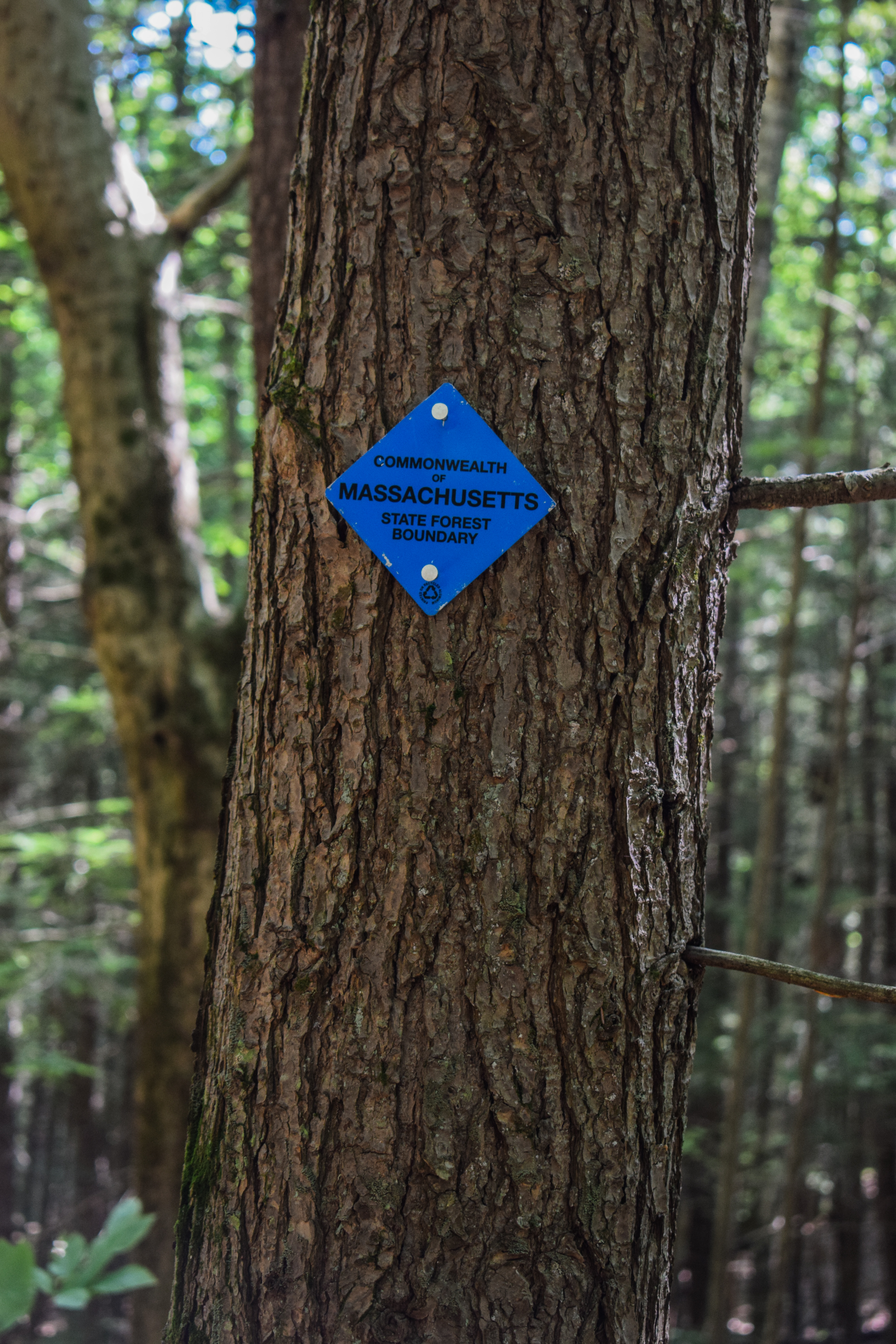
I decide to do the loop counter-clockwise, only because I hiked it clockwise last time and remembering the back half taking a while. I hiked across the meadow, which was not flooded (unlike last time), and joined the Around-the-Mountain Trail, which was blazed with blue triangles. The trail here was a bit of a roller coaster that trended downwards through very pretty woods. 

I crossed a bridge over a mossy stream that led me into a younger forest, and I found myself wondering if the younger trees were from logging, the ski area growing in, or just somehting else? The trail eventually split at an unsigned, unmapped junction. The trail continued left and turning right brought me over a bridge to a little picnic area - it was cute!

I spent some time in the "processing the breakup" void - tomorrow will be two weeks post-mortem and I think I'm doing better. I kept circling back to the point that we weren't experiencing life the same. I would think we had a really great evening/day/weekend, but he would feel otherwise, and that disconnect is no way to live life.

I hiked past a nice collection of mushrooms and enjoyed hiking in actually nice shoes. I eventually came to a four-way junction, where an old piece of metal had an arrow drawn in it to guide the way. I passed an old rope tow motor just after pinging one mile, and couldn't help but notice how I would have had no idea this was an old ski area if it wasn't for the old motor and guide poles. The trees really grew back effortlessly. 

I later saw a barred owl flying around! I followed it from tree to tree, and was just about to get a photo of it when a trail runner came barreling up behind me and scared it away - curses! It always amazes me how quietly owls can glide from tree to tree. Soon, the sun began to hit the treetops and began to cast a golden glow on the forest, and just before the junction with the New England Trail, I noticed bits and peices of either an old fridge or stove in the woods?

There was no sign, but I turned left onto the New England Trail and immediately saw a white blaze. I reluctantly took my comfortable fleece off for this climb, because I knew I would be sweating soon. The climb began to parallel an old stone wall in a blowdown area and then I passed a dad and two kids who seemed to be backpacking (and more importantly, thought I was doing something cooler than a quick hike). The dad had a rip in his pants and loudly said "is there a rip in my pants or is this just a sign of a good night?!"

The New England Trail followed a nicely graded old road past a shelter and then climbed more moderately, navigating around a blowdown before flattening again. I stepped over a pile of old bear poop and hiked over a relatively new bridge over a wet area. I was happy to see that the mushrooms were still living strong in these woods!

I left and later reentered Massachusetts State Forest land and eventually my body felt nice and warmed up!

Later, the New England Trail split to the left while the Around-the-Mountain Trail continued around the mountain to the right. The trail climbed pretty moderately from here to the summit with a few reroutes around old, eroded spots. There were some insane sounds coming from the right side of the woods - probably a train? My sweat started to get sweaty during this climb, and I remembered this downhill feeling like a slog last time I was up here. I felt the occasional twinge of leftover sciatica, but overall I was feeling good! I passed a fork in the trail a bit higher up that was on AllTrails, and then the trail had a steep push followed by an easy ending up to the summit clearing, which features a cool breeze and nice sunshine!

From the top I found the disc on top of the boulder and climbed up the tower while I had the summit to myself. I didn't really remember where the other disc was, but I was hoping to find it from the top of the tower. I caught a nice view of Monadnock from the top of the stairs (cabin was locked) with Stratton and Mt. Snow behind me. Briefly through the trees I could see Mt. Ascutney, which was fun! Looking south I could just make out the northern forks of the Quabbin. 

I found the other disc on my way down, which, steeping off of the stairs, was on the right, just outside of the fence. I saw a spot on the boulder that used to have a plaque, wondered what it used to say, and then started my descent down the New England Trail.

The trail followed a power cut off the top which was a little wet and grassy, but overall pretty fine. I passed the communication towers on the left through the woods before winding in and out of the woods on a steeper descent. I had to tighten my shoes on the descent to keep my toes from smashing again the front of the boots, but once I was laced up again I was feeling good!

The New England Trail descended moderately on an eroded, old road with a few powerlines overhead (I was confused because I was not on the power cut, or so I thought, but the power lines followed this stretch while the bigger cut/clearing was for the road, I guess), and when the trail came within ~15 feet of the road (obvious), I made a sharp left turn onto the road, going slightly uphill, following signs for Ohlson Field.

I soon turned right to get back into the woods and continued to follow signs for Ohlson Field. The trail/old road started out joyfully flat and then began to descend steeply with leafy footing. I really needed to tighten my shoes again, but I was just too lazy and close to the end! I was about to mark my territory on a tree when a trail runner came up behind me. I let him pass and then I got on with my business. 

My first hike of the day ended with a walk across Ohlson Field and passing another shelter on the right. I wonder what happens at this field? There were many more cars in the parking lot now. This is a great little fitness hike - nothing too spectacular, but a nice way to spend a morning!

Now I had another breakfast sandwich in the car calling my name and I started my drive south down towards Mt. Lincoln in the mysterious town of Pelham!

Step-by-Step
- From Ohlson Field, turn right and start hike on Around-the-Mountain Trail (blue).
- At jct., turn left onto New England Trail (white).
- Summit Mt. Grace, then follow New England Trail down.
- At a point where the New England Trail nears the Fire Tower Road, turn left onto Fire Tower Road.
- Turn right onto next path, following arrows "To Ohlson Field."
- Follow signage back to car.

Saturday, June 21, 2025

Mt. Grace via Round-the-Mountain Trail and NET (Mt. Grace State Forest)

Mt. Grace via Round-the-Mountain Trail and NET (Mt. Grace State Forest)

Hike Type: Loop
Distance: 5.85 miles
Elevation: 1,581 feet
Time: 2 hours, 23 minutes (2 hours, 8 minutes moving)
Hiking Challenges: Massachusetts Fire Tower Challenge, Operation Alaska Benchmark Challenge

The Hike 
Another hike on a wedding weekend! Two of my best friends Jess and Bae were getting married in South Deerfield at the Magic Wings Butterfly Conservatory, so I drove out early in the morning and decided I'd explore Mt. Grace in Mt. Grace State Forest - an area I had not been to before. I decided on Mt. Grace one becuase it was new, two because it had a fire tower I had not yet visited, and three becuase it had a USGS disc I hadn't seen yet! I left at 6am, christened the Leominster Cumberland Farms at 7am, and made it to the trailhead just before 8am! I didn't sleep well, was still feeling a little sick, but I was excited to get out and do some exploring. The AllTrails and DCR maps didn't line up, and other peoples' recordings on AllTrails didn't match either, so I figured I'd just explore the best I could and see what happens!


It was a beautiful morning in the low 60s, and I was off! The hike starts on a nice open field with a shelter and picnic table before dipping into the woods in the furthest lefthand corner onto the Round-the-Mountain Trail, blazed with blue triangles. 


The trail in the woods was on wonderfully soft road grade that had some dried-up lady slippers on either side. The trail came to a split and I followed the "To Summit" side on the right, and at another split soon after I continued straight, which was not on the AllTrails map, but was on the DCR map. Here, the trail was briefly wet but soon dried out and began to climb steeply as the blue blazing continued. My bug spray went on and I continued to climb, moderately now, to the Fire Tower Road. 


Following the DCR map, I turned left onto the Fire Tower Road, noticing the New England Trail a few feet away in a grassy patch, and then descending along the gravel road. I wasn't fully confident that I'd find the trail I wanted, but I knew worst case scenario would be that I land on a real road and find the NET trailhead. I got my first and only mosquito bite, but was rewarded just after when I found the trail I wanted!


This trail, still marked with blue blazes (less, though), followed more road grade with a few rutted, wet spots. The trail followed the contour line and then descended for a while before turning and following a lower contour line. I noticed deer tracks in a few wet spots, but no actual sightings of large mammals. 


I rose through a bit of nastier wet spot, but it was line with blooming mountain laural, so I can't really ocmplain! There was one problematic blowdown that I had to bushwahck around, but I was soon at the junction with the New England Trail, which was clearly signed and blazed.


The New England Trail climbed up the ridge to Little Mt. Grace through some beautiful forest on a narrower footpath. The woods here looked almost gladed for skiing, I wonder? The trail climbed steeper through a blowdown patch that revealed some blue skies above, which was exciting! I also saw an eft in this area!


The outdated DCR map didn't show this stretch of trail as a part of the NET, but I am glad that it is now! The trail traverses the little plateau of Little Mt. Grace, with some tree views on the left, the best of which is just past the height-of-land in an open area. 


Descending to the col between the two peaks, the trail skirted above and around a few flowbowns while staying near the impressive drop-off on the left. I made it to the col and heard the sound of a larger mammal doing who know's what, but I never caught a glimpse. Most likely a deer. The NET climbed steeply out of a col, past a boulder and some fighting squirrels, and descends slightly near that grassy patch at the Fire Tower Road I saw earlier.


From here, the New England Trail follows a steeper road grade (possibly the old fire tower access road?), sometimes with and sometimes without power lines. I got cat-called by a red squirrel on this last climb and could soon see the tower! The final final push was through some more tall grass, which wasn't great, but was truly fine. I made it!


I found two USGS discs and then climbed up the tower, which had nice hazy/humid views in all directions. Mt. Monadnock was the star of the show, with the rest of the Wapack Range on the right, and then Mt. Wachusett after. I could make out the northern forks of the Quabbin Reservoir after that. Behind, I could just barely make out Stratton Mountain through the haze. I called the hotel I was staying at from the top of the tower, but sadly they said my room was not ready yet (which is so far, it was just after 9am). 


I was partially dreading the long return trip, but I was manifesting lovely trails on the return (spoiler alert: it worked!). I followed the Fire Tower Road for just a quick moment before turning left into the woods and starting the long (feeling) descent. The trail was medium-steep and eroded, but never al problem.


A little ways down, the trail splits. The right fork goes over another sub-peak while the New England Trail continued left, which I continued to follow. The trail continued to be eroded and unproblematic, but it seemed like a few more good rain storms could impact the trail a bit more severely. The trail entered a wonderfully fragrant area near a stream and continued to descend past a blaze someone had turned into a smiley face and then through a partially rerouted stretch.


The Round-the-Mountain Trail joins on the left and then the two trails coincide for a bit, skirting the state land boundary, crossing a stream on a bridge (unnecessarily), and cominng to a shelter. The trail that split higher up termianted just after the shelter at a culvert crossing and the New England Trail became more wet as it continued to descend.


The trail became a bit grassier as it neared the road and eventually to where the Round-the-Mountain Trail turns right. I followed the NET to the road just for funsies and the possibility of finding a fun sign (I did not, but on the opposite side of the street had the final section sign). Now continuing on my last stretch of the hike on the Round-the-Mountain Trail, I hiked along more old road grade with good footing and no spiderwebs (I had collected at least 500 webs on the hike so far), paralleling a stream and the road. 

I came up what appeared to be a very intact rope tow engine, which was super cool! I stopped for photos, but was swarmed with bugs almost immediately, so I continued on. The trail rises and falls occasionally, but never too aggressively. The trail does trend upward near the end, with a few steep pushes followed by flats, and then slowly arrives at the field and parking area!


Only issue - there was a bridge over a flooded patch on the field, but the field was pretty grown-in, and it was WET. There was zero chance of escaping dry, so after my first horrible wet step, I just charged ahead to my car. There were three other cars in the lot, but I didn't see a single human! I had a wonderuflly scenic drive to the Taco Bell in Hadley, picked up some Legos at Walmart, and made my way to Northampton for the beautiful wedding festivities!


Step-by-Step
- Start hike on Round-the-Mountain Trail on left from main parking area (blue blazes).
- At perceived terminus on Fire Tower Road, turn left.
- Descend, turn right onto Round-the-Mountain Trail (blue blazes).
- At signed jct., turn right onto New England Trail (white blazes).
- Follow New England Trail up and over Little Mt. Grace and Mt. Grace.
- Descend via New England Trail.
- At MA-78, turn right onto Round-the-Mountain Trail (blue blazes).
- Return to car.