Perkins Notch, Rainbow Trail, Mt. Hight, Carter Notch Loop (White Mountain National Forest)
Hike Type: Loop w/ Spur
Distance: 16.09 miles
Elevation: 3812 feet
My Time: 10 hours, 1 minute (8 hours, 5 minutes moving)
Book Time: 9 hour, 57 minutes
Parking: Parking for ~4 cars at Bog Brook Trailhead, with room for ~4 more futher down the road before the gate.
Hiking Challenges: Operational Alaska Benchmark Challenge
Hiking Challenges: Operational Alaska Benchmark Challenge

The Hike
Fall is in the air and it was IMPERATIVE that I got back up to the Whites. I had been eyeing the Rainbow Trail up Carter Dome for quite some time, and with the foliage starting to come through, it felt like a perfect opportunity, especially with a Monday off for Yom Kippur! When I was looking at possibly getting a hotel room, I was astonished at how expensive they were until I realized I had Columbus Day weekend selected accidentally - I got a room at the Chrsitmas Farm Inn for just $80!
I drove up Sunday afternoon through the rain and had truly a delightful check-in experience - they are SO nice there! They got me in for a dinner reservation and all set up for my night. I chilled in the room for about 45 minutes as I waited for Sarah to land. The whole place was adorable and Christmas-themed. Our room was small, but it was all we needed, and the bed was COZY. Dinner was simply wonderful - we both got this salmon with sauteed cheesy spinnach on top, all baked in puff pastry? It was a DREAM. We had a warm brownie with ice cream, marshmallows, and graham crackers for dessert, and ended our night playing some Milles Bornes before bed!
We were up around 5:30am (Sarah grunted "noooooo" when my alarm went off) and out the door around 6:00am to start our adventure! We opted to leave my car at the Inn and just take her car to the trailhead, which was a whopping 13 minutes away. There was parking for maybe four cars at the trailhead, and to no surprise we were the only ones there! We spent some time to eat breakfast and caffeinate (thankfully I had my morning christening in the hotel) before slowly getting ready. It was a chilly 40 degrees with mostly clear skies above. The clouds went from white to pink to gold as we booted up, and then we were off onto the Bog Brook Trail!
[6:44am - Bog Brook Trail]
We entered the trail, passing a couple signs that read: [1] "WILD RIVER ROAD AND CAMPGROUND CLOSED DUE TO ROAD DAMAGE" and [2] "ATTENTION HIKERS. SEVERAL WASHOUTS EXIST THROUGHTOUT THE WILD RIVER. USE CAUTION IN AREAS ADJACENT TO BROOKS AND RIVERS WHERE UNDERMINING HAS OCCURRED. PORTIONS OF THE HIGHWATER TRAIL WERE BADLY DAMAGED OVER THE WINTER. THE TRAIL MAY BE DIFFICULT TO FOLLOW AND NON-EXISTENT IN PLACES. PLEASE PLAN ACCORDINGLY AND TURN BACK IF IN DOUBT."
The woods were instantly beautiful. The trail followed a soft footbed dotted with fallen birch or beech leaves (there WILL be a day where I can tell the difference). We immediately started saying "MILF: Man, I love Fall."
The trail sharply turned left to join an old route at a collapsed camp, maybe with some fire damage (on our way out, we noticed the former driveway to this camp still has a chain up). The trail was a bit wider now and equally as beautiful. We soon came to the first of three crossings. The guidebook listed all three as difficult in high water, but thankfully this one (the Wildcat Brook) was easy peasy, and absolutely beautiful.
We noticed the high blue-diamond blazes and assumed this is a cross-country ski route in the winter, and we were loving the different shades of changing hobblebush leaves all around. The surrounding woods were absolutely beautiful in the morning light, and our second crossing was similarly nice and easy (this was an unnamed brook, I guess?). We passed more and more hobblebush and the start of what would be a day FULL of wonderful, bountiful mushrooms. The final crossing of this segment was over the Wildcat River, which was noted as being the most difficult, and to our delight it was still an easy rock hop. We were absolutely LOVING this trail so far!
[7:06am - Bog Brook Trail/Wildcat River Trail]
Just after the third crossing we passed the junction with the Wildcat River Trail and saw our first frog of the day, bringing our people to frog ratio 0:1 - a great start! The trail gently rose, but grades were overall nice and easy (like most of the hike so far).
[7:16am - Bog Brook Trail/FR 233]
We crossed FR 233, which looked nice and easy to follow as a possible return route if we were too tired/lazy to rock hop at the end, and continued back into the woods. We hiked over some slippery and rotted boards and carefully stepped through some muddy spots, but overall the trail remained a delightful walk. We caught an occasional glimpse out to the cloud-covered mountains, and passed our first pile of moose poop (paired with a hefty moose print).
The Bog Brook Trail soon began to wiggle through a ferny wonderland, bordering some wetlands, and we just kept saying how much we were loving this hike! The wetlands were results of beavers, and at an arrowed sharp left turn, we could start to make out the Carter Dome-Hight ridge through the trees (we think, at least). We crossed the Bog Brook technically five times in this stretch, but our final count was around eight crossings, so who knows what was what. Thankfully, all were easy, and the final one was at the base of a beaver dam with plenty more moose poop. This wasn't the poopiest trail, but the moose sure were around!
Soon after that final crossing, the Bog Brook Trail terminated at the Wild River Trail. What was BEAUTIFUL day!
[8:13am - Wild River Trail]
The Wild River Trail continued the theme of the Bog Book Trail - beautiful! There were leaves on the ground, but not enough to be a problem (yet), and the woods were just stunning. The grade of the trail remained nice and easy and before we knew it we were starting the first of two side trips for the day!
[8:31am - Wild River Trail/Rainbow Trail]
[8:32am - Wild River Trail/Entering Wild River Wilderness]
Our first spur trip was to the Perkins Notch Tentside and No-Ketchum Pond (I can only think about Ash Ketchum from Pokemon...). We hiked past the Rainbow Trail sign, over some sketchy boards, and into the Wild River Wilderness. This was officially my first time hiking in the Wild River Wilderness. I stepped into it for the bit twice before: once with Gen when we hiked the Royces to the Basin and once with Sarah and Emma on the way to Shelburne Moriah. The trail was a bit more narrow, which provided us with some wet ankles, but truly wasn't much different than before.
[8:46am - Wild River Trail/Enters FPA]
We gained a smidgen of elevation before descending for a few minutes, and we entered the Forest Protection Area somewhere in there too. We caught a few glances over towards the Carter Dome mass of land through the trees and were sincerely enjoying our hike. The trail crossed some more wet, slippery, slightly sketchy boards and entered an open, grassy area that used to be the site of the Perkins Notch Shelter and then the Perkins Notch Tentsite!
[8:51am - Perkins Notch Tentsite]
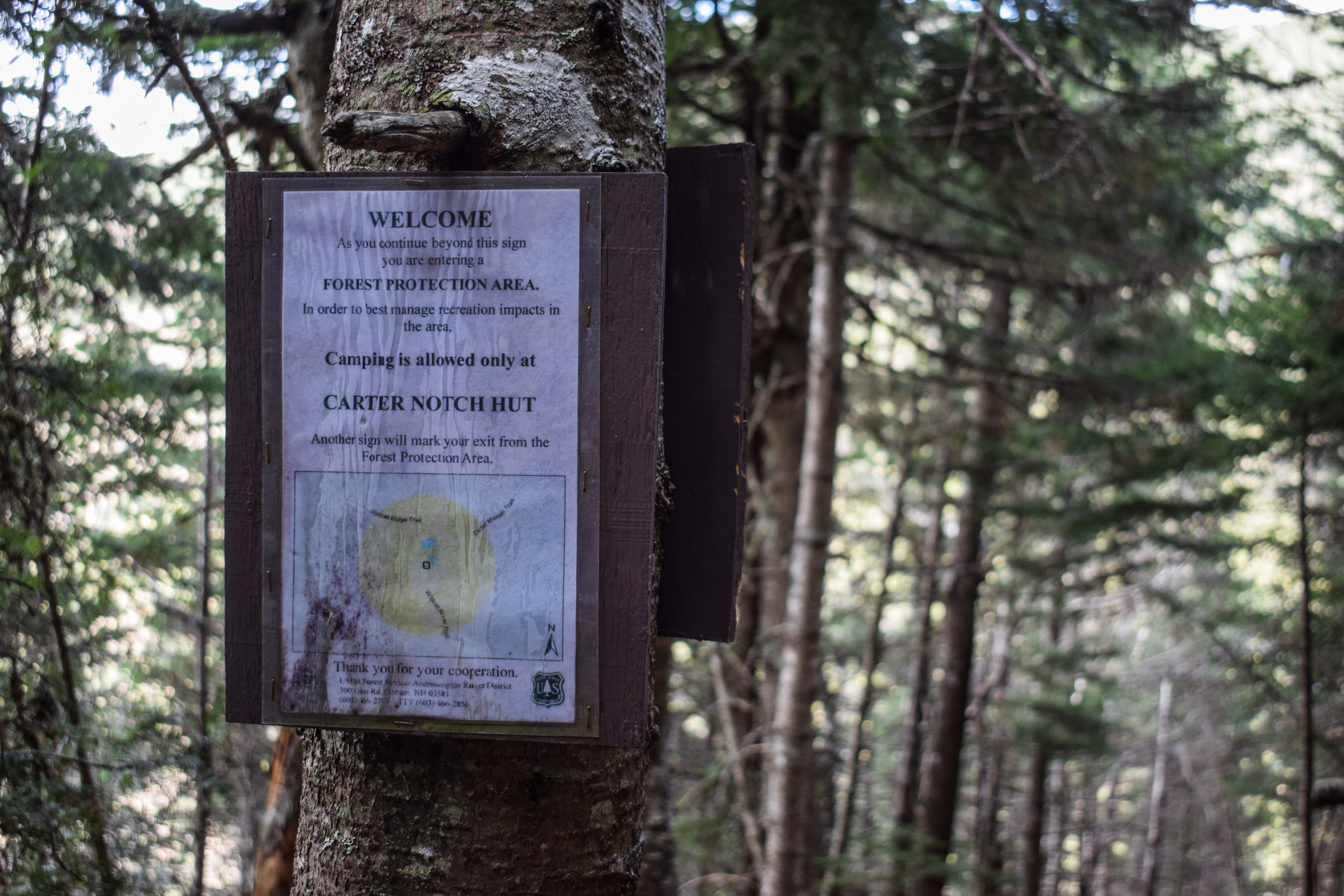
We were greeted to the tentsite with a hand-drawn map, some rules and regulations, and some safety regulations. The tentside is on a beautiful, relatively open knoll above the Wild River Trail. First we came to the fire ring on the left where we dropped our packs, and then deeper into the area are a few dirt tent pads, once with some nearby moose poop! There are also a few revegetation area signs around the area - it was really beautiful! We both found spots to pee and kept our packs off for another side quest to No-Ketchum Pond.
We hiked further down the Wild River Trail, keeping an eye on the left for the two spurs described in the guidebook. We made it to the far end of the pond and had only found one, maybe we had to go a bit further, who knows?
[9:04am - No-Ketchum Pond]
We turned onto the one clear spur path and it was a short adventure but QUITE the adventure. The bushes were pretty grown in on either side, getting us nice and wet, and there were a few tricky mud pits, one in particular... Sarah got across by balancing on submerged limbs, I guess. I thought I was doing the same, but when I went to take a little leap onto the dry ground my back foot slipped, causing my front foot to land early, and I SUNK into about two feet of mud. I was UPSET. It was one of the most unpleasant feelings I have ever felt. I made an unholy sound and Sarah said "I could only see your hair over the bushes!"
I bravely pulled my foot out of the muck and got to the end of the spur, which at least was pretty... The Carter Range was still in the clouds but what might be the southerly knob of Carter Dome that the Rainbow Trail ascends was out in the open and looking beautiful, especially with the early autumnal yellows.
We took our photos, I "cleaned off" by scraping my leg on the wet bushes, and we stopped back at the tentsite for a quick snack before resuming our journey and putting a bow on this silly side quest.
[9:20am - Wild River Trail]
[9:36am - Wild River Trail/Departs FPA]
[9:39am - Wild River Trail/Departs Wild River Wilderness]
We had a lovely return hike on the Wild River Trail, warming up as it easily gained a little bit of elevation. We exchanged more rounds of "MILFs," exited the Forest Protection Area, lamented at how we still need to actually climb a mountain, and then exited the Wild River Wilderness. We dipped to cross the rotting boards before the rainbow trail, and then... *schlurp.* I stepped in ANOTHER mud put. This one was only a foot deep, but just as horrific. Neither of us spoke - I think Sarah was too scared to talk first. I took a deep breath and accepted my new lifestyle of trench foot.
[9:40am - Rainbow Trail]
On the plus side, it was time to climb a mountain! We had been excited about the Rainbow Trail and were eager to see if it lived up to the hype - EVERYBODY seems to love it! The trail got off to a great start - soft dirt, yellow leaves, and a frog, bringing our ration to 0:2! The mushrooms were still exceptional, as well.
We climbed easily and moderately, and after about 20 minutes we came to "beautiful birch woods with luxuriant undergrowth," per the guidebook. Actually, it was a stunning area with an open canopy and a reasonable amount of undergrowth (the last time the guidebook read "luxuriant undergrowth" was when I hiked the Unknown Pond Trail from Mt. Cabot and the undergrowth was up to my chest, so I was nervous!). The views of the dead birch trees in this area were beautiful (similar to Casablanca at Saddleback), and we were ELATED to see our first views across the valley to nearby peaks, Mt. Kearsarge in the distance, and the Baldfaces a bit higher up. We took our sweet time in this area beacause it was simply stunning. There were plenty of clouds overhead, but they were beginning to burn off (finally!).
We passed an assumedly old white blaze and entered coniferous woods, sadly leaving that stunning area. From here, we climbed more moderately with a few steeper pushes. This was the first time during the hike that Sarah and I more or less "locked in." That was, until I inhaled a fly and had to gargle my water to not throw up. Rough day for me!
The trail began to transition to large rocks to a beautiful, more graudal, moss-lined trail that eased up and slowly began to provide views of... a cloud! Do it for the views!!!
[10:51am - Rainbow Trail/Southerly Knob]
In fairness, it was really cool. The primary view was towards the Carter Dome ridge, which was fully in a cloud but wind would provide peaks at the foliage leading up to the summit. There were more beautiful views from this southerly knob as the clouds blew around. We could see the Baldfaces through a few trees, and as the clouds blew over we could make out the end of the Montalban Range with the Sandwich Range far to the left and behind. It was COLD and windy on this knob, and knowing we still had to climb some more, we didn't stick around for too long.
The hike down to the sag between the southerly knob and Carter Dome was also in the open, which provided some more views of the clouds whipping around. There would have been a unique view into Carter Notch from here, but I guess I'll have to come back another time!
We fully arrived back into the woods and started to climb again along some more beautiful trail at a relatively easy-moderate grade, passing more moose poop and entering the clouds (against our will). The trail climbed a bit steeper near the top and passed what must be a couple lookouts, but we were fully socked in at this point. Thankfully, just a few minutes later we made it to the top!
[11:30am - Carter Dome Summit]
It was actually very fun (and comical) to be at the top of this mountain again! We wanted to summer when we did our overnight at Carter Notch Hut years ago, but we ran out of daylight and didn't want to tempt the steep descent in the dark. We wanted to do it after our Wildcat traverse, but Sarah's ankle was hurting bad. We FINALLY got it back in March of 2025, but not before I plunged my foot into a freezing river and had to wrap it up in a ziplock and hope for the best (it worked!). The views we got that day were incredible and Sarah SWORE she'd never be back, but here we were again - this time in a cloud!
We giggled at how we couldn't even tell there were fire tower footings when we were there with the snow. I got a picture of the disc and we recreated a few photos from that hike before taking a nice sit. I JOYFULLY took my shoes off to let me feet air out before putting new socks on (game-changer). The grey jays saw us snacking and immediately tried sizing us up, but we don't mess around! I wanted to take photos of them, but I couldn't walk around the summit barefoot due to a lot of broken glass (I guess from the fire tower windows? It wasn't bottle-shaped). A trail runner passed us (1:2) and then a duo hiked up from the notch and we joked about it being a perfect day for a view (3:2). Soon after they went on to Mt. Hight, we packed up and followed. Mid-pack-up, I looked up and saw blue skies and screamed "SARAH. BLUE." and we ran like animals to the little viewpoint and got a SMALL window towards... something. It was something, though!
[11:58am - Carter-Moriah Trail]
We started our second side quest of the day: Mt. Hight! Hiking down the Carter-Moriah Trail, we were immediately impressed with the height of the trees and moreso with the depth of the snowpack from our last hike up here. Not too soon after starting the trip, there was a little spur on the left that led to a view... A VIEW?! I YELLED again, and Sarah came barreling down the trail and we caught a unique view of the lower Chandler Ridge and lower slopes of Jefferson and Adams peaking through the clouds. The valley below had a nice hint of red appearing, too. We might get a view on Mt. Hight?! We could barely see South and Middle Carters through the flying clouds, too.
[12:09pm - Carter-Moriah Trail/Black Angel Trail]
Back on track, we easily descended along the Carter-Moriah Trail, carefully navigating some slippery boards and coming to another viewpoint at the Black Angel Trail junction toward the Baldfaces (and a fun note - the Black Angel Trail sign was fully barried last time we were up here).
[12:11pm - Carter-Moriah Trail/Carter Dome Trail]
Just after the Black Angel Trail junction we turned right to stay on the Carter-Moriah Trail towards Mt. Hight. The trail was pretty flat and unfortunately pretty muddy (I was suffering from post-traumatic stress). The trail was in the clouds the whole time, and we laughed when we came up to a little knob with only a cloud view. We climbed up a bit before emerging onto the open summit area that was, you guessed it, fully socked in! It was also WINDY!
[12:24pm - Mt. Hight Summit Area]
We chatted with the duo from Carter Dome for a minute, passing around jokes about being in clouds, talking about the 48, and we learned that they're from Connecticut and their kid is interested in the 48, but they just like hiking. Over the next 30ish minutes, the clouds started to clear up, revealing some spectacular views!
The summit area proper was beautiful by itself. To the left of Carter Dome we could see Table, Attitash, and the Moats with Chocorua and Shaw behind. We loved seeing the ridge that we hiked up along the Rainbow Trail. Further on the left, working counter-clockwise, we then saw the Baldfaces again, which were looking much smaller! To the north were the Royces, Mahoosucs behind the clouds, and then Shelburne Moriah, Moriah, and the Carters. There was a small plane low in Pinkham Notch and we caught an occasional glance at the lower slopes of the northern Presidentials.
After a while with the wind whipping, we did start to get cold and it was time to head on back! Sarah would have stayed truly all day, but I could no longer feel my fingers.
[12:54pm - Carter-Moriah Trail]
[1:06pm - Carter-Moriah Trail/Carter Dome Trail]
[1:07pm - Carter-Moriah Trail/Black Angel Trail]
To our delight, the return trip took hardly any time! We enjoyed a few peek-a-views from the trail as we passed the Carter Dome Trail and Black Angel Trail junctions. We were both feeling hunkered down for the climb back up Carter Dome, but it was truly easy peasy.
We checked out the view spur again, and ran into person #4 (4:2/2:1 ratio still isn't too bad!) and were overjoyed to see a mostly clear view of Mt. Washington! Huntington Ravine was looking exceptionally rugged from this viewpoint. We also loved seeing back to Mt. Hight, Middle Carter, South Carter, Mt. Moriah, Shelburne Moriah, and peaks far beyond. We noticed a piece of old, rusted metal in the woods at this spur - maybe an old fire tower-affiliated roof situation?
[1:22pm - Carter-Moriah Trail/Carter Dome Summit]
We said hello to the summit of Carter Dome again and began our descent back to the hut! We were both very curious about this descent, as we hadn't hiked this stretch of trail any of the three previous trips to this range! It started out pretty pleasant, reasonably descending with very obstructed tree views over to Washington and a wonderful breeze. Mt. Madison had officially left the clouds and a few trees let us catch a nice view that way, too.
The trail began to descend more moderately with rocky-but-decent footing, and this led us to a "viewpoint" sign, so naturally we had to take it!
[1:56pm - Carter-Moriah Trail/Viewpoint]
The spur climbed uphill for just a minute before opening up to a truly spectacular view down into Carter Notch. The Carter Lakes were rippling in the wind and the green roofs of the hut complex were standing proudly. The mass of Wildcat A looked ridiculous and beautiful with the specks of color, and Pulpit Rock was directly on the left kind of looking like a pseudo "old man." We could see Black Mountain, the Doubleheads, and Kearsarge to the right of Pulpit Rock, with the Moat-Attatash-Table Range, Chocorua, and Shaw after that. Further over we could see the bulk of the Sandwich Range with some smaller peaks like Iron Mountain and Mt. Tremont in the distant foreground. On the right side of the notch was Washington again in-and-out of the clouds. This was just stunning! Oh, and how could I forget to mention the stunning view down to the Ramparts?
We were both feeling quite hungry at this point, so we didn't stick around for too long. After the viewpoint, the trail began to steepen. It was steep, but footing was pretty good with many, many stone steps. We could hear someone singing ahead (or below...) of us, and it was someone working on a Diretissma attempt! Another person crossed paths with us soon after, and after fighting with gavity for a few more minutes, we delightfully entered the Forest Protection Area!
[2:10pm - Carter-Moriah Trail/Enters FPA]
Nautrally, the fight with gravity continued, but after a few million more steep stone steps, the trail began to level out. We both concluded that we would have been fine descending down here in the winter, but it wouldn't have been pleasant. I would absolutely go up this trail in the winter, though, to get a little Carter Dome-Hight loop.
After a bit more hiking that was only increasing in enjoyment, we came to the end of the Carter-Moriah Trail and turned onto the Nineteen Mile Brook Trail!
[2:25pm - Nineteen Mile Brook Trail]
Carter-Moriah Trail terminates right at the larger Carter Lake, which is always just beautiful. The cliffs of Wildcat A were daunting straight ahead, and if it was a little/much warmer out, we might have taken a swim! Water levels were low at the smaller Carter Lake, but the view up to Pulpit Rock and the cliffs of Carter Dome were beautiful.
[2:29pm - Carter Notch Hut]
[2:30pm - Wildcat River Trail
We walked just for another minute to find the Carter Notch Hut simply abuzz with AMC workers turning it over for the off-season. Every piece of cookwear was outside drying, all pillows and blankets were in the main room, all the bunkhouses were cleaned and airing out, and the... poop containers were being serviced? We speculated what that actually meant, but we did not ask. Instead of taking out break at the hut, we decided to continue on up past the bunkhouses and to the Ramparts for our final break of the day.
[2:31pm - Ramparts]
The sign for the Ramparts was super clear and a short, rugged footpath led to the expansive boulder field with just a stunning view up to the cliffs and Pulpit Rock and over to the "U" of Carter Notch. We spent a nice amount of time here just enjoying the serenity of this beautiful area, ate some snacks (including the cookie we got from Santa himself!), and did a quick potty break before our final blast off (and by blast off, I mean longer-than-I-was-ready-for hike out).
[2:55pm - Wildcat River Trail]
The Wildcat River Trail was identified as "pleasant" in the guidebook, and let me just say, the guidebook was correct! The trail left the rugged notch and entered some beautiful woods with a soft trailbed, gently meandering around and beginning to descend.
[3:00pm - Wilcat River Trail/Departs FPA]
We left the Forest Protection Area and descended more moderately, but never steeply. Footing was just about always good. We were both tired at this point of our hike, but still feeling good! We eventually crossed what the guidebook described as a washout from a 2011 slide, but it was really just a ~10ft long rocky section versus something cool to see. We hiked over a few streams and enjoyed the increasing deciduous trees showing their autumnal yellows and spent some time yapping about what a wonderful hike this had been! We had a nice and easy crossing of Wildcat River (the guidebook again said that it would be difficult at high water) and soon after came to the Wild River Trail junction!
[3:41pm - Wildcat River Trail/Wild River Trail]
We had one more uphill stretch which was totally fine and reasonable after the junction, which ultimately led to another easy crossing, but this time of the Bog Brook! This was the spot where the Bog Brook and the Wildcat Rivers meet, which was fun. We decided we would not hike the Bog Brook Trail back to the car and instead follow the gravel fire road becuase we were both all done with thinking for the day.
[4:19pm - Forest Road 233]
We HAPPILY turned onto Forest Road 233, crossed a bridge over Bog Brook (sign; we were confused becuase we thought this was the Wildcat River now?), and hiked uphill for just a couple minutes (we both silently lamented about this) and then had a delightfully easy hike out, crossing the Wildcat Brook (sign) on a bridge on the way.
We couldn't beleive our eyes when we saw the gate, and truly were confusing ourselves beacause we didn't see Sarah's car at first, but we didn't know there were two parking areas. We passed two more people at the end and their dog. Woman #1 said "he's friendly," and Woman #2 said "but I'm not," which gave us a good laugh!
[4:44pm - End of Hike]
Back at the car we changed into our clean clothes, got my car, and had a wonderful dinner at the Shannon Door right on NH-16 in Jackson! We each got a Chicken Parm and it was delicious! We wanted to stay longer since the live music was just getting started, but we were still three hours from home and it was a school night!
The drive home was pretty easy and when I got home I had one question: how do I quit working and do this every day?
Step-by-Step
- Start hike on Bog Brook Trail.
- At terminus, turn right onto Wild River Trail.
- At Perkins Notch Tentside, explore Tentsite and No-Ketchum Pond, then turn around.
- At jct., turn right onto Rainbow Trail.
- At terminus, turn right onto Carter-Moriah Trail.
- At Mt. Hight Summit, turn around.
- Follow Carter-Moriah Trail over Carter Dome and down to terminus in Carter Notch.
- At terminus, turn left onto 19-Mile Brook Trail.
- At Carter Notch, continue onto Wildcat River Trail.
- At jct., turn left to Ramparts.
- Enjoy the view, then turn around and return to the trail.
- Turn left onto Wildcat River Trail.
- At jct., with FR 233, turn right.
- Follow FR 233 back to car.
Map
Photo Album