Showing posts with label Fenno Hill. Show all posts

Friday, April 18, 2025

Chickatawbut Skyline Trail, Fox Hill, Little & Great Domes (Blue Hills Reservation)

Chickatawbut Skyline Trail, Fox Hill, Little & Great Domes (Blue Hills Reservation)

Hike Type: o-o Loop
Distance: 6.71 miles
Elevation: 758 feet
Time: 2 hours, 23 minutes
Hiking Challenges: Blue Hills Grid; Trail Trace the Blue Hills

The Hike 
Time for ANOTHER hike in the Blue Hills on ANOTHER beautiful day! It was my first day of April break and I was set on making my way over the Little and Great Domes (plus Fox Hill for some gridding). Temperatures were in the mid-50s when I started hiking in the morning and were set to climb. Originally, I had hoped to hike somewhere up north, but I NEEDED some sleep (and thank goodness I got it!). 


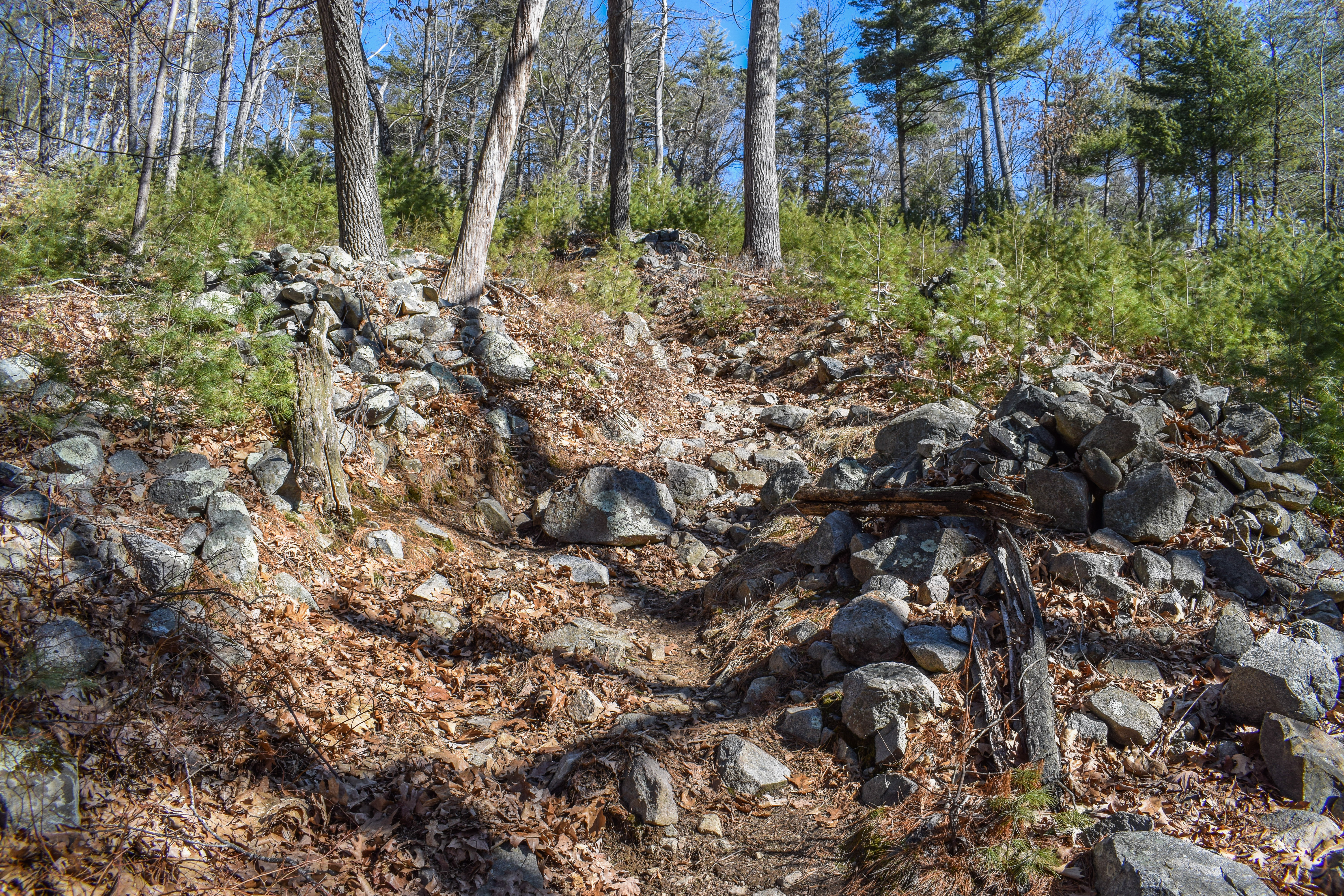
From the Braintree Pass Path trailhead, I started my hike along the Pipe Line just after 10:00am. I wore my waterproof boots for good measure, which paid off at the classically wet and muddy stretch. I passed a small bird's nest, scared the life out of some poor ducks, and admired the skunk cabbage that was growing in strongly. The mud started at the incline, which also featured some deer tracks. 


I made my way to the Hemlock Bound Foot Path, hiked to MA-28, and followed MA-28 for ~15 feet to the Skyline Trail, which had a normal blue but also an orange/brown blaze, which confused me. Maybe an old Great Dome Trail blaze? Not sure. 

Anyway, I followed the Skyline up the three distinct climbs up Chickatawbut Hill, which are steep and fun (and have herd paths around the steeps which I do NOT agree with). The temperature felt HOT now that I was climbing, but it was still delightful. I also included a note that I am, in fact, still mad about the fence around Chickatawbut Hill. 


I followed a faint herd path at the height-of-land to get to the true summit of Fenno Hill and continued down the well-crafted stairs up and over Kitchamakin and Nahanton Hills, the ladder of which features just beautiful views. I did notice a dad and child basically free-climbing up the rocky ledges of Nahanton which seemed wildly dangerous? To each their own, I guess... 


I was enjoying the beautiful walk across the Broken Hills when I got my first bug bite of the season followed by being charged at by a giant spider! Horrible. I also crossed paths with another large back snake - smaller than the one on Kitchamakin - but this one shook its tail to pretend it was a rattlesnake, which I did NOT like. 


Eventually, I escaped the cursed Broken Hills, crossed Wampatuck Hill, and made my way to Fox Hill. There was a vulture circling overhead, and with my luck, I was stressed, but thankfully I escaped unharmed. I descended via Fox Hill Path and began my drip to Sawcut Notch Path, where I turned onto a herd path at the height-of-land to summit Little Dome, which was LOVELY! There was a tree view of Hancock Hill and some daffodils (I think) next to a fire ring.


I retraced my steps back to Sawcut Notch Path, hiked alongside some spooky orange mud, and started on the herd path/old Great Dome Foot Path to the summit of Great Dome. The foot path was just discernable enough to follow it mostly without question, and the summit is just beautiful! It features a very unique view with Fox Hill's open forest, the Broken Hills behind it, and Hancock to the right. This summit also had daffodils and some purple flowers that I did not identify. 


I wandered around the summit for a bit, hoping to find an old blaze or foot path to continue along the old Great Dome Foot Path (Great Dome Trail?), but eventually fell short and gave up. I did see a goldfinch, though! I retraced my steps, noticed some golfers through the trees, and continued along Satcut Notch and then Short Path past a comical amount of robins.


I looked hard for any evidence of the old Great Dome Foot Path/Trail, but did see anything clear in my return... oh well. I followed the appropriately named Pleasant Trail to the Pipe Line, which started my long walk back to the car! It was wetter one near Chickatawbut Road, but overall not too bad. This was a seriously fun, unique loop!


Step-by-Step
- Park at Braintree Pass Path trailhead.
- Start hike on Braintree Pass Path.
- At 3022, continue right on Pipe Line.
- At 3013, turn right onto Hemlock Bound Foot Path.
- At terminus, turn right onto MA-28.
- At jct., turn right onto Skyline Trail.
- Cross Chickatawbut Road.
- At 4134, turn left onto path, staying left.
- At Pipe Line turn left.
- At terminus, turn right onto Fox Hill Path.
- At 4102, turn left onto Indian Camp Path.
- At 4091, turn left.
- At 4083, turn right onto Sawcut Notch Path.
- At height-of-land, hike herd path on left to Little dome, then continue on Sawcut Notch Path.
- Beofre height-of-land, hike on former Great Dome Foot Path to Great Dome on right, then continue on Sawcut Notch Path.
- At 4133, turn right onto Short Path.
- At 4124, turn right onto Crags Foot Path.
- At 4091, turn left onto Indian Camp Path.
- At 4086, turn right onto path.
- At 4082, turn right onto Pleasant Trail.
- At 4046, turn left onto Pipe Line/Headquarters Path.
- Follow Pipe Line/Headquarters Path to Chickatawbut Road.
- Cross Chickatawbut Road, follow Pipe Line/Headquarters Path back to car.


Monday, May 1, 2023

Chickatawbut, Squamaug, Sassaman, Lee (Blue Hills Reservation)

Chickatawbut, Squamaug, Sassaman, Lee (Blue Hills Reservation)

Hike Type: Lollipop Figure 8
Distance: 5.12 miles
Elevation: 617 feet
Time: 1 hour, 55 minutes 
Hiking Challenges: 52 Hike Challenge; Blue Hills Grid; Blue Hills 125 Mile Club (2x)


The Hike
Now that I'm finally over being sick, I'm back on my usual grind! It was a beautiful Monday afternoon and I was looking forward to doing a hike with some views after it had rained ALL weekend and get just a little bit of elevation gain. I got nervous when I pulled in the parking lot - there were bugs EVERYWHERE. Thankfully the clouds were clearing up, and with that came a steady breeze that kept the monsters at bay. I needed to remember my primary objective: taking a selfie (Judy Jacobs, executive director of the Friends of Blue Hills requested a photo of me in the reservation for their annual report, where they're quoting me from one of my Facebook posts).

This was also a special day becuase I was debuting a new pack! Well, the exact same pack I've been using, but in different colors and not disgusting yet! There's a small hole in my usual pack and it smelled BAD, so I'm either going to wash it and continue to use it, wash it and put it in storage, or wash it and then maybe turn it into a tote bag (key point here is that needs to be washed). I was suprised how different the new pack felt, especially becuase it's the exact same one...

Now officailly on my hike - I was immediately thrilled with how green everything is getting! Especially paired with the blue sky opening up, it was the emotional boost that I needed! I followed the Braintree Pass Path to the Bouncing Brook Path (briefly), and then up to the Skyline Trail. The first stretch of the Skyline Trail up Chickatawbut Hill is STEEP, with one slightly tricky scramble, but the views are definitely the reward for this section. The sun was hot, but the breeze was cool - truly wonderful weather. 

I noticed all the colors again when I hit the burnt section of Fenno Hill - the way the blue sky, green plants, and burnt ground really contrasted beautifully, even if a little spooky. I was still able to smell some smoke when I did a short bushwhack to the high point of Fenno Hill for my grid. There really seems to be a footbed leading there, although its comically wiggly. 

I almost missed the summit of Kitchamakin, but thankfully someone passed me which caused me to stop for water and I realized where I was. The climb up Nahanton went well and I noticed that I was feeling abnormally strong - must be a positive effect of taking a week off to rest and having a lighter pack than I'm used to (I also seem to have lost my kahtoolas...). There was a group of teens enjoying 420 at 4:20 coming down Nahanton, and I gotta give them credit for the dedication and punctuality. I just hope they were mindful of embers.

I then wiggled down Squamaug toward Chickatawbut Road, went back up Slide Notch, and then over and down Sassaman Notch, where there was a lovely stream paralleling the trail. I decided to make my way over to the Great Dome Foot Path along the Bouncing Brook since it had rained recently, and it was perfect! Dry trail, but flowing stream. The best view was from the Laurel Path looking at the Boucning Brook, but the brook alongside the trail was still lovely. 

My final stretch of hiking for the day was the Bouncing Brook Path, Lee Path, and then returning via Braintree Pass Path again. I could hear the spring peepers in the distance and noticed some old stone walls around the Lee Path. Maybe Lee lived here? The Lee family? I'm sure there's a map somewhere with that information. It's crazy to think about how all this area used to be privately owned, and sometimes habited. I do think a member of Lee's family got mad at me when I stepped off trail to pee - once I finished up a stick fell directly onto my head!

My energy was winding down by my final walk out on the Braintree Pass Path, and soon enough I was back at my car and getting ready to head home! It was such a lovely afternoon, and I was bummed that I wouldn't be able to get back out for a few days (Red Sox game tomorrow, rain the rest of the week). 

Step-By-Step
- Park at Braintree Pass Path Trailhead (Chickatawbut Rd. & MA-28).
- Start hike along Braintree Pass Path (red blazes).
- At 3042, veer left to join Skyline Trail and Bouncing Brook Path (red and blue blazes).
- At next junction, turn left to continue on Skyline Trail & climb Chickatawbut Hill (blue blazes).
- Follow Skyline Trail (blue blazes).
- At 3144, turn left onto Squamaug Notch Path.
- At 3104, continue along trail to Slide Notch Path.
- Slightly uphill, hike spur on right and return.
- Continue along Slide Notch Path.
- At second junction, veer left onto Sassman Notch Path (red blazes soon after).
- At 3135, turn right onto Curve Path (red blazes).
- At 3130, veer straight/right onto Bouncing Brook Path and Laurel Path.
- At 3111, turn right onto Great Dome Foot Path.
- At 3085, turn left onto Bouncing Brook Path (red blazes).
- At second junction, turn left onto Lee Path.
- At 3155, turn right onto Braintree Pass Path.
- Follow Braintree Pass Path back to car.


Monday, March 20, 2023

Chickatawbut West (Finale) (Blue Hills Reservation)

Chickatawbut West (Finale) (Blue Hills Reservation)

Hike Type: Speghetti
Distance: 10.52 miles
Elevation: 1335 feet
Time: 3 hours, 53 minutes
Hiking Challenges: Blue Hills Winter Trace; Blue Hills Grid


The Hike
Time for the last hike of winter! The solstice is at 5:24 pm today, so I will definitely be done before then. I parked at the Braintree Pass Path trailhead, already suited up from my warm-up hike, and got right to it! It was still chilly outside, but thankfully not too cold, and the sun was getting warmer by the minute. There were a few other cars in the parking area, but I would be delighted to realize how few people I would see during my journey. I was dreading hiking along the Pipe Line, but I was delighted to learn that it was in decent shape. The flat section only had one short moment of squishy mud, and eveything else was firm and stable. It helped that some areas were still frozen over! It did get muddier as the incline started, which required some tricky maneuvering. I stuck to the lefthand side of the Pipe Line for this, but realized about halfway up the right side was dryer. It was the wettest by the Skyline Trail junction, but thankfully I survived unscathed. 


I started my first round of wiggle around 3013, eventually landing along the Slide Hill Trail and Carve Path up Chickatawbut Hill. The Carve Path was an interesting route - an older burned section, a deer enclousure, an eroded path, and a bunch of confusing large cairns that bordered the trail. The climb was steep, but the breaks in the trees allowed the almost spring sun to shine on me, which truly felt revitalizing. Unfortunately, it was at this moment when I realized I forgot to bring a buff AND I forgot to take a puff of my inhaler - oof. There is a lovely open view near the top of the path, and every now and then I could smell a hint of spring. 


Once up on Chickatawbut Hill, I had to do some wiggling near the yellow loop where I found what is likely to be the last needle ice of the season! I found myself stopping every time the sun hit me for some much needed lizard time. The power of the sun is incredible. 

Next step was to descend the Skyline Trail from Chickatawbut Hill all the way to MA-28. The Skyline Trail descends gradually to a great view of Hawk Hill and Buck Hill, and then descends steeply over scrambles and slabs. It comes to another lower view, and then descends steeply again. At the lowest point, the Skyline Trail travels over flat land, before slightly ascending to a very, very wet area near the Pipe Line. At the jct. with MA-28, the granite trail marker has been uprooted and knocked over, but still intact. 


I followed MA-28 for a few feet to now join the Hemlock Bound Trail, which was narrow and had the lovely mysterious yellow blazes. I did a bit more wiggling, which brought me to the loop with the Hawk Hill and Savoy Paths. Just before that loop, the Pipe Line crosses MA-28, and a few feet south of that jct. is an old trail no longer in use that I briefly explored. It seems to maybe connect to the Savoy Path terminus, but I didn't travel too far in. I know there is an old trail somewhere in this area that goes to the Pakomet Spring, but I couldn't find it easily (and still had much ground to cover). 


After my loop I headed up back to the Savoy/Hawk Hill Path jct. to see the view just to the left of the junction, and then worked my way toward the Glover Path, where I was greeted by some impressive stone walls and two lovely deer with extremely fluffy white tails. I really enjoy trails like the Glover Path - long (for the Blue Hills) without other junctions. Very peaceful. 


From there I made my way back to the Braintree Pass Path with an out-and-back on the Lee Path soon after. The rest of the Braintree Pass Path is a favorite of mine - again, long and peaceful. It's really pretty up near the height-of-land where the old Hemlock Bound Trail intersects. There are some seasonal views through the trees, and the trail terminates at an old barricade just before a steep cliff that plummets to I-93. Even more fun, I could see the barricade on the other side of the highway where it used to connect. 


The rest of the Braintree Pass Path is a narrow footpath connecting the old terminus with the Laurel Path, and it's a bit messy. I was able to follow it decently, but it was unclear at times. The Laurel Path was easy and gentle as always, with rushing water near the Great Dome Foot Path. My final climb was on the Curve Path and then Sassaman Notch Path, which is where my lungs really started to get angry with me. I took my time and slowly made my way up, admiring a few well-trained dogs and the eerie burnt woods. Once finally in the notch I hit the 9 mile mark and quetioned my sanity - I really should have drank more water and had some more food, whoops! All I needed was to get up and over Kitchamakin Hill and then down Slide Notch to the car.

The final stretch of trail was much easier, and all I could think about was food, shower, and rest. I was grateful to only have seen a handful of people during this hike. I also remembered that I had hiked an additional 1.5 miles this morning, which definitely contributed to my level of exhaustion. This ended up being my longest-distance and longest-time hike of 2023! Especially when paired with my warm-up hike in Braintree. 12.18 miles/4 hours, 46 minutes! I'm glad I'm still revving things up, which will hopefully help me crush bigger hikes as the weather gets nicer and nicer. Now it's time to put the winter map away and get back to working on my second round of the 125-mile challenge!


Step-By-Step
    - Park at Braintree Pass Path Parking (Chickatawbut Road & MA-28).
    - Start hike along Braintree Pass Path (Red Blazes)
    - At 3022, veer right onto Pipe Line.
    - At 3011, turn right onto Bouncing Brook Path.
    - At MA-28, turn around.
    - At 3011, turn left to retrace steps on Pipe Line.
    - At 3031, veer right onto Slide Hill Trail.
    - At jct. with Braintree Pass Path, turn left onto Braintree Pass Path.
    - At jct. with Bouncing Brook Trail, turn around.
    - At jct. with Slide Hill Trail/Carve Path, turn left onto Carve Path.
    - At 3065, turn right onto Skyline Trail.
    - At second junction, turn right onto Stowe Path.
    - At next junction, turn left to continue on Stowe Path.
    - At terminus, turn left onto Sassaman Notch Path (Yellow Blazes).
    - At next junction, turn around, and hike Sassaman Notch Path to 3094.
    - At 3094, continue straight onto Sassman Notch Path (Red Blazes). 
    - At junction with Skyline Trail, turn sharply right onto Skyline Trail.
    - Hike Skyline Trail to summit of Kitchamakin Hill and Fenno Hill (off-trail).
    - Re-summit Chickatawbut Hill on Skyline Trail, and then follow Skyline Traill all the way to MA-28.
    - At MA-28, turn left to Hemlock Bound Trail Trailhead.
    - Hike along Hemlock Bound Trail to jct. with Bouncing Brook Trail.
    - Turn right onto Bouncing Brook Trail.
    - At 3011, turn left onto Pipe Line.
    - At MA-28, turn around and hike to 3005.
    - Turn right onto 3005, then make another immedite right onto Pakomet Path.
    - At terminus, turn right onto Savoy Path.
    - At MA-28, turn around and hike Savoy Path to 3030.
    - At 3030, turn left onto Hawk Hill Path.
    - Just before 3005, turn left onto Pakomet Path.
    - At terminus, turn left onto Savoy Path.
    - At 3030, turn right onto Hawk Hill Path.
    - At 3044, turn left onto Glover Path.
    - At 3040, turn right onto Slide Hill Trail.
    - At terminus, turn right onto Braintree Pass Path.
    - At 3155, turn left onto Lee Path.
    - At terminus, turn around.
    - At 3155, turn left onto Braintree Pass Path.
    - At terminus, turn left onto Laruel Path.
    - At 3130, turn left onto Curve Path.
    - At 3135, turn left onto Sassaman Notch Path.
    - At jct. with Skyline Trial, turn left onto Skyline Trail.
    - At jct. with Slide Notch Path, turn left onto Slide Notch Path.
    - At 3072, turn right onto Bouncing Brook Path.
    - At 3042, turn right onto Braintree Pass Path.
    - Return to car.

Sunday, January 29, 2023

Chickatawbut Skyline Trail to 3174 Loop (Blue Hills Reservation)

Chickatawbut Skyline Trail to 3174 Loop (Blue Hills Reservation)


Hike Type: Spaghetti Figure-8 Loop

Distance: 6.62  miles

Elevation: 942 feet
Time: 2 hours, 39 minutes

Hiking Challenges: Blue Hills Winter Trace, Blue Hill Grid


The Hike
It’s Sunday and… actually spring now? The temperature was almost exclusively in the 50s during this hike which was equal parts lovely and unsettling to the brain. Hearing the songbirds chipping was lovely, though. I parked at the Chickatawbut Overlook, hiked to the tower, and then headed to the Sassaman Notch Path toward Chickatawbut Road, which was an easy, little traveled out-and-back. Now headed in the opposite direction, I took the barely visible Thayer Path steeply up old stone steps, followed it to the left down its other branch, then went up the stone steps once more before hitting the road up Chickatawbut. I had my usual crankiness that the actual summit of Chickatawbut Hill is inaccessible to hikers, and then continued past the road along the Thayer Path. There are nice partial views heading down Thayer before diving into the woods, and I had a brief moment of sentimentality where I was just so grateful to live near such a great series of hills and trails.

Continuing down Thayer Path, I startled a family of deer and then followed a herd path into a power cut and then around the perimeter of the water tower to hike out-and-back the water tower road. I retraced my steps, and then continued down the Thayer Path to 3042, which is comically difficult to find at first. It was a breezy day, and the fire-charred trees were sawing LOUDLY in the wind, which was spooky for sure. I walked past a group (guided?) hike, followed the Braintree Pass Path for a short while before turning left onto an unnamed path (Stokes Foot Path! Finally found its name on the FBH website on an old map) that eventually connects with the Skyline Trail. I loved this trail! It gets a little steep at times, but never anything silly. The upper stretch is along a rocky ridge which reminded me of the Kittatinny Ridge in NJ. You could tell there used to be a good amount of views from this trail a few decades ago, but the trees have grown in. This trail terminates at the Skyline Trail a little past halfway up Chickatawbut Hill, and slightly down the hill is an excellent view of Hawk Hill, Buck Hill, and Great Blue Hill (I saw this outcropping from Buck Hill yesterday and wondered about it!). My Sunday hungover legs were surely feeling the burn by this point, but thankfully the views made up for the pain. A passerby reminded me that this 50-degree weather is not to be trusted.

Finally heading up to the top (or as close to the top as I can get) of Chickatawbut Hill, where I passed the group again as they were exploring small spurs to views. The next few hills were fun to go over, but also eerie, as this area was severely burned last spring/summer. There are stairs going up Fenno, up and down Kitchamakin, and again up Nahanton. Fenno was the most burnt, and it was spooky. An eerie sense of beauty, but also upsetting knowing that they were set with mal intent. There is a great view coming down Nahanton, one that I barely remembered from my Skyline Traverse 1.5 years ago - I need to do one again.

The next section of the trail was through the Broken Hill - I counted four plus a small knob. The first broken hill was the biggest and most burnt, and it descended to a small pond, before immediately rising to a small knob. Just after the knob there is an old sign post, and then the rest of the trail had old fence posts remnants. I assume this has to do with the old Blue Hills Reservoir, which I learned was decommissioned in the late 90’s and filled in the 2000’s and replaced with the current water tanks and pond. Not sure though! Broken Hills 2 and 3 were gentler, with a nice view coming down #2. #3’s height-of-land is a big rock slab, and then there is a steeper climb up to #4 with a big, open summit area. I finally descended off the Skyline Trail to Chickatawbut Road, and instead of road walking, I found an unmapped path (later learned it used to be called Pocapawmet Path) that went where I needed to go.

I followed Pocapawmet Path to Wampatuck Path, quickly hiked to the road, and got side tracked by a lost family trying to find their hike. The woman asked me where “Great Blue Hill via Skyline Trail” was, and I showed her on the map. I asked if she meant to take Skyline since it is comically steep, and she said her mom is in the car and in her 70s and they do not want steep. I told them to take the outer red-dot loop from the Trailside Museum - I hope they had a good time!

I hiked over to do the loop near 3174 which was my least favorite part of the hike. 3163 to 3174 is along industrial property, and there was one section that was very polluted and very stinky - it kind of brought me back to reality. Thankfully, the Wood Path was beautiful, and even the Curve Path, which was completely flooded, was still very scenic. My final challenge for the day was climbing back up Sassaman Notch Path, which was a beautiful trail, through Sassaman Notch, back to the tower, and then back to my car. I was only chafing a little, and so happy I got to enjoy this lovely, yet disheartening weather. When I got home to check my stats, I found that I’m officially ahead of last January except for 68 feet of vertical gain that I still need - two more days of January to do it!

Step-By-Step
  • Park at Chickatawbut Overlook, start hike on yellow-dot trail to Chickatawbut Tower.
  • At Chickatawbut Tower, turn right to follow yellow-dot Tower Path.
  • At 3075, hike out and back on Sassaman Notch Path to Chickatawbut Rd.
  • Back at 3075, hike on Sassaman Notch Path in other direction.
  • At unmarked intersection, turn right and hike Thayer Path branches, and then follow Thayer Patch all the way to Braintree Pass Path near 3022, hiking the dirt road from and to the water tower..
  • At 3022, follow Braintree Pass Path toward Skyline Trail.
  • Soon after 3022, turn left at unmarked intersection onto unnamed path.
  • At terminus, turn right onto Skyline Trail to see a great view of Hawk and Buck Hills.
  • Retrace steps to last junction, continue on Skyline Trail to Chickatawbut Hill, Fenno Hill, Kitchamakin Hill, Nahanton Hill, and the four Broken Hills.
  • At Chickatawbut Road, turn onto Pocapawmet Path (not on 2020 map).
  • At terminus, turn left onto Wampatuck Path, hike to road, retrace steps, and continue on Wampatuck Path.
  • At 3160, turn left onto Squamaug Notch Path.
  • At 3163, turn left onto Romari Path.
  • At 3174, turn right on Wood Path to Wood Rd., retrace steps.
  • Back at 3174, hike on Wood Path to 3153.
  • At 3153, continue left onto Curve Path.
  • At 3135, turn right onto Sassaman Notch Path.
  • Follow sign for yellow-dot path, and then follow yellow dots back to car.