Showing posts with label Rock Circuit Trail. Show all posts

Tuesday, November 19, 2024

Partial Rock Circuit Loop (Middlesex Fells Reservation)

Partial Rock Circuit Loop (Middlesex Fells Reservation)

Distance: 4.23 miles
Elevation: 505 feet
Time: 1 hour, 26 minutes
Hike Type: Lollipop Loop
Hiking Challenges: N/A

The Hike
"Man Versus The Sun" - that could be the title of this one. I had a couple hours to kill after work so I headed back to the Fells for the first time in a while to tackle the Rock Circuit Trail. I knew I would be cutting it close. I zoomed over after school and got started by crossing the busy Woodland Road. It was sunny, a bit breezy, and a warm 55 degrees.


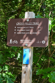
Once in the woods, I followed the Cross-Fells Trail to E4-8, curving around the dried-up Shiner Pool and turning onto the Rock Citcuit Trail. The Braintree police department put out a public safety notice joking that if you even look at a leaf the wrong way, it'll catch fire, and that was apparent up here, too. 


The Rock Circuit Trail joined a gravel road rounding another dry pool, passed over a dead mouse (RIP), and then crossed another gravel road that led to the Fells Reservoir. The trail neared an apartment complex and then turned further into the woods, where blazes were abundant.


At the first outcropping, I passed the terminus for the Crystal Spring Trail, and began to traverse up and down and up and down over many rock outcrops. There was an "almost-view" right before descending to cross the Fellsway East, and then ascends back up again toward Melrose Rock.

Melrose Rock provided a nice view. Notably, I could see a plume of smoke coming out of a nearby brush fire. A similar view from White Rock was up next, followed by a trickle of water heading down The Cascade. I wanted to investigate it further, but I was still racing against the setting sun.


There was another nice view from Black Rock, which included the ocean for the first time of the hike, followed by another view to some nearby athletic fields. The Rock Circuit Trail continued to wiggle up and down several more outcroppings, ultimately landing at the best view from Pinnacle Rock, overlooking Boston. 


I quickly backtracked and then continued over the loop, acknowledging that I might be losing this race against the sun. I made it over Boojum Rock and the MIT Observatory site, but later dipped off onto Hemlock Pool Road. I do think I could have made it, but the dimming light was making following the trail difficult, and I knew I would be fine on a wider road/trail. My return trip was nice and easy, the Hemlock Pool was also fully dried up, and I arrived at the Woodland Road crossing with perfect timing - no cars in either direction!


Step-By-Step
- Park at Flynn Rink.
- Carefully cross Woodland Road.
- Start hike on blue-blazed Cross-Fells Trail/Woodland Path.
- At E4-8, turn left onto white-blazed Rock Circuit Trail.
- Follow loop clockwise.
- After MIT Observatory, when Rock Circuit Trail nears Hemlock Pool Road, cut through woods to Hemlock Pool Road.
- Turn left onto Hemlock Pool Road.
- At E4-13, turn right onto Woodland Path.
- Return to car.


Map of Middlesex Fells Reservation (2024)

Thursday, June 1, 2023

Rock Circuit Trail (Middlesex Fells Reservation)

Rock Circuit Trail (Middlesex Fells Reservation)

Hike Type: Lollipop Loop
Distance: 5.07 miles
Elevation: 561 feet
Time: 2 hours, 22 minutes
Hiking Challenges: 52 Hike Challenge 2023


The Hike
Time for a change of scenery! I had to stay on the north shore for some drag bingo in the evening, and I had a few hours to kill, so I decided to head back to the Fells! It was hot as balls outside - 92 degrees, and my lungs were feeling weird after my lung function test from the day before, but off I went! I noticed there was a new trailhead kiosk with a map at the rink trailhead, I carefully crossed Woodland Road, and my journey had begun!


Last time I hike the Rock Circuit Trail I included the Rock Circuit Connector to make a figure-8 loop - this time I was going to follow the loop as written counter-clockwise. I chose this direction because I remembered the last mile-ish being easier than the rest, and I hoped that would give me a chance to cool off. I was right, thankfully, but in the future I'll likely follow the loop clockwise, which saves the best views for the end. 


The Cross Fells Trail intersects the Rock Circuit Trail at intersection E4-8, and right away the rollercoaster begins! It was slightly cooler in the woods than it was in the parking lot, but it was still ridiculously hot for my New England body. The first view is soon after getting on the trail, which is less of a view and more of an open, unnamed ledge, but still nice nonetheless. The temperature difference was drastic from the woods to the ledge.


Even the birds were overheated - they were out and about but not wasting any precious energy on singing (that's how that works, right?). Continuing on, I found my way to the old MIT Observatory where I met quite a large cottontail rabbit. The first real view was from Boojum Rock, and it's spectacular! A great view of Boston and Great Blue Hill. 


The trail continues to wind and wiggle and climb and descend, and then briefly coincides with the Cross Fells Trail as it crosses the Fellsway East, which is slightly terrifying. On the other side of the road the trails diverge again and the rollercoaster continues, steeply climbing and descending, continuing onto Ziggy's Rock, which is not listed on the DCR map. It also looks like it's an out-and-back to the rock, but it is a close loop. It does have a lovely view of Boston! Acting as a preview to Pinnacle Rock.


The Rock Circuit Trail skirts past a communication tower and then steeply climbs to Pinnacle Rock, which is wide open with an excellent view of the nearby neighborhoods and Boston in the distance. If it wasn't 10,000 degrees outside, it would have been a fantastic spot for a break, but it was hotter than Satan's sauna outside. I noticed there used to be a USGS disc up there, but it had been removed. 


After Pinnacle Rock, the trail dips back into the woods and continues to rollercoaster about. There is one particularly intense scramble - almost a 50-60 degree slab that is well textured with a few footholds. I remembered this one from last time - there is also a bypass that is blazed. It looks like the scramble is blazed in the ascending direction, and the bypass is blazed for a descending direction. It was fun, but I am glad I followed the appropriate blazes (i.e., I wouldn't descend this way). 


I admired some of the abandoned catepillar nests (looked more like hammocks) as the trail climbed up to Black Rock, which had some nice views of the nearby towns and Logan Airport in the distance, where I was able to see a plane taking off! I couldn't help but admire how the stats of the trail technically weren't difficult, but oof my legs were feeling it!


The trail passes past the Cascade, which has a yellow-blazed trail that is not on the map. I followed this last time, and its nice, but I was overheated and cranky. Next up was another great view, and the last view, Melrose Rock! Wide open, another lovely break spot in nicer weather. From Melrose Rock, the trail climbs some more to another viewless high point, and then descends to cross the Fellsway East agian. 


Now in the final stretch of the hike, the rollercoaster had died down (not done though!) and the heat was pumping. My fingers were officially sausages, and I noticed a helicopter hovering overhead, probably a traffic copter since I-93 was nearby. The trail was a little grown-in before F4-8, but nothing too bad. Continuing to wind, the trail makes its way to a junction with a red-blazed trail, and then comes to a corner that borders a health facility. 


I saw a few people in this last mile, but not too many, which I enjoyed. I crossed the gravel Reservation Path and heard a vehicle drive behind me - a DCR firetruck? With its lights on? A little further down the trail I noticed some firefighters in the woods, and then I noticed they were putting out a brush fire! Thankfully I wasn't in any danger, but wow! They were pulling water from the Fells Reservoir. I guess that's what the helicopter was for?


I got to walk past four different fire trucks on Hemlock Pool Road, and the next bit of the hike was very smoky. Really neat and unique, but smoky as heck, which wasn't great for my asthma. I could see and hear the trucks and firefighters from the other side of Shiner Pool. There were a few fully charred leaves that floated their way over, which were iconically satisfying to crunch. 


Soon enough I was back at the car and headed to bingo! I blasted the air conditioning, and a few hours later the fire was on the news - a 4-acre brush fire of unknown origin, first reported around 3:00pm and out by 6:30. I'm glad I didn't do the hike in the opposite direction!


I find it vitally imporant to point out that now that I've posted this hike, I'm officially caught up in my journaling! 


Step-By-Step
- Park at Flynn Rink.
- Carefully cross Woodland Road.
- Start hike on Cross-Fells Trail (blue blazes).
- At E4-8, turn right onto Rock Circuit Trail (white blazes).
- Follow Rock Circuit Trail for its entirety.
- At E4-8, turn right onto Cross-Fells Trail (blue blazes).
- Carefully cross Woodland Road, return to car.

Monday, June 6, 2022

Rock Circuit Figure 8 Loop (Middlesex Fells Reservation)

Rock Circuit Figure 8 Loop (Middlesex Fells Reservation)

Hike Type: Figure 8 Loop
Distance: 6.39 miles
Elevation: 735 feet
Time: 2 hours, 50 minutes
Hiking Challenges: 52 Hike Challenge

View from Boojum Rock.

The Hike
Another day exploring the Fells! My heart still belongs with the Blue Hills, but the convenience of the Fells is definitely alluring. I've watched Adam Hoyt's video on YouTube about the Rock Circuit Trail forever ago, and I was excited to dive in today! The plan was to make a figure 8 loop with the Rock Circuit Connector trail, and I was happily successful with only a few scratches (that I'm not entirely sure where they came from). I parked at the Flynn Rink, carefully crossed Woodland Road, and started my hike on the Cross-Fells Trail for a short moment until I turned right onto the Rock Circuit Trail.


The first thing I noticed wasn't any views, it wasn't the blazes or any possible scrambles... it was the pollen. EVERYWHERE. I've never seen everything so yellow. It was so yellow that when I tried to take a photo, my phone auto-adjusted the white balance. The leaves were dusted, the rocks covered, and my eyes FULL. Thankfully, the trail started rewarding right away with open rocky areas that were fun to hike up and down (for now). The first leg of this hike led to the site of an old MIT Observatory, which wasn't more than an informational kiosk and a pile of rocks at the site of the former tower, but still cool nonetheless.


Soon after, I turned onto the orange-blazed Rock Circuit Connector trail to start the figure-8 part of the hike. The trail itself was relatively featureless. It skirted the restricted area around the reservoir and paralleled a swampy area with interesting mud/orange algae/pollution(????). The bugs started to get feisty here, but thankfully it didn't last long. This trail terminates just before the Rock Circuit Trail crosses the Fellsway East, which was another careful road crossing. After crossing the road, I officially rejoined the Rock Circuit Trail, now traveling clockwise.


The views really start to pick up on the Eastern side of the trail, starting with the appropriately named Melrose Rock (and tons of Blueberry bushes on the way!), that primarily gives views of Melrose down below, but also a slight view of Boston. I took a surprise trip to see The Cascade, which is marked as a landmark on the map, but the yellow-blazed trail leading to it was not. I took a side trail to see the upper reaches and then followed the yellow trail down to see the basin where it lands. We're in a moderate drought right now so there was nothing more than a trickle, but I imagine it's incredible after a heavy rain!


Back on the Rock Circuit Trail, I continued hiking towards Black Rock and ultimately Pinnacle Rock, both offering great views of the neighboring communities and Boston. Somebody spray painted a series of messages, ultimately resulting in a proposal on the trail in this area. I hope Jessica, the subject of these graffitis, said yes but called the fiance a butt for spray painting that much. The view from Pinnacle Rock was by far the best and most expansive, which proves the appropriateness of the name. 


After Pinnacle Rock, there was another crossing of the Fellsway East, a very steep scramble up a massive rock, and another view from Boojum Rock before reuniting with the Rock Circuit Connector Trail. The second trip on this trail was the same as before, and the final leg of the Rock Circuit Trail was relatively featureless, which I was grateful for at this point as my legs were tired from the endless ups and downs. Before I knew it, I was back at the Cross-Fells Trail, crossing Woodland Road, and back at the car! I will definitely repeat this hike in the future. 

Step-By-Step
  • Park at Flynn Rink, carefully cross Woodland Road.
  • Enter woods at blue-blazed Cross-Fells Trail/Woodland Path.
  • At E4-8 intersection, turn right to start the white-blazed Rock Circuit counter-clockwise.
  • Carefully follow white blazes.
  • After the MIT Observatory Site, at intersection F5-8, turn left to the orange-blazed Rock Circuit Connector trail, follow to it's terminus.
  • At terminus, carefully cross Fellsway East and rejoin the white-blazed Rock Circuit trail, this time traveling clockwise. 
  • Near intersection G4-4, turn left onto the yellow-blazed trail that leads to the cascade. Explore and return.
  • Back at the intersection, turn left to continue on the white-balzed Rock Circuit Trail clockwise. 
  • Enjoy the views throughout, after Boojum Rock watch for the familiar intersection F5-8.
  • Back at F5-8, turn right onto the orange-blazed Rock Circuit Connector Trail and hike to it's terminus, again.
  • This time, at the terminus, turn left onto the white-blazed Rock Circuit Trail to continue the loop. 
  • Continue to follow blazes carefully.
  • Back at intersection E4-8, turn right onto the blue-blazed Cross-Fells Trail, carefully cross Woodland Road, and scrape the dead bugs off at the car.