Showing posts with label Houghton's Pond Area. Show all posts

Wednesday, May 7, 2025

Buck Hill via Bugbee, Dark Hollow, HQ, Buck Hill, Fells, Beech Hollow Paths (Blue Hills Reservation)

Buck Hill via Bugbee, Dark Hollow, HQ, Buck Hill, Fells, Beech Hollow Paths (Blue Hills Reservation)

Hike Type: Tracing Loop
Distance: 4.72 miles
Elevation: 525 feet
Time: 1 hour, 42 minutes
Hiking Challenges: 52 Hike Challenge; Trail Trace the Blue Hills

The Hike 
I had a slow, Wednesday drive to the Blue Hills and hardly a plan. I ended up in Houghton's Pond Parking Lot C, where I'd never been before! I figured I'd just trace some needed trails and see where that led me. It was a wonderful 70 degrees out with partly cloudy skies and a glorius breeze - really a beautiful afternoon! I did a quick pee in the porta potty and then suited up for my adventure. 


I started by following the path the edges the forest past the picnic area, enjoying the view of Great Blue Hill from the pond, and then made my way over to the pavement for an unpleaseant climb. Things improved once on Bugbee Path, and the trail smelled like summer! Only issue with that was that the pollen was also out and proud, and I was SNEEZING up a storm.


I ducked under an easy blowdown on Dark Hollow Path and did a little loop at 2112 to hit a couple spurs I needed. It was a little buggy on the Quincy Path, but not muddy! I continued past the old Buck Hill summit trail, which is clearly still in use, and then worked my way over to the Buck Hill Path.


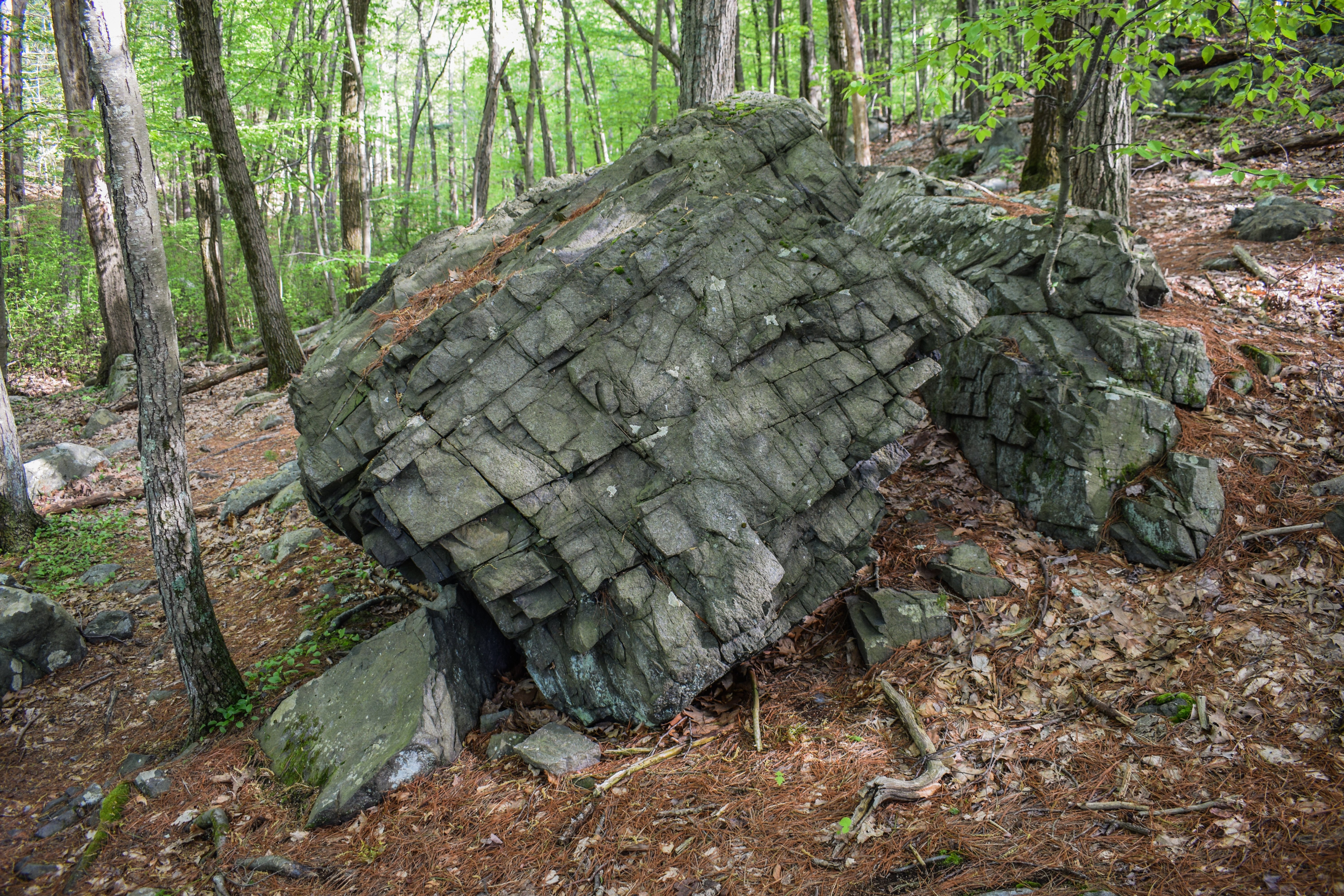
The upper stretch of Buck Hill Path has burn evidence on the right, which was both pretty and eerie. Once at the Skyline junction, I braved the steepness and climbed up to beautiful Buck Hill! The climb really wasn't that bad. Steep, sure, but short. The view to Great Blue Hill and Hancock Hill were excellent, and Wachusett wasn't looking too shabby either. There was also a stunning breeze.


Some springtime observations I found: plenty of tent catepillars, black chokeberries had white flowers, black huckleberries had red buds, and Wooly Catkin Gall Wasps created these cotton-like puffs on some bushes, which I had never noticed before. I spent a decent amount of time on the Seek app while on Buck, which was super fun.


On my descent, I planned to just get needed trails that were roughly on the way back, which was primarily Fells Path and Beech Hollow Path, with a few spurs on either side. I was reflecting on my spring so far (and winter) and felt really proud of myself for making Wednesday hikes a semi-regular thing. I used to easily talk my self out of hiking on Wednesdays since I get out at 3:00pm, therefor get hiking later, but this year I've just... done it!

The bugs were getting more... friendly at this point in the day, and the clouds were rolling in. I felt like Old Route 128 was narrower than the last time I was there, which was definitely possible - it's a cool walk. I continued to sneeze up a storm as I hit a few final spurs, the last of which had a downed pine limb that smelled AMAZING. Soon enough I was back at the car and on my way home.


Step-by-Step
- Park at Houghton Pond Parking Lot C.
- Start hike on path that borders the woods along the picnic area.
- At halfway point, continue straight, veering right to 2053.
- At 2053, turn right to follow green blazes.
- At 2070, turn right onto Bugbee Path.
- At 2095, turn left onto Dark Hollow Path.
- At 2112, turn left onto Quincy Path.
- At jct., turn right onto Headquarters Path.
- At jct., turn right onto Dark Hollow Path and then immediately left onto Quincy Path.
- At terminus, continue onto Headquarters Path.
- At 2164, turn right onto Buck Hill Path.
- At 2181, turn right onto Skyline Trail.
- At 2141, turn left onto Doe Hollow Path.
- At jct., turn left onto Massachuseuck Trail.
- At 2152, turn right onto Fells Path.
- At 2149, turn left onto Pig Rock Path.
- At 2154, turn around.
- At 2149, turn left onto Fells Path.
- At 2140, turn right onto Bugbee Path.
- At 2135, turn left onto Beech Hollow Path.
- At 2132 , turn right onto Doe Holow Path.
- At jct., turn around.
- At 2132, turn right onto Beech Hollow Path.
- At jct., continue right. 
- At terminus, turn right onto Old Route 128.
- At 2100, turn right onto Angle Path.
- At 2092, turn left onto Burnt Hill Path.
- At 2085, turn right onto Old Route 128.
- Hike two spurs on right along Old Route 128, continue on Old Route 128.
- Return to car.


Wednesday, April 30, 2025

Great Blue Hill; Wolcott, Unquity, & Chestnut Run Paths (Blue Hills Reservation)

Great Blue Hill; Wolcott, Unquity, & Chestnut Run Paths (Blue Hills Reservation)

Hike Type: Figure-8 Loopty Loops
Distance: 6.64 miles
Elevation: 928 feet
Time: 2 hours, 10 minutes
Hiking Challenges: Great Blue Hill Summits; Trail Trace the Blue Hills

The Hike 
Day 3 in a row! I had a midly painful drive after school (Wednesdays are my later days, which is stinks). I was eventually hiking at 4:15pm on another hot day with a breeze and POLLEN. The goal today was to hit the summit and then trace around some trails in the Great Blue Hill area that I needed, hoping to hit all of the ones I needed!


I hiked the random paths near the north parking area at the Trailside Museum and then went up Eliot Path, which was again filled with more leaves than before! Bugs and families were out, but all were bearable to hike past. A morning dove cheered me on as I reached the summit, and I was surprised to see more cars than usual up top. 

On the initial descent, I used the Seek app to observe a Bear Oak, which was a scrubby oak with red leaves and danging pollen, which was really cool! I hiked past the Eliot Tower, where a child was having a meltdown, and then continued down Skyline North, which had some flowering trees that the app couldn't fully pinpoint. There were also tons of singing birds out and one screaming red squirrel.


The swamp near 1103 was at least two feet lower than last time I was over here, but still offering wonderful reflections. My Nalgene was warm, but bearable, and I continued to hike at a heightened pace to escape the bugs. This time of year I always catch myself daydreaming of hiking bigger mountains up north, but then I'm reminded about the miserable conditions up there right now with rotting monorails, and I'm brought back to reality.

I spun around the triangle at 1121, completing the Rotch Path, and headed up Wolcott Path towards Downtown Crossing. I continued to now descend on Wolcott Path, admiring the aggressively blue skies, and made an easy crossing of Hillside Street before turning left onto Headquarters Path on the Houghton side. This stretch of trail kind of stinks - following a busy road with loose gravel, but what must be done must be done!

Once back in the woods, I hiked past some lesser periwinkle and worked my way to Unquity Path, which is a hidden gem surrounded by loud, busy roads. I had to cross Unquity Road, which took a minute, and then turned right to find my next trail. The road walk was short, but stinky. The woods immediately after were cool and lovely. I did a loop around the trail ends in this area and then worked my way to Chestnut Run Path, which had a wonderful golden glow from the sun.


I made my way over to Border Path, which was the end of the thinking portion of the hike! I did stick out my tongue to habitually lick my lips at one point, and a gnat landed right on the tip, and then I unknowingly brought it into my mouth like a frog, which was a solid bummer, but other than that, it was a nice return! I played some Pokemon Go and did another test of the messed up trail distance signs:

1. "Trailside Museum 0.25 Miles" when my watch was at 5.78 miles.
2. "Trailside Museum 0.5 Miles" when my wach was at 6.26 miles.
3. Arrived at Trailside Museum when my watch was at 6.61 miles.
Findings: 0.25 sign is 0.83 miles away; 0.5 sign is 0.35 miles away.


I loved hiking past the old trees near the end of Wolcott Path, and soon enough I was back at the car and headed home for a shower, food, and some sleep!


Step-by-Step
- Start hike from Trailside Museum north parking on Wolcott Path (green dots).
- At jct., veer right.
- At jct., turn left and follow unnamed path to Summit Road.
- At Summit Road, turn right.
- At jct., turn left onto Canton Ave. spur path.
- At Canton Ave., turn around.
- At Summit Road, turn right.
- At spur to parking lot, turn left.
- At parking lot, hike back to Wolcott Path.
- A few feet into woods, follow herd path to trail around Trailside Musuem.
- At Eliot Path, turn left onto Eliot Path.
- At 1055, turn right onto Eliot Circle.
- At Summit Road, turn left onto Summit Road.
- At next jct., turn right and summit Great Blue Hill.
- From summit, follow path east toward 1066.
- At terminus, turn left onto Eliot Circle/Skyline Trail.
- At 1063, turn right onto Skyline Trail North.
- At 1092, turn left onto Wildcat Notch Path.
- At 1103, turn left onto Puddle Path.
- At 1105, turn right onto Samoset Path.
- At 1100, turn righ tonto Wolcott Path.
- At next jct., veer right.
- At next jct., turn left onto Wildcat Notch Path.
- At 1115, turn right onot Wolcott Path.
- At 1122, turn left onto Rotch Path.
- At 1121, turn around.
- At 1122, turn left onto Wolcott Path.
- At terminus, cross Hillside St.
- After crossing, turn left onto Headquarters Path.
- Hike spurs to road, then turn right onto White Pine Path.
- At next jct., turn right onto Tucker Hill Path.
- At terminus, turn left onto Headquarters Path.
- At next jct., turn right to cross road.
- Continue onto Unquity Path.
- Cross Unquity Road, turn left.
- Reenter woods on Pipsissewa Path.
- Hike past 1204, turn turn left onto Base Path.
- At 1203, continue onto spur to parking lot.
- Turn right onto Unquity Road.
- Turn right onto Hancock Trail.
- At 1217, turn left onto Chestnut Run Path.
- At terminus, turn right onto Unquity Road.
- At jct., turn right onto Pipsissewa Path.
- At second jct., turn right onto Hemenway Hill Path.
- At 1203, turn left onto Chestnut Run Path.
- At 1191, turn left onto Base Path Connector.
- At 1183, turn right onto Base Path.
- At terminus, turn left onto Chestnut Run Path.
- At 1175, turn left onto Border Path.
- At 1100, turn right onto Wolcott Path.
- Follow Wolcott Path back to car.

Monday, March 10, 2025

Buck Hill via AMC, Fells, Beech Hollow, Monatiquot, & Forest Paths (Blue Hills Reservation)

Buck Hill via AMC, Fells, Beech Hollow, Monatiquot, & Forest Paths (Blue Hills Reservation)

Hike Type: ooO loop
Distance: 4.20 miles
Elevation: 469 feet
Time: 1 hour, 27 minutes
Hiking Challenges: Blue Hills Winter Trace (2x)

The Hike
Happy Monday! I had a super easy drive after work on a beautiful, 60 degree day. I made a plan to do some tracing around Great Blue Hill, but I left the map I doodled on at school, so I pivoted over to Buck Hill, where I had more open trails (and therefore a smaller chance of accidentally repeating). I was SUPER sleepy (blame daylight savings time), but I was parked around 3:25, so no complaints there! I suited up in my t-shirt and shorts, and was off!

I parked at the Forest Path trailhead but walked on Chickatawbut Road to the Buck Hill Path trailhead to officially get started. I noticed a "no atv" sign posted by the MDC I hadn't seen before (or saw and forgot about...) and dodged my first horse poop of the year on the Headquarters Path. There was an occasional breeze that felt cool in the shade but the sun felt AMAZING. 


I made my way over to the old school house on MA-128 and then hiked up the AMC Footpath to Buck Hill, which was a little hard to follow down low, easy in the middle, and tricky up top again because of criss-crossing mountain bike trails, and a few old orange blazes throughout (circles, not the rectangles seen elsewhere). Buck Hill was magical as always, even with the guy loudly talking on his phone. I could see Mt. Wachusett prominently, followed by the round Mt. Watatic with Mt. Monadnock behind (Watatic looked huge compared to Monadnock from this angle which was fun), and then the Pack Monadnocks further on the right. I've said it before and I'll say it again - I just love that I did the Wapack Trail - I have such a new, deeper appreciation for that range now.


I continued past a blue arrow painted on a rock that I had never seen before and started my trip down to Old Route 128, down the Doe Hollow, Fells, Bugbee, and Beech Hollow Paths. All were a little muddy, but never were any a problem. I saw a bunch of deer tracks on Fells Path and I was just enjoying the warmth. I made my way onto Old Route 128 and giggled at how they basically just baried the rest of the road underneath the new one.


After Old 128 went under the current highway, I continued onto Monatiquot Path, which had plenty of highway litter on the right side. Nearer to Bugbee Path, I heard some commotion off into the woods followed by heavy breathing. I'm assuming it was just a few deer, but it was spooky! It could have been a sasquatch, though...


Once I saw the time, I decided to not do a second summit of Buck and follow the Forest Path all the way back - I had my Monday rotisserie chicken on the mind. There were some large mounts of horse poop on Forest Path that I had to creatively dodge, and I did see a final remnany of ice in a rut. Soon enough I was back at the car and off to Costco!


Step-by-Step
- Park at Forest Path trailhead.
- Walk westbound on Chickatawbut Road.
- Turn left into woods at Buck Hill Path. 
- At 2164, turn left onto Headquarters Path.
- At MA-28, turn around.
- At jct., turn left onto AMC Footpath.
- At 2165, turn right onto Skyline Trail.
- At 2141, turn left onto Doe Hollow Path.
- At next jct., turn left onto Fells Path.
- At 2140, turn right onto Bugbee Path.
- At 2135, turn left onto Beech Hollow Path.
- At second jct., continue straight to Old Route 128.
- At terminus, turn left onto Old Route 128.
- At terminus, continue onto Monatiquot Path.
- At 2190, turn left onto Bugbee Path.
- At terminus, continue onto Forest Path.
- Follow Forest Path back to car.

Monday, February 24, 2025

Houghton's Pond, Angle Path, Tucker Hill, Burnt Hill Path (Blue Hills Reservation)

Houghton's Pond, Angle Path, Tucker Hill, Burnt Hill Path (Blue Hills Reservation)

Hike Type: oooo Loop
Distance: 4.85 miles
Elevation: 518 feet
Time: 1 hour, 57 minutes
Hiking Challenges: Blue Hills Winter Trace (2x); Blue Hills Grid

The Hike
February break is officially over and I'm back at the Blue Hills! It was a 45 degree, sunny, and breezy afternoon. It felt kind of warm after the past week of skiing in comically cold temperatures! There was a lot of snowmelt happening and I forgot my spikes - going to be interesting! I also realized I forgot to take a photo of the map I'm tracking my progress on, so I'm guessing what trails I still need...


Hiking in from the B lot at Houghton's Pond, the exposed grass was SUPER soft and the leftover snow and ice was super slippery. I made it halfway to the loop around the pond before turning around to grab my spikes from the car to give myself a sliver of a chance to enjoy the hike. Take-two! I successfully made it over to the visitor center area and noticed some guys out on the ice which was... brave. I briefly took my spikes off at the bathhouse but they soon went back on. I was basically experiencing every trail condition imaginable besides dry. To make things more fun, my legs were super wiggly - probably in part due to the slushy conditions and also from skiing the past 9 out of 10 days.


I eventually made it along Andover, Angle, and Bugbee Paths unscathed and then onto the red blazes, which was steeper and slushier. I was taking very small steps and really digging my spikes into any base that was left. I was thankful to actually find some solid ice when I made my way up Tucker Hill (also proud of myself for actively working on my Blue Hills Grid for this very brief moment!


On top of Tucker Hill, I followed the mysterious yellow blaze to the true summit (or my best try at it) and an overgrown view before heading down Athol Path - where I saw people! I've never seen people on this side of Tucker, so that was jarring. After crossing Tucker Hill Path, I was only the second set of prints going down the steepest stretch of Athol, but I took it slow and only faced death once or twice. There were lots of deer tracks, though! 


I then meandered my way around the Tucker Hill Path over to the Burnt Hill Path - delighted to find out that I had already summited Burnt Hill for February - yay! I followed more deer tracks as I descended on Burnt Hill Path, which had just brutal slushy trail conditions. I eventually found the family of deer right before Old Route 128, which was fun, but then the fun ended when I discovered Old Route 128 had equally, or even worse conditions than Burnt Hill Path. Hiking is a mental game!


I made my way over to the picnic area, which was a slushy ice rink, but the rest of the Houghton's Pond loop was fully frozen, which was nice I guess? Only downside was that it was frozen and covered in post-holes, so it was truly an ankle buster. Yikes! This was a surprisingly brutal hike, but as always, no regrets and I was just happy to have been outside!


Step-by-Step
- Park at Lot B at Houghton's Pond. 
- Start hike by hiking entry trails.
- Turn left to follow yellow blazes.
- Follow footpath hugging the pond, then climb stairs.
- Resume following yellow blazes. 
- At split, continue to follow red/green blazes. 
- At 2053, continue to follow green blazes. 
- At next jct., turn right/continue onto Andover Path. 
- At 2092, turn left onto Angle Path.
- At 2075, turn left onto Bugbee Path.
- At 2071, turn right onto red blazes. 
- At 2094, turn left onto Ayer Trail.
- At next jct., turn right onto Athol Path.
- At terminus, turn right onto Headquarters Path.
- At next jct., turn right onto Tucker Hill Path (green blazes). 
- At 2072, turn left onto Ayer Trail.
- At next jct., turn right onto Athol Path.
- At terminus, turn left onto red blazes. 
- At 2094, turn right onto Dark Hollow Path.
- At 2111, turn right onto Burnt Hill Path.
- At 2085, turn right onto Old Route 128.
- At gate, follow path to yellow loop around the pond.
- At the pond, turn left and follow yellow blazes back to car.


Thursday, February 6, 2025

Breeze, Boyce, & Buck Hills via Houghton Pond (Blue Hills Reservation)

Breeze, Boyce, & Buck Hills via Houghton Pond (Blue Hills Reservation)

Hike Type: Ooo Loop
Distance: 5.41 miles
Elevation: 600 feet
Time: 1 hour, 53 minutes
Hiking Challenges: 52 Hike Challenge; Blue Hills Winter Trace (2x); Blue Hills Grid

The Hike
It's a snow day! I finished my 4:45am yoga by checking WCVB.com and saw my district closed for the day! I was already up, so I finished my morning work out and decided to stay up until I could get a morning hike in - hopefully before the snow! I made it to the Houghton's Pond main parking area at 7:15am, which was incredibly empty. It was a cold 24 degrees and cloudy and my goal was to wiggle around the Boyce/Buck Hill area. I used my uninsulated boots to see how warm my feet would be in 24 degrees/no sun/normal socks (spoiler alert, they were completely fine!). 

I started my hike by following the path from the mid-parking lot to the picnic area and then willing around the Paddock/Prescott area towards Breeze Hill. It smelled like snow was going to fall (which was on my mind as Ray is rewatching Gilmore Girls) and my puffy came off 10ish minutes in. I did go to the true top of Breeze Hill only to find out that I had already done it for February - oh well. I did appreciate how the Prescott Foot Path to Breeze Hill used to absolutely gas me out a few years ago, and now I made it up with only a mildly pounding heart beat!


I continued my wiggle toward the Boyces, both of which I needed for February still. I crossed paths with my first human, a trail runner near the Peeper Swamp, passed a lost designer glove, and worked my up the Boyce Hill Trail and to the summit (or summit area) of South Boyce, which the only hill in this reservation that makes me go "do I really want to persue this "grid" thing?" (answer is: yes, but I maintain it's going to be many many years before I finish it). 


Now on my way to North Boyce, I crossed paths with a couple who asked about a lost white glove - I was ELATED to let them know I saw it and knew exactly where it was! Hopefully they were able to find it. I ended up hiking North Boyce two times to get a couple more trails traced for my second winter map. I saw the first snowflake of the day fall on lap 1, and it was flurrying by lap 2. I continued on the Skyline Trail up the icy rock steps to Buck Hill, where it was officially snowing. I loved hearing the soft pitter-patter of the flakes falling on the earth below. The views were cool, as I'd never been up while it was snowing! The ground was beginning to get covered in a dusting, so I kept it moving.


I hit my first patch of dicey ice coming down the Buck Hill Summit Trail, and paired with the new and falling snow, I decided I'd put my spikes on. The trail conditions were super variable, which is why I had been avoiding it, but I reminded myself that I have a pair of rock spikes for a reason, and it helped me and my pacing immensely (even though they were fitting a bit looser than usual, which was confusing). 


Turns out spikes were the correct call as the ice didn't let up until the end of the trail, and I kept them on for the bulk of the rest of the hike, too. I continued along the Barre Trail, Quincy Path, and Tucker Hill Path, slowly becoming a snow man. I took my spikes off for Headquarters Path, but it was still nice and slippery (I stuck to the grassy spots). I made it back soon after with a frozen snowball of a head! 


Step-by-Step
- Park Houghton Pond parking lot A.
- Start hike by hiking spur from mid-parking lot.
- At terminus, turn left onto gravel road.
- At next jct., turn right onto Paddock Trail.
- At terminus, turn left.
- At next jct., turn left onto red-blazed Prescott Foot Path.
- At 2071, turn right onto Bugbee Path.
- At 2070, continue left on Bugbee Path.
- At 2096, turn right and hike to next jct., and then turn around on Dark Hollow Path.
- At 2095, turn right and follow red blazes.
- At jct., turn left onto Boyce Hill Trail.
- At 2117, turn right onto Skyline Trail.
- At 2141, turn left onto Doe Hollow Path.
- At 2151, turn left onto Boyce Hill Trail.
- At 2117, turn left onto Skyline Trail.
- Before 2165, turn left onto Buck Hill Summit Trail.
- At 2153, turn left onto Doe Hollow Path.
- At 2151, turn right onto Boyce Hill Trail.
- At 2130, turn right onto Barre Trial.
- At jct., turn left onto Quincy Path.
- At terminus, continue to follow green blazes.
- At jct., turn left onto Tucker Hill Path.
- After 2072, turn right onto Skyline Trail.
- At Hillside St., turn left onto Headquarters Path.
- Return to car.


Friday, January 3, 2025

Houghton's Pond & Breeze Hill Loop (Blue Hills Reservation)

Houghton's Pond & Breeze Hill Loop (Blue Hills Reservation)

Hike Type: Figure-8 Loop
Distance: 2.82 miles
Elevation: 138 feet
Time: 52 minutes
Hiking Challenges: 52 Hike Challenge 2025; Blue Hills Winter Trace (2x)

The Hike
First hike of 2025! I woke up feeling... not great on New Year's Day, which made sense, but it turned out I was actually medium sick. My only goal for the day was to get outside and move my body, so I set my sights on Houghton's Pond. It was 34 degrees, partly cloudy, and slightly breezy. The first thing I noticed was the fire damage on the Great Blue Hill side of Hillside Street - I completely forgot about the fire! Many trees have since been cut down, I assume to prevent blowdowns in the road. 


I started the hike by following the footpath/sidewalk alongside Hillside Street, eventually turning onto Nursery Trail. Once on the loop around Houghton's Pond, I noticed some new yellow triangle blazes stapled to trees along this route. Maybe they're redoing the yellow circles? Maybe a new map will be coming out soon?


I hiked the spur paths to Old 128, admiring the very trace amounts of snow that were left. There were occasional moments of sunshine, but the clouds dominated the sky. I continued to follow the yellow blazes and then started a secondary loop around breeze hill - first along the gravel road and then on the paved path. At the height of land, where the green circles usually pick up, stapled green triangles now appeared! Exciting!


I wasn't feeling great, but the cool, fresh air did feel good. I saw some new red triangles, too, and continued back to Houghton's Pond. I passed a man with his dog and got a boisterous "HAPPY NEW YEAR!," which was kind. 

I wrapped up my hike by following a path to the shoreline and then walking the boardwalk along Marigold Marsh back to the parking lot - it was nice to see water back in the marsh! It was also fun to learn that its called Marigold Marsh (via signage). A nice, easy first hike of the year!


Step-By-Step
- Park at Houghton's Pond Lot A.
- Start hike on path along Hillside Street.
- At corner of Blue Hill River Rd. & Hillside Street, turn left. 
- Turn left again onto Nursery Trail.
- At terminus, turn right onto Prescott Foot Path (yellow blazes).
- Turn left to hike spur to Old Route 128.
- At terminus, turn left onto Old Route 128.
- At next jct., turn left onto spur path back to Prescott Foot Path (yellow blazes).
- At terminus, turn right onto Prescott Foot Path (yellow blazes).
- Follow yellow blazes until jct. before bathhouse, veer right.
- Hike around Breeze Hill clockwise, eventually following green blazes.
- Follow green blazes to boardwalk behind visitor center.
- Follow boardwalk back to parking lot.


Thursday, October 31, 2024

Buck Hill via Houghton's Pond & AMC Footpath (Blue Hills Reservation)

Buck Hill via Houghton's Pond & AMC Footpath (Blue Hills Reservation)

Hike Type: Lollipop-ish Loop
Distance: 5.70 miles
Elevation: 594 feet
Time: 1 hours, 59 minutes
Hiking Challenges: Trail Trace the Blue Hills

The Hike
Happy Halloween! In an attempt to be a Halloween Scrooge and avoid seeing any more children than I am contractually obligated to, I sought refuge in the Blue Hills. I had a shockingly easy drive to the "B" parking lot at Houghton's Pond and got right to work, hitting a few random trails in the northwest corner of the area, ultimately landing at the porta potties to take care of some business. It was unseasonably warm out with an 80 degree high, which was equally lovely and unsettling.


The swamp near the visitor center was almost completely dry and the surrounding trees were shining in their late-fall gold. There was some new drainage work on Bugbee Path right where it becomes a dirt road, and I made my way onto the Skyline Trail. I didn't have a plan besides hitting Buck Hill, so I just let my map guide me, focusing on trails I haven't hiked in a while.


There was a vauge fire smell in the air while I fought spider webs on the path called Ayer (I had fun writing that sentence). The Mattapan Path was fine now that I actually know how to follow it, and then I wound my way over to the Forest Path at 2175. I noticed more "do you know who did this?" posters than usual, which makes sense considering how on-fire the area has been recently. I noticed a metal stake in a rock near 2175 also, which was curious.


The chipmunks, gray squirrels, and red squirrels were out and about as I wiggled up Buck Hill via the AMC Footpath, entering a burned area at 2182, which was mostly covered in leaves and hard to follow. The views from Buck Hill were, of course, lovely, and it looked like the fire on Wolcott Hill was done smoking (or at least for the most part). I enjoyed seeing numerous planes flying in and out of Logal, and then I was brought right back to reality as I approached MA-28, which is more or less a life-sized go-kart/bumber car course. 


Continuing my wiggle, I scooted around a recent blowdown on the Oblique Path and started my long walk back along Old Route 128, where I played some Pokemon Go to pass the time. It was starting to get dark around 5:25, which reminded me how much daylight saving's time was going to hurt.

I made it back to Houghton's Pond, which was very quiet and peaceful, even while surrounded by busy roads. The only other people around were along the shoreline fishing, and soon enough I was back at the car heading home. It was a really nice afternoon hike!


Step-by-Step
- Park at Houghton's Pond parking on Blue Hill River Road.
- Hike to Houghton's Pond yellow-dot loop via unmarked trail.
- Follow yellow dots to the Houghton's Pond Bathhouse.
- Hike towards paved section of Paddock Trail.
- At Bugbee Path, turn left onto Bugbee Path.
- At 2054, turn right onto Skyline Trail.
- At next jct., turn left onto Tucker Hill Path.
- At 2072, turn right onto Ayer Trail.
- At second jct., turn right onto Athol Path.
- At terminus, turn left onto red-dot-blazed path.
- Follow red dots past 2094, then turn left onto Mattapan Path.
- At terminus, turn right onto Skyline Trail.
- At 2117, turn left onto Boyce Hill Trail.
- At 2151, conitnue onto Doe Hollow Path. 
- At 2153, continue onto Headquarters Path.
- At 2175, turn right onto Forest Path.
- At 2194, turn right onto AMC Footpath.
- At 2165, turn left onto Skyline Trail.
- At 2181, turn right onto Buck Hill Path.
- At 2183, turn left onto red-dot-blazed path.
- At 2210, turn right onto Skyline Trail.
- Turn right onto Forest Path.
- At 2189, turn left onto Pipe Line.
- At 2176, turn right onto Sullivan Trail. 
- At 2163, turn left onto Oblique Path.
- At terminus, turn right onto Old Route 128.
- At paved road circle, turn right to hike along Houghton's Pond, joining with the yellow-dot-blazed loop.
- Near snack shack, hike trails nearer pond.
- Follow paths back to car.


Thursday, September 5, 2024

Houghton's Pond, Bunt Hill, Boyce Hill Trail, Tucker Hill Path (Blue Hills Reservation)

Houghton's Pond, Bunt Hill, Boyce Hill Trail, Tucker Hill Path (Blue Hills Reservation)

Hike Type: Loop
Distance: 4.35 miles
Elevation: 341 feet
Time: 1 hours, 39 minutes
Hiking Challenges: Blue Hills Grid, Trail Trace the Blue Hills, 52 Hike Challenge

The Hike
Time for the first after-school hike of the school year! I planned to go yesterday, but ended up almost falling asleep on I-95, so I decided home was the right move (it was). I didn't have much of a plan besides galavant around the Houghton's Pond Area, mostly hitting trails I haven't hiked for my "Trail Trace the Blue Hills" map. Temperatures were in the upper 70s with bright, warm sunshine, but feeling cool in the shade. 


I meandered around the pond, hitting some segments I ususally don't get to until I'm finishing a map. There was a BEAUTIFUL fall breeze coming over the pond, which was just lovely. My legs were VERY sore from leg day - the first one in a WHILE (I always giggle when I write things like that, implying I'm some hard core "gym rat" - I'm really just lazy and desperately trying to adhere to a morning routing!). 


I got both trails that connect to Old Route 128 and realized I don't think I've ever walked the western stretch of Old Route 128 outside of winter before, which was fun! My legs continued to feel stiff as boards, and I was a bit nervous thinking forward to the upcoming weekend - Gen's "Bachelorette Party" is actually just an Airbnb in Bartlett and a hike up Adams/Madison (god willing) - hopefully my legs will be in decent shape before then!


I continued my wander into the woods towards the Andover/Burnt Hill Paths. The woods were a bit buggy - mostly just gnats, and SUPER dry. It was peacefully quiet back here, but I did start suffering when heading up Burnt Hill on my stone legs. I ended up wiggling to the "true" "summit" of Burnt Hill, truly covering myself in spider webs.


I crossed the "Peeper Swamp" on the Winthrop Path, which was also full dried up. Continuing onto the Boyce Hill Trail, I decided I simply did not want to go to the tops of either Boyces, so I didn't! There was some horse poop on trail, and more excitingly, some early fall colors! The birch trees were beginning to slowly turn yellow!


I hiked past the swamps on the Quincy Trail, which were also dried up. I wonder how the Ponkapoag Boardwalk is? I've never seen this area so dry before, maybe it's passable? Anyway, I continued on, now on the Tucker Hill Path, and almost got MURDERED by a mountain biker (they flew around a corner and nearly hit me), and then hiked the rest of the Tucker Hill Path, which did land me feeling a bit bored after a bit.


I continued onto the red-dotted path back to the pond and then followed the boardwalk behind the visitor center back to the car. That swamp was also mostly dried up, with many ducks feasting on it! I definitely need to do some reconaissance work on the boardwalk, maybe that'll be a project for next week?


Back at the car, I noticed the stop-sign line was still super slow and long. I hoped to go to Cotsco afterwards, and parked in the Houghton lot to avoid traffic, but that did not work as planned. I ended up going straight home to eat some food I had and to watch more of The Circle on Netflix!


Step-By-Step
- Start hike Houghton's Pond playground.
- Follow path to porta potties at Houghton's Pond visitor center.
- Follow path to circle, take counter-clockwise.
- Turn right onto yellow-dotted path.
- Follow yellow dots to south side of Houghton's Pond.
- Take first trail on right to Old Route 128.
- Turn left onto Old Route 128.
- Turn left onto next trail.
- Turn right onto yellow-dotted path.
- At big view of Houghton's Pond/Great Blue Hill, turn around and follow trails to the middle jct. with  Andover Path.
- At jct., turn right onto Andover Path.
- At terminus, turn left onto Burnt Hill Path.
- At 2111, turn left onto Bugbee Path.
- At next jct., turn right onto Winthrop Path.
- At terminus, turn right onto red-dotted path.
- At next jct., turn left onto Boyce Hill Trail.
- At 2130, turn left onto Barre Trail.
- At next jct. before road, turn left onto Quincy Path.
- At terminus, continue left onto Headquarters Path.
- At jct., turn left onto White Pine Path.
- At terminus, continue straight/left onto Tucker Hill Path.
- At 2071, turn right onto red-dotted path. 
- Follow red dots to the boardwalk behind Houghton's Pond Visitor Center.
- Follow boardwalk behind Houghton's Pond Visitor Center.
- Return to car.