Showing posts with label Ponkapoag Pond Area. Show all posts

Monday, May 5, 2025

No Name, Prescott, Swamp, Ponkapoag Paths; Madden Road (Blue Hills Reservation)

No Name, Prescott, Swamp, Ponkapoag Paths; Madden Road (Blue Hills Reservation)

Hike Type: Loopty Loop
Distance: 4.81 miles
Elevation: 377 feet
Time: 1 hour, 48 minutes
Hiking Challenges: 52 Hike Challenge; Trail Trace the Blue Hills

The Hike 
After yesterday's achilles flare up, I planned to take this Cinco de Mayo Monday hike easy. It was a raw, misty, chilly 50 degrees out, and I just planned to hit the Madden Road corner of Ponkapoag with a bonus view of the pond from the cabins. Easy is the key word here! There was only one other car in the parking lot when I started my hike on Ponkapoag Trail, which was in it's green tunnel glory! Really beautiful start.


I noticed some orange blazes at 5322, I think marking the old Prescott Foot Path and whatever the long-distance trail was that traversed the entire park - I need to refresh my brain on the old maps. It was not raining out, but whenever a breeze hit the treetops, plenty of water fell on me. Once back on Ponkapoag Trail, I hiked past some flowering dogwood and some slugs munching on rotting logs. I continued onto Swamp and Duck Pond Foot Paths, the ladder of which had a narrower footbed and passed an EVIL looking road, which was super cool and extra spooky in this weather. 


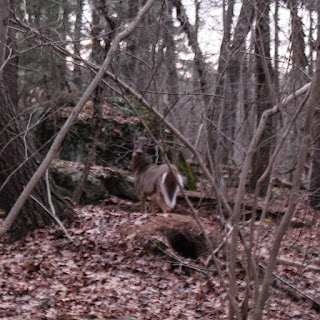
I followed some horse prints over to Three Pines Path and Madden Road, where I also spooked a deer (thankfully he paused for a photo). My hands were chilly, but I was warm enough to take off my windbreaker after moving for a half-hour or so. The woods were super peaceful and calm, even with the sound of I-93 and MA-24.


Near the Three Pines Path/Madden Road corner, I noticed someone spray painted "I <3 TRUMP" on a tree, which gave me a lot of pause. One, don't paint trees, period. Two, why are we making the graffiti political? I also struggled with whether or not to take a photo of it, but I do like to take photos and write these entries as more or less a mini-history for the future, and it unfortunately is now a part of the parks history... I guess? I have the photo, and I don't like it, but also no one will probably ever see it because this is my echo-chamber. I don't know. Lots of thoughts!


I was also in a backpack strap crisis - I never know how tight each strap should be (waist, shoulder, chest). I feel like I have to CINCH my waist strap so tight to keep the weight off my shoulders. I'll figure that out someday. 

My crises aside, I found some northern starflowers! I did a little loopty loop, working my way over to Duck Pond Proper, which was very full. I wish there was a better viewpoint, but it was still nice. I hiked past a LOT of horse poop on Ponkapoag Path, and then made my way to the dock at the AMC Cabins, which provided a magnificent and spooky view of the pond shrouded in fog - I couldn't see the other side! It was so beautiful and spooky. I did a little victory lap to hit another trail I needed at the cabins and then started my return trip, passing the first and only person of the day!


I loved seeing the old blazes along the Prescott Foot Path. My ankle was feeling 99% fine, with only a short moment here and there of feeling a small sensation. I'm so curious what happened! I soon turned onto No Name Path, and then back onto Ponkapoag Trail to return to my car - it's chicken time!


Step-by-Step
- Park at Ponkapoag Trail (Exit 3).
- Start hike on Ponkapoag Trail.
- At 5322, turn left onto Prescott Foot Path.
- At 5330, turn left onto No Name Path.
- At 5344, turn left onto Ponkapoag Trail.
- At 5371, turn right onto Swamp Path.
- At 5380, turn left onto Duck Pond Foot Path.
- At 5383, turn left onto Three Pines Path.
- At terminus, continue left onto Madden Road.
- At 5374, turn left onto Ponkapoag Trail.
- At 5371, turn left onto Swamp Path.
- At 5380, turn left onto Duck Pond Foot Path.
- At 5383, turn right onto Three Pines Path.
- At 5382, turn right onto Jones Link.
- At 5381, turn around.
- At 5382, turn right onto Three Pines Path.
- At 5385, turn left onto spur.
- At Duck Pond, turn around.
- At 5385, continue left.
- At 5362, turn right onto Ponkapoag Path.
- At 5361, continue on path to shoreline.
- At Ponkapoag Pond, turn right.
- At 5364, turn right onto Swamp Path.
- At 5361, turn right on path.
- At next jct., turn right.
- Back at Swamp Path, turn left onto Swamp Path.
- At 5371, turn left onto Ponkapoag Trail.
- At 5343, turn right onto Prescott Foot Path.
- At 5330, turn left onto No Name Path.
- At 5311, turn right onto Ponkapoag Trail.


Wednesday, February 26, 2025

Hogdon, Madden, Duck Pond, No Name, and Prescott Paths (Blue Hills Reservation)

Hogdon, Madden, Duck Pond, No Name, and Prescott Paths (Blue Hills Reservation)

Hike Type: oo-o Loop
Distance: 3.75 miles
Elevation: 308 feet
Time: 1 hour, 25 minutes
Hiking Challenges: Blue Hills Winter Trace (2x)

The Hike
After the trail conditions on Monday's hike, I cautiously approached the Blue Hills again. I had a decent drive after work, landing at Exit 3/Ponkapoag Trail just before 4pm (Wednesdays are my late days leaving school. It was a WARM 50 degrees out with bountiful sun and some wind. I was mentally prepped for some brutal trail conditions a la Monday, and I was off!


The YMCA gate was open which was surpring, and the road section of Ponkapoag Trail was nicely plowed and melted. My spikes went on once on teh Hogdon Foot Path, and the temperature dropped once I was in the woods surrounded by snow. Overall, traction was good. It got messier/more variable once near the Redman Farm Path, and my spikes came off once back on the road grade, which in FULL mud season.


Once back in the woods on No Name/Prescott my spikes were back on, and I noticed there were more bare spots than Monday and there was also less slush, which was a delight. I even noticed an old orange blaze on the Prescott Foot Path, which is one of my favorite things to stumble upon. There were nice tree views to Ponkapoag Pond in these woods, and I continued to meander my way over to Madden Road, which was unfortunately a firm layer of slush on top of water. Also, someone left a fur-lined headband on a tree that nearly scared the life out of me. 


I missed the turn for my intended route (which I have already forgotten) and continued to meander my way around Duck Pond, onto Fire Trail, and then along Swamp Path. Swamp was in great conditions for spikes, but seemed like it'll be living up to it's name once the ice melts. Back on the No Name/Prescott criss-cross, I found a couple of deer and made my way back to the car, where I was the last one to leave for the day. This was a MUCH nicer day in the woods!


Step-by-Step
- Park at Exit 3/Ponkapoag Trail parking.
- Start hike on Ponkapoag Trail
- At 5320, turn right onto Hogdon Foot Path.
- At 5218, turn left onto Redman Farm Path.
- At 5241, turn left onto Ponkapoag Trail.
- At 5311, turn right onto No Name Path.
- At 5330, turn right onto Prescott Foot Path.
- At 5343, turn left onto Ponkapoag Trail.
- At 5371, continue onto Madden Road.
- At 5383, turn left onto Three Pines Path.
- At 5382, turn right onto path.
- At 5381, turn right onto Fire Trail.
- At 5365, turn right onto path (green blazes). 
- At 5370, continue right onto Swamp Path.
- At 5371, turn left onto Ponkapoag Trail.
- At 5344, turn right onto No Name Path.
- At 5330, turn right onto Prescott Foot Path.
- At 5322, turn right onto Ponkapoag Trail.
- Return to car.


Tuesday, February 4, 2025

Ponkapoag Pond Loop via Exit 3 (Blue Hills Reservation)

Ponkapoag Pond Loop via Exit 3 (Blue Hills Reservation)

Hike Type: Lollipop Loop
Distance: 4.22 miles
Elevation: 230 feet
Time: 1 hour, 28 minutes
Hiking Challenges: 52 Hike Challenge; Blue Hills Winter Trace (2x)

The Hike
Another easy drive after work to the Blue Hills! The plan today was the simplest form of the Ponkapoag Loop, following the green balzes the whole way! I was hiking at 3:30pm. It was a windy 40 degree day with some clouds but more sun. The trail initially was icy, slushy, muddy, wet, and dry, which made for some interesting hiking. At the height-of-land, a limb came off a tree ~50 feet into the woods from the wind - spooky!


There were some impressive (and difficult to navigate) patches of ice by the YMCA camp, the boardwalk was still closed (no surprise), and I even hiked past some guys golfing? Not sure if the course is even open, since its half covered with snow, but I applaud their dedication!

There were lots of thorny bushes paralleling the golf course and the dam, with it wonderful views to the pond and Great Blue Hill, was a mixture of hard-pack snow and sheets of ice. There was a brief moment of relief once back in the woods, but almost the entire southern stretch of the trail was a sheet of ice. I managed to stay off to the side and only slipped a few times.


I noticed some trees, rocks, and wooden posts had orange spray paint along this stretch - maybe some drainage work? Not sure. I skipped Fisherman's Beach because of, you guessed it, ice! The conditions somehow got even worse once the AMC driveway joined the trail, but thankfully relief was momentarily felt once near the AMC Camps. Just kidding! More ice. I'm heavily considering investing in some CHEAP cheap spikes for days like today. I had my Hillsounds in my pack, but it wouldn't had been worth it to chew up those good spikes on this terrain.


Thankfully, I finally felt ACTUAL relief once past the AMC camps. There was a stunning golden hour for the rest of the return trip, although it got WINDY. My hands were surprisingly cold - probably because I wasn't hiking much elevation so my heart rate was lower. I caught up to my first human right where the loop ended, and soon enough I was back at the car!


Step-by-Step
- Park at Exit 3 parking.
- Follow green blazes counter-clockwise around Ponkapoag Pond.
- Return to car.


Wednesday, October 9, 2024

Ponkapoag Loop & AMC Camp via Maple Road (Blue Hills Reservation)

Ponkapoag Loop & AMC Camp via Maple Road (Blue Hills Reservation)

Hike Type: Lollipop Loop
Distance: 5.23 miles
Elevation: 266 feet
Time: 1 hours, 45 minutes
Hiking Challenges: Trail Trace the Blue Hills, 52 Hike Challenge

The Hike
Back to the Blue Hills! I had a decent after-school drive and made it to the Ponkapoag Golf Course around 4:10pm - I planned to drive to Fisherman's Beach, but an accident on Washington Street/MA-138 backed up right to the golf course entrance, so I altered my plans. It felt a little like I didn't belong, but there was a clear "Blue Hills Reservation" sign right at the parking lot! I hiked in via the beautiful, paved Maple Avenue, as many folks, young and old, golfed around me. The snack shack smelled absolutely delicious!


I forgot to pack shorts but thankfully wore sweatpants to work (I am hands-down the most professionally dressed, he said with extreme sarcasm). It was a breezy 65 degrees out, so the sweatpants and T-Shirt actually felt nice! It was fun to be somewhere new in the park. Soon enough, I turned onto Redman Farm Path to start my loop. 


I saw a sign indicating that archery hunting would be starting up soon and continued through the woods.


My legs were, yet again, a little sore from "leg day," which always feels silly. I emerged from the woods and went right back in to cross the Dorchester Path, Boardwalk entrance, and YMCA area. This stretch had some recently fill-ed gravel potholes, yay! I saw the many spur paths on the right to the pond, which I always want to investigate, but yet again, I saved it for a later adventure. An unleashed dog ran up to me and I was dodging falling acorns like it was the fire swamp from my favorite movie, The Princess Bride. 


The sun and pond were trying to BLIND me as I approached near the AMC Camp, but from the viewpoint it looked stunning. I always love the views of the pond from here! I wiggled a bit around the camps, eventually hitting most of the shoreline path. At the south-western corner of the path, there was a dock I had never seen before. Either new or temporary - it was probably used for the canoes. I was thinking how much fun it would be to get a bunch of people together and rent a bunch of the cabins for a weekend! What could go wrong...


Continuing along the loop on the Acton Path, falling pine needles blanked the ground (and my head). I noticed right at the corner (5355) there was a very old, rusted, something attached to a tree. Maybe an old trail sign? 


I spent a little bit of time playing Pokemon Go - with a short phone break at Fisherman's Beach to take some photos of Great Blue Hill in the golden hour light.


I skipped the two golf course spurs on the south side of the loop because I was excited to be home and have my bat and pumpkin-shaped ravioli. The sun was shining bright as I approached the dam and I was stunned by how beautiful Great Blue Hill looked in the low lighting. There was also a bird who I had never seen (or heard) before, and boy, it was loud! [UPDATE: It was a Belted Kingfisher]

"Belted Kingfisher"
from https://www.allaboutbirds.org/guide/Belted_Kingfisher/overview
Belted Kingfishers are common along streams and shorelines across North America. You’ll probably hear a loud, rattling call before you see the kingfisher. Its large head and hefty bill give it a distinctive profile as it patrols its territory, using the open space above the water as a flyway. They also perch on riverside branches and telephone wires. Belted Kingfishers also make long commuting flights over fields and forests, far from water, so be prepared for the occasional surprise flyover wherever you are birding.


The final return on Maple Road was easy and beautiful during the sunset. A few people were heading toward the pond and others were just finishing up their game of golf. This was a lovely afternoon (and the raviolis were DELICIOUS!).


Step-By-Step
- Park at Ponkapoag Golf Course parking area.
- Start hike on Maple Road.
- At 5175, turn right onto Redman Farm Path, hiking short spur onto golf course (green dot).
- At 5241, continue right onto Ponkapoag Trail (green dot).
- At 5343, continue right onto Acton Path (green dot).
- At 5364, turn right onto unnamed path.
- Enjoy view, turn sharply left to ascend hill to AMC Camp main area.
- Turn right back onto Acton Path (green dot).
- At 5361, turn right onto unnamed path.
- At terminus/pond, turn left onto unnamed path along pond.
- At 5332, turn right onto Acton Path (green dot).
- Hike spurs to AMC Camp Entrance and Fisherman's Beach, continue on Acton Path (green dot).
- At 5175, follow Maple Road back to car.


Thursday, September 12, 2024

Ponkapoag Boardwalk via Exit 3 (Blue Hills Reservation)

Ponkapoag Boardwalk via Exit 3 (Blue Hills Reservation)

Hike Type: Loop-ish
Distance: 2.94 miles
Elevation: 128 feet
Time: 1 hours, 12 minutes
Hiking Challenges: Trail Trace the Blue Hills, 52 Hike Challenge

The Hike
It's been super dry the past few weeks, and after noticing that the swamps in the Great Blue Hill and Buck Hill areas are all dried up, I figured it was time to tackle the Ponkapoag Boardwalk! I had a relatively easy drive for a Thursday afternoon, landing at the Exit 3/Ponkapoag Trail parking area at 3:45pm. There were a surprising amount of cars, but I saw very few people. I threw on my waterproof boots just in case, and got hiking on this warm, 85-degree, sunny day.


My only goal was the boardwalk plus maybe a few of the extra trails in the area - I'll be heading up to the Whites after school tomorrow to camp at Moose Brook State Park and then hiking Mt. Success (and maybe Mt. Carlo, and MAYBE Goose Eye Mountain, too) Saturday morning, so I didn't want to get into anything too intense (I also wanted to run to Sierra to hopefully buy a cheap tent - no luck, they only had a 6 person for $70 or a 2 person for $200, neither of which I'm particularly interested in). I started along the Ponkapoag Trail and soon turned right onto the Hogdon Foot Path, hiking past (and saying "hello" to) "pee rock" - the name should imply its purpose.


It was buggy in the lower stretches of trail and the very end had some dense vegetation. Now on the Redman Farm Path (everytime I hike this trail I wonder if the name is potentially offense?) - I couldn't help but notice how hot my feet were - these boots, even though not winter boots, definitely insulate! I hiked through the YMCA trails and noticed that they're not yet closed for the season - toys all around the basketball courts and the pool still appeared to be open - not a human in sight, though!


After the YMCA stuff I crossed Redman Farm Path again and hiked the turn-around loop, which had a new sign! Next, I headed for Dorchester Path, which was a spider web heaven (or... it was...), before heading towards the infamous boardwalk.


Starting my adventure inward, I quickly remembered how grown-in the vegetation was - I had to crouch a bit for the beginning. The ground was dry but looked like it was muddy, and the boards were just a touch wiggly. I also couldn't help but notice how incredibly humid it was in here.


Next up was the fairytale forest section, which was equally beatiful and sketchy. The trees were creeking in the wind and there were only a few small pools of water beneath. It was cool to see the old boardwalk infrastructure - basically layers of old wood - a curduroy, a rotted plank, a slightly less rotted tree trunk, and then sometimes a new(er) plank of wood. 


Fairytale Forest leads to Meadow #1, which is just beautiful. The ground just before was a little wet with some bouncier planks, but I made it unscathed. The footbed was super narrow at this point, but the early fall grass colors were stunning. I just love this area - it really feels like nowhere else in the park, and truly feels like you're in some remote backcountry instead of a few miles from Boston.


The boards between Meadows #1 and #2 were more slippery and some were covered in mud, implying they're usually submerged. Meadow #2 was full of little cotton puff plants, which was beautiful to see.


The final push between Meadow #2 and The End was the sketchiest of all, with very slippery boards, a good amount of water underneath, and dense overgrowth - almost like a jungle. Thankfully, the end was near, revealing the small, but beautiful view into Ponkapoag Pond.


I was grateful the bugs never got too bad in this area, and I started my slow and steady return trip. Back on Redman Farm Path, I passed many spur-like footpaths that I assume lead to the pond - someday I'll explore these. Then, I turned onto Ponkapoag Trail and was back at the car, heading to Sierra, where I unfortunately came up empty handed.


Step-By-Step
- Park at Exit 3 off of I-93 (Ponkapoag Trail).
- Start hike along Ponkapoag Trail.
- At 5320, turn right onto Hogdon Foot Path.
- At 5218, turn right onto Redman Farm Path.
- At 5176, turn right and hike YMCA trails.
- Hike turn-around loop on other side of YMCA trails, then continue on Redman Farm Path.
- At 5174, turn right onto Dorchester Path.
- At golf course, turn around and veer right at triangle-split.
- Turn left back onto Redman Farm Path toward Boardwalk.
- Veer right and hike boardwalk CAREFULLY.
- At terminus, turn around.
- At entrance, turn right, continue onto Redman Farm Path.
- At 5241, turn left onto Ponkapoag Trail, return to car.


Saturday, March 9, 2024

Ponkapoag East, Hemlock Road, AMC Cabins (Blue Hills Reservation)

Ponkapoag East, Hemlock Road, AMC Cabins (Blue Hills Reservation)

Hike Type: Spaghetti Loop
Distance: 10.36 miles
Elevation: 532 feet
Time: 3 hours, 23 minutes
Hiking Challenges: 52 Hike Challenge, Blue Hills Winter Trace

The Hike
COVID Chronicles: Episode 4!

I was feeling the same level of blegh as yesterday, but overall being outside and moving felt better than rotting into the couch, so off I went! The big goal for the day was to get Ponkapoag East plus some leftover trails on the southeast side of the main Ponkapoag Pond area... which was apparently longer than I had previously thought. Whoops! Temps were in the mid-30s, it was cloudy and raw outside, I was the only person in the parking lot at Donovan Elementary, and into the woods I went!


Right away I reminded about the heavy horse activty over here which is... fine. I know the trails are meant to be shared by all, but jeeze... If anything my mind stayed sharp dodging the massive piles of fresh excriment. The trail to Fawn Circle was recently brushed, which was visually nice but I read somewhere that it contributes to erosion because it basically creates a channel for water to rush down?

The loopty-loop area on the west side of Meadow Road was pretty and very muddy. The usually dried swamps were full ponds after the recent rain, but thankfully they stayed within their banks. There were "no bike" signs at all the entrances to this area, but it was clear the mountain bikers have been around, which is frustrating.


Next up was the dreaded Pasture Road section, which truly is just brutal, between the poop and the mud. I hiked the Pequimmit Trail out-and-back and then went in for the last round of loopty-loops. There was one duck-under blowdown right before the terminus of Pasture Road, and I did get stuck behind a couple of horses on my way out. I didn't want to keep my slow pace or worse, try to pass them, so I took the Pequimmit Trail again to make my way over to the Horse Bridge.


The Pipe Line south of the Horse Bridge was surpringly lovely, with wetlands on either side but a very dry, not-overgrown trail. It seemed like there was less graffiti on the bridge than usual (I truly think it would be fine to treat the bridge like the Quarries where graffiti is basically allowed, as long as it doesn't get on any natural beings (i.e., trees). 


I miss hiking in mountains.

Now on the eastern side of the main Ponkapoag Pond area, I worked my way to the end of Hemlock Road, which also had its fair share of muddy spots. The trail terminates just before a road at what appears to be a pump house. The Pipe Line leading toward the green dot route was dreadfully wet, but needed to be done!

The areas by the cabins were actually lovely - and the cabins were more or less occupied which was fun! Many fireplace fires, which smelled lovely. The views of Ponkapoag were lovely, but I was starting to feel very tired, especially brain tired. I was feeling ready to put a bow on the Winter Trace. 


Okay, with the Cabins done and my body shutting down, the reasonable next step would be to go home - but not for me, who wanted his patch! The only thing that kept me going was that the rest of my hike would be relatively low-brain. I crossed the Horse Bridge and turned sharply left onto the Wannamanhut Path, where I passed two guys Civilized Hiking with Budweisers (little strange, but truly who am I to judge?). 

I crossed over to Middle Road, where I yet again thought "I want to explore over here..." but again, eyes were on the prize (sitting down and a patch). From Middle Road, I followed the unmapped path to the Smith Trail, where I found the "chubby old man of the mountain" toward the end. I love that even though this was the third time I've hiked all the trails, I'm still noticing/realizing new things. 


Finally back at the Pipe Line, I was immediately greeted by a recently deceased rabbit... yikes. And soon enough, I was on the return schlep! I was very happy to make it back to my car, take off my shoes, lament at the blister that was now on my foot (have I mentioned that I really need to get uninsulated boots?), and worked my way home.

Step-By-Step
- Park at Donovan Elementary School in Randolph.
- Enter woods, turn left onto Meadow Road.
- Hike spur on left, continue on Meadow Road.
- At 5420, turn around, and then turn left onto unmapped trail. 
- At terminus, turn left onto path.
- At Reed Street, turn around.
- At next junction, turn left onto path that connects to Fawn Circle.
- At someone's back yard, turn around.
- At same junction, turn left to continue on path.
- On left, hike network of trails including Summer, Cranberry, and Coolidge (current and former maps disagree on what's actually over here).
- Continue left on Meadow Road. 
- At 5414, turn right onto Pasture Road.
- At 5423, turn left onto Pequimmit Trail.
- At 5421, turn around.
- At 5423, turn left onto Pasture Road.
- At 5424, turn right onto footpath.
- At terminus, turn right onto wider path.
- Follow path around to Pasture Road junction.
- At Pasture Road, turn right.
- At next junction, veer left/straight to continue on Pasture Road (now footpath).
- At 5440, turn around.
- At same junction, turn left to continue on path.
- At next junction, turn right onto footpath (repeat).
- At next junction, turn right onto wider path (repeat).
- At junction with Pasture Road, turn left.
- At 5423, turn right on Pequimmit Trail.
- At 5421, turn left onto Pipe Line.
- At 5413, continue straight on Pipe Line.
- At terminus, turn around.
- At 5413, turn left onto Randolph Path (Horse Bridge).
- At 5401, hike triangle that makes up Vose Path.
- Hike south to complete Hemlock Road.
- At Turner Road, turn around.
- At 5395, turn right to hike Pipe Line.
- At terminus, turn around.
- At 5395, continue straight onto Pipe Line (some maps have it labeled as Acton Path). 
- At 5335, turn left onto path.
- At terminus, turn sharply right onto Acton Path (green dots).
- Continue to follow green dots.
- At 5332, turn left to hike trails around AMC Cabins. 
- Once complete, travel to 5361, and turn onto Ponkapoag Path.
- At first junction, veer right.
- At second junction soon after, turn sharply right onto Randolph Path.
- At 5360, turn right to follow green dots.
- Hike both driveway spurs on left.
- At 5361, turn right onto Ponkapoag Path.
- At first junction, turn right.
- At second junction, continue straight onto Randolph Path.
- Follow Randolph Path to 5413.
- At 5413, turn sharply left onto Wannamanhut Path.
- At next junction, turn left onto Middle Road.
- At MA-24, turn around.
- Cross Pipe Line, continue on Middle Road at 5422.
- At terminus at Middle Street, cross pavement, and continue onto unmapped trail.
- At terminus, turn right onto Smith Trail.
- At terminus, turn around.
- At 5425, turn right onto Pipe Line.
- At terminus, turn around.
- Follow Pipe Line.
- At 5413, turn left onto Meadow Road.
- Follow Meadow Road to car.


Tuesday, February 6, 2024

Northeast Corner of Ponkapoag Pond (Blue Hills Reservation)

Northeast Corner of Ponkapoag Pond (Blue Hills Reservation)

Distance: 5.01 miles
Elevation: 364 feet
Time: 1 hour, 41 minute (1 hour, 38 minutes moving)
Hike Type: Spaghetti Loop
Hiking Challenges: Blue Hills Winter Trace; 52 Hike Challenge 2024

The Hike
I had a nice Tuesday-afternoon drive after work to the Blue Hills with minimal traffic. My goal was to hit whatever I wanted on the eastern side of Ponkapoag Pond - no real plan, just a map with trails I haven't hiked in winter yet! It was 35 degrees, I forgot my camera clip (tragic), and I had to pee. Pretty standard after-work Blue Hills hike!


I got started on the Ponkapoag Trail and then turned onto the Prescott Foot Path, where I took care of my business on a rock that has become sort of a tradition for me. The lighting today was muted, but pretty - the sun was casting a gentle light through the clouds, and paired with the blue skies, created a similar ambiance as that once scene in the (wild) movie Saltburn where Oliver and the mother and chit-chatting outside while drinking cocktails (if you know, you know). 


I meandered all around the old roads of the northeast corner of area, admiring the partially-frozen wetlands, excellent glacial erratics, and overall tranquility of hiking on these wide trails without anyone else. I admired the "ridge" feeling of Madden Road, and the solitude of the narrow Duck Pond Foot Path. I also accidentally spooked a small group of 2-3 deer.


I noticed, nearing Duck Pond for a second time, that the sun was beginning to peek through the clouds, could I actually see a sunset tonight? I picked up my pack down the Ponkapoag Path and through the AMC Cabins to a BEAUTIFUL scene of the sun setting behind the partially-frozen pond, which diffused the light magnificently. 


I wish I could have stayed longer, but I didn't have a headlamp with me (and I was hungry), so after taking at least 1,000,000 photos, I started my return trip. The sky changed from a dark yellow to a vibrant orange, and then a pale pink as I hiked along the paths. I took the Prescott Foot Path to the No Name Path to hit a few last needed trails, and then spooked another (or the same) family of deer right near the trailhead - one of the deer stayed close so I could get a photo - how kind!


Step-By-Step
- Park at Ponkapoag Trail parking (Exit 3 off I-93).
- Start hike on Ponkapoag Trail.
- At 5322, turn left onto Prescott Foot Path.
- At 5330, turn left onto No Name Path.
- At 5344, turn right onto Ponkapoag Trail.
- At 5343, turn around.
- At 5371, turn right onto Swamp Path.
- At 5365, turn left onto Fire Trail.
- At 5381, turn left onto Jones Link.
- At 5382, turn right onto Three Pines Path.
- At 5385, turn left onto trail to Duck Pond.
- At Duck Pond, turn around.
- At 5385, continue straight onto Hemlock Road. 
- At 5384, turn right onto Fire Trail.
- At 5381, turn right onto Jones Link.
- At 5382, turn left onto Three Pines Path.
- At 5383, turn left onto Duck Pond Foot Path.
- At 5380, turn left onto Swamp Trail.
- At 5371, turn right onto Ponkapoag Trail.
- At 5374, turn right onto Madden Road. 
- At turn, continue onto Three Pines Path.
- At 5385, turn right onto Hemlock Road.
- At 5362, turn right onto Ponkapoag Path.
- At next jct., turn right onto path.
- Cross Swamp Trail, hike toward AMC Cabins/Bathrooms, descend hill.
- Enjoy sunset at northwest corner of AMC Camp area.
- Return to 5364.
- At 5364, turn left onto Acton Path.
- At 5343, veer right onto Prescott Foot Path.
- At 5330, turn left onto No Name Path.
- At 5311, turn left onto Ponkapoag Trail.
- At 5241, turn around.
- Follow Ponkapoag Trail back to car.