Distance: 5.54 milesElevation: 98 feetTime: 3 hours, 12 minutes (3 hours moving)
Hike Type: Point-to-Point
Hiking Challenges: 52 Hike Challenge
Prologue
This will likely be my longest entry to date. In one part, becuase it spans the course of two days, but also because this was a very new, positive experience that I want to actively take the time to reflect upon. I do want to do an overnight hut stay again, but there were so many little details that went into this trip, most of which were decided upon while I was wildly overwhelemed, so this space is where I can flesh it all out and use as a guide when I try for my next one!
Chapter 1: Getting Ready
Last fall, Sarah and I reconnected for the first time in years at the UMass homecoming game, and I jokingly asked if she wanted to come teach back at the high school I work at, and to my surprise and delight, she said yes! Fast forward a few months, I circled back and asked again (without a few gallons of spiked apple cider running through my veins), and the answer was still yes! In addition to marching band, we also started talking about hiking, which led to our first hike together since college - tackling Mt. Galehead and the Twins (which, in hindsight, is really quite the day to dive into with someone you haven't hiked with since the MUCH smaller mountains of the Pioneer Valley when you went to college together), which was truly a great day. I remember Sarah mentioned a trip she wanted to do: an overnight at the Carter Notch Hut, hitting the Carters on one day and the Wildcats on another. I expressed my aggressive disinterest in ever backpacking, but did say I could be persuaded for a hut stay.
Fast-forward now to the fall, we're deep in the marching band season and Sarah asks "have you done the Carters and Wildcats yet?," to which I replied, "no, and I want to the thing I think you're about to ask if I want to do" (I was right!). We booked three bunks for me, Sarah, and her fiancee, Alec, for the Friday of Veterans Day weekend, and then the panic set in - "What on Earth do I need to pack?" "Can my body handle this?" "Will I even like this?" - just a sampler of my thoughts during this time. I figured questions two and three would be answered in real-time, but question one was definitely a "now problem."
I already owned most of the things I needed - in hindsight, the only thing I actually purchased for this trip was pumpkin spice Poptarts (on sale!) and a larger pack. My Cotopaxi Luzon 24L has served me VERY well - somewhere around 1,000 miles just with this one pack style - but I've been wanting something a little larger for a while now, specifically for winter hikes. I didn't do too much research thanks to REI's excellent return policy, so I went to their website and got the pack that seemed best for my needs, the Trail 40.
My next crises were figuring out WHAT to pack and HOW to pack it. Thankfully there are many diagrams out there detailing how a backpacking pack should be packed (drink every time I write the word "pack"), and I still had Sarah to bother, which I did PLENTY. I made sure to write down everything that went into my pack JUST IN CASE I enjoyed this trip, so I could remember what went well and what went unused.
The final curveball we experienced was the weather - there was a COLD weekend forecasted. Carter Dome's high temperature was expected to be in the teens with windchills near zero. I then read every reddit forum possible about sleeping in huts in the winter and they made me feel VERY stressed. My packing list is as follows:
Clothes: 2 pairs of pants (wearing 1), 2 thermal leggings (wearing 1), 1 pair of fleece-lined leggings, 3 pairs of Darn Tough socks (wearing 1), 2 pairs of underwear (wearing 1), 3 merino/polyester long-sleeve base layers (wearing 1), 2 buffs (wearing 1), Dakine liner gloves, Dakine insulated mittens, Merrell insulated waterproof boots, slides, Patagonia Houdini windbreaker, Kavu Teannaway Fleece, Enlightened Equipment Torrid Puff.
Food: 3 peanut butter sandwiches, snack bag of pistachios, 4 packs of Welch's fruit snacks, 2 Kirkland protein bars, 2 packs of Pumpkin Spice Poptarts, 2 Vermont meat sticks, 1 Fatty meat stick, 1 beef steak, 10 Nuun tablets.
Gear: REI Trail40 Pack, off-brand trekking poles, Enlightened Equipment Revelation Quilt (30-degree) and sack, off-brand inflatable pillow and sack, Hillsound Trail Crampon and sack, Blistex, Emergency Kit (paracord, emergency blanket, 2 plastic bags, first aid kit, compass, zip ties), Aquaphor Diaper Rash Ointment (for chafing), polyester sleeping bag liner, journal & pen, 3 1L Nalgenes with Nuun, deck of cards, hand warmers, inhalers (for asthma), toilet paper & trowel, ibuprofen, Zyrtec, Lucotape.
Electronics: Nikon D3300 with kit lens, camera lens cleaning cloth, PeakDesign clip, iPhone, Anker 30000mA charging battery, iPhone lightning cable, Micro USB cable, 2 rechargeable headlamps.
Suddenly it was Thursday night at 9:00pm, my pack was somehow fully packed weighing in at 27lbs without my camera, and I was ready for bed. I had an early wake-up call ahead of me (3:30am), and I was delighted to pass out almost immediately. Sarah and Alec stayed the night in North Conway, so I would be meeting them at Wildcat. Here goes nothing!
Chapter 2: Arrival
Friday morning started as every day-trip to the whites does - with an alarm at a silly hour, gathering the items I packed the night before, chugging some water and caffeine, and getting on the road. I was fully on the road by 4:00am and very anxious for the adventure to come - not the bad kind of anxious, but very anticipatory of what was to come. The drive itself was delightfully uneventful with periods of sleepiness.
I found a Circle K in who knows where, NH and got my next dose of caffeine and a couple of breakfast sandwiches, and then made my way to the Ossipee McDonalds, where I christened and destroyed that bathroom. While this would be traumatic for many, I was simply delighted! This meant I had a much lower chance of having to poop in the woods, which is one of my least favorite activities, especially in winter weather. The sun was beginning to rise through the foggy clouds, and I was delighted to see a snow-capped Mt. Chocorua shrouded in a pink light from the early sun - absolutely stunning.
Further along my drive I needed to use the bathroom one final time, but didn't realize it until I was past all of civilization and making my way through Jackson into Pinkham Notch. I pulled into the AMC Pinkham Notch Visitor Center, really hoping I would find a bathroom. The parking area was relatively full for 7:20am on a Friday, and there were campers going in and out of the main building. I parked my car in the 15-minute area, walked in the visitor center, noticed the busy breakfast area on the right and the gift shop on the left (I practiced self-restraint here), and then saw the holy grail - a bathroom sign! It was down in what felt like the dungeon, but it definitely got the job done.
On my way out a camper saw me wearing one of my ridiculous fleeces and gave me the most honorable compliment one can get from a presumably straight man - "that's fucking sick." I was on cloud nine! With the high of that compliment, I made my way just a bit further down the road to Wildcat Mountain Ski Area, and parked in the middle of the main lot trying to figure out what on Earth I was supposed to do. I drove a bit closer to the main lodge to hop on their wifi, and learned I need to head to the far right corner of the parking lot and go down to the B Lot, where overnight parking was allowed. I waited about ten minutes before Alec and Sarah arrived, hopped in my car, and we made the short drive to a familiar trailhead - Imp Trail.
Chapter 3: Some Familiar, Some New, Some Decisions
I was excited for the beginning of this hike because it would be my first repeat of a 52 With-a-View (excluding Monadnock). My memory told me that the first bit of the hike was through lovely woods and then began to climb after a brook crossing, and boy was I right! We entered the woods that were covered in a light dusting of snow and enjoyed the gentle grades. It was nice to be hiking with Sarah and Alec - there's always a bit of anxiety when hiking with someone new because there are so many moving parts, but all was going well!
The trail followed the Imp Brook on a high ridge for some time before easily crossing the brook at a nice little cascade.
From here, the trail begins to climb more moderately. The only excitement we faced was a black dog running at us, completely ignoring their owner. I know I write about this frequently, but please leash your dogs! Especially if they don't have good recall. The owner giggled as she passed us and said "hope she didn't scare you!" - which grinded my gears a bit. Thankfully my love for canines rebounded when we passed another dog who was very well trained and truly didn't want anything to do with us - much respect.
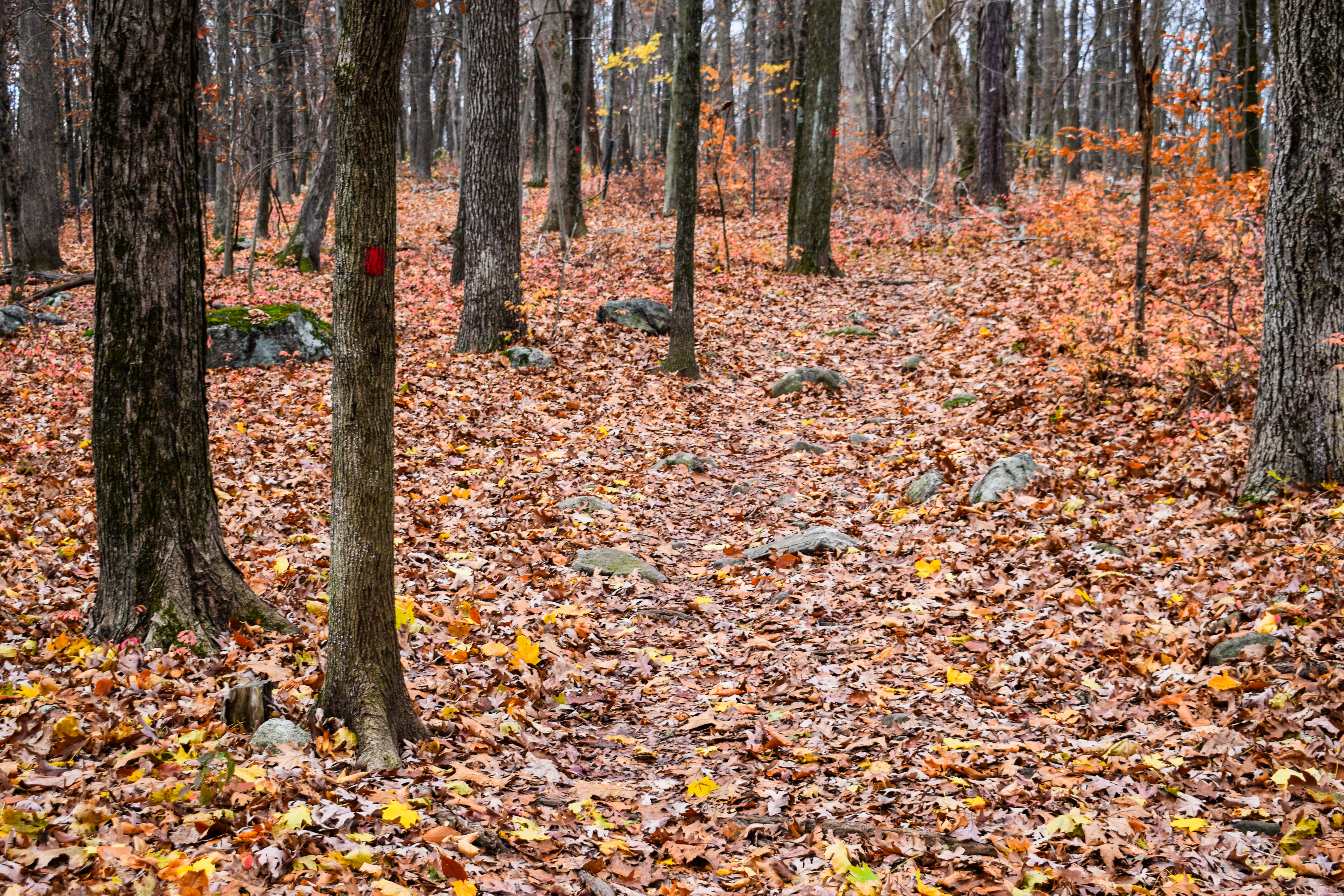
The trail led to a nice walking break through a deciduous forest, providing a view up towards Imp Face through the leafless trees. The leaves on the ground still had a tinge or orange to them, which made for a really beautiful color contrast with the white snow dusting over them.
I remember from my last visit that there was a section of trail with poor footing, and boy we knew when we were there! Our pace slowed down as the grade increased, but we were grateful that nothing was too icy. We all had our spikes on deck ready to deploy, but we hadn't needed them yet. From here, the trail slogged on. We climbed and climbed, eventually turning to climb some more (I foolishly thought that the turn was the "light at the end of the tunnel" - not yet!

Eventually, after a few more turns, I DID see the light at the end of the tunnel! I remember this view was absolutely stunning of the Presidentials and Pinkham Notch, and I was absolutely delighted to get to see it again in a new season. The Presidentials were high in the clouds, but every now and then we would get a peak to the snow-capped mountains. It was cool and daunting to see the Carter and Wildcat ridges from this vantage point - "how on earth are we going to get all the way over there?!" We took our photos but soon jumped back into the woods for a break, it was WINDY. The forecasted temps were hovering around the 20-degree area without windchill.


Our first break was about 2 hours into our hike and involved sandwiches and leftover chicken - truly a gift! I was looking forward to the next bit of trail as we were now in new territory for me. We were even more excited when we realized that the next bit of trail was going to be easy! There were a bunch of small to medium water crossings, but all with decent footing and easily navigable. Now that we were higher up, the trees had a dusting of snow on them as well as the ground, which made this flat-but-rugged section of trail even more beautiful.
I was doing a pretty good job reminding myself that I'm not supposed to be sweating at this point - only my back was wet, and that is truly inevitable. I was feeling shockingly good physically for my first time with a bigger pack, and I was proud of that! We eventually came to the North Carter Trail trailhead, which was going to be the more strenuous climb of the day.
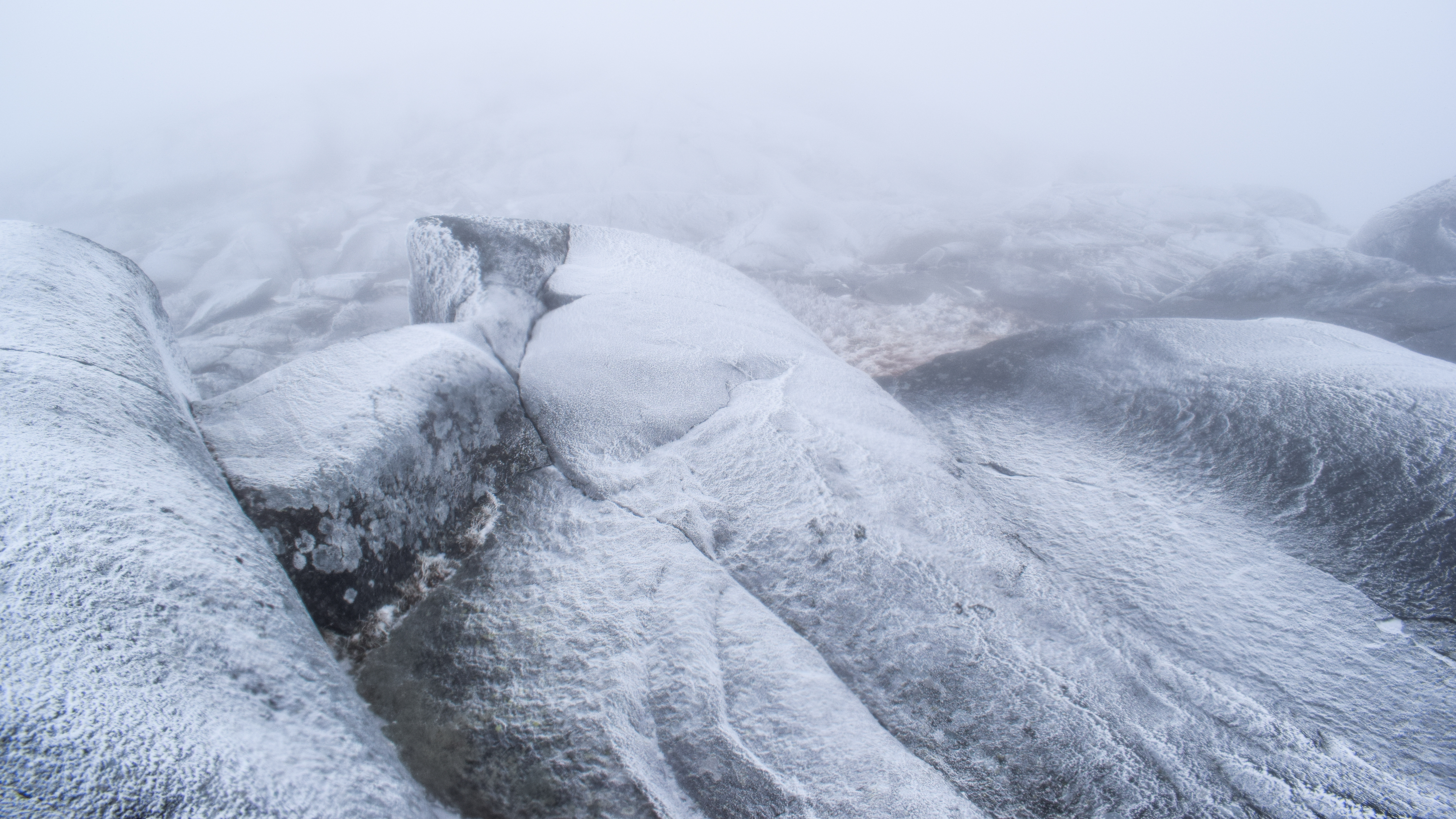
The North Carter trail started off with a moderate climb and slowly became steeper. It reminded me of the stretch of trail going up Owl's Head after the slide that is never technically difficult, but also never lets up. The only saving grace from this section of trail was when we hit the 4000-ft.-ish mark, the trees switched over from having a dusty of snow to being fully covered, which was absolutely stunning, and made the 1,250 feet over 1.2 miles feel just a little better.
Our next break was at the junction with the North Carter and the Carter-Moriah Trails. We all took a moment to have another snack, drink some liquids, and use the bathroom. To my horror, I was peeing out the color of dandelion, and I realized that I definitely have not been hydrating like I should be. Part of this is because I opted to not bring a bladder, the other part of it was because I was dumb and forgot to drink water.
It was chillier up on the ridge, so we wrapped up our break and got moving. The guidebook described the next section of trail as "five ledgy humps with boggy depression in between" - which was wildly accurate. The first three humps were insignificant, but the boggy depressions in between were stunning. Winter wonderlands with snow-covered bog boardwalks.
We were actually enjoying the five ledgy humps/bumps/lumps (we kept changing what they were) rollercoaster, as it was more interesting than just a grueling climb straight up. One of the boggy depressions was a mini-meadow which was absolutely stunning. I believe the meadow was just before the fourth ledgy hump, which is where the views began!
The view of the trail alone was enough to take my breath away - a small treadway through a carwash of white-capped trees (we did turn into snowmen at times), but once we hit the fourth ledgy hump I was in awe. The best of the views were into the Wild River Wilderness and toward the Baldfaces, which looked so incredibly tiny from this vantage point. The only thing that kept us moving along from taking 1,000 photos was the cold, windy air. [I should also note, during this hike we were playing a game that Sarah introduced us to (she said she learned this game while hiking the Camino in Spain) - something along the line of "fart baseball." Rules are: if you fart, you get on base, if you fart again, you're on second, and if you fart a third time, you get a home run (we are aware baseball doesn't work like this) - BUT if anyone else farts while you are on base, you lose your streak and they get on base. First person to three uninterrupted farts gets a homerun/point. I scored my first homerun at this point.]


Continuing on, we could help but notice both the Wild River Valley and Pinkham Notch were illuminated by sunlight, but we had a perpetual dark-grey cloud hovering over us. It did make for some cool photos, but we did desperately crave a taste of sunlight.
In the "boggy depression" between the 4th and 5th ledgy lump we saw some bird tracks in the snow. I was SURE it was one of those bastardly grouses, so I was following the tracks with my pole, pointing into the woods, quietly looking, when a Grey Jay flew no more than 10 inches over my head, truly scaring the life out of me. Whoops - not grouse tracks, but Grey Jay tracks! This was a feisty Grey Jay (comically implying that they aren't all feisty) who really wanted some snacks. I am proud to say that this far into my hiking career, I have not succumbed to their pressure.


The Grey Jay followed us as we climbed up the 5th ledgy bump, enjoyed those views, and then finally made our way to our first 4,000-footer of the trip, Middle Carter. I truly do not remember the climb up to Middle Carter, so I assume that means it was chill and easy. The summit was marked by a small cairn with a little American flag popping out, and there was a small spur to a view - similar to the one from the wooded summit of Mt. Field. The feisty Gray Jays somehow multiplied up here, we took a short break, and then continued on our adventure.


The descent from Middle Carter was longer than we were emotionally prepared for with some steeper sections offering occasional views, both Sarah and Alec took spills here (and therefore now owe me ice cream). Mt. Hight and Carter Dome did look a bit daunting from a distance. We passed our first people of the day, with one group asking about "bear tracks" that someone ahead of us saw (we did not see any bear tracks). The climb from Middle to South Carter was not bad at all, but I had a pretty severe thigh cramp once we started ascending again. I had to take a short break to chug a liter of Nuun (which I had been neglecting) and stretch, and then did some slow hiking behind the group before we met up at the summit again. I also had a Pumpkin Spice Poptart that I got on sale at Star Market which was shockingly delicious and truly brought me back to life!


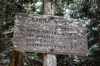
The summit of South Carter was very similar to Middle Carter - wooded, small cairn, small spur view. From this view, though, was Mt. Hight and Carter Dome. Alec wasn't feeling too hot, and Sarah and I were very cognizant of the weather and the time. We came up with three plans: (A) Carter-Moriah Trail to Mt. Hight, Carter Dome, down to the hut, (B) Carter Moriah Trail to Zeta Pass, then Carter Dome Trail to Carter Dome then to the Hut, or (C) Carter-Moriah Trail to Zeta Pass, then Carter Dome down to 19-Mile Brook Trail, then up to the hut. There were pros and cons to all of them, but we deferred making a decision until we were down in Zeta Pass.

It was a steep descent down from South Carter, but thankfully the various blowdown patches and seasonal views made it really scenic. Once down in Zeta Pass, we took a break and went through our options. Both plans A and B would involve a climb up a mountain then a steep descent, likely in the dark. Plan C involved losing a TON of elevation, and then an easy-moderate climb to the hut, also likely in the dark. We begrudgingly picked plan C, which sucked, but we reminded ourselves that the safest option is the best option, and we were objectively making the right decision. We could always come back for Carter Dome and Mt. Hight - maybe take the famous Rainbow Trail? A trip for another day. [AllTrails stats for options (A): 8.92mi/4682ft; (B) 8.68mi/4577ft; (C) 9.95mi/4,688ft]


The initial descent via Carter Dome Trail was on the steeper side, but same nice frozen trail conditions that did not require microspikes (we actually would never need to break them out). The trail skirted a steep slope which provided neat views through the trees - notably the DEEP shade of blue that was cast over the Presidentials, which were still deep in the clouds.
The trail followed a series of switchbacks, which were surprising but more than welcome, and then began to slowly deteriorate into a wet, sloppy mess. There were a good amount of easy water crossings in the lower stretch, all leading to the main Nineteen-Mile Brook. This part of the hike really dragged on, but we reminded ourselves that we were making a sucky choice to stay safe as possible, which is always the right call (we repeated this many, many times). Poor Alec had a second fall here, and Sarah got her fart-baseball home run.
We were THRILLED to land at the VERY wet junction with the Nineteen-Mile Brook Trail, where we took our last break for the day. Thankfully, we were all back to peeing clear!
Now started the last leg of our long Day 1 journey - the death march up the Nineteen-Mile Brook Trail to Carter Notch Hut. I'm actually being very dramatic, the trail was wet but lovely with relatively easy grades the whole way through. Emotionally, though, it dragged on. Headlamps came on at 4:48pm while we admired the purple clouds overhead, but most of this stretch was quiet hiking.
FINALLY at the height-of-land, we passed a couple setting up their tent (which I think was not legal due to the 1/4-mile radius forest protection area), and then steeply descended down to the Carter Lakes, which was the boost we needed! They looked other-worldly with the lights from our headlamps - and we wouldn't even know how incredible they were until morning. I got my second and final point in baseball right before the hut, and then we were kicking snow off of our shoes and heading inside. We did it!
Chapter 4: My First Overnight
It was warm, humid, and busy in the hut's main building when we entered. The oldest hut building in the current hut system, it was packed with happy hikers enjoying drinks and food... and then there were the three of us, still in full gear, backpacks on, VERY overstimulated. We met the lovely caretaker, Peter, who talked us through our stay. We could join three other hikers in a 6-person bunkroom or have our own 4-person one a little further away - we opted to stay with ourselves, naturally. Bunkroom #7 in the upper bunkhouse! The only open kitchen times were at 5:30 and 7:30 (it was currently 5:31), so Alec and I took Sarah's bag, went to the bunkroom to drop our stuff and change out clothes, and then assisted her with dinner. The layout of the hut was unique - there was the main building which had the common area, kitchen, the "croo's nest." The building was made of stone and had a very cozy feeling to it. There were three picnic-style tables set up and two additional benches around the wood-burning stove. There was a small area with purchasable goods, including gear, t-shirts, and candy. The Kitchen had a many-burner stove, lots of pots, pans dishes, three "Guest Food" bins (I assume to protect from vermin), and a sink area with a very meticulously thought-out dish-cleaning system.

Then, up a snowy, stone staircase, was the lower bunkhouse, and then above that the trail split. To the right was the bathhouse - two gendered bathrooms that have since become gender-neutral, and to the left was the upper bunkhouse, featuring bunkroom #7! Our room had four beds, two bottom bunks and two top bunks. Alec and Sarah were on bottom and I was up on top. We had a window at the back and the front had two large windows and a windowed door. Each bunk had a reading light on the wall, and there were hooks EVERYWHERE - that was much appreciated!
Sarah was truly the mastermind behind dinner, she brought a shit ton of spaghetti, a tupperwear of marinara sauce, and chicken sausages. It wasn't a glamorous meal, but those carbs have never tasted so good! Peter was super kind and helpful throughout the kitchen process, you could tell he has his hut's system down to a T. With dirty dishes, step one was to use the warm, soapy water to clean the dish - there was an extra grey water bucket under the sink. Step two was to soak them in clean, warm water. Step three was to submerge them in a light bleach solution for 7 seconds before placing the clean dishes in the drying rack. There was a whole different system for cast-iron, though! Sarah was in charge of that, so I can only imagine. There was a big emphasis on "zero-waste" - we used our starchy pasta water for the soapy water - it worked!
The toughest part of settling in was finding a spot to sit and eat - the hut was very crowded and busy, and people were not leaving anytime soon. We eventually got a bench near the fire, surrounded by everyone's drying boots. Alec wasn't feeling too good, so he had a few bites of dinner and then went back to the room. Sarah wasn't feeling good, but she just needed to use the potty. I was feeling great! I truly inhaled two bowls of pasta before staring into the void of the fire.
I took a quick trip back to the bunkroom to grab my pen and journal to write down some thoughts from the day, and Sarah and I spent a good long time roasting by the fire, sipping hot chocolate, and enjoying the ambiance. I really warmed up to the hut (literally and figuratively) once my overstimulation settled and I was able to simply relax. The other guests were very social (and packed in their own booze), so they were fun to listen to. Finally around 8:00pm Sarah and I headed back to start our getting-ready-for-bed rituals. It was a warm 30-degrees outside (it was forecasted for low 20s with gusty winds) - we were thrilled!
I used the bathroom a couple times, really hoping to pee out everything I had in me so I wouldn't have to walk through the snow in the middle of the night (spoiler, didn't work). I was nervous about getting gold at night so I wore all my bottom layers and a dry merino wool long sleeve to bed. I also brought up my puffy, a hat, a sleeping bag liner, and extra socks up to my bunk with me in case I got cold. The fire went out in the common area at 9:00pm, and there was about 30 minutes of noisy neighbors as they settled in before all was peacefully quiet.
I was delighted to discover that my quilt was the perfect temperature for most of the night. It's rated for 30-degrees and our room was likely hovering just above that temperature for most of the night. The outside temperature plummeted to the single-digits/10s overnight, so I was a little chilly when waking up, but that was still with just base layers on. My pillow was rough, but if I put my fleece underneath it, it was the perfect height. The only complaint I had overnight was how badly and how often I had to pee! I was up at least 5 times, which was a bummer considering (1) I was on the top bunk and (2) it was a 100-ish foot walk outside to the bathroom. Nevertheless, I persisted. There was a nice moment when I went outside around 2:00am to pee - it was snowing! The beautiful snowglobe kind of snow.
Chapter 5: More Decisions, Hiking Out
The next morning we were up around 6:00am. It was cold and windy! More incredibly, it was bright outside! We were absolutely blown away by the rugged, dramatic scenery surrounding the hut - we had no idea all of this was around us! The morning started out cold and cloudy and slowly the clouds began to part to reveal stunning blue skies contrasting with the harsh, grey and white peaks on either side. The windows in our bunkroom were wet with condensation from our body heat, and when the door opened for the first time, all of it instantly froze. It felt like textured glass to the touch - really neat (and satisfying).


Breakfast at the hut was peaceful and cozy. Peter hadn't lit the fire yet - he was doing his morning jobs - but the hot water tank was boiling, and other campers were trickling in. I had some truly awful oatmeal for breakfast, but that was okay. We chatted for a while with the other campers about different adventures, and then we went back and forth about our plans for the day. The higher-summits forecast called for 60-80mph winds and temps around -15-degrees with windchill. We decided our goal is to have fun and enjoy the hike, and we realized we wouldn't be able to enjoy the hike if we were being bombarded with wind. We made another difficult/annoying decision to hike out via Nineteen-Mile Brook and then road walk back to my car instead of following the Wildcat Ridge Trail to the ski area.


It was finally time to pack up and head out - but not before I took a MASSIVE poop. I enjoyed having a moment to reflect on my first hut stay while in the bathroom - I will definitely do this again! We slowly got our bags packed up, filled up our waters, and started our return trip.
The Carter Lakes were STUNNING in this new day's light - we definitely took our time enjoying the many views. Looking back at recent trail reports, they are recently ice-capped. The initial and only climb was to the height-of-land in Carter Notch where we saw the same campers. We were already playing a game of leap frog with other hut guests, and started our long descent.
Thankfully, the Nineteen-Mile Brook Trail felt very quick in the first half, which was a welcomed change from last night. The trail was a little more frozen than last night, which was also welcomed, but once we hit the junction with the Carter Dome Trail, it was back to a wet mess. We continued our game of leap frog and apparently just missed seeing a Buck in the middle of the trail! We also began to pass many groups of hikers heading up to Carter Dome and the hut - some more prepared than others...
Further down, we passed about three student/scout groups, a cool dam with emerald-green waters, and landed in a forest that was still in late-autumn, not early winter.
We were equally relieved and upset to have made it to the road. It was nice to be on solid ground and at a landmark, but a bummer when we remembered how much we still have to walk. The road walk actually wasn't too bad, but the occasional wind gusts were brutal. There were neat views of Mt. Madison and Pine Mountain, which were appreciated. When we eventually made it to the Imp Trailhead and saw my beautiful CR-V, we were equally shocked and delighted!
From the Imp Trailhead, we had a quick drive to Wildcat to get the second car that we didn't even need, changed our clothes while enjoying the views from the parking lot. We decided to celebrate our trip at the Moat Mountain Brewing Company, which was a lovely time. Big, juicy burger, DELICIOUS warm pretzel with beer cheese, and a hard cider. The drive home was long and painful, but so worth it for a really amazing trip!
Chapter 6: Reflections
This trip reminded me why it's called a "48 Journey." The mountains are more than just a list of the biggest boys in all the land, but instead more of a collection of different experiences-to-be. It's fun to reflect on my first 4k hike up Moosilauke, with my free Cotopaxi Luzon 18L and my busted Sketchers sneakers, thinking about how my body was absolutely shredded (in the bad way) afterwards, to now where, even with changing plans twice and only hitting two peaks over two days, I'm able to carry a 30lbs bag, sleep in a hut, and be actually alive the next day AND having fun. Middle and South Carter mark my halfway point through my 48, and I'm very excited to see what adventure is next!
Now, some logistical reflections...
- Next hut stay will involve getting to the hut MUCH earlier. The ONLY qualm I had about our stay was getting there at 5:00pm when it was already packed. I would have loved to get a spot at a table where we could play games, stare into the void, and partake in the comradery, but the room was FULL. I also have been going back and forth on bring booze - I would have loved a drink or two, but packs heavy! Maybe the solution is to bring a couple nips to spike the hot chocolate with...
- Backup plans! I am no stranger to having backup plans and being familiar with the map, but this trip highlighted the importance of not just knowing about backup plans, but also researching backup plans. I still believe we made the right decisions, but it would have been much easier if we (I) had taken the time to read about the other trails to have even more knowledge in order to make an informed decision.
- Gear!
- I am happy with all of my pack gear, including the items I did not use. I am so happy with the amount of food I brought - too much is always better than too little! I truly just might bring a backpacking freeze-dried meal for my next off-season hut trip to save on dishes and to keep things easy, but the pasta was fun.
- My overnight gear worked swimmingly well. My only sleep system complaint was my small pillow, but I made it work, and I asked for a new one for Christmas anyway. I am THRILLED with my quilt, but I also need to be cognizant that if it gets much colder, my quilt will not be enough. I also am not sure I ever need to camp when it is much colder...
- Clothes! This is where I definitely overpacked. My outer layers were all good - waterproof shell (someday I'll upgrade this to something less bulky), puffy, fleece, wind breaker (unused, but happy to have). I basically brought one more of everything else than I actually needed. I brought two thermal leggings, only needed one, but I will likely bring two again (virtually no weight, I should have changed them in the morning but I was a lazy girlie). I brought two outer pants but only needed one. I brought a pair of leggings that I did not use, but I would bring this again for emergency warmth. I brought three pairs of socks, only used two, but would bring three again. I brought two underwears, only used one (gross), but will likely bring two again. I brought three merino and/or polyester long sleeves, only used two - I will likely only bring two next time unless its cold cold. I brought two buffs, only used one, will only bring one next time. My liner gloves were good, and I didn't use my mittens because Alec was using them, but I also didn't need them, BUT I will definitely always bring them.
Appendix A: Step-By-Step
- Drop one car at Wildcat Ski Area in the B (right, lower) lot.
- Drive to northern Imp Trailhead.
- Start hike along the Imp Trail.
- Enjoy views at Imp Face.
- Continue along Imp Trail.
- At junction, turn left onto North Carter Trail.
- At terminus, turn right onto Carter-Moriah Trail.
- At junction in Zeta Pass, turn right onto Carter Dome Trial.
- At terminus, turn left onto Nineteen-Mile Brook Trail.
- At terminus, arrive at Carter Notch Hut.
- Next morning, descend via Nineteen-Mile Brook Trail.
- At terminus, turn right onto NH-16 (north).
- Return to northern Imp Trailhead.
- Return to Wildcat Ski Area B Lot to pick up unused car.
Appendix B: Route Descriptions
“Imp Trail” from White Mountain Guide, 31st Ed. (2022)
[From northern terminus on NH 16 (1,259 ft) to North Carter Trail (3,220 ft.): 3.1 mi; 2,050 ft; 2:35]
WMNF This yellow-blazed trail makes a loop over the cliff that bears the Imp Face, providing fine views of the Presidential Range. The ends of the loop are 0.3 mi. apart on NH 16, with the north end 2.6 mi. north of Mt. Washington Auto Rd. and 5.4 mi. south of US 2 in Gorham. Roadside parking is available at both trailheads (plowed in winter).
The north branch of Imp Trail crosses a narrow power-line cut and heads east up the south side of the Imp Brook valley, through a pleasant stand of hemlocks, and then crosses the brook at 0.8 mi. (difficult in high water). The trail angles north up to a ridge and follows its crest, nearly level for some distance; then it angles more steeply up the north side of the ridge and continues nearly ot the bottom of a ravine northeast of the Imp Face cliff. Here, Imp Trail turns right and then climbs steeply, swinging to the left to reach the Imp Face viewpoint at 2.2 mi.
From the cliff, the trail drops over a ledge, passes a viewpoint, and skirts the edge of the Imp Brook ravine, crossing two small brooks and then a larger brook at 2.7 mi. Becoming gradual but somewhat rough, the trail continues generally south, ascending and then descending; it crosses another small brook and then the head of Imp Brook shortly before reaching the jct. with North Carter Trail on the left at 3.1 mi. [...].
“North Carter Trail” from White Mountain Guide, 31st Ed. (2022)
[From Imp Trail (3,220 ft.) to Carter-Moriah Trail (4,470 ft.): 1.2 mi; 1,250 ft; 1:15]
WMNF This trail leaves the jct. at the upper end of the Imp Trail loop, 3.1 mi. from NH 1 via the north branch of Imp Trail or 3.2 mi. from NH 16 via the south branch. North Carter Trail follows an old logging road and at 0.3 mi. turns right onto another old road. At 0.5 mi., the trail turns sharply left off the old road and climbs more steeply to Carter-Moriah Trail, 0.3 mi. south of the summit of North Carter.
“Carter-Moriah Trail” from White Mountain Guide, 31st Ed. (2022)
[From North Carter Trail to Nineteen-Mile Brook Trail: 5.3mi; 1,600 ft; 3:25]
WMNF This trail runs 13.8 mi. from Gorham to Carter Notch, following the crest of the Carter-Moriah Range. [...]. From the Kenduskeag Trail jct. near the summit of Mt. Moriah to Carter Notch, Carter-Moriah Trail is part of the AT and thus blazed in white. Water is very scarce on many parts of this trail because it runs mostly on or near the crest of the ridge.
[...].
Part III: North Carter to Zeta Pass
Carter-Moriah Trail continues south, passes an excellent outlook east over the Wild River valley, and winds along the crest of the ridge. At 8.5 mi., North Carter Trail enters right, and Carter-Moriah Trail continues over a series of five ledgy humps, with boggy depressions between. Good views are available from ledges on the two southernmost humps. Ascending from the col south of the last hump, the trail passes a good outlook west and north, and in another 70 yd., it reaches the level, wooded summit of Middle Carter Mtn., at 9.1 mi.
The trail descends easily, passes an open area with fine views west at 9.3 mi. And continues along the nearly level ridge with one climb up a short, steep ledge and occasional views. It then descends moderately to the col between Middle and South Carter at 10.0 mi. The trail ascends steadily to a point 10 yd. left (east) of the wooded summit of South Carter (reached by a side path) at 10.4 mi. A few steps farther along the main trail, another side path leads 15 yd. left to a view southeast. Carter-Moriah Trail now descends, steeply at first, passing through an open blowdown patch with a view of Mt. Hight and Carter Dome ahead. The trail then runs at easier grades along the west side of the crest, with two slight ascents. It passes through another blowdown patch, swings left and then right, and descends gradually to Zeta Pass, where it makes a short ascent to the jct. with Carter Dome Trail on the right at 11.2 mi. Water may occasionally be available in a small stream (usually dry in midsummer) that can be reached from Carter Dome Trail 80 yd. below this jct.
“Carter Dome Trail” from White Mountain Guide, 31st Ed. (2022)
[From Nineteen-Mile Brook Trail (2,322 ft.) to Zeta Pass (3,890 ft.): 1.9 mi, 1,550 ft, 1:45]
WMNF This blue-blazed trail runs from Nineteen-Mile Brook Trail 1.9 mi. from NH 16 to Zeta Pass and the summit of Carter Dome, following the route of an old road that served the long-dismantled fire tower that once stood on Carter Dome. Grades are steady and moderate all the way. Leaving Nineteen-Mile Brook Trail, Carter Dome Trail follows a tributary brook, crossing two branches of it at 0.5 mi. and recrossing it at 0.8 mi., at a small, attractive cascade; in this area, parts of the trail were damaged by Tropical Storm Irene in 2011. Carter Dome Trail swings left and then in 50 yd. turns sharply right and ascends by a series of seven switchbacks, passing a good spring on the left at 1.1 mi., and reaching the jct. with Carter-Moriah Trail at Zeta Pass at 1.9 mi.
“Nineteen-Mile Brook Trail” from White Mountain Guide, 31st Ed. (2022)
[From NH-16 (1,490 ft.) to Carter Dome Trail (2,322 ft.): 1.9 mi, 850ft, 1:25]
[From NH-16 (1,490 ft.) to Carter Notch Hut (3,290 ft.): 3.8 mi, 1,900 ft, 2:50]
AMC This blue-blazed trail runs from a parking area (plowed in winter) on the east side of NH 16, 1.0 mi. north of Mt. Washington Auto Rd. and 2.4 mi. south of the jct. with Pinkham B Rd. (Dolly Copp Rd.), to Carter Notch Hut and is the easiest route to the hut. (The parking area is a stop for the AMC Hiker Shuttle.) Sections of the trail near the brook bank sometimes become dangerously icy in the cold seasons.
Leaving NH 16, Nineteen-Mile Brook Trail enters the woods to the left of a kiosk on a relocated section and then rejoins the original route at 0.1 mi., following the northeast bank of Nineteen-Mile Brook on the remains of an old road at easy to moderate grades. At 0.7 mi. the trail crosses an open bank above the brook and soon turns left up rock steps on another relocation, returning to the old route at 0.9 mi. At 1.1 mi. it crosses a major tributary on a large bridge just downstream from the former crossing. At 1.2 mi., the trail passes a dam in the brook and becomes somewhat rougher, with minor ups and downs, and at 1.9 mi., Carter Dome Trail diverges left for Zeta Pass. Here, Nineteen-Mile Brook Trail crosses a tributary on a footbridge, and at 2.2 mi., the trail crosses another brook at a small cascade, also on a footbridge. At 3.1 mi., the trail crosses a small brook and begins to ascend more steeply to the height-of-land at 3.6 mi., where Wildcat Ridge Trail diverges right (west). Nineteen-Mile Brook Trail then drops steeply to the larger Carter Lake, passes Carter-Moriah Trail left at 3.8 mi., crosses between the lakes, and reaches Carter Notch Hut and the jct. With Wildcat River Trail 100 yd. from the Carter-Moriah Trail jct.
Appendix C: Other Descriptions
“Carter Notch Hut (AMC)” from White Mountain Guide, 31st Ed. (2022)
For more than 130 years, AMC’s White Mountain hut system has offered hikers bunks for the night in spectacular locations, with home-cooked dinners and breakfasts, cold running water, and composting or waterless toilets. AMC constructed this stone hut in 1914. It is at an elevation of 3,290 ft., about 60 yd. south of the smaller Carter Lake, at the southern terminus of Nineteen-Mile Brook Trail and the northern terminus of Wildcat River Trail. The hut, with two bunkhouses, accommodates 40 guests in rooms for four to six people. Pets are not permitted in the hut. The hut is open for full service with meals provided from June to mid-September and is open on a caretaker basis the rest of the year. Limited drinks, snacks, and gear are available for purchase by day visitors. For current information and schedule, contact AMC’s Reservations Office (603-466-2727) or visit outdoors.org/destinations.
“Geography” from White Mountain Guide, 31st Ed. (2022)
The Carter-Moriah Range would be a great deal more prominent among White Mountain ranges were it not for those neighbors that rise 1,500 ft. higher across Pinkham Notch. On a high, mostly wooded ridge about 10 mi. long are eight significant peaks more than 4,000 ft. tall, as well as wild, dramatic Carter Notch. The most impressive views in the range are commanded by Mt. Hight, which remains bare after having been swept by fire in 1903. Views from Shelburne Moriah Mtn. and Mt. Moriah are also excellent, and hikers will find several fine outlooks in various directions along the range’s trails. To the east, the range overlooks the broad, forested valley of Wild River and the rocky peaks of the Baldface group, and far beyond lies the Atlantic OCean, which on clear midmornings reflects the sun onto the southeast horizon behind Sebago Lake.
Rugged Wildcat mtn. Rises at the south end of the range. Of its numerous summit, the highest is the one nearest to carter Notch. Wildcat Mtn.’s five most prominent summits are designated, from east to west: A Peak (4,399 ft.), B Peak (4,298 ft.), C Peak (4,268 ft.), D Peak (4,060), and E Peak (4,040 ft.). The mountain is heavily wooded but has magnificent outlook ledges on Wildcat Ridge Trail west of E Peak, a lookout platform with good (although increasingly restricted) views on D Peak near the top of Wildcat Mtn. Ski Resort (on the northwest slopes of the mountain), and excellent views straight down into Carter Notch from A Peak.
Carter Notch, the deep cleft between Carter Dome and Wildcat Mtn., includes some of the finest scenery in this region, particularly the two small, beautiful Carter Lakes that lie in the secluded hollow in the deepest part of the notch. The actual pass (3,385 ft.) in the main ridge connecting Carter Dome to Wildcat Mtn. is north of the lakes and 100 ft. higher than them. The Rampart, a barrier made up of rocks that have fallen from the cliffs above on both Wildcat Mtn. and Carter Dome, stretch across the floor of the notch so that the lakes are totally enclosed by natural walls, and their outlet brook on the south side is forced to run underground. Above the lakes, the impressive wooded cliffs of Wildcat Mtn. rise vertically nearly 1,000 ft. to the west, and to the east, Carter Dome also rises steeply, with the immense boulder called Pulpit Rock jutting out above the notch. A rough path leaves the Wildcat River Trail about 100 yd. south of AMC’s Carter Notch Hut and runs east over the Rampart’s huge rocks, affording a good view towards Jackson. The many boulder caves among the fallen rocks, where ice sometimes remains through the summer, invite exploration (use caution).
Carter Dome (4,840 ft.) once bore a fire tower on its flat, scrub-fringed top. An open area near the summit still offers good views west and north but the bare southeast spur crossed by the Rainbow Trail is a better viewpoint. A bare rock peak, Mt. Hight (4,690 ft.) has the best views in the range. South Carter Mtn. (4,445 ft.) is wooded but has a partial view south. Middle Carter Mtn. (4,624 ft.), also wooded, has good outlooks from various points along its ridge crest, including an excellent view of the Presidential Range 70 yd. north of the summit. [...]. The Imp Face (3,123 ft.) is an interesting cliff on a west spur of North Carter Mtn. The profile, which is named for its imagined resemblance of the grotesquely misshapen face of a part-human wood sprite (an imp), is best seen from Hayes Field in the WMNF Dolly Copp Campground. The top of the cliff affords an outstanding view of the Presidential Range.