Showing posts with label Mt. Washington. Show all posts

Wednesday, June 25, 2025

Mt. Isolation via Lion Head, Mt. Washington, Davis Path, & Glen Boulder (White Mountain National Forest)

Mt. Isolation via Lion Head, Mt. Washington, Davis Path, & Glen Boulder (White Mountain National Forest)

Hike Type: Tilted Lollipop Loop
Distance: 17.24 miles
Elevation: 6,217 feet
Time: 13 hours, 48 minutes (10 hours, 33 minutes)
Hiking Challenges: New Hampshire 4000 Footers, Operation Alaska Benchmark Challenge, NH Rocks that Rock

The Hike 
Time for my annual "NOBODY TALK TO ME I'M GOING TO THE MOUNTAINS" vacation, but this time, featuring some friends! I some had convinced Sarah to hike Mt. Isolation with me. First we talked about doing the tradition route up Rocky Branch and Isolation Trail, but decided against it because of her famous ankle issues. Then we pivoted to out-and-back via Glen Boulder, but then we decided we might as well do some form a loop, so we decided we'd go up Boott Spur and down Glen Boulder. Then we had a heat wave and while it was supposed to be significantly cooler out, it was still going to be humid. I am famously the sweatiest human on earth, so I got nervous about water. I proposed the idea of going all the way up to Washington so we could just a couple of liters of water and then use their spigot to fully load up for the long trip down to Isolation and the longer (feeling) trip back to the car. Like any insane person, Sarah immediately agreed! To beat the heat we also opted to get up a f*** o'clock and possibly catch a sunrise - with the sun rising at 5:00am, we decided it made sense to start hiking at 3:00am, which led to Sarah getting a room in North Conway for two nights - perfect!

After the chaotic planning, we officially met for dinner Tuesday night at the North Conway Applebees and were promptly in bed by 8:00am. We locked in our plan of dropping a car at Glen Boulder, driving the other car to Pinkham, hiking up Tuckerman Ravine Trail to Lion Head for sunrise, then following Lion Head and Tux again to the summit. From there, we'd descend via Crawford and Davis Paths all the way to Isolation. Afterwards, we'd head back up Glen Boulder and descend all the way to the car. Neither of us slept well, but we were both stoked for our upcoming adventure!

Our 2:00am alarms went off and we were soon up and getting ready (with a dash of delirium for good measure). We made it out the door at 2:15am and it was horribly hot and humid outside (my car read 82 degrees), BUT the skies were clear, and that's what I really cared about. Driving seperately, I was the line leader, and our drive was mostly uneventful. I got a text from Sarah while we went through North Conway saying "who is this asshole going below the speed limit at 2:22 in the morning?!" which made me absolutely cackle, and later on we discovered a HUGE blowdown (do we call it that if it's on a major road?!) entirely blocking NH-16. Thankfully, we both reacted quickly enough so neither of us were in danger, but it was jarring! There was just enough of the gravel shoulder exposed that we could carefully skirt around it. Starting things off exciting! 

We made it to the Glen Ellis Falls parking area, which was recently reopened. We only had a 10 dollar bill, so we decided we'd be humanitarians by paying the $5 recreation fee and "donating" the other $5. We left Sarah's car there and I drove us to Pinkham Notch Visitor Center, where we got suited up and ready to go! There were plenty of cars and plenty of parking - we tried to be quiet as we were the only fools up and about. 

Higher Summits Forecast by the Mt. Washington Observatory (7:08pm Tuesday)
[...]. While the worst of this week's heat and humidity is over, a heat advisory will remain in effect until 8 pm EDT Tuesday. Tomorrow will sill remain warm, through less so, particularly at lower elevations and neighboring trailheads. While tomorrow's highs will rebound just to the upper 50s, lower elevations will still be in the mid 80s, so it will still be important to hydrate, stay as cool as possible, kepe an eye out for signs of heat exhaustion, and be ready for the warmer temperatures you have to return to following your time at the higher summits. 
Wednesday: Mostly in the clear under partly sunny skies.
High: Upper 50s. Wind: NW at 25-40 mph early, 35-50 mph w/ gusts up to 60 mph midday, and 25-40 mph later.

[3:07am - Start of Hike] 
We walked through the center of the Pinkham complex to the truly massive Tuckerman Ravine Trail sign. One thing I did think about was NOT hiking the Tuckerman Ravine Trail the whole way because of possibly encountering snow. One did I did NOT think about was how the Lion Head trail would be affected by lingering snow. The avalanche information board read "AVALANCHE DANGER. A GENERAL ADVISORY. LONG SLIDING FALL. CREVASSES. DANGER FALLNIG ICE. UNDERMINED SNOW. WINTER ROUTE." I hadn't thought about the Lion Head winter route at all, and I would mentally bounce back and forth of which was was the right way to go for most of this initial hike.


[3:11am - Tuckerman Ravine Trail] 
[3:13am - Tuckerman Ravine Trail/Old Jackson Road] 
The Tuckerman Ravine Trail started off (and remained) wide, open, and super easy to follow for our entire journey. We passed a camper in their tent with a large fallen limb no more than 4 feet from their tent - we think the limb fell overnight as thunder and rain rolled through the area (the same thunder and rain that likely knocked the limb down on NH-16) - thank goodness they were okay!

This first stretch of trail had a few landmarks - notably the junction with Old Jackson Road and the Blanchard Ski Trail (which has sparked a rabit-hole of reading about the ski trails in the area, but that's something to dig into another day). We neared the Cutler River and could see some cascading water through the trees with our headlamps and later crossed the river, and to our dismay, entered a horrible cloud of thick, moist, warm air that we lived in for for about the next hour. The only saving grace was the viewpoint of Crystal Cascade, which was super cool to see in the dark! Only bummer here was that Sarah was attacked by a MASSIVE moth. I also learned about Sarah's phobia of moths in this moment!

[3:24am - Tuckerman Ravine Trail/Boott Spur Trail] 
The Tuckerman Ravine Trail then passed the junction with the Boott Spur Trail - a trail we decided not to take because we wanted lighter packs (we will never know if the lighter packs made any difference since we added ~1000 feet of elevation gain... on well!). It was pretty brutally buggy here for a while. We both applied bug spray and ended up removing the headlamps from our heads and had to hold them out in front of us. On the plus side, we saw tons of slugs and frogs! Sarah decided she'd start counting how many frogs we would see versus humans. We were at 3 frogs and 0 humans so far!

We could slowly begin to see first light through the trees. There were clouds to the north and some overhead, but the horizon proper was still open. Maybe we will get a sunrise?! We hiked on, appreciating that miles do not count in the dark, and also how this trail was consistently climbing with decently okay footing - we were making good time to meet our loose, unstated goal of breaking treeline in time for sunrise. 

[3:55am - Tuckerman Ravine Trail/Huntington Ravine Trail] 
[4:15am - Tuckerman Ravine Trail/Huntington Ravine Fire Road] 
We crossed the Cutler River a couple of times on bridges and noticed we were just able to see the outline of a high ridge (either Lion Head or the headwall of Tuckerman Ravine, probably) and a couple of headlamps HIGH up! We crossed the Huntington Ravine Trail, joked about climbing it, and then made it to the Huntington Ravine Fire Road, which still had its winter-only sign up (at least winter-only according to the White Mountain Guide). We went back and forth on what to do, and ultimately decided to stick with the summer route. Worst case, we turn around!

[4:31am - Tuckerman Ravine Trail/Raymond Path] 
[4:36am - Lion Head Trail] 
Continuing on, we hiked past the Raymond Path junction and landed at the Lion Head Trail summer route. We did a short break here to chug some water, use the bathroom, and I took a moment to wring out my shirt, which was SOAKED with my sweat. We had more or less left the humidity bubble, but I was still cooking!

Now the fun was about to begin! The Lion Head Trail traveled past a shelter, dipped slightly, and then began to shoot up the steep shoulder, past an "Avalanche Area" sign (we were delighted to see no snow on the trail). The climb was steep, scrambly, but fun! It reminded me slightly of the climb up Wildcat Ridge Trail. The morning colors were starting to show through the trees, and we both gasped at the first viewpoint, which provided obstructed views toward the Wildcat Ridge and Carter Dome.

Lion Head Trail zig-zagged up the shoulder, climbing up a fun ladder and few trickier scrambles before revealing the first views over to Boott Spur, whose cliffs were breathtaking. 

The clouds began to illuminate with the sun's first glow of the day and I truly blasted off, trying to reach treeline in time for the sun to break the horizon. I nearly put myself into cardiac arrest, but I was (mostly) successful in my mission! The sun debuted the start of the day over the northern Carter-Moriah Range as Sarah and I exchanged a series of "oh my god"s. Beautiful doesn't even begin to put it into words!


Just a little but further up we officially broke treeline at another "Avalanche Area" sign, where we got to enjoy more views toward the Wildcats and Carters, down towards Jackson and Conway, and up towards the cloudy summit of Mt. Washington. We also loved to see some alpine flowers in bloom! The first of which was "bog labrador tea," which can apparently be used to make tea!

We now set our sights on Lion Head proper, where we planned to stop for our first break of the day. The climb continued to be steep, but grades always feel easier above treeline. The views definitely help! Clouds alternated between nearly encasing us to showing us the most incredible views. To our surprise, we crossed paths with two people who were coming off the summit (maybe the people from before?). 4 frog vs. 2 people so far.

We caught our first glimpse into Tuckerman Ravine, too, which had just a few patches of snow left! For the climb from the Avalanche Area to just below Lion Head, the sun was behind the clouds, but it popped out again just before our break, and WOW. It was such a gift to see this incredible area be illuminated by the early morning light. The summit even became visible for a bit!

[5:30am - Lion Head Trail/Lion Head] 
We parked on Lion Head for a nice snack as we stared in awe in all directions. It was a bit chilly now as the wind was blowing and we were soaked in sweat, but we were both still feeling good. There was even a survey "button" on Lion Head! We loved watching the clouds roll over Boott Spur and Nelson Crag as we could hear the waterfall at the Tuckerman Ravine headwall draining into the Cutler River. Even as the sun began to hide behind the clouds again, the occasional ray of light would shine so beautifully and dramatically through the humid air. I'm still in awe!

Once the sun was away, it was time to keep moving! The summit was back in a cloud as we continued our beautiful walk from the Lion Head to the junction with the Alpine Garden Trail, which was easy and beautiful! I even got a point in mine and Sarah's game of fart baseball! There were some purple flowers lining the trail that my Seek app can't seem to identify from my iPads screen, but I will say they were pretty!

[6:00am - Lion Head Trail/Alpine Garden Trail] 
We soon crossed the junction with the Alpine Garden Trail. Lion Head Trail stayed flat for a moment as it traveled through some wet scrub before starting to climb again. There were MANY Canadian bunchberry flowers in this area (and throughout much of our hike) as well as azure bluets. 

Officially in "rock hell," the game became "follow the cairns while still gawking at the views" - we only lost once! We had a nice view back to Lion Head as we slowly entered the clouds, which alternated from "you may not see more than 10 feet ahead of you" to "I can show you the whole wide word!"

My favorite flowers were the moss campions, which were newly budding, and the parts that had budded were closed up for nighttime still. In fairness, I'm really just a sucker for any pink/purple flower. We also passed three-toothed cinquefoils before scrambling through a short rock doorway and eventually making our way through the clouds to the Lion Head Trail terminus at the Tuckerman Ravine Trail, which we think was missing its sign (there was only a sign for Lion Head Trail, not Tuckerman Ravine Trail).

[6:30am - Tuckerman Ravine Trail] 
Back on Tuckerman Ravine Trail! This short, final push was a doozy and almost fully in the clouds, with only occasional glimpses around. It climbed steeply and steadily through rock hell and a few patches of grass. It truly felt even more other-worldly than usual with the clouds! After some huffing and puffing, I saw a sign, and yet again, BLASTED off, nearly putting myself into a coma. It was the Auto Road!

[6:53am - Mt. Washington Auto Road] 
Never had we ever been so excited to see pavement high on a mountain - we made it! Visibility was no more than 50 feet, so all we knew was to follow the auto road "up." We soon climbed up and over a large staircase, and found the Sherman Adams building!

[6:58am - Mt. Washington Summit] 
Once in the area, we BOLTED for the summit. Turns out, if you climb Mt. Washington for 7:00am, you won't have to wait in line! We got our photos with the summit sign, I got my photos of the two discs in the summit area (one at the sign and one ~10 feet away; I also saw a rumor on Facebook that there's another one somewhere near the cog tracks... another day...), and we giggled about how much fun we were having without anyone else there! We also giggled because Sarah's classes would fog up, but only one side at a time, depending on which side the wind was blowing from. According to the observatory, it was 54 degrees out with wind speeds at 32 mph and gusts up to 38 mph. 

Only downside was that we were SOAKED. We knew our two goals were 1) fill up all of our water vessles and 2) sit and snack. While circling the building for the water spigot, we noticed a door was cracked open - hmmm? We opened the door, and the automatic sliding doors just inside opened for us to the mud room. The main doors to the visitor center were still closed, I guess they left it unlocked for hikers needing shelter? Sweet! We parked ourselves inside and for the first time realized how DRENCHED we were. The cloud was, in fact, water, and everything we had was sopping wet. We took a nice LONG break here. My main goal was to dry off my camera, which eventually did happen with some patience. 

I snacked on my peanut butter and cheddar cheese tortilla, some BBQ-flavored chick peas, and beef jerkey while Sarah moaned "food is AMAZING." After sitting for a while, we saw the first worker of the day arrive (they came in through a different door and paid us no mind). We took turns refilling our water and realized how chilly it actually was outside now that we had warmed up inside. 

We noticed toward the end of our break that the clouds were parting occasionally, so we ran out one last time for some photos, before RUNNING back inside because we were frozen! Once back in, we put our puffies on and a new worker came over and said "How'd you guys get in here?" We told him the door was open and he said "Huh... Are you thru hikers?" When we told him we were not he said "You know, we don't have any hot food until 11:00pm." We assured him that was fine and went our seperate ways - poor guy seemed so genuinely confused why we were there (fair). Then another guy came out hauling some... materials? And finally a woman came out and so politely said "Hi! Who let you guys in?" and we said "Oh, no one, the door was open, but we're on our way out!" She was super kind and very concerned that the door was left open (we were grateful). Sarah apologized to both workers that talked to us, but I didn't feel an apology was necessary as the door was open and we just sat there!

Anyway... time to go! We did a quick bonus lap around the summit and then made our way over to the Crawford Path.

[7:52am - Crawford Path] 
The Crawford Path was like a dream in more ways than one! When we left the Sherman Adams Building, the clouds parted just enough to show a small nearby undercast and once on the trail, it was like a wonderful cobblestone street. Clouds continuted to roll in and out, but trending toward more visiblity now. The grass looked greener, we could see the summit structures behind us, and soon we hit the junction with Gulfside Trail!

[8:00am - Crawford Path/Gulfside Trail] 
We think we saw god in this stretch - the souther Presidentials were all still in clouds at first, but over the course of maybe just two minutes we watched the peaks reveal themselves along with the vast Bigelow Lawn. We shared another round of "oh my god"s while we just enjoyed the show! We could now see down toward the Cog base station, Lakes of the Clouds Hut, Mt. Monroe, an a few taller peaks now peeking through the clouds, too. It was really spectacular. One more thing of note: we both had to pee badly in the beginning of this stretch, but we were nervous that the clouds would part right as we were at our most vulnerable. We ultimately went for it, strategically placing ourselves in rocky nooks, and hoping for the best (we were literally fine).


Eventually, though, it was time to keep moving. We noticed a SEA of humans hiking up the Crawford Path from Lakes of the Clouds Hut, so we picked up the pace a bit since we'd be leaving on the Davis Path soon. 

[8:27am - Crawford Path/Westside Trail] 
[8:28am - Davis Path] 
We hit the junction with the Westside Trail and then it was time for the Davis Path! I had a dream of hiking the entire Davis Path all the way to US-302, but the combination of Sarah's ankle and a recent trail report had me letting that dream go (FOR NOW!). We watched more and more hikers hiking up Crawford from the hut, so we were happy to disembark. The Davis Path was immediately less-manicured than the Crawford Path, but that is to be expected. 

[8:35am - Davis Path/Southside Trail] 
[8:45am - Davis Path/Tuckerman Crossover] 
I really do love the vast network of trails up here. I'm sure its comparable to the density (if not less dense) than the RMC trails off Appalachia, but I love how you can actually see the trails from a good distance away. One thing I didn't love was the INSANE amount of spiders that were in what felt like every nook and cranny of the path. I know Sarah and I were counting frogs vs. humans, but if we included spiders in that count, spiders would have won by a longshot. We were constantly in awe with how massive the summit cone of Mt. Washington was/is and we just loved hiking into what felt like the abyss toward Boott Spur.

[8:54am - Davis Path/Camel Trail] 
[8:59am - Davis Path/Lawn Cutoff]
Eventually, Nelson Crag came into view and later, Lion Head. It was extra fun getting to essentially trace the route we took up the mountain! Sarah and I were pretty silent at this part of the hike, just enjoying the gentle grades and beautiful scenery with rolling clouds.

The trail weaved around and over the different faux summits of Boott Spur, we passed an eastern swallowtail butterfly, which according to AMC's Field Guide to the New England Allpine Summits (Slack & Bell, 3rd Ed., 2013) is "a surprising sight in the alpine zone" (p. 163).

[9:23am - Boott Spur Trail] 
[9:26am - Boott Spur Summit] 
At the Boott Spur Trail junction, we decided to hit the summit, which was just a couple of minutes off-trail. The view back to Mt. Washington was commanding, as was the wind! I am SO MAD that I lost my anemometer (again) - I'm guessing gusts were in the upper 30 mph zone (based on my experience - the 30s is typically where I've felt the wind "pushing" me). We got a great view down toward Wildcat Mountain from the summit, which was more or less marked by a drill hole. We had a quick return down to the Davis Path, and our next stop would be the Glen Boulder junction!

[9:29am - Davis Path] 
We took another emergency pee break (we might have over-hydrated, which is NOT a bad thing - I had a liter of Nuun pre-hike, two liters on the climb to Washington, and a fourth liter on our break up top to theoretically compensate for all my sweat) and continued on. This stretch (and the next) really felt like we were hiking into oblivion in the best possible way. The trail sloped gently downward toward the craggy sub-peak at the Glen Boulder Trail junction, revealing the ridge that the Glen Boulder Trail follows and a playful crow, hopping along the fragile alpine vegetation.

[9:43am - Davis Path/Glen Boulder Trail Junction] 
[9:56am - Davis Path]
We did a short sit and snack at the Glen Boulder Trail junction, as we knew we wouldn't want to stop again until we were at Mt. Isolation. The trail followed the shoulder of the grassy paradise for a bit, soon entering the Presidential Range-Dry River Wilderness.


[9:58am - Davis Path/Presidential Range-Dry River Wilderness] 
I particulatly loved this wilderness boundary because it wasn't the typical sign that we're used to - it was just a plank that said "WILDERNESS." I was also grateful that the trail condition didn't change at all, which is a pro to hiking on a popular trail, even in a wilderness area. 

From here the trail continued over the spider's paradise, eventually descending toward the scrub. We passed two more people here, which surpassed the number of frogs we'd seen so far. The saw-like summit of Boott Spur was behind us as the Montalban Ridge revealed itself ahead. The scrub slowly grew to knee-height, and then eventually above our heads where a sign welcomed us to the wilderness area.

[10:11am - Davis Path/Depart Alpine Zone] 
Tragically, it was BUGGY in the scrub. Thankfully, that only lasted for a few minutes as the trees grew taller and taller. The descent was moderate, with nothing crazy (which we were WELL aware of, since we'd have to hike back up this later). The trail was bright, but well-shaded, too. We took another potty break in the col between Glen Boulder Trail and North Isolation, and continued on!

There were a few blowdown patches that provided views ranging from "yeah I guess that counts as a view" to "oh my god we have to go back up there?!" We even saw some moose prints! There were a few patches of slightly eroded trail, but nothing crazy at all. 

[10:56am - Davis Path/Isolation Trail (West)] 
Time was definitely moving slower here in the tree canopy, and it moved even slower after the junction with the Isolation Trail (west). There was a stretch of blowdowns that weren't impossible to navigate, but were not pleasant either. We were forced to take our time, pretending to enjoy the views through the dead trees, as we weaved in and out of nature's jungle gym. This stretch also provided a RUDE view to Mt. Isolation, which looked dreadfully far

[11:12am - Davis Path/Isolation Trail (East)] 
Spirits began to pick up once we hit the junction with the Isolation Trail (east), since this was our last landmark before the final push! If the last trail segment was known for blowdowns, this segment would be known for mud and "crooked trails." The mud wasn't anything too horrible, but it did require some thought and some pole-poking to find good ground to stand on. 

The "crooked trails" were two blowdown areas/fir waves (I think all fir waves are blowdown areas but not all blowdown areas are fir waves, like squares and rectangles?) where the trees were simply tilted over. It didn't require going over or under, but just walking at a slant, kind of like a cheap carnival's fun house!

After the second "crooked trail," we had the first final push. The trail became steeper (which was the first steeper stretch of trail since Lion Head and Tuckerman Ravie Trails, so we were not complaining, and then we made it to the Mt. Isolation Spur! 

[11:40am - Mt. Isolation Spur] 
We were ready to absolutely blast off to this summit, but we ran into a couple of hikers coming down from the summit, one who was excited to talk (and to be clear, we are not unfriendly hikers, we had just been hiking alone in the wilderness for a WHILE now and were not used to other humans!). He got extra excited when he heard that this was going to be peak #46 for me, becuase it was also his 46th peak! He had the two Wildcats left, and he planned to hike them A-to-D so his wife could take the chairlift up to celebrate with him, which he was adorably (and rightfully) excited for. He asked my last two, I told him Cannon and Moriah, and he said "well Cannon is a quick up and back, but Moriah is a solid 9.5/10," which I appreciated. 


After our chit chat, Sarah and I actually blasted off along the steep spur path to the truly magnificent view from Mt. Isolation!

[11:48am - Mt. Isolation Summit]
We were NOT allowed to gawk at the view until we hit the true summit marker, so we hiked past the main vista through a few more feet of scrub to the summit disc and cairn, gave it a solid boop, gave each other a high-five, and then finally enjoyed.

The main unobstructed vista spanned from Mt. Pierce all the way to Boott Spur and the Rocky Branch Ridge. Behind the Rocky Branch Ridge were the Carters, with many other mountains in view over the scrub in other directions. This view was truly magnificent. We took a nice sit and snack here, peed again (cheers to hydration), said hello to a few other hikers who summited, and eventually (and reluctantly) started packing up. It was at this point two silly things were realized: 1) I was looking for my chafing  salve (which is the nicer way of saying diaper rash ointment) deep in my pack when I realized I was not only carrying my Kahtoolas with me, but also my Hillsounds and 2) Sarah left her keys in my car, meaning that this was officially a loop hike! Thank goodness the car spot was only a mile away - the fact that it was so (relatively) close made this into a very funny faux-pas instead of a borderline crisis - I giggled all the way back!

[12:27pm - Mt. Isolation Spur] 
[12:30pm - Davis Path] 
Our return trip down the spur was short and sweet and then we began to descend on the Davis Path before ascending, descending, ascending, descending, ascending, etc.... We bravely tackled the mud pits and the tilted trees between the Isolation Spur and the Isolation Trail (east)...

[12:58pm - Davis Path/Isolation Trail (East)] 
We then courageously traversed the blowdown section and the horrid views to our climb back to Glen Boulder Trail between Isolation Trail (east) and Isolation trail (west)...

[1:14pm - Davis Path/Isolation Trail (West)] 
The rude view was rudest from and summnit plateau of North Isolation (apparently a Trailwright's 72 peak - I don't think the true summit is on the Davis Path). 

The descent from North Isolation into the col was gentle, and then it was time to turn the brains off and just climb. We were cheered on by some bluebead lillies and another frog (frogs were losing badly at this point), but the climb hurt! Sarah and I mostly stuck together in this stretch, not saying much. As I write this, it sounds much more dramatic than it actually was - we were literally fine, just tired. 

[2:08pm - Davis Path/Alpine Zone] 
Spirits picked up once we entered the Alpine Zone again. Grades eased as the rolling clouds created really beautiful patterns on the nearby ridges and summits. 

[2:20pm - Davis Path/Depart Wilderness Area] 
We exited the Wilderness Area, finished the climb back to the Glen Boulder Trail junction, and did a short sit break (and sunscreen application). Time for the final descent! I knew I'd be going back to my car to retrieve the keys, but Sarah wasn't sure if she wanted to come with me or wait at the Glen Ellis trailhead - her ankle would be the deciding factor - tbd!

[2:22pm - Glen Boulder Trail] 
The Glen Boulder Trail was absolutely beautiful up high. We descended on its ridge gently, occasionally through patches of scrub (some of which were tighter than we would prefer). The scrubby patches were buggy, but the rest was wonderful. Eventually, the tightest stretch of scrub led to a fantastic view of Boott Spur and the Gulf of Slides as the trail wiggled toward Slide/Gulf Peak. The trees at the floor of the gulf looked like they had been flattened. Maybe by wind, snow, or a mythical giant?

After the "peak" (more like just the end of the ridge's shoulder), the Glen Boulder Trail descends back into the scrub and what felt more or less like treeline (we did not formally leave the Alpine Zone, yet, because we had another open stretch coming up).

[3:03pm - Glen Boulder Trail/Spring] 
We passed a spur to a spring in the trees, which I flirted of following just for funsies. I know somewhere down the line of my life I'll likely attempt hiking all the trails in the White Mountain Guide, so I sometimes pretend to think ahead to help myself out down the road (like hiking a spring spur), but that was not in the cards for today). We crossed paths with two guys who looked to be in their upper-teens or low-20s and Sarah asked them where they were headed. Their response was "eh ya know we're just kinda poking around!" which was absolutely wild. Hope they had a good hike!

The Glen Boulder Trail soon exited treeline again, affording wonderful views again back to Boott Spur, the Gulf of Slides, Boott Spur's main ridge, and the trailless ridge between the one we were on and Boott's. Looking down toward NH-16 we could see the Glen Ellis parking area, Pinkham Notch Visitor Center, and the Wildcat Ski Area parking area. I made another joke about the keys here.

The trail became steeper and rougher here, which slowed us down significantly. We truly inched our way down, eventually approaching the Glen Boulder. The footing was along the lines of "just bad and steep enough where you have to almost sit and scootch every few feet" - this was exacerbated by our viciously tired bodies. Ouch!

[3:41pm - Glen Boulder Trail/Glen Boulder] 
We eventually made it to THE Glen Boulder, where we made a series of jokes at Glen's expense (when I typed "Glen" into my phone, it autocorrected to "Helen," which also provided us some joke content. Two guys we had seen hours earlier caught up to us and asked if we tried to push it over - I joked to Sarah that I wouldn't want to try since I'm the strongest man on the mountain and wouldn't want to ruin the boulder for everyone else! 


They (foolishly) let us get ahead of them as the trail dipped back into the trees. Descents are where Sarah and I ususally get split up - she needs to go slowly for her ankle but I prefer to go quicker and let gravity do most of the work. She officially made the call at Glen Boulder that she did not want to hike to Pinkham with me, so we agreed that once we hit treeline I would blast off to get the car.

The Glen Boulder Trail dipped back into the trees for a moment before hitting one last area of scrub. While waiting for Sarah, I head the two guys pass her and a lot of laughter. When she caught up with me, she said the one guy asked her if she wanted any of his black flies. She said "no thanks I have plenty of my own!" His repsonse was "are you sure? They're all named Glen!" which might be the funniest delirium joke I have ever heard.

The guys passed us, Sarah and I reviewed our plan, and then we hit the Alpine Zone sign.

[4:05pm - Glen Boulder Trail/Depart Alpine Zone] 
At the Alpine Zone sign the trail conditions continued to be steep but footing drastically improved. We said our momentary goodbyes as I began my blast off, which also gave me a huge surge of energy (I LOVE a side quest, and I secretly wanted to beat her to Glen Ellis). It was significantly warmer in the woods. There was a gentle stream crossing that took every ounce of willpower in me to not lay in.

I eventually caught up to the guys from before (who we nicknamed "the Glens"), exchanged some nods, and I continued past them. The Glen Boulder trail intersected with a ski trail, steeply descended for a moment, and then leveled out with rough footing as the trail neared The Direttissima. I passed the two men from the Isolation Spur (who I nicknamed "46"), and they unfortunately wanted to talk some more. Again, I promise I am a friendly person, especially on the trail, but I was on a mission! 

[4:32pm - Glen Boulder Trail/The Direttissima] 
Soon after passing 46 I arrived at The Direttissima. I was grateful for this side quest, dubbed "Operation Rendez-Vous," as it really was the mental boost that I needed. The Direttissima immediately felt less-traveled and I immedaitely caught a spider web to my face (first of the day, though, so that's okay). The overall vibe to the trail was like a Wilderness Trail, just with a highway within earshot. I could also hear Glen Ellis Falls, though, so that was fun!

The Direttissima skirted the bottom of a cliff and had a few more "ups" than I was ready for. There was one little spur path that led toa  little view toward a far shoulder of Wildcat before descending roughly with confusing footing. There were some neat, overhanging rocks, though!

The trail crossed a bridge over a lovely, skinny waterfall and then traversed a flat stretch before coming to an end at a parking pull-off just off of NH-16.

[4:54pm - The Direttissima/End of Trail] 
From here, a footpath led from the parking area, over a footbridge, over the confluence of the New River and Cutler River, and to the southern end of the Pinkham Notch Visitor Center parking area. I had a short walk back to the car, and at 4:59pm, I had officially completed this BEAST of a hike! Definitely my hardest-to-date. Not my longest, but definitely with the most elevation gain.


[4:59pm - End of Hike]
I didn't change anything at Pinkham except for my shoes (I NEEDED my flip flops on) and then I zoomed over to Sarah's car, where I learned that I had officially won the race! At the parking area, I finished my 9th liter of water, changed my clothes, and waited just about five minutes for Sarah. 

Our final count was 9 frogs and 21 people. We eventually left the parking area with one common goal: clean. Sarah's version of that was finding a river to soak in, mine was taking a shower with soap (in fairness, she did shower after!). We accomplished our tasks, I checked into my hotel at the Green Granite Inn in North Conway, and then we met back up at the Wicked Fresh Craft Burgers in North Conway, where Gen joined us! All three of us went to Dairy Queen for dessert, and then Gen and I said goodbye to Sarah before getting into our room to watch some Law & Order before passing out. Truly what an amazing hike!


Step-by-Step
- Park at Pinkham Notch Visitor Center
- Start hike on Tuckerman Ravine Trail.
- At jct., turn right onto Lion Head Trail (summer route).
- At terminus, turn right onto Tuckerman Ravine Trail.
- Summit Mt. Washington.
- Continue hike descending on Crawford Path.
- At jct., turn left onto Davis Path.
- Follow Davis Path into treeline for some time.
- At jct., turn right onto Mt. Isolation Spur.
- Summit Mt. Isolation.
- Retrace steps to Davis Path.
- At jct., turn left onto Davis Path.
- At jct., turn right onto Glen Boulder Trail.
- At jct., turn left onto The Direttissma.
- Return to car at Pinkham Notch Visitor Center.

Friday, August 30, 2024

Mt. Monroe, Mt. Washington, & Mt. Clay via Ammo, Alpine Garden, & Jewell (White Mountain National Forest)

Mt. Monroe, Mt. Washington, & Mt. Clay via Ammo, Alpine Garden, & Jewell (White Mountain National Forest)

Distance: 15.34 miles
Elevation: 5,279 feet
Time: 10 hours, 32 minutes (9 hours, 3 minutes)
Hike Type: Loop
Hiking Challenges: New Hampshire 4000 Footers

The Hike
After Tuesday's hike of Mt. Jefferson, I was officially hooked on the Presidentials! The weather looked like it was going to be perfect for this day (Friday), so I decided I'd hike Monroe and Washington. Then I thought "well I wanted to hike Mt. Clay on Tuesday but we didn't have time," so I added that one. Then I thought "well I kind of want to explore more than just the Crawford Path," so I added Tuckerman's Crossover, Alpine Garden, and Nelson Crag. I also had a moment of descending into one of the ravines and climbing back out, but that would have been dumb (by body barely survived this hike). I had a plan!

I got to sleep in for this one - 2:00am alarm! I was out the door at 2:15am and could only imagine what my neighbors could be thinking about me somewhat consistently leaving in the middle of the night. I IMMEDIATELY almost ran over a bunny, which I did fear was an omen, but I believe its life was spared, as was mine. I did stop at the Lexington Service Plaza to fill up a tire that had low pressure, and then it was smooth sailing up to Hooksett. I landed at Hooksett at 3:30am to use the bathroom (nothing of substance) and get some snacks for the day (two pieces of Cabot cheese, pretzles, a Celcius, a Fresca, and two Reece's Big Cups - the cashier commented "breakfast of champions"). 

Part two of my drive was super easy too - I hit a few foggy patches on US-302 and my veins were full of caffeine. I had leftover pizza from last night for breakfast and eventually made it back to the Ammonoosuc Ravine Trailhead at 5:10. I took care of some personal chores (christening the bathroom and taking a hit from my inhaler), paid my $5, and made the executive decision to take a nap - I didn't want to start this one in the dark 1) because I'm scared of the dark and alone and 2) the guidebook made the Ammonoosuc Ravine Trail sound beautiful, and I wanted to actually see it! It was 45 degrees out with crystal clear skies and just a faint light illuminating the silhouette of the Presidential Range. It was expected to be a great day!

Mt. Washington Weather Observatory Higher Summits Forecast for Friday, August 30th, 2024
"While pressure to our north and its associated ridge has brought about seasonably cool and dry conditions across much of New England, an approaching cold front is expected to bring about cooler temperatures and increased rainfall going into the holiday weekend. Low southeasterly winds will allow tonight's temperatures to dip into the lower 40s with minimal increase expected as southerly winds ramp up into the weekend. As the high pressure begins to gradually shift southeast toward the Canadian Maritimes tonight through later Friday, it will provide plenty of dry air across the region. Clear and sunny conditions with no expected precipitation will continue Friday, though a tightening pressure gradient due to the approaching front will significantly ramp up winds later tomorrow." 


I did nod off and woke up from a school-related dream (something about teaching kids solfege improperly, really intellectual stuff) when people started to activate around 5:45am. There weren't too many cars in the lot which was great. I did have to take a tums after my breakfast pizza and hit the bathroom one more time. A man was LOUDLY talking to his huskies in the parking lot, which made me nervous, but I was delighted to see they were headed to the Jewell Trail.


The squirrels were officially awake (and insane) and I was on trail at 6:07am! My MAIN plan was to hit Ammo-Monroe-Crawford-Washington-Gulfside-Jewell. I was HOPING to add Mt. Clay on the tail end of that. My DRAEM was to go with the big plan and add in the Alpine Garden as well. Time will tell! I hopped on the Ammonoosuc Ravine Trail right next to the bathrooms - let the adventure begin!


Part 1: Ammonoosuc Ravine
[6:07am: Ammonoosuc Ravine Trail]
The Ammonoosuc Ravine Trail follows a blue-blazed gravel path from the parking lot over relatively wet ground (there were advanced water bars and decomposing bog boardwalks - little bit of everything!). The woods here were already super pretty and I was dealing with a slight left heel pain - not sure if it was skin issue or my achilles (update from the future: I think it was a stiff achilles, as I forgot about it soon after and there are no visible skin issues as I'm writing this the next morning). I did put my buff on about 5 minutes in to give my lungs a fighting chance.


The footbed transitioned from muddy to rock as the trail approached Franking Brook in a very lush area. The crossing was three-pronged, with the first two being small streams and the third being a bit wider, but easily rock hoppable. My fleece came off right after this crossing. 


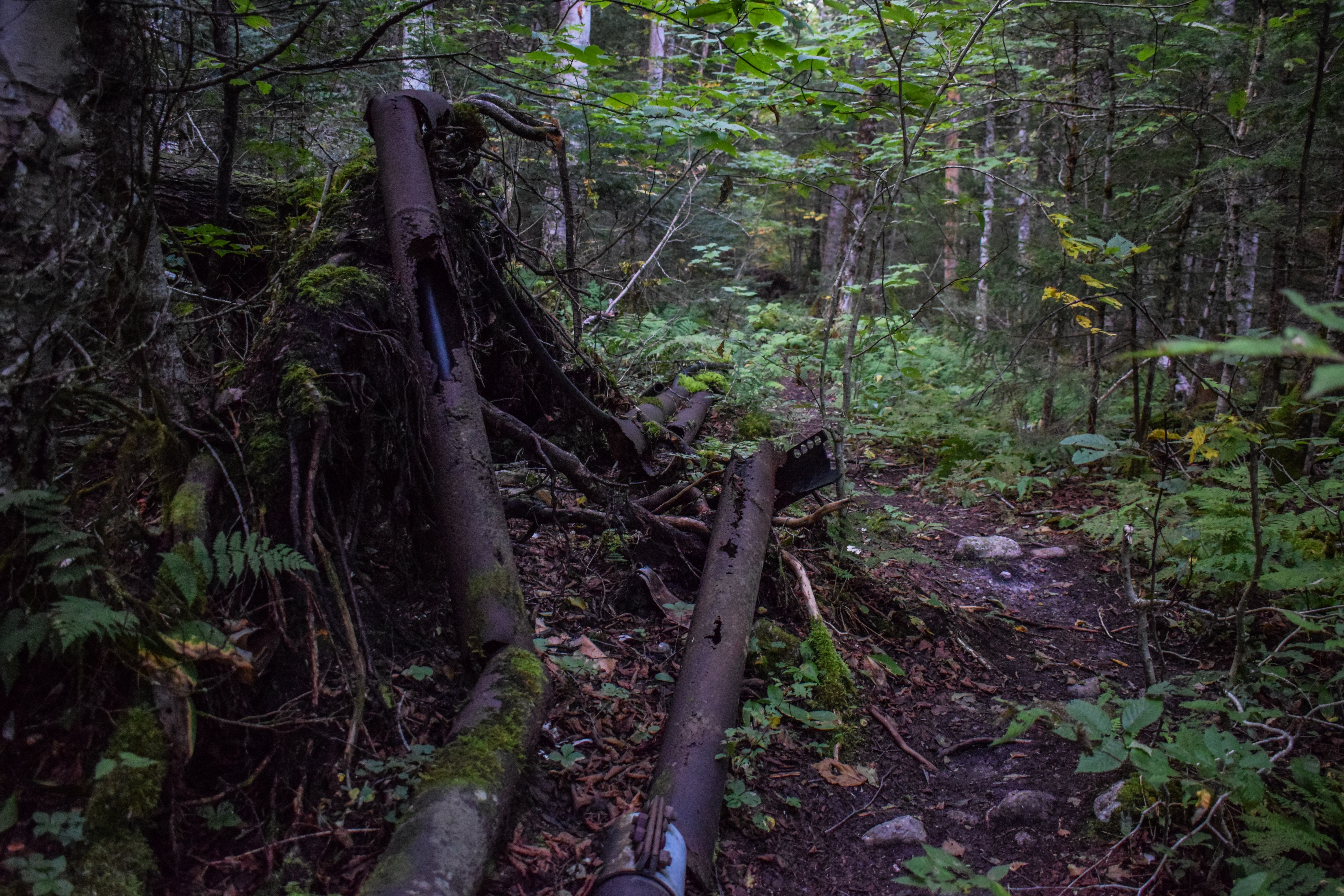
The easy ascent continued (for now) as the trail crossed two rused old pipelines. After dipping again to cross a small stream, I passed a friendly duo ahead of me, trudged through some muddy patches, and eventually landed at the Ammo Link junction, which had both signs for the Cog R.R. and the Lakes of the Clouds Hut (2.1 miles away!). 


From here, the Ammonoosuc Ravine Trail turned right to follow alongside the Ammonoosuc River. The grade wasn't steep but the trail was wet, rocky, and rugged. Sometimes the trail was a stream, too - it must have rained recently. After passing another I realized I was definitely going faster than I should be, most likely because I had no one to yap with! I mentioned this to someone and she said "eh it builds character!"


There would be occasional off-trail peeks to the ravine headwall, which looked impossibly high and far away. I also realized I forgot my visor which would be a BUMMER considering how much time I would have above tree line. I remember, after forgetting it for Mt. Jefferson, I told Sarah the FIRST thing I would do when I got back to my car was to strap it back onto my pack... I simply did not too do that. I did bring sunscreen, though!


I continued my hike past some more truly insane squirrels - two of them were chasing each other and more or less charged at me until I yelled at them. The trail crossed an impressive damaged area, and I missed the memorial plaque described in the guidebook. The riverside views continued as the high Presidential Ridge became clearer and nearer. I was thinking about how I'm pretty far along in the 48/52 journey - if/when I finish, I want to put together all these little essays I've written into a "book" - book in quotes becuase it would just be for me, no intentions of publishing etc. But before I'd do that I'd want to read through them all and add little "post-partum" notes - notes from the "other side" - something like that. I still need to backlog my first few 52 With-a-View hikes, too. TBD!


The Ammonoosuc Ravine Trail crosses Monroe Brook easily a bit further down, and to no surprise, my tummy was starting to act up. Thankfully, there are multiple bathrooms on my planned route (I just need to get to them, first!). I passed another duo as the trail climbed up above the Ammo and flatted for a bit. There were some red rocks in the river that added a nice pop of color, and then I hopped off trail to see a great view up to the daunting ravine headwall. I have to get all the way up there?!


A new person passed me as I was taking a thousand photos. The trail began to get more rugged, I noticed some trees beginning to yellow on the shoulders of the ravine, and then I arroved at the truly stunning Gem Pool! A narrow waterfall plunging into a clear, still swimming hole. Really beautiful!


The serenity was quickly broken as the trail immediately begins a ridiculously steep ascent - very similar in my mind to the climb up South Twin from Galehead. I was grateful for the thousands of stone steps, which I prefer to slab or just steep dirt. I was sweating, but threw my buff back on to protect the lungs - thank goodness I remembered it!


A bit further up I passed the junction for spur path to the Gorge, whose sign appeared to be missing. This side trip should be mandatory! The path was narrow, clear, and short, with a small scramble at the end, but the falls were insane in the best way. High up the water cascaded onto shelves before plummeting down into a low pool. I saw a guy here and all I could say was "oh wow."


Andddd right back to work! It was easy getting back to the Ammonoosuc Ravine Trail, and then the climbing resumed. First back on the stairs, and then the trailbed began to transition to slabs, with some obstructed views beginning to poke through.


My right knee was hurting and the glue holding the cork on my pole has disintegrated, but the hike was starting to get fun! There was a small ladder to climb and then the trail was on slabs for more or less the rest of the climb. It was getting REALLY pretty with increasing views down to the base station and a distant undercast. I was starting to get chilly, though, from stopping every three feet to take photos!


It was 45 degrees up here, but I did my best to keep it moving to stay warm (also I was SOAKED from sweat). The trail crossed more streams and falls and I played leapfrog with the guy I saw at the Gorge. There was moving water everywhere, but never to a point where the trail felt unsafe. It really felt so wild up here! Especially higher up, where the Ammonoosuc River has been reduced to a small stream. 


[8:00am: Alpine Zone]
After a few more stairs, the trail officially enters the Alpine Zone, right at 8:00am on the dot! The sign was right where another series of falls drops into a snother small pool, which was just stunning.


The trees began to quickly shrink and the sunshine quickly increased. The shoulder of Mt. Washington that the Cog Railway climbs looked fantastic from these views. Mt. Washington and its vast rocky fields, slowly being illuminated by the sun.


To keep me humble, a bug flew right into my ear, rested for a minute, and then buzzed out. After a slabbier stretch the views continued from the ravine to the ridge followed by the first cairn of the day. The air was warming up with the sun and it felt amazing. My watch was being rude (again) and telling me that my heart rate was much lower than it was (give me credit where credit is due! I was working hard!). 


I emerged from the scrub the actual second that my watch pinged the three mile park, and it was beautiful. I could see over to the Franconias and up to the ridge above, which was much close than it was before!


I did catch a whiff of human waste, which was alarming, but then I realized I was right at the hut and I guess the composting tanks? It was a small bummer, but I quickly forgot about it when the famed Lakes of the Clouds Hut emerged over the ridge. This was really exciting for me to be there - its a place I've seen in photos and always fantasized about visiting, but I truly thought that it was so far out of my physical ability to actually visit. 


Part 2: Lakes of the Clouds & Mt. Monroe
[8:30am: Lakes of the Clouds Hut]
To my dismay, breakfast and check out had just wrapped up so there was a SEA of people coming out of the hut. I sat on a bench outside, had a snack, and watched conga lines of people heading up Mt. Monroe and on the Crawford Path towards Mt. Washington. I did have a fantastic time marinating in the sun, though! I used the bathroom with the most beautiful view and refilled my Nalgene. I acted as personal photographer for a few hiking groups, too.


I wasn't sure which way I wanted to do the Mt. Monroe Loop - I initially wanted to hit Monroe first, but the sea of humans heading up gave me pause. I also thought that if I change my plans, it will give the sun some more time to get higher in the sky, which would be better for photos. I decided to make the call when I hit the junction.


[8:40am: Crawford Path Southbound]
From the hut, the Crawford Path is extremely well-manicured, similar to the Franconia Ridge Trail between Lafayette and Little Haystack. At the junction with the north end of the Mt. Monroe Loop, I did decided to do this loop clockwise, saving Monroe for last. I also ended up putting my poles away so make taking photos easier. 


[8:45am: Crawford Path/Mt. Monroe Loop (N) Junction]
I was immediately rewarded for my decision with BLUEBERRIES. I wonder if eating wild blueberries violates Leave No Trace? If it does, I might as well be arrested by now. The initial views from this stretch of the Crawford Path were absolutely stunning. Mt. Monroe loomed above while Mt. Washington dominated the landscape behind. It was hard to conceptualize I was actually going to be heading up there later. Ahead, it looked like the trail walked into the sky.


The trail paralleled a closed area to protect some rare vegetation, and slowly the view forward began to open with layers and layers of mountains, with Mt. Passaconaway on the right.


The greens and browns of the alpine vegetation worked in beautiful contrast, especially with the grey rocks and the crystal clear blue skies. I kept writing in my notes "god it's incredible up here."


Another direct quote from my notes: "Can't believe to describe how beautiful this is. Looking into the dry river wilderness, I'm absolutely blown away. Sandwich Range looking excellent with just a few clouds. 


After snaking on some more blueberries, the Crawford Path rounded a corner to reveal the first view of the Southern Presidentials, which was just incredible. The ridge of Mt. Franklin was closest, with Mt. Eisenhower peeking up behind, followed by Pierce, Jackson, and Webster. Willey, Field, and Tom were looming behind with other Pemigewasset peaks further back. The Sandwich Range was still proudly on display with the Montalban Ridge on the left, which I always love getting to see. 


The Crawford Path was relatively flat the whole time with overall good footing. I could see people up on Mt. Monroe and was reassured that I made the right choice doing this loop clockwise. I found even more blueberries right before the trail skirted a cliff that had a fantastic into the wilderness (and the Oakes Gulf I would later learn). I did run into a group that was descending via a herd path from the col between Little Monroe and Mt. Monroe. They were loud and happy, which was so great for them, but I was enjoying my alone time!


I sped up a little bit, passed a neat stone-hedge area, gawked at seeing the Crawford Path traverse to Mt. Eisenhower, and made it to the junction with the Mt. Monroe Loop!


[9:10am: Mt. Monroe Loop Northbound]
The Mt. Monroe Loop immediately gets rocky and scrambles up a terrain I've dubbed "rock hell." It was more or less "choose your own adventure" between cairns. I crossed paths with a group descending, and soon enough was up on Little Monroe! There was a stunning view of Mts. Monroe and Washington ahead and the Southern Presidentials behind. 


The summit of Little Monroe, marked by a cairn, was just ahead, with more views towards Mt. Jefferson and the nearby ridges (the one the cog collows, the one the Jewell Trail traverses, and finally the Caps Ridge. Up here, it was in the low-mid 50s with winds 10-15 mph with occasionally faster gusts, all in all, a beautiful day!


The sag between the two Monroes was flat, grassy, and beautiful. There was a unique view of M.t Washington just peeking over Mt. Monroe's shoulder. The trip to the top of Monroe was more scrambling through Rock Hell, but still nothing too bad. I loved getting to see the Crawford Path down below from the edge.


[9:30am: Summit of Mt. Monroe]
The true summit is marked by a bolk, same at Mt. Jefferson. Mt. Washington loomed ahead with the two Lakes of the Clouds down below, and of course the views in literally every direction! I even saw the first cog of the morning heading up, black smoke and all.


Descending, I crossed paths with the two women who I passed early on in the morning down low (the one who mentioned me going too fast builds character). They mentioned they have free leftover at the hut! Speaking of the hut, it looked miniscule from this high vantage point. Another view highlight was seeing the Davis Path's cairns traverse a high, flat ridge toward Boott Spur and the Bigelow Lawn.


[9:43am: Crawford Path toward Lakes of the Clouds Hut]
It was steep coming down with one scramble, but soon enough I was back on the Crawford Path headed back to the hut, desperately needing to pee, but not before taking yet another group's photo (I truly didn't mind this, but I do always prefer to be left alone).


Back at the hut, I christened the bathroom yet again (best of the day, in my opinion). I decided to not take any leftover because I needed to eat my own food (read as: lighten my pack's weight). I took another another group's photo, put on sunscreen, stared into the void, rolled at my eyes at a couple of thru hikers smoking a joint (more on them later), and made the decision to take the long way around Washington - I was excited!


Part 3: Mt. Washington (the long way)
[9:54am: Crawford Path Northbound]
I was trailing a few people leaving hut (which turned out to be the marijuana thru-hikers and an international couple I took a photo for - I also couldn't help but notice how many people weren't from America! It was kind of cool) and passed the Lakes of the Clouds - wow! The lower lake was rippling in the wind with Mt. Monroe in the back. 


Crawford Path passed the famous "stop" sign, detailing the worst weather in America. This was a milestone for me - I've never hit this sign before! (Don't worry, though, I've read "Not Without Peril," so I know all about the deaths on Mt. Washington).


"STOP. THE AREA AHEAD HAS THE WORST WEATHER IN AMERICA. MANY HAVE DIED THERE FROM EXPOSURE, EVEN IN THE SUMMER. TURN BACK NOW IF THE WEATHER IS BAD. WHITE MOUNTAIN NATIONAL FOREST."

Above the lower lake is an air quality research station - just a few instruments - with a sign asking to not disturb.


The upper lake had Mt. Washington rising far behind it, which was just stunning. It seemed to just drop off into the abyss (the abyss in question is the Ammonoosuc Ravine). Really just beautiful.


[10:01am: Tuckerman Crossover Trail]
After rising slightly, the Crawford Path reaches the junction with Tuckerman Crossover and Camel Trail. My plan was to avoid the crowds and follow Tuckerman Crossover toward the Alpine Garden, but I was surprised to see that both the Mary-Jane Thru-Hikers™ and the photographed couple were headed that way. There's no way they intended to come this way?


I happy took a break to take (more) photos to give some space between them. The view back towards the upper Lake of the Clouds and Mt. Monroe was just breathtaking. Forward, Mt. Washington was proudly standing. This trail looked less-traveled - it was much grassier, but well cairn'd (I LOVE the quartz-topped cairns - I only noticed this because Sarah pointed it out on Tuesday). 


I was soon welcomed back to Rock Hell. The trail ascended easy to moderately to a plateau, and then it leveled out in the area of the Bigelow Lawn. It crossed a spot of mossy rocks that must be a vernal pool before opening up a fantastic view of the Davis Path toward Boott Spur. It was cool to see Mt. Washiington growing nearer - climbing it has always been such a daunting benchmark on this silly little journey and I was really excited to be finally, and relatively confidently, going for it. To no surprie, I was completely blown away at the landscape. I couldn't believe how vast this area was. It truly felt like a whole new world. 


[10:24am: Tuckerman Crossover/Davis Path Junction]
At the Tuckerman Crossover/Davis Path junction I caught up with Hash Hikers™ and the foreign couple, and it turned out all four of them meant to take the Crawford Path all the way to the top. I truly think the thru-hikers were just high out of their minds and the foreign couple just followed. I pointed them onto the Davis Path and said my goodbyes!


I continued to be enamoured by the vast cairns up here. With the vantasge point I had, it almost looked like a full-scale connect the dots paper - it was, for the lack of better words, really cool!


After the height-of-land at the Davis Path crossing, views started to appear toward the Wildcat-Carter-Moriah ranges. I think I audibly said to myself "oh hell yeah." I conitnued to be just overwhelmed in the best possible way.


I slowly caught up to another presumably lost thru-hiker as the view of Wildcat Ski Area and Lion's Head came clearer into view. Rock Hell finally eased up near the junction, and it was starting to warm up. I did read that this side of the mountain tends to get less wind.


[10:35am: Tuckerman Crossover/Southside Trail Junction]
[10:36am: Tuckerman Junction]
I eventually caught up with the person ahead of me at Tuckerman Junction (the junction with Tuckerman Crossover, Lawn Cutoff, and Tuckerman Ravine Trail). She looked like she was about to head up Tuckerman Ravine Trail to the summit. I turned right here to descend briefly on Tuckerman Ravine Trail, which right away provided really cool views down into Tuckerman Ravine. 


I did reflect on how silly it was that I was choosing to descend when I haven't yet reached the top, but I was really excited to see some of this side of the mountain. It was steep and rugged, I passed MANY folks coming up (many of which appeared to not be having nearly as much fun as I was), and the views slapped (in the good way). I particularly enjoyed seeing Lion's Head and the Boott Spur ridges that make up the ravine.

[10:42am: Alpine Garden Trail]
Soon enough I was at the next junction and turning onto the Alpine Garden Trail! I was sweating again, so I checked the temperature, and it was up to 69 degrees! A scorcher! There was also a sign for the Cutler River Drainage Forest Protection Area - which I'd never heard of before. It encircles the Tuckerman Ravine Trail, Lion Head Trail, Huntington Ravine Trail, Raymond Path, Boott Spur Link, Alpine Garden Trail, and a few other spurs and bordering trails. 


"Because of heavy use the Cutler River Drainage receives, the following special restrictions are in place to increase visitor enjoyment and to protect the environment. Your cooperation is appreciated. These prohibitions are enforcable under teh Code of Federal Regulations (CFR's). 1. OVERNIGHT CAMPING IS PROHIBITED EXCEPT AT DESIGNATED SITES (36 CFR 261.58e). The shelters and tent platforms at Hermit Lake are open year-round and are the only site where year-round camping is permitted in the Cutler River Drainage. The Harvard Mountaineering Club Cabin and tentsites are open from December 1 to April 1 of each year. use of the Harvard facilities is ONLY permitted during this time. 2. WOOD AND CHARCOAL FIRES ARE PROHIBITED (36 CFR 261.52a). Stoves using processed fuels such as alcohol, gas, and gasoline are permitted."


The first bit of trail was right along the headwall, providing excellent views into the deep ravine. My legs and body were starting to feel some wear and tear at this point in the hike. I definitely would be having my pizza break on top of Mt. Washington, but I could foresee a break coming up sooner, too. I also had to pee, which when above treeline, is kind of an issue. 


Rock Hell continued on the first section of the Alpine Garden Trail, which was well-blazed, but lacking much of a garden. One particular view into Tuckerman Ravine showed the river outflow, which was cool to see because, like, ravine = river? I really enjoyed that. I also found more blueberries! I was learning that the smaller ones tasted better than the bigger ones, which were usually a bit sour.


Eventually, the trail passes a patch of scrub, that gave me enough shelter to give my bladder some relief, thank GOODNESS. Also in the scrub were some flower at the later stage of their bloom - specifically some purple Mountain Aster. 


[10:56am: Alpine Garden Trail/Lion Head Trail Junction]
Back out of the scrub, I noticed that the rocks on Mt. Washington were more green on this side of the mountain. I crossed the Lion Head Trail junction (where there were more people) and continued on the Alpine Garden Trail.


After the junction is where the "garden" part of "alpine garden" really kicks off. It was beautiful! Some of the low scrub was green, other plants had yellowing leaves, some were already brown, and the vast blueberry bushes had their dark plum autumn foliage. It was really stunning to see, and this isn't even "the good season"!


Continuing on, a peak that I thought was Jefferson came into view, but it turned out to be Nelson Crag. To the left of Nelson Crag was the slightly higher Agiocochook Crag (sometimes labeled as Agiochook Crag). Behind was still the impressive mass of Boott Spur.


I took a quick inhaler break and found a piece of Cabot Seriously Sharp Cheddar that I bought at Hooksett - I GASPED with excitement! I was also starting to hear some cars from the summit - it was like a very slow launch back into society. 


The Alpine Garden Trail crossed an easy-to-navigate wet area that was flowing over the ravine wall. There is also where I passed the first people I'd seen in a while! One of them said "if we were doing Franconia Ridge today we'd be around 100 more people!" I was so happy to be here. The trail rounded a corner revealing more impressive views of the crags and more vast garden, of course with Mt. Washington standing proudly on the left. The breeze was back, coming up from the deep ravines, which felt fantastic on my skin but my lungs were hurting.


Nelson Crag drew nearer as the grass was truly shimmering in the wind. I was nervous I'd start to get tired of the views (I specifically remember being on Skyline Drive in Shenandoah National Park and thinking "eh I've already seen this view") - DIDN'T HAPPEN. I think part of my exuastion was wholly emotional. So much beauty in a day, and I was only halfway done!


The line of cairns leading to Nelson Crag started to become visible, just like the ones that I could see on the Bigelow Lawn/Davis Path from Mt. Monroe earlier in the morning. I passed a Scottish duo, played "which mountain is which" (a game that I'm getting VERY good at after climbing so many of these peaks!), and the trail began to gradually gain elevation as it climbed to the junction with the fabled Huntington Ravine Trail.


[11:33am: Alpine Garden/Huntington Ravine Trail Junction]
I was enjoying tracing the cairns ahead of me to see how far I would be going when suddenly I was at the edge of a cliff of Huntington Ravine! That's a little dramatic, the cliff was safely off-trail, and I was NOT tempting fate today, but it was for sure impressive. The junction of the Alpine Garden Trail and Huntington Ravine Trails is marked by a massive cairn and usual trail sign. 


I did dip down about 30 feet to the next cairn on the Huntington Ravine Trail to catch a view, and it was impressive! I likely could have seen more if I continued down, but again, not tempting fate! There was a lovely, cool breeze, though.


Continuing on, I could peep at the Cog summit station , which was impressively far away again (oops), and followed some small tweeting birds. This stretch of the Alpine Garden felt impressively less-traveled as I transitioned back into Rock Hell. I caned a bit more elevation, peeked back toward the Huntington Ravine Headwall, and made it to the junction with the Nelson Crag Trail - my final trail before I hit the summit of Mt. Washington!


[11:43am: Alpine Garden Trail/Nelson Crag Trail Junction]
I did need a break when I got here, as my body was FEELING IT. From here on out, I was officially on THE "rock pile." The junction was marked by another big cairn and trail sign in a flat sag between Agicochook and Nelson Crags. I had another tortilla with peanut butter while I took in the views of Washington, the ravines, and Adams and Madison just poking over the horizon. I could hear the cog doing its thing, which was fun at first, but eventually got a bit old. I devoured another piece of cheese and protein bar, and eventually got back on the move!


[11:59am: Nelson Crag Trail]
And I was off again! Right back into Rock Hell. I knew this was going to be a long, slow climb, and I wanted to make sure I kept it that way. One for safety, one for self-preservation, but also I knew there would be a ton of people up there and I was NOT emotionally ready for that! The trail was steep going up to Agiocochook Crag, but the view from there was beautiful. Ball Crag was now in the foreground, hiding Mt. Washington, with pieces of the Auto Road now in view, Route 16, and a good section of the Alpine Garden!


I now could see the other Northern Presidentials in all of their glory to the right. Behind was Nelson Crag, always looking significantly smaller. Forward, I could see an Auto Road pull-off where a group of people in orange hats came out of a van and walked down to a cairn on Huntington Ravine Trail. The group leader immediately knocked it over, and then the group rebuilt it. Maybe it was a training of some sort? Not sure. Interesting for sure. I'm sure they enjoyed watching me fight for my life, too!


[12:11pm: Nelson Crag Trial/Huntington Ravine Trail Junction]
There was a "Welcome to the Alpine Zone" sign at the junction of Nelson Crag/Huntington, and I understand why its there, but I couldn't help but find humor in it, considering I've been in the Alpine Zone for over four hours now. 


Continuing up the arduous climb to Ball Crag, I felt like I truly understood and earned the right to call Mt. Washington a rock pile now. I thought I learned on Jefferson - NOPE. This was advanced rock pile. I also noticed that I was stepping with my right leg too much, which led to some interesting pain. I took a moment to reapply sunscreen, too, when I realized that the white part of my skin where my watch usually is (I ended up switching wrists when it was being rude with my heart rate) was turning a light pink.


I know a lot of what I'm writing about views is repetitive, but even while fightinig for my life, I was in utter awe of this place. Both Agiocochook and Nelson crags looked absolutely miniscule now. I was just about higher than Mts. Jefferson, Adams, and Madison, and I still had more elevation to go. Even Jefferson began to look small!


[12:31pm: Summit of Ball Crag]
I eventually rounded the shoulder of Ball Crag, revealing how close the summit of Mt. Washington (finally) was. Someone was trail-running past me (which is absolutely insane) as I descended to a brief flat area. The Nelson Crag trail then crossed the Auto Road followed by the Cog Tracks. I did get momentarily stopped by a train, which was such a bummer, but that's okay. I mentally prepared for swarms of people (unsuccesfully). 


The final push up the Nelson Crag Trail was steep and rocky, again, but soon enough I made it! My goal was to go right to the summit, and then I could take my break. I saw the "Mt. Washington State Park" sign as I weaved through people. I cut through the Sherman Adams building and saw the fabled line for the summit sign and got weirdly emotional. Like very choked up. Not because of how beautiful the summit area is, because frankly, its not, but I think just a combination of pushing my body physically, mentally, and accomplishing a goal that I've wanted to do for a very long time, and finally having the confidence to do it? As I'm writing this, I'm still processing the emotions. It was similar to my Hale-Zealand-Bonds day when I got choked up as I climbed up Bondcliff. It kind of felt similar to a post Drum Corps cry, too. 


[12:43pm: Summit of Mt. Washington]
Feelings aside, my goal was to see everything first and then sit, snack, and disassociate. It was 50 degrees up here with 15-20mph winds (which sounded even more violent when near the weather equipment). I quickly shifted from proud to annoyed with all of the people, but I tried to keep that under wraps. I wandered around the viewing platform, then the Sherman Adams building. I asked if the summit disc was in a different spot than the sign, and they regretfully told me no. I wandered around both gift shops (looks like one is state park owned and the other, maybe cog-owned? Th eonly view I really got a photo of was the Crawford Path, clearly leading all the way from Mt. Washington to Mt. Pierce. 


I checked out the exteriors of some of the weather buildings, and then found a picnic table back at the terminus of the Nelson Crag Trail for my pizza/Reece's break. I took a bathroom break downstairs (upstairs was swamped, there was nobody downstairs), accidentally left my Nalgene on a table, and made my way back to the summit. The line for the sign was still stupid. I did hear multiple hiking parties complaining that there should be a seperate "hikers only" sign, which was all the validation I needed! Since I skipped the summit sign, I didn't get a photo of the summit benchmark, so I'll just have to come back (maybe for a sunrise hike, because yikes). 


Part 4: The Great Gulf & Mt. Clay
[1:12pm: Trinity Heights Connector]
This short stretch of the Appalachian Trail descends the summit to the Gulfside Trail. It was blazed because the original route did not go over the summit - blasphemous! This stretch was unfortunately busy with tourists doing a quick summit loop hike, many of which were not pleased with the trail conditions. I enjoyed the views back to the summit buildings, and especially toward Mt. Clay, who looked so small and far away (but still my next stop!).


[1:18pm: Gulfside Trail]
The short Trinity Heights Connector terminates at the Gulfside Trail, which I was now following toward my good friend, Mt. Clay. My fleece came off again (I had put it on during my snack break since it was chilly) and this is where I realized I forgot my Nalgene - it was TOO LATE. There's no chance I was going back up there! Only sad part is that it was a fun Nalgene with a fun print AND the little sippy top than Gen got me for my birthday. Tragic. I hope someone brings it home, washes it, and gives it plenty of love. 

I couldn't help but notice a VERY large group ahead of me, which was... fine. It had to be fine! The views of the Northern Presidentials up ahead helped me cope, for sure. 


The summit buildings began to fall behind the rock pile and I began to approach the cog, which was fun to cross again (even though I almost tripped and died taking a photo of it... oops!


[1:26pm: Gulfside Trail/Great Gulf Trail Junction]
Not too much later the Gulfside Trail hits the terminus of the Great Gulf Trail, which had a wilderness sign right behind it. This section of trail was STUNNING (I know I've overused that word, there's only so many ways to put it)! The Northern Peaks continued to dominate the view, but the Great Gulf began to open up on the right, eventually providing a view all the way down to Spaulding Lake - someplace I now NEED to visit!


I was officially in "send it" mode, as I tend to do on descents. I just learned it takes so much less energy to let gravity do the work (this is also how I forced myself to get more comfortable with skiing faster - its simply easier). I passed a good amount of people during this stretch, and not even in a pride way, I truly just enjoy moving faster on the downhills. One group, in particular, stuck with me. I was passing a trio, while all four of us crossed paths with a solo hiker with a "bigfoot" shirt on. One hiker from the trio asked if he's had any luck finding bigfoot, and the solo hiker so sincerely answered that he's never seen one, but his group definitely heard one last night at their campsite. No one really knew how to respond to that. 


[1:41pm: Gulfside Trail/Westside Trail Junction]
I continued my descent and admiration of the Great Gulf and noticed that I was COOKING. It was hot out again! I forgot to check the actual temperature, but the sun beating down on the rocks was heating things up. This side of the range was also more shielded by the winds, so the air was mostly still. 


[1:44pm: Mt. Clay Loop]
I delightfully realized that many, if not most of the folks on the Gulfside Trail were there because they were descending via the Jewell Trail. That meant, my turn onto the Mt. Clay Loop signaled my next batch of peaceful, quiet hiking, which was well-welcomed as I was on my last inch of life. The views into the Great Gulf were well-described in the guidebook as "suberb." The 4,000 Footers book (Smith & Dickerman, 2022) highlight the the Great Gulf is "the White Mountain's largest glacial cirque," which is pretty neat. My body was hurting but it was so worth it to add this last bit of new territory. 


I slowly climbed to the southern summit reminding myself there were multiple summits, which provided excellent and satisfying views toward Mt. Monroe and Lakes of the Clouds Hut, with the Sandwich Range behind. This stretch ran very close to the Jewell Trail, where there were endless other people.


The Great Gulf truly looked like someone took a bite out of Mt. Washington.  The Cog trains continued their loud climbs and descents, as I continued my loud climb and descent. 


Further along, near the middle peak that no guidebook believe exists, I could make out the Ammonoosuc River drainage from the Lakes of the Clouds, which was super fun to see! I reapplied sunscreen one more time as I descended from the middle/second summit into a beautiful grassy sag. 


I told myself all I had to do was this climb and then the gentle ascent to the Jewell Trail and then I was officially in the home stretch! This sag was actually stunning with bright orange grasses shimmering in the gentle breeze coming out of the Great Gulf. I was still super happy that I brought my buff with me, because I had been using it truly all day for the ascents. Its that time of year again!


[2:07pm: Summit of Mt. Clay]
There was a little scramble up to the summit plateau, which provided the best views into the Great Gulf. It was also very satisfying to see Mt. Jefferson again. It's fun to finish unfinished business, especailly only a few days later! I was wondering if Clay was a president, because I am relatively unfamiliar with the name, and the 4,000 Footers book (Smith & Dickerman, 2022) said "Mt. Clay is named for Henry Clay (1777-1852), the famous American senator and statesman. [...]. Though not a president, Clay was a candidate for the office several times."


On the way down, I found a great pee spot, and be great, I mean a slightly taller bush on the side of the trail. I wonder what other people, especially folks who need to sit to pee, do when they gotta go up here? There must be an insane Reddit thread about it somewhere... From the chosen bush, I was able to make out Ball, Agiocochook, and Nelson Crags, which make up Mt. Washington's Chandler Ridge. 

I continued to admire the view toward Mt. Jefferson and a new perspective on Sphinx Col as I traversed another stretch of Rock Hell. I could see the junction and noticed that no matter how hard I looked, I couldn't see a single other person on any nearby trails! This was excellent news for me, who simply needed to die in peace.


Part 5: Familiar Territory
[2:28pm: Gulfside Trail toward Mt. Washington]
Clay is complete! That's three massive peaks (well, two official ones) in a day! The final challenge now is getting back to the car (and getting home after). I was POOPED. Also still processing the emotional moment I had up on Washington... I'm not someone who "feels" "feelings" often, so that was a lot. Everything was hurting. Up we go!


In reflection, I remember feeling physically underwhelmed with Tuesday's trip to Jefferson, and I specifically wanted a "big hike that beats the sh*t out of my body" - so here we are! Clay was looking good up ahead, and Jefferson was look excellent behind with his Caps on full display!


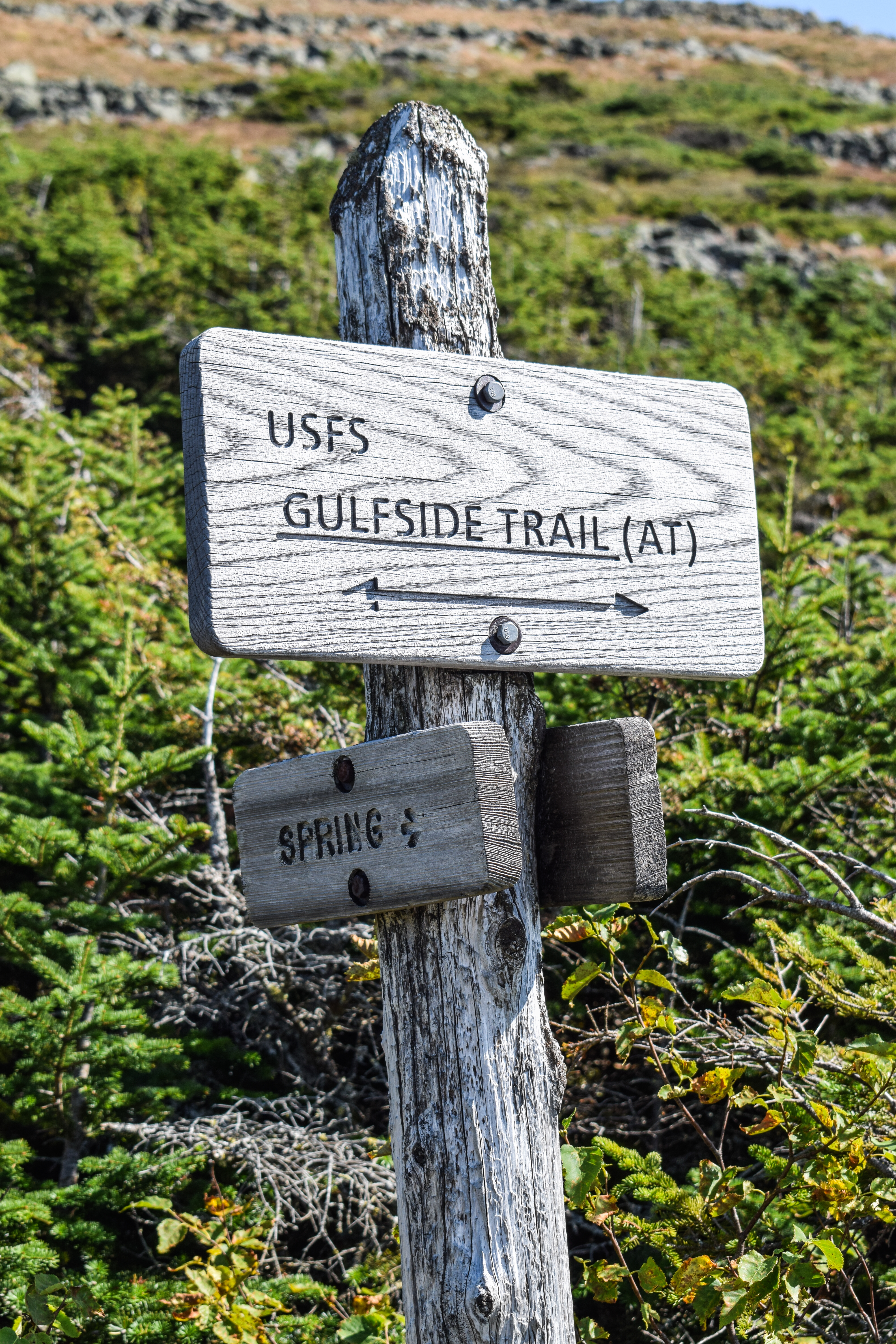
There was the expected Rock Hell, but my body was so tired I just aimlessly trudged through. I passed the junction with the Spring, which I kind of wanted to check out, especially since it says its a loop, but it looks so overgrown and I was so tired that, again, I was NOT tempting fate! 


This stretch of trail felt even longer today. I may have been on my last hours of life on earth, but it was so beautiful out and wonderfully quiet. I couldn't get over what perfect weather I had today (and Thursday). Eventually, I made it to the Jewell Trail, signaling a short 3.7 miles back to the car. I took a quick break here to get my poles, and I was off!


[2:52pm: Jewell Trail]
Not to be repetitive, but ouch. My body was hurting. Good hurt, though, not injured hurt. Just "I've done A LOT today." The familiar views up high were lovely, especially the trail cooridoor heading down the ridge. The ravine seperating this ridge from the ridge that the Cog climbs is the Burt Ravine. I knew the trail would just get better and better the further down I went, which was helpful to remember becuase I was suffering through my last bit of Rock Hell.

Part-way down, I lost the trail on Tuesday, but I did NOT lose it this time! I was pleased with myself to have enough cognition to still have small victories. I passed the hobbit hole that Sarah had to pee in on Tuesday, and lamented at the large group of hikers I could see ahead of me.


Soon enough I turned the corner and was back into the woods for the first time in a WHILE. It smelled like christmas down here, and then I realized that Mt. Clay never had a "welcome to the wilderness" sign... rude!


I heard the group ahead of me as I started to descent in my usual fashion - it was a family I passed earlier on the Great Gulf Trail! It was validating to my "physical fitness" that I was able to catch up with them, even with adding over a mile and a few hundred feet of elevation. 

I can't begin to describe how nice it felt to be in shade and on dirt again. I officially left the Alpine Zone at 3:30pm, making 7.5 hours my official "Alpine Zone Time." I was truly thrilled with how well everything worked out - my goal was to see as much as possible, which I am quite satisfied with! I also now have a list of everything that I didn't get to see that I now want to see (notably: Boott Spur, Davis Path along Bigelow Lawn, Tuckerman Ravine, Lion's Head, Huntington's Ravine (not for a long time that's too scary), the Great Gulf, and the Dry River Trail through the Oakes Gulf, along with someday doing a Presidential Traverse). 

Just past the Alpine Zone boundary, there was a tent set up immediately off-trail, which I think goes against Leave No Trace? I think you're supposed to be 200 feet off-trail. I'm not sure how the semantics work there. The salt stains on my shirt from sweating all day were impressively showing as I continued down, passing another group that I saw earlier on the Gulfside Trail. 

Every now and then there are a few feet of trail that are truly flat, and everytime I traversed one (never longer than 15 feet), I could feel euphoria come over my battered body. The trail traverses 4ish blowdown patches with very obstructed views. I was able to make out Eisenhower from one, though. 


Further down, as the trail conditions became lovelier, I passed seven more people, two of which I saw earlier on the Gulfside Trail. My upper back, shoulders, and lower neck were aching. I think I needed to loosen my shoulder straps? I did it, but I was in way too deep to feel a difference. Next time!

As I approached the Cog area I could smell burning rubber - how fun! At one point, I reached another flat section and audibly moaned, not realizing that there was a man no more than 30 feet away from me. Thankfully, he was also finishing his hike for the day, and seemed to understand. 

The air temperature dropped a bit and the sound of Clay Brook drew louder. I crossed on the footbridge and followed the short, but cruel uphill to the junction with the Jewell Spur. I thought about taking to do something new, but the thought of road walking made me want to chop me feet off. Onward!


[4:12pm: Jewell Trail/Jewell Spur Junction]
I followed the trail, which was again through beautiful woods, descending slightly and steeply at times. I was in full noodle arms-mode, which was silly as I barely used my arms for this hike. The CRAZY squirrels were back - I watched one yell at me for over 30 seconds without taking a breath, really impressive. I finished my 6th liter of water down here, which was honestly perfect timing. I would have liked one more Nalgene full of Nuun, but we all know what I left that...

[4:26pm: Jewell Trail/Boundary Line Trail Junction]
The Jewell Trail easily crossed a small stream then came to the Boundary Link Trail junction. I could hear the Ammonoosuc River in the distance, then soon entered the Forest Protection Area. As I was taking a photo of the sign, a guy came up behind me and nearly scared the life out of me! I hadn't seen another human in a while. 


Once at the Ammonoosuc River, I crossed on the bridge and then splashed my face to wipe some of the sweat and sunscreen off, to minimal success, but it sure felt good! The guy who passed me turned right after the bridge, which is the same mistake I made on Tuesday. 


[4:39pm: Ammonoosuc Ravine Trailhead]
There was one final quick climb and then a flat meander until the beloved trailhead was in sight! I trudged to my car, changed in the bathroom (which was full of flies - ugh.), and slowly got ready to leave. Wow. What a hike.


Part 6. Epilogue
The beginning of my drive was quite lovely. I did forget it was Labor Day weekend, so there were TONS of cars coming into the Whites. I was glad to be going against traffic! I stopped at the new convenience store at the US-3/US-302 junction and was delighted - it smelled new and had all three liquids that I wanted/needed: a bottle of Fresca, my light blue Gatorade Zero, and the big Celcuis (strawberry dragonfruit, naturally). My drive featured a beautiful sunset and a strangely awake me, which I'll take! When I got home, I immediately plugged my SD card into my iPad to import to Lightroom, and it turns out I have a new record for photos taken in a single hike - 823! It'll take a while to go through all of them, but I'm excited to visually relive it.

This hike had the most amount of elevation since my Hale-Zealand-Bonds Traverse, and my body definitely felt it! I've had other 5,000ft+ days since then, but they were always multi-hike days. Wait - just kidding! This was actually my second ever 5000ft+ day. Point is, I'm really proud of how much I've grown in this journey, and that includes the physical challenge.

Looking forward, I'm getting almost scary close to finishing my lists! I'm hoping to hit Carrigain on Monday (weather and hangover tbd), and this weekend, for Gen's Bachelorette, we're hoping to hit Adams & Madison (weather permitting). Those are also the last three that Sarah has done that I haven't. I still have Roger's Ledge and Mt. Success on the 52 With-a-View list to wrap up, and they're faaarrrr away. Hopefully I can get at least one of them on a fall weekend. For the 48, besides the three I just mentioned, all I need are: Cannon (Sarah is saving this for her 48 finale, so depending on timing, I'm also waiting with her, Isolation (I really want to do this one as a point-to-point), the Wildcats, and Carter Dome. That will leave Moriah and Shelburne Moriah as my final too, which will complete both lists in one hike and bring me 100 peaks! It's crazy how it's actually feeling close, and I think I can reasonably and realistically finish it by my 30th birthday next August. I won't be upset if I don't hit that timeline, because I'd rather enjoy my journey than stress over it, but that would be so cool.

Step-By-Step
- Park at Ammonoosuc Ravine Trailhead.
- Start hike on Ammonoosuc Ravine Trail.
- At terminus at Lakes of the Clouds Hut, continue onto Crawford Path (AT) toward Mt. Monroe. 
- At jct. with Mt. Monroe Loop, continue onto Crawford Path.
- At jct. with southern end of Mt. Monroe Loop, turn right onto Mt. Monroe Loop.
- At terminus, turn left onto Crawford Path, return to Lakes of the Clouds Hut.
- At Lakes of the Clouds Hut, continue onto Crawford Path toward Mt. Washington.
- At jct., veer right onto Tuckerman Crossover.
- At terminus, turn right onto Tuckerman Ravine Trail.
- At jct., turn left onto Alpine Garden.
- At jct., turn left onto Nelson Crag Trail.
- Summit Mt. Washington.
- From summit, continue hike on Trinity Heights Connector (AT).
- At terminus, turn right onto Gulfside Trail (AT).
- At jct., turn right onto Mt. Clay Loop.
- At terminus, turn left onto Gulfside Trail (AT).
- At jct., turn right onto Jewell Trail.
- Return to car.


“Ammonoosuc Ravine Trail” from White Mountain Guide, 31st Ed. (2022) 
WMNF Ammonoosuc Ravine Trail ascends to Lakes of the Clouds Hut from a parking lot (Recreation Pass required, restrooms, plowed in winter) on Cog Railway Base Rd., 1.1 mi. east of its jct. with Mt. Clinton Rd. and Jefferson Notch Rd. The parking area is a stop for the AMC Hiker Shuttle. The trail can also be reached on foot from Jefferson Notch Rd. via Boundary Line and Jewell trails (Section Two). Together with the upper section of Crawford Path, Ammonoosuc Ravine Trail provides the shortest route to Mt. Washington from the west. The trail follows the headwaters of the Ammonoosuc River, with many fine falls, cascades, and pools, and affords excellent views from its upper section. This is the most direct route to Lakes of the Clouds Hut and the best route to or from the hut in bad weather because the trail lies in woods or scrub except for the last 0.2 mi. to the hut. The section above Glen Pool is very steep and rough and is likely to prove arduous to many hikers, particularly those with limited trail-walking experience. Many hikers also find it somewhat unpleasant to descend this section due to the steep, often slippery rocks and ledges. Follow the trail with care on the ledges, where it is not always marked well.
        Leaving the parking lot, the blue-blazed trail follows a path through the woods, descending to cross Franklin Brook at 0.3 mi. and then passing over a double pipeline as the trail skirts the Base Station area at mostly easy grades. The trail joins an older route at the edge of the Ammonoosuc River at 1.0 mi., after a slight descent. Here a link trail from the Cog Railway joins from the left (signs: “Cog R.R.,” “Lakes of the Clouds Hut”). Descending, bear left here to return to the WMNF parking area. [...].
        From this jct., Ammonoosuc Ravine Trail bears right along the attractive river. It ascends by easy to moderate grades, although with much rough and rocky footing. This section offers numerous views of the river, which was widened by heavy rainfall and landslides in October 2017. After passing a memorial plaque for Herbert Judson Young, a Dartmouth student who perished from hypothermia near here in 1928, the trail traverses a gravelly washout, where caution is needed. It crosses Monroe Brook at 1.7 mi., and at 1.9 mi., at an open spot along the river, there is a good view of the headwall of Ammonoosuc Ravine a few steps left of the trail. Soon the trail skirts an area that was severely damaged by a large avalanche in 2010; the avalanche track can be seen to the left of the trail. It then follows the main branch of the river away from the avalanche track, and at 2.1 mi., the trail crosses the outlet of Gem Pool, a beautiful emerald pool at the foot of a cascade.
        Now the very steep, rough ascent begins, with many rock steps. At 2.3 mi., a side path (sign) descends right about 80 yd. to a spectacular viewpoint at the foot of the gorge. Above this point, the main brook falls about 600 ft. down a steep trough in the mountainside at an average angle of 45 degrees; another brook a short distance to the north does the same - and these two spectacular waterslides meet in a pool at the foot of the gorge. Ammonoosuc Ravine Trail continues its steep ascent, crossing a side stream and ascending steep, often slippery ledges, one by means of a short ladder. The trail passes an outlook over the cascades to the right and, at 2.5 mi., crosses the main brook on flat ledges at the head of the highest fall, a striking viewpoint. (When descending, turn left after crossing the brook and descend over ledges; avoid a beaten path leading ahead into the woods.) The grade now begins to ease, and the trail makes several more brook crossings; follow the trail with care where it crosses a brook and continues up ledges between that brook and another brook on the right. As the ascent continues, ledges become more frequent, and the scrub becomes smaller and more sparse. At 3.0 mi., the trail emerges from the scrub and follows a line of cairns directly up some rock slabs (which are slippery when wet), passes through one last patch of scrub, and reaches Crawford Path at the south side of Lakes of the Clouds Hut.

“Lakes of the Clouds Hut (AMC)” from White Mountain Guide, 31st Ed. (2022) 
For more than 130 years, AMC’s White Mountain hut system has offered hikers bunks for the night in spectacular locations, with home-cooked dinners and breakfasts, cold running water, and compositing or waterless toilets. Originally built in 1915 and greatly enlarged since then, Lakes of the Clouds Hut is open to the public from June to mid-September and closed at all other times. The hut is on a shelf near the foot of Mt. Monroe, about 50 yd. west of the larger lake, at an elevation of 5,014 ft. The hut is reached by Crawford Path or Ammonoosuc Ravine Trail and has accommodations for 90 guests in bunkrooms for six, eight, twelve, and fifteen people. Pets are not permitted in the hut. Reservations are highly recommended (603-466-2727; outdoors.org/destinations). Small stocks of drinks, snacks, and gear are available for purchase by day visitors. A limited number of backpacker spaces are offered at a significantly reduced rate for AT thru-hikers only - first come, first served. A refuge room in the cellar is left open in winter for emergency use only.

“Crawford Path” from White Mountain Guide, 31st Ed. (2022) 
[...]. At 6.2 mi., Mt. Monroe Loop diverges left to cross both summits of Monroe, affording excellent views. The loop is about the same length as the parallel section of Crawford Path but requires about 350 ft. more climbing with rougher footing. Crawford Path is safer in inclement conditions because it is much less exposed to the weather. Crawford Path continues along the edge of the precipice that forms the northwest wall of Oakes Gulf and then follows a relocated section, passing to the left of an area that has been closed to public entry to preserve the habitat of the dwarf cinquefoil, an endangered species of plant. (Note: The area between the two ends of the Mt. Monroe Loop is one of great fragility and botanical importance. To protect this area - probably the most significant tract of rare vegetation in the entire White Mountain region - hikers should take great care to stay on the defined trail.) At 6.9 mi., Mt. Monroe Loop rejoins on the left, and Crawford Path descends easily to Lakes of the Clouds Hut at 7.0 mi.
        Ammonoosuc Ravine Trail enters on the left at the corner of the hut, and in another 30 yd., Dry River Trail enters on the right. Crawford Path crosses the outlet of the lower, larger Lake of the Clouds and passes between it and the smaller, upper lake. In a short distance, at 7.2 mi., Camel Trail (leading southeast, then east to Boot Spurr) and Tuckerman Crossover (leading northeast to Tuckerman Junction) diverge right at the same point.

“Mt. Monroe Loop” from White Mountain Guide, 31st Ed. (2022) 
AMC This short trail runs parallel to Crawford Path and passes over the summits of Little Monroe and Mt. Monroe. The views are fine, but parts of Mt. Monroe Loop are rough, and the summits are very exposed to the weather. The trail diverges from Crawford Path 6.2 mi. from Mt. Clinton Rd. It quickly ascends the minor crag called Little Monroe and then descends into the shallow, grassy sag beyond. Mt. Monroe Loop climbs steeply over boulder fields to the summit of Mt. Monroe at 0.4 mi., follows the northeast ridge to the end of the shoulder, and drops sharply to Crawford Path 0.1 mi. south of Lakes of the Clouds Hut.

“Tuckerman Crossover” from White Mountain Guide, 31st Ed. (2022) 
AMC This trail connects Tuckerman Ravine with Lakes of the Clouds Hut. It is totally above treeline and crosses a high ridge where there is much exposure to westerly winds. Tuckerman Crossover leaves Tuckerman Ravine Trail left (southwest) at Tuckerman Junction, where the latter trail turns sharply right to ascend the cone. In 30 yd., Southside Trail diverges right. Tuckerman Crossover then rises gradually across Bigelow Lawn, crosses Davis Path, and descends moderately to Crawford Path, which it meets (along with Camel Trail) a short distance above the upper Lake of the Clouds. After a left turn on Crawford Path, Lakes of the Clouds Hut is reached in 0.2 mi. In the reverse direction, Tuckerman Crossover is the left-hand trail of two trails that diverge to the right (east) from Crawford Path, 0.2 mi. above the hut; Camel Trail is the right-hand trail of the two.

“Tuckerman Ravine Trail” from White Mountain Guide, 31st Ed. (2022) 
[...]. At 3.4 mi., a short distance above the top of the headwall, Alpine Garden Trail diverges right. At Tuckerman Junction, located on the lower edge of Bigelow Lawn at 3.6 mi., Tuckerman Crossover leads almost straight ahead (southwest) to Crawford Path near Leakes of the Clouds Hut [...].

“Alpine Garden Trail” from White Mountain Guide, 31st Ed. (2022) 
AMC This trail leads from Tuckerman Ravine Trail to Mt. Washington Auto Rd. through the grassy lawn called the Alpine Garden. Although Alpine Garden Trail’s chief value is the beauty of the flowers (in season) and the views, it is also a convenient connecting link between the trails on the east side of the mountain, making up a part of various routes for hikers who do not wish to visit the summit. The trail is completely above treeline and exposed to bad weather, although it is on the mountain’s east side, which usually bears somewhat less of the brunt of the mountain’s worst weather.
        The tiny alpine flowers that grow here are best seen in middle to late June. Especially prominent are the five-petaled white diapensia; the bell-shaped, pink-magenta Lapland rosebay; and the very small pink blossoms of the alpine azaleas. (For more details, see the AMC Field Guide to the New England Alpine Summits, AMC Books.) No plants should ever be picked or otherwise damaged. Hikers are urged to stay on trails or walk very carefully on rocks so as to not kill the fragile alpine vegetation.
        Alpine Garden Trail diverges right (northeast) from Tuckerman Ravine Trail a short distance above the ravine headwall, 0.2 mi. below Tuckerman Junction. It leads northeast, descending and then ascending and, bearing toward Lion Head, crosses Lion Head Trail at 0.3 mi. Beyond this jct., Alpine Garden Trail ascends gradually northward. The trail traverses the Alpine Garden and crosses a tiny stream that is the headwaters of Raymond Cataract. (This water may be contaminated by drainage from the summit buildings.) The trail soon approaches the top of Huntington Ravine and crosses Huntington Ravine Trail at 1.2 mi. (In winter and spring, take care not to approach too close to the icy gullies that drop precipitously from the edge of the Alpine Garden.) Rising to the top of the ridge leading from Nelson Crag, the trail crosses Nelson Crag Trail at 1.4 mi. and then descends and soon enters the old Glen House Bridle Path, constructed in 1851, whose course is still plain although it was abandoned more than 170 years ago. In a short distance, Alpine Garden Trail turns left and soon enters the Auto Rd. just above the 6-mi. mark, opposite the upper terminus of Wamasutta Trail.

“Nelson Crag Trail” from White Mountain Guide, 31st Ed. (2022) 
[...]. It passes over Nelson Crag and crosses Alpine Garden Trail, swings left, skirts the south side of a rocky bump recently named Agiocochook Crag (5,735 ft.), and crossing Huntington Ravine Trail at 2.8 mi. Nelson Crag Trail climbs up the rocks to Ball Crag (6,112 ft.), descends briefly, runs across the Auto Rd. and the Cog Railway, and finally ascends to the summit, passing to the left of the Sherman Adams summit building. To descend on this trail, follow the walkway down along the lower (east) side of the Sherman Adams building.

“Trinity Heights Connector” from White Mountain Guide, 31st Ed. (2022) 
AMC This trail was created to allow the AT to make a loop over the summit of Mt. Washington; formerly the true summit was a side trip, albeit a very short one, from the AT, so technically the AT did not pass over the summit. Trinity Heights is a name previously used for the summit region of Mt. Washington. From the true summit (a rock outcropping, marked by a sign, between the Tip Top House and the Sherman Adams summit building), the trail leaves at a sign to the right of the Tip Top House and runs northwest, descending moderately over the rock to Gulfside Trail, less than 0.1 mi. to the north of its jct. with Crawford Path.

“Gulfside Trail” from White Mountain Guide, 31st Ed. (2022) 
Part III. Sphinx Col - Mt. Washington 
From Sphinx Col, Gulfside Trail leads toward Mt. Washington. In 220 yd., Mt. Clay Loop diverges left to climb over the summits of Mt. Clay, offering impressive views into the Great Gulf. Mt. Clay Loop adds about 300 ft. of climbing and 10 min. of time; the distance is about the same. Gulfside Trail is slightly easier and passes close to a spring but misses the best views. It bears right from the jct. with Mt. Clay Loop, runs south, and climbs moderately, angling up the west side of Mt. Clay. About 0.3 mi. above Sphinx Col, a loop leads to a potential water a few steps down to the right. The side path continues about 30 yd. farther to Greenough Spring (more reliable) and then rejoins Gulfside Trail about 100 yd. above its exit point. Gulfside Trail continues its moderate ascent, and Jewell Trail from Cog Railway Base Rd. enters from the right at 4.6 mi. Gulfside Trail swings southeast and soon descends slightly to a point near the Clay-Washington col (5,389 ft.), where Mt. Clay Loop rejoins the trail from the left.
        The path continues southeast, rising gradually on Mt. Washington. About 0.1 mi. above the col, Westside Trail branches right, crosses under the Cog Railway, and leads to Crawford Path and Lakes of the Clouds Hut. Gulfside Trail continues southeast between the Cog Railway on the right and the edge of the gulf on the left, with magnificent views into the gulf and across to the northern peaks. If the path is lost, the railway can be followed to the summit. At the extreme south corner of the gulf, Great Gulf Trail joins Gulfside Trail from the left, 5.5 mi. from Madison Spring Hut. Here, Gulfside Trail turns sharply right, crosses the railroad, and continues south to the plateau just west of the summit, where it passes a jct. with Trinity Heights Connector, a link in the AT, which branches left and climbs for 0.2 mi. to the true summit of Mt. Washington. [...].

“Mt. Clay Loop" from White Mountain Guide, 31st Ed. (2022) 
AMC This trail traverses the summit ridge of Mt. Clay roughly parallel to Gulfside Trail, providing access to superb views into the Great Gulf from Mt. Clay’s east cliffs. The entire trail (except for its end points) is within the Great Gulf Wilderness.

“Jewell Trail” from White Mountain Guide, 31st Ed. (2022) 
WMNF This blue-blazed trail begins at a parking area (Recreation Pass required; restrooms; plowed in winter) on Cog Railway Base Rd., 1.1 mi. east of its jct. with Jefferson Notch Rd. and Mt. Clinton Rd. (Cog Railway Base Rd. is the road that leads from US 302 to the Cog Railway Base Station at Marshfield.) Jewell Trail ascends the unnamed ridge that leads west from Mt. Clay and ends at Gulfside Trail, high on the west slope of Mt. Clay, 0.3 mi. north of the Clay-Washington col and 1.4 mi. north of the summit of Mt. Washington. The grade is constant but seldom steep, there are no rock scrambles, and the footing is generally good below treeline and only moderately rough and rocky in the last section below Gulfside Trail. In combination with Gulfside Trail and Trinity Heights Connector, Jewell Trail provides the easiest route to Mt. Washington from the west, featuring a great length of ridge walking above treeline with fine views, but this section is also greatly exposed to the weather and offers no shelter between the summit and treeline. In bad weather, or if afternoon thunderstorms threaten, it may be safer to descend from Mt. Washington via Lakes of the Clouds Hut and Ammonoosuc Ravine Trail, despite the steep and slippery footing on the latter. When the weather cooperates, descent by Jewell Trail offers much easier footing and thus may be preferred. The trail is named for Sergeant Winfield S. Jewell, once an observer for the Army Signal Corps on Mt. Washington, who perished on the Greely expedition to the Arctic in 1884.
        Jewell Trail enters the woods directly across the road from the parking area, descends slightly to cross the Ammonoosuc River on a bridge at 0.1 mi. and then swings northeast and ascends at an easy grade. At 0.4 mi., Boundary Line Trail diverges left, and Jewell Trail ascends the crest of the low ridge between Ammonoosuc River and Clay Brook, joining the old route of the trail at 1.0 mi. Here, a link path from the Cog Railway joins on the right (sign: “Cog R.R.”). [...].
        From this jct. with the link, Jewell Trail descends slightly to Clay Brook, crosses it on a footbridge at 1.1 mi., and then climbs northeast by long switchbacks. At 2.0 mi., the trail passes through a blowdown patch at the edge of the steep wall of Burt Ravine, which offers limited views. It then swings somewhat to the north side of the ridge and climbs east, staying well below the ridge crest until near treeline. Reaching treeline at about 3.0 mi., the trail zigzags at a moderate grade with rough, rocky footing up the ridge crest, which quickly becomes less prominent and blends into the slope of Mt. Clay. At 3.5 mi., Jewell Trail swings to the right, going far away from what remains of the ridge, and angles up the slope at an easy grade to Gulfside Trail. To ascend Mt. Washington, follow Gulfside Trail to the right (south).