Showing posts with label Castle in the Clouds Achievement. Show all posts

Thursday, April 18, 2024

Shannon Brook, Brook Walk, Faraway Mtn. Trail (Castle in the Clouds Conservation Area)

Shannon Brook, Brook Walk, Faraway Mtn. Trail (Castle in the Clouds Conservation Area)

Hike Type: Merging Out-and-Back 
Distance: 12.49 miles
Elevation: 2,165 feet
Time: 4 hours, 56 minutes (4 hours, 38 minutes moving)
Hiking Challenges: 52 Hike Challenge, Castle in the Clouds Achievement

The Hike 
It was going to be another rainy day in Southern New Hampshire, so I decided I would head up to the Lakes Region/Ossipee Mounatins to finish my redlining of the Castle in the Clouds Conservation Area. I woke up at my usual time of 4:40am and made my way to Hooksett for my first stop of the day - which involved a toilet christening AND breakfast sandwiches! I still have yet to understand the schedule of breakfast sandwiches being available there, but the dopamine rush I get when they ARE available is worth it. From Hooksett to the trailhead I got to enjoy a beautiful sunrise from first light all the way to sun up. It was 40 degrees at the trailhead with a small breeze. I was joined by two other cars who got started just before me, and I experienced the classic lower abdomen pressure (thankfully it never grew to anything). It was just after 6:30am, and I was off!


The actual trailhead is across the road from the parking area, which is shared by a nice informational kiosk.

"Welcome to Castle in the Clouds Conservation Area" from Trail Kiosk
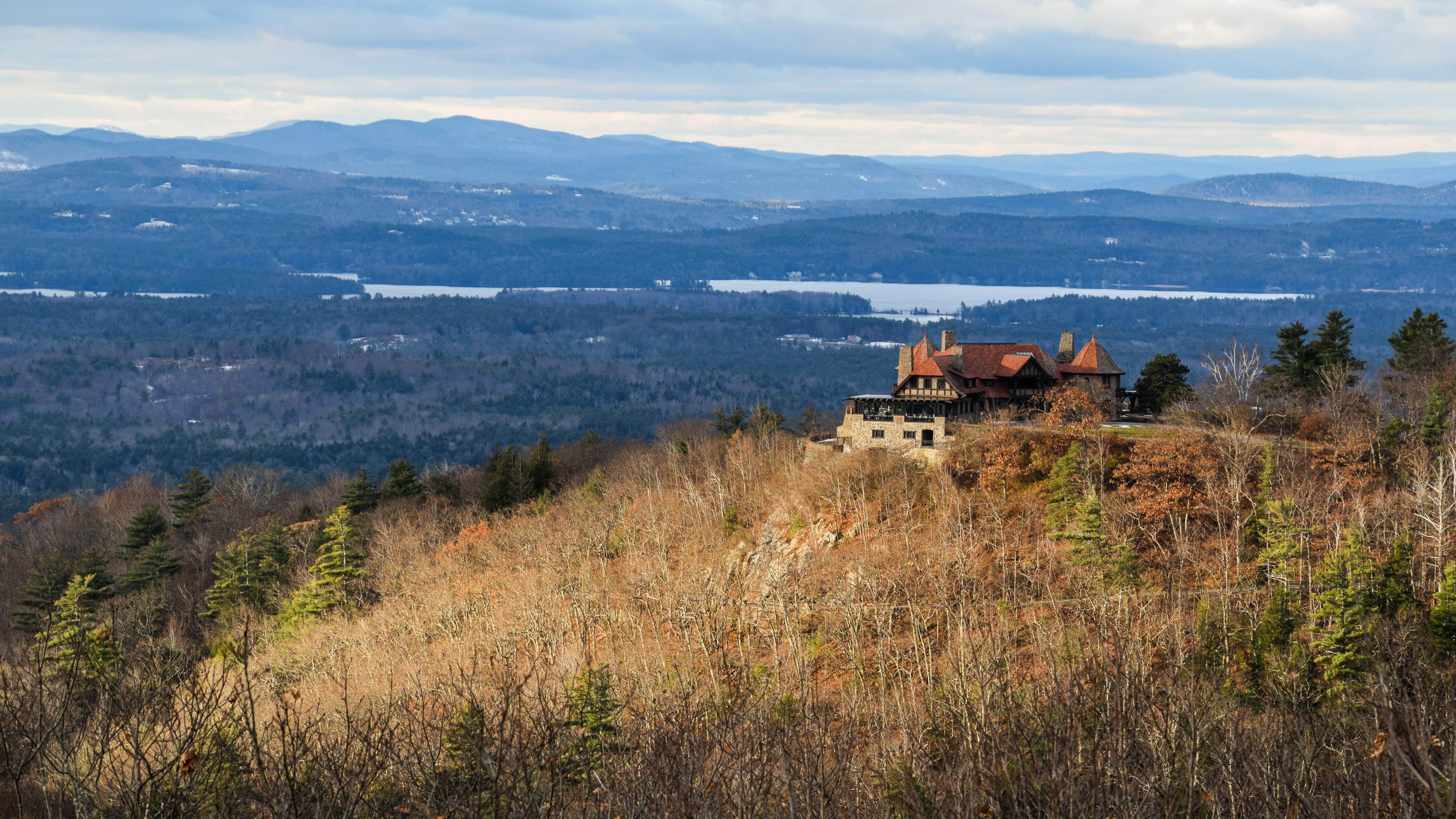
This landmark property is part of the Ossipee Mountain ring dike, a circular formation of volcanic origin nine miles in diameter whose impenetrable terrain long discouraged roads and settlement. Beginning in the late 1700s, this property was the site of a small farming community that became known as the Lee Settlement, and in the late 1800s, Boston industrialist B.F. Shaw established Ossipee Mountain Park, with a summer hotel for visitors who were coming to the Lakes Region for its natural beauty and pictureque villages. Literay figures John Greenleaf Whittier, Lucy Larcom, and Robert Frost all visited this land. In the early 1900s, Thomas Plant, who made his fortune in the shoe manufacturing industry, constructed Lucknow, the striking stone Arts and Crafts-style house known today as the Castle in the Clouds
        In 2002, through the generosity of over 2,000 donors, the Lakes Region Conservation Trust (LRCT) acquired this magnificent 5,381-acre property, for thoughtful public recreation, conservation of wildlife habitat, and preservation of the special character of the Lakes Region. In 2004, LRCT established the Castle Preservation Society (CPS), which now owns and oversees the magagement of the Castle in the Clouds historic buildings and 135 acres of surrounding grounds for their historic, cultural, and community values. LRCT holds a conservation easement on the CPS property and owns and stewards the surrounding 5,246 acres of land - LRCT's largest conserved property - including two trailhead parking areas and 30 miles of trails which are open free of charge from sunrise to sunset for enjoyment by all. With their complementary nonprofit missions, LRCT and CPS work in partnership in caring for this landmark property.
        We hope that you will enjoy exploring the property, and we ask that you respect the boundaries and property rights of abutting landowners and treat the land with care. With its mountain summits and scnic forested slopes, miles of trails and carriage roads, spectacular views and waterfalls, diverse flora and fauna, unique geological features, remnants of early settlement, and remarkable Castle, this property is one of the ecological and historical treasures of New Hampshire.

"Shannon Brook Trail" from Trail Kiosk
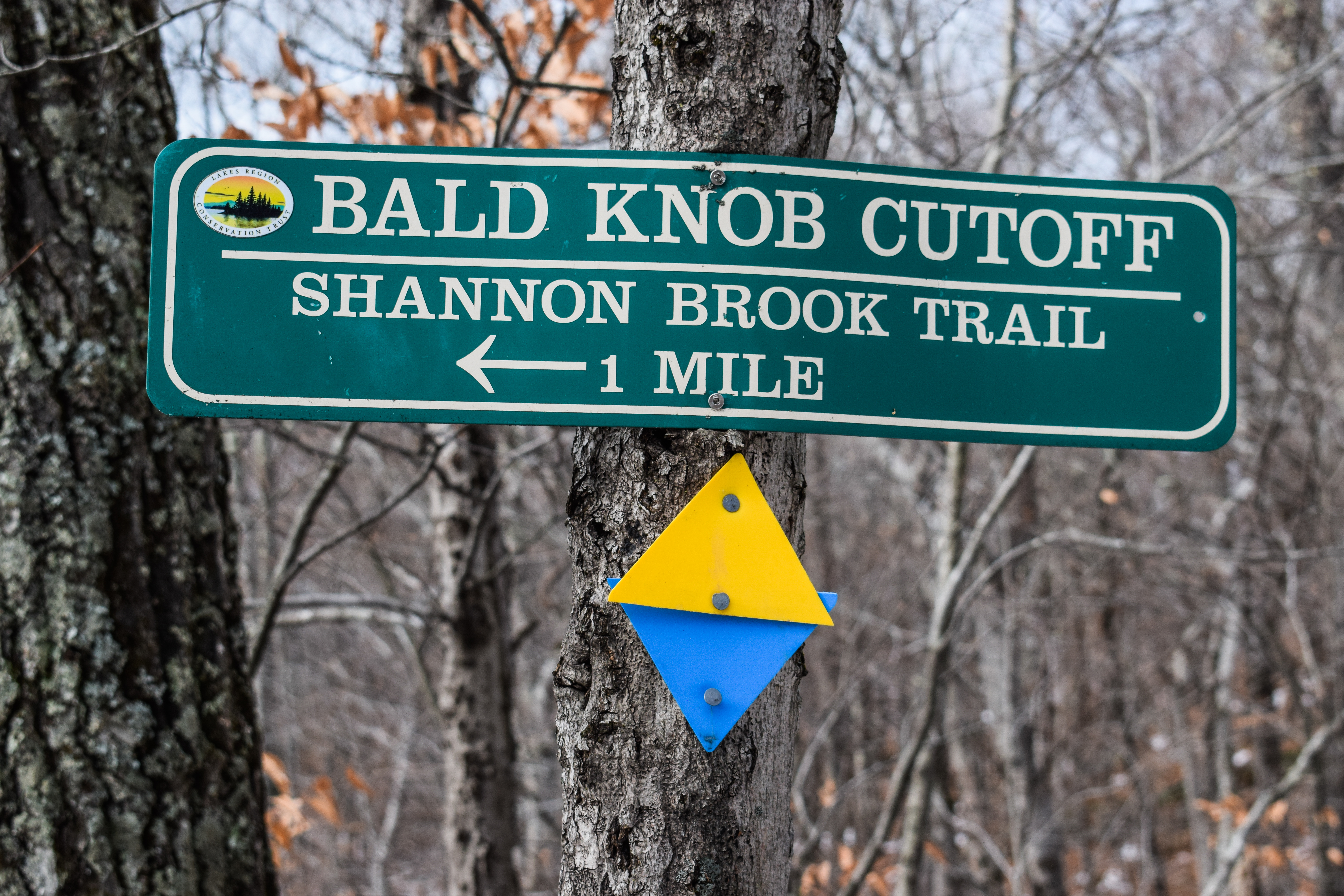
This trail starts across the road from the Lower Trailhead Kiosk. Follow this trail 1.4 mi to access the many trailheads located near the Shannon Pond Kiosk. There are also many trail junctions along this trail. In the winter this is a major State of NH maintained snowmobile corridor.


The lower Shannon Brook Trail (and all of it, truly) was a wide, pine cone-covered woods road. It was delightfully and shockingly dry considering the springtime of it all, and the trail soon parallels the Shannon Brook with the access road on the other side. The trail eventually levels out at a fenced portion (I assume for erosion control and/or snowmobile saftey). There was a large, easily navigable blow down after the snowmobile bridge just before the start/end of the Brook Walk.


The Brook Walk almost instantly became my favorite trail!

"Brook Walk" from Trail Kiosk
The Brook Walk Trail begins at the upper bridge crossing Shannon Brook below Shannon Pond. The bridge is accessible from the Shannon Pond Kiosk or the Brook Walk Kiosk. From this bridge, the path descends for 0.3 mi, passing seven waterfalls and then crossing the lower bridge and climbing steeply for 0.2 mi to the Shannon Brook Trail.

"History of the Brook Walk" from Trail Kiosk
In the late 1870's, Boston industrialist Benjamin Franklin (B.F.) Shaw bought hundreds of acres of land here in the Ossipee Mountains and created one of the first summer resort sites in the Lakes Region, Ossipee Mountain Park, for visitors seeking rest and recreation amid the region's lake and mountain scenery. Ossipee Mountain Park included a large guest lodge named Weelahka Hall, after the beautiful brook running through the property. Among the visitors to Ossipee Mountain Park were some of the leading figures of the day, including poets John Greenleaf Whittier, Lucy Larcom, and Robert Frost, whose experiences here are reflected in some of their works.
        One of the most popular features of Ossipee Mountain Park was a path known as the Brook Walk, constructed along a two-mile section of Shannon Brook (then known as Brook Weelahka). Here the brook runs through rugged terrain (once referred to as the Little Yosemite of the East) where, during the period of glacial retreat, the brook had carved several impressive gorges into the landscape, sculpting beautiful rapids, flowing through cataracts, flumes, and waterfalls along the way.
        The Brook Walk allowed Ossipee Mountain Park's guests to take leisurely strolls along the banks of the brook while enjoying the numerous scenic beauties which nature had created here. A series of rustic bridges crossed the brook, enabling guests to gain the most favorable perspectives from which to view these natural wonders. Artists and early photographers came to capture these beautiful scenes. 
        In the early 1900s, the land was purchased by shoe manufacturer Thomas Plant, who constructed "Lucknow," the magnificent house known today as the Castle in the Clouds. Plant eventually closed the property to the public, and the Brook Walk and its marvelous attractions were lost to public view. Eventually the path fell into disrepair, and the bridges and parts of the path were lost to lack of maintenance and to floodwaters. 
        In 2002, through the generosity of over 2,000 donors, the Lakes Region Conservation Trust acquired the magnificent 5,381-acre Castle in the Clouds proeprty - for thoughtful recreation by the public, conservation of wildlife habitat, and preservation of the region's natural heritage and scenic character. LRCT stewardship volunteers soon identified the Brook Walk as a lost wonder of the property and began a project to restore the path, to the extent feasible, to something of its former wonder.
        Through the dedication and hard work of these volunteers, the Brook Walk was reopened in 2007 and can again be enjoyed by visitors to the property. The rugged terrain along the brook and the many beautiful falls make this one of the most dleightful short hikes in the Lakes REgion. You can read more about the Brook Walk and its history in The Brook Walk: Hidden Gem at the Castle in the Clouds (2017) by David Leuser, which is available at the Castle in the Clouds Gift Shop.
        Walking the Brook Walk Today. This trail will lead you to viewing points for seven spectacular waterfalls. Much of the trail follows the route of the trail that led visitors to these viewpoints more than a century ago. Signs along the trail provide descriptions of the waterfalls and include images of old photographs, postcards, and stereoviews that will give you an idea of how these falls appeared to Ossipee Mountain Park visitors many years ago. 
        Visitors have the choice of walking the Brook Walk and returning uphill by the same trail or making a loop and returning by other trails as shown on the map.


The trail started with a steep descent on a narrow footbed, quickly coming near the Shannon Brook with a distant view of Bridal Veil Falls. The trail eventually bottoms out and crosses a footbridge over the brook to a spectacular view of the Falls of Song. There was a boardwalk to the right an a wide, unblazed path to the left (which apparently only leads to the access road). The boardwalk had a sketchy blowdown on it but I explored anyway. It was so cool! I didn't expect this trail to be a little gorge.

#7 Falls of Song


The Falls of Song, 50 feet in height and formerly known as Ossipee Falls, is the largest and most spectacular of the falls seen along the Brook Walk. From the Brook Walk's early days, this site has been a popular resting place for visitors. In the days of Ossipee Mountain Park, there was a bridge known as Cataract Bridge, across the falls. An 1995 Boston newspaper description of the scenic beauty and amenities of Ossipee Mountain Park stated of the Falls of Song that "their location in the depths of the primeval forest, their exquisite setting under the overhanging cliffs, the silvery clearness of the water and their magical musical effects, seemingly changing their song at every hour of the day, unite to place these falls among the most interesting and wonderful in the United States." It was B.F. Shaw's visits to the famous Ossipee Falls in the summer of 1879, and his climb to the source of Brook Weelahka and his delight in the prospect across the mountain and lake landscape, that inspired his purchase of the land that became Ossipee Mountain Park.

The trail then climbs up to the top of the falls, but does not provide any views of the brook going over (unless you're feeling really daring, but I would not recommend that). I saw a tiny black rodent scurry across the trail (I don't think it was a mouse, I didn't notice a tail), and then I came to the Bridal Veil Falls - the same falls I could see through the trees from before. 

#6 Bridal Veil Falls

Bridal Veil Falls (also known as Upper Ossipee Falls) can, under the right water conditions, have a lacy appearance like a bride's veil. A huge boulder was once located near the base of the falls, as seen in this photograph. It was moved downstream by floodwaters in the twentieth century and is now found many feet farther down the ravine.

Next up were the Emerald Pool Falls which were more gentle, less spectacular, but still very pretty.

#5 Emerald Pool Falls

Emerald Pool was named for the mosses on the rocks at the bottom of the falls, which, in the right light create a vivid emerald color. The bridge shown in the photograph was washed away along with a substantial amount of rock and soil in floods in the mid-twentieth century, resulting in the smaller pool you see today.

The trail rejoined an old road bed and then turned to approach The Cascades, which were a lovely series of smaller falls.

#4 The Cascades

The Cascades consist of a series of low falls flowing into pools. Harriet's Bridge, named for the wife of B.F. Shaw, once crossed the stream over the Cascades. The path continued along the stream bank on the opposite side. The bridge and path along the bank were washed away by floodwaters many years ago. In the 1890s, the bridge was rebuilt and renamed "Dollie's Bridge" after B.F. Shaw's granddaughter, Dorothy James. This second bridge also did not survive floodwaters and was washed away. The path was then relocated and now runs along the high bank on which you stand.

Further up were the Whittier Falls - I noticed that this trail would be best hiked in the opposite direction that I hiked it (i.e., in the order in which the falls are labeled) so it ends with the most spectacular. To be clear, though, all of the falls were absolutely beautiful.

#3 Whittier Falls

Named after John Greenleaf Whittier (1807-1892), one of the most celebrated American poets in the late nineteenth and early twentieth centuries, Whittier Falls consists of two tiers of falls. Whittier was recognized as the poet of everyday life in rural New England, and at one time all New England school children learned his poems. Less known is that in the years leading up to the Civil War, he was a passionate and active abolitionist. This set of falls was one of Whittier's favorite resting spots in Ossipee Mountain Park. "Surely there is nothing in all New England mountains to compare with thy place," Whittier wrote to B.F. Shaw, the owner of Ossipee Mountain Park. An arched bridge, originally known as Mary's Arch, crossed the brook above the upper level of the two-tiered falls, shown in these postcards.

I saw the sun for the first time when I approached the Twin Falls, which I assumed were named becuase there were two of them, but the description says the naming origin is unclear...

#2 Twins Falls

How the falls got their name "Twin" is unclear. It may have been from the photograph featured top right, which was published in the October 1892 issue of The New England Magazine accompanying an article entitled "In the Ossipee Glens" by 19th century poet Lucy Larcom. In the article Miss Larcom related her impressions of a visit to Ossipee Mountain Park, including a walk along the path known as the "Brook Walk." The three sets of small falls as seen in the photograph - each of them made of two seperate small falls, side by side and about equal in size - a series of "twins." Twin Falls was also known by some as "Seven Cascades" as it made up a series of small falls flowing over a 90+ foot-long area of rough ledge. A footbridge formerly crossed the brook below the falls and is shown in some old photographs, including the stereoview photograph to the bottom right. 

Aaaaaand finally - the Roaring Falls! There was a bridge atop of these falls, but it was partially hidden by blowdowns. This bridge leads to the closed part of the Brook Walk. The open section of the Brook Walk gently climbs to the open parking areas around Shannon Pond.

#1 Roaring Falls

Roaring Falls is the first waterfall downstream from Shannon Pond. Note that Shannon Pond, and the dam which created it, did not exist when the Brook Walk was constructed in the 1880s. Roaring Falls lives up to its name, with rushing water flowing from a small flume cut through ledge starting below the bridge visible just upstream. The pool below Roaring Falls was called Pewee's Pool, after the small woodland birds (members of the flycatcher family) that visited it to get a drink. In old photographs and postcards, a large boulder is visible at the left of the falls. In the mid-1900s it was moved by floodwaters and came to rest near the top of the next falls, Twin Falls, about forty yards downstream.

I found a picnic table near Shannon Pond in the sun to enjoy my second breakfast sandwich of the day. The breeze was a little chilly but the sun felt incredible. From here, I meandered my way over to the Settlement Trail, which was wide, dry, and relatively featureless. I took the wide part of the loop on the ascent, which didn't lead to anything noteworthy. I'm guessing by its name, there used to be settlements in this area? The trail reaches a Height-of-Land near the loop and then gradually descends, crosses a crystal clear brook on a footbridge, and then crosses Cold Spring Road.


"Settlement Trail" from Trail Kiosk
This 1.0 mi trail begins 0.2 mi from the start of the Mt. Roberts Trail. The trail continues for 0.3 mi and then forms a loop from which a 0.5 mi spur leads to Cold Spring Rd and the Cold Spring trailhead.

Cold Spring Trail starts at Cold Spring Road and was immediatley VERY muddy. It slowly and gently meandered up the bowl that is made up by the high ridge connecting Mt. Roberts and Mt. Shaw - a very classic Castle in the Clouds Conservation Area trail. I mindlessly continued along until I head some commotion over in the woods. I initially looked up for birds and saw an ADORABLE black bear cub high up in a tree, and then I peered down to see what I assume is the mama bear standing standing to the tree taking turns looking at the cub and then at me. Due to her attention to me, I did not stop for pictures, but instead made some noise and kept on hiking - minding my business. THEY WERE SO CUTE. Just a little spooky. The Cold Spring Trail continued on a few switchbacks, past the Roberts Cellarhole, and then terminated at the Faraway Mountain Trail.


"Cold Spring Trail" from Trail Kiosk
From the Upper Trailhead Kiosk, walk toward Shannon Pond and follow the left fork of the paved road toward the barn with the red roof. Before the barn, there will be a gate to the right on a paved road near the NW shore of Shannon Pond. Follow this road for about 0.5 mi to the trailhead of Cold Spring Trail. The trail is a carriage road with many switchbacks that will lead in 1.3 mi to the junction with the Faraway Mtn Trail. Combined with the Oak Ridge Cutoff, it is the shortest distance to the High Ridge Trail and Mt. Shaw.

Roberts Cellarhole
On this site stood the home of Isaac Roberts (born c. 1780) and his wife Nancy (born c. 1793). The home was built in the early 1800s. The couple had seven children, and the farm stayed in the Roberts family until 1911 when two of the Roberts' daughters, Lydia Roberts and Jane (Roberts) Whitten, sold 100 acres of land to Alfred H. Handley, Thomas Plant's personal secretary. Handley worked with Plant's brother, William, to acquire the properties that became Plant's Lucknow estate, known today as the Castle in the Clouds. In addition to the stone foundations indicating the location of the Roberts homestead buildings, evidence of the farm is present in the old apple trees scattered through the woods nearby. The Roberts family is also remembered in the name of Mt. Roberts, one of the most popular hiking destinations on this property.

I had to take a moment to emotionally prep for this last long new segment of trails - 1.7 miles would be the longest stretch of the day, and it was all up (althought, CiTC up is not too difficult). I was hypervigilant of all sounds, but never passed another animal larger than a crazy red squirrel! The trail had a few long switchbacks with the occasional snowmobiling bridge. I appreciated the gentle grades but did feel bored at times. I also was able to hyper-fixate on my pack straps. I think I'm doing something wrong - I feel some pulling on my shoulders no matter what I do... Hmm!


Higher up, there was seasonal obstructed views of Lake Winnipesaukee and Gunstock Mountain (which made me wish I were skiing). Snow began to appear about halfway up the trail, and the last few switchbacks were much wetter and snowier - it looked like it had been a few days since anyone had been up here! 


"Faraway Mtn. Trail" from Trail Kiosk"
This trail begins 1.4 mi up the Turtleback Mtn. Trail from the Shannon Pond Kiosk. It climbs steadily N on a carriage road, often on switchbacks, for 2.9 mi until it ends at the High Ridge Trail. From this junction you can turn W for 0.9 mi until you reach the Faraway Mtn. viewpoint, which provides splendid views to the S of the Castle with Lake Winnipesaukee and mountains in the background. Continue for another mile to Mt. Roberts. If you instead turn E at the junction, you will reach Mt. Shaw in 3.3 mi. Along the Faraway Mtn. Trail, there are four side trails that can provide shorter loop hikes back to Shannon Pond. 

I eventually reached the ridge on the Faraway Mountain Trail, which soon termianted at the High Ridge Trail (it looked like a former trail used to continue straight at this junction, but it is not marked on the Trail Bandit Map, so maybe not). I had a delightful Snickers bar at this junction for a short break. I was very glad that I drove north to be in the sun - it shaped up to be a beautiful day at 45 degrees with sun and almost no wind. 


The lower Faraway Mountain Trail was absolutely lovely, continuing at easy grades winding around a few drainages. I also enjoyed seeing the ledges on Mt. Roberts through the trees - a definite perk to hiking here in the early spring.

I left the Faraway Mountain Trail onto the Faraway Mountain Connector Trail, which felt more like a trail than an old carriage road, which was a nice change. The sky looking north was crytsal clear, but I noticed the sky looking south was getting darker. There was an impressively muddy spot near the end of the Connector Trail, and then I wiggled my way back to the Crystal Spring Trail and back onto Settlement, which was slightly punishing with the gentle uphill after all the miles.


"Faraway Mountain Connector Trail" from Trail Kiosk
The trail begins 0.2 mi from the start of the Cold Spring Trail on Cold Spring Rd. After crossing a stream, the trail heads uphill to the Faraway Mtn Trail. Combined with the Oak Ridge Cutoff, it is the shortest distance to the High Ridge Trail and Mt. Shaw.

I followed the Settlement Trail, skipping the wide loop, to the Whitten Trail, which was short but had a cool graveyard and a few cellar holes. 


"Whitten Trail" from Trail Kiosk
This trail begins 0.2 mi from the start of the Settlement Trail. After 0.2 mi it will end at Cold Spring Rd while passing the Whitten and Copp cellarholes.

Whitten Cellarhole
On this site stood the Whitten homestead. The house was probably built in the early 1800s. In 1850 Joseph Whitten (born c. 1816) and his wife Sally (born c. 1820) lived here with their nine children. Joseph left to fight in the Civil War, joining the Fifth Regiment New Hampshire Volunteers (the famous "Fighting Fifth," which sustained the greatest total loss in battles of any infantry or cavalry regiment in the Union Army) and participating in 18 major combat engagements. He was captured during the Richmond-Petersburg Campaign in 1864 and died in a Confederate prison camp in early 1865. In appears that a son, Joseph (born c. 1846), then took over as head of the family. Records show that in 1881, another son, Samuel (born c. 1853), granted permission to B.F. Shaw to lay water pipes over his land. The land was eventually acquired to become part of Thomas Plant's Lucknow estate. 

Copp Cellarhole
On this site lived Jonathan Copp, 2nd (born c. 1792) and his wife Sarah (Sally) Horn Copp (born c. 1785). They were married in Moultonborough in 1817, and they probably cleared the land and build their house around that time. They had one son, John A.H. Copp (born c. 1820). At the time of the 1840 U.S. Census, Sally's mother, Hannah Horn (born c. 1765) was living in the household. Sally's father, Ebenezer Horn (born c. 1755), had been a soldier in the Continental Army during the Revolutionary War. After the deaths of Jonathan and Sally in the 1860s, their son John continued to live here for a time. By 1880, he was living in the Carroll County Home in Ossipee. The land was eventually acquired to become part of Thomas Plant's Lucknow estate.

From the Whitten Trail terminus, I turned onto the Crystal Spring Road, and decided I would be a good law-abiding hiker and not try to hop my way across the Shannon Brook on the closed bit of trail. I hiked around Shannon Pond, enjoyed the views of Roberts and Faraway from Shannon Pond, and then hiked the section of the Pond Trail that I needed, which had some cool old artifacts lying around in the woods, and had a final interpretive trail sign that I missed last time I was here!


"Pond Trail" from Trail Kiosk
This is a short trail that starts just before the Shannon Pond Kiosk on the left beside the pond. It first travels close to the shoreline and then through a short section of woods bordering the pond. By corssing a small footbridge and bearing left on Cold Spring Rd, you can loop around the pond and return to the kiosk. It can be enjoyed by all, but is especially suitable for young children who enjoy exploring the natural world. Distance is about 0.5 mi.

Station 18. Source of Life
Living creatures, including people, need clean water to suvive. Animals drink water from the brook and other water bodies. Keep your eyes open for tracks along the edges of the brook. 
        Shannon Brook starts as a wetland high up on Faraway Mountain. Rain and melting snow collect there, run downhill, are joined by other small streams and flow into Shannon Pond. Flowing under the dam, it becomes a brook again, with a series of 7 spectacular waterfalls you can enjoy from the Brook Walk (see Castle Trails map). Some of this water will flow to lake Winnipesaukee. Some of it will evaporate into the air to form clouds, and become rain and snow. 

Now officially on my return, I was super happy to have completed all the trails! I only saw people around Shannon Pond all day, which was a joy. I was embarassingly excited for another round of car pizza... again... but it was worth it! I noticed my hips were also acting up, which seems to only happen when I'm hiking here (I think it's because it's the only time I hike at 3mph for long distances with no breaks). There was a short uphill after a snowmobile bridge, but soon enough I was back at my car with PIZZA!!!


I had a nice easy drive home, avoiding rush hour traffic, and noticed that RayTheMover.Net "The Florida Express" in Manchester closed down?!?!?!? A landmark, gone!! (I later learned they just moved locations). 

Step-By-Step
- Park at Shannon Brook Trailhead on NH-171
- Start hike along red-blazed Shannon Brook Trail.
- At second jct., turn left onto white-blazed Brook Walk.
- At terminus, turn right onto road and follow signs towards Mt. Roberts Trail.
- Continue onto orange-blazed Mt. Roberts Trail.
- At hairpin turn, turn right onto white-blazed Settlement Trail.
- At Settlement Loop split, turn left.
- At loop terminus, turn left to continue on Settlement Trail (skipping a small part of the trail).
- Settlement Trail terminates at Cold Spring Road - cross road.
- Continue onto red-blazed Cold Spring Trail.
- At terminus, turn left onto orange-blazed Faraway Mtn. Trail.
- At terminus with High Ridge Trail, turn around.
- At jct. with Cold Spring Trail, continue on Faraway Mtn. Trail.
- At second jct., turn right onto red/yellow blazed Faraway Mtn. Connector. 
- At terminus, turn left onto red-blazed Cold Spring Trail.
- Cold Spring Trail terminates at Cold Spring Road.
- Continue onto white-blazed Settlement Trail.
- At Settlement Loop, continue straight to skip loop. 
- At jct., turn left onto Whitten Trail.
- At terminus, turn right onto Cold Spring Trail.
- Follow road around Shannon Pond.
- Turn left onto orange-blazed Pond Trail.
- At kiosk, follow green blaze to Bridle Path and turn left to continue on Pond Trail.
- At bridge washout, turn around.
- At kiosk, turn left onto yellow-balzed Turtleback Mountain Trail.
- At jct., turn right onto Turtleback Connector.
- At terminus, turn left onto Shannon Brook Trail.
- Follow Shannon Brook Trail to car.


"Shannon Brook Trail" from Southern New Hampshire Trail Guide, 5th Ed. (2021)
This red-blazed trail is the access route from the LRCT trailhead on NH 171 to the various trails that lead from the Castle in the Clouds grounds to the higher summits of the Ossipees. In 2019, the upper 0.4 mi. of the trail was closed permanently due to erosion caused by repeated flooding from the Shannon Pond Dam. Shannon Brook Trail begins as a gated woods road on the north side of NH 171, 0.2 mi. east of the main entrance to the Castle in the Clouds and across from the designated hiker parking area. It follows the woods road, soon swings left past one of the estate buildings and approaching Shannon Brook at 0.3 mi. The route climbs moderately keeping well above the brook, and passes the junction with Bald Knob Cutoff on the right at 0.7 mi. Then it swings left and descends to cross a bridge over a branch of the brook at 0.8 mi. It passes a junction with Brook Walk on the left at 0.9 mi., and at 1.0 mi. the trail ends at a gate and junction with red-and-yellow-blazed Connector Trail on the right. To continue to Shannon Pond, follow Connector Trail for 0.1 mi. and then turn left onto Turtleback Mtn. Trail for 0.3 mi.

"Brook Walk" from Southern New Hampshire Trail Guide, 5th Ed. (2021)
This white-blazed trail follows the route of a historical path used by guests visitng Ossipee Park in the late 1800s and early 1900s. It is exceptionally scenic, passing seven named waterfalls on Shannon Brook, accompanied by interpretive signs. (Note: Parts of the route are rough along the steep brook bank.) Reach Brook Walk from the hiker parking area on NH 171 (via Shannon Brook Trail) or at the upper end of Ossipee Park Rd. In 2019, the short segment of a snowmobile trail that connected Brook Walk to Shannon Pond Trail was closed permanently due to erosion caused by repeated flooding from Shannon Pond Dam.
        The upper end of the longer and more scenic western section of Brook Walk begins at a kiosk near a paved road on the Castle in the Clouds grounds, 125 yd. south of Shannon Pond. Here, the trail descends gradually on a grassy road for 0.1 mi., turns left onto a snowmobile trail for 10 yd., and then turns right into the woods, descending along the west side of Shannon Brook past Roading Falls, Twin Falls, and Whittier Falls. At 0.3 mi. it turns left onto an old road, follows it for 100 yd. past Harriet's Cascades, and then turns left off the road and descends along the brook, with rough footing in places, passing Emerald Pool Falls. The route continues down to a beautiful view of Bridal Veil Falls at 0.5 mi., swings away from the brook briefly, and then descends to a flat area on the left near the top of the 60-ft. Falls of Song. (Caution: Use great care in this area. Do not venture near the edge of the falls.) The trail descends steeply over rock steps, turning left at the bottom at 0.6 mi. It then crosses a short bridge to a boardwalk that leads left 50 yd. to a viewing platform at the base of the Falls of Song. An extension of the trail continues ahead (southwest) for 0.1 mi. to a parking area at a hairpin turn on Castle in the Clouds' entrance road, 0.4 mi. above the gate on NH 171. Brook Walk crosses a bridge over Shannon Brook, then swings left (northeast) and climbs steeply to the east of and away from the brook, meeting Shannon Brook Trail 0.9 mi. above NH 171 and 0.5 mi. below Shannon Pond.

"Settlement Trail" from Southern New Hampshire Trail Guide, 5th Ed. (2021)
This white-blazed trail, with a loop in its middle section, follows old roads at easy grades through an area of settlements from the early 1800s. It diverges right (northeast) from Mt. Roberts Trail 0.4 mi. from the parking area on Ossipee Park Rd. and ascends gradually, crossing two spots that were paved with cobblestones 200 years ago. At 0.3 mi. blue-blazed Whitten Trail diverges right and descends 0.2 mi. to Cold Spring Rd., passing the Whitten family gravesite and cellar hole and the Copp cellar hole. Settlement Trail swings left and reaches the lower junction with Settlement Loop at 0.5 mi. The right branch of the loop ascends 50 yd. to the upper loop junction. The left branch (the main route) continues ahead for 0.1 mi. and then turns right and leads to the upper loop junction at 0.7 mi. Here, Settlement Trail turns left, then swings right and descends gradually, crossing a brookbed just before reaching Cold Spring Rd. across from the start of the footpath section of Cold Spring Trail.

"Cold Spring Trail" from Southern New Hampshire Trail Guide, 5th Ed. (2021)
This red-blazed trail follows a paved road and an old bridle path from Shannon Pond to the middle section of Faraway Mtn. Trail. From the kiosk by Shannon Pond, the most scenic route follows orange-blazed Pond Trail to the right (north) into the woods, passing the junction with Oak Ridge Trail on the right, bearing left across a bridge over Shannon Brook, and reaching paved Cold Spring Rd. at 0.2 mi.; Cold Spring Trail turns right here. (Pond Trail makes a 0.5-mi. loop around the pond, using roads part of the way.)
        Pond Trail's junction with Cold Spring Rd. can also be reached in 0.2 mi. from the parking area near the gate on Ossipee Park Rd. Walk up the paved road past the gate for 0.1 mi. and turn left at a T intersection. In another 80 yd. bear right to continue on the paved road, avoiding a gravel road ahead that leads to Mt. Roberts Trail, and walk past a sign for Cold Spring Trail and a gate to the junction with Pond Trail. Mileages given below include the 0.2-mi. approach by either route. 
        Cold Spring Trail follows the road uphill at easy grades. At 0.4 mi., by the Copp cellar hole, blue-blazed Whitten Trail diverges left. It climbs past the Whitten family gravesite and cellar hole and ascends 100 ft. to meet Settlement Trail in 0.2 mi. At 0.6 mi., opposite the northern terminus of Settlement Trail, Cold Spring Trail turns right into the woods onto an old bridle path; travel is prohibited on the road beyond this point, as it leads to an inholding (i.e., privately owned land located within a parcel of public land). The trail soon passes to the right of the Roberts cellar hole, and at 0.7 mi. Faraway Mtn. Connector (marked with red and orange diamonds) diverges right, ascending 0.3 mi. and 200 ft. to Faraway Mtn. Trail. Cold Spring Trail climbs moderately through several turns, with occasional wet footing. At 1.0 mi. it bears right at a fork and ascends by long, grassy switchbacks to Faraway Mtn. Trail, which can be followed left for 1.7 mi. to High Ridge Trail.

"Faraway Mtn. Trail" from Southern New Hampshire Trail Guide, 5th Ed. (2021)
This orange-blazed trail follows an old carriage road and connects Turtleback Mtn. Trail, 1.1 mi. from the kiosk at Shannon Pond, with High Ridge Trail, 0.9 mi. east of Faraway Mtn. Lookout. Leaving Turtleback Mtn. Trail by either of two forks, Faraway Mtn. Trail ascends gently past junction with Bridle Path on the left at 0.1 mi. and, after a sharp right turn, on the right 0.2 mi. At 0.5 mi. Faraway Mtn. Connector enters on the left, having ascended 0.3 mi. from Cold Spring Trail, and in another 90 yd. Oak Ridge Cutoff diverges right. At 0.8 mi. Faraway Mtn. Trail turns sharply left across a bridge over a branch of Shannon Brook. It turns right where Cold Spring Trail enters on the left at 1.2 mi. Faraway Mtn. Trail then makes a long traverse to the left and climbs by several switchbacks to end at High Ridge Trail.

Friday, November 24, 2023

Turtleback Mountain & Bald Knob (Castle in the Clouds Conservation Area)

Turtleback Mountain & Bald Knob (Castle in the Clouds Conservation Area)

Distance: 13.96 miles
Elevation: 2,343 feet
Time: 5 hours, 31 minutess (5 hours, 23 minutes moving)
Hike Type: Redlining Loop
Hiking Challenges: Ossipee 10; Castle in the Clouds Hiker Achievement


The Hike
Note: I included excerpts from the Oak Ridge Interpretive Trail in this entry. I decided to include them out-of-order, first because I explored them out-of-order, and second because some were location-specific, while others were just general forest knowledge. I also did my best to include the many grammatical errors on the signs, out of humor. Some were not included here, as they did not provide information, just posed questions.

This hike was preceeded by quite the tumultuous drive. I drive the hour+ to where NH-16 leaves I-95 and realized that I had left my wallet at home, had no cash or cards, and did not have enough gas to eitehr get to the Ossipees or turn around. I also very much had to use the bathroom, and not the kind that a Gatorade bottle could fix. I made it to the nearest McDonalds and it was CLOSED. Further down the road, I found an open Dunkin, ordered a breakfast sandwich (grateful for the Dunkin app), and destroyed that bathroom. Only issue, the water pressure was WEAK. Once I emotionally recouperated, I made my way into my car and tried to download the Cumberland Farms SmartPay app, which simply would not work for me (I used to have an account with them when I was student teaching in 2017). Stressed and desperate, I finally signed into my bank's app and THERE IT WAS. "Do you want to add your credit card to your Apple Wallet?" I've never used Apple Pay before, but there was no better time than the present! I went to one gas station - no tap to pay, but the second one did! I was back in business!


Finally continuing my drive, I enjoyed the stunning orange sunrise driving through Ossipee, and finally made my way to the trailhead at the Castle in the Clouds. It was 34 degrees, one other car, and a little breezy. I started my hike hiking towards Shannon Pond and veering left, enjoying the view of the slightly-drained pond. 


What's going on at Shannon Pond?
Severe weather in June 2023 exacerbated known issues with the Shannon Pond dam, which we have taken immediate steps to begin correcting. Guided by the NH DES Dam Bureau, the Castle Preservation Society: implemented a controlled breach of the dam to lower the level of the pond; adjusted the primary spillway to maintain lower pond level until a permanent solution is approved; is working with an engineering firm to design a new permanent spillway. Once the new design is approved, funded, and installed, the pond will return to the normal level. This may take a year or more. This work will lead to a safer and healthier environment for our visitors and the animals, and is another facet of our mission to preserve this amazing estate. 

What about the wildlife?
The giant rainbow trout, ducks, and other wildlife hav emoved to safe locations away from the construction sites and have not been harmed by the work. We will continue to monitor pond conditions, and will take steps to protect the wildlife if needed as this project moves forward.

Shannon Pond and Dam
Shannon Pond is a man-made water feature and part of Thomas Plant's grand Lucknow Estate. The pond was formed when the dam was constructed in 1913/1914, and was used for swimming, fishing, and canoeing. Both the pond and th edam are recognized as contributing features to the Estate's listing on the National Register of Historic Places. 

I forgot my buff which was a big bummer, but I was sporting a new Outdoor Research "Trail Mix" 1/4-zip fleece (with the micro grid) and I was (and am) obsessed. It breathes so well and came with a fun color pattern on sale from Backcountry. Thrilled!


I was confused and without cell service at the Pond Trail - I thought only a small portion was closed, but the trailhead had a handwritten sign that said closed, and I couldn't check the website since I had no service... I checked the map I had and saw there was no better way to get to the Oak Ridge Trail from where I was, so I decided I would carefully hike on this short stretch of trail and turn back if I was about to cause damage or be in any danger. I found the reason why it was closed - the bridge/plants/whatever went over Shannon Brook was washed out. I stared at it for a long while and found a way to safely cross while still staying dry - so I continued on.


The Oak Ridge Trail started just after this crossing and was immediately a slushy, muddy mess. I didn't realize this was an interpretive trail, which was actually really fun! There were 18 station total, each with a different bit of information or question about the forest. 


Oak Ridge Interpretive Trail
The Oak Ridge Interpretive Trail is a 1.8 mile loop which ascends to a lookout point with spectacular views and then heads gently downhill. The loop will take you about three hours if you take your time and stop at all 18 stations. The Interpretive Trail begins right here. The trail starts on the Turtleback Mountain Trail (blazed yellow), then follows the Oak Ridge Trail (blazed blue) making a counterclockwise loop. The 18 stations of the Interpretive Trail are identified with green numbered signs and described on panels off to the side of the trail. 

I passed some frozen bear prints, then stations #18, #17, #16, and #15.


Station 17. Plants
The horsetails and ferns you see here like moise ground and shade. These plants are only one to two feet tall but, if we had been here 300 million years ago, we would be walking among their ancestors which could grow up to 100 feet tall. The present-day horsetails are also known as 'scouring rushes' because they contain abrasive (scratchy) silica and were used by the early settlers for scrubbing dishes and shining gunstocks. Campers still use them today for cleaning pots. 
        Look for the four plants described below as you descend the trail: Purple Flowering Raspberry: rose-purple blossoms on a straggly shrub. In fall its bright red fruit stand outs. Hawkweed: bright orange with a rosette of fuzzy leaves at its base. Asters look like stars and bloom mostly in fall. They are a huge family, with plants of many heights and flowers of many shades of white, blue, purple, and magents. Jewelweed: Look for their explosive seed pods called poppers later in the season. A gas builds up inside the pods, causing them to burst when they are mature or touched, spreading the seeds far form the mother plant. 

Station 16. A Mystery
Did you see the rock piles? There are over 20 of them nearby. The answer is that we know it wasn't volcanic eruptions or glaciers - they weren't that neat and tidy! But, we really don't know which people made the rock piles or when. We don't think the piles are Indian graves, or cannonball collections. Most likely they were made by early farmers. There is a short section of wall nearby. Perhaps they meant to build more. But it's not asbolutely certain... so have fun wondering!


Station 15. Forest Resources
Most forests in the northeast, including sections of this one, have been cut-over, sometimes more than once, in the last 250 years. In New England, trees will grow back quickly as long as there are still seed sources and the soils are intact. Some of the trees here have been growing back since a timber harvest which took place prior to 2007, just before LRCT acquired the property. A mix of different tree ages and tree species benefit wildlife by providing a variety of food and different types of shelter. Many animals and birds depend on the nuts from mature trees, and on the shelter found in older forests. Moose and deer browse on young shoots, and bears eat raspberries and blackberries, which sprout in the sunny spots and disturbed soils of recent, natural or man-made clearings. The resurgent "Northern Forest" of NY, VT, NH, and ME plays a role in global climate stability.

The trail climbed into a dark hemlock grove, which provided a neat contrast against the white floor of the decidious forest. I also passed the following warning about the stretch of trail I had just hiked:


During wet times of the year, especially in spring after snowmelt, the trail between Station 15 and Station 18 can be very muddy. When conditions are wet, we strongly recomment that you turn around here to protect your feet and the trail. (We hope you will com eback and explore the last four stations - forest, history, plants, and water - on another, drier day!) Return to the trailhead kiosk by hiking back the way you came.

And then Station 14, talking about the hemlock grove:

Station 14. Hemlock Grove
You are standing in a hemlock forest. Hemlock trees, like all conifers, hold onto their needles all year round. Very little grows underneath their shade, partially due to the chemistry of their root systems. A number of animals often use hemlock forests for protection in winter, especially when the snow is deep.
        Deer. Deep snow is hard for deer to walk through, and predators like coyotes have an easier time with it. Hemlock branches catch the snow, so less of it piles up under them and the wind is partly blocked. 
        This grove faces north and is probably too small and cold for deer to "yard up." But, imagine a large grove on a sunny slope, with a dozen or so deer lying down resting, or stripping off hemlock bark with their lower teeth for a winter meal.

Station 13 was at a beautiful view of Lake Winnipesaukee, the Belknaps, and the caslte from the Castle in the Clouds. The SECOND I started to continue on I got spooked by a grouse... evil little chickens.


I continued to enjoy the interpretive trail as it zig-zagged down Oak Ridge, past a neat cellar hole, through the snowmobile gate, and then to the Turtleback Mountain Trail, which I would get to know well on this hike. 

Station 12. Claw Mark Clue
The claw marks in the bark were made by a black bear climbing the tree in the fall to reach beechnuts, a favorite food. Beechnuts are high in protein and fat; bears need to store up a lot of both before they den up for the winter. 

Station 11. Beech Bark
Forests change over time and can be disturbed by natural and human forces. Fire, wind, lightning, snow and ice, insects feeding, microbial activity are all forces which can damage trees in the forest. The tree with the "Station 11" sign on it is an American beech. Look closely at the bark. Healthy beech trees have smooth gray bark. Healthy beech trees are a very important tree in this ecosystem, because of the nutritious nuts they produce in the fall - about 22% protein. Ususally, like oaks and acorns, beech trees produce a bumper crop of nuts about every three years. Diseased beeches have blistered bark with lots of small dark spots. Beech Bark Disease is caused by three organisms: one insect and two closely related fungi. The insect, introduced from Nova Scotia, Canada around 1890, causes tiny wounds in beech bark with allow the fungi to enter the tree and cause small cankers (dark spots). If a large number of cankers occur, trees usually die within 2-5 years. Fortunately, some beech trees are able to resist the disease. We don't know why. 


Station 10. Everything is Connected
Here is an earthy, mossy bank on the left beside the trail. Scrunch down and take a closer look. Many organisms live here on the forest floor, such as reticulated beetles, millipedes, woodlice and earthworms. These and other organisms are doing an important job - helping dead materials (like dead trees) turn into soil from which new plants and trees will sprout. Bacteria and fungi make enzymes which also help with decomposition. You will have to smell the soil to experience the bacteria on the job - are they are too small to see without a microscope. Everything is connected in an ecosystem. 

Station 7. Trees, Above and Below Ground
Red Oak, with its acorns and its heavy, hard wood that makes good "overnighter" logs in a woodstove. Acrons are a key food for deer, bears, mice, squirrels, chipmunks, turkeys, pheasants, woodpeckers, crows, bluejays and other birds.
White Pine, with needles that stay green all year. The trees the explorers found here were much bigger than today's pines - 300+ feet, more like small redwoods. These big pines of Maine and New Hampshire were cut by the thousand as ships' masts for the British Navy. Giant pines are very rare today, but if we leave some of the smaller trees to grow, out descendants may see them in a few hundred years.
White Birch, New Hampshire's state tree, with white bark. A thin-barked tree like the birch can weaken or die if microbes get inside and cause decay through "frost cracks," which can open up in winter when one side of the tree is heated up by the low-slanting sun and the other side stays very cold. The birch has adapted to the north: its white bark reflects the sun's heat, instead of absorbing it, keeping teh temperature more even across the trunk - no cracks, no microbes, longer life!
        Tree root systems are even larger than the branch systems above. The roots interweave. Mycorrhizal species of fungi help the roots absorb minerals, white the roots give the fungi the sugars they need. Some mycorrhizal fungi act as the Robin Hoods of the forest, taking nutrients from the big trees that get plenty of sunlight and giving them to the smaller trees in the shade beneath. Scientists are only beginning to learn the amazing secrets of healthy forests.

Station 6. The Witham Cellarhole
The photograph was taken in about 1890 from this exact spot. The farmhouse was almost certaintly no longer lived in. The people on the knoll are summer visitors, enjoying the view of Lake Winnipesaukee. Until about 1880, this was the Witham farm. The family probably cleared the land and built the house some time between 1790 and 1820, along with the other families - Bryant, Copp, Horne, Lee, Roberts - that comprised this hill farm community known as "The Lee Settlement." Successive generations farmed this valley for about 100 years, likely raising sheep and apples as well as subsistence crops.
        The 1850 cencus lists Jedediah Witham, farmer, 49, and his wife Naomi, 53, in reisden there with at leave five of their eight children, ages 11 to 20. Three older sons are listed as farmers: one is married and has a house nearby. About this time, hill farmers across New England began to move west for better farming soils, or to towns for industrial work. Sons Moses and Timothy Witham sold off the land piece by piece from 1880 to 1902. 


I hiked a short bit toward the Connector Trail, and then turned around, past Station #5, and then along the Turtleback Mountain Trail. 

Station 5. Two Roads
Here are two old roads. One is older than the other. The steep, narrow road on the left led to an old farmhouse, and dates from as early as the 1790s. In those days, people walked on foot, and used oxen to pull carts, plow fields and haul rocks for stone walls. The wider, flatter road on the right was a carriage road built in the early 1900s. Teams of horses pulled large wagons with 8 or 10 sightseers, so the roads needed to be wider and less steep than the farm roads. 


The Turtleback Mountain Trail is consitently long and easy with many switchbacks. My legs were finally starting to feel heavy when I neared the Faraway Mountain Trail junction, and I reviewed some back-up plans if I wasn't feeling up to the full shabang - definitely still wanted to get both summits, though. The trail continues to SLOWLY climb and SLOWLY got snowier with a few slippery sections. Footing was a bit messy on switchbacks, which became monotnous after a while. I guess it was good I wasn't sweating?


Once at the spur to Bald Knob, I decided I was going to be a big boy and stick to my plan. I wished the sun was out to warm me a bit, but I had to live with the overcast. I turned around at the junction to make the schlep back to the Faraway Mountain Trail and passed my first people! The schlep thankfully wasn't too painful. Plus, I had my last Pumpkin Spice PopTart at the next junction, which gave me a lovely boost.


The Faraway Mountain Trail was breezy, very wet, and then very snowy. There were small hints of sunshine, and I was eternally grateful for the excellent signage at the Castle in the Clouds Conservation Area. I was dreading the Oak Ridge Cutoff based off what I remember from my Roberts, Faraway, Shaw hike (wet, eroded, dreadful), but it wasn't too bad. Just a steady climb with a wet section near the upper junction with Upper Bridle Path. 


The wind picked up near the High Ridge Trail, and the snow was about 6" deep with a decent treadway. I added my fleece layer, followed some deer tracks, then bear tracks, thought I lost my hat (turns out it was just in my car the whole time), and lamented in the icy wind. At least the trail was beautiful!


I passed the partially frozen swampland where the trail continue to Mt. Shaw - I turned right onto the Turtleback Mountain Trail. The trail was a variety of conditions, changing from dry to wet to grassy to snowy to icy. It did start flurrying, which was just lovely. 


I finally made it to the spur to the Turtleback Summit, passed a shocking amount of people (four), fought through truly dreadful winds while my face became frozen in place, but then enjoyed the lovely view from Turtleback Mountain! The old remains on the summit area were cool, too. The sun even came out! I only wish I had my buff.


Continuing on, my hip was starting to give me troubles, but I had no choice but to keep it moving since it was so cold. I truly think that my butt sweat began to freeze. Thankfully, conditions improved once I was lower in elevation. 


I passed at least 1,000 people heading up Bald Knob (including the four I saw on Turtleback), but couldn't enjoy the view for too long because of the brutal winds - I wish I knew how fast/cold they were (UPDATE: just bought an anemometer on Amazon). The view was stunning, though. Similar to that of Oak Ridge, but more grandiose. 


I finally started my descent on the Bald Knob Cutoff Trail and was CRUISING. The footbed wasn't very clear with patchy snow and leaves, but the blazing was frequent and clear. There was a VERY short uphill, which dramatically turned my legs into jello, but a nice view presented itself soon after. I took one (1) singular photo, and then continued my jaunt downard. I was more than ready to be done. 


I passed a few people on my basically running descent (that might be a bit dramatic...), enjoyed how not windy and freezing cold it was, and soon enough I was down at the Shannon Brook Trail.


I followed the Shannon Brook Trail over a bridge, up a small hill, up another small hill, past a DENSE young patch of trees, and then to the gate at the closed section of trail. I followed some Blue Jays up the Connector Trail, and then turned back onto the Turtleback Mountain Trail for the last time of the day! Also, I got to see the last few stations of the interpretive trail.


Station 4. Rocks and Ice
During the Ice Age, New England was covered by glaciers. For much of this period, the Lakes Region of New Hampshire was buried beneath an ice cover approximately 1 mile thick. As the earth began to warm about 14,000 years ago the glaciers began to retreat. As the ice melted, rocks that had been picked up along the way were left behind, like the large glacial boulder you can see off to the side of the trail. The lakes Region was ice free approximately 12,000 years ago. After the glaciers retreated, this area was at first dominated by a sedge plant community (grass-like plants) characteristic of the present Arctic tundra. Trees first began to return from the south as the climate warmed roughly 7,000-9,000 years ago. People weren't part of this natural landscape until approiximately 9,000 years ago. Native Americans lived here and made arrowheads on the north slope of the Ossipees, using hornfels they found here. Hornfels is the hardest rock in New England, and the arrowheads were traded widely. 

Station 3. Exploring with Your Senses
New Hampshire has the kinds of soil, rainfall, temperature and elevation just right for our northern trees, plants, and wildlife. All together this is called an ecosystem - a place where everything is connected. In 2004, a two-year study was completed of species living in the 5,381 acre Castle in the Clouds Conservation Area. Below are the results of this bio-inventory. 
        Number of species: Mammals (37), Amphibians (12), Reptiles (3), Insects (120), Birds (103). With luck and sharp senses you may see some of these creatures on your walk here today. Sounds: insects humming, chipmunks or squirrels chattering, woodpeckers hammering, a snake rustling in the leaves, birds singing. Smell: Bobcats, bears, and foxes are some of the animals which makr thei rterritory with musky scent. Look for nibbled tips of young trees' branches. Deer and moose like to feed on saplings. Tracks provide are great clues. More on tracks at Station 18! Look for different sizes and shapes of scat (that's "poop"). Often you can tell what animal has been here, how recently and what they are. Here are three types of scat you may see along the trail.

Station 2. Pine Lodge
This is a sensistive historic site. Please stay on this side of the fence. We have plans to officially document this historic site and others along this trail. It is important that the site remain in its present condition until we complete this work. Please stay clear of teh structure to avoid causing any damage.
        From 1913 to 1941 all of this land was owned by Thomas Plant. He built the castle for his home and miles of trails for visitors to use on horseback or in wagons. Around 1914 he built a couple of guest cottages. The one here was called Pine Lodge. When Pine Lodge was built, this was open land with only a few big trees - probably pines. In order for lower branches to grow on white pines, sunlight needs to reach the trunk. In a forest, lower branches die off, but in open areas like pasture, white pines grow like the one you see here. This was the foundation supportin ga wooden building. We have no pictures of Pine Lodge. Perhaps you would have heard guests' rocking chairs creaking on a porch, crickets in the field, birds chiping and the clip-clop of hooves.


Station 1. Getting Started
The Oak Ridge Trail has many stories to tell about wildlife, forests, plants, water, geological and landscape changes over time, as well as the history of the people who have lived or visited here in the past.

I was gifted with the final station at the Shannon Pond Kiosk. I skirted past an older couple, skipped (read as: dragged my body) across the field, and made it back to my car! I changed faster than I ever had, blasted the heat in my car, and began my journey home. I drove past what had to be 75 other cars in the area, and after a few minutes, my face began to BURN. I never felt the "burning-finger-defrosting" pain in my face before, but WOW. I guess lesson learned is that I shouldn't forget my buff again?


Step-By-Step
- Park at hiker parking area on Ossipee Park Road.
- Start hike by following road, staying left at Shannon Pond onto Cold Spring Road.
- Turn right onto Pond Trail (Orange) [CLOSED AS OF 11/27/23].
- Cross brook, turn left onto Oak Ridge Trail (Blue).
- Follow Oak Ridge Trail (Blue) to terminus.
- Turn right onto Turtleback Mountain Trail (Yellow).
- At jct. with Connector Trail, turn around.
- Follow Turtleback Mountain Trail (Yellow) until jct. with Bald Knob Trail.
- At jct. with Bald Knob Trail, turn around.
- At next jct., turn right onto Faraway Mtn. Trail (Orange).
- At third jct., turn right onto Oak Ridge Cutoff (White).
- At terminus, turn right onto High Ridge Trail (Blue).
- At next jct., turn right onto Turtleback Mountain Trail (Yellow).
- At second jct., turn left onto Turtleback Summit Trail (Orange).
- At summit, turn around.
- At terminus, turn left onto Turtleback Mountain Trail (Yellow).
- At next jct., turn left onto Bald Knob Trail (White).
- Summit Bald Knob, turn turn around.
- At next jct., turn left onto Bald Knob Cutoff (Yellow/Blue).
- At terminus, turn right onto Shannon Brook Trail (Red).
- At gate, turn right onto Connector Trail (Red/Yellow).
- At terminus, turn left onto Turtleback Mountain Trail (Yellow).
- At terminus kiosk, continue straight onto Pond Trail along Shannon Pond.
- Return to car.


"Ossipee Mtns." from Southern New Hampshire Trail Guide, 5th Ed. (2021)
        These mountains, just northeast of Lake Winnipesaukee, occupy a nearly circular tract about 9 mi. in diameter. They are the result of an unusual geologic formation called a ring dike, in which magma wells up into a circular fracture in the earth’s crust. The range shelters beautiful Dan Hole Pond on its southeast edge and harbors areas of old-growth forest and a great diversity of vegetation, including several rare species.
        Mt. Shaw (2,990 ft.), the highest of the Ossipees, affords outstanding views north toward the White Mtns. and other mountains to the east from its partly cleared summit; it may be ascended by a combination of trails in the Castle in the Clouds Conservation Area. A southern shoulder called Black Snout (2,803 ft.) offers excellent vistas to the south and west, particularly of Lake Winnipesaukee. (This is not the Black Snout shown on USGS maps, which is at the north end of the range and is not reachable by any trails.) The promontory Bald Knob (1,800 ft.) also provides fine views of Lake Winnipesaukee. Other outlooks are on the south slope of Faraway Mtn. (2,782 ft.), at the summit and on the south ridge of Mt. Roberts (2,584 ft.), on Turtleback Mtn. (2,205 ft.), and on Oak Ridge.
       The 5,381-acre Castle in the Clouds Conservation Area, owned and managed by Lakes Region Conservation Trust, encompasses most of the south slopes of the range, including all the summits listed above. (No admission is charged to enter the estate grounds, but there is a fee for a guided tour of the mansion on site, called Castle in the Clouds.) LRCT has created more than 30 mi. of trails, marked with paint blazes and diamond markers. Many of these routes were originally carriage roads and bridle paths built in the late 1800s and early 1900s when the area was a private estate, owned first by Benjamin Shaw (for whom Mt. Shaw is named) and later by the eccentric millionaire Thomas Plant. These routes are not available as public hiking trails. LRCT has published a topographic trail map (created by AMC cartographer Larry Garland) showing these trails; it may be purchased from LRCT. Sections of the LRCT trail system are shown on the Ossipee Mtns. map in this guide. Several other blazed trails head off the LRCT property onto adjacent private lands, some of which may be posted against trespassing; these trails are not maintained by LRCT and are not described in thai guide or shown on the LRCT trail map. Use them only if you have obtained permission from the landowner.
        Two hiker parking areas provide trailhead access. The large Shannon Brook trailhead parking area, with a kiosk and well marked by signs, is on LRCT land on the south side of NH 171 in Moultonborough, 0.2 mi. east of the main entrance to Castle in the Clouds and just east of the junction with Severance Rd. The second parking area, on Ossipee Park Rd., is just outside the gate to the estate grounds and is convenient to several trails; Ossipee Park Rd. leaves NH 171 0.5 mi. southeast of its junction with NH 109 and rises steeply for 1.3 mi. to the signed parking area on the right. Drivers should be alert for tractor-trailers going to and from the spring-water bottling plant near the gate. (if this fairly small upper parking area is full, hikers must use the lower lot on NH 171.) To reach the major trail junction on the estate grounds near a kiosk at Shannon Pond, walk up the paved road past the gate. In 0.1 mi. turn right at a T intersection, and then soon turn left onto a gravel road that crosses a dike at the south end of the pond, reaching the kiosk at 0.2 mi. from the parking area. (Another 125 yd. Ahead on the paved road, beyond the left turn, is the upper end of Brook Walk.) LRCT request that hikers not park on the estate grounds inside the gate, as the access road gates are locked from late afternoon through midmorning during summer and fall, and at all times in winter and spring. No camping, overnight use, fires, or wheeled vehicles are permitted on LRCT land. A few of the trails receive heavy snowmobile use in winter. These trails may be indicated by orange arrow signs at turns.
        The carriage road trails are generally wide with easy grades; the amount of vegetation on a trail may vary. Several connecting paths make possible a variety of rewarding loop hikes. LRCT offers a Hiker Achievement Patch for those who have climbed five summits on the property (Bald Knob, Black Snout, Mt. Shaw, Mt. Roberts, and Turtleback Mtn.) and have hike all nineteen designated trails, totaling 30 mi., that lie within the property. For more information, visit lrct.org.

"Oak Ridge Trail" from Southern New Hampshire Trail Guide, 5th Ed. (2021)
        This blue-blazed trail makes possible an easy loop over the southern end of a low ridge, passing a good viewpoint above Lake Winnipesaukee. An interpretive guide, keyed to eighteen stations along the route, can be purchased from LRCT. Oak Ridge Trail begins on either of two short branches (each about 100 yd. long) that leave Turtleback Mtn. Trail, 0.4 mi. and 0.5 mi., respectively, from Shannon Brook Trail. From the point where the two branches join, Oak Ridge Trail follows a carriage road through several turns before reaching a short loop that leads to Oak Ridge Lookout on the left at 0.4 mi. Oak Ridge Trail crosses the flat crest of the ridge and descends gradually, crossing Bridle Path at 0.7 mi. From here, it descends moderately on a woods road, making a long curve around to the left (south). At 1.2 mi. it meets orange-blazed Pond Trail; here, it turns left, and the two trails coincide until they reach the junction with Shannon Brook Trail near the kiosk by the east shore of Shannon Pond.

"Turtleback Mtn. Trail" from Southern New Hampshire Trail Guide, 5th Ed. (2021)
        This yellow-blazed trail follows old carriage roads across the south slopes of the Ossipees, connecting the Shannon Pond area with trails leading to Bald Knob, Turtleback Mtn., Black Snout, and Mt. Shaw. It leaves sharply right (east) from Shannon Brook Trail near the kiosk by the shore of Shannon Pond and runs at easy grades. At 0.4 mi. it passes a connector on the right that descends 0.1 mi. to Shannon Brook Trail. In another 85 yd. it passes a branch of Oak ridge Trail on the left, and at 0.5 mi. it passes another branch of that same trail. At 1.1 mi., after a short, moderate ascent, Turtleback Mtn. Trail passes two entrances to Faraway Mtn. Trail, also on the left. It swings around a brook ravine, crosses the brook on a culvert at 1.3 mi., and then climbs by easy switchbacks. At 2.0 mi. it meets white-blazed Bald Knob Trail, which continues ahead 0.7 mi. to Bald Knob. Turtleback Mtn. Trail, meanwhile, turns sharply left and climbs by short, then longer, switchbacks to the height-of-land between Turtleback Mtn. and Middle Mtn. at 3.0. Here, Turtleback Summit Trail leaves on the right, while Turtleback Mtn. Trail soon turns left (north) and then swings right (east) again, crossing a bridge over a brook at 3.7 mi. It follows the brook for a short distance before swinging right around a minor ridge. At 4.4 mi. the trail turns sharply left and climbs to the junction with Black Snout Trail on the right at 5.0 mi. Here, Turtleback Mtn. Trail turns sharply left and then ascends gently to meet High Ridge Trail near a stagnant pool.

"Faraway Mtn. Trail" from Southern New Hampshire Trail Guide, 5th Ed. (2021)
        This orange-blazed trail follows an old carriage road and connects Turtleback Mtn. Trail, 1.1 mi. from the kiosk at Shannon Pond, with High Ridge Trail, 0.9 mi. east of Faraway Mtn. Lookout. Leaving Turtleback Mtn. Trail by either of two forks, Faraway Mtn. Trail ascends gently past junctions with Bridle Path on the left at 1.0 mi. and, after a sharp right turn, on the right at 0.2 mi. At 0.5 mi. Faraway Mtn. Connector enters on the left, having ascended 0.3 mi. from Cold Spring Trail, and in another 90 yd. Oak Ridge Cutoff diverges right. [...].
        [...]. It descends to a junction with Turtleback Mtn. Trail on the left by a stagnant pool at 1.1 mi. Here, High Ridge Trail turns right and meanders along the ridge. At 1.5 mi. the trail turns sharply right (north) and follows the contour of the west slope of a knob, passing a junction with Oak Ridge Cutoff on the left at 1.7 mi. [...].

"Oak Ridge Cutoff" from Southern New Hampshire Trail Guide, 5th Ed. (2021)
        This white-blazed trail connects Faraway Mtn. Trail, 0.5 mi. North of Turtleback Mtn. Trial, with High Ridge Trail, 1.7 mi. west of Mt. Shaw. Oak Ridge Cutoff forms part of the shortest route from the Shannon Pond area to Mt. Shaw and Black Snout. From Faraway Mtn. Trail, Oak Ridge Cutoff climbs moderately northeast along the west side of Oak Ridge on an old woods road; then it swings right (east) and at 0.5 mi. passes a junction with Upper Bridle Path on the right. It continues climbing moderately and meets High Ridge Trail via either of two short branches.

"High Ridge Trail" from Southern New Hampshire Trail Guide, 5th Ed. (2021)
        This blue-blazed trail follows carriage roads along the crest of the range between Mt. Shaw on the southeast and Faraway Mtn. and Mt. Roberts on the northwest. The amount of vegetation on the trail may vary, depending on how recently the trail was cleared and how much foot traffic it has received. [...].

"Turtleback Summit Trail" from Southern New Hampshire Trail Guide, 5th Ed. (2021)
        This orange-blazed spur trail follows an old carriage road from Turtleback Mtn. Trail - at the height-of-land at 3.0 mi. from the Shannon Pond trailhead - to open ledges at the summit of Turtleback Mtn. The trail curves left and right and then follows the contour of the west slope of Turtleback Mtn. It then swings left at 3.0 mi. and ascends easily by switchbacks to the ledges, where there is a fine close-up view of Mt. Shaw and the main ridge of the Ossipees.

"Bald Knob Trail" from Southern New Hampshire Trail Guide, 5th Ed. (2021)
        This portion of this trail that ascends to Bald Knob from NH 171 near the Moultonborough-Tuftonboro town line crosses private land and is not included in this guide or on the LRCT map. Ascend to Bald KNob from either the LRCT trailhead on NH 171 (via Shannon Brook Trail and Bald Knob Cutoff) or the trailhead on Ossipee Park Rd. on the Castle in the Clouds ground (via Turtleback Mtn. Trail). The maintained portion of Bald Knob Trail now begins on Turtleback Mtn. Trail, 2.0 mi. From the kiosk at Shannon Pond on the estate grounds. The white-blazed trail follows an old carriage road south at nearly level grade along the side of Turtleback Mtn. At 0.4 mi. Bald Knob Cutoff entered on the right. Bald Knob Trail now ascends gradually, breaking into the open at 0.6 mi. and ending at the old carriage road turnaround at 0.7 mi., just behind the open ledges of Bald Knob with their fine views of Lake Winnipesaukee. An unofficial trail leading north from Bald Knob toward Turtleback Mtn. has been closed by LRCT due to erosion and to protect sensitive vegetation. Signage indicating the closure has been posted, and hikers should not use this trail.

"Bald Knob Cutoff" from Southern New Hampshire Trail Guide, 5th Ed. (2021)
        This trail links Shannon Brook Trail with the upper part of Bald Knob Trail, providing the best route to Bald Knob and its excellent views. It is blazed in yellow and blue. Bald Knob Cutoff leaves Shannon Brook Trail on the right (east), 0.7 mi. from the trailhead on NH 171, and climbs by switchbacks to a ledge with a view southwest at 0.4 mi. Here, the trail turns left twice and then quickly right; it begins to climb northeast, passing to the left of a rocky knob and crossing the height-of-land at 0.6 mi. It then descends to an old woods road, turns right, and traverses a flat area, where a short alternate route bypasses a wet spot. At 0.9 mi. a spur (sign) leads 25 yd. left to some interesting rocks that are a fine example of columnar jointing. Bald Knob Cutoff then climbs moderately to meet Bald Knob Trail, turn right to reach the ledges at 0.3 mi.

"Shannon Pond Trail" from Southern New Hampshire Trail Guide, 5th Ed. (2021)
        This red-blazed trail is the access route from the LRCT trailhead on NH 171 to the various trails that lead from the Castle in the Clouds grounds to the higher summits of the Ossipees. In 2019, the upper 0.4 mi. of the trail was closed permanently due to erosion caused by repeated flooding from Shannon Pond Dam. [...], and passes the junction with Bald KNob Cutoff on the right at 0.7 mi. Then it swings left and descend to cross a bridge over a branch of the brook at 0.8 mi. It passes a junction with Brook Walk on the left at 0.9 mi., and at 1.0 mi. the trail ends at a gate and junction with the red-and-yellow blazed Connector Trail on the right. To continue to Shannon Pond, follow Connector Trail for 0.1 mi. and then turn left onto Turtleback Mtn. Trail for 0.3 mi.