Old Rag Mountain (Shenandoah National Park)
Hike Type: Loop
Distance: 9.54 miles
Elevation: 2595 feet
Time: 6 hours, 5 minutes (5 hours, 1 minutes moving)
Hiking Challenges: Summit Beer Society

The Hike
The most anticipated adventure of our trip - a hike up Old Rag Mountain! I didn't take any notes during this one, but took a comical amount of photos. Our drive from Bear Church Rock to our hotel in Winchester provided some nice views of the mountain, which just increased our excitement. The drive to the trailhead also has great views that kept us going on the early morning. The trailhead is apparently new in the past few years, with two composting toilets, plenty of parking, and a ranger to scan our day use reservations and park pass. The forecasted high was 84 degreen, there wasn't a cloud in the sky, we took care of all our early morning hiking chores, made great use of the toilets, scanned our passes, and got to hiking!

The hike started off crossing a lovely bridge and then a gentle climb with some more moderate sections than yesterday's hike. The leaves were just as beautiful as yesterday and there were occasional spring flowers and really interesting Umbrella Magnolias. There were occasional views of Old Rag and the surrounding mountains through the trees, and there was a beautiful Black Swallowtail butterfly on an azalea flower. There was a partial view on top of a wabbly boulder partway up, but the real views started around the first scramble (you'll know when you've made it!). The first scramble was fun, either shimmying up a ~4.5ft deep crack or leaping up and ducking under an overhanging rock, and led to some spectacular views of Old Rag, the surrounding mountains, and the distant valleys. The bugs were out, but not bothersome, and the light greens and yellows of the springtime trees were breathtaking, all while the views up to the summit were daunting.

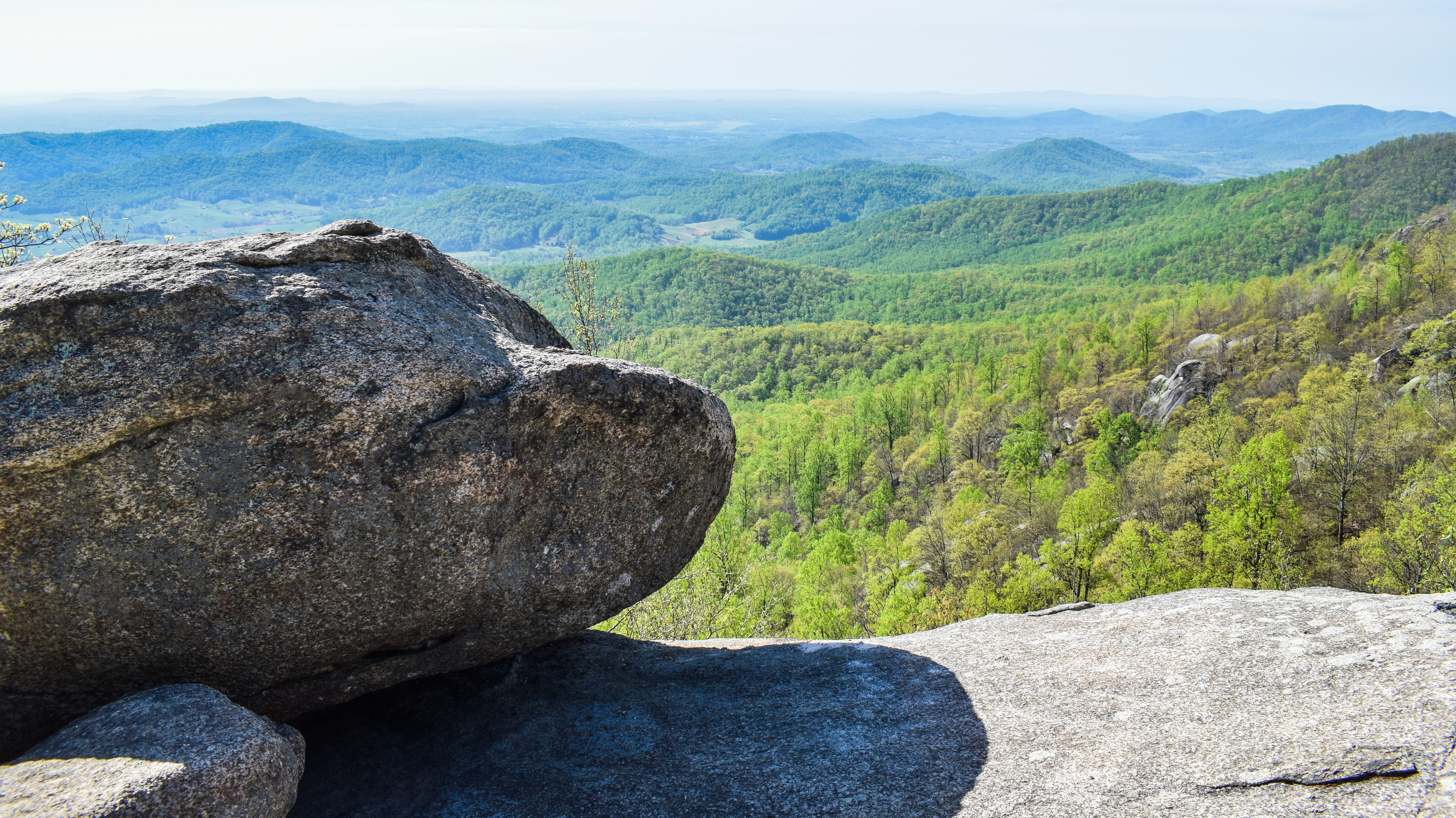

This view is labeled as the "false summit" (I'd more call it a knob, it's clear you're not at the top), and it's the kickstart for one of the more ridiculous scrambling sections I've done on a hike. There is some meandering up and down, under and over, and of course, in between rocks, and then a deep descent into a crack between two massive boulders (instead of a blaze, there is just an arrow that points straight down). There were lots of butt scootches, swearing, and "how on earth do we get there?" comments, but this was absolutely the most fun part. The packs had to come off a few times, and there were a few more stable moments where we were able to catch our breaths.

A favorite spot was rock cave/tunnel (not claustrophobic) where the temperature was easily 20-30 degrees cooler than it was outside, followed by a lovely view, then followed by a bizarre staircase-type area with a massive rock wedged between the walls. One obstacle after another! There was one particularly difficult section for me, as a beefy guy, where you essentially had to give a rock a big hug and hurdle yourself up and over... That was the hardest section for me, and I made it! We were trailed by a tall solo hiker with only a fanny pack (we later overheard him say he would rather fall off the mountain than hike with a full pack... okay) who told us he spent two years not being able to walk so he's ready for this hike. Interesting fella!

Pain aside, the scrambles were so fun (and not yet over!). Our hands and knees were scraped up, but we continued on. Thankfully, the views kept getting better and better! Unfortunately, everytime we caught a view of the actual summit, we felt like it never got closer! A comically narrow passageway marked the begininng of the end in my opinion. You essentailly pop out like a praire dog onto the scrambly ridge walk. There was one final difficult scramble over a large drop (someone on AllTrails called it a leap of faith, and I agree!), but the rest of the scrambles were more fun and less terrifying.

The trail settles down near the summit, and eventaully comes to the beautiful "Old Rag Mountain Summit ->" sign, with the spiderweb network of spur trails leading to views in all direction and one last comical pile of giant rocks. The views were incredible with the budding trees and hazy horizon. There was a "summit brick" ontop o fthe tallest rock that I did not want to tempt fate climbing, but the tall hiker who spent years not walking did go up and said "haha this asshole. It says "good job making it to the top!" which made me giggle. We took in a few views, and decided to have our summit beverages and snacks at the shelter, not knowing if we would have any scrambles down.


The summit marked the end of the brutal Ridge Trail and the beginning of the Saddle Trail. The trip down was ridiculously easier, with gentle grades and easy footing. We stopped at the Byrd Shelter which had an enclosed picnic table where we took our long break. I personally decided to skip the backpacking meal so I could drink the extra water I brought, but we still had a great break. The trail to the Old Rag Shelter was beautiful with views to the left, moderately descending. I had to get ahead of the group since my thighs were burning trying to move slowly (here we learned that my friend Chris does fast uphill and slow downhill, I do the opposite).

The trail levels out at the Old Rag Shelter. Emma was super excited to use the privy that was there, but to her dismay it was MESSY. Lots of crusted poo and garbage... they all ended up peeing in the woods. The shelter itself was nicer than the Byrd Shelter, with room for a few more people to have a snack break. This shelter also marked the terminus of the Saddle Trail and the beginning of the Old Rag Fire Road, which was a much wider trail and rather featureless. We did see a garter snake!


We departed the Old Rag Fire Road and joined the Weakley Hollow Fire Road at "Post Office Junction" (signed). It reads:
Community Central
This location was once the sight of a small mountain community. Here residents shopped, socialized, and attended church and school. When Shenandoah National Park was established in 1935, residents were relocated making way for the hiking trails you enjoy today. As you explore, please help preserve history by not disturbing evidence of former human use and respecting those who still live in this area.
Meet the Postman
W.A. Brown was the Old Rag postmaster and storekeeper. A community leader, Brown lived next door to the post office and store. Reisdents picked up their mail, visited, and bought basics like coffee, sugar, and five-cent sodas.
The trip from Post Office Junction is even easier, continuing along wide fire roads with gradual descents. There were a couple of nice cascades on either side of the trail along the Brokenback Run (excellent name), one large vehicular bridge, and lots of very tall trees. Near the terminus there is a series of four lovely footbridges crossing the stream, which has washed out the road. We crossed paths with a juvenile eastern rat snake, which was truly almost cute!

The final stretch of our hike was deciding to follow the paved road down instead of hiking the Ridge Access Trail (not sure if that was technically allowed, but I did NOT want to climb up any more elevation! It seems like this route used to be part of the actual trail before the Ridge Access Trail was opened (old blazes), and it links to another trail down the road. We were DELIGHTED to make it back to the parking area, where we changed out clothes, used the bathroom, and set forth to the best place to get a reward... Taco Bell!

Step-By-Step
- Park at trailhead and ranger station (this location has changed in recent years, we used "Old Rag Circuit Hike" on Google Maps).
- Start hike along blue-blazed Ridge Trail.
- Follow ridge trail to false summit knob, and then begin the strenuous scrambles.
- Summit Old Rag Mountain.
- Descend via Saddle Trail
- At Old Rag Shelter (the second shelter), continue right onto Old Rag Fire Road.
- At junction, turn right onto Weakley Hollow Fire Road.
- At next junction, continue straight through gate onto VA Route 600.
- Follow pavement to parking area.


