Bear Church Rock (Shenandoah National Park)
Hike Type: Out-and-Back w/ Spur
Distance: 8.59 miles
Elevation: 2346 feet
Time: 5 hours, 1 minutes (4 hours, 34 minutes moving)
Hiking Challenges: Summit Beer Society
Hiking Challenges: Summit Beer Society
The Hike
After a great night in Atlantic City and a few days in Washington D.C./Alexandria, VA, we made the hour-and-a-half drive to Shenandoah National Park for our first of two hikes! We parked at the end of Graves Road at the Graves Mill Trailhead in a gravel lot, slowly got our bags in order, and started our hike around 9:45am! The Graves Mill Trail is blazed in yellow and follows the Rapidan River, winding along the banks and into the woods, with one eroded section that will likely collapse into the river after a few intense storms.
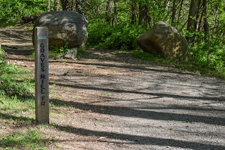
The first junction is a half-mile in, and we were introduced to the Shenandoah trail markers - a concrete obelisk with a metal band near the top, with trail signage and distances embedded into the metal. Here, we turned left onto the Staunton River Trail, which parallels the Staunton River... I think. There are also the names "Garth Spring Run" and "Wilson Run" on Google Maps, and there's little information that I can easily find on Google. Whatever its called, it was beautiful! [EDIT: When I checked the USGS Topo Map, I found the Wilson Run is a minor/seasonal stream that the trail crosses, and eventually joins the Staunton River. Same with Garth Spring Run, but that one is much higher up and my hike did not cross it.] A great, relatively easy trail. There were two great cascades along the trail and some beautiful woods. One cascade had some man-made infastructure, but I couldn't figure out what it could be. [EDIT: I just did a Facebook search on the "Shenandoah National Park Hikers" group and found this: "They’ve added some stuff since I was last there. I’m guessing both setups are related to water quality. This has been a long-term study by Virginia Tech since the Flood of 1995 wiped out 100% of the fish population and made huge changes to the stream bed of the Staunton River."]. There were also some old stone walls/foundations which were cool to see. I'd love to find out what/who used to be there!
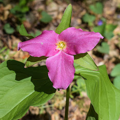
We admired the trilliums and other blooming flowers, continued to be in awe that there were leaves on the trees (compared to the bare sticks we still have in New England), and eventually hit the Jones Mountain Trail junction. This is where the climb began! The trail immediately got steeper and the sweat started pouring. It was nothing crazy steep, but we had gotten used to the gentler grades down below! There is an excellent tunnel of mountain laurel near the junction with the Jones Mountain Cabin - I wish it was in bloom!
There is a gentle, then steep descent to the shelter, with one small view off-trail. The view will definitely diminish as the leaves grow in, but it was a welcomed break! The final descent to the cabin was steep and we were DEVISTATED to learn that the privy was locked! Absolutely heartbreaking. We did our best to leave no trace in the woods, took a snack break, explored the exterior of the cabin, and then got right back to work.
The climb up from the cabin was painful, but quick, and then we had the final push up the Jones Mountain Trail. The trail was realtively steep, but nothing ever ridiculous. The trail was beautiful, with a green ground-cover and narrow footbead. The leaves reverted to buds higher up, and before we knew it we were at the incredible Bear Church Rock viewpoint!
The view was spectacular of surrounding mountains, drainages, and even Old Rag in the distance! There was a wide-open viewpoint that we were delighted to have all to ourselves. We spent a solid half-hour up top enjoying our time (and snacks). We made it a mission to take a nice, long break on this hike, so we brought along some of our Ready Wise backpacking meals and my JetBoil so we could have some good warm food, and be forced to chill out up top. I will say, I was disappointed with the Breakfast Skillet - it was unsightly, which isn't much of an issue, but the meal was also dissatisfying. The Mountain House is much better in my opinion.
Our return trip was straightforward and easy - only passing one other hiker near the top and one mom/daughter duo near the bottom. There were lots of beautiful flowers, LOTS of green leaves, and I was in awe of the tall trees. Are they actually taller down here, are they just older, or am I delusional? Not sure, but I loved it! We took our time getting cleaned up, and eventually started the long drive to Winchester where our new home would be for the next few days.
Step-By-Step
- Park at Graves Mill Trail trailhead (end of Graves Road; "Rapidan River (lower section) on Google Maps).
- Start hike along yellow-blazes Graves Mill Trail.
- At junction, turn left onto blue-blazed Staunton River Trail.
- At junction, turn left onto blue-blazed Jones Mountain Trail.
- At junction, turn left onto Jones Mountain Trail.
- At junction, continue left onto Jones Mountain Cabin Spur.
- At cabin, turn around.
- At junction, turn sharply left onto Jones Mountain Trail.
- Arrive at Bear Church Rock.
- Retrace steps, skipping the Cabin Spur, back to trailhead.
"Rapidan River" from Wikipedia
"The Rapidan River begins west of Doubletop Mountain in Shenandoah National Park where the Mill Prong meets the Laurel Prong at Rapidan Camp, approximately 3 miles (4.8 km) south of Big Meadows. The river defines the border of Orange County with Culpeper and Madison Counties. Sections of the lower Rapidan River are preserved by a conservation easement.[2] The Rapidan River was the scene of severe fighting in the American Civil War, and historic sites such as Ely's Ford, Chancellorsville, Brandy Station, Kelly's Ford, and the Battle of the Wilderness are nearby."
"Jones Mountain Cabin" from Potomac Appalachian Trail Club
"Built by moonshiner, Harvey Nichols, this chestnut log cabin is located in the Central Section of SNP. Access the cabin by a strenuous 3.8 mile hike-in from the park boundary at Graves Mill. This the longest hike-in of all PATC cabins and, as a result, this cabin is only recommended for experienced backpackers. There, you will find a main floor complete with 2 bunks, an eating area, counter space, and a wood stove for heat. Find a loft space for up to 7 mattresses and a large covered porch in the front. Hikers can explore the trail system in SNP. Nearby Jones Mountain Trail leads to a spectacular view at Bear Church Rock. Note that firewood should be used conservatively, and outdoor fires are not permitted per park regulations. Be prepared to pay the park entrance fee."


No comments:
Post a Comment