Showing posts with label Fire Tower. Show all posts

Friday, April 25, 2025

Hadley Mountain Fire Tower (Adirondack Park)

Hadley Mountain Fire Tower (Adirondack Park)

Hike Type: Out and Back
Distance: 3.44 miles
Elevation: 1,535 feet
Time: 1 hour, 38 minutes (1 hour, 30 minutes moving)
Hiking Challenges: ADK 29er, Adirondack Firetower Challenge, Operation Alaska Benchmark Challenge

The Hike
It was now the second weekend of April break, and I was in New Jersey, but had to end my day in northern Vermont. I spent some time looking at ways to break up the drive, and landed at the Hadley Mountain Fire Tower on the edge of the Adirondack Park! The drive from NJ to the trailhead was long but easy, and I made it to the empty trailhead just before 7:30am. It was a crisp 48 degrees with a few bugs hovering about, but overall all was good! The access road was dirt and narrow but in good condition. I took care of my Code Yellow just off the parking lot, feared a Code Brown, pulled it together, and got to my adventure!

I chose to be bold and start cold, which was a good move (as always), as I immediately started sweating as the trail got right to work. I had a bit of hip chafing from yesterday's hike in Harriman, but it wasn't burning too badly. Skies were overcast as I climbed up to the trail register that was missing a writing implemenet. 


The trail continued past the register on a wide, eroded trail. The dark, dense forest opened up to a young hardwood area where I noticed a #2 on a tree - maybe this is an interpretive trail? (Yes! You can download the brochure from https://hadleymtfiretower.org/). The #2 was in reference to bear marking on the trees. 

I enjoyed the smell of warm, wet forest as the trail began to climb more steeply. I misssed #3 (bedrock) but did notice marker #4 (natural sculptures). There were lots of small critters around the forest floor doing their morning chores and I enjoyed some hazy tree views behind me. The trail bends at a signed arrow, crosses a creek, and arrives at marker #5 (stream crossing). 

The trail was well-blazed in red and I was sweaty! I climbed up what was the beginning of MANY slabs, which at this moment were wet, but not slippery. I was worrying about the descent, but I'd let that be a later problem. I noticed a tree view to some undercast in the distance and also some early spring budding (as opposed to the almost-leaves of Harriman State Park). 


The slabs got a bit dicier and eventually, the trail turned off of the slabs and continued on steep, rocky footing (which was a welcome change). I zig-zagged through another ledgy spot and climbed up an adorable, ~3ft tall chimney. I felt one single rain drop as the trail continued to rise up to the col between Hadley Mountain and it's neighbor peak (#6 - The Resting Rock on Panther Pass). 


Once in the col, which I guess is also known as Panther Pass, I enjoyed a heavenly walking break before the trail narrowed and began to climb again. The climbing now was much easier as I collected spider webs and continued to fear what my stomach was capable of (remember the Code Brown scare from earlier? It's back!). I passed marker #7 ("Pioneer" White Birch - the first trees to grow after a forest fire) and enjoyed the sound of woodpeckers hard at work.

The trail climbed through a rocky notch and turned left at marker #8 ("Sharp Turn Left!") before steepening in a grassy, ledgy area, which led to a wonderful tree view to a lake. This was followed by another wonderufl walking break and another ledge view to nearby mountains. It even smelled like a pine candle up here - I was so happy.


The climbing became easy at this point as I soon arrived at the old warden's cabin and privy (with a spooky little cave, too). There was a quick scramble and push to the true summit, which was mostly open with wonderful views, the tower, a USGS disc, and a summit bolt. 


The tower climb wasn't too awful and the cabin was open with a small ladder that was terrifying, but worth the extra emotional push. The views north were exceptional, but I couldn't make out the Catskills due to clouds. The tower was marker #10 (Top and the Tower!) and I had missed #9, but it was at the cabin and cave. 

I took a bunch of photos and then started my descent right at the one-hour mark. I was thrilled to have encountered absolutely zero signs of winter, and I was back at Panther Pass in 15 minutes! On a side note, I really love hiking in New York specifically because you can tell which trail plackards are new and which are old - I find it super fun!


I significantly slowed down on the wet slabs further down and did NOT fall. I did my best to be good and avoid going off-trail, but a few stretches were too dangerous with the moss and moisture to go straight through. The lower slabs, which were dry, were an absolute dream! Soon enough I was back at the car, solidifying that this was a zero-person hike! It was now 60 degrees, and I was on my way to Vermont! I soon drove past a porcupine on the access road followed by some turkeys. Just after, on Eddy Road, I got a great view of Hadley Mountain. The rest of my drive to and over Lake Champlain was just beautiful.


Step-by-Step
- Start hike on Hadley Mountain Trail (red blazes).
- Summit Hadley Mountain, climb fire tower, return to car.

Wednesday, March 5, 2025

Nobscot Hill Fire Tower via Monson Trail (2x) (Nobscot Scout Reservation)

Nobscot Hill Fire Tower via Monson Trail (2x) (Nobscot Scout Reservation)

Hike Type: Lollipop Concentric Circle Double Loop
Distance: 3.05 miles
Elevation: 761 feet
Time: 1 hour, 24 minutes
Hiking Challenges: 52 Hike Challenge; Massachusetts Fire Tower Challenge 11; Massachusetts Fire Tower Challenge 45; Operation Alaska Benchmark Challenge


The Hike
Time for something different! I'm having a great hiking streak right now: 5/5 days in March! For this after-school hike, instead of going to the Blue Hills, I went out to Sudbury and the Nobscot Scout Reservation to knock off another Massachusetts Fire Tower (I'm so glad this list exists). The drive out was super easy and parking felt wrong even though it was right! It was WARM out - 56 degrees with overcast skies and some wind. I tragically forgot to bring shorts, but thankfully I'd been lazy all week and had sweatpants on. The t-shirt was in!


The hike started by following the road around the Monson Trail, through the pavillion, and onto the winding road. The road was mostly frozen with muddy ruts where ATVs have driven through. I was flirting with extending my hike over to Tippling Rock, but didn't have enough info on distance, so I'd pin that for another day. I took my spikes off and on a few times as I meandered on road grades up Monson, and then briefly on White Ridge Trail, which linked just after passing a cabin. 


I turned left onto the Hillard Trail at a stream and began an icy, slushy, muddy, wet, eroded, steep climb. Spikes were off for this bit as I navigated the comically squishy terrain. At the next junction, I turned onto the much wider Pierce Trail, which started off as wide and muddy but became frozen again after turning a corner. My legs felt a cool breeze while my upper body felt a warm breeze, which was very interesting. The tower was now in sight!


...or so I thought. Turns out there's a bunch of towers on Nobscot Hill, some of which are square on the top and some are tall communication towers. The Pierce Trail terminated at a communication tower/square topped tower, I took my spikes off again, and then followed the gravel road uphill to the summit and the Fire Tower! It was gated off, so no public access, but I got my photo, and after some exploring, I found a UGSG disc! Yay!


From here, I descended on the Bay Circuit Trail (two entrances from the tower, I took the right one), which coincides with the Tower Trail for a bit. The trail comes to a ledge that's view was mostly overgrown, and then descends on a muddy, narrow trail that skirts the hillside. I decided to just keep my spikes on for the rest of the hike at this point, regardless of conditions. I also hiked past what I assume was an exploded bird? Small feathers EVERYWHERE.


Down on the valley floor, I decided to extend the hike and head up again. This time, I turned onto the White Ridge Trail, that followed a road grade through lovely, open forests, and paralleled an old stone wall. I went past another cabin and then came up to an abandoned cabin that looks like it was crushed by a tree some time ago. At the abandoned cabin, I turned onto Jethro Trail, which would follow more road grade back to the Monson Trail (and it went past a surprive privy and some shelters, how fun!). 


Back on the Monson Trail I meandered back to the Hillard Trail, now with some blue skies above! I continued on Hillard past the Pierce junction, and the new stretch of Hillard was a continuation of the first bit, steep, eroded, muddy, frozen, and slushy, but now steeper! It got a little sketchy at times, but my spikes did their jobs. I felt like this stretch was my pennance for skipping leg day this morning (I skipped it because of my tweaked knee, in fairness). The Bay Circuit Trail joins higher up, and then I was back at the fire tower!


The skies were super pretty overhead now and the sun was trying to poke through the rest of the clouds - I do kind of wish I went over the Tipplin Rock, but I'm not sure I would have had enough daylight to do it all. I followed the Tower Trail down again, and I just barely could make out the Boston skyline from the ledge this time. I continued straight where I turned onto the White Ridge Trail earlier into some darker woods, past some campsites and another privy. 


I completed the Jethro Trail and made it onto the EllisLand Trail, where I followed some deer tracks in the deep mud and some ATV tracks too. The trail took me through the Explore Alley campsite and eventually back onto the Monson Trail! I reflected for a bit about how much I hated Boy Scouts when I was a kid and how funny it is that I'm now outdoors multiple days a week - I think a lot of it was I was lazy but more of it was just the masculine culture around all of it. I'm happy I'm where I'm at now! To no surprise, this was another lovely after school hike.


Step-by-Step
- Park at Day & Visitor Parking at Nobscot Scout Reservation.
- Start hike on Monson Trail.
- At terminus, turn right onto White Ridge Trail.
- At next jct., turn left onto Hillard Trail.
- At next jct., turn right onto Pierce Trail.
- At terminus, follow gravel road to summit/fire tower.
- From fire tower, descend on Tower Trail/Bay Circuit Trail.
- At jct., turn left onto White Ridge Trail.
- At second jct., turn right onto Jethro Trail around abandoned cabin.
- At terminus, turn left onto Monson Trail.
- At terminus, turn right onto White Ridge Trail.
- At next jct., turn left onto Hillard Trail.
- Follow Hillard Trail to summit/fire tower.
- From fire tower, descend on Tower Trail/Bay Circuit Trail.
- At jct. with White Ridge Trail, continue straight on Tower Trail.
- At jct. with Jethro Trail, continue left on road grade on Jethro Trail.
- At later jct., continue left onto EllisLand Trail.
- At terminus, continue right onto Monson Trail.
- Follow Monson Trail back to car.


Sunday, March 2, 2025

Lenox Mountain Fire Tower via Trail of the Ledges and Overbrook (Pleasant Valley Wildlife Sanctuary)

Lenox Mountain Fire Tower via Trail of the Ledges and Overbrook (Pleasant Valley Wildlife Sanctuary)

Hike Type: Loop
Distance: 4.85 miles
Elevation: 518 feet
Time: 1 hour, 57 minutes
Hiking Challenges: 52 Hike Challenge; Massachusetts Fire Tower Challenge 11; Massachusetts Fire Tower Challenge 45

The Hike
I was delighted and shocked to find a fire tower hike so close to Bousquet! I drove about 6 minutes on a paved road and then another 4 on a soft dirt road, and then I was there! There was a nice parking area with plenty of space for me on this now toasty 15-degree, sunny afternoon. I suited up in my car (thought about just keeping my ski gear on but made the responsible decision to change into my hiking clothes), and got right to it!


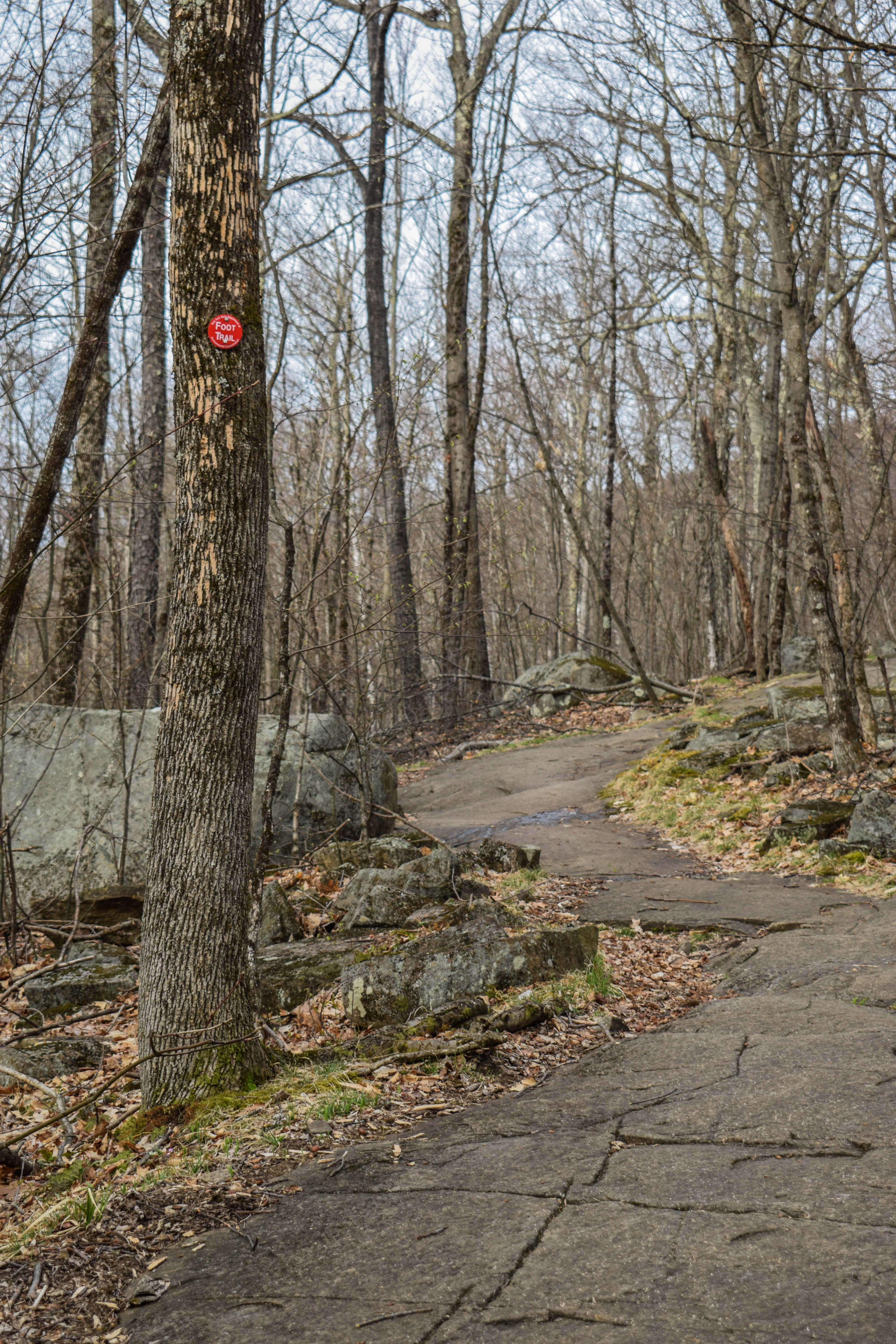
The hike begins by walking past the Mass Audobon office and then up to some large solar pannels. The AllTrails track had me follow a trail that was not broken out right at the road, which is why I pivoted and headed toward the solar pannels. Spikes went on at the solar pannels and then I turned onto the still-not-broken-out All Persons Trail, which cut across a meadow and led to a LOVELY boardwalk that overlooked Pike's Pond.


"Pike's Pond" from Trailside Kiosk
Pike's Pond is a productive, thriving aquatic habitat. Shallow depths allow sunlight to reach the bottom, enabling aquatic plants to grow from shore to shore, providing a rich source of nutrients and forming a broad variety of habitats. Swimming, floating, or darting around leaves and stems are a myriad of zooplankton - the tiny creatures that form the foundation of the pond ecosystem. Backswimmers, water striders, dragonfly nymphs, and other aquatic insects and crustaceans feed on them. Snapping turtles leisurely scavenge the bottom. Tadpoles graze on algae near the shoreline. Frogs proclaim their territories, witing for prey to hop, swim, or fly by. Herons stir the muck, seeking an unwary fish, frog, or crayfish. Painted Turtles bask atop logs. Filled with life, this pond is a marvel of biological diversity.
Red-spotted Newts have four life stages: egg, larva, eft, and adult. The red eft is teh only terrestrial stage, lasting four to five years before the adult salamanders return to the pond to reproduce.
Pike's Pond provides a home and ample food supply for the nymphs of many dragonfly and damselfly species. Some of these species have aquatic stages lasting six or more years. Damselfly nymphs are predatory carnivores. The Common Whitetail dragonfly is one of nearly 50 species of odonates found at this sanctuary.
Crayfish are important pond scavengers. In turn, they too become food for herons, Hooded Mergansers and raccoons.
Vegetation, shading and a variety of water depths allow fish to inhabit various microhabitats in the pond. Found here are warm water species including bass, perch, minnows, and shiners. The male pumpkinseed sunfish hollows out a nest depression where one or more females lay their eggs. He then guards teh next until the eggs have hatched.
Birds of Pike's Pond: Many species of birds are able to find food in or along the shores of Pike's Pond. Herons feast on fish, frogs, crayfish, and insects that call the pond home. Belted Kingfishers plunge dive into the pond in hopes of catching small fish like shiners and pumpkinseeds. Hooded Mergansers, which nest in natural tree cavities and wooden nest boxes, eagerly dive for crayfish meals. Red-winged blackbirds often hunt for insects in meadows as well as wetlands, but attach their nests to the stalks of emergent plants like cattails. 
The nature of Pike's Pond is a result of changes people have made to Yokun Brook. Sanctuary staff built a dam on Yokun Brook in 1932, hoping to create a pond to attract wildlife. The pond was again altered when wildlife managers successfully reintroduced beavers downstream along Yokun Brook in 1932. What you see now has resulted from extensive beaver activity that has continued since then. Today, we work alongside the beavers to maintain and protect this network of biologically diverse wetland habitat.

The view from the boardwalk and then the Pike's Pond Trail were absolutely lovely, but I was confused about the blazing. Apparently, instead of giving each trail it's own color, blazes are blue when you are hiking away from the office and yellow when you are hiking towards. An interesting system, but I don't dislike it! I only had two qualms at this point of my hike: 1) I forgot my snack pack at home so I did not have a Reece's Big Cup to eat and 2) I was about to go snowblind - I think when I inevitably get new ski googles I'll make my current ones my hiking ones. Unfortunately, I really can't wear sunglasses AND a buff, and I really need to wear the buff for my asthma. Tragic!


The Pike's Pond Trail crosses a lovely bridge with a solid snowpack over a stream, and then reaches the "Trail of the Ledges," which in my opinion is a very dramatic name, but it was time to go up! My puffy came off and I started the climb.


To my dismay, there were only one set of recent footprints ahead of me. Thankfully, the snowpack was mostly frozen over, and I wasn't postholing, so overall it was fine. I made it past the closed Waycross Trail, followed a stream, and then passed the Ravine Trail, which was also closed. I took my fleece off here. Both trails were closed for storm damage, which was clearly visible from the junction. 


Continuing on, the trail definitely got steep, and my hat eventually came off. There were plenty of animal prints, including some of the most adorable, definted bunny prints I had ever seen! The Trail of the Ledges continued into a stunning coniferous forest and up some ledges that had good grip with spikes. I also noticed some larger, older mystery footprints that really looked like bear prints. Maybe a bear woke up from it's winter nap for some exploring?


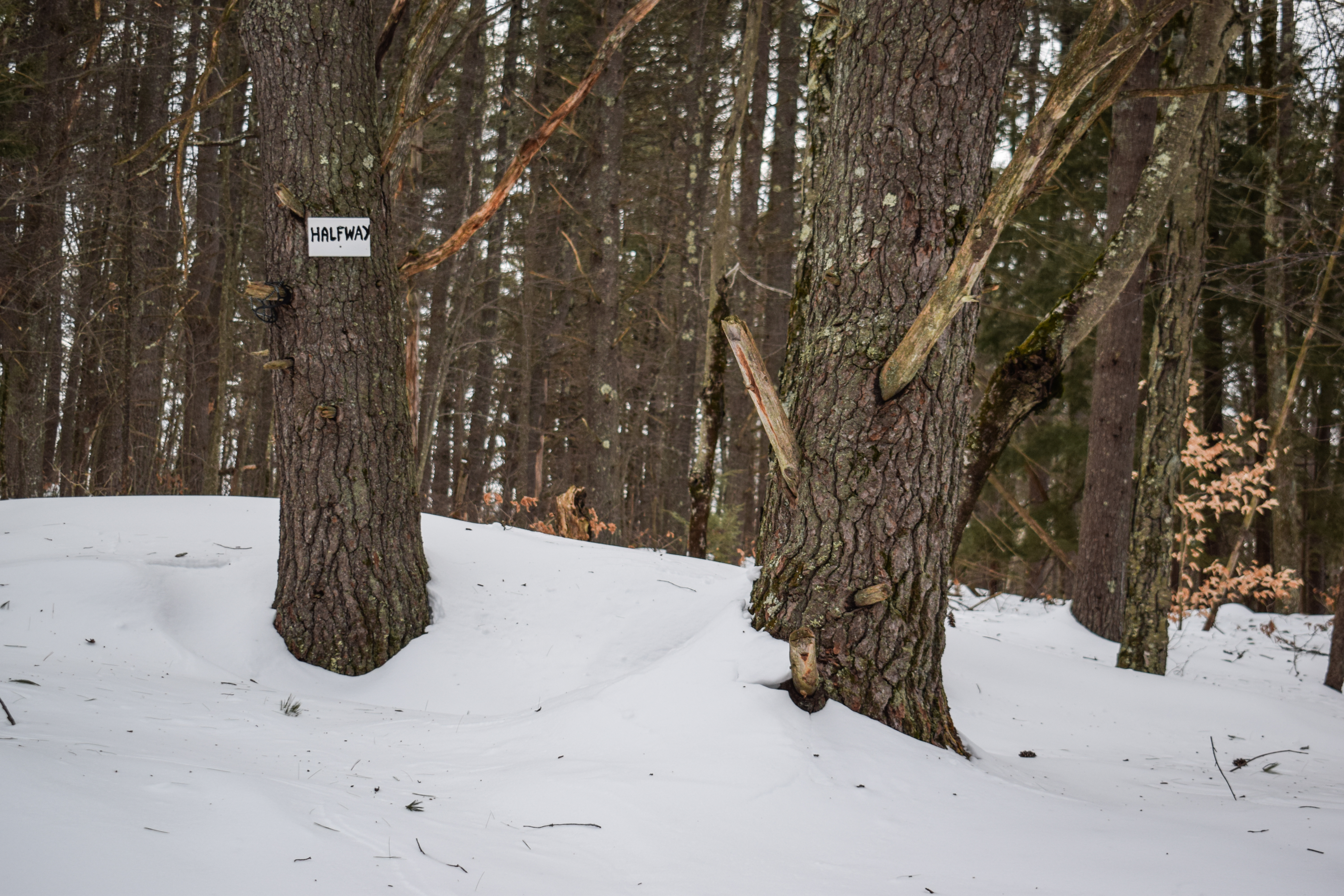
The last big climb was up to the junction with the Laurel Trail, which really got my heart pumping! There was an overgrown view at the junction, and then I continued through gentler and beautiful forests. The snow was deeper up here, and the wind was flowing through the trees now, which cooled me down a bit. I passed by an impressive blowdown and then traversed through a lovely mountain laurel grove. 


Gently rising, the Trail of the Ledges continued into another beautiful conifer forest before descending a bit, offering a tree view to the fire tower! I followed some deer prints into the sag and climbed with many more critters' tracks up the final push. I put my fleece back on when I could see the sky through the trees, and soon came up on the junction with the Overbrook Trail, which would be my return route. 


There was a short, final push up to the tower/summit area. The tower itself did not have a cabin and was fully fenced off, basically attached to a communication tower. There was an excellent view from a clearing around the fence, and I could even make out the Catskill high peaks from the side! The trail to Yokun was not broken out, which I was bummed about, because I was flirting with extending my hike, but that's okay. It was a chilly 15 degrees up here with 15 to 20 mph wind gusts. Also, for some reason, my anemometer was in celcius and I couldn't figure out how to change it, so I had to do some conversions back at the car. 


After retracing my steps to the Overbrook junction, I noticed that the same single set of footprints was leading me down. I guess no one comes up here on cold days? There were more older tracks, though, which made for some exciting "ankle buster" moments. There were still MANY animal prints, though. 


The Overbrook Trail descended for a while, steeply at times (not as steep as Trail of the Ledges), and then eventually came up to a partially frozen stream (is this the namesake brook the trail goes over??) which had a couple beautiful frozen cascades. I imagine this stretch will be gorgeous during the spring runoff!


I eventually found my first people at the bottom of the cascades, a group of four moving slowly. I guess they just wanted to come up to the brook and back. Once they noticed me, they let me pass by, and then I continued down to a mini gorge that was super neat. I found another person a bit further down who I unfortunately scared (sorry!), and eventually, the Overbrook Trail terminates at the Bluebird Trail.

The Bluebird Trail crossed three footbridges and meandered through open forests in between. After the third bridge, the trail struggles up a powdery hill that leads right back to the Audobon area! My spikes came off once I hit the buildings, and then I had a lovely, squishy walk back to the car.


"A Succession Story" from Trailhead Kiosk
This quiet field may appear serene and peaceful, but there is a constant competition that could lead to great changes. In fields like this, shrubs and tree seedlings vie with grasses, goldenrods, and milkweeds for nutrients, sunlight, and space. In New England, without disturbance or management, these fields will eventually return to forest. The progression from field to forest is called old field succession.
In a field succeeding first to shrubland and then to forest, the types of "pioneering" trees and shrubs that first invade depends upon soil, climate, location, and other factors. The first shrubs and trees cast shade and increase soil moisture, making it possible for other seeds that need moise conditions to flourish. In this way, the pioneers set the stage for their own replacement by shade-tolerant woodland trees.
Room to Grow: The seeds of pioneering species like gray birch, white pine, and cherry require sunlight in order to germinate. These fast-growing pioneer trees thrive in the available space and sunlight. In a matter of years, these pioneers are replaced by shade-tolerant woodland trees like Sugar Maple and American Beech.
What is we stopped mowing?These fields are magnets for wildlife - butterflies around in June, bluebirds and Song Sparrows breed here in spring and summer and foxes hunt for field mice throughout the year. With mowing, the field remains open, providing food and habitat for a great number of mammals, birds, insects, and plants. If we stopped mowing, shrubs and trees would take over and the field would soon become a woodland.


This was a LOVELY hike and a perfect way to wrap up (or potentially begin) a half day of skiing at Bousquet! I do wish the hike was longer, but it was good that I finished when I did so I could get home to Boston for my Sunday scaries.

Step-by-Step
- Park at Pleasant Valley Wildlife Sanctuary.
- Start hike on Bluebird Trail.
- At jct., turn left onto All Persons Trail.
- At jct., turn left onto Pike's Pond Loop.
- At jct., turn left onto Trail of the Ledges. 
- At jct., turn left to Summit Spur.
- At summit, turn around.
- At jct., turn left onto Overbrook Trail.
- At terminus, turn right onto Bluebird Trail.
- Follow Bluebird Trail back to car.


"Pleasant Valley Wildlife Sanctuary" from Massachusetts Trail Guide, 11th Ed. (2021)
This 1,300-acre Mass Audobon wildlife sanctuary is on the east slope of Lenox Mtn. in the town of Lenox. A 7-mi. trail network leads to diverse features, such as beaver ponds, marshes, streams, and forests. All trails are marked with blue and yellow blazes: blue blazes lead away from the sanctuary office and main entrance, while yellow blazes lead back toward the entrance. All trail junctions are clearly signed. Attractions include a picnic area and the universally accessible All Persons Trail, which includes a "Sensory Trail" overlay with printed, Braille, an daudio tours and an observation deck.
        From the intersection of US 7 and US 20, drive north 3.0 mi. and turn left onto West Dugway Rd., marked by a sign for the sanctuary. Follow West Dugway Rd. for 0.75 mi. and then bear left onto West Mtn. Rd. (dirt) and travel 0.8 mi. to the sanctuary entrance and parking. Trail information is available at the office near the parking area.

"Pike's Pond Trail" from Massachusetts Trail Guide, 11th Ed. (2021)
This trail, which offers an easy, relaxing walk around the waters and wetlands of Pike's Pond, begins at the sanctuary office. Clockwise, the loop heads across the lawn to a long baordwalk that negotiates a shrubby swamp. Pike's Pond trail then roughly follows the south shore of the pond before crossing a wooden bridge over a section of Yokun Brook at 0.3 mi. The trail swings around the west shore, passing marked junctions with Trail of the Ledges and Yokun Trail on th left before running very closely along the north shore. Pike's Pond Trail then leaves the pond and ends at the intersection with Bluebird Trail, about 400 ft. north of the office.

"Trail of the Ledges" from Massachusetts Trail Guide, 11th Ed. (2021)
This strenuous, sometimes very steep trail leads from Pike's Pond Trail to the top of Lenox Mtn. (2,126 ft.), an elevation gain of about 800 ft.
        Trail of the Ledges begins at the jct. with Pike's Pond Trail, 0.3 mi. from the sanctuary office. The route initially ascends along a stream and past jcts. with Waycross and Ravine trails. It then leaves the brook and climbs steeply to the Laurel Trail, at 0.8 mi., where a ledge offers an excellent view. Trail of the Ledges continues past another lookout on the right at 1.1 mi. and reaches the summit at 1.6 mi. The summit area is owned by the state of Massachusetts (managed by DCR) and offers excellent views to the west and north. The historical summit fire tower, which is closed to the public, is used to support communications equipment. (Note: Trail of the Ledges is not recommended for descent; use Overbrook Trail on the return trip).

"Overbrook Trail" from Massachusetts Trail Guide, 11th Ed. (2021)
The recommended route for descent of Lenox Mtn. in all weather conditions, this steep and strenuous trail also offers an alternate ascent route to the summit. Follow Bluebird Trail north from the sanctuary office for 0.3 mi. and then turn left onto Overbrook Trail (just after the jct. with Beaver Lodge Trail). Overbrook Trail heads northwest up the slope of Lenox Mtn. along a cascading brook, passing the four-way jct. with Laurel Trail at 0.5 mi. The path ascends along a ravine, weaving from bank to bank before leaving the sanctuary and climbing to the summit at 1.3 mi. 

Friday, February 21, 2025

Oak Hill Fire Tower via Sharker Road(Oak Hill City Forest)

Oak Hill Fire Tower (Oak Hill City Forest)

Hike Type: Out and Back
Distance: 3.97 miles
Elevation: 663 feet
Time: 1 hour, 37 minutes (1 hour, 28 minutes moving)
Hiking Challenges: New Hampshire Fire Tower Quest

The Hike
Vacation was technically over but school break was still going strong! After tweaking my knee doing something on Wednesday at Saddleback, I took my mandatory day of rest on Thursday. Now it was Friday, and it was time to get back into it! The end-plan for the day was to meet Emma at Cochran's Ski Area in Richmond, VT for some rope-towed night skiing (for $5), so I backwards-planned my day to start with an early morning hike, continuing to finish up the New Hamphire Fire Tower Quest list (you get the patch for 5 towers, but I want to finish the list still). My alarm went off just before 5:00am and it was a STRUGGLE to get up. Thankfully, I had an easy drive to Hooksett with a successful christening of the bathroom. I got two stuffed hash browns for first breakfast, and a sandwich for second breakfast that I would eat after my hike. I made it to the Oak Hill City Forest parking lot on Shaker Road at 6:45am and was delighted to see 1) a plowed lot and 2) not a single other car. Skies were overcast with a breeze and it was 19 degrees out. I brought snowshoes but the trail looked well-packed, so I made the decision to hike it in just my spikes. 


The trail starts at a kiosk and follows yellow blazes the whole way. The snow was a little softer than expected, and in hindsight it would have been good to practice hiking in snowshoes, but I was fine. The wind was causing the trees to do some spooky creaking and I was gleefully following many deer tracks as the trail meandered through the woods, intersecting with many other trails (all blazed in blue, red, or yellow, and were mostly well-signed). My nano puff came off at 0.25 miles and my fleece came off at 0.5 miles. I noticed tracks on these intersecting trails and wondered if they could be used to make a loop (or partial loop), but they were significantly less-traveled and would have required snow shoes (I should have brought them...). 


The Tower Trail skirted a semi-recently-logged area that had tree views to either Kearsarge South or Cardigan (not sure which one, I'm guessing Kearsarge) and MANY private property signs. The trail got choppier here and continued to be less-packed as it entered a denser forest, crossing a couple of bridges. 


Right at the one-mile mark there was a "1/2 way" sign, and the Tower Trail intersected many other criss-crossing trails, but now most weren't broken out. It was relatively flat in this area, and I was starting to get ready for some uphill as I was getting chilly. The trail eventually came to a sharp turn at a granite marker that marked the Concord/Ludon town line, and then the trail followed a power cut for a final push up to the tower. 


The final push was a bit more moderate, which was welcomed at this point. The snow here really could have used snowshoes, as the firm monorail was about 4" wide (I only postholed once, though!). Up top, there was an old cabin, an abandoned RV, a few communication towers, some form of old machinery, and of course, the fire tower! The climb, similar to other NH towers, was steep and narrow, but not nearly as sketchy as some others. The view was a little grown-in, but I could see Monadnock, Kearsarge South, and Cardigan, which was super fun! It was 15 degrees up here with 15 to 20 mile per hour winds (I got a new anemometer! I also wrote my name, address, and phone number on this one...). I opted for no hot chocolate or break, as I just wanted to keep moving and stay warm. I also hit the two-mile mark at the top of the tower!

'

Mt. Monadnock.

Mt. Cardigan (Possibly)

Mt. Kearsarge (Likely)

I postholed once again going down, but still only once! Some blue skies were beginning to pop out, and the rest of my return trip was nice and easy. This was a great spot to explore just off the highway, and I'd be curious to wander around some of the other trails in the forest! Now, though, it was time for a quick change and a drive to Whaleback Mountain for some skiing!


Step-by-Step
- Park at Oak Hill City Forest trailhead on Shaker Road.
- Hike to Fire Tower out-and-back on yellow-blazed trail.


"Oak Hill (In Loudon; 941 ft.)" from Southern New Hampshire Trail Guide, 5th Ed. (2021)
Oak Hill is a long ridge running east and west in Loudon and Concord. A fire tower on the wooded summit was refurbished in 2019 and offers pleasant views of the surrounding countryside and hills. Other outlooks lie lower on the mountain.

"Tower Trail" from Southern New Hampshire Trail Guide, 5th Ed. (2021)
        This yellow-blazed trail is the most direct route to the summit and fire tower from the main Shaker Rd. trailhead and also serves as a trunkline trail where several other trails branch off, making various loop hikes possible. Grades are generally easy the whole way and footing is mostly good aside from a few rocky sections. The immediate area around the summit has been impacted by logging but the trail itself is only slightly affected.
        Tower Trail leaves the parking area at a kiosk and branch of Concord's Little Free Public Library and ascends easily along a wide path to a junction at 0.2 mi. where blue-blazed Lower Trail diverges right for the Vista Way trailhead. Tower Trail bears left, immediately passes the closed former section of Ledges Trail on the right, then in 25 yd. passes a junction on the right with the current route of that red-blazed trail. At 0.5 mi. Tower Trail passes a junction on the right with red-blazed Upper Trail, which leads to the scenic vista and Oak Hill Rd. trailhead. It ascends easily, levels as it passes north of Potter Ridge, then descends to a four-way junction at 0.9 mi. where red-blazed Dancing Bear Trail leaves left (turn left onto this trail to reach the Swope Slope Vista) and blue-blazed Potter Ridge Trail leaves right.
        Tower Trail continues traight ahead and footing becomes rockier. At 1.2 mi. it passes through a lower four-way junction with the blue-blazed Krupa Loop, climbs easily over an unnamed 775 ft. bump, then descends to an upper four-way junction with Krupe Loop at 1.3 mi. Tower Trail continues an easy ascent, with a few minor ups and downs, and reaches an old stone wall at 1.7 mi. which, along with an engraved granite post on left, marks the boundary between Concord and Loudon. Here, red-blazed Ron's Way departs right.
        Tower Trail passes through the wall, turns sharply left and follows a power-line corridor at easy to moderate grades. At 1.9 mi. the fire tower comes into views as the trail makes the final ascent to the summit. The trail crosses two newer skid roads, jogging left then right at the second one, and emerges onto the broad summit clearing at 2.0 mi. When leaving the summit, Tower Trail diverges right at a fork (sign: "Tower Trail") where Oak Hill Summit Rd. bears left by the communications tower.

"History of the Oak Hill City Forest" from Trailhead Kiosk
The bedrock of what is now called Oak Hill (elev. 980 feet) formed 410 to 365 million of years ago in the late Devonian period. It consists of a rock type called Concord Granite and is part of the same rock formation that is quarried in Concord on the west side of the Merrimack River. Oak Hill came into being when the softer rock that had encompassed the granite slowly eroded away. Part of the granite formation can be observed on the Ledges Trail. The most recent geologic event that helped shape Oak Hill was the ice age. When the glacier receded about 12,000 years ago, it deposited the soil and the boulders presently found on the hill.
        Settlers first moved into the Concord area in the early to mid 1700's. They probably found Oak Hill covered by a forest of red oak, white oak, American chestnut, and a scattering of hemlock, red maple, black birch, and hickory mixed in. Most of the forest was cleared in the mid to late 1700's for agriculture. Many of the trees that were cut down were burned to create charcoal that was used in area mills and forges. The Tower Trail crosses directly over an old charcoal pit which is located about halfway between the trail's intersections with the Upper Trail and the Dancing Bear Trail. Old deeds referenced that some of the chestnut groves were left standing as the chestnuts provided nutritious food for both humans and livestock.
        Due to the steepness and rockiness of the soil, most of the hill was only suitable for pasture. As a result, only one farmstead can be found on the City Forest as there was not enough productive cropland to support more than one family. Stone walls and rock piles tent to mark the areas used for growing crops. Those areas can be found along the Tower Trail between the northern trailhead and the Ledges Trail turn-off, and in the area along Skaker Road immediately south of the farmstead site at the southern trailhead. A small amount of granite was quarried from the hill during the colonial era. Some large boulders were split along the west side of the Lower Trail just south of the footbridge and the bedrock itself was quarried near the hill's summit on the Loudon Town line. Due to poor soil conditions, most of the pasture land was abandoned in the mid to late 1800's and quickly grew in with a mixture of pine, hemlock and chestnut. Unfortunately, the chestnut was killed off by a blight in the 1920's, though many of the dead stems were salvaged. The blight intensified growing concerns about forest protection and a system of fire towers was developed throughout the State. Because Oak Hill commanded spectacular views of central New Hampshire, a fire tower was constructed on its summit in 1928. Most of the pines that developed in the abandoned pastures were logged off in the early to mid 1900's which allowed the present oak forest to develop. The areas that were used for growing crops were eventually converted to hayfields until they too were abandoned in the early 1900's and they also grew in with the white pine currently found there. Severe Gypsy Moth infestations in 1980 and again in 1990 killed off many of the hemlocks and numerous oaks, though the forest seems to have now recovered from that ordeal.
        The City of Concord started acquiring land on Oak Hill in 1975 for conservation purposes. Between 1975 and 1999 the City obtained six parcels of land that totaled approximately 300 acres. In 1989, the City started an intensive forest management program by setting up two timber sales and then used some of the skidder trail to initiate the hiking trail system. A goal of creating a trail to the firew tower on the summit of Oak Hill was soon developed. In 1999, the City purchased a tract of land that connected the City Forest to the Loudon Town Line. Permission was obtained in 2000 to cross the private land on the summit of Oak Hill in Loudon to complete the trail to the fire tower.
        As with other City Forests, the City of Concord manages the Oak Hill City Forest under the Multiple-Use concept where consideration is given to timber production, recreation, wildlife habitat improvement, watershed protection and education. It is hoped that a sound forest management program will continuously provide the public with the many benefits that a well-managed forest has to offer.