Wildcat Ridge Traverse (White Mountain National Forest)
Hike Type: Point-to-Point
Distance: 10.41 miles
Elevation: 3,104 feet
Time: 9 hours, 12 minutes (7 hours, 10 minutes moving)
Hiking Challenges: New Hampshire 4000 Footers; 52 Hike Challenge; Operation Alaska Benchmark Challenge; Terrifying 25
Hiking Challenges: New Hampshire 4000 Footers; 52 Hike Challenge; Operation Alaska Benchmark Challenge; Terrifying 25
The Hike
Sometimes I think I need to learn to say no to hikes, but I guess on the other hand I have never regretted doing one... A shot backstory - Friday night I was up late seeing my favorite Boston cover band, The Femmes! I got home around 1:00am, and I was up at 5:30am for a full day of marching band. We ended up getting 1st place, which has NEVER happened before, so we HAD to go out and celebrate. I ended up getting home just before midnight, which is usually fine, but Sarah and I had planned to hike the Wildcats Sunday morning, and I REFUSED to back out. Sarah drove up that night, but I had to go home to finish packing. I ended up sleeping from 12:15am-2:45am and then had a brutally sleepy drive up to Pinkham Notch.
Higher Summits Forecast for Sunday, October 20th, 2024
High pressure weakens Sunday as a trough dips down from the north for the start of the week. Sunday will start with sunny skies, relatively low winds, and temperatures well above normal for late October. Mild temperatures will remain throughout the day. However, winds will increase, making overall conditions feel colder on exposed skin. Clouds from the approaching trough will spread in overhead Sunday afternoon and then continue to thicken and lower overnight into Monday. [...]. Snow and ice from last week has started to evaporate and sublimate in the lower elevations however, the higher terrain still has snow and ice coverage. So appropriate equipment, footwear, and additional traction devices should be considered if traveling to the higher elevations of the White Mountains over the forecast period. Ryan Knapp -- Staff Meteorologist. Updated at 4:46am on Sunday.
Sunday: In the clear under mostly sunny skies. High: Upper 40s. Wind: W 15-30 mph early, 30-45mph midday, and 45-60 mph later.
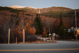
Skies were crystal clear and I painfully munched on Cheerios to stay awake (specifically the Apple Cinnamon ones on this drive). I began to perk up near the end when I could make Mt. Washington's snow-peaked summit from the scenic outlook on NH-16 (where I had to christen a very cold porta-potty), and later in Pinkham Notch.
[6:45am - Lost Pond Trail]
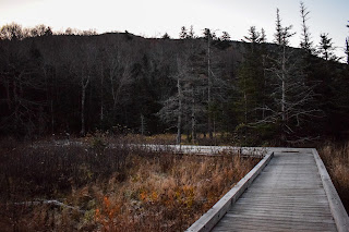
The Lost Pond Trail begins on a lovely boardwalk through an area of beaver activity. The water was perfectly still and after leaving the boardwalk, the trail followed the shoreline of one of the beaver ponds and showcased a beautiful early-morning reflection of snow-capped Mt. Washington - the water was basically a mirror!
The trail continued, gently rising past the Ellis River to Lost Pond, which was similarly beautiful and still, carved out of the mountainside on the left. We took a moment to shed layers here and take in the sights. We also were able to hear ourselves echoing unfortunately clearly!
The Lost Pond Trail followed the shoreline, providing stunning, reflective views of the trees with the orange-glowing Presidential Peaks behind. The sun was just beginning to hit the upper elevations, notably lighting up Huntington Ravine in a firery light.
We veered away from the pond and the trail began to descend more ruggedly than before, which was actually a nice warmup for what's to come! We took a moment at the terminus to de-layer some more and take care of some personal maintenance chores before we embarked on the BIG climb!
[7:24am - Wildcat Ridge Trail]
We started our climb with an immediate game of leap frog with a kind gentleman. The trail first steeply ascends through some leftover foliage (which provided views of the Preisdneitals through the trees - now glowing in yellow) before entering a softwood forest and going straight up. The Wildcat Ridge Trail opened up to a slabby area where care is needed and then ascended via chimney-like scramble. Up here, there were lovely views to the Gulf of Slides, Boott Spur, Mt. Washington, and Huntington Ravine, with southern Pinkham Notch and Mt. Chocorua in the distance on the left. We were also able to make out Mt. Isolation, which was fun! It's one of four 4000-Footers that I have left to explore. This is described as an "excellent view" in the guidebook.
The comically steep climbing continues with really nice views across Pinkham Notch, eventually also featuring Mts. Adams and Madison! We enjoyed looking into the ravines and making out Glen Ellis Falls down below.
The sun began to poke over the Wildcat Ridge and we arrived another viewpoint, now facing south toward the Sandwich Range. This is labeled in the guidebook as a "fine view." Around here we also were presented with a rude tree-view toward Wildcat E, which looked further away than we wanted!
We headed back into the woods and my body decided that it was TIME. Code brown, if you will. Sparing details in mind, I did cause a splash. ANYWAY, we continued past a spring spur, up some wooden steps, stone steps, and some slab, to what is listed as a "superb view" in the guidebook - which we agreed with! We got to enjoy the entire mass of Mt. Washington, with Tuckerman and Huntington Ravines hugging either side. Boott Spur and the Gulf of Slides to the left, with the Isolations soon after. Mt. Carrigain was now proudly popping up over the shoulder, and the Pinkham Notch Visitor Center was far down below.
From the superb view, we dipped back into the woods and climbed a final bit to the summit of Wildcat E, whose summit was just a few feet off-trail.
[9:37am - Wildcat E Summit]
From the summit of Wildcat E, we joked that we had "one mountain down and somewhere around four to six to go!" - implying that we haven't written off hitting Carter Dome and Mt. Hight yet. There was a small herd path from the summit that led to a tree view facing east, and we realized we could see the Atlantic Ocean! A clear day paired with the sun hitting at the right angle made it visible for us. We weren't sure at the time, but later, a view kiosk at the top of the Wildcat Ski area mentioned it, and folks on the "Hike the 4000 Footers of New Hampshire!" Facebook further varified.
[9:45am - Top of Wildcat Ski Area]
After summit Wildcat E, the trail descends for a short bit to the top of the Wildcat Ski area, which had stunning views toward the Presidentails and behind toward the Doubleheads, Kearsarge, and the ocean! There was a view kiosk at this view with some info on the view and Appalachian Trail.
"Appalachian Trail"
from view kiosk
Trail Description: You are standing on part of the Appalachian Trail (AT), designated by Congress as a National Scenic Trail in 1968. It meanders over 2140 miles from Springer Mountain in Georgia north to Katahdin in Maine. The Trail crosses fourteen states, eight National Forests, six National Park areas, and many state lands. It is enjoyed by millions of day hikers annually. AN extensive system of shelters and tentsites provide overnight accommodations. Hundreds of through-hikers complete the entire trail each summer.
Trail History: Proposed in 1921 by Benton MacKaye, the AT was completed in 1937, mostly through the efforts of hundreds of volunteers. Today, most of the AT in the region is maintained by seasonal staff and volunteers of the AMC, in cooperation with the USFS, ATC, and others.
View: You are on the eastern edge of the White Mountain National Forest. Looking east, in the foreground is the scenic Wild River valley. Beyond, along the Maine/New Hampshire border, area series of smaller rounded mountains formed by the glacial peroid ending 14,000 years ago. On a clear day you can see the Atlantic Ocean, 90 miles away. To the west of the AT traverses the Presidential Range, Mt. Washington, and the Great Gulf Wilderness. To the north are the towns of Gorham, Berlin, and the Mahoosuc Range. South are the towns of Jackson, Bartlett, and the Conways.
Trail(s) Management: The AT is protected, managed, and maintained cooperatively by the National Park Service (NPS), the U.S. Forest Service (USFS), the Appalachian Trail Conference (ATC), state agencies, and 31 member clubs. The White Mountain National Forest is responsible for managing over 1200 miles of trails, including 105 miles of the AT.
Recognition: This sign is the result of a cooperative effort between the U.S. Forest Service, the Appalachian Trail Conference, and the Appalachian Mountain Club.
With the true summit looming just past the ski area, we took a nice break at a picnic table right where the chair lifts drop off, overlooking Mt. Washington. We had a lovely break full on rest and snacks! The sun felt super warm at 68 degrees, and we were feeling good!
[10:14am - Wildcat D Summit]
There was a short, steep ascent to the actual summit of Wildcat D, which featured an observation tower and summit disc underneath. The view was better from the ski area, in my opinion, but it was still nice up here! We could now see a shoulder of Mt. Jefferson, in addition to Adams and Madison.
The Wildcat Ridge Trail steeply descends, offering a few views ahead. This ended up being mentally the longest bit of our hike - as D/E and A/B/C are relatively close to each other. Eventually, we made it down to Wildcat Col, which featured a couple view-less blowdown patches, and tragically, I had another Code Brown. I'm not sure what was wrong with my body (yes I do - I was aggressively sleep deprived and have the diet of a monster), but the Wildcat Ridge won't soon forget about me!
The push up Wildcat C took some mental and physical endurance, but we were rewarded with a neat view back towards D, E, and some shoulder ridges coming off of Boott Spur.
[11:15am - Wildcat C Summit]
Wildcat C is marked by a small carin at the height of land in some beautiful mossy woods and descends to another col. There were patches of snow in some nooks in cols and at the higher elevations, but nothing dangerous at all. Soon enough, we were climbing up to Wildcat B!
[11:36am - Wildcat B Summit]
The summit of Wildcat B wasn't clearly marked by anything besides the height of land, and afterwards we had yet another descent to a gentler col before easily rising up to the summit of Wildcat A/Wildcat Mountain, which is on a herd path just off-trail.
[11:51am - Wildcat A Summit]
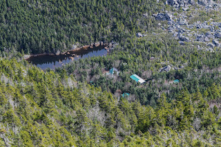
We took our selfie at the true summit and followed the short spur path to the view over Carter Notch, which was really spectacular. Carter Dome dramatically dominated the foreground, with Carter Lake and Carter Notch Hut steeply down below. South Baldface was on display on the right, followed by the Doubleheads and Kearsarge, and the rest of the Carters on the left, followed by Gorham. The valleys had an orange/brown glow to them with a slightly hazy sky in the horizon.
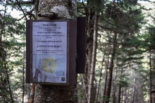
The initial descent to Carter Notch was steep, wet, icy, and dicey. This is the only stretch where we had to take caution due to ice - we both agreed that its nice we got to wait so long before hitting ice! The trail eases, descending moderately past a few landslide tracks - some older than others, and then eventaully enters the Carter Notch Hut Forest Protection Area!
[12:31pm - Carter Notch Forest Protection Area]
The descent continued, and eventually bottomed out. I knew we made it to the notch when I could hear my voice echoing back to me! We were both feeling a little beat up at this point, so we decided we'd take a nice break at the hut, look at the facts, and decide if we're going to hit any extracurricular peaks then.
[12:43pm - 19-Mile Brook Trail]
The view up to Wildcat A from the Carter Lakes was absolutely stunning, and really fun to see in a different season! We meandered around the lakes, and eventually made ito the hut!
[12:55pm - Carter Notch Hut]
We had a nice, long break at the hut. Starting with Sarah taking a passerby's photo for them, then a necessary bathroom break, and after we went inside for food and chats. We chatted about our extracurricular peaks (Carter Dome and Mt. Hight), and ultimately decided to skip them again. We were both tired, and Sarah wasn't sure how her ankle would do descending from that high elevation after all the descent we'd already done. This was a heavy decision for her, as recovering from any injury, especially one where your foot gets literally disconnected from your body, is a long process, but we kept saying that that mountain isn't going anywhere! We joked around some, ate more and more food, and eventually decided to get moving back down to the cars!
[1:51pm - 19-Mile Brook Trail]
Back on the Nineteen-Mile Brook Trail, we skirted between the two Carter Lakes and rose back up to the height-of-land/Wildcat Ridge Trail junction, where a large group was hanging out. We awkwardly scooted past them and started our descent. At first, the trail was pretty rugged and some parts were VERY eroded, but nothing was ridiculous. We crossed paths with a hiker who I've seen on YouTube - Rachel Whelton (https://www.youtube.com/@RachelWhelton)! We did the classic hiker thing of passing each other and saying "hey hows it going," commenting on the weather, etc. and she (Rachel Whelton) said "it's a slow and steady demise" - which had us both cackling (mostly in agreeance).
[2:56pm - 19-Mile Brook/Carter Dome Trails Junction]
Nineteen-Mile Brook Trail crosses a stream on a nice log bridge, descends some more, and then crosses another just before the junction with Carter Dome Trail. From here on out, it was smooth sailing! The large group from the notch passed us (it seemed like they had split into two groups - the ones who were sending it down the mountain and the ones who were enjoying the walk), we caught up with the woman who Sarah chatted with at the hut, and then we made it to the dam in the brook, crossed a big bridge, and entered the Forest Protection Area!
At this point the trail was easy walking and I was BONKED. While this hike was challenging, I was feeling exceptionally exhausted - I think the lack of sleep finally caught up with me, as I've done much harder hikes without feeling as destroyed.
[3:55pm - End of Hike]
To much celebration - we started to hear NH-16, and soon enough were back at the parking lot! Sarah had officially won fart baseball 2-to-1 and we quickly got in her car and zoomed over to Pinkham Notch. I shockingly had a pretty stable drive home - I like to thank the Taco Bell in North Conway for giving me the necessary fuel! This was #43 and #44 for my 48 - just Carter Dome, Isolation, Cannon, and Moriah left!
Step-By-Step
- Drop car at 19 Mile Brook trailhead, drive to Pinkham Notch Visitor Center.
- Start hike by crossing NH-16 and entering the Lost Pond Trail.
- Follow Lost Pond Trail to terminus at Wildcat Ridge Trail.
- Turn left onto Wildcat Ridge Trail, follow all the way to Carter Notch.
- At terminus, turn right onto 19 Mile Brook Trail to Carter Notch Hut.
- Follow 19 Mile Brook Trail from Hut down to NH-16 to complete hike.
"Lost Pond Trail" from White Mountain Guide, 31st Ed. (2022)
AMC This short link trail runs from Pinkham Notch Visitor Center (on the west side of NH 16 near the height-of-land in Pinkham Notch, 11.8 mi. north of the jct. with US 302 in Glen and 10.6 mi. south of the eastern jct. with US 2 in Gorham) to the lower end of Wildcat Ridge Trail, avoiding the often difficult and sometimes dangerous crossing of Ellis River at the beginning of Wildcat Ridge Trail. Lost Pond Trail is part of the AT.
Lost Pond Trail leaves the east side of NH 16 50 yd. south of the entrance to Pinkham Notch Visitor Center (plowed parking in winter), crosses a bridge over Ellis River in an area of beaver activity, and turns south at the end of the bridge, where, at 90 yd., Square Ledge Trail leaves on the left. Lost Pond Trail follows the east bank of Ellis River, which is soon joined from the opposite side by the larger Cutler River. The trail then leaves the riverbank and climbs at a moderate grade to Lost Pond at 0.5 mi. It follows the east shore with good views of Mt. Washington, descends slightly through a rocky area, and ends at Wildcat Ridge Trail.
"Wildcat Ridge Trail" from White Mountain Guide, 31st Ed. (2022)
AMC This trail climbs up to and across the numerous summits of the long ridge of Wildcat Mtn. and then descends to Nineteen-Mile Brook Trail 0.2 mi. north of Carter Notch Hut. Wildcat Ridge Trail officially begins at the Glen Ellis Falls parking lot (WMNF Scenic Area sign; Recreation Pass required; restrooms; not plowed in winter; nearby roadside parking may be available) on NH 16. The entrance to the parking lot is 0.7 mi. south of Pinkham Notch Visitor Center and 8.9 mi. north of the red covered bridge (NH 16A) in Jackson. However, this end of the trail is more commonly reached by following Lost Pond Trail for 0.9 mi. from Pinkham Notch Visitor Center to avoid the often difficult and sometimes dangerous crossing of Ellis River. From the Lost Pond jct. to Carter Notch, Wildcat Ridge Trail is part of the AT. The sections from Lost Pond Trail jct. to E Peak and from A Peak to Carter Notch are very steep and rough, and there are several ups and downs and other steep, rough sections along the rest of the trail that make it more difficult and time-consuming than one might infer from a casual glance at the map or the distance summary. (Caution: The section between NH 16 and E Peak may be dangerous when wet or icy, and hikers with heavy packs should allow substantial extra time.)
Wildcat Ridge Trail starts on the east side of NH 16 oppositre the parking lot for Glen Ellis Falls. From the south end of the parking lot (sign for Glen Ellis Falls Trail and Wildcat Ridge Trail), follow Glen Ellis Falls Trail down stone steps and through a pedestrian underpass beneath the highway. On the far side of the underpass, Wildcat Ridge Trail, briefly blazed in blue, diverges left at a sign. In about 30 yd. it turns right at another sign and crosses Ellis River (may be very difficult) to a third sign. At 0.1 mi., Lost Pond Trail enters on the left, and from here Wildcat Ridge Trail is blazed in white as part of the AT. The trail soon begins the very steep climb up the end of the ridge (use care on all ledge areas). The first pitch, up rock and wooden steps, leads to an outlook across Pinkham Notch. After a tricky traverse and a difficult scramble up a steep rock chimney, Wildcat Ridge Trail crosses a ledge with an excellent view of Mt. Washington. The trail climbs steeply past another view of Mt. Washington and at 0.9 mi. passes a level, open ledge with fine views south. The trail dips slightly, traverses a shoulder, and then resumes the climb. At 1.2 mi., a side path leads left to a spring, and at 1.5 mi., Wildcat Ridge Trail climbs rocks and wooden steps to the top of a steep ledge with a superb view of the great ravines on the east side of Mt. Washington. The trail continues to climb over seveal knobs, passes 3 yd. left of the wooded summit of E Peak at 1.9 mi., and then descends to the summit station of Wildcat Mtn. Ski Resort in the col at 2.1 mi. [...].
From the col, Wildcat Ridge Trail climbs steeply to the summit of D Peak at 2.2 mi. Here, an observation tower offers good although partly restricted views; an easier trail maintained by the ski area parallels this segement to the west. Wildcat Ridge Trail then descends fairly steeply into Wildcat Col, the deepest col on the main ridge, at 2.5 mi. Here, it passes over a small hogback and through a second sag and then begins the climb to C Peak over seveal "steps" - fairly steep climbs interspersed with level sections, with occasional views - to the wooded summit of C Peak at 3.3 mi. The trail makes a significant descent into a col, swings to the north, and climbs to B Peak; then it descends to a shallower col and makes an easy climb to A Peak at 4.2 mi. As Wildcat Ridge Trail turns left near this summit, a spur path leads right 20 yd. to a spectacular view into Carter Notch. The actual summit of Wildcat Mtn. is a rock in the scrub just off the spur path to the right (south) within a few years of this point. The trail now descends by switchbacks, rather steeply at times, with many rock steps, to a sharp right turn. It continues down steeply, passing a spring and then crossing a landslide track (potentially dangerous if icy) that provides a view north. About 0.2 mi. beyond the landslide, Wildcat Ridge Trail meets Ninteen-Mile Brook Trail at the height-of-land in Carter Notch. For Carter Notch Hut, turn right (south) on Nineteen Mile Brook Trail.
"Nineteen-Mile Brook Trail" from White Mountain Guide, 31st Ed. (2022)
AMC This blue-blazed trail runs from a parking area (plowed in winter) on the east side of NH 16, 1.0 mi. north of Mt. Washington Auto Rd. and 2.4 mi. south of the jct. with Pinkham B Rd. (Dolly Copp Rd.), to Carter Notch Hut and is the easiest route to the hut. (The parking area is a stop fro the AMC Hiker Shuttle.) Sections of the trail near the brook bank sometimes become dangerously icy in the cold seasons.
Leaving NH 16, Nineteen-Mile Brook Trail enters the woods to the left of a kiosk on a relocated section and then rejoins the original route at 0.1 mi., following the northeast bank of Nineteen-Mile Brook on the remains of an old road at easy to moderate grades. At 0.7 mi. the trail crosses an open bank above the brook and soon turns left up rock step on another relocation, returning to the old route at 0.9 mi. At 1.1 mi. it crosses a major tributary on a large bridge just downstream from the former crossing.
At 1.2 mi., the trail passes a dam in the brook and becomes somewhat rougher, with minor ups and downs, and at 1.9 mi., Carter Dome Trail diverges left for Zeta Pass. Here, Nineteen-Mile Brook Trail crosses a tributary on a footbridge, and at 2.2 mi., the trail crosses another brook at a small cascade, also on a footbridge. At 3.1 mi., the trail crosses a small brook and begins to ascend more steeply to the height-of-land at 3.6 mi., where Wildcat Ridge Trail diverges right (west). Nineteen-Mile Brook Trail then drops steeply to the larger Carter Lake, passes Carter-Moriah Trail left at 3.8 mi., crosses between the lakes, and reaches Carter Notch Hut and the jct. with Wildcat River Trail 100 yd. from the Carter-Moriah Trail jct.











No comments:
Post a Comment