Buck Hill via HQ, Doe Hollow, Bugbee, Pig Rock, and Summit Trails (Blue Hills Reservation)
Distance: 3.4 miles
Elevation: 403 feet
Time: 1 hour, 30 minutes
Hiking Challenges: 52 Hike Challenge, Blue Hills 125-Mile Club (2x), Sunset Six
The Hike
This hike is filed under the usual category of "I just wanted to go home until I stepped foot in the woods." I had a long afternoon of meetings followed by a long, slow drive to the Blue Hills, and I was simply not having it, but thankfully once I got going I was thrilled to be back! I parked on the side of Chickatawbut Road at the Headquarters Path granite marker (not labeled on the map, but you can kind of tell where it is if you follow the Headquarters Path to where it seems to terminate), awkwardly got suited up as cars flew past me, and then dipped into the woods to start the journey.
It was a gorgeous, almost chilly, fall afternoon, and I knew I wanted to see some views from Buck Hill. I started by following the Headquarters Path back along the road for a little while, and when I hit the wide path, I turned left. I skirted around the base of N. Boyce, and then made a sharp right at 2151, to hike along the Doe Hollow Path, which was easy hiking through some scenic woods. It crosses the Skyline Trail and then coincides with the red-dot route for a bit.
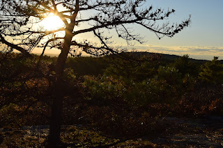
I turned onto the Bugbee Path at 2129 and hiked along "Beech Run," which is a swampy area, but had some beautiful fall colors, and then hit some other trails in the area, making a small speghetti moment, before ultimately hitting the Pig Rock Path and the Buck Hill Summit Trail, which I remembered is one of the most beautiful in the park. It meanders upward and then along a ridgy area with views south, then turns into a recently burned section of forest before crossing the red-dot route. Past that junction, there is a beautiful stretch of unique forest, and then the trail emerges to the "tree line" with beautiful views. The highlight of the view this day was the sun setting next to Big Blue, but also the ocean, Chickatawbut Hill, and the Boston skyline were all beautiful. Monadnock and Wachusett were also visible, but not crystal clear due to some clouds out west. I took some time here to take a million photos and enjoy the moment.
To close out the loop, I continued along the Buck Hill Summit Trail, which zigzags down the north side of the hill through beautiful, changing woods. There is one great view of Boston near the top, and the rest is wooded. This would be a very gentle way to ascend Buck Hill, for people who don't hike as often but still want the good good views. As the sun set, the woods began to darken, and I may have spooked myself at one point, but we survived and made it home in one piece!
Step-By-Step
- Park on the side of Chickatawbut Road at Headquarters Path granite marker (unmarked on map).
- Enter woods, and turn right to hike on Headquarters Path.
- Turn left onto wide path toward 2130.
- Continue toward 2151.
- At 2151, turn right onto Doe Hollow Path and follow to 2129.
- Turn left onto Bugbee Path at 2129.
- Turn left at 2140.
- Turn right at 2149.
- Turn right at 2154.
- Turn left onto Bugbee Path.
- Sharp left at 2172 onto Pig Rock Path.
- Back at 2154, turn right onto Buck Hill Summit Trail.
- Summit Buck Hill.
- Descend all the way to car via Buck Hill Summit Trail.


No comments:
Post a Comment