West Mountain Shelter via 177W & Timp Torne (Bear Mountain State Park)
Hike Type: Loop
Distance: 5.82 miles
Elevation: 1,178 feet
Time: 2 hours, 43 minutes (2 hours, 38 minutes moving)
Hiking Challenges: 52 Hike Challenge; Harriman Shelter Challenge; Bear Mountain Trail Challenge
Hiking Challenges: 52 Hike Challenge; Harriman Shelter Challenge; Bear Mountain Trail Challenge
The Hike
Finally, a weekend down in New Jersey to see the family (or apparently just Mom) and not skiing up north! To stay on theme, I hoped to ski Shawnee Mountain in PA while my mom was at a baby shower, but apparently they have blacked out Saturdays even into March! Boo! Instead of skiing, I decdied I'd head back up to Harriman/Bear Mountain for a hike and to knock off another shelter. I was up around 7am and was out the door around 8am. I was shocked and nervous at the crowds I saw at some of the more popular trailheads along the Seven Lakes Drive, but I was delighted to see that my parking area only had two other cars. It was 42 degrees with overcast skies. It smelled and felt like spring, and it was my first hike in shorts of 2025!

"The Historic 1777 & 1779 Trails" from Trailhead Kiosk
You are walking part of the 1777 historic trail that retraces as nearly as possible the routes taken by the British army during the Revolutionary War.
The 1777 trail represents the route taken by British General Sir Henry Clinton's forces on October 6, 1777. After landing 2,100 men at Stony Point, he marched north to capture Forts Clinton and Montgomery. At Doodletown, the trail splits. The east branch of the trail follows the march of the forces under Sir Henry Clinton and Major General John Vaughn that captured Fort Clinton. The west branch follows the route of Lieutenant Colonel Mungo Campbell's force, which captured Fort Montgomery
The 1779 trail trace the route taken by Brigadier General Anthony Wayne's Corps of Light Infantry in its assault on the British fortifications at Stony Point just after midnight on July 16, 1779. After a brief but fierce fight, Wayne's men captured Stony Point, achieving one of the Continental Army's most spectacular victories.


My fleece came off at the junction with Timp-Torne Trail, which was right near the main road. Now following blue balzes, the Timp-Torne Trail felt more recently traveled with medium-new blazes. The sun was beginning to poke out and I was very glad that I was wearing shorts, as my heart was pumping! There were nice tree views over to Bear Mountain as the trail followed a spine of West Mountain - the terrain felt very similar to Norvin Green State Forest, a favorite of mine.

After the view, the trail climbed more moderately to steeply to another overlook that I chose to not fully investigate, as it was super icy and I didn't plan to fall off of a mountain on this day. There was a small bypass-able scramble followed by a trickier scramble. I crossed paths with a human for the first time! He warned me that I'd need microspikes ahead... sigh... okay. Thankfully, it was so delightfully warm out, I felt great!
From the height-of-land after the scramble, there was a great view down to the Anythony Wayne Recreation Area and the Long Mountain Traffic Circle. The trail then descended, with the blazed route and an "EZ" route. Both stretches were short. I descended the "EZ" way, came back up the blazed, and descended "EZ" again. The blazed way was fun! A narrow squeeze followed by a mini-chimney.

Climbing again, I could see a group of teenage boys ascending, so I picked up the pace to hopefully avoid any social interactions. I was successful, but definitely hit the gas a little too hard, because I was FIGHTING for air at the top of the climb, also while rock-hopping around snow. The Appalachian Trail left the Timp-Torne at this point, and signs indicated the shelter was further down Timp-Torne. I put spikes on here for a short bit and enjoyed a great view of Bear Mountain and a peek at the Hudson River.

The trail turned onto a sunny ledge overlooking the other side now, and my spikes came back off. I was starting to worry about sunburn! I scrambled into a sag and then another lovely ledge. There was evidence of old AT blazes on the trees, now scraped off, too. Ascending again, I hit another icy patch that was not easily bypass-able, but I did it, and passed a few more views in both directions. Bear Mountain was looking exceptional on the left, and I'm pretty sure I could see Jackie Jones on the right. I was starting to flirt with heading to Bear Mountain after I descended West Mountain, but wasn't sure if I brought enough water... Time will tell.

The Suffern-Bear Mountain Trail joined the Timp-Torne Trail for a little bit, rambling on a plateau ridge with minor ups and downs. My tummy was actually behaving excellently on this hike, until a few scary flatulence emissions, but they qucikly subsided. The Suffern-Bear Mountain Trail left the Timp-Torne Trail, which continued forward just a bit further to the shelter! Unfortunately, there was a group of about 20 people at the shelter taking up all the space (and the view!). I did a quick lap, snapped a quick photo, and quickly got back on my way. I was briefly followed by someone's off-leash chihuahua, but eventually they got their dog.


Back at the Suffern-Bear Mountain/Timp-Torne Trail junction, I turned right and started my descent on Suffern-Bear Mountain Trail. The trail was beautiful, wandering around a grassy plateau, followed by an icy descent that I did not descend gracefully. My spikes went on for the next bit, as the ice continued, and as I scraped my legs on some firm vegatation. The trail then got steeper and sketchier, solidifying my choice to put spikes back on.

I followed some deer tracks as the variable trail conditions tortured my Kahtoolas, but I reminded myself that this is why I have a pair of rock spikes. I did take them off briefly, but had to immediately put them back on. The trail then ascends to a knob, which was bare, so spikes off, and just when I motioned to fully put them away, they had to go back on again for the longer descent. Comically, the song "I Hate This Part" by the Pussycat Dolls was stuck in my head.


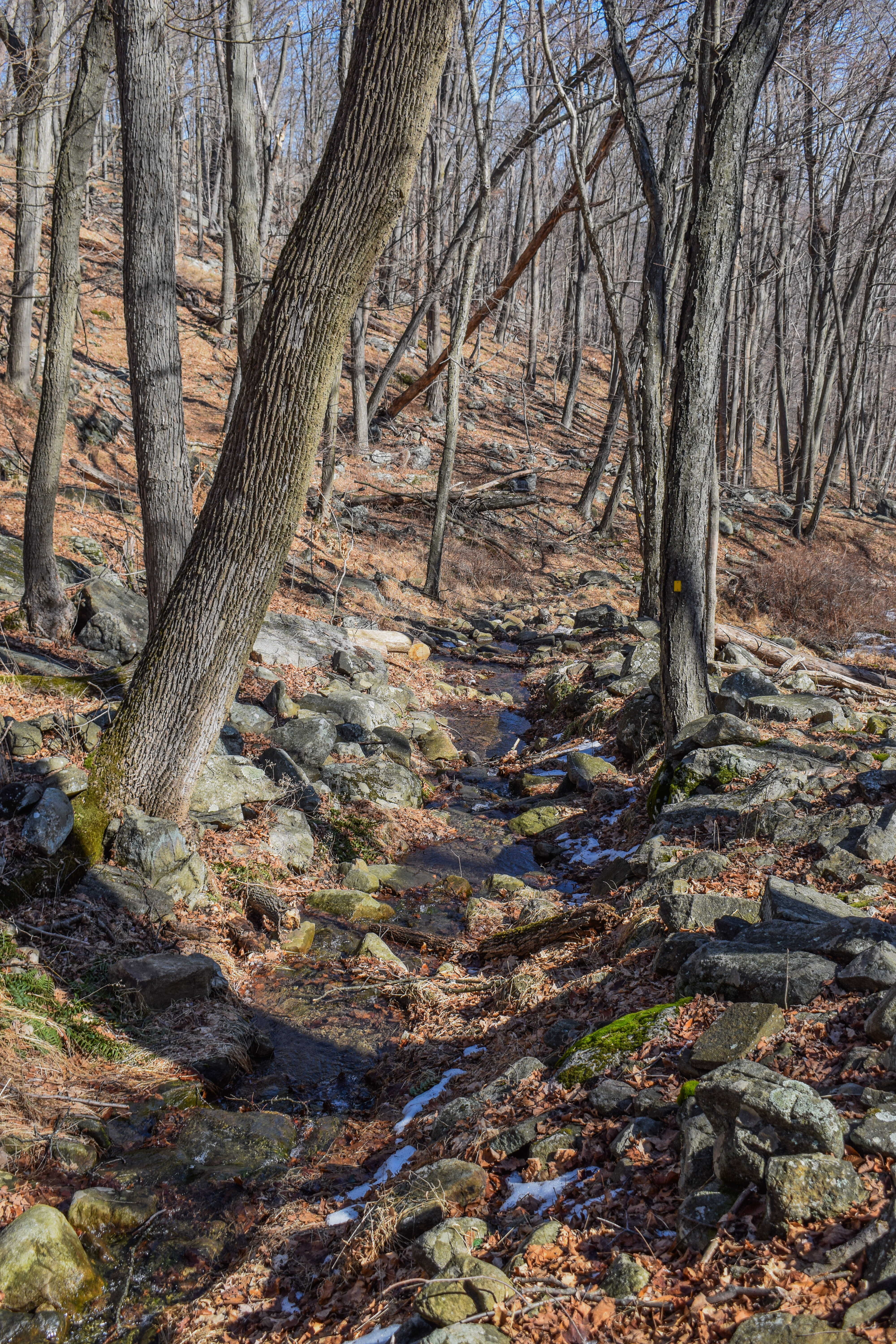
The Suffern-Bear Mountain Trail joined a road grade and got VERY squishy, but then left the road grade at the Fawn Trail junction. The trail descended into a mountain laurel grove (I still need to learn the difference between mountain laurel and rhododendron), crossed another stream which required 5% brain power, and then came to 1777W! There were some old "trail closed" signs stashed away.

1777W came to an old sign with a #5 on it, and then joined the Appalachian Trail. After rising a little, the trail hit another brutal stretch of ice, snow, and slush, but I REFUSED to put spikes back on. The Appalachian Trail then left 1777W, and I returned to the parking lot!

This was a fantastic hike and I would 100% recommend it... once all the trails are open! For someone who wanted to prioritize hiking conditions, I'd recommend going clockwise (not what I did) to get the Suffern-Bear Mountain stretch over with early, but for someone who wanted to prioritize crescendoing views, I'd recommend my route. First views were peeks through trees, and the best views were at the end before the descent. To my surprise and delight, the lot was also basically full when I left! I had a tough time getting home at first, accidentally getting on the Palisades Interstate Parkway, turning around at Anthony Wayne, and then taking the wrong exit at the rotary, but I eventually made it home, showered, and got a SOLID nap in before mom got home from the baby shower. Back to New England tomorrow!
Step-by-Step
- Park at 1777W Trail parking off of Seven Lakes Drive.
- Start hike westbound on 1777W.
- At jct., turn left onto blue-blazed Timp-Torne Trail.
- Appalachian Trail joins Timp-Torne Trail, continue.
- Appalachian Trail leaves Timp-Torne Trail.
- Suffern-Bear Mountain Trail joins Timp-Torne Trail.
- Suffern-Bear Mountain Trail leaves Timp-Torne Trail.
- Arrive at West Mountain Shelter, then turn around.
- Follow Suffern-Bear Mountain Trail left, begin descent.
- At jct., turn left onto 1777W.
- Return to car.

"1777W Trail to Fort Montgomery" from Harriman Trails, 4th Ed. (2018)
[...]. At 0.5 mile, an intersection with the Suffern-Bear Mountain Trail (yellow) and Doodletown Road is reached. Here, 1777W turns left onto Doodletown Road, which it follows gently uphill towards the Seven Lakes Drive. At 1.05 miles, just before 1777W reaches the Seven Lakes Drive, it turns left, joining the Appalachian Trail (AT), which comes in from the right. Both trails climb the hillside on a footpath. At 1.2 miles, the AT departs to the left, while 1777W continues ahead, soon passing a parking area. The trail continues to run roughly parallel to the Seven Lakes Drive until, at 1.95 miles, it joins the Timp-Torne Trail (blue), and both cross the Palisades Interstate Parkway on an overpass. [...].
"Timp-Torne Trail" from Harriman Trails, 4th Ed. (2018)
[...]. After cross the Palisades Interstate Parkway on an overpass, 1777W departs to the left, while T-T goes up a bank to start the climb up West Mountain. 0.2 mile from the Parkway, the Anthony Wayne Trail (white) starts on the right. After climbing a small knob, with a good view, T-T crosses the Fawn Trail (red F on white). T-T now climbs more steeply, with more views along the way, to a junction with the Appalachian Trail (AT) at 5.4 miles.
Shortly after the junction with the AT, the trail arrives at a viewpoint over Bear Mountain and the Hudson River. T-T/AT then crosses to the west side of West Mountain, where there is an excellent view of Beechy Bottom and the Anthony Wayne Recreation Area. For the next 0.65 mile, the join trails run along the ridge, with a number of additional viewpoints. T-T then turns left as the AT continues straight ahead and begins its descent (that was the original "western leg" of T-T). At 6.3 miles, the Suffern-Bear Mountain Trail (S-BM) (yellow) comes in from the right and runs jointly with T-T for 0.3 mile. S-BM then departs to the left. At 6.7 miles, the trail passes the West Mountain Shelter. This shelter was built in 1928, with burros being used to carry up the lumber and cement. [...].
"Suffern-Bear Mountain Trail" from Harriman Trails, 4th Ed. (2018)
[...]. On the crest of West Mountain, the Timp-Torne Trail (T-T) (blue) joins for 0.3 mile. T-T then departs right to the West Mountain Shelter, while S-BM goes northwest to a knob, with views of the Perkins Memorial Tower on Bear Mountain. A rocky descent, soon followed by a steep ascent, leads to anothe rknob, a high point of West Mountain. From here, S-BM goes steeply down and continues to descend along an old woods road, following the gully of the Doodlekill. After crossing the brook, S-BM turns left onto the Doodletown Bridle Path at 21.5 miles, and both run together for 0.15 mile. S-BM then goes right, leaving the Bridle Path (the Fawn Trail, which begins here, continues ahead on the Bridle Path). S-BM goes over a low ridge, crosses two branches of a brook an dgoes up a bank to rejoin the Bridle Path at the old Doodletown Road. The 1777W Trail crosses here.
No comments:
Post a Comment