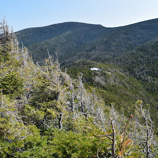
Sunday, May 28, 2023

Galehead, South Twin, & North Twin (White Mountain National Forest)

Galehead, South Twin, & North Twin (White Mountain National Forest)

Hike Type: Out-and-Back
Distance: 14.88 miles
Elevation: 4,577 feet
Time: 11 hours, 1 minute (9 hours, 33 minutes moving)
Hiking Challenges: New Hampshire 4000 Footers


The Hike
Time for my first 4000-footer of the year! I had recently reconnected with a great friend from college and we started chatting about hiking, and then about hiking in New Hampshire, and then about the 4000-footers, and then we set a date to tackle some! She requested we do views, and I still needed the Twins, so we landed on Galehead and the Twins for our hike. My 2:15am alarm went off (ouch) after a night out in the North End (ouch) and I started my drive up to meet her about an hour north. I picked her up, continued onto the Mecca (Hooksett), where I not only christened the bathroom, but they actually had breakfast sandwiches out! I guess it's truly random when they will be available, because at this point it was 4:30am and they were fully stocked, but other times I've been there at the same time and there's been nothing. Who knows! Our drive continued on, the sun began to rise, the mountains grew closer, we stopped to christen the Lincoln Dunkin Donuts' bathroom (this was going to be a theme for me today), and I did not crash my car gawking at the alpenglow while driving through Franconia Notch. Finally, we made it off of I-93 and found Gale River Loop Road and the trailhead. We spent a good amount of time slowly getting ready for our long day, and by 6:00am we were ready to go!


The first long chunk of our hike was along the scenic Gale River Trail, which coincidentally follows the North Branch of the Gale River, which is audible for most of the trail's length. There were two gentle stream crossings early on, both of which were easily rock-hoppable. The trail was very easily graded for the first few miles, passing through newly green forests and many wildflowers (I loved seeing the Trillium!). The trickiest crossing was across the Garfield Stream, but thankfully for us tricky was not difficult at all. I made the classic joke "whoever falls in buys ice cream after," which actually wasn't a joke... but no one fell in so we didn't have to worry about that. We could see the outline of what we thought was one of our mountains through the trees at the crossing, but silly us didn't realize how wrong we were! It was a low shoulder off the ridge of N. Twin, well over a thousand feet below the summit, and at least a thousand feet above us. Spirits were high, and we continued on!


The trail slowly increased to a moderate grade at points, crossing over many streams and occasional footbridges, eventually opening up to a view along the river caused by an old slide, with a slight view up to the ridge of the Twins HIGH up ahead. The trail began to climb more steeply after this, with occasional "peek-a-boo" views toward the ridge of the Twins. We noticed that there was one mountain with cliffs reflecting brightly in the sun. We thought this may have been North Twin, but we would later find out how terribly wrong we were when we saw the same cliffs from the summit of North Twin, MUCH higher up than the cliffs (after reading the chapter on the Twins in The 4000-Footers of the White Mountains, A Guide and History, 2nd Edition, I learned this was a part of the ridge of North Twin, just a low part, described as having "buttresses").


The Gale River Trail terminates at a junction with the Garfield Ridge Trail (Appalachian Trail), and we turned left toward the Galehead Hut. The Garfield Ridge Trail here was similar to the upper stretches of the Gale River Trail, steep and rocky with occasional "peek-a-boo" views. We knew we were getting close when we started crossing paths with folks descending after their breakfast at the nearby hut. We only followed the white blazes for 0.6-miles, where the trail terminates at the Galehead Hut. 


We were immediately greeted by a magnificent view up to South Twin, the Twin Brook Valley, the further reaches of the Pemigewasset Wilderness, Owl's Head, and the summit hump of Galehead. The evergreen covered peaks were a dark green, while the trees down in the valley were almost a lime green, with their early spring leaves. There were a few Grey Jays flying about asking to be fed, and I had to pause my enjoyment to run to the bathroom. The hut bathrooms are truly the most luxurious things in the world. I'm almost five miles from the nearest road, on the boundary of the federal Wilderness Area, surrounded by some of the highest mountains in New England, and I get to use the bathroom on a toilet with running water? Absolutely incredible. 


Following my christening of the hut (that's three for those keeping track at home), we filled up water, enjoyed the view, had a quick snack, and then started our way up to Galehead Mountain on the Frost Trail (named for the couple that built the trail). The trail started with a bouldery, scrambly descent, followed by a steep ascend, and then a final moderate climb. I caught myself having some choice words to say about the steep ascent, but thankfully it was short. We passed the overlook so we could summit first, and then we found the magnificent summit area - entirely wooded, maybe 10 feet in diameter, with a cairn to mark the mundane accomplishment. Peak #1 - complete!


We met Cassie at the summit, where we took turns taking each other's photos. Now retracing our steps, we made it back to the outlook, where we met Cassie, and we took turns taking each other's photos, again! She was really kind - her hiking dog had passed away recently so now she takes photos with her dog's leash on every peak she does without her. Sarah and I were trying to contain our emotions during that story! The view from the outlook was fantastic. Similar to that from the hut, but this view really showcases how massive South Twin and its south ridge are. We could also see North Twin off on the left and the Galehead Hut, which is always fun.


The trip back down the Frost Trail was quick, with an occasional "peek-a-boo" view of South Twin taunting us. Back at the hut, to no surprise, I christened the bathroom (4) and we took another break. This was supposed to be a short break, but I broke out my zoom lens to take some photos of the birds, which naturally delayed things. Those Gray Jays are feisty! I also saw a white-throated sparrow, which had really pretty gold feathers around its eyes. Once I was done procrastinating, we got our packs on, sighed at South Twin looming over us, and started what was expected to be (and was) the toughest part of our hike.


The Appalachian Trail continues now on the Twinway, which initially descends before reaching a snowy/muddy col, and then steeply climbs almost 1,000 feet in 0.8 miles. The trail was steep, but straightforward, with only a few scrambles and one slippery spot due to spring runoff. There were occasional patches of ice that was easily avoidable, and one patch of snow near the top that was no problem. We took it very slow, and made it to the top without too much anguish! It helped that there were views back toward Galehead, Garfield, and Franconia Ridge popping up throughout this slog. Our energies started to pick back up when the trees started krummholzing (my word for getting smaller) and the world started to open up around us - WOW. In one direction is Galehead, Garfield, Franconia Ridge, and Owl's Head. In another is the Bonds. In another is North Twin. And all this is just from the trail - we're not even at the top yet! I had to remind myself that I cannot go faster because I will pass away, but I was so excited!


The final push brought us to a great summit with two "areas" for enjoying and relaxing. The "main area" has the trail signs and all of the people. And then no more than 20 feet further, technically along the North Twin Spur (I think), is the second which is at essentially equal height. The 360-degree views were absolutely incredible, with a gentle haze in the air from humidity or wild fires or who knows what. The traces of leftover snow on the higher peaks were shining in the sun, and I was just mesmerized. Most impressive was how small some of the 4000-footers looked. Specifically, Owl's Head, Hale, and Galehead. We ran back into Cassie, who got right to business saying "Hey again let's take some pictures!" We learned that she was one day two of a two-day Pemi Loop, and did didn't tell her mom she was doing this until she was too deep to quit! We planned to take a long break up here after we hit North Twin, so we gathered our brains and continued on!


The North Twin Spur started out above treeline with great views towards the Presidentials, and then dipped back into the trees, which were very grown-in and tickled and scratched us the whole time. This was paired with occasional patches of snow/ice, and deep pockets of mud - fun! We did acknowledge that this was the first time we dealt with less than ideal trail conditions, so we took our win and slogged on. Once back in the forest cover, we were dealt with our next challenge - snow! And lots of it! There were some trace of monorail, but it was mostly 0-30" of snow, which was either firm, soft, icy, or soaking wet. Really made for some slow going and interesting moments of post-holing. We had our spikes, but nothing was slippery enough to warrant them. 


We finally survived the first half of the North Twin Trail when we hit the col, which had a nice obstructed view toward Washington through a very damaged area. The climb up to North Twin was much less interesting, with only one scrambly section, all of which was snow-free! The North Twin Spur terminates at a large cairn, and the true summit is a small cairn on the outlook spur. The cairn is underwhelming, but the view from the outlook is incredible! The main event is the monstrous South Twin, which connects to Galehead via a long, steep ridge, that we somehow climbed? Behind that is Owl's Head, with Flume and Liberty further back. 


The views continue from Galehead all the way to Lafayette where you can see how ridiculous the Garfield Ridge Trail is, and the tippity top of Cannon was peaking out too. The surrounding mountains faded out into the hazy horizon, but wow. We spent a good 15-20 minutes here, admiring the couple that brought one of those inflatable sofa-sacks with them. That's luxury!


We told ourselves we're getting a long break on South Twin, so we packed up once more and made the trek back, which was much easier. We survived with zero post holing, probably thanks to gravity no longer working against us. Once we were back being tickled by the trees, we were greeted with the summit cone of South Twin laughing once again at us, but we were eager enough to get back up we pushed on. Back up top, we found a spot to sit, take our shoes off, and stare into the beautiful void that is the White Mountains. At one point, I caught myself thinking "wow, that slide looks like a dancing crab" - I stand by that thought (turns out this was Zealand Mountain). I also admired the "fir waves" along the North Twin ridge - it almost looked like Elsa from Frozen did a bit of "Let it Go" over the ridge.


After at least a half hour it was officially time to work our way back down. Our trip down Twinway was still slow, but not nearly as bad as I had thought it would be. While writing this, I'm sure part of it was just taking it slow, but I'm also sure part of it is all the hiking that I'm doing actually paying off, plus having great company to pass the time. I'm really happy with myself for once! ... anyway tangent over - we passed a few coming up, one of which was someone I follow on YouTube - ChrisGoesOutdoors. Just like Floki, I was too starstruck to introduce myself, but how cool! I'm eagerly waiting for his video to drop.


I christened the hut... again (5) before we started our final slog descent down, which definitely felt long, but everything feels long when your final mileage reaches its teenage years. We passed a bunch of folks on the Garfield Ridge Trail, presumably camping somewhere for the night, before turning onto the Gale River Trail, where we didn't see a single soul. As with most return trips, this one was rather uneventful. Sarah and I hit the two extremes of hiking conversations - religion, and hiking in absolute silence, both of which are great options! I cannot stress how grateful I am to have reconnected with her and to now have another hiking buddy! The only challenge we had in this final stretch were our tired ankles, we both managed to impressively roll them three times each, thankfully to no sustaining injuries!


We did our final stream crossings before giving our faces and bodies a good rinse in the final one - it was incredibly how much salt I had running down my face. The cold water truly felt incredible and gave me the much needed push to get back to the car, which thankfully wasn't too far away! We spent a little bit of time changing and stretching before getting in the air conditioning (it was in the upper 80s at the trailhead - thankfully the weather up top was beautiful) and driving to the Woodstock Inn for some hefty burgers. I was home by 9:15pm, and slept like a literal boulder.

Step-By-Step
- Park at Gale River Trail parking area.
- Start hike on blue-blazed (scarcely) Gale River Trail.
- At terminus, turn right onto white-blazed Garfield Ridge Trail.
- At terminus, veer right/straight onto Frost Trail.
- Enjoy the Galehead Hut, then continue onto Frost Trail to Galehead Summit.
- Retrace steps to Hut and then Garfield Ridge Trail terminus.
- At junction, turn right onto white-blazed Twinway.
- Slowly follow Twinway straight up to summit of South Twin.
- From summit, turn left onto blue-blazed North Twin Spur.
- At terminus, turn left onto "Outlook" spur.
- Enjoy views from North Twin.
- Retrace steps all the way back to the car.


"Gale River Trail" from White Mountain Guide, 31st Ed. (2022)
    This blue-blazed trail runs from the gravel-surfaced Gale River Loop Rd (FR 92) to Garfield Ridge Trail 0.6 mi. west of Galehead Hut. The trailhead is reached by leaving US 3 at its intersection with Trudeau Rd; this intersection, sometimes called Five Corners, is 5.3 mi. west of the stoplight in Twin Mountain and 4.4 mi. east of the jct. of US 3 and NH 141. Watch for signs for Trudeau Rd. and Gale River Trail. Follow FR 25 southeast, bearing left at 0.6 mi., and then turn sharply right at 1.3 mi. on FR 92 and continue to the parking area on the left at 1.6 mi. (Straight ahead on the road, it is 1.6 mi. to the Garfield Trail parking lot.) The parking area is a stop for the AMC Hiker Shuttle. FR 25 and FR 92 are not open to public vehicular use in winter; plowed parking is available on the northwest side of the Five Corners intersection. Gale River Trail lies within the watershed of a municipal water supply, and hikers and campers should take care not to pollute any of the streams in the watershed.
    From the parking area, Gale River Trail enters the woods, and in 40 yd, a path from the AMC Hiker Shuttle stop joins from the left. At 0.2 mi., the trail descends a bank and crosses a tributary brook; then it turns right on an old logging road that climbs easily along the west side of the North Branch of Gale River, some distance away from the water. At 1.4 mi., the trail comes near the edge of the North Branch, and 1.7 mi., it turns sharply right onto a relocated section, muddy in places and more than 1 mi. long, that was constructed in 2011 to bypass two difficult crossings of the North Branch. Gale River Trail swings right, then left, up a bank and swings left again as it heads south up the valley, high above the North Branch, at easy to moderate grades. At 2.2 mi., the trail descends slightly to cross Garfield Stream, a tributary of the North Branch (may be difficult in high water), and then continues to climb through fine woods. The trail then swings left and descends gradually to rejoin the original route of the trail at 2.8 mi. (In the reverse direction, bear left and uphill on the relocated section.) After crossing several small brooks and passing the gravel outwash of an overgrown slide, Gale River Trail emerges at 3.2 mi. on a gravel bank above the stream at the base of a slide, offering views down to the North Branch and up to the high ridges of the Twins. The trail becomes significantly steeper and rougher and ends with a fairly steep climb, with many rock steps, to Garfield Ridge Trail.

"Garfield Ridge Trail" from White Mountain Guide, 31st Ed. (2022)
    [...]. Garfield Ridge Trail contours around the steep slope of Galehead Mtn., passing a restricted outlook north at 6.3 mi., and then turns right and climbs to a jct. with Twinway and Frost Trail 40 yd. from Galehead Hut. Turn right on Frost Trail for the hut.

"Frost Trail" from White Mountain Guide, 31st Ed. (2022)
    This short trail heads from the jct. of Garfield Ridge Trail and Twinway to Galehead Hut and the summit of Galehead Mtn. From the jct., Frost Trail leads 40 yd. south to the clearing in front of Galehead Hut. Leaving the hut clearing, the trail descends southwest into a sag and then turns sharply right at a jct. where Twin Brook Trail enters left. After a short distance, Frost Trail ascends a steep pitch, at the top of which a side path leads left 30 yd. to an excellent outlook over the Twin Brook valley. Frost Trail continues at a moderate grade to the rather flat and viewless summit.

"Twinway" from White Mountain Guide, 31st Ed. (2022)
    This trail extends from a jct. with Garfield Ridge Trail and Frost Trail by Galehead Hut to a jct. with Zealand Trail and Ethan Pond Trail 0.2 mi. beyond Zealand Falls Hut, forming an important ridge crest link along the north edge of the Pemigewasset Wilderness that connects the  mountains of the western part of the region - the Franconia Ridge, Mt. Garfield, and the Twins - to the Bonds, the Zealand-Hale region, the Willey Range, and the northern parts of the Pemigewasset Wilderness. Twinway offers magnificent views from the summits of South Twin Mtn. and Mt. Guyot and from the outlook at Zeacliff. Connecting trails lead to a number of other superb outlooks. For its entire length, Twinway is part of the white-blazed AT.
    The following description is in the eastbound direction (from Galehead Hut to Zealand Falls Hut). Distances, elevation gains, and times are also given for the reverse direction. From the jct. of Frost and Garfield Ridge tarils 40 yd. from Galehead Hut, Twinway leads east, passing over a ledgy hump and descending to a sag. It then climbs steadily and steeply on a rocky footway up the cone of South Twin, emerging from the scrub near the top, to the south knob of the open summit at 0.8 mi. North Twin Spur begins here, running straight ahead 40 yd. to the north knob and then on to North Twin. [...].

"North Twin Spur" from White Mountain Guide, 31st Ed. (2022)
    This blue-blazed trail connects Twinway on the bare summit of South Twin with North Twin Trail near the summit of North Twin. North Twin Spur leaves Twinway at the south knob of South Twin, crosses the north knob in 40 yd., traverses an open shoulder, and then descends moderately to the fern-filled col at 0.8 mi. From here, North Twin Spur ascends moderately, with occasional views, to the summit of North Twin, where North Twin Trail continues straight ahead. A spur path (sign: "Outlook") leads left 60 yd. over the wooded true summit (small cairn) to a fine outlook from the western edge of the summit area.

Monday, May 22, 2023

Chickatawbut Hill & Eastern Trails (Blue Hills Reservation)

Chickatawbut Hill & Eastern Trails (Blue Hills Reservation)

Hike Type: Loopty Loop
Distance: 8.76 miles
Elevation: 1,093 feet
Time: 3 hours, 9 minutes
Hiking Challenges: Blue Hills 125-Mile Challenge (2x)


The Hike
This hike is brought to you by a disgusting, homophobic, transphobic email by a parent that I led me to either 1) exercizing the rage away or 2) taking up a new career path similar to Beatrix Kiddo. Thankfully, it worked! I had a handful of trails to wrap up the Chickatawbut Hill area, and I thought I finihsed after this one, only to find I missed about 50 feet near the tower, which is OKAY. ITS OKAY. This didn't help my rage, but it's okay. 


Anyway, I made my way to the Blue Hills Reservoir to start my hike by following the path around. I was greeted by a few barn swallows, with their beautiful blue/orange plumage, gathering twigs for their nests, and a Great Carmorant, which was fun to see! The carmorant had its wings wide while swimming around, and I was glad I finally started bringing my zoom lens. The penninsula was getting very overgrown, but was still passable. 


After I finished my loop, it was time to dip into the woods. First mission: Ridge Path to Squamaug Notch Path to Endicott Path. The flagging along the Endicott Path has truly saved the day - there is a solid footbed how and its significantly clearer than it has been. The trip up Nahanton Hill was nice - I realized I have only ever gone this way on the Skyline Trail once or twice, so it was a nice change of pace. I wiggled around the Stowe Path, and then descended via the slide notch path, which had a lovely stream following the drainage off to the side. 


Once down on the Braintree Pass Path I looped around all the way to the Stokes Foot Path, which I'm still a big fan of! Less-trodden and more rugged than usual - it's fun! I followed Stokes to its terminus up on the Skyline Trail just below Chickatawbut Hill, and then did a Traverse from Chickatawbut Hill to Chickatawbut Road, which is truly a lovely stretch! Nothing too challenging, and plenty of nice views. There are some lovely green patches growing in through last season's burn in the Fenno Hill area. I particularly enjoy the view from the final broken hill - it's like a last hurrah! The view itself isn't spectacular, but its just a nice spot after a fun scramble.


Once I hit Chickatawbut Road, I follwed the unmapped Pocapawmet Path to Wampatuck Road and then a LOT of wiggling to hit all the trails in this area. There was a very fragrant unfamiliar smell on the Curve Path, and when I made my way to the Romari Path I realized that it was from the industrial area and it was actually fumes. I really dislike this area, one for the fumes, but also now close it gets to the industrial area (I believe "Consildated Precision Products" - from Google Maps).

"Consolidated Precision Products (CPP) manufactures highly complex components for the commercial aerospace market including engine housings, gear boxes, front frames, shrouds, panels, fairings, blades and vanes. Consolidated Precision Products (CPP) manufactures multiple components for the defense market including engine housings, gear boxes, front frames, shrouds, panels, fairings, missile bodies and various other structural components to support munitions. Consolidated Precision Products (CPP) manufactures multiple components for the industrial gas turbine market in support of both oil exploration and power generation. Parts include vanes, blades, shrouds and diffuser casings." from https://www.cppcorp.com/. 

I realized I would be doing more miles than origianlly planned... whoops... I also ran out of water... oops! The good thing about the Blue Hills is that you're never too far from civilization, so even if I start to cramp it's not like I'm deep in a wilderness. I'm curious about the history of Wood Path - there was a bug catcher (maybe?) and a lot of stone piles - maybe this was planned to become a paved road? Not sure. 


When my wiggling was finished I hiked back up Squamaug Notch and enjoyed an early golden hour through the Canadian Wildfire smoke, which turned the sun into a dark orange orb in the sky - a really unique view. I made my way home, and got into bed just in time to wake up early the next morning!


Step-By-Step
- Park at Blue Hills Reservoir.
- Start hike around Blue Hills Reservoir clockwise.
- Back at car, turn left onto Chickatawbut Road.
- Turn left into woods at Ridge Path.
- At 3131, turn left onto Squamaug Notch Path.
- At pink flag tape, turn right onto Endicott Path.
- At 3132, turn right onto Skyline Trail.
- Follow Skyline Trail until Sassaman Notch Path, then veer right onto Sassaman Notch Path.
- At Thayer Path, turn around. 
- At next junction, hike all three forks of Stowe Path.
- Turn right onto Slide Notch Path.
- At 3073, turn right onto Braintree Pass Path.
- Before 3022, turn right onto Stokes Foot Path.
- At terminus, turn left onto Skyline Trail.
- Follow Skyline Trail to Chickatawbut Road.
- At Chickatawbut Road, turn right onto Pocapawmet Path (not on map).
- At terminus, turn left onto Wampatuck Path.
- At 3177, turn around.
- At 3153, turn left onto Curve Path.
- At 3135, turn around. 
- At 3160, turn left onto Squamaug Path.
- At 3163, turn left onto Romari Path.
- At 3174, turn right onto Wood Path.
- At road, turn around.
- At 3157, turn left onto Wampatuck Path.
- At 3152, turn left onto Bouncing Brook Path.
- At 3163, turn left onto Squamaug Notch Path.
- At 3131, turn right onto Ridge Path, return to car.


Sunday, May 21, 2023

Chickatawbut, Savoy, Glover (Blue Hills Reservation)

Chickatawbut, Savoy, Glover (Blue Hills Reservation)

Hike Type: Loopty Loop
Distance: 4.43 miles
Elevation: 696 feet
Time: 1 hour, 48 minutes
Hiking Challenges: Blue Hills 125-Mile Challenge (2x)

The view off of Hawk Hill Path.

The Hike
I was very grateful that I did not and slip and fall off of Mt. Monadnock yesterday, and somehow I still had energy/motivation to hit the Blue Hills! This was a medium realxing, low-brain hike (because my brain was literally mush). I got to my most popular trailhead as of recent, Braintree Pass Path, and got right into the woods! I followed the unnamed power cut up to the Thayer Path, and I couldn't help but realize how stinky my pack was from yesterday's hike. Aside from that, I was feeling good!

There was a lovely breeze and relatively cool air, which kept the bugs at bay. The meadow-y section on Thayer was still wet from yesterday's rain, which resulted in VERY wet ankles which was less than lovely. I did appreciate the smell of wet woods, though. I made my way around Chickatawbut Hill and descended via the Carve Path, and then worked my way over to the Hawk Hill area via the Bouncing Brook Path. 

Next I had to do that weird loop with the Savoy Path, which was a little mindless, but okay. I noticed someone picked up the litter at the Savoy Path trailhead and left it on the old wall, which I guess is good. I saw a slug heading up Savoy, and then did the loop to do it all again! My return trip was via the Glover Path and the Braintree Pass Path, both of which were lovely, uneventful walks.


Step-By-Step
- Park at Braintree Pass Path parking area.
- Start hike along Braintree Pass Path, but immediately turn left onto Headquarters Path.
- At road, turn around, and turn left to hike up unnamed path up to water tower.
- At water tower, merge with Thayer Path, continue to climb Chickatawbut Hill. 
- Merge onto Skyline Trail, circling the summit of Chickatawbut Hill.
- At 3065, descend via Carve Path.
- At 3051, turn right onto Braintree Pass Path/Bouncing Brook Path.
- Veer left onto Bouncing Brook Path.
- Turn left onto Skyline Trail.
- At 3011, turn right onto Pipe Line. 
- At 3013, turn around.
- At 3011, turn right and hike to road.
- At MA-28, turn around.
- At 3011, turn right onto Pipe Line.
- Follow Pipe Line to MA-28.
- At MA-28, turn around.
- At 3005, turn right onto Hawk Hill Path.
- Immediately after, turn right again onto unnamed path.
- At terminus, turn right onto Savoy Path.
- At MA-28, turn around and hike Savoy Path.
- At 3030, turn left onto Hawk Hill Path.
- At next junction, re-hike loop to 3030.
- At 3030, turn right onto Hawk Hill Path.
- At 3044, turn left onto Glover Path.
- At 3040, turn right onto Side Hill Trail.
- At terminus, turn left onto Braintree Pass Path, return to car.

Photo Album

Saturday, May 20, 2023

Mt. Monadnock via Royce, Monte Rosa, Marlboro (Monadnock State Park)

Mt. Monadnock via Royce, Monte Rosa, Marlboro (Monadnock State Park)

Hike Type: Loop
Distance: 6.9 miles
Elevation: 2264 feet
Time: 4 hours, 16 minutes (4 hours, 3 minutes moving)
Hiking Challenges: Monadnock Redliner


The Hike
Mountain time! I loved my day in the Ossipees and I’m fully back with my spring/mountain fever! I had a bit of time in the morning to tackle an all-time favorite, Mt. Monadnock! I mapped out the last four hikes I needed for my Redliner patch, and I landed on this one that wraps up the Monte Rosa area. I had a very early wake-up alarm, christened a Cumbies bathroom in the early morning, and landed at the Old Toll Parking Area at 5:30am - eventually getting hiking by 5:44am. I was proud of myself for actually getting up and out since we had company last night and I had a few drinks… thankfully Monadnock State Park accepts advance reservation so I already paid for it!


The top of Monadnock was in a Monadnock-shaped cloud, which was fine. I didn’t expect any views since rain was coming in the afternoon. The sun was rising like an giant orange through the haze. My hike started along the road, connecting the trailhead to the Royce Trail, which is covered with “No Parking” signs. There were a few ticks along the grass next to the road (I’ve become quite good at spotting them - reminds me of people who have an eye for sea glass… I have an eye for ticks!). I reached the “No Parking” signs, and dipped into the woods onto the Royce Trail, which doubles as the Metacomet-Monadnock Trail, which may or may not still be a thing? I know the New England Trail follows that route for most of MA, but it’s hard to find much information online about it now.


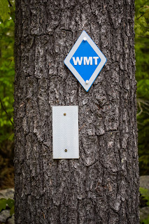
The Royce Trail is relatively narrow with a solid footbed, steadily rising the whole time. It comes near and then crosses a lovely mossy brook (is it the mossy brook? Not sure, I need to dig a little more and look at the USGS maps, maybe). I couldn’t help notice WMT signs, which I originally guessed could be Wachusett or Wapack-Monadnock Trail, but turns out its the Wantastiquet-Moadnock Trail (https://wmtcoalition.org/), which is a new 50-mile trail that links Brattleboro, VT with Mt. Monadnock (no patch… yet… I hope…). 


My pack was definitely feel heavy, but I countinued on through the forest of loud songbirds. I realized that my giant Cumberland Farms breakfast probably wasn’t helping me… Oh well! There were some nice stone walls, a few feisty mosquitos, and I took a short break at an old drainage after passing the Cart Path where someone had collected at least a hundred shards of glass/pottery, likely from the Old Toll House. 


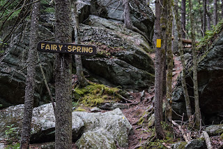
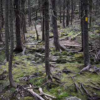
I continued onto the Fairy Spring Trail which passed by the “Fassett Mountain House Site.” The woods behind this site became the next site where I christened the mountain. My stomach was in a MOOD. After the house I apologized to the mountain and steeply climbed up and through the beautiful, mysterious forest to some neat rocks and the Fairy Spring, which was truly a mossy wonderland. There was one more steep pitch that led to the junction with Monte Rosa Trail/Smith Bypass, the second of which I followed.


The Smith Bypass is a short trail that connected Fairy Spring/Monte Rosa with Smith Summit Trail, and terminates at “the tooth, a prominent rock at the junction of the Smith Bypass and Smith Summit Trail, both named for Scott A. Smith, one of the most active trail builders among the Half Way House guests in the 1890s” (read that on Facebook). The Tooth also welcomed me to the clouds, where I remembered that clouds have a distinctive smell. 


Being in the clouds up here was kind of cool - felt like I was in the void in my own universes. I meandered through my cloud to Monte Rosa, and then slowly figured my way down the abysmal Great Pasture Trail. The only perk of the Great Pasture trail was the early purple rhodora flowers, but even that wasn’t enough to make me less cranky about how steep this beast was (I may be being dramatic, I may be not). The original plan was to do an out-and-back via the Great Pasture Trail, but once I descended that steep disaster, I quickly changed my plans to follow Marian to Marlboro and summit that way. I was nervous about submitting with the clouds and upcoming rain, but I always had Marian to Mossy Brook as a bail point, so I continued on.


I forgot how beautiful the Marian Trail was - lots of moss and a few fun scrambles toward the end. At this point of my hike I haven’t seen a single other human, and I loved that! The pine scent and large chunks of white quartz on the Marian Trail helped validate my decision to elongate my hike, too. 


I made my way to the Marian/Marlboro junction, where it was starting to mist. I just reminded myself that if I ever feel unsafe I can absolutely turn around. It was also here were I got my next tummy rumble, and I was displeased. I hate pooping in the woods, and I especially hate having to do it twice in a hike! I also forgot how much I dislike Liquid IV - its so sugary and the sugar lingers in my mouth. I am team Nuun!


Once I got over my personal problem I continued up Marlboro, where the wind started to pick up, but man, what a fun trail! There’s plenty of scrambles, but nothing particularly challenging or scary. The mist continued to increase the higher I went, but I continued on. I eventually made my way to Jim’s Junction and put my shell on, which did a great job shielding the wind… not so much the water. 


I continued on, and truly before I knew it I was at the summit! It’s incredible how quickly I made it there when I wasn’t able to stare at it the whole time! I booped the top, watched another hiker almost slip and hit head, I almost slipped and hit my head, and now it was definitely time to descend. I look closely for the cairns/paint pointing toward the Smith Summit Trail, and SLOWLY started my descent.


This was the epitome of “slow and steady doesn’t fall off the mountain.” Lots of sitting and scootching. Lots of two feet two hands one butt on the rocks. Thankfully, the stress of getting down in one piece helped my body forget the internal battle it was going through! I was officially out of the Danger Zone about half way down, where I realized my watch was paused for about 10 minutes, rude. I started to lose energy once back in the woods, which truly was okay. 


Next up was the Amphitheatre Trail, which climbed to the top of the Black Precipice, which was fine, but I was truly tired of going up. I was now below the clouds and took of my wet shell to continue on, and had a stroke of majesty when I realized my final new trail, The Side Foot Trial, was not the SLIDE Foot Trail. For some reason in my head I kept reading “slide,” and that would just have been a major bummer. 


I did get a little cock on the Side Foot Trail, where I took a nice slip, but caught myself. It’s good to stay humble. The forest here was absolutely beautiful, similar to Fairy Spring Trail. I passed the abandoned Hedgehog Trail, the Noble Trail, Do Drop Trail, and finally Thoreau trail, where I heard voices of people taking a break at the Halfway House Site. I checked out some ruins, and then finally started my final descent along the Old Toll Road.


This final bit dragged on, but truly was fine. I noticed the top of the mountain was still in the clouds, which made me happy (I’m still mad about Sugarloaf in Nash Stream Forest), and I stared in envy at the house near the top of road (the envy died down once their car almost hit me). My body remembered it needed to poop only for a moment, when I realized there were at least 50 mosquitos swarming me, which sent me into a power walk back to the car. 


Finally at the car, I dried off, changed, thanked my knees and body for not letting me die, and went back to the scene of the crime (Cumberland Farms) for a nice lunch!

Step-By-Step
- Park at Old Toll Road Parking (fee).
- From parking lot, turn right onto NH-124.
- Road walk to Royce Trail Trailhead.
- Turn right into woods onto Royce Trail (white blazes).
- At terminus, continue onto White Arrow Trail (white arrows).
- After ~15 feet, turn left onto Fairy Spring Trail (yellow blazes).
- At terminus, continue along Monte Rosa Trail (yellow blazes).
- After ~15 feet, turn right onto Smith Bypass (unsigned; yellow blazes).
- At "The Tooth," turn left onto Smith Summit Trail (white dots).
- At terminus at Monte Rosa, turn right onto Great Pasture Trail (unblazed above treeline - look for cairns; yellow blazes in woods).
- At terminus, turn right onto Marian Trail (yellow dots).
- At terminus, turn right onto Marlboro Trail (white rectangles and white Ms).
- At jct. with Dublin Trail, continue on the Marlboro/Dublin Trail.
- Summit Mt. Monadnock.
- Briefly retrace steps, follow sign/cairns for Smith Summit Trail (white dots with occasion SS).
- Descend via Smith Summit Trail.
- At next jct., turn left onto Amphitheatre Trail (yellow blazes).
- Cross white arrow trail and continue on Amphitheatre Trail (yellow and white blazes).
- At next jct., turn right onto Side Foot Trial (white blazes).
- At terminus, turn left onto White Arrow Trail, crossing the Halfway House Site.
- Finally descend via Old Toll Road.


"Mt. Monadnock (3,170 FT.)" from Southern New Hampshire Trail Guide, 5th Ed. (2021)
    Mt. Monadnock, also called Grand Monadnock (and listed as Monadnock Mtn. on USGS maps), rises in the towns of Jaffrey and Dublin, about 10 mi. north of the New Hampshire-Massachusetts border. This isolated mountain tower 1,500 to 2,000 ft. above the surrounding country, visible from most of the prominent viewpoints in central New England. Monadnock is an Abenaki word thought to mean "mountain that stands alone," though its exact meaning - and spelling - has been the subject of some debate. As a result of the mountain's prominence and popularity, geologists use the term "monadnock" in a general sense to describe an isolated mountain that rises far above the surrounding terrain. (The Harvard geography professor William Morris Davis originally suggested this usage in 1894. Webster's International Dictionary accepted it in 1900, and the Encyclopedia Brittanica did so in 1910.) The bedrock of Mt. Monadnock is primarily layered schist and quartzite - metamorphic rocks thought to be about 400 million years old. In some outcroppings, prominent folds are visible. These rocks are highly resistant to erosion. Many signs of glaciation can be seen on the mountain, including a number of glacial striae (scratches made in the bedrock as bounders were dragged along the base of the ice sheet).
    The summit of Mt. Monadnock commands exceptionally extensive and distant views; Mt. Washington is sometimes visible on very clear days. Two prominent souther crags are noteworthy: Monte Rosa (2,515 ft.) on the southwest ridge and Bald Rock (2,626 ft.) on the south ridge. On the northeast side is the long Pumpelly Ridge.
    Combining rugged mountain scenery, a relatively short and moderate ascent (compared with major peaks in the White Mtns.), and convenient access from the population centers of southern New England, Mt. Monadnock is reputedly the third most frequently climbed mountain in the world, after Tai Shan in China and Mt. Fuji in Japan; it is estimated that 100,000 people climb it each year, with the highest numbers coming during foliage season in October.
    Despite the relative east of access, do not underestimate Mt. Monadnock, particulatly if you are unused to mountain trails. All routes of ascent involve at least 1,700 ft. of elevation gain, and many trails are rocky and rugged, with some ledge scrambling. The vast expanses of open ledge on the upper slopes, which provide the panoramic vistas tha tmake this mountain so attractive to visitors, can also be very slippery in wet or icy conditions (and slick even when dry), and hazardous in thunderstorms. Above treeline, trails can be difficult to follow when clouds cover the mountain; at such times, hikers must follow markings carefully to avoid encountering dangerous cliffs in an attempt to descend off-trail. In any weather, descending hikers must take extra care to follow the correct trail or end up miles away from the intended trailhead. On the open ledges, trail names are painted on the rock at intersections. Many trails may be very icy in late fall, winter, and early spring (depending on weather), at which times traction devices are required for safe passage. Treat any water source before drinking.
    Major trails reach the summit from several directions, and there is a network of connecting and secondary trails on the east, south, and west sides of the main peak. The most popular trailhead is at Monadnock State Park Headquarters, located at the end of Poole Rd., on the southeast side of the mountain. The headquarters also has large parking areas (open year-round), picnic grounds, restrooms, a park store, a small visitor center, and a campground. The park has an admission fee year-round. For driving directions, see the description for White Dot Trail, perhaps the busiest route on the mountain.
    The network of trails on the southwest and south sides deteriorated badly after a fire in 1954 destroyed an old hotel called the Half Way House, where many amateur trail builders had their base of operations, but most of these trails have been restored by the dedicated efforts of state park personnel and volunteers. It is possible to ascend Mt. Monadnock in relative solitude on these attractive trails, particularly on weekdays. White Arrow Trail - the most direct route to the summit on this side - and many other trails, including attractive circuit trips, begin near the Half Way House Site, an open, grassy clearing on the west flank of Mt. Monadnock's south ridge at about 2,100 ft. Direct routes to this site arre provided by a foot trail - Old Half Way House Trail - and by a former toll road, now closed to public vehicular use but upen for hikers. (Note: Yield to vehicles approaching or leaving the private residence near the top.) The trail and road both leave a parking area (sign: "Old Toll Rd. parking, fee charged") on NH 124 near the height-of-land (the highest point on a given trail, ridge, or road), 5.3 mi. west of the major intersection in the center of Jaffrey and about 4 mi. east of Troy. (At the busiest times, on the weekends and during the summer, this lot may be filled to capacity.) From the parking area, Old Toll Rd., a gravel road, climbs 1.2 mi. and 600 ft. in elevation to the old hotel site. Parker Trail joins the road at 0.6 mi., 1.5 mi. from its trailhead at the state park headquarters The maintained part of the road ends at 1.1 mi., where a driveway diverges right to a private house; just beyond here, Old Half Way House Trail joins from the left. The final 0.1 mi. to the hotel site follows the eroded old roadbed.
    The upper 500 ft. of the mountain is open ledge, bared by a series of forest fires. Early eyewitness reports from European settlers indicate that the summit of the mountain was heavily forested, with Bald Rock being the only prominent bare ledge. Farmers frequently set fires to clear the lower slopes for pasture, and around 1800 a major fire of unknown origin burned for about two weeks, greatly damaging the forests on the upper part of the mountain. A second major fire occured around 1820 and lasted for a number of days, fanned by wind and drought conditions. It burned with an intensity that consumed even the soil, reducing the upper part of the mountain to bare, sterile rock. Since then, small subalpine plants, shrubs, and trees have lodged themselves in cracks and crannies, creating pockets of soil and beginning the process that, if left undisturbed, will restore the mountain forest in a few millennia. Many rare subalpine plants around the summit are found nowhere else south of the White Mtns. 
    The first English-language recorded ascent of the mountain was in 1725, when Captain Samuel Willard and a company of 14 rangers climbed it from the south and "campt on ye top." Visitors from outside the immediate vicinity began to arrive at about the same time as the last of the great fires, and by 1850 Mt. Monadnock was established as a major attraction for New Englanders. Due to the proximity of the mountain to Concord, Massachusetts, where the transcendentalist literary movement and its deep interest in nature developed around the writers Ralph Waldo Emerson and Henry David Thoreau, Mt. Monadnock attained an almost sacred status and was immortalized in the works of these notable writers and others. Mt. Monadnock probably bears more historical trails, former trails, ruins, and named minor features than any other mountain in New England, including Mt. Washington. Details about the mountain's storied history are found in Annals of the Grand Monadnock, by Allen Chamberlain (who served as both councillor of exploration and president of AMC in the early 1900s and edited earlier versions of the AMC Monadnock trail map), originally published in 1936. An interesting history is Monadnock: More Than a Mountain, by Craig Brandon, published by Surry Cottage Books. The Monadnock Guide, by Henry I. Baldwin, was originally published by the Foreset Society and has been reissued by Surry Cottage Books. It provides historical background, as well as extensive information about the natural history of the mountain.
    Land protection of Mt. Monadnock began in the 1880s, when the selectmen of the town of Jaffrey set aside a tract for public ownership and protection. Over the years, local citizens and conservation groups, led by the Forest Society, have averted several development threats. In 1987, the mountain was designated a National Natural Landmark. The public reservation on the mountain now comprises more than 5,000 contiguous acres and includes conservation and public lands owned by the Forest Society; the towns of Dublin, Jaffrey, and Troy; the Monadnock Conservancy; The Nature Conservancy; the New England Forestry Foundation; and the New Hampshire Department of Resources and Economic Development. Recreation use is managed by the NHDP in conjunction with the Monadnock Advisory Commission.
    Note: Camping is not permitted anywhere on Mt. Monadnock, except at the state park campgrounds. By New Hampshire state law, dogs or other pets are not allowed anywhere on the mountain, along the trails, or in the campgrounds.
    The Mt. Monadnock trail sustem is shown on this book's AMC Southern New Hampshire Trail Map (Map 1), and Mt. Monadnock is covered by the USGS Monadnock Mtn., Troy, Dublin, and Marlborough quadrangles. Also shown on the AMC map are 25 points of interest - historical and natural features that can be seen along the trails - described below. On the state park's trail map, the following are designated as "main trails": Dublin, Pumpelly, Cascade Link, Birchtoft, Red Spot, White Dot, White Cross, Lost Farm, Parker, White Arrow, Old Half Way House, and Marlboro. These are well trod and, in general, well marked and easy to follow. The other trails described here are designated as "footpaths" on the state park map, and while some are well marked, they may require some considerable care to follow.

"Fairy Spring Trail (NHDP)" from Southern New Hampshire Trail Guide, 5th Ed. (2021)
    Fairy Spring Trail (C4), marked with small yellow rectangles, leaves the east side of Monte Rosa Trail just beyond the bridge over Fassett Brook. It runs 35 yd. northeast on a relocated section, turns left back onto the original route, and ascends past the foundation of Fasset's Mountain House (sign) on the left. It then climbs, steeply at times, across Fairy Brook at Fairy Spring and rejoins Monte Rosa Trail.

"Great Pasture Trail (NHDP)" from Southern New Hampshire Trail Guide, 5th Ed. (2021)
    Great Pasture Trail (C3-C4) is also marked wtih yellow rectangles, though it is blazed only for the ascend. The trail leaves the junction of Marian and Mossy Brook trails, crosses Mossy Brook, and ascends to the summit of Monte Rosa and Monte Rosa Trail at 0.3 mi., emerging on ledges near the top.

"Marian Trail (NHDP)" from Southern New Hampshire Trail Guide, 5th Ed. (2021)
    Lightly used Marian Trail (C3-B3), marked with yellow disks, begins at the junction with Mossy Brook and Great Pasture trails, turns sharply right 60 yd., and ascneds north through spruce woods, with occasional short descents. At 0.2 mi. it crosses a ledge with a view west. It continues up through the woods, crosses a small brook, and then climbs by switchbacks through a rough, rocky area, emerging on open ledges before reaching Marlboro Trail at 0.6 mi. by the Rock House.

"Marlboro Trail" from Southern New Hampshire Trail Guide, 5th Ed. (2021)
    This is one of the oldest trails to the summit, dating to about 1825. It is the only route up Mt. Monadnock from the west. Parts of it are quite steep and rough. [...].
    [...]. At 1.3 mi. Marian Trail leaves Marlboro Trail on the right on a large open slab; the trail names are painted on the rock. Above this junction on the right is the formation known as the Rock House or Stone House, a natural shelter. Marlboro Trail continues briefly up open ledges, reenters the trees at a hairpin turn, and rises steeply at times, with rough footing and occasional views. It emerges from the woods; climbs a very steep, ledgy pitch; and at 1.9 mi. ends at the junction with Dublin Trail (sign: "Jim's Junction"), which comes up from the left and continues 0.2 mi. in teh open, at moderate grades, to the summit. 

"Smith Summit Trail" from Southern New Hampshire Trail Guide, 5th Ed. (2021)
    This lightly used trail, opened by Scott A. Smith in 1898, ascends from Monte Rosa to Mt. Monadnock's main summit, following a winding route on the southwest side of the cone. The path is steep in places but affords many fine views. It is marked with white dots and Ss, which must be followed carefully on the upper ledges.
    From the summit of Monte Rosa, Smith Summit Trail makes a short, steep descent to the Tooth, a prominent pointed ledge on the right with a scenic view, where Smith Bypass (a yellow-blazed connector, 0.1 mi. long, from Monte Rosa Trail) enters on the right. Smith Summit Trail bears left and winds up over ledges and through scrub to the junction with Amphitheatre Trail on the right (signs) at 0.3 mi. It ascends moderately through spruce woods, and then at 0.4 mi. it begins to climb up steep ledges, with occasional scrambles and excellent views south and west. At 0.6 mi. the trail swings right (east) and soon scrambles up a narrow gully. (At the bottom of this pitch, ledges 20 yd. to the right of the trail provide a good veiw of the Billings Fold - layers of rock that were pressed or "foldedd" up against each other when the mountain was formed - on a cliff.) The route meets White Arrow and Dublin trails just below the summit.
    Descending, look for "Smith Summit Trail" painted in white on the rock just below where White Arrow Trail diverges from the left. 

"Amphitheatre Trail (NHDP)" from Southern New Hampshire Trail Guide, 5th Ed. (2021)
    Scenic, yellow-blazed Amphitheatre Trail (C4) leaves Smith Summit Trail on the right (east) 0.3 mi. above Monte Rosa and climbs to open ledges at the top of Black Precipice at 0.1 mi., where there are wide views south over a ravine called the Amphitheatre.
    The trail swings left and climbs steeply then turns right and runs across ledges at easier grades. It descends to cross White Arrow Trail at 0.3 mi., coincides with wide-dotted Side Foot Trail for 100 yd., continues ahead when Side Foot Trail diverges right, and finally descends to Smith Connecting Link at 0.4 mi., at the junction known as Four Spots.

"Side Foot Trail (NHDP)" from Southern New Hampshire Trail Guide, 5th Ed. (2021)
    Side Foot Trail (C4-D4) is an excellent alternative to the lower part of White Arrow Trail and avoids much of the heavy traffic on that trail, Marked with white dots, it begins at a sign for Side Foot, Do Drop, adn Noble trails at the northeast corner of the Half Way House Site clearing. Side Foot Trail leads into the woods, swings right, and at 0.1 mi. turns left at a junction; here steep and rough Do Drop Trail (D4) continues ahead. At 0.2 mi. on Side Foot Trail, Noble Trail (C4) diverges right. In a very short distance, Side Foot Trail passes a former junction with Hedgehog Trail (now closed) on the right. Side Foot Trail then climbs north through spruce woods at a moderate grade and meets yellow-blazed Amphitheatre Trail at 0.7 mi. Here, it turns left and, coinciding with Amphitheatre Trail (watch for white and yellow markings), soon turns right up a steep ledge and then left again, reaching White Arrow Trial in 40 yd. Here, Side Foot Trail ends, and Amphitheatre Trail continues ahead across White Arrow Trail. For the shortest route to the summit, turn right on White Arrow Trail for a steep climb of 0.5 mi.