Thursday, June 2, 2022

Final Blue Hills Reservation Trails (Blue Hills Reservation)

Final Blue Hills Reservation Trails (Blue Hills Reservation)

Hike Type: Multiple Hikes
Distance: 4.09 miles
Elevation: 686 feet
Time: 1 hours, 38 minutes
Hiking Challenges: Blue Hills 125-Mile Challenge; 52 Hike Challenge

*NOTE: These stats are the total of the three seperate hikes I did to complete this challenge.*
*NOTE2.0: There will be a seperate post to summarize and reflect upon this challenge.*


Hike #1: 6900 to 6896 Loop
The shortest hike of the afternoon. I needed the small spur trail from 6896 near Little Blue Hill, which I had missed a long time ago during the beginning of my Blue Hills hiking. I parked at the Park and Ride which was a very interesting subculture on it's own. Some people working on their cars, others chit chatting, some large vans, and random people seemingly aimlessly wandering the unmarked trails... definitely interesting. I walked into the woods at 6900 and turned left to meet up with the Skyline Trail, which climbed to the intersection I needed. I had to do a bit of wandering since this trail was very difficult to find - but it seems that someone marked the path with orange tape tied to a few trees which was helpful. The path led to the meadow/pond marked in the map, and there is a whole network of unmapped trails back there that allowed me to turn this into a loop. Hike #1 done!


Hike #2: Houghton's Hill & Raccoon Hollow
This was going to be the biggest hike of the day. I needed to hike the lower half of the Raccoon Hollow Path and the two trails that intersect at 1151. I parked at Houghton's Pond and followed the HQ Path, crossed the road, and starting to hike up Houghton's Hill on the south Skyline Trail. This stretch has become more or less of a physical fittness test for me. I've been up it dozens of times, all at different levels of "hiking fittness." I am always winded, but sometimes I have been on death's porch and other times I have made it up without stopping. Since I only stopped twice for muscles (I'm still a bit sore from all my hiking last weekend), I'll take it as a win!

At the top of Houghton's Hill, I turned left and left again at the almost hidden intersection at 1156. I hiked 1156 to 1151, turned left, turned right onto the road, turned right onto the other end of the trail, and back at 1151 turned left again to complete this "loop." I cut through Houghton Path to get to Raccoon Hollow Path, hiked it to Five Corners, took Five Corners to Wolcott Path, and took Wolcott Path down to park headquarters. This stretch was gentle and cathartic, and I saw a massive deer that was just checking me out. I crossed the road, followed Bugbee Path, turned right onto the paved path, and made my way back to the parking lot. Only one trail left - the infamous Quarries Footpath!


Hike #3: Quarries Footpath from 4223
"The Final Countdown" plays in my head as I park my car right at 4223 (which was hidden by trees, naturally). Poetically speaking, one of my first hikes in the Blue Hills involved me getting lose in the Quarries section. I was aimlessly exploring, made it to the scenic, littered area, and then proceeded to have no clue where I was for quite some time. When I hiked the quarries with the intent of hitting all the trails, the same thing quite literally happened to me. I never found the bottom half of the Quarries Footpath in my previous hikes, so that's what landed me here today for my final hike!

The hike opens up to a network of trails that don't exist on current maps. I did my best to follow the contour of the map and the gps tract on AllTrails, which brought me to a grassy, mostly overgrown section with a couple of blowdowns. I quickly landed at the base of a stack of rocks/the quarry/slabs/whatever the granite mass is. At this point I zoomed all the way in on AllTrails and did my best. I ended up climbing up the rocks which led to a suprisingly beautiful rocky area that was reminiscent of a mountain summit. This area looked vaugely familiar, just like the spot I kept getting lost at. I continued to follow the track, and landed in a very familiar area (I think)! I accepted this as officially connecting the dots, and then I got lost again. Very grateful for GPS tracking. I made my way back down, had some peanut butter crackers to celebrate and made my way home!


Monday, May 30, 2022

North Percy Peak (Nash Stream Forest)

North Percy Peak (Nash Stream Forest)

Hike Type: Loop
Distance: 5.86 miles
Elevation: 2172 feet
Time: 3 hours, 40 minutes
Hiking Challenges: 52 With a View; Terrifying 25; Go North 9er


The Hike
I had attempted this hike at the end of last summer, made it up to the summit of South Percy, and by the time I made it back to the junction to head up North Percy the weather had begun to get cold and icky so I headed back down. Today was redemption day! I had left Vermont around 4:30am to make the hour and a half drive and to my DELIGHT I drove past two moose on VT-105! To say I nearly crashed my car in excitement is an understatement. One dipped into the woods but one hung out, munching on the plants on the side of the road. Life goal: achieved! After a few minutes of gawking, I continued my drive. When I got into NH, I felt a familiar gurgle in my tummy, so I began to mentally prep to have to poop in the woods (sadly my least favorite activity). To my second DELIGHT, there was a porta potty just outside of Nash Stream Forest that I paid my respects to. The day was off to an excellent start!


I took my time getting ready at the parking lot, checked out Nash Stream and really thought about taking a nap. Once I got over myself I geared up and started my hike! I really like how this hike never gets too monotonous - the scenery is always changing. It starts following the Slide Brook where frogs were in abundance and there is always the sound of rushing water. This section slowly climbs up the hillside as the brook gets further and further away. There were a few muddy sections, but nothing too terrible. This section ends at the "big fancy rock with the tree on top." There's many big fancy rocks on this hike, but you'll know which one this is. 


At the big fancy rock with a tree on top, the trail turns left and starts to climb steeply next to what appears to be an old slide. Again, this section is STEEP. Thankfully there are a few moments where you can CAREFULLY peek over the slide to get some views which are just beautiful. The trail turns away from the slide and starts to level out over some slanted sketchy slabs that provide some more partial views. At this point you can start to see South Percy looming above. This section informally ends after a slab section dips into the woods, which I have titled the "fairytale forest."


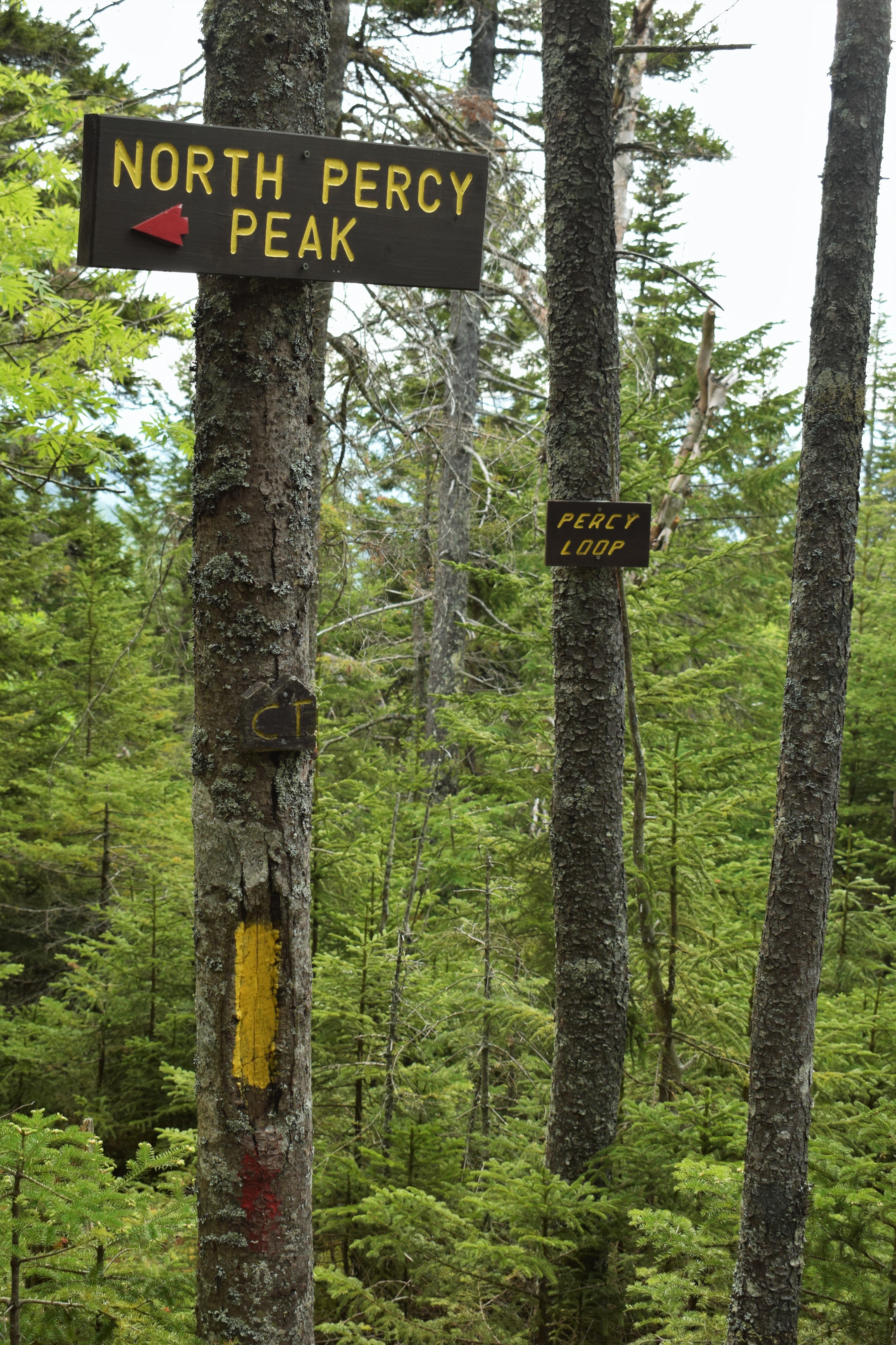
The fairytale forest climbs a bit more before leveling out in the col between the Percy Peaks. It starts climbing through dense forest, and levels out to an open forest with different conifers and off-trail blowdowns before. It's one of those areas that belong in a Yankee Candle. Eventually the trail intersects with the Old Summer Club Trail that leads to the South Percy spur, and continuing on the Percy Peaks Trail leads to the junction with the Percy Loop Trail. The Percy Peaks Trail climbs to the slabby summit of North Percy which quite literally took my breath away. It is steep, slabby, and stressful, but just gorgeous. I took a ton of long breaks on my climb up just to stare in awe. The summit area is scrubby and scenic with views in all directions. Absolutely breathtaking.


After a long break of picture taking, eating, drinking, and staring, it was time to turn around. The bugs also have officially woken up at this point which solidified that it was time to go. I spent a little more time admiring the beautiful rhodora in bloom, and SLOWLY inched my way down the slabs. I never felt that my footing was off, but it was a daunting descent. Back at the junction, I opted to take the Percy Loop Trail down which truly brought me to another world.


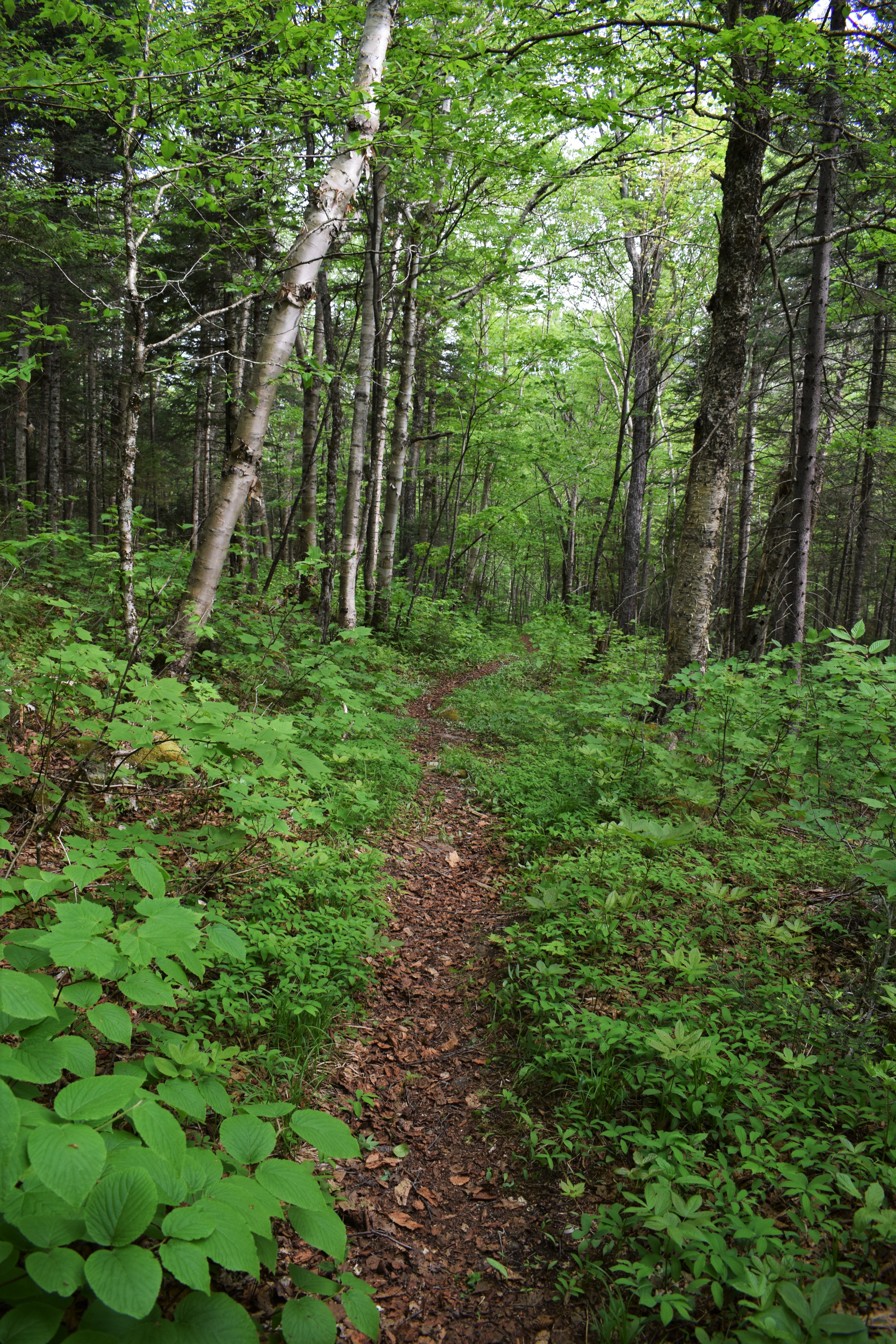
The Percy Loop Trail near North Percy really feels like you're in another world. The trail is hardly defined and comprised of mostly large rocks covered in moss. A beautiful forest, but careful attention needs to be paid to blazes to stay on the trail. The forest turns into a young hardwood forest soon after following, according to Google Maps, Long Mountain Brook. Since the last junction, the Percy Loop Trail has been following concurrently with the Cohos Trail, which eventually splits in the harwood forest. 


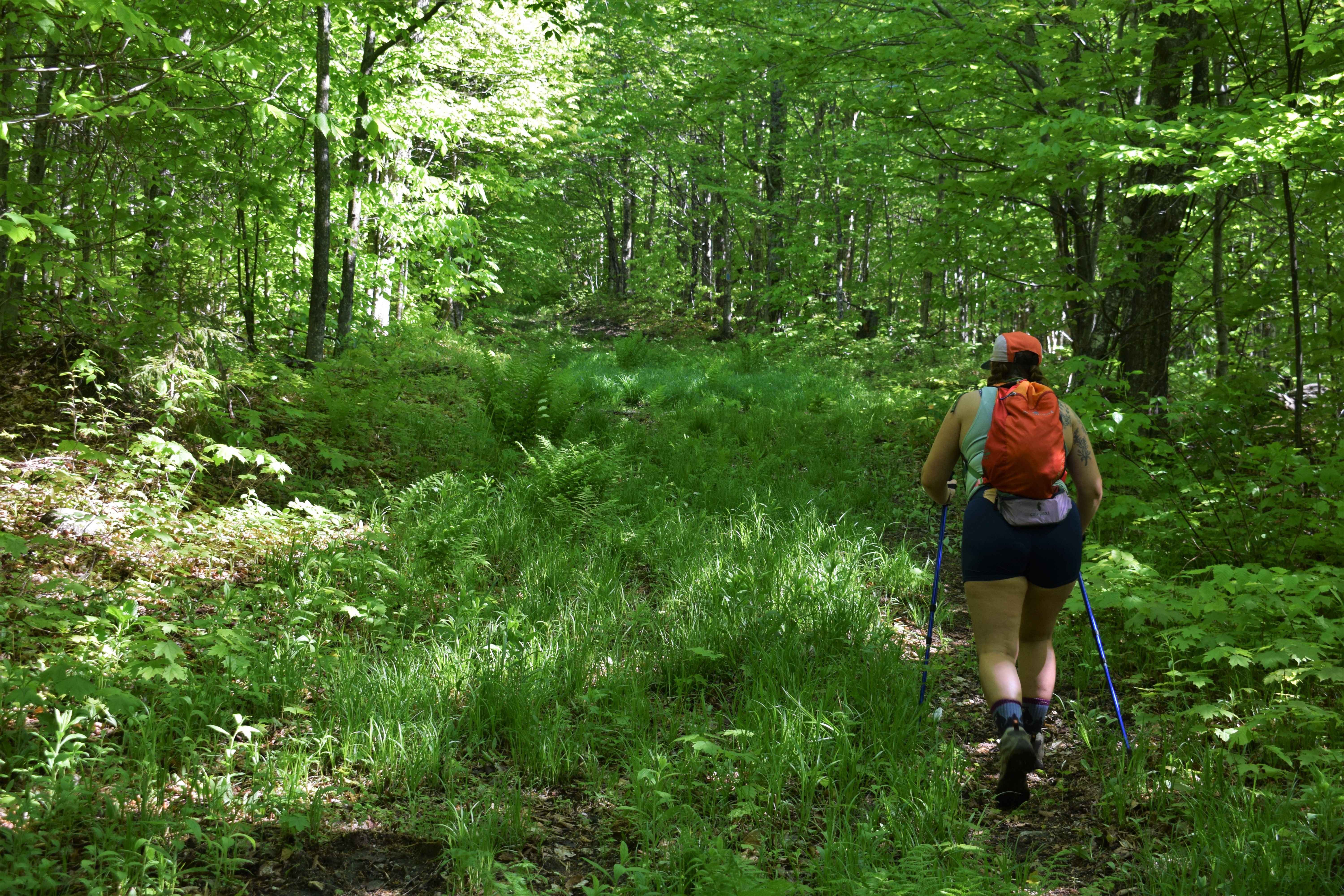
The final two stretches of this hike were the only two that dragged on. Following the split with the Cohos Trail, the Percy Loop Trail follows old logging roads until it's terminus at Nash Stream Road. The descent was steady and there were a few blowdowns, but overall it was easy going. The final mile on Nash Stream Road was straightforward and buggy. There was one view of Nash Stream and a nearby peak, but the bugs reminded me it was time to go home. Before I knew it I was back at my car and driving back to Boston!


Step-By-Step
  • Park at designated parking area just before the bridge over Slide Brook.
  • Walk across the bridge and turn right to join the orange-blazed Percy Peaks Trail.
  • Follow the Percy Peaks Trail until the junction with the Old Summer Club Trail, continue on Percy Peaks Trail.
  • At next junction with Percy Loop/Cohos Trail, turn left to continue on Percy Peaks Trail to the summit of North Percy Peak.
  • At the summit, turn around and carefully retrace steps to the previous junction.
  • Follow signs for the red-blazed Percy Loop Trail (which coincides with the yellow-blazed Cohos Trail).
  • Follow Percy Loop Trail through rugged terrain until it splits with the Cohos Trail - continue on red-blazed Percy Loop Trail.
  • At terminus at Nash Stream Road, turn left onto Nash Stream Road and walk back to car.


"The Nash Stream property has never been the hikers' destination that the White Mountains have been since the late 1800s. Nevertheless, mountain peaks, ponds, and other natural features of the property have provided destinations to some recreational hikers for many years. Berry pickers climbed South Percy Peak as early as 1876. Within four years after the foundation of the Percy Summer Club on Christine Lake, a path had been cut from their camps to the summit of North Percy3. Mr. Earl Roberts of Lancaster published a trails map (Figure 3) for Coos County in 1940 that identifies a dozen trails on the Nash Stream property. The current condition and use of many of these historic trails is unknown."

"The Sugarloaf Mountain and North Percy Peak trails, totaling more than 5 miles in length, are the only maintained mountain hiking trails. The short trail to Pond Brook Falls from the Main Road is also worth mentioning as a hiking trail because of its recreational value even though it is only a few hundred feet in length. Numerous walking opportunities exist on the Forest's 66.5 mile road and trail network. Most, if not all, of the network will be utilized as multi-use trail corridors and maintained to generally accepted trail maintenance standards as discussed under Trails above. There are opportunities to improve hiking on the Nash Stream Forest including better marking and signing of trails, re-opening of selected historic hiking trails, addition of hiking loops from single destination trails, establishing a regular hiking trail monitoring and maintenance program, and possible construction of new mountain hiking trails. Although funding and staff for hiking trails is limited, proper hiking trail maintenance and improvements can be accomplished with the aid of volunteers and the Statewide Trail System Advisory Committee. For example, the North Percy Trail has been well maintained by local interests for years prior to state purchase of the Forest. More recently, the Appalachian Mountain Club voluntarily performed an assessment of work needs for the West Side Trail on North Percy in the summer of 1991, and accomplished some of the trail work called for in the assessment."

"In 1998, construction began on the Cohos trail through Nash Stream. The Cohos Trail was a proposed through trail system that had its conceptual beginning as far back as 1978. It began as an editorial in the Coos County Democrat, an idea that Kim Nilsen conceived. In the late 1990’s this proposal started to become a reality, with Nash Stream front and center in the master plan. Approximately 15 miles of trail was developed on Nash Stream, however, much of the trail was existing gravel roads, woods roads and old trails. In 2003, two remote campsites locations were approved; one on the Percy Loop trail, north of the Percy Peaks and the other on the Arm of Sugarloaf trail. The Percy Loop campsite was developed shortly after as a tent platform with an outhouse. The Arm of Sugarloaf site was not developed for many years. Finally, in 2012 a lean-to structure was erected on the approved site with an outhouse facility as well. This lean-to was donated by the Garland Mill and is a timber frame shelter."

"Hiking opportunities in the Nash Stream Forest include designated trails, challenging walks on multipleuse woods roads, and off trail exploration. There are two hiking trails that lead to summits on the property, the Percy Peaks and Sugarloaf Mountain. The Percy Peaks trail is the most popular trail on the property, starting at the trailhead on the main road and ascending along Slide Brook to the 3,418-foot summit of North Percy Peak. The main Percy Peaks trail had a substantial amount of work completed in 2009. There were several small relocations to better stabilize the trail. The summit of North Percy provides an excellent 360 degree view of the surrounding region, and is a popular site for blueberry picking in August. There is no designated trail to South Percy Peak, although it is often visited. In 2003, the Percy Loop trail was constructed. The trail heads north from the junction with the Old Summer Club Trail and skirts around the northeast flank through Bowman Valley to Long Mt. Brook eventually coming out onto the main road."

Sunday, May 29, 2022

Gore Mountain (Silvio O. Conte National Wildlife Refuge)

Gore Mountain (Silvio O. Conte National Wildlife Refuge)

Hike Type: Out-and-Back
Distance: 5.2 miles
Elevation: 1237 feet
Time: 2 hours, 37 minutes
Hiking Challenges: Northeast Kingdom Mountain Challenge; Go North 9er; Summit Beer Society; New England 50 Finest


The Hike

I was super excited for the journey to this hike, and feeling lackluster about doing the hike itself. When Emma first moved to Vermont, I made it my life's mission to see a moose. We read that VT-105 and the NWR were two good moose spotting locations, so one evening we set forth onto one of the dirt roads in search for the giant northern mammals. Long story short, we failed in our search and only found a thousand frogs. When I saw that we could hike Gore Mountain from the NWR, I knew it was redemption time (evidently, it was not redemption time). Thankfully, the roads have recently been re-graded, and there were three boardwalks off the side of the road to break up the drive in, all of which were lovely. We started the hike from the famous Lewis Pond Overlook, which lived up to its reputation of having an incredible view (pictured above).


The trailhead is clearly marked and follows a wide woods road that doubles as a VAST snowmobile trail in the winter. It was MUDDY, which became a theme for this hike. After 0.4 miles, the Gore Mountain Trail turns right into the young forest while the woods road continues straight. The map shows a viewpoint at this junction, but we did not find it (we also didn't really look for it at all). It was clear that this trail was seldom used by humans (but frequently used by moose - poop galore!). At times we had to really concentrate on the blazes due to lack of trail definition, but thankfully there were plenty of blazes. 


After some nice hiking in the woods, the trail starts to climb what feels like a power cut/slide, and this is where the mud and bugs really kicked in. Most of this stretch of hike was spent looking down, swatting bugs, and dodging neverending mud pits. There were brief moments where we would get some relief when the trail would dip into the woods for a split second, but that rarely lasted for long. The most fascinating part of this stretch was how it was also covered in moose poop. At one point Emma shouted "do the moose just hike up and down this all day?!" The only redeeming quality of this stretch was the view when you turned around.


The trail levels out towards the summit, and the mud and bugs increase. It was pretty, but we did not spend too much time to enjoy it due to the aforementioned factors. The summit is marked by an old cabin with a new red roof and a summit sign on the outside. There were some trail maintainers seeking refuge in the cabin when we got there, and one of them thought to make what sounded like a baby bear call as were approaching, which was definitely in good fun, but definitely unsettling. We cheersed our summit beverages but waited until after the steep portion to indulge. We did check out the cabin and signed the register, and were on our way back soon after. 


The hike down went much faster than the way up, naturally. Continued dodging of moose poop and mud pits, and once we were at the bottom of the messiest section we cracked open our beverages to enjoy for the remainder of the hike. Our favorite moment was crossing paths with another hiker - we had our poles in one hand and beverages (in koozies, naturally), in the other, and this man says proudly "now THAT is civilized hiking!" which fully made our day. Merch drop soon? We'll see.


Once back at the car we spent a couple minutes enjoying the view again from Lewis Pond Overlook before hiding from the bugs in the car. We bought a bunch of cheese, crackers, and meats to indulge in, and I think I have a new favorite post-hike snack! The drive our of the refuge wasn't too bad, and before we knew it, it was nap time!


Step-By-Step
  • From parking lot at Lewis Pond Overlook, find trailhead for Lewis Pond Trail/Gore Mountain East Trail and begin hike.
  • At 0.4 miles, the trail will leave the woods road (VAST Trail) it has been following and head into the forest (follow blue blazes).
  • Continue on Gore Mountain Trail to the Gore Mountain summit cabin. After hiding from the bugs in the cabin, head back down to the car.


From Wikipedia:
"Gore Mountain is a mountain located in the uninhabited Avery's Gore in Essex County, Vermont, about 6 miles (10 km) south of the Canada–US border with Quebec. In Vermont, gores and grants are unincorporated portions of a county which are not part of any town and have limited self-government (if any, as many are uninhabited). Gore Mtn. is flanked to the northeast by Black Mountain, and to the northwest by Middle Mountain.

The north and northwest sides of Gore Mountain drain via several short brooks into the Coaticook River, thence into the Massawippi River, Saint-François River, and Saint Lawrence River in Quebec, and thence into the Gulf of Saint Lawrence. The southwest side of Gore Mtn. drains into Jim Carroll Brook, thence into the North Branch of the Nulhegan River, the Connecticut River, and into Long Island Sound in Connecticut. The southeast side of Gore Mtn. drains into the Logger Branch, and the east side into the Black Branch, of the Nulhegan River."

From Kingdom Heritage Trails Map:

"The Nulhegan Basin Division of the Silvio O. Conte National Fish and Wildlife Refuge is managed by the US Fish and Wildlife Service and protects 26,000 acres of lowland forest that supports rare species, extensive wetlands, and migratory songbird habitat. The lands are available for hunting, fishing, and contabile recreation."

"Gore Mountain once served as a forest fire lookout station- overlooking the vast timerlands of northern Essex County. Built in 1912, it was the second oldest lookout in Vermont. In 1934, the Civilian Conservation Corps (CCC) constructed a new fire tower that was in use until it was removed in 1973."

Bluff Mountain (South Peak) (Brighton Town Forest)

Bluff Mountain (South Peak) (Brighton Town Forest)

Hike Type: Lollipop Loop
Distance: 3.2 miles
Elevation: 1171 feet
Time: 1 hour, 59 minutes
Hiking Challenges: 52 Hike Challenge; Northeast Kingdom Mountain Challenge; Summit Beer Society


The Hike
Back hiking in Vermont's Northeast Kingdom for the first time since the early fall! This day's goal was to hike Bluff Mountain in Island Pond and Gore Mountain from the Silvio O. Conte National Wildlife Refuge, both places that we've previously visited but never hiked. We saw the early morning sunrise colors from the dirt roads, took a pit stop at the blessed porta potty right in Island Pond, and started our hike soon after on the Bluff Mountain Community Trail, which turns into the Bluff Mountain Trail. 


The hike begins in an open, planned forest where all the trees are in rows, which is equally pretty and spooky. Horror films could definitely be filmed there, but also lovely meandering walks in the woods. This section ends at a trail register, and the trail heads into the more-traditional woods. The trail here is gentle with a moderate incline- really nice hiking. We turned left at the junction with the Lookout Trail to follow the Lookout Trail, which to much dismay immediately started descending. The trail dips for a little while, and when it starts to climb it starts to CLIMB. Before we knew it we saw the "CAUTION: STEEP" signs and then we were climbing up iron rungs. 


Thankfully once the steep section was over we were immediately rewarded with a beautiful view of Island Pond (the town and the pond) and the surrounding landscape. We took a break here, had our summit beverages at 6:50am, and enjoyed the view. Thankfully, the bugs did not want to both us at this early hour. Once we were ready, we continued our hike to the junction with the Bluff Mountain Trail and found the summit sign which was just past that in the opposite direction. The hike back to the car was quick and gentle with only a few signs of moose activity and still minimal bugs. Before we knew it the morning hike was over and we were back at the car ready for the next adventure! We decided that someday we want to the whole Kingdom Heritage Trail - starting from the NWR to Gore, Middle Mountain, Bluff, and ending with dinner in Island Pond... someday!


Step-By-Step
  • Park at Bluff Mountain Community Trail parking lot on Mountain Road.
  • Start hike by following the blue-blazed Bluff Mountain Trail.
  • At first junction, veer left to start the yellow-blazed Lookout Trail.
  • At jext junction, continue on the yellow-blazed Lookout Trail, and be ready for a steep climb.
  • At the top of the steepest climb is a great view of Island Pond, from there continue on the yellow-blazed Lookout Trail.
  • At re-junction with Bluff Mountain Trail, turn right to return to the parking lot via the Bluff Mountain Trail. (The summit is slightly away from this junction).


Friday, May 27, 2022

Mt. Kearsarge (South) via Winslow/Barlow (Winslow State Park)

Mt. Kearsarge (South) via Winslow/Barlow (Winslow State Park)

Hike Type: Loop
Distance: 2.7 miles
Elevation: 1112 feet
Time: 1 hour, 48 minutes
Hiking Challenges: 52 With-a-View; New Hampshire Fire Tower Quest


The Hike
Happy Memorial Day Weekend! I was headed up to the Northeast Kingdom of Vermont for the weekend and wanted to split up my drive up with a hike. I was between Cardigan and Kearsarge South - and the wonderful people of Facebook led me to Kearsarge! The biggest plus was that it was right off of I-89, so it was quite literally on the way up. The Winslow State Park website says that the parking area closes at 6:00pm, but the same wonderful people of Facebook told me that it's never closed in the warm season. I took the gamble, arrived around 5:00pm and got to hiking!

View from the picnic area at the parking lot.

There were a couple of other cars in the parking lot, and I ran into their group right at the trailhead so I had the whole mountain to myself. I went up the red-blazed Winslow Trail and got quite the workout in! While it's not a long trail, it does get steep. Nothing crazy, but definitely enough to get the heart racing. Rocks and roots make up the majority of this trail, and it vaguely reminded me of the rockier parts of Mt. Tammany in New Jersey. Halfway up there is a rock with a "1/2" painted on which felt equally encouraging and patronizing. 


The first view came just at the perfect time (i.e., when I was questioning my life choices) and gave me the boost I needed. After the first view the trail continues to climb, but more gradually over shrubby slabs. The rhodora were in full bloom and it was a beautiful final ascent, even with the gloomy weather. The Winslow and Barlow trails meet back near the top just before the final summit area. The summit area has expansive views in all directions, a radio tower, a firetower, and finally the summit cairn. It was windy up there so I didn't dilly-dally, but still took time to enjoy the scenery and having the whole summit to myself.


I took the Barlow Trail on the way down which was just beautiful. The biggest highlight was the alpine bog in full spring bloom - just gorgeous. A few more views were to be had,  and I was back at the car before I knew it! This time, however, all the bugs came with me. I've never packed up so fast in my life. The remaining drive to the NEK was spent looking at views off of I-89 and killing bugs in my car. 

Step-By-Step
  • Park at Winslow State Park and walk toward "To Trails" kiosk.
  • Turn right at junction for red-blazed Winslow Trail.
  • Follow Winslow Trail until junction near summit.
  • At junction, continue following trail to summit area. 
  • Walk past fire tower to find summit cairn.
  • When finished at summit, retrace steps back into the scrub to the Winslow/Barlow trail junction.
  • At junction, turn right onto yellow-blazed Barlow Trail.
  • Follow Barlow Trail back to parking lot. 

    Wednesday, May 25, 2022

    Mt. Wachusett via Harrington & Jack Frost (Mt. Wachusett State Reservation)

    Mt. Wachusett via Harrington & Jack Frost (Mt. Wachusett State Reservation)

    Hike Type: Lollipop-ish Loop
    Distance: 5.7 miles
    Elevation: 1240 feet
    Time: 2 hours, 34 minutes
    Hiking Challenges: 52 Hike Challenge; Wachusett Mountain Redliner


    The Hike

    Hike #2 of the Wachusett Mountain Redliner challenge! I loved my first hike up and was super excited to get up again. Something different about this hike was that I went after school on a Wednesday. Probably got started around 4:30 and finished around 7:00pm. Once I finish this challenge, I definitely see a sunset hike in my future. Just over an hour drive home, which really isn't that bad. The creator of the challenge patch curated four hikes that cover all the trails in the reservation, so that was my guidance for this one!


    My hike started at the parking by Stage Coach Road. I wasn't alone due to other after-work hikers and many, many bugs (thankfully this was the last time I would see most people and bugs!). Stage Coach Road is an access road to the wind farm so it's a steady incline and wide wooded road. At the top of the wind farm there's room for wandering, but I headed right into the Stage Coach Trail. The map provided on Facebook has a "bushwhack" cutting across the wind farm, but I decided to hike the whole Stage Coach Trail to Harrington. I wrote bushwhack in quotes because there were a couple clearly defined herd paths cutting through the wind farm.


    Once on the Harrington Trail, I headed away from the mountain to hike the short windmill footpath, which was poorly defined and seldom used, and to hike the Dickens Trail. The Dickens Trail was muddy and buggy but very scenic. At one point it crosses a view of a beautiful meadow/bog/swamp/whatever it's called, and at the height of land the trail technically ends and turns into the Mass Audubon property. I turned around at that point, took a few photos of the signs, and made my way back to the Harrington/Stage Coach junction.


    I continued on the relatively featureless, yet still scenic Harrington Trail until it crossed West Road, which I followed towards Administration Road, and ultimately the Jack Frost Trail, which might be my new favorite trail. It starts through dense rhododendron which were probably a week or so away from blooming, then meanders through a hardwood forest, then climbs steeply, then wanders through a grassy pitch, and then a pine forest to round things out. I never got bored! Also, the Jack Frost Trail is blazed in blue with little white paw prints, which is just a plus.


    At the terminus, I joined the Mountain House Trail for my final push to the top. This was the first and last time I would see people on this hike, which I was not upset about. The summit is nice once you get past the heavy infrastructure. The views are lovely and it's spacious enough to not be too crowded (as long as the auto road is closed). I contemplated staying for sunset, but I had two more new trails to hit and it was a school night - another time!


    The return trip started off quickly - Mountain House back to Jack Frost. Just before the steep section of Jack Frost there is a junction for the High Meadow Trail, which I took. High Meadow and Jack Frost are very similar trails in terms of difficulty and terrain. The plus of Jack Frost is the rhododendron, and the perk of High Meadow is its namesake high meadow! I was so happy to see a bench and a lovely view - highly recommend going this way.


    After the overlook, the High Meadow Trail leads to Echo Lake, Echo Lake Road, and eventually the Echo Lake Trail, which was relatively featureless, but it brought me back to the car! It was another great day on Wachusett and I'm excited to go for my (possibly) final hike of the redline challenge soon!


    Step-By-Step
    • Park at Stage Coach Rd. Parking.
    • Walk up Stage Coach Road.
    • At clearing, veer right to continue onto Stage Coach Trail.
    • At terminus, turn left onto red-blazed Harrington Trail (aka Midstate Trail)
    • At unmarked junction, turn left onto footpath to the Windmill Farm (faint blue triangles and footpath unclear at times). 
    • Turn around, return to Harrington Trail, turn left to continue on Harrington Trail.
    • Cross Westminster Road and enter Dickens Trail (aka Midstate Trail).
    • At approximately the height of land, turn around at the entrance to the Mass Audubon Wachusett Meadow Sanctuary (clearly marked).
    • Retrace steps across Dickens Trail and Harrington Trail to original junction with Stage Coach Trail.
    • Continue on Harrington Trail to West Rd. 
    • Turn right onto West Rd. and follow.
    • Veer right onto Administration Rd. 
    • Turn left onto blue-rectangle-with-white-pawprint-plazed Jack Frost Trail (appears to be Lower Link Trail on the map, but clearly marked as Jack Frost Trail in person).
    • Follow Jack Frost Trail until it's terminus at the Mountain House Trail.
    • Turn left onto Mountain House Trail and follow to summit.
    • After enjoying the views, return to the Mountain House Trail and then the Jack Frost Trail.
    • At junction, turn left onto the High Meadow Trail.
    • Follow High Meadow Trail until it's terminus at Echo Lake.
    • Continue on Echo Lake Road and then turn left onto Echo Lake Trail.
    • Follow blue-blazed Echo Lake Trail back to the parking lot.

    Tuesday, May 24, 2022

    Prospect Hill (Waltham)

    Prospect Hill (Waltham)

    Hike Type: Loop
    Distance: 3.1 miles
    Elevation: 499 feet
    Time: 1 hour, 12 minutes
    Hiking Challenges: 52 Hike Challenge


    The Hike
    This hike was a continuation in the series "time to get hiking again so I don't die in Vermont next weekend." I've had this on my short list for a few months now, but always ended up going to either the Fells or Blue Hills - not any longer! This was the day! The parking area is right off of the busy busy Totten Pond Road and looks just like a municipal park. It was a little confusing getting started, but I used AllTrails and followed the track to a T and found my way at the "trailhead!"

    After walking across the lawn of the park, I climbed what appears to be a sledding hill which had an opening into the woods, which I believe was the Hawks Run Trail. In the woods, the trail was short, steep, and to the point. Looked like an old power cut, ski run, or sled run? Not sure, but it was right up and straight. At the top of the first hill there is a cute picnic area with a view of the tops of trees, which is something! 


    Continuing in the same direction (and after taking a breather at the picnic benches), the trail becomes the Hanson Slope Trail, which felt more like a hiking trail than an old ski path. Neither of the trails have had any markings at this point, but they were easy to follow. The concrete water towers were a cool industrial surprise - I walked counterclockwise around the closest one. After a very short road walk, the hike dips back into the woods past a gate on what seems to be the Whitney Trail. At the junction, I turned right to climb again to the radio tower, which seemed like it belonged in a lecture on post-moderism-concrete-industrial-brutalism. Kind of steampunk-y. Either way, I think I missed a view from the Sunset Shelter.


    From the tower, I followed the sparsely blazed Ridge Trail that went down into a col before climbing to the magnificent view of the Boston area! I loved this view. There was a second view a little further down, but there were a group of friends there, so I let them be. 

    The return trip followed a random network of trails - I just followed whatever the AllTrails recommendation was. There wasn't much to write home about here, but it was a nice walk in the woods. I ultimately ended up on the Malloy Trail, the Bond Trail, and then the Sunset Trail, all which paralleled I-95. The hike ended with a road walk back to the main parking area. I will definitely be back, but will adjust the route to probably add some mileage and avoid some road walks. 


    Step-By-Step
    • Park at main parking area off of Totten Pond Road.
    • Walk to West side of parking lot, follow sidewalk towards the grassy area.
    • Cross the grassy area towards what appears to be a sledding hill (Hawks Run Trail).
    • Ascend the right side of the sledding hill and follow the steep, defined trail up. 
    • Merge with unnamed trail at view with picnic tables.
    • Continue along, following the Hansen Slop Trail (not blazed).
    • At water tank, travel in either direction (I did counter clockwise because that's what the route I was following took, but I would have rather done it clockwise to avoid more road walking).
    • Walk on road for brief moment, turn left at gated road onto unblazed Whitney Trail.
    • At next junction, turn right onto unnamed trail and climb to radio tower. 
      • I think there's a view at the Sunset Shelter just north of the radio tower, but I did not check.
    • Turn onto the Ridge Trail (marked) and follow into the col, climb back up to the view of Boston.
    • Descend briefly, and walk along paved road, pass Summer House Shelter, and turn left onto Summer House Trail.
    • Cross the road, merge onto Buttrick Trail.
    • At junction, turn left onto Barry Trail.
    • At junction, turn left onto Blueberry Trail.
    • At junction, turn onto Malloy Trail.
    • At junction, turn left onto Bond Trail.
    • At junction, turn left onto Sunset Trail.
    • At road, road walk back to the parking lot.