Tuesday, March 28, 2023

Little Blue Hill Area (Blue Hills Reservation)

Little Blue Hill Area (Blue Hills Reservation)

Hike Type: Spaghetti Loop
Distance: 4.80 miles
Elevation: 427 feet
Time: 1 hour, 55 minutes
Hiking Challenges: Blue Hills 125-Mile Challenge (2nd Round); Blue Hills Grid


The Hike
My body was a little tired from yesterday's jaunt, so I decided to hit a section that I haven't been to in a while - Little Blue Hill! I made my way down after school, parking in the weird park and ride off of MA-138, and got started soon after! The goal was more or less to get all the trails in the section between Green Street and MA-138. The biggest challenge was getting onto the correct trail, espectially between Little Blue and 138. I immediately took the wrong trail from the parking lot and ended up almost walking into a man standing and staring into the void... I made my way back and followed AllTrails to hit the correct path, and continued on!

It was warm in the high 40s with rolling clouds - it had clearly rained earlier but it was lovely to see sun and blue skies. The spur trail off of 6877 was a little strange - blocked by a blowdown, there was a sign that read "TRAIL <-", and it seemed to skirt past someone's yard and terminate at a driveway. Continuing on around the Cosmos Path I crossed two unmapped trails up Little Blue on the left, one with another "TRAIL" sign. There were some beautiful greens and teals on the pine trees around the Moulton Path/Cosmos Path junction, and I was delighted to see the field that the Cosmos Path crosses over was mowed (versus 2ft high grasses from last time I was over here). 

After crossing the field that may have doubled as a dog park (?), there were on and off showers, but nothing too drastic. I continued along and passed one other hiker, and then it started to rain rain. I took shelter next to a tree and then basically tree hopped with my camera in my sweatshirt. Thankfully it wasn't too cold out. I went back and forth debating whether or not to cut my hike short, and just as I was deciding to call it, it started to hail for at least 3 minutes. Thankfully it was the pretty small pellet type of hail, and not the kind that stings. Once that passed I finished up my Cosmos Path semi-loop, and decided I'd keep moving along with my hike, which was the right choice! The weather was great for the rest of the afternoon.

I hit the short, steep climb up to the ridge of Little Blue and back down again, and then hiked the Skyline Trail to Green Street and back. I passed the same guy from before a couple more times before we parted ways, and I noticed a significant temperature drop after the rain. Now on the K Path, I was enjoying the gentle terrain and the sea of green prickers, while walking slowly to keep distance between a couple that was now in front of me with their unleashed dog. They ended up going in a different direction, which was welcomed by me, but their dog did growl at me for no good reason. Leash your dogs. 

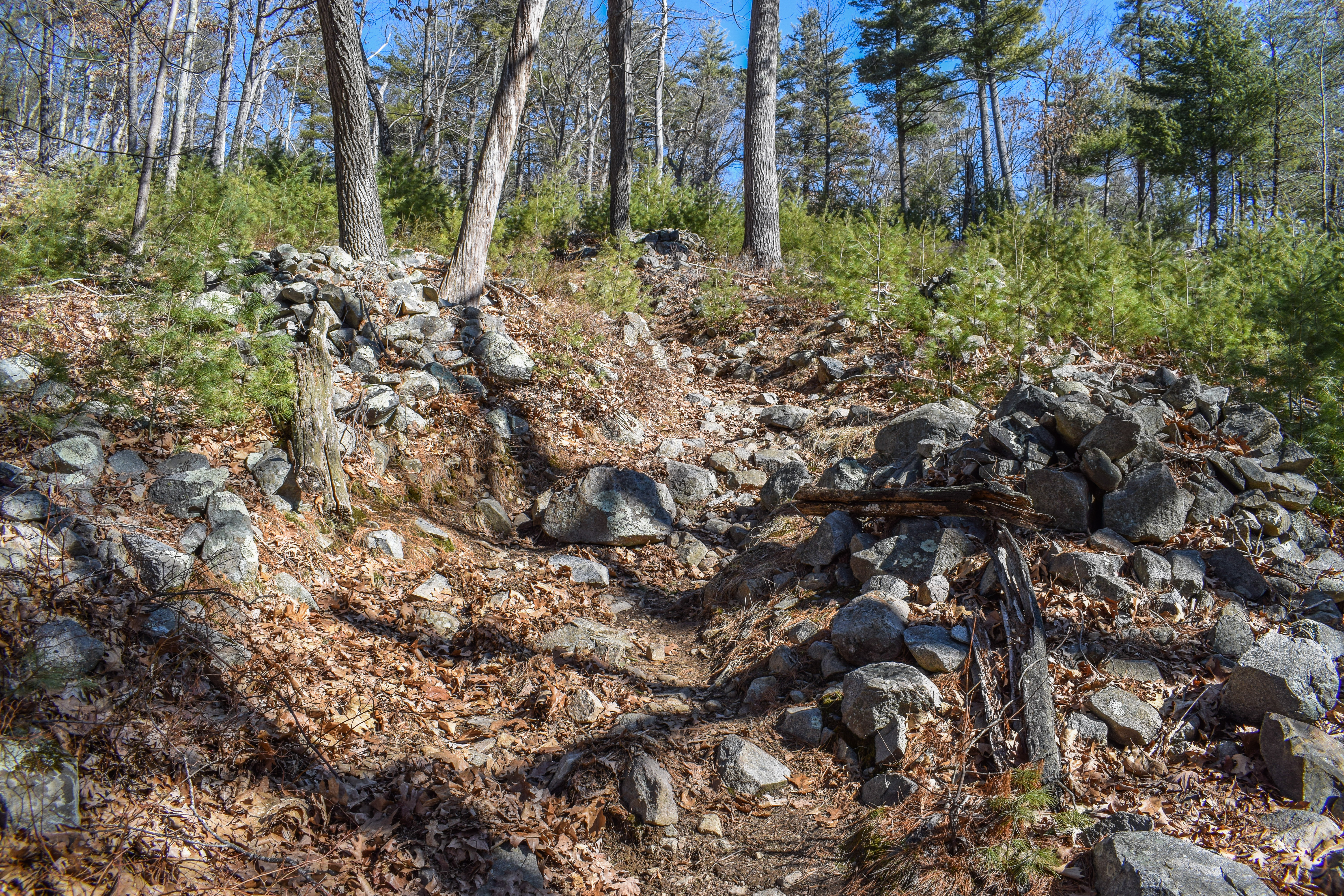
Finally making my way toward the top, I first found the Hemenway Bench that likely had a lovely view years ago, and then followed the trail up to the summit of Little Blue Hill, where there is a lovely open space with a slightly obstructed view of Great Blue Hill, and just a smidge of graffiti. There are a TON of unmapped trails up here, enough where I was able to get lost twice and then follow a third herd path back to the actual trail. Some blazing would be nice up here. I worked my way down via the mapped trail and then took the spur off of 6896, which was effectively not a trail. Someone tied orange flagging tape to mark a path, but without it would be fully undiscernable. About halfway down a small footbed appeared, and the trail ends at another network of unmapped trails in a restoration area which I have since dubbed "the land of 1,000 condoms," unfortunately. Some funny business happens in these woods - there were at least 5 wrappers I walked past and two used ones on the ground... How do they even achieve this? The parking lot closes at 8, so maybe its a cold weather activity when the sun sets earlier? A myster for sure!

The final stretch of the hike is hitting the remaining bits of the Skyline Trail. The section going up Little Blue was steep, and the section leading to 138 was nasty, but now they're done! I had to work hard to find the correct trail leading to the parking lot, but I managed and made it out alive! A weird afternoon in the woods, but still glad I made it out.


Step-By-Step
- Park at Park and Ride on MA-138.
- Start hike along Cosmos Path, try to stay on path and avoid unmapped trails.
- At 6877, hike out and back along trail.
- At 6877, turn right back onto Cosmos Path.
- Hike to 6680, then backtrack and continue on Cosmos Path. 
- At 6650, hike spur to row and continue on Cosmos Path.
- At 6850, turn right onto K Path.
- At terminus, turn around.
- At 6800, turn right onto Skyline Trail.
- At 6896, turn around.
- At 6600, turn around.
- At 6800, turn left onto K Path.
- At 6670, turn right onto Cosmos Path.
- At 6830, turn right onto Moulton Path.
- At 6891, turn around.
- At 6880, turn right into woods and hike trail to Little Blue Hill. 
- At summit, turn around and follow mapped trail to 6896.
- At 6896, follow orange flagging tape onto unclear trail.
- At terminus, follow unmapped trails to the Skyline Trail.
- Turn left onto Skyline Trail.
- At 6896, turn around.
- At MA-138, turn around.
- At next mapped junction, turn right and return to car.

Monday, March 27, 2023

Carberry, Hemenway, Eustis, Great Blue Hill (Blue Hills Reservation)

Carberry, Hemenway, Eustis, Great Blue Hill (Blue Hills Reservation)

Hike Type: Spaghetti Loop
Distance: 6.21 miles
Elevation: 876 feet
Time: 2 hours, 18 minutes
Hiking Challenges: Blue Hills Winter Trace; Great Blue Hill Summits


The Hike
Spring spring spring! The weather has gotten absolutely beautiful, trees are starting to bloom, and the frogs are chiping in the Blue Hills! I wanted to take it easier for this hike after my bonked afternoon last week. I parked at the Ski Area (the ski season is over!) and started my hike on the Eliot Path, following the red dots. I first hit the spur trail that leads on the right to the bottom of the ski area and back... I'm not sure why this is a listed trail, it's eroded so you can see the path, but everything else shows no sign of use. From there, I worked my way around the backside of the Trailside Museum to hit the spur that connects the Summit Road with Canton Ave., which is a fine path but truly leads to nowhere. Once those initial "chores" were complete I hiked up to the Wolcott Path and really got going.

I found a herd path/abandoned trail/something else that connected the Wolcott Path to the middle of the Carberry Trail (just past the overgrown section), so I happily took that to complete the Carberry Trail. I'd love to see some old photos of this area - the old gate at the terminus fascinates me. There were lots of little birds and critters scurrying about in the meadow too. I'm glad I got this trail completed, because I do not want to have to whack my way in when the plants have grown in more. 

Next stop was the Rotch Path where I heard the beautiful found of the peepers, and then over to the Hemenway Hill Path. I was delighted to barely run into anybody in this part of my hike, except for the one guy who kept asking about my camera on the Summit Road... At least he was nice! The woods up on Hemenway are always so quiet and peaceful, especially off of the Skyline Trail. From Hemenway, I descended via Jeffires Trail, which is a favorite of mine. It meanders through a lot of interesting forest that has varying degrees of damage and regrowth. I waved to the caged well and successfully made it across the Chestnut Run before continuing along the Base Path, and then the entirety of the Eustis Trail, which could really use a nice raking (I don't even know if that's the correct thing to do on trails?).

Afterwards I took the Wolcott Path over to Wildcat Notch to make my way up Big Blue, and this is where I starting running into plenty of people, specifically teenagers. Nothing wrong with that, but I've just been used to my winter crowds. I also noticed that people with hiking backpacks on ate 400% nicer and friendlier than those who are in jeans holding a Dasani. I did make one wrong turn onto the Puddle Path where a couple asked where the towers were. I told them to find the blue trail, but didn't have the heart to tell them how steep it is. 

I eventually made my way up to the top via Raccoon Hollow, saw a nice view from the tower, and then got the random spur trails off of the true summit before dipping down to the top of the ski area, where I admired the incoming rain cloud and the melting snow. I love the juxtaposition of the past two days - cold and skiing at Wachusett yesterday and warm hiking today. 

My trip down was via Raccoon Hollow then Cliff Path, and there was a mysterious helicopter following me the whole time? It was directly overhead for a while... definitely eerie. Maybe they saw me pee in the woods?? Unscathed, I made my way down via the rest of the red-dot loop, and ended taking the spur right before the terminus to the entrance to the Trailside Museum, which I had apparently missed before!


Step-By-Step
- Park at ski area parking area. 
- Start hike by following Eliot Path, and then follow trail behind Trailside Museum.
- Continue onto Wolcott Path, and then veer left onto unnamed trail to Summit Road.
- Turn right onto Summit Road.
- Turn left to hike trail to Canton Ave, turn around.
- Turn left onto Summit Road. 
- At 1046, turn left onto Wolcott Path (green dots).
- Near 1085, follow herd path on left to the middle of Carberry Path.
- Turn left onto Carberry Path, turn around at terminus.
- Hike all of Carberry Path. 
- At 1100, turn left onto Border Path.
- At 1114, turn right onto Rotch Path.
- Turn around at terminus.
- At 1121, turn right onto trail.
- At 1140, veer right onto Hemenway Hill Path.
- At 1154, turn right onto Jeffries Trail.
- At 1150, turn around to hike all of Jeffries Trail.
- At 1182, turn left onto Base Path.
- At terminus, turn left onto Eustis Trail.
- At 1140, turn left onto Five Corners Path.
- At 1141, turn sharply right onto Wolcott Path.
- Hike large triangle at 1115, then turn right onto Wildcat Notch Path.
- At 1092, turn right onto Raccoon Hollow Path.
- At terminus, turn right to follow Eliot Circle clockwise and climb tower. 
- After 1066, turn right to summit Great Blue Hill.
- Hike spur East to road and back.
- Follow trail down to top of ski area, turn around.
- Turn left onto Eliot Circle.
- Turn left back onto Raccoon Hollow Path.
- At 1082, turn left onto Cliff Trail.
- At Summit Road, continue across to Trailside Path.
- Merge onto Eliot Path.
- Take spur on left to ski area, turn around.
- Just before terminus, take spur on right to Trailside Museum Entrance.
- Follow driveway back to car.

Sunday, March 26, 2023

Skiing Wachusett Mountain Ski Area

What's this? A ski post? Not sure if I'll keep this up or not, but I just finished up a day at Wachusett Mountain Ski Area and am feeling the same drive to reflect and write about it, so here we area! I've gotten much stronger, more comfortable, and slightly more confident this season, and I likely won't be getting out to ski again this season, so here we are!

Some stats...

Distance: 10.46 miles
Time: 1:00:37
Total Descent: 7,933 feet
Max Speed: 21.9 mph
Number of Runs: 16 (19 if you count the magic carpet!)

Snow Report
"Happy Sunday Skiers and Riders. It’s going to be a partly sunny day today with temps reaching the high 40’s. Conditions are looking good with an average 4 foot base depth on hill! We have two great events going on today that you won’t want to miss; The ride with River railman and the annual Cardboard box race! One week until closing day, don’t miss out on some spring skiing!"

The Day
Our day started in the teaching/slow skiing area where we did three runs on the Easy Rider carpet, which were vital. I had just bought my first pair of skis and Gen and I are still newbies who are flying solo without Emma for the first time. I STRUGGLED with the first one - the last skis I used were 160s and my new ones are 176s. Thankfully it started coming back to me after each run. The snow was crusty and a bit icy, but thankfully not sheet ice. There were a few other kids out learning, but the mountain wasn't crowded at all at 8:15am. Truly the hardest part of this warm up was getting to the front of the carpet - it was slightly up hill and these long skis were throwing me off. The attendant did compliment my skis, so that's a win!

After our magic carpet warm up we scooted over the Monadnock Express Quad, which we hopped on like NATURALS (except for me getting caught behind a fence post and then ultimately falling out of my skis). Up top we learned why it was called the Monadnock Express - there's an EXCELLENT view of Mt. Monadnock from the top! I loudly told Gen and derailed a ski instructor's lecture, which brought me some joy. We spent some good time here, doing six runs, alternating between Sundowner/Easy Rider and Indian Summer. I was a big fan of Sundowner - you get speed dropping in, then it levels out for a while so you can coast, and then there's a mini headwall that requires some brain time. It's also wider and less crowded than Indian Summer. Indian Summer was fine, but pretty uneventful. It was the faster of the two runs, and I really got to practice my passing skills. The snow on both was frozen but groomed, so it was LOUD loud. By the sixth I was starting to feel more comfortable with my skis, so my personal challenge was hitting a steeper section that joined the two trails near the bottom. I was feeling good!

We took a water break and then the next goal was to take the Minuteman Express to Ralphs Run - a blue run that's listed as a "Family Trail - Use Caution" - perfect for us! I ended up doing 10 runs on Ralph - Gen took four of them off to work on a boot crisis she was having. I'm so glad that I got mine punched out after our last Jay weekend - my feet actually felt great today (minus my burning arches during the first few runs on the magic carpet, which has become standard for me). I really enjoyed Ralph's Run - it started off not too steep, picked up some speed, had a few speed humps (no idea what to call these), and then a STEEP (for me) ending. I fell twice around the steeper sections, both times when I lost control from going too fast. Partially my brain overloading, partially me leaning back because I get scared, and partially me trying to fight my skis/boots. Both falls were graceful and I remembered to put my downhill ski on first! My last few runs were devoted to trusting myself and not leaning back, and it was terrifying, but I did it! Aside from the panicking, I'm still finding myself getting more confident. When I had my four solo lift rides, one of them was completely solo which was DELIGHTFUL, one was with a silent snowboarder, one was with a lovely college student who seemed like she skis like me and Gen will next year, self aware, and another one was a group of three 12 year olds who were blown away by the open terrain park and they were really looking for Uncle Charlie, who can really do backflisp, apparently. The only embarassing moment I had was coming off the chairlift toward the end - my thighs completely forgot how to stand up, so when I got off the lift I was in a full squat, hand on the ground, fully butt sliding 20 feet away from the lift. I have no idea how it happened, but it was highkey fun... 

Our original goal was to get to the top and take the other family friendly trail down, but Gen's crisis took a lot of time so we decided to finish on what we knew, which I was more than fine with. We scanned in for our last lift ride right as it was about to time-out, had a nice last run, and then went to the upstairs restaurant for some lunch before making our way home. It was a great day! I kept Emma updated all day on our progress, and I reminded her that I'm mad at her for costing me so much money. We're likely done for the season now, but I'm thirlled that I have all my gear and already paid for our Indy Passes for next year! Now to rest my very tired body.


Wednesday, March 22, 2023

Tucker Hill, Old 128, Buck Hill Path (Blue Hills Reservation)

Tucker Hill, Old 128, Buck Hill Path (Blue Hills Reservation)

Hike Type: Loop
Distance: 5.69 miles
Elevation: 1335 feet
Time: 2 hours, 8 minutes
Hiking Challenges: Blue Hills Winter Trace; Blue Hills Grid


The Hike
First hike of the spring! I had an ambitious plan for the day, resulting in a final sunset for my Sunset Six Challenge, but my brain and the sky had different plans - regardless, I parked at the Buck Hill Path trailhead and got right to it! My hike started along the Headquarters and then Quincy Path, which were comically soaked with spring runoff. I could not have been more grateful for the NEMBA bridge to save the day! There were moments where I was sure I was going to be walking out of the woods with soaked feet. I made my way to the Athol Path, which like always was steep but lovely. Lots of blowdowns in the upper area, some over the trail, and most in the woods. Curious why - weather, disease, fire, something else? This is where I also had to shed my sweatshirt - first t-shirt and shorts hike of 2023!

After crossing Tucker Hill and trying to figure out which rock was the highet point, the rest of Athol Path was steep and looks seldom used. I then meandered over the Dover Trail, which is thin but lovely, and eventually made my way down the Ayer Trail to the Dark Hollow Path where I heard my FAVORITE sound - frogs! It's officially frog season! Specifically, peepers! I love that sound, truly the beginning of spring. 

The next part of my hike was around Old 128, which is when a bunch of clouds rolled in. I went back and forth deciding if I wanted to keep to my original plan or not. I kept moving as planned and felt my pack feel heavier and heavier, the bugs were waking up, and I really just wasn't in it to win it, so I decided to listen to my body and cut it short, and that is okay! (I had to remind myself of that numerous times. After some more aimless meandering I made my way back to the Buck Hill Path, waved to Buck Hill, and worked my way back to the car. It's okay to not be in the right headspace some days, I reminded myself. And now that means I have another reason to visit Buck again!


Step-By-Step
- Start hike at Buck Hill Path trailhead.
- At 2164, turn right onto Headquarters Path.
- At 2153, turn right to continue on Headquarters Path.
- Where Headquarters Path crosses the road, continue left onto Quincy Path.
- At 2112, walk to road and then follow white-triangles along road.
- Veer left into woods back along Headquarters Path.
- Take third left onto Athol Path.
- At terminus, turn right onto Dover Trail.
- At 2071, turn right onto Tucker Hill Path
- At 2072, turn sharply right onto Ayer Trail.
- At 2094, turn slightly right onto Dark Hollow Path.
- At 2096, continue left onto Bugbee Path.
- At 2129, turn right onto Doe Hollow Path.
- At next junction, turn right onto Bolton Foot Path.
- At terminus, turn left onto Angle Path.
- At 2100, turn left onto Old Route 128.
- At 2123, turn left onto unnamed trail.
- At next junction, veer left onto Beech Hollow Path.
- At 2132, turn around.
- At next junction, veer left to continue on Beech Hollow Path.
- At 2146, turn left onto Oblique Path.
- At 2150, turn right twice onto Old Route 128.
- At 2123, turn around.
- At 2150, turn left onto Oblique Path.
- At 2163, turn right onto Sullivan Trail.
- At 2176, turn left onto Pipe Line.
- At 2189, turn left onto Bouncing Brook Path.
- Near MA-28, continue left onto Forest Path.
- At second junction, turn sharply left onto Buck Hill Trail.
- At 2183, turn right onto Buck Hill Path, follow to car.

Monday, March 20, 2023

Chickatawbut West (Finale) (Blue Hills Reservation)

Chickatawbut West (Finale) (Blue Hills Reservation)

Hike Type: Speghetti
Distance: 10.52 miles
Elevation: 1335 feet
Time: 3 hours, 53 minutes
Hiking Challenges: Blue Hills Winter Trace; Blue Hills Grid


The Hike
Time for the last hike of winter! The solstice is at 5:24 pm today, so I will definitely be done before then. I parked at the Braintree Pass Path trailhead, already suited up from my warm-up hike, and got right to it! It was still chilly outside, but thankfully not too cold, and the sun was getting warmer by the minute. There were a few other cars in the parking area, but I would be delighted to realize how few people I would see during my journey. I was dreading hiking along the Pipe Line, but I was delighted to learn that it was in decent shape. The flat section only had one short moment of squishy mud, and eveything else was firm and stable. It helped that some areas were still frozen over! It did get muddier as the incline started, which required some tricky maneuvering. I stuck to the lefthand side of the Pipe Line for this, but realized about halfway up the right side was dryer. It was the wettest by the Skyline Trail junction, but thankfully I survived unscathed. 


I started my first round of wiggle around 3013, eventually landing along the Slide Hill Trail and Carve Path up Chickatawbut Hill. The Carve Path was an interesting route - an older burned section, a deer enclousure, an eroded path, and a bunch of confusing large cairns that bordered the trail. The climb was steep, but the breaks in the trees allowed the almost spring sun to shine on me, which truly felt revitalizing. Unfortunately, it was at this moment when I realized I forgot to bring a buff AND I forgot to take a puff of my inhaler - oof. There is a lovely open view near the top of the path, and every now and then I could smell a hint of spring. 


Once up on Chickatawbut Hill, I had to do some wiggling near the yellow loop where I found what is likely to be the last needle ice of the season! I found myself stopping every time the sun hit me for some much needed lizard time. The power of the sun is incredible. 

Next step was to descend the Skyline Trail from Chickatawbut Hill all the way to MA-28. The Skyline Trail descends gradually to a great view of Hawk Hill and Buck Hill, and then descends steeply over scrambles and slabs. It comes to another lower view, and then descends steeply again. At the lowest point, the Skyline Trail travels over flat land, before slightly ascending to a very, very wet area near the Pipe Line. At the jct. with MA-28, the granite trail marker has been uprooted and knocked over, but still intact. 


I followed MA-28 for a few feet to now join the Hemlock Bound Trail, which was narrow and had the lovely mysterious yellow blazes. I did a bit more wiggling, which brought me to the loop with the Hawk Hill and Savoy Paths. Just before that loop, the Pipe Line crosses MA-28, and a few feet south of that jct. is an old trail no longer in use that I briefly explored. It seems to maybe connect to the Savoy Path terminus, but I didn't travel too far in. I know there is an old trail somewhere in this area that goes to the Pakomet Spring, but I couldn't find it easily (and still had much ground to cover). 


After my loop I headed up back to the Savoy/Hawk Hill Path jct. to see the view just to the left of the junction, and then worked my way toward the Glover Path, where I was greeted by some impressive stone walls and two lovely deer with extremely fluffy white tails. I really enjoy trails like the Glover Path - long (for the Blue Hills) without other junctions. Very peaceful. 


From there I made my way back to the Braintree Pass Path with an out-and-back on the Lee Path soon after. The rest of the Braintree Pass Path is a favorite of mine - again, long and peaceful. It's really pretty up near the height-of-land where the old Hemlock Bound Trail intersects. There are some seasonal views through the trees, and the trail terminates at an old barricade just before a steep cliff that plummets to I-93. Even more fun, I could see the barricade on the other side of the highway where it used to connect. 


The rest of the Braintree Pass Path is a narrow footpath connecting the old terminus with the Laurel Path, and it's a bit messy. I was able to follow it decently, but it was unclear at times. The Laurel Path was easy and gentle as always, with rushing water near the Great Dome Foot Path. My final climb was on the Curve Path and then Sassaman Notch Path, which is where my lungs really started to get angry with me. I took my time and slowly made my way up, admiring a few well-trained dogs and the eerie burnt woods. Once finally in the notch I hit the 9 mile mark and quetioned my sanity - I really should have drank more water and had some more food, whoops! All I needed was to get up and over Kitchamakin Hill and then down Slide Notch to the car.

The final stretch of trail was much easier, and all I could think about was food, shower, and rest. I was grateful to only have seen a handful of people during this hike. I also remembered that I had hiked an additional 1.5 miles this morning, which definitely contributed to my level of exhaustion. This ended up being my longest-distance and longest-time hike of 2023! Especially when paired with my warm-up hike in Braintree. 12.18 miles/4 hours, 46 minutes! I'm glad I'm still revving things up, which will hopefully help me crush bigger hikes as the weather gets nicer and nicer. Now it's time to put the winter map away and get back to working on my second round of the 125-mile challenge!


Step-By-Step
    - Park at Braintree Pass Path Parking (Chickatawbut Road & MA-28).
    - Start hike along Braintree Pass Path (Red Blazes)
    - At 3022, veer right onto Pipe Line.
    - At 3011, turn right onto Bouncing Brook Path.
    - At MA-28, turn around.
    - At 3011, turn left to retrace steps on Pipe Line.
    - At 3031, veer right onto Slide Hill Trail.
    - At jct. with Braintree Pass Path, turn left onto Braintree Pass Path.
    - At jct. with Bouncing Brook Trail, turn around.
    - At jct. with Slide Hill Trail/Carve Path, turn left onto Carve Path.
    - At 3065, turn right onto Skyline Trail.
    - At second junction, turn right onto Stowe Path.
    - At next junction, turn left to continue on Stowe Path.
    - At terminus, turn left onto Sassaman Notch Path (Yellow Blazes).
    - At next junction, turn around, and hike Sassaman Notch Path to 3094.
    - At 3094, continue straight onto Sassman Notch Path (Red Blazes). 
    - At junction with Skyline Trail, turn sharply right onto Skyline Trail.
    - Hike Skyline Trail to summit of Kitchamakin Hill and Fenno Hill (off-trail).
    - Re-summit Chickatawbut Hill on Skyline Trail, and then follow Skyline Traill all the way to MA-28.
    - At MA-28, turn left to Hemlock Bound Trail Trailhead.
    - Hike along Hemlock Bound Trail to jct. with Bouncing Brook Trail.
    - Turn right onto Bouncing Brook Trail.
    - At 3011, turn left onto Pipe Line.
    - At MA-28, turn around and hike to 3005.
    - Turn right onto 3005, then make another immedite right onto Pakomet Path.
    - At terminus, turn right onto Savoy Path.
    - At MA-28, turn around and hike Savoy Path to 3030.
    - At 3030, turn left onto Hawk Hill Path.
    - Just before 3005, turn left onto Pakomet Path.
    - At terminus, turn left onto Savoy Path.
    - At 3030, turn right onto Hawk Hill Path.
    - At 3044, turn left onto Glover Path.
    - At 3040, turn right onto Slide Hill Trail.
    - At terminus, turn right onto Braintree Pass Path.
    - At 3155, turn left onto Lee Path.
    - At terminus, turn around.
    - At 3155, turn left onto Braintree Pass Path.
    - At terminus, turn left onto Laruel Path.
    - At 3130, turn left onto Curve Path.
    - At 3135, turn left onto Sassaman Notch Path.
    - At jct. with Skyline Trial, turn left onto Skyline Trail.
    - At jct. with Slide Notch Path, turn left onto Slide Notch Path.
    - At 3072, turn right onto Bouncing Brook Path.
    - At 3042, turn right onto Braintree Pass Path.
    - Return to car.

Braintree Traingle (Blue Hills Reservation)

Braintree Triangle (Blue Hills Reservation)

Hike Type: Out-and-Back; Lollipop Loop
Distance: 1.66 miles
Elevation: 39 feet
Time: 35 minutes
Hiking Challenges: Blue Hills Winter Trace


The Hike
Last day of winter! I know that I'm not going to finish the Winter Trace this season, but I figured I'd do my best to set future me up for success. I took a day off of work, and started the journey with a "warm up hike" around the Braintree Triangle (also known as Ponkapoag East). It was a chilly, breezy morning out here in no-mans land. Some of the water in the swamp was frozen and the muddier parts of the ground were nice and crunchy. The highway is very close, and I was constantly reminded of that as cars whipped by. 

The first part of the hike was an out-and-back along the Hemlock Path. There were at least three defined paralleling trails, so I did my best to guess which was correct! Near the highway, there are some ruins that may be old road or fence posts - its unclear. Some of the structures were similar to the barricade found on the other side of the highway, so maybe that's it. I couldn't stop thinking about how wild it was that they cut the Great Cedar Swamp in half with a whole interstate. 

Back at the beginning, I continued my hike along the paved Old Route 128, which was very featureless aside from the marshlands on either side. The trail gently gains minimal elevation, and near the end there are a few unmapped trails on either side. At 5611, I turned into the woods along the continuation of the Braintree Pass Path. The woods were nice an open here, and the old road was wide and soft with pine needles. The path terminates at I-93, and its hard to not imagine the world before the highway when the path connected to the other side. 


Now following the yellow-blazed loop, I continued left onto a much more rugged trail paralleling the highway, before turning left again and hiking over a ton of broken glass, which was interesting. It just isn't a place I expected to see so much broken glass. The return trip was quick, and the weather was finally starting to creep up. It went from 31 degrees to 41 degrees in the half hour I was out - and I was looking forward to a bit more later in the day. 


Step-By-Step
    - Start hike at parking area off of West St. in Braintree (5620)
    - Hike along the Hemlock Path out-and-back.
    - Back at 5620, turn right onto Old Route 128.
    - At 5611, turn right into woods onto Braintree Pass Path.
    - At 5610, turn left onto Winnemoiset Path.
    - At 5600, turn left onto dirt portion of Old Route 128.
    - Continue onto paved section of Old Route 128.
    - Walk to car.

Sunday, March 19, 2023

Black Pond via Lincoln Woods (White Mountain National Forest)

Black Pond via Lincoln Woods (White Mountain National Forest)

Hike Type: Out-and-Back
Distance: 7.22 miles
Elevation: 522 feet
Time: 2 hours, 43 minutes
Hiking Challenges: N/A


The Hike
Gen and I had just spent a great day up at Jay Peak practicing our skiing, and now it was time for the long journey home. I needed to stop in Lincoln to get my boots "punched" because I have mammoth feet, so while we waited we headed to Lincoln Woods for a morning hike. We got to the trailhead around 9 and got moving soon after. We were DELIGHTED to see that they now had a way to pay the day-use fee with a credit card! No more partially-filled envelopes! (Disclaimer: we were actually excited, we are 100% here for supporting the forest, we're just bad at remembering enough cash). The temperature was in the high teens with occasional wind - we put on our layers and got started!

Spikes went on immediately at the ranger cabin, where we chit chatted with the ranger for a few minutes as he watched us struggle with our spikes. He said we had a great plan heading to Black Pond, and then we comisserated over Owl's Head together. The East Branch of the Pemigewasset River was quickly flowing under the suspension bridge and through the icebergs with crystal clear water. We were shocked to see that the sun was peaking through the clouds on what was supposed to be a strictly cloudy day.


We turned onto the Lincoln Woods Trail, back in somewhat familiar territory... although out of the past three times we were on this trail two were in the dark and one was in the rain... The first landmark was the washout from Tropical Storm Irene, which is also the area where they may or may not close the trail someday for repairs. It definitely looks more washed out than before, but that could also just be becuase last time I saw it my head was down avoiding rain drops.


The flat hike continued through some beautiful woods along the old railroad corridor, and then we hit our second landmark: the Osseo Trail trailhead. Across from the trail sign is a kiosk telling about the history of the area, with a reminder to not steal anything (I didn't know I wanted an old railroad stake until now...). Soon after the Osseo Trail junction the trail comes close to the river's edge again where there is an excellent view of a snow-capped Bondcliff. 


We noticed at each landmark along the Lincoln Woods Trail the snowshoe track got thinner. What started out as a wide, open, flat trail, is now only a couple feet wide with snowbanks on either side (that will give way if stepped on). Soon after the view there is a closed bridge and therefore a water crossing, but the rocks were excellently spaced to make the crossing very easy (and thankfully not icy). The trail continues through the serene woods before finally coming to the junction with the Black Pond Trail, which we were happy to take. 


The footbed along this windy trail was just wide enough for a couple of snowshoes. Thankfully it was still cold enough that we were not postholing at all, but some people the past few days weren't quite as lucky. There were postholes over two feet deep - we were highly impressed. The Black Pond Trail starts by wiggling between trees with views to an old Ice Pond. There are a few ups and downs which would have been brutal without spikes. The trail crossed the Birch Island Brook three times, each a little wider than the previous, but none were too wide that a majestic leap couldn't conquer. 


The trail then leads to a view of the water flowing out of Black Pond and a picturesque Owl's Head in the distance. A little further down at the trial terminus is a wide view of the frozen pond with the Bonds rising up behinid the trees. This was a beautiful area and I'm really glad we took the time to come visit, especially since we didn't take the bushwhack on our way to Owl's Head. We took a few moments to enjoy the view, and then started our way back.


The return trip was generally uneventful, but still beautiful. We started passing the afternoon tourist folks who were increasingly less friendly by the minute. We made our way back to the famed bridge, now the sky was much cloudier, and made out way back to the car. I put on my dry clothes in my favorite bathroom in the whole national forest, and we were on our way to pick up my boots and head home.

Step-By-Step
    - Park at Lincoln Woods and begin hike by crossing suspension bridge.
    - Turn right onto Lincoln Woods Trail
    - Continue straight at jct. for Osseo Trail.
    - At next junction, turn left onto Black Pond Trail.
    - Hike Black Pond Trail to its terminus (a view of the pond with the Bonds in the background).
    - Backtrack to car.


"Black Pond Trail" from White Mountain Guide, 31st Ed. (2022)
This east, yellow-blazed spur trail leaves Lincoln Woods Trail 2.6 mi. from the Kancamagus Highway parking area and ends at Black Pond, offering a view of Bondlciff from the shore. Diverging left (west) from Lincoln Woods Trail by an old logging camp site, Black Pond Trail first follows a former logging railroad spur, then leaves it on the left after 150 yds. and skirts teh north shore of an old ice pond, which is in sight but not actually reached. The trail then meanders to the right of a beaver-flooded area, making several turns and climbing over a low knoll; follow blazes carefully. At 0.2 mi., Black Pond trail turns rigiht onto an old logging road, crosses an overgrown logging camp clearing, approaches Birch Island Brook, and then bears slightyl right away from it up a moderate incline, following the brook on a narrow footway along a high bank. At 0.5 mi., the trail makes a short, sharp descend to cross the outlet brook from Black Pond and then recrosses it at a boggy spot. Soon the trail crosses the outlet brook for the third time and follows it to the outlet of Black Pond, where there is a view of Owl's Head Mtn. In another 100 yd. the maintained trail ends at the veiwpoint on the southwest shore.