Friday, October 28, 2022

Puffer's Pond Loop

Puffer's Pond Loop

Hike Type: Loop
Distance: 0.81 miles
Elevation: 39 feet
Time: 16 minutes

Hiking Challenges: 52 Hike Challenge


Happy homecoming weekend! I had some grand plans to hike some of the mountains of Matthew's past, but ended up going the gentle road down memory lane. Instead of waking up at the crack of dawn to hike the Seven Sisters, I slept a little later, drove to Worcester, followed the beautiful MA-112 through North-Central Mass, skirted around the Quabbin, and found my way to the beloved Yankee Candle Village. I got lunch at Dunks, and then drove over the Puffer's Pond. 

Fall colors were past peak but still beautiful, and there was a stillness to their that can only come when the weather begins to dip. I parked on the backside of the pond and took the loop clockwise, only passing a few people enjoying the serenity. The trail is narrow in places, but easy to follow and always scenic. There is a road walk near the beach and over to the dam, and as quicky as it started, it was over and I was back to the car. Truly a beautiful morning, followed by a long nap at the Howard Johnson.


Wednesday, October 19, 2022

Buck Hill via HQ, Doe Hollow, Bugbee, Pig Rock, and Summit Trails (Blue Hills Reservation)

Buck Hill via HQ, Doe Hollow, Bugbee, Pig Rock, and Summit Trails (Blue Hills Reservation)


Hike Type: BH Loop (Loop w/ Spurs)
Distance: 3.4 miles
Elevation: 403 feet
Time: 1 hour, 30 minutes

Hiking Challenges: 52 Hike Challenge, Blue Hills 125-Mile Club (2x), Sunset Six


The Hike

This hike is filed under the usual category of "I just wanted to go home until I stepped foot in the woods." I had a long afternoon of meetings followed by a long, slow drive to the Blue Hills, and I was simply not having it, but thankfully once I got going I was thrilled to be back! I parked on the side of Chickatawbut Road at the Headquarters Path granite marker (not labeled on the map, but you can kind of tell where it is if you follow the Headquarters Path to where it seems to terminate), awkwardly got suited up as cars flew past me, and then dipped into the woods to start the journey.


It was a gorgeous, almost chilly, fall afternoon, and I knew I wanted to see some views from Buck Hill. I started by following the Headquarters Path back along the road for a little while, and when I hit the wide path, I turned left. I skirted around the base of N. Boyce, and then made a sharp right at 2151, to hike along the Doe Hollow Path, which was easy hiking through some scenic woods. It crosses the Skyline Trail and then coincides with the red-dot route for a bit. 


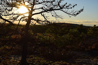
I turned onto the Bugbee Path at 2129 and hiked along "Beech Run," which is a swampy area, but had some beautiful fall colors, and then hit some other trails in the area, making a small speghetti moment, before ultimately hitting the Pig Rock Path and the Buck Hill Summit Trail, which I remembered is one of the most beautiful in the park. It meanders upward and then along a ridgy area with views south, then turns into a recently burned section of forest before crossing the red-dot route. Past that junction, there is a beautiful stretch of unique forest, and then the trail emerges to the "tree line" with beautiful views. The highlight of the view this day was the sun setting next to Big Blue, but also the ocean, Chickatawbut Hill, and the Boston skyline were all beautiful. Monadnock and Wachusett were also visible, but not crystal clear due to some clouds out west. I took some time here to take a million photos and enjoy the moment. 


To close out the loop, I continued along the Buck Hill Summit Trail, which zigzags down the north side of the hill through beautiful, changing woods. There is one great view of Boston near the top, and the rest is wooded. This would be a very gentle way to ascend Buck Hill, for people who don't hike as often but still want the good good views. As the sun set, the woods began to darken, and I may have spooked myself at one point, but we survived and made it home in one piece!


Step-By-Step

  • Park on the side of Chickatawbut Road at Headquarters Path granite marker (unmarked on map).
  • Enter woods, and turn right to hike on Headquarters Path. 
  • Turn left onto wide path toward 2130.
  • Continue toward 2151.
  • At 2151, turn right onto Doe Hollow Path and follow to 2129.
  • Turn left onto Bugbee Path at 2129.
  • Turn left at 2140.
  • Turn right at 2149.
  • Turn right at 2154. 
  • Turn left onto Bugbee Path.
  • Sharp left at 2172 onto Pig Rock Path.
  • Back at 2154, turn right onto Buck Hill Summit Trail.
  • Summit Buck Hill.
  • Descend all the way to car via Buck Hill Summit Trail. 

Wednesday, October 12, 2022

Partial Forest Path Loop (Blue Hills Reservation)

Partial Forest Path Loop (Blue Hills Reservation)

Hike Type: Loop with Spurs
Distance: 6.09 miles
Elevation: 640 feet
Time: 2 hours, 4 minutes

Hiking Challenges: 52 Hike Challenge, Blue Hills 125-Mile Club (2x)


The Hike

I have been slow to write up this one. Maybe its because it lacks the glittery luster of a moose sighting or the fall foliage of the whites right now... or maybe I'm just going through a moment and feeling uninspired. Who knows! Either way, I took the long, trafficky drive from school down the Blue Hills for some hiking on a beautiful fall day in Massachusetts. I parked at Houghton's Pond, used the terrifyingly nasty porta potties, and got started!


I started by walking past the playground and onto the green/red/yellow route, following the shoreline of the pond. There was a cross country meet going on, so I stayed to the side as the teenagers sprinted past me. At the split, I followed the yellow route towards the athletic fields, but then dipped into the woods on the footpath that skirts around the dirt road portion of Old 128. I did a little bit of wandering in this area to hike some trails for my 2nd round of the 125-mile challenge, and then followed the Burnt Hill Path to join the white-triangle blazed Forest Path Loop, which ironically was partially burnt from the fires from this summer.


The scent of the woods with the fall breeze and falling leaves reminded me of my senior year at UMass when I would wander the trails around Puffers Pond, it brought me back to a really peaceful moment in a very hectic part of my life. On the other hand, I was furiously gassy during this hike and I was truly just grateful to be around grey squirrels again (no more crazy red squirrels). It's important to see both sides of things!


I strictly followed the white-triangle blazes at this point, skirting around Buck Hill, just enjoying my time in the woods. A really beautiful section was the Forest Path near Route 28 - the winding trail bordered by the yellow trees made for some beautiful walking. I found the granite markers for the Bugbee Path and Skyline Trail along the spurs to 28, and there was one burnt section with a tip line phone number to report arson - interesting.


I definitely started to lose energy when the trail followed Chickatawbut Road - so instead of following the blazes the rest of the way, I hopped on the Bugbee Path at 2096 and followed the Bugbee Path to Park HQ, and followed the Headquarters Path back to my car at Houghton's Pond. A really beautiful day in the woods! I decided for at least the rest of fall, I'm going to start bringing my camera again. This park is too pretty for my iPhone 8. 


Step-By-Step

  • Park at Houghton's Pond parking.
  • Follow green/red/yellow route.
  • At split, continue to follow yellow route.
  • At picnic area along east side of Houghton's Pond, take path into woods.
  • Hike trails in this area, eventually ending at 2092.
  • Hike Burnt Hill Path to 2111.
  • Follow white triangles for a while.
  • When white-triangle route coincides with red route after South Boyce Hill, turn left onto unnamed unnumbered path toward 2096.
  • Follow green dot to pavement at 2070, and then follow Bugbee Path to Hillside St.
  • At Hillside St., follow Headquarters Path back to parking lot.

Thursday, October 6, 2022

South Moat Mountain (White Mountain National Forest)

South Moat Mountain (White Mountain National Forest)
Moat Mountain Trail

"Happy First Day of Spring"

Hike Type: Out-and-Back
Distance: 5.64 miles
Elevation: 2142 feet
Time: 3 hours, 36 minutes

Hiking Challenges: 52 With a View, Operation Alaska Benchmark Challenge


The Hike 

After surviving the slow drive behind the Quebecois tour bus, going under the Albany Covered Bridge, and not crying while driving on the sketchy part of Passaconaway Road, I finally made it to the South Moat Mtn. Trailhead! The parking lot was decently sized, but also decently full. I was able to find (make?) a spot between two trees. I noticed right away that the weather was much warmer than it was before, and it somehow smelled like spring? While I was getting ready, I was reflecting on the day so far and was just so happy that I was doing this (and not at work). 


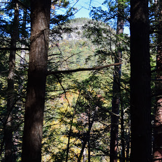
I started the hike right at the trailhead which followed a logging road through a recent clearing. The trees in this early section were very young and some excellent yellow colors that lit up the area. It really felt like a summer day, but with fall colors. The trail followed the logging roads, then dipped into the woods to cross a small brook, then goes through another young forest, and then heads back into another denser section. The trail continues to follow an old wide road, with one section that seems to be rerouted with a nice switchback. South Moat Mountain is barely visible through the trees around this section. The trail dips down to cross the Dry Brook on a lovely bridge. 


The trail begins to pick up steepness soon after crossing the Dry Brook, alternating between gentle trails and steep climbs. There were two sections of rerouted trails: the first was a steep pitch rerouted through some lovely switchbacks, and the second was a steep pitch rerouted through a mini boulder field, which was a little difficult to follow at times. 


After the mini boulder field, the trail starts alternating between climbing up rock slabs and walking breaks in the woods. This section, inoffensively, reminded me a lot of the Kittatinny Ridge in NJ. Open canopy, rocky flooring, and a good amount of partial views. The sun was really beating down at this point, and I spent a good amount of time contemplating the paradox of needing to carry lots of water when its hot, but therefore sweating more when carrying lots of water. Anyway, there is one ledge where there is a lovely view of the surrounding landscape, and Mt. Chocorua likes to pop its head through every now and then. 


The trail continued to meander through slabby sections and gentle woods, and there were two spots that smelled awful - I guess it could have been a decomposing animal? Mushroom? Not sure. The trail was sometimes tricky to follow along the slabs, but I made it up in one piece! The further up the trail, the more views start to appear, and the more bugs start to appear (are these fall bugs or resurrected bugs because of the warmth?). 


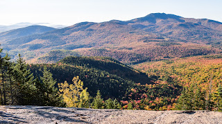
Just below the summit is the first excellent view towards the Sandwich Range, and a little further up is the true summit area which is breathtaking. Views in all directions - just amazing! The area is flat and sandy with some taller rocks on either side that can be climbed. The fall colors were spectacular and nobody was at the true summit! I then realized why... the flies! I've never been so bombarded with flies before. I think they may have been deer flies? I'm not really sure. They were insane. The rocks looked like they were moving with all of the beasts crawling on them! Either way, the views were amazing and worth the bit of torture. I parked just below the summit for a quick break.


The views...


...and the flies!

Heading down the mountain started slow as six mountain bikers walked up past me carrying their bikes (?!), but then I flew down the mountain. I found humor in how slowly I went up, but how quickly I went down. The return trip really felt fast, and before I knew it I was back at the car. I did my quick change, and then set up a camp chair to journal outside of the car since the weather was so nice. A chipmunk even came up to me to say hello (or beg for food...). Either way, once finished I hopped back in the car and started the long drive home. The cherry on top of this amazing day was my shower once I got home, and while washing my hair, I found one last fly.


Step-By-Step

  • Carefully follow Moat Mountain Trail (yellow blazes) from parking lot to summit and back.


“Moat Mountain Trail” from White Mountain Guide, 30th Ed. (2017)

This trail traverses the main ridge of Moat Mtn., providing magnificent views from numerous outlooks. Parts of the ridge are very exposed to weather, particularly in the section that crosses Middle Moat and South Moad. the trail can be hard to follow along the open ridge sections in poor visibility; look carefully for cairns and blazes, many of which are faded. 

The south terminus of the trail is located on Passaconaway Rd. (formerly Dugway Rd.). at the lights on NH 16 in COnway village, turn north (directly opposite NH 153) onto Washington St., which becomes West Side Rd. Go left at a fork, then at 0.9 mi., turn left onto Passaconaway Rd. Moat Mtn. Trail (sign) leaves Passaconaway Rd. at a trailhead parking area on the right, 3.2 mi. from West Side Rd. Passaconaway Rd. continues west another 3.4 mi. and joins the Kancamagus Highway near Blackberry Crossing Campground (but the west part of Passaconaway Rd. is closed to vehicles from November to May).

[...].

[...]. The trail descends to a col with a patch of woods that would provide some shelter in a storm, turns sharply right, climbs over an open ledgy knob, and ascends to the summit of South Moat at 7.0 mi.

The trail descends into scrub with intermittent views for 0.3 mi. then enters wood with many beautiful red pines. At 7.6 mi., the trail crosses a large, open ledge with southwest views (on the ascent from the south terminus, this is the first good outlook reached), and the trail becomes steep with rough footing. Below this section, the grade eases somewhat (although there a number of rough ledges), and at 8.3 mi., the trail turns right onto a wide, well-constructed relocation. The trail runs generally west, descending at easy grades with occasional minor ascents, crosses Dry Brook on a bridge at 8.6 mi., swings left and then right over a small ridge, and crosses a small brook at 9.3 mi. The trail climbs over another low ridge then turns left and runs 0.1 mi. followed by a temporary reroute to the right of an active log landing. (Starting from the trailhead, the reroute went left into the woods.) when the timber harvest is completed, the trail will resume its former route for the southernmost 0.1 mi. on a logging road beyond the gate at the trailhead.


Photo Album

Table Mountain (White Mountain National Forest)

Table Mountain (White Mountain National Forest)
Attitash Trail - Table Mountain Summit Spur

"Death by Red Squirrels"

Hike Type: Out-and-Back
Distance: 3.71 miles
Elevation: 1388 feet
Time: 2 hours, 8 minutes
Hiking Challenges: 52 With a View, 52 Hike Challenge


The Hike

I was feeling a little tired and not-wanting-to-drive after yesterday's adventure to Morgan & Percival - but the weather was supposed to be immaculate and I had promised myself that I would take a day off mid-week to see the foliage and hit some peaks, so this was that day! My 3:45am alarm went off, had a long sleepy drive to Bear Notch Road, but immediately woke up when I saw a moose! It didn't hang around for me to take too many photos, but it was majestic as anything. I drove a few more miles and then turned into the fascinating trailhead for the Attitash Trail - massive potholes, a few spots for cars, but nothing extremely clear. It was only me, it was 45 degrees, so I suited up and went into the woods! 


The trail starts by following above Louisville Brook, which makes for a beautiful beginning. There are a couple of small crossings, but nothing serious. The trail continues on and the brook becomes closer, eventually leading to some beautiful cascades. It looked as if some people shimmy down the ledge to get closer, but I was not feeling too adventurous. The trail, now in line with the brook, begins to get a bit wet, and then turns right to ascend for a short moment to the col between Bear Mtn. and Table Mtn. 


After the short ascent, there is more easy woods walking. I saw a couple toads, admired the beautiful, changing leaves, and whispered "wow" to myself as the sun started to illuminate the top of the forest. There were extremely obstructed views of Bear Mtn. through the trees, which was being lit up with the golden hour sun. The next turn starts the challenging section of the trail.


The trail begins to climb more steeply, and there are some nice switchbacks to help with this process. The ground gets very gravelly with loose footing and one scramble, but then opens up to a slabby section where the views begin - wow! The fall colors were being lit up by the morning sun, it was breathtaking! There were three sections of views, each getting better (and higher) than the previous. Between the views were pebbly/rocky/slabby sections, but nothing too daunting. The main view was truly excellent with views from Passaconaway on the right all the way past Chocorua on the left. 


I took the optional route to the true summit, because why not. I followed the Attitash Trail a little further down, which was noticeably more narrow now, and then turned left at an obvious spur path. This was a very claustrophobic section of trail, with hard branches jutting out in every direction. The red squirrels were not happy about my presence, either. There is one steep section on this spur path, and it leads to a large summit area, indicated by a tree with a green stripe painted on itself. 


This started the beginning of the return trip, which went very fast. I had to go slower at the upper sections of slab and loose gravel, but really cruised down the rest of the trial. The woods were just beautiful with the morning sun, and I was so glad that I took the day and the time to come up. Back at the parking lot, there were two cars: one couple that was going hiking, and one leaf-peeping couple that had no idea what they were doing. They asked me about the hike and I told them the beginning was lovely but it does get tricky at the top, they walked into the woods, and no more than 5 minutes later were back out of the woods. I wish them the best! Now, it was time for me to drive over to the South Moat Mountain Trailhead, and practice my patience as I got stuck behind a Quebecquois tour bus...


Step-By-Step

  • Carefully follow Attitash Trail from parking lot to summit.

  • At height of trail past the main view, turn right for the summit spur path.

  • Hike to the summit and back.

  • Retrace steps back down Attitash Trail to car.


“Attitash Trail” from White Mountain Guide, 30th Ed. (2017)

This trail runs from Bear Notch Rd., 2.7 mi. south of its jct. with US 302 in Bartlett village, to Moat Mtn. Trail, 2.4 mi. west of West Side Rd. This trail is well trodden from Bear Notch Rd. to the ledges of Table Mtn., where you have good views from an area burned by a small forest fire in October 1984. Except for these ledges, the trail is in the woods all the way, and the section east of Table Mtn. is wild, rough, and very lightly used. This part of the trail has prolific vegetation, and hikers may encounter blowdowns and overgrown sections. Though it was well-cleared in 2016, this section is not recommended for inexperienced hikers. The trail is marked with yellow blazes of various ages, although not all sections are marked well.

Leaving the small parking area on the east side of Bear Notch Rd., the trail follows a logging road that crosses a major branch of Louisville Brook in about 120 yd. At 0.3 mi., the trail bears right on an older road. At 0.6 mi., the trail comes to the edge of Louisville Brook at a small, ledgy cascade and follows near the brook. In less than 0.1 mi., the trail crosses a branch of the brook then turns left (arrow) at a logging road fork and ascends moderately to the col between Bear Mtn. and Table Mtn. at 1.3 mi. The trail turns sharply left here and climbs more steeply; loose gravel on ledges makes for frequently slippery footing, particularly on the descent. Soon reaching the edge of the burned area, the trail crosses several ledges with excellent views to the south and southwest, with one fairly steep scramble. At 1.9 mi., the trail reaches its high point on Table Mtn. and passes somewhat south of the summit, with views available a short distance to the right from a large ledge at the edge of the south cliff. 


Photo Album

Wednesday, October 5, 2022

Mt. Morgan & Mt. Percival (Squam Range)

Mt. Morgan & Mt. Percival
Mt. Morgan Trail - Ladder Spur - Crawford-Ridgepole Trail - Mt. Percival Trail - Morse Trail

"It's Friggin' Fall"
Hike Type: Loop
Distance: 5.41 miles
Elevation: 1509 feet
Time: 4 hours, 32 minutes

Hiking Challenges: 52 With a View, Operation Alaska Benchmark Challenge, Terrifying 25, 52 Hike Challenge, Summit Beer Society


The Hike 

It's Yom Kippur and my school district has the day off! In order to atone for our sins, Kerri and I headed up to the Squam Range for our first hike together - to tackle Mt. Morgan and Mt. Percival! I chose these for their relatively easy stats (~5mi, ~1400ft), views, and the optional T25 routes, and it did not disappoint! The parking lot wasn't clearly marked, but Google Maps did its job well. We were the only ones in the parking lot at 8:00am on a cloudy Wednesday, so we got the party started!


The Mt. Morgan Trail is very easy to follow and really beautiful, especially with the fall colors popping up. The trail starts gentle and then picks up in elevation gain, but nothing ever gets too steep. I couldn't stop gawking at the fall weather and colors, constantly screaming "its friggin' fall!!". Naturally, I was still sweaty, but at least the weather was more forgiving! The fun really begins at the junction with the ladder trail (signed as "Mt. Morgan via Cliffs).


The ladders themselves looked daunting, but they weren't too bad. The first one had a little give to it when climbing, but still felt very sturdy. The transfer from the first to the second was easy, and the transfer from the second to third was a bit sketchy. The third ladder spreads out in a V shape which was... interesting. It was fine, though. There is a small cave at the end of the ladder trail that I was VERY stressed about, but it ended up being easy peasy. 


The cave opens up to a great view of Mt. Webster, presenting some excellent fall colors, and then continues to climb. There is the word "SHADOW" painted in blue on the rocks with a yellow arrow that points to the trail, which was interesting - I'm not sure what it meant. There is one sketchy scramble after the view, but it wasn't too challenging. After this, it was smooth sailing!


The trail opens up to a magnificent view of Mt. Webster and Squam Lake. We got really lucky with our choice of mountain. The Belknaps were in the rain and the Ossipees were all in the clouds, so we were so happy to be dry AND not in the clouds. The fall colors were absolutely beautiful, and the weather was in the 50s and just perfect. Just past the view is the left turn to the true summit, so we booped the disc and then continued our journey.


The Crawford-Ridgepole Trail between Morgan & Percival is relatively easy with a few ups and downs, some rockier than others. The red squirrels were in full effect, making Kerri question if they were actually harmless (they sure don't sound like they are). The trail alternates between green piney forests and hardwoods with lovely foliage. Soon enough, the trail opens up again to the summit area of Mt. Percival!


The summit area is marked by a large cairn, but the true summit is atop a large boulder behind some trees, marked by a drill hole. There are excellent views from just below the cairn at the top of the boulder cave route (that we did not take). We took a long sit here to eat and drink our Downeast Cider Donut hard ciders - delicious!! The only thing that got us moving again was the thought of a hot lunch, so we started the trip down.


We followed the "cliff route" instead of the "cave" route, and although it had steep scrambles, it was very doable. The trail slightly mellows at the junction with the cave route, and then begins to actually mellow out further down. There was one rocky section where we briefly lost the trail, but it was quickly and easily fixed. From here on out, the trail was easy going! Nice walking, Kerri got to use a pee-funnel so she could stand up to pee, and we only passed one other person. It did feel like it took forever, but I was simply ready for a cheeseburger. The final new section was the Morse Trail, which connects the Mt. Morgan and Mt. Percival Trails, and it was more easy hiking. 


There is a very short walk after the Morse Trail back to the parking lot, which was now almost full, insinuating that most people are doing the same route that we did. We did a quick change because it was cheeseburger time! We drove to the Twin Barns Brewery for a delicious cider and the most insane burger I've had in a while. It was called the brunch burger, and it had two patties, a hash brown patty (which was more like a latke), a fried egg, and hollandaise aioli - the chef watched me eat it it was so impressive (I inhaled it). A great day!


Step-By-Step

  • Start hike from Mt. Morgan Trail parking lot.

  • Follow Mt. Morgan Trail up the majority of Mt. Morgan.

  • At jct. with the Ladder Trial, turn left to climb ladders.

  • At view of Mt. Morgan, continue on trail and turn left to climb to summit.

  • Return to jct., turn left to hike along Crawford-Ridgepole Trail towards Mt. Percival.

  • Summit Mt. Percival.

  • Follow Signs for Rt. 113 via Cliffs.

  • Follow Mt. Percival Trail down mountain.

  • At jct. with Morse Trail, turn right onto Morse Trail.

  • At terminus of Morse Trail, turn left back onto Mt. Morgan Trail and hike to parking lot.


“Mt. Morgan Trail” from White Mountain Guide, 30th Ed. (2017)

This trail, leading to a summit with fine views, leaves the west side of NH 113, 5.5 mi. Northeast of its jct. With US 3 in Holderness and 6.3 mi. southwest of its jct. with NH 109 in Center Sandwich. From the parking area, the trail follows an old logging road, turning left off it almost immediately. At 0.1 mi,. Morse Trail diverges right, leading 0.5 mi. to Mt. Percival Trail. Mt. Morgan Trail climbs west at a moderate grade then swings right and traverses to the north. At 1.4 mi., the trail swings left to begin the steeper ascent of the southeast slope of the mountain. At 1.7 mi., Crawford-Ridgepole Trail enters left from Mt. Webster, and the two trails coincide, passing a difficult spur path (use caution) that branches left, ascends three ladders, and climbs about 100 yd. through a boulder cave and up steep ledges to the cliff-top viewpoint. After climbing a set of steps, the main trails soon reach a jct. where Crawford-Ridgepole Trail diverges to the right for Mt. Percival. Here, Mt. Morgan Trail leads 0.1 mi. Left to the cliff-top viewpoint; partway along, a short spur leaves on the right and runs 50 yd. To the true summit, where you have a restricted view north.


“Crawford-Ridgepole Trail” from White Mountain Guide, 30th Ed. (2017)

This trail follows the backbone of the Squan Range from Sandwich Notch Rd. to the south knob of Cotton Mtn. The trail starts on the southwest side of Sandwich Notch Rd., 3.7 mi. from NH 113 in Center Sandwich, 0.5 mi. beyond the Sandwich Town Park/Bearcamp River Trail parking area, and 1.8 mi. south of the power line along the Beebe River. There is space for one or two cars at the trailhead; other parking may be found a short distance east along the road. Except for the very popular segment between Mt. Percival and Mt. Morgan, the trail is used infrequently, despite fine views in the Squam-Doublehead section. The northern half of the trail is ledgy and rough in places and is more difficult than the statistics and the map would suggest.

[...].

The trail crosses the east summit of Mt. Squam, where you have a good view, at 3.0 mi. The trail continues along the ledgy ridge, in places requiring care to follow, crosses the west summit of Mt. Squam, passes an outlook south, descends through a notch, and climbs to Mt. Percival Trail and Mt. Percival’s excellent views at 4.4 mi. Continuing along the ridge with minor ups and downs and occasional views, Crawford-Ridgepole Trail passes just west of the actual high point of the range (sometimes called the Sawtooth, it can be reached by a short but thick bushwhack and has a restricted view) and continues to a jct. with Mt. Morgan Trail at 5.2 mi. Here, Mt. Morgan Trail leads to the right 90 yd. to a fork; the left branch (almost straight ahead) laeds another 50 yd. to a fine cliff-top viewpoint, whereas the right branch leads 50 yd. to the true summit of Mt. Morgan, where you have a restricted view north.

From this jct., Crawford-Ridgepole Trail and Mt. Morgan Trail coincide, bearing left and descending a set of steps. Shortly, a difficult spur path (use caution) branches right, ascends three ladders, and climbs about 100 yd. through a boulder cave and up steep ledges to the cliff-top viewpoint on Mt. Morgan. The main trail descends to a jct. at 5.6 mi., where Mt. Morgan Trail turns left to continue its descent to NH 113, and Crawford-Ridgepole Trail turns right to climb at mostly easy grades toward Mt. Webster. [...].


“Mt. Percival Trail” from White Mountain Guide, 30th Ed. (2017)

This trail provides access to fine views and interesting boulder caves on Mt. Percival and, in combination with Mt. Morgan Trail, Morse Trail, and Crawford-Ridgepole Trail, offers one of the most popular and scenic loop hikes on the southern fringe of the White Mtns. The trail begins on the north side of NH 113, 0.3 mi. northeast of the Mt. Morgan-Rattlesnake parking areas. Parking for this trail (sign) is available at the end of a short gravel road. 

The trail follows a logging road past a chain gate and ascends at an easy grade. At 0.2 mi., Morse Trail diverges left for Mt. Morgan Trail. Mt. Percival Trail passes through a clearing, and at 0.4 mi. the trail turns left onto a relocated section then loops back to rejoin the original route at 0.6 mi. At 0.9 mi., after a slight descent, the trail crosses a brook and climbs moderately. At 1.5 mi., the trail turns right (northeast) and traverses the south slope of Mt. Percival for 0.1 mi., descending slightly. The trail then swings left and climbs steeply to a fork at 1.9 mi. (From this fork, an alternate route diverges left and ascends a difficult and very strenuous route through a boulder cave [not recommended in wet weather] then continues up ledges to the summit.) Here the main trail turns right; struggles up a steep, rough, ledgy section; crosses a cliff top with a fine view of Squam Lake; and continues over ledges to join Crawford-Ridgepole Trail at the open summit.


“Morse Trail” from White Mountain Guide, 30th Ed. (2017)

            This trail links the lower ends of Mt. Morgan and Mt. Percival trails, making possible an excellent loop hike without a road walk on Nh 113. Morse Trail diverges right from Mt. Morgan Trail 0.1 mi. from NH 113 and descends easily to cross a small brook. Morse Trail passes through a gap in a stone wall and ascends gradually, crosses a brook on a footbridge at 0.4 mi., passes through a gap in another stone wall, and bears right to meet Mt. Percival Trail, 0.2 mi. From NH 113.


Photo Album