Skyline Loop via Trailside Museum (Blue Hills Reservation)
Distance: 4.49 miles
Elevation: 1,184 feet
Elevation: 1,184 feet
Time: 1 hour, 47 minutes
Hike Type: Lollipop Loop
Hiking Challenges: 52 Hike Challenge 2024, Blue Hills Grid, Great Blue Hill Summits
Hike Type: Lollipop Loop
Hiking Challenges: 52 Hike Challenge 2024, Blue Hills Grid, Great Blue Hill Summits
The Hike
We're finally back! It was a lovely late-morning - 60 degrees and sunny (we were having "fake fall" in Boston). It was my first time back at the Blue Hills all summer and it felt good to be back! I was seeing Pink this afternoon, and I was officially breaking in my new hiking shoes (another pair of Merrell Moab 3s).
Right away I noticed that Eliot Tower construction signs were gone - was it open again?? The fall-like weather was delightful on the ascent and soon enough I was in the newly reopened tower! It even smelled new! They did a great job tidying up and securing the tower for years to come. They even added panoramic view guides in the terrace area.
I continued onto the actual summit and saw a sign that they had to cut down some tall white pines that were interfering with the weather station - I found the remnants of the trees in the woods along the summit spur (the path that also leads to the top of the ski area). It smelled like a candle!
Continuing on, I also noticed there were new plaques along the Eliot Bridge (the circular ones that have been missing for years). I had to tighten the shoes since they were adjusting to my feet, and I was now on the descent. I made it up and down Wolcott without problem (minus some angry lungs, but it was not a problem). Downtown Crossing was quiet and so was Hemenway with its classic view.
One weird thing I've been dealing with is walking in such a way where my left foot kicks my right heel bump (I have no idea the actual term for this), causing a scab. I usually forget about it until I kick it, and I kicked it hard coming down Hemenway! I guess I need to relearn how to walk?
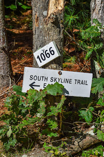
Another easy up on Hancock and I noticed the grassy regrowth was going strong on the burned areas! I made my way down, turned onto Hillside Street (they're still working on renovating the barn), and found one last Eliot Tower construction sign (a leftover) right at the Skyline South trailhead.
To no one's surprise, I was pretty gassed going up Houghton Hill, but what else is new? I also started planning tomorrow's hike with Adam and Sarah (due to timing and Adam having a child, we decided on Monadnock via less popular trails), and then I passed a women who loudly proclaimed "ITS FINALLY COOL ENOUGH TO HIKE!" - I agree, lady, I agree.
My body was feeling tired but it felt good to be back. I suffered through the final climb up Great Blue Hill again and had a nice, quick descent. When I landed, the parking lot was really starting to fill up, so I was happy to be down. Off to Pink (SHE WAS AMAZING)!
Step-By-Step
- Start hike from Trailside Museum parking on Eliot Path (red dots).
- At terminus, turn right onto Eliot Circle.
- At next jct., turn left onto Summit Road.
- At next jct., turn right onto spur trail to Summit.
- Descend summit towards Skyline Trail South.
- Turn left onto Skyline Trail, and then right onto Skyline Trail South.
- Follow Skyline Trail South to Hillside St.
- At Hillside St., turn left onto Hillside St.
- After stables, turn left onto Skyline Trail North.
- Follow Skyline Trail North to Eliot Tower.
- At Eliot Tower, turn left onto Eliot Circle.
- At second jct., turn right to summit Great Blue Hill.
- Retract steps back to parking lot.


No comments:
Post a Comment