Sunday, December 29, 2024

Jug End via Appalachian Trail (Jug End State Reservation)

Jug End via Appalachian Trail (Jug End State Reservation)

Distance: 1.64 miles
Elevation: 633 feet
Time: 0 hours, 54 minutes 
Hike Type: Out-and-Back
Hiking Challenges: N/A

The Hike
So, skiing was a bummer, but surely the weather will lighten up for a short hike! I found a hike ~10 minutes from Catamount along the Appalachian Trail to "Jug End" that was just over a mile and a half long - a perfect, easy ramble! I got to the trailhead (pull-off on Jug End Road) and saw there's only about 10 more minutes of rain left, so I broke out my pack cover for the first time ever and dug out my Frogg Toggs that I bought for my Mt. Cabot hike. I haven't used the jacket since that hike in late June, and it smelled BAD. But I still threw it on because going rain jacket-less in 40 degrees seemed like a very poor idea. My camera came in my pack for a ride, and I was off!


The woods were peaceful with the pitter-patter of the rain and there was no snow down low, which was welcomed. I passed a tree with very wet, very red bark, and heard gunshots in the distance. Curious if it was a range, a private home, or a hunter? Thankfully I was very visible, so I did not get hunted!

There was some ice at a switchback and then the trail began to climb more moderately with some sketchy footing. I was SWEATING under the jacket, but my own moisture was better than cold rain. The trail continued to zigzag and easy to moderate grades and came to one switchback with some intense ice. I was able to avoid it by going off-trail, but I would not have been able to get across it without spikes.


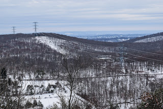
Higher up, there was another tricky spot that I was able to slowly avoid. The rain slightly lit up for a bit and I took the jacket off to cool down. Soon enough, I came to an open ledge that had what I'm sure is a beautiful view, but I just had the pleasure of looking into a cloud! The true summit of the knob was just off-trail but easy to find. I could have continued down the AT for another mile or so to another peak, but it was back to raining so I figured I wouldn't push it. I could just barely make out a nearby ridge on my way down, and the jacket was soon on again as I got chilly quickly (I was fine once it was back on, thankfully). 


The return trip was slow, steady, and easy. I was glad I didn't wait in my car any longer but this rain was not giving up, which was a bummer, but did validate my choice to stop skiing for the day. Before I knew it was descending down to Jug End Road and it was time to change into dry clothes and wait a comically long time for some breakfast at the Great Barrington Dunkin! And just like that, this concludes the 2024 year of hiking!


Step-By-Step
- Park at Appalachian Trail crossing on Jug End road.
- Hike out-and-back on AT soutbound.

Skiing Catamount Mountain

Skiing Catamount Mountain
December 29th, 2024

Runs: 5
Distance: 5.04 miles
Elevation: 3,576 feet
Max Speed: 26.6 mph
Avg. Speed: 11.8 mph
Moving Time: 25 minutes, 5 seconds
Total Time: 1 hour, 8 minutes, 24 seconds


Time for my great pilgrimage back to New England! The weather forecast was looking warm with an unclear amount of rain, but I decided to bite the bullet and make a reservation at Catamount - somewhere I had already been. I had a nice drive up and was one of the first 20-ish cars in the parking lot, ready for the 8:30am lift start time.

Mountain Report: Sunday, December 29th. You may have looked at the weather and seen the little rainy cloud image shown for today's weather. We did too, but we're here to tell you, things are actually looking good for today! Despite that daunting rain clouds, the forecast is only showing a short peroid of rain in the morning and then just cloudy skies and warm temps for the rest of the day, all the way through night skiing. With temps staying above freezing last night, there's a good chance of soft snow and great conditions today.

Runs 1-2:
Run 1: Catamount Quad - Cat's Meow - Colonel's Caper - Holiday
[0.65 mi; 3:22; 374 ft; 21.9 mph max; 11.6 mph avg]
Run 2: Catamount Quad - On Stage
[0.45 mi; 3:25; 404 ft; 25.9 mph max; 7.8 mph avg]

I realize that I've been spoiled by Jay Peak, which runs like a well-oiled machine (and is super communicative with condition updates). The Catamount website said five lifts would be spinning at 8:30am, but only the Catamount Quad started right away. There was also race training, so I got started a few minutes after 8:30am once all the racers made their way up the practice slope. My first run was a route I hadn't done before, Cat's Meow - Colonel's Caper - Holiday, which was fine. Cat's Meow was a cat track and the rest of the run was more like spring skiing, which was fun to remember how to ski! I tried to get to the Meadow's Triple, which was supposed to be open, but it was closed to everyone except ski school.

I scooted my way back to the Catamount Quad for a quick run down On Stage. At this point, the high speed quad was not spinning, but the Glades Triple was, so I took that up to near the top.

Runs 3-5:
Run 3: Glade Triple - Ridge Run Ext - Ridge Run - Upper Promenade - Lower Promenade - Homeward Bound
[1.48 mi; 7:03; 945 ft; 24.1 mph max; 12.6 mph avg]
Run 4: Glade Triple - Upper Sidewinder - Lower Sidewinder
[1.01 mi; 4:07; 922 ft; 26.6 mph max; 14.8 mph avg]
Run 5: Glade Triple - Ridge Run Ext - Ridge Run - Upper Promenade - Lower Promenade - Homeward Bound
[1.46 mi; 7:07; 932 ft; 25.0 mph max; 12.3 mph avg]

It was now raining, which wasn't too bad. My first run was the long route, following the Ridge Run Ext to Ridge Run, the Promenades, and finally Homeward Bound. It was a nice gentle run, but the snow felt so different than the hard pack/ice I've skied on so far this season! The big thing I noticed were my edges catching complete randomly. I also noticed that when that would happen, I was sitting back in my boots... classic!

Second run was down Sidewinder, which is a super fun run. I attacked it with more confidence, and then fell right at the end. I think again, a combo of sitting back slightly and slushy snow had my brain confused. I'll blame the rain for some, too!

My fifth and final run was another long lap from Ridge Run to Promenade. I emotionally wanted to get some more, but the mountain was only getting busier and the rain was only getting harder. I headed back to the car, checked the weather again, and saw the rain should be ending in a half hour. I made the wild decision to change and drive to a trailhead and get a hike in - more on that soon!

Friday, December 27, 2024

Tourne Loop (2x) (Tourne County Park)

Tourne Loop (2x) (Tourne County Park)

Distance: 2.80 miles
Elevation: 643 feet
Time: 0 hours, 55 minutes 
Hike Type: Lollipop Loop
Hiking Challenges: N/A

The Hike
A quick final trip to the Tourne of 2024! It was a pretty, chilly morning at 15 degrees and there were no other cars in the parking lot (yay!). The morning light was stunning on the snow, which ranged from a dusting to 3". My puffy came off after a few minutes and then I alternated with a baselayer/fleece sleeps up and down for the rest of the hike. I only saw one person on my hike - one guy at the top of my second lap. The best thing I saw, though, was a beautiful red fox following the trail down with me. It was fixating on something in the woods, so I had to announce myself a couple of times so it knew to keep it moving. A fun morning!


Step-By-Step
- Park at parking area on the Old Denville Side of McCaffrey Lane.
- Start hike on Yellow Dot trail from parking lot.
- At terminus, turn left onto Yellow trail to hike the loop.
- After two loops, return to car via Yellow Dot trail.


Tuesday, December 24, 2024

Pyramid Mountain Loop via Boonton Ave. Field (Pyramid Mountain Natural Historic Area)

Pyramid Mountain Loop via Boonton Ave. Field (Pyramid Mountain Natural Historic Area)

Distance: 5.59 miles
Elevation: 712 feet
Time: 2 hours, 28 minutes
Hike Type: Lollipop Loop
Hiking Challenges: 52 Hike Challenge

The Hike
Merry Christmas Eve! No skiing today, but it was a perfect morning to head out to Pyramid Mountain for a snowy stroll through teh woods. It snowed just over an inch overnight and it was beautiful out! 26 degrees with a small breeze in open areas. I parked at the Boonton Ave Field and followed the green blazes over to the official trailhead, which featured yet another new map!


I was setting first tracks on the Green Trail once in the woods, with a few critter prints here and there. I remembered a slippery section near the end of the Green Trail from previous excursions, and just as I was wondering where that spot was... SPLAT. The spot was an ice-coated slab hidden my snow... ouch! I didn't bruise, but I felt that one for a few days!


My humbling fall hed to the Orange Trail, which I followed clockwise. I didn't mess around with the ledge view based on my previous tumbling, but it was still very pretty. There were also a few sets of footprints too, which was nice. There were a few sketchy spots with slippery footing near the reservoir, but slow and steady was all that was needed. That, and some calls of encouragement from a daunting amount of crows.


The Orange Trail ends at the Blue Trail, which I followed through the power cut, turned the sharp corner, crossed the power cut again, and then noticed another reroute of the Blue Trail! Instead of the steep, eroded pathway up, it now follows a much longer route (little less than a half mile extra) that is much gentler. Eventually, I did made it to the summit with a nice view, and then continued on.


On the Blue Dot Trail, I saw something I hadn't seen in a while - snow fleas! Lots of them, too. Some blue sky was starting to pop out once near Tripod Rock, and then I continued my way back to the Orange Trail and then onto Green.

The sun was shining, I was STARVING, and I followed my sole footprints back to the car on green. I did pass a duo near the end of my hike, but overall it was delightfully quiet. The sun felt like a lovely reward on my final way out!


Step-By-Step
- Start hike on Green Trail via Boonton Ave. Field.
- Enter woods, continue to follow Green.
- At terminus, turn left onto Orange Trail.
- At terminus, continue straight onto Blue Trail.
- At cairn, turn sharply right to continue on Blue Trail.
- Follow Blue Trail's new route via signage to the top of Pyramid Mountain.
- At summit, continue on Blue Trail.
- At jct., continue left on Blue-Dot Trail.
- Continue past Tripod Rock on Blue-Dot Trail.
- At terminus, turn right onto Orange Trail.
- At next jct., turn let onto Green Trail, return to car.


Monday, December 23, 2024

Skiing Berkshire East

Skiing Berkshire East
December 23rd, 2024

Runs: 7
Distance: 6.99 miles
Elevation: 6,243 feet
Max Speed: 29.6 mph
Avg. Speed: 15.0 mph
Moving Time: 27 minutes, 6 seconds
Total Time: 1 hour, 13 minutes, 49 seconds

I was feeling good after my sunrise hike and now it was time for some more cold skiing! Temps were not yet in double-digits, but the sun was up and the mountain was in a cloud of snowmaking. I easily got my lift ticket and brought my stuff up to the lodge, which was more bare-bones than I had ancitipated (I think I was expecting something more like Catamount's lodge since they're owned by the same people). Instead of booting up at the car or paying for lockers or having hooks, they just had a small bag room with some shelves, which truly was fine! I bet it would get hectic on a busy day, but it was fine on this day!


Mountain Conditions: "It is looking like another great weekend of skiing and we anticipate the following trails to be open: Green Circle (Easier) - Little Mohawk, Bobcat, Top Notch, Outback, Lower Mohawk, Riva Ridge; Blue Square (More Difficult) - War Dance, Chief, Lower Competition, Deer Run, Ralicki's Run; Black Diamond (Most Difficult) - Upper Competition. Berkshire East is now open 7 days a week and night skiing hours begin on Thursday December 26th! Please remember we are closed Christmas Day. The Crazy Horse Bar & Grill is open Saturday from 11am - 8pm and Sunday 11am - 6pm with a new winter menu. The West Lodge is open 9:00am - 4:30pm. Waffle Haus will be opne 10:00am - 4:00 pm.

Runs 1-4:
Run 1: T-Bar Express Quad - Outback - Deer Run - Competition
[1.31 mi; 6:00; 1,043 ft; 21.6 mph max; 13.1 mph avg]
Run 2: T-Bar Express Quad - Outback - Deer Run - War Dance
[1.22 mi; 4:01; 1,020 ft; 29.2 mph max; 18.1 mph avg]
Run 3: T-Bar Express Quad - Riva Ridge - Outback - Deer Run - War Dance - Little Mohawk - Exhibition - Danny's Run
[1.34 mi; 5:07; 1,024 ft; 26.2 mph max; 15.7 mph avg]
Run 4: T-Bar Express Quad - Mohawk - Big Chief - Lower Mohawk
[0.94 mi; 3:38; 1,037 ft; 29.6 mph max; 15.6 mph avg]

Once lifts started spinning I headed out to the only running lift, the T-Bar Express Quad. Similar to yesterday, only a handful of runs were open, so my plan was basically to ski them all and lap the ones I like! The lift ride was nice and I only had to share it once. My first run down was sighed as the easiest, and it was delightful! I ended the run on Competition, which actively had snowmaking operations going, which was surprising for my tired legs. I turned earlier only War Dance on my second run, which was a much more fun way to get down - I got some nice turns in and nobody was there!

I flirted with hitting the only open black on my third run, but I got to the headwall and decided "eh no thanks" and continued down a similar, lovely route. This time, I turned onto Little Mohawk off of War Dance and stumbled into some more snowmaking operations.

The four run before a warming break was down Mohawk - Big Chief - Lower Mohawk, which was more narrow and plenty fun. At this point, my nose was about to fall off and my toes were numb - time for a break!

Runs 5-7:
Run 5: T-Bar Express Quad - Mohawk - Big Chief
[0.77 mi; 3:05; 1,027 ft; 27.9 mph max; 14.9 mph avg]
Run 6: T-Bar Express Quad - Outback - Deer Run - War Dance - Little Mohawk - Exhibition
[1.27 mi; 4:24; 1,030 ft; 27.0 mph max; 17.3 mph avg]
Run 7: Top Notch Double - Danny's Run
[0.15 mi; 0:51; 62 ft; 20.0 mph max; 10.5 mph avg]

The next batch of runs were mostly repeats. Crowds were increasing and I was losing steam (emotional steam, my body shocking felt great minus the cold). I was skiing strong, but ready to continue my voyage home. That's something I really like about the Indy Pass and the concentration of mountains in New England - I could ski for just over an hour and not feel bad about wasting money! I did get a surprise seventh run when I bottomed out at the base of the Top Notch Double, where I could either walk back to the lodge or ridge what might be the world's oldest wooden chair and follow Danny's Run back (I went with option #2). 

Something I really enjoyed about the past couple of days was getting to sample the mountains in the early season. Now when I return later on, when hopefully much more terrain is open, I already have a slight lay of the land and hopefully won't feel as overwhelmed!

Shelburne Fire Tower via Halligan Ave (Shelburne State Forest)

Shelburne Fire Tower via Halligan Ave (Shelburne State Forest)

Distance: 3.37 miles
Elevation: 1,050 feet
Time: 1 hour, 57 minutes (1 hour, 36 minutes moving)
Hike Type: Reverse Stemmed Figure-8 Loop
Hiking Challenges: 52 Hike Challenge; Operation Alaska Benchmark Challenge

The Hike
Day 3 in my little outdoor adventure weekend! After skiing at Jay and Ragged, my plan for today was to head to NJ for the holidays via a hike up to the Shelburne Fire Tower followed by some more skiing at Berkshire East. I was up at 3:45am and out the door at 4:00am. The drive out west was nice and easy, aided with an Egg McMuffin and a brutal gas station christening near Turner's Falls. 

Just after 6:00am I made it to the confusing trailhead. There were turn around signs on Halligan Ave about 50 feet from Route 2 telling hikers to turn around at the sign (in a tricky spot) to park. I did a 30-point turn and parked on the side of Halligan Ave. near the trailhead, which seemed to be okay! It was a crystal clear morning and there were no degrees outside, off we go!


There was a dusting of snow and a few sets of footprints on this well-blazed white trail. My puffy came off five minutes in and heard the classic sound of a twig snapping in the distance - spooky! The snow on the ground sparkled like glitter in my headlamp's light and my buff was freezing, but it was so wonderfully peaceful. 


My second puffy came off at the junction with the yellow-blazed Big Trees Trail junction, and the trail climbed moderately to the junction with an orange-blazed trail. After crossing with Big Trees Trail again, the trail went through a power cut, showing some light on the horizon. I hit the final terminus of the Big Trees Trail at 0.66 miles while my eyelashes were freezing together. 


There was some avoidable ice near the top and as per usual, I was sweating. Thankfully, my layering system was working well! I did wish I brought a second shirt, but oh well... Just before the top there was some impressive needle ice, and then voila! The top had a picnic table, a nice clearing, and the very unique stone fire tower. 


There was no door to the tower and it was DARK in side. With my headlamp, I carefully and cautiously climbed up. There were a few windows on the way up followed by three at the top level of the tower, just below the locked cabin. This was by far the most unique fire tower that I've climbed! I took some photos - the town of Shelburne Falls, the cloud of Berkshire East's snowmaking, and Mt. Greylock out of one, Mt. Monadnock and surrounding hills out of another, and the Pioneer Valley, including the Holyoke Range and UMass, out of the third. Once the sun broke the horizon I headed down to make some hot chocolate!


I made the hot chocolate with my JetBoil down at the picnic table, where I also found a survey disc nearby. I climbed back up with cocoa in hand and a nip of Pumpkin Spice Rum Chata, which was LOVELY. I enjoyed the views and the unique solitude in this cold tower.


After a nice break, I finished my cocoa and started my return trip. I passed a guy near the top with a little dog wearing the BIGGEST coat - what a trooper! I followed the Big Trees Connector Trail down, and TECHNICALLY broke trail, as I was the first human to hike it since the last snow, even if it was only coated in an inch. Either a bobcat or coyote got ahead of me, though! Footing was a little slippery, but I went slow and had no problem.


It seems like the Big Trees Trail and connector are new trails, as its hard to find information on them, and even the trailhead info was outdated. 


On this trail and the actual Big Trees Trail, many of the trees had ID tags naming the type of tree and how to ID them, which I genuinely had a fantastic time reading and guessing. I saw a hawk/falcon at the power cut and followed some bunny tracks for a while, and later saw a deer near the end of the Big Trees Trail.


Once back on the white trail, I was soon at the car. What a lovely hike! I would absolutely come back, especially for a sunrise before Berkshire East. All of my clothes were basically frozen solid at this point, but I did a FAST change and zoomed over to the mountain!


Step-By-Step
- Park on side of the road on Halligan Ave.
- Start hike on white-blazed Tower Trail.
- Follow Tower Trail to summit.
- Turn around and retrace steps.
- At junction with Big Trees Trail Connector, turn right onto yellow-blazed Big Trees Trail Connector.
- At next jct., cross Tower Trail and continue onto yellow-blazed Big Trees Trail.
- At terminus, continue descend on Tower Trail to car.

"The Fire Tower Trail" from brochure (outdated)
The trail climbs 1.25 miles to the stone fire tower at the top of Mt. Massaemett. It is rated strenuous. Begin at the culvert at Rt. 2 and Halligan Avenue, just west of the South Maple Street entrance to Shelburne Falls. Park on the uphill side of Halligan Avenue. The trees on the first part of the trail are blazed with white paint. The trail continues across a power line. Coming to a junction with a wide trail (orange blaze), turn right and follow, bearing left uphill to the tower. You can climb the tower for a tree state view. Return the way you came or continue down the road to the cell tower (3rd structure). Turn left and follow the fence on the left side to link up with The Ridge Trail to the High Ledges Sanctuary). 

"Fire Tower Trails, Shelburne, MA" from brochure (updated)
THE HIKE: The 1.3-mile Fire Tower Trail and the Big Trees Trail provide many educational panels and tree identification stops along the way to the summit of Massaemett Mountain. A rigorous hike up these trails leads to the Shelburne State Forest Fire Tower, with scenic views in all four directions.
THE HISTORY: There had been two wooden, recreational, observation towers on the summit during the late 1800's. One burned down and the other blew down. A more durable stone & cement tower was constructed in 1909, from stone quarried near the summit of the mountain. In 1911, the tower also began to be used as a fire lookout to watch for forest fires. Currently, during periods of high fire danger, the glass "cab" on top of the tower is staffed by Mass Dept. of Conservation and Recreation. This historic tower is one of only two stone fire towers still in use in New England.

Sunday, December 22, 2024

Skiing Ragged Mountain

Skiing Ragged Mountain
December 22nd, 2024

Runs: 8
Distance: 6.36 miles
Elevation: 6,854 feet
Max Speed: 26.8 mph
Avg. Speed: 14.3 mph
Moving Time: 26 minutes, 28 seconds
Total Time: 2 hours, 27 minutes, 35 seconds


Emma is also on the Indy Pass this year, so we wanted to hit another Indy mountain on the way down to Boston/RI. We wanted to hit Pats Peak, but didn't realize they had blackout dates, so Ragged it was! We had a beautiful early drive (I got ahead of her since she needed to clean out her car). There was an incredible ice crystal rainbow on I-89 after Montpelier, and then I had an interesting time trying to see through the dried salt on my windshield (it's always around this time of year when I remember I need to add the de-icer windshield washer fluid...). 

The drive into Ragged Mountain was clear until it wasn't. I remember reading on Facebook that Google likes to mess people up, so in a panic I ignored most of the turns and just followed signs, which truly worked fine. There weren't too many cars when I landed just after opening, and it was a balmy 2 degrees out! I got my pass for the day and booted up in the nicely sized lodge.

Runs 1-3:
Run 1: Barnyard Triple - Barnyard
[0.30 mi; 1:13; 249 ft; 21.8 mph max; 14.7 mph avg]
Run 2: Barnyard Triple - Barnyard
[0.29 mi; 1:14; 226 ft; 20.5 mph max; 14.3 mph avg]
Run 3: Barnyard Triple - Barnyard
[0.36 mi; 2:23; 230 ft; 25.6 mph max; 9.1 mph avg]

I decided to head to the Barnyard area for a few runs while Emma finished up her drive. The Banyard Triple was nice and gentle and the Barnyard run itself was wide, groomed, and lovely! I only wished it was a little longer so I could have warmed up a bit more during these runs. It was a bluebird day, though, with minimal winds!

Runs 4-6:
Run 4: Summit Six - Blueberry Patch - Raggedy Andy - Main Street
[1.15 mi; 4:41; 1,250 ft; 23.2 mph max; 14.7 mph avg]
Run 5: Summit Six - Blueberry Patch - Raggedy Andy - Main Street
[1.13 mi; 4:07; 1,243 ft; 24.4 mph max; 16.5 mph avg]
Run 6: Summit Six - Upper Ridge - Headwall - Wild Side - Village Green - Main Street
[1.03 mi; 5:09; 1,211 ft; 26.8 mph max; 12.0 mph avg]

Once Emma arrived I met her to get her pass, and they comped her the RFID card becuase she's a patroller at Jay - yay! Lola, her dog, was snug as a bug in the car, which stayed remarkably warm. We fully booted and layered up in the lodge and got our first few runs in on the Summit Six. There were no lifties outside to man the detachable, but they were blasting "Defying Gravity" as we took off, which was objectively VERY fun. The view toward the Whites was stunning from the top, and the runs were fun! The third run in this set we hit the only open black - Headwall - which was no issue at all. After the three we were COLD. We headed inside for a bit and Emma went to check on Lola. I got us hot chocolate! Emma said that Lola was doing great but her car wasn't starting... oop!

Runs 7-8:
Run 7: Summit Six - Upper Ridge - Headwall - Raggedy Andy - Lower Chute - Main Street
[1.02 mi; 4:10; 1,227 ft; 24.1 mph max; 14.7 mph avg]
Run 8: Summit Six - Upper Ridge - Sunnyside - Blueberry Patch - Raggedy Andy - Main Street
[1.07 mi; 3:31; 1,220 ft; 25.3 mph max; 18.3 mph avg]

We got a couple more runs in after our hot chocolate break, but we were absolutely frigid and Emma was stressed about her car. We did successfully ski every open trail the mountain had (minus one that was partially closed for race training), and we had a great time! I am definitely excited to check it out again during the good part of the season. We packed up, got back to the cars, and Emma's car started! A Ragged Mountain miracle!

Saturday, December 21, 2024

Skiing Jay Peak

Skiing Jay Peak
December 21st, 2024

Runs: 16
Distance: 18.66 miles
Elevation: 17,812 feet
Max Speed: 34.3 mph
Avg. Speed: 12.9 mph
Moving Time: 1 hour, 27 minutes
Total Time: 5 hours, 25 minutes, 12 seconds


First Jay day this winter! Also the winter solstice, which was just a bit fun. ALSO the first day of the season for Tram and Village Double - more fun! I drove up the night before through a surprising amount of snow and met Emma and a few others in Burlington to see a comedian. When we got to the venue I saw a poster for a comedian that I knew from TikTok - apparently she was the one we were seeing! Ashley Gavin - she was as hysterical as I had hoped! The next morning Emma decided to sleep in and only do a half day patroling, but I still wanted to get up there, so I left just after 7:00am (I just wanted the sun to be up). The drive was sketchy as usual, but I was at the Tramside Lodge just after 8:30 and skiing not too much later! I parked at Tramside becuase of Jay Peak's Winter Shine event, which promised live holiday music, a Christmas-light-decorated tram, and fireworks! I decided I'd take the Tram up for my first run of the day - which was bold of me, but I got in line and waited for about 15-20 minutes.

Snow Report: Saturday December 21st at 6:39am. The former Saturday Night Live character Stefon (played by Bill Hader) gave the scoop on New York's club and party sceen as the Weekend Update's city correspondent: instead of naming 'New York's hottest club,' I think he would definitely say that Vermont's hottest ski hill is Jay Peak, because the mountain has everything. The Tram, which runs for the first time today and opens up access to the summit. Upwards of 50 trails thanks to amazing snowmaking and another 2-4" of natural snow since yesterday. Vermonter. Valhalla. Green Beret. Poma. JFK. Wedelmaster. Beaver Pond, Andres. This mountain has them all. 2.5k acres of groomed and open Nordic Trails. Fireworks, s'mores, and thousands of lights at the third instrallation of WinterShine tonight at Alce's Table patio beginning at 6pm. Holiday tunes at the apres spot, the Tower Bar from 4-7p. No velvet ropes. No bouncers. No girls crying in the bathroom. Everyone's welcome at this club.
It's going to be cold today and even colder tomorrow, and snow will keep us company for a few more days. As we head into the holiday week, check out our blog for an operations update on what we have to look forward to for the rest of December. More trails, more lifts, more snow, and more fun. With the addition of the Flyer lift on Monday, we'll be at 9/9 lifts before Christmas.

Runs 1-4:
Run 1: Tram - Upper Northway - Angel's Wiggle - Paradise Meadows
[2.02 mi; 8:02; 2,028 ft; 24.3 mph max; 15.1 mph avg]
Run 2: Jet Triple - Haynes - Mont L'Entrepide
[0.76 mi; 4:58; 1,237 ft; 22.2 mph max; 9.2 mph avg]
Run 3: Jet Triple - Montrealer - Angel's Wiggle - Paradise Meadows
[1.24 mi; 5:56; 1,237 ft; 24.9 mph max; 12.6 mph avg]
Run 4: Taxi Quad - Queen's Highway
[0.81 mi; 4:09; 597 ft; 25.6 mph max; 11.7 mph avg]

The Tram Ride up was super exciting - the second or third one of the season for Jay, so the energy was abundant. Only down side was that I was directly next to someone with an "I <3 Trump" sticker on her helmet... which... I just don't get. Regardless of political alignment, why bring it into skiing? ANYWAY. I wanted to check out the Vermonter, since I had only every done it once when there was basically no snow, but I decided for my first run of the day I'd stick to one I've done before. The Upper Northway was in excellent condition, as was Angel's Wiggle and Paradise Meadows. I did have a few minutes of feeling like I had never skied before, but I slowly regained my legs. For December, the snow felt fantastic, and MUCH better than Waterville Valley just a few days ago!

Up next was a ride on the Jet to Haynes, my designated black run for the day. I will say, after dealing with Waterville Valley, The Jet and Haynes seemed less steep! I slowly wiggled my way down Haynes and sped up for Mont L'Entrepide. A goal of mine for the season is to get more comfortable going faster down the steeps. I know the technique, and I'm executing the technique medium-well on the blue runs, so I think I just need to get comfy with being scared.

Next run was the Jet down the Montrealer, Angel's Wiggle, and Paradise Meadows, which was just a great run. I was COLD though - so my final run for this first stretch was the Taxi to Queen's Highway, followed by a break in the Tramside lodge. I sat for a bit, hydrated, and read some of the book that I broght ("Death on Mount Washington").

Runs 5-8:
Run 5: Metro Quad - Perry Merril Ave - Grammy Jay
[0.95 mi; 3:55; 587; 27.4 mph max; 14.5 mph avg]
Run 6: Village Double - Chalet Meadows
[0.23 mi; 1:13; 151 ft; 18.7 mph max; 11.1 mph avg]
Run 7: Bonaventure Quad - Northway - Angel's Wiggle - Hell's Crossing - Sweetheart
[1.44 mi; 5:12; 1,532 ft; 30.8 mph max; 16.6 mph avg]
Run 8: Jet Triple - Montrealer - Angel's Wiggle - Paradise Meadows
[1.30 mi; 6:14; 1,276 ft; 29.5 mph max; 12.5 mph avg]

Once I regained feeling in my toes, it was time for my second bunch of runs for the day. At this point, Emma had officially arrived to the mountain and she was doing patrol duties. I was hoping to stalk her location and eventually meet up (spoiler alert: I was mostly unsuccessful). I took the Metro over to Perry Merril and the first run of the season down my favorite trail - the Grammy Jay! My toes were quickly losing feeling again on the Village Chair, but I rallied for a few more runs before warming up again.

Next was my first trip up the Bonnie for the season, with a great ride down Northway to Sweetheart. I had another nice moment of reflection on how my confidence and skill has improvied with this silly activity - Northway and Angel's Wiggle used to scare me, but they're just fun now! I remembered Emma told me a story about "boulders" on Sweetheart - large bits of gravel the groomers dug up - and they were still present, which added a fun excitement to an otherwise beautiful run.

The last run of this bunch was another lap of the Jet/Montrealer, which brought me to the Bullwheel in the Stateside lodge for a hard cider to help warm me back up! Naturally, at this point, Emma was on Tramside. 

Run 9:
Run 9: Bonaventure Quad - Northway - Angel's Wiggle - Taxi - Lower Can Am - Queen's Highway
[1.99 mi; 10:06; 1,683 ft; 31.8 mph max; 11.8 mph avg]

After my cider, I hopped back on the Bonnie for a longer route to Tramside. Taxi was closed at the beginning of the day, but it had since opened up with an upgrade to a black trail, which I thought was insteresting, but it would make a nice connection! Northway was still skiing delightfully and then I started the slow trip down Taxi, until... Turns out Taxi wasn't fully open, and it was upgraded to black because it stops at the top of Lower Can Am, which is ungroomed and BUMPY. I sighed, regretted my life choices, and made it down somehow successfully! After a deep breath, I was back on Queen's Highway for another warming break. Emma was no longer at the lodge, and was on the Tram heading to the top...

Runs 10-13:
Run 10: Tram - Vermonter - Angel's Wiggle - Paradise Meadows
[1.77 mi; 7:59; 2,034 ft; 27.5 mph max; 13.3 mph avg]
Run 11: Jet Triple - Montrealer - Angel's Wiggle - Hell's Crossing - Paradise Meadows
[1.24 mi; 4:36; 1,254 ft; 28.2 mph max; 16.2 mph avg]
Run 12: Jet Triple - Montrealer - Angel's Wiggle - Paradise Meadows
[1.23 mi; 4:47; 1,296 ft; 34.3 mph max; 15.4 mph avg]
Run 13: Taxi Quad - Queen's Highway
[0.95 mi; 7:16; 646 ft; 25.3 mph max; 7.9 mph avg]

My penultimate bunch of runs accepted that I may never see Emma again. I did follow her lead and take the Tram up, which took about three runs before I was able to get on. I was surrounded by some loud French Canadians who could best be described as having the personalities of high school football players that think they're a better team than they actually are... anyway... I took the Vermonter down which was DELIGHTFUL. MUCH nicer than last time!

Next were a couple of laps on Montrealer - which had some views for the first time all day! I was skiing well and skiing fast at this point, which felt good. 

Soon enough, though, I was an icicle again! I took Taxi to Queen's Highway back to Tramside Lodge for some more reading and some lunch (chicken tenders, fantastic!). 

Runs 14-16:
Run 14: Metro Quad - Perry Merril Ave - Chalet Meadows
[0.69 mi; 3:21; 394 ft; 27.3 mph max; 12.4 mph avg]
Run 15: Jet Triple - Montrealer - Angel's Wiggle - Hell's Crossing - Paradise Meadows
[1.24 mi; 6:22; 1,247 ft; 26.9 mph max; 11.7 mph avg]
Run 16: Taxi Quad - Queen's Highway
[0.79 mi; 3:15; 610 ft; 26.4 mph max; 14.7 mph avg]

I wasn't sure if I was going to back out after lunch, but I rallied for just a bit longer. Emma requested I bring her a rice ball, but I simply could not fathom waiting outside for them, so I decided to bring her a Reece's instead. The painfully slow Metro was... painfully slow. Then I went up the Jet and joined Emma and her two patroller friends in the patrol shack to deliver the goods (also warm up) (also also to watch them play bananagrams).

I took Montrealer down and had my one and only fall of the day! No idea how, but likely because my legs were DEMOLISHED and I was probably sitting back. Oh well! Final final run was Queen's Highway back to the Tramside lodge to warm up. My legs were rightfully sore, because as it turns out, this was my biggest day ever! I skied over a mile further than my previous longest day, descended over 2000 feet more, and was moving for just about 10 more minutes. Not that I'm making it a goal necessarily, but it would be sweet to hit a 20 runs/20 miles/20,000 feet day sometime this season...

The rest of my evening was quite lovely. I packed everything up, did a COLD run to the car, broke in my new apres crocs, sat in the Hotel Jay lobby on a couch to read some more, and then met Emma and her patroller friend Sarah at the Tower Bar for some dinner and apres drinks. We got to listen to some live Christmas music inside and watch the WinterShine fireworks!

(Not updated for 2024-2025)

Sunday, December 15, 2024

Skiing Waterville Valley

Skiing Waterville Valley
December 15th, 2024

Runs: 13
Distance: 8.65 miles
Elevation: 10,225 feet
Max Speed: 21.9 mph
Avg. Speed: 8.3 mph
Moving Time: 58 minutes, 33 seconds
Total Time: 5 hours, 23 minutes, 5 seconds


First day of the season! That is, if you're not counting my day at Big Snow on July 29th (I decided I am not, even though it's VERY funny to ski in a New Jersey mall in the summertime). Truly, my goals for the season are just to ski more and if I improve a little bit while doing so, even better! I was flirting with heading to Pats Peak or Ragged, but ultimately decided with heading up to Waterville Valley. I want to wait until more of Pats and Ragged are open before exploring a new mountain, while I hit Waterville twice last year, so I was more or less familiar. I texted Gen and Sarah and they were both on board, and then Sarah's mom joined on, and then her brother, and then they ran into their cousins, too! It was a silly fun day of Gen and I joining someone else's family, again!

We got to the parking lot around 8:30am (lifts started spinning at 8:00am) and got booted up at the car before heading to the lodge to get our lift tickets and use the bathroom. Our plan was to start in the Lower Meadows area to get a few "remember how to ski" runs in before going up the mountain and seeing what was happening up there. We ran into Sarah and Mom, who were running a half hour behind us, as we headed out. Skiing!!!

Runs 1-4
Run 1: Lower Meadows - Stemtation
[0.21 mi; 1:45; 180 ft; 14.9 mph max; 7.1 mph avg]
Run 2: Lower Meadows - Revelation
[0.24 mi; 1:56; 190 ft; 14.9 mph max; 7.1 mph avg]
Run 3: Lower Meadows - Leroy's Loop
[0.25 mi; 1:34; 171 ft; 18.1 mph max; 9.1 mph avg]
Run 4: Lower Meadows - Revelation - Baseway
[0.23 mi; 2:52; 141 ft; 16.5 mph max; 4.8 mph avg]

The first four runs were nice and easy and provided us some nice time to find our sea legs again. We skied from the base lodge down past the ski school to the Lower Meadows double (a similar voyage from the Jay Stateside Lodge to the Jet) and then conquered the first challenge of the day - remembering how to get on a chair. After a brief moment of internal panic, we both successfully made it on! I still have some trauma from my snaffus at Bolton Valley at the end of last season... 

Our first run was down the main trail in this pod - Stemtation. It was a wide trail with frozen corduroy. I definitely (think I) noticed that my skis were moving quicker since I just got them waxed and sharpened. I kind of remembered how to turn, but I still hadn't a single clue what to do with my poles. One step at a time!

Run #2 was down Revelation, which was steeper than I was emotionally prepped for, and run #3 was down Leroy's Loop, which was much more enjoyable. At this point though, the bees started to arrive. I started called massive pods of children all skiing to a chair bees because it truly feels like a swarm of bees coming in. We decided this would be our last run in this area because the line had suddenly double/tripled in size. We followed Revelation halfway down and followed Baseway past the snow guns and back to the lodge for a pee break. We ran into Sarah's extended family who were heading up the Tecumseh Express, so we agreed to wait for them at the bottom. This was followed by a desperate search for free water in the lodge, which was much more difficult than anticipated, but we eventually got a cup from the coffee shop...

Run 5
Run #5: Tecumseh Express - White Caps - Upper Sel's Choice - Tommy's World Cup Run - Lower Preiphery
[1.09 mi; 8:07; 1,686 ft; 18.2 mph max; 7.7 mph max]

Now we had officially joined our new family and headed up the Tecumseh Express! Sarah and her mom said the initial route they took down was "...fine," with a brutal middle section, so they wanted to try a different way this time. We got in the incredibly comfortable six-pack and zoomed up. I forgot how slow the disembarkment was on this lift, it basically comes to a screeching hault and then lets you out (unlike the Flyer at Jay that shoots you out - I think I prefer that way). 

From the top, we banged a left and headed down White Caps, which was a big jump in skill from the easy greens we started the day with. It skied pretty well, though. No better way to remember how to ski than to plunge to the gates of hell right away! Things got interesting once we hit the junction with The Chute/Upper Sel's Choice. It was STEEP and basically a massive sheet of ice. This was some rough skiing, and Sarah even said it so I know I wasn't being a weenie! This led us into Tommy's World Cup Run, which was 5% better, but still rough. We didn't realize that this route had black runs, as Sarah's mom was in charge. When I saw the sign later on, I said to Sarah under my breath "do NOT let Gen know this is a black" - unfortunately Gen did read the sign, but on the plus side, she's officially skied her first black! On the plus side, once at the bottom, Lower Periphery was lovely! We took some deep breaths, and I begged Sarah to teach Gen and I how to use a T-Bar so we can delay another run like that one.

Runs 6-9
Run #6: Tecumseh Express - High Country T-Bar - Tree Line
[0.38 mi; 2:46; 420 ft; 16.5 mph max; 7.5 mph avg]
Run #7: High Country T-Bar - Tree Line
[0.39 mi; 2:25; 397 ft; 20.1 mph max; 9.0 mph avg]
Run #8: High Country T-Bar - Tree Line
[0.40 mi; 2:37; 417 ft; 19.5 mph max; 9.0 mph avg]
Run #9: High Country T-Bar - Tree Line - Tippecanoe - Siegel Street - Lower Old Tecumseh - Lower Periphery
[1.56 mi; 9:38; 2,070 ft; 21.3 mph max; 9.2 mph avg]

Our next batch of runs were MUCH more enjoyable. We rode the six-pack up and then went over the High Country T-Bar. Sarah gave us a thorough coaching on what to do and we got to watch a bunch of folks before us do it. For better or for worse, it was a double T-Bar, so Gen and I got to snuggle as we feared for our lives! It honestly wasn't that bad once I knew what to expect. There was some racing/training going on the main slope, so we went over to the Treeline Run, which on this day was a lovely series of banked turns leading over a couple jumps that were easy to go slow over. It was DELIGHTFUL, and a nice redemption run from our last run! We ended up lapping this a few times before heading all the way down for lunch. The route down Tippecanoe - Siegel Street - Lower Old Tecumseh was much better, although still a bit rough. Tippecanoe was remarkably steep for a blue run, and there were still some spots that were aggressively skied off, making for some exciting "turns," which were more like parallel skids (again Sarah validated me in this). Sarah also gave me a great tip that made me so angry - "skiing is like marching band, you need to seperate your lower and upper body and stay in a slide position" - which unfortunately helped my form more than I care to admit. All roads lead back to marching band!

Runs 10-13
Run #10: Tecumseh Express - Upper Bobby's Run - Terry's Trail - Old Tecumseh - Lower Old Tecumseh - Lower Periphery
[1.34 mi; 8:06; 1,677 ft; 21.7 mph max; 9.9 mph avg]
Run #11: Tecumseh Express - High Countryr T-Bar - Tree Line
[0.39 mi; 2:25; 420 ft; 21.9 mph max; 8.3 mph avg]
Run #12: High Country T-Bar - Tree Line
[0.41 mi; 2:29; 423 ft; 21.5 mph max; 9.5 mph avg]
Run #13: High Country T-Bar - Tree Line - Tippecanoe - Siegel Street - Lower Old Tecumseh - Lower Periphery
[1.75 mi; 11:04; 2,080 ft; 20.0 mph max; 9.1 mph avg]

We had a very nutritious lunch at the cafeteria, filling our bellies up with chicken tenders, mac and cheese, and chips. Overpriced, but a ski lodge cafeteria chicken tender hits like no other, truly. After lunch, Gen decided she was done with the upper mountain, which was fair. She headed back over to the Lower Meadows area and we headed up the six-pack. I thought we were going back to the T-Bar, but Sarah's cousin needed to leave for work, so we did another trip down connecting some different open runs. I concluded the only ways down the mountain were steep and icy, and that was just a fact I had to live with. I did feel like I was making some improvements along with dusting off the cobwebs, specifically on pole-planting and keeping my weight forward. Afterwards, we headed back up for a few more runs on Tree Line, which were absolutely delightful. Since it was nearing the winter solstice, the sun was already beginning to set around 2:00pm, and the light was flattening, so we called it after a few laps and did one final, slippery ride down.

Our day ended by meeting up with Gen in the lodge (who naturally had found a fireplace to roast by), changing, and heading upstairs to the Freestyle Lounge for a quick apres. We shared stories from our trips, notably to Saddleback, and had a lovely time together! It was really fun to ski with Sarah and her (extended) family, and Gen too, of course! Sarah might even join Gen and I for our Saddleback trip this upcoming February!

Writing this now a couple days later, I'm super excited to get up to Jay this weekend. My lower back is killing me, but I'm hoping that's just becasue its sore from using these muscles in a way they haven't been used in a while, and not because I've been doing something terribly wrong. Time will tell!

Tuesday, December 3, 2024

Railroad Trestle to Bear Hill (Middlesex Fells Reservation)

Railroad Trestle to Bear Hill (Middlesex Fells Reservation)

Distance: 2.28 miles
Elevation: 243 feet
Time: 48 minutes
Hike Type: Loop
Hiking Challenges: 52 Hike Challenge

The Hike
Back to the Fells! I had to drop off the four tubas that I stole/borrowed for TubaChristmas, but had an hour to kill. With the limited sunlight this time of year, the Fells made the most sense! I drove over to a corner I had not been to before, near Bear Hill. The parking was right off the highway and felt very... wrong, but it was marked on the map and allowed during daylight hours!

I started my hike on Dike Road and then veering left toward the highway onto an unblazed path that is on the map. The trail was nice, even though it paralleled I-93. There was plenty of needle ice in the shady areas, which was fun! There were occasional unmapped criss-crossing paths, but I stuck to paralleling the highway to moderate success.


The trail passed below a large concrete cylinder on to of Bear Hill - I would investigate that later. Eventually, some older yellow blazes began to appear on top of even older blue ones. I continued along, immersed in the sounds of nature, which in this case were cars, police sirens, and helicopters. Eventually, the path steeply descended to a gravel road at D2-7.


This started a lovely, flat stretch that I believe was an old railway (based on being named "Railraod Trestle" on the map). It first traveled between two high rock walls, and then over a fenced-in trestle, which was very fun and unique. 


I turned off of the Railroad Trestle trail at a second, smaller bridge, and wiggled my way to the more rugged Skyline Trail. I enjoyed the variety of terrain on this small hike. There was a lot of needle ice going up Winthrop Hill, which had a newer bench at the top. Just after there was a nice view into the interior of the Fells. I descended the hill and zig-zagged over to Bear Hill Road, which climbed gently up to Bear Hill.


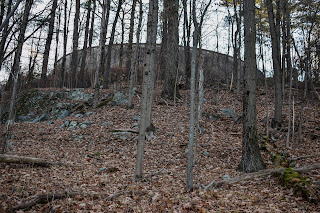
Bear Hill had a massive concrete water tower (the cylinder mentioned before) with a really unique open-faced observation tower that seems to be in early-stage decay. The water tower was heavily fenced-in, and the observation tower was surrounded by a fence with multiple human-sized holes. I may or may not have scoped the area for a possible USGS disc, but did NOT tempt fate by climbing up the tower, but it was clear that many have/do, as evidenced by the massive amounts of graffiti. It was a super interesting area, for sure!


After descending Bear Hill on Bear Hill Trail, I then joined the Reservoir Trail, where I passed my first human of the day, and meandered back to Dike Road, which had a large amount of locked up manhole covers. I finished my hike soon after, and I made a note that I need to remmeber that 45 minutes in the woods is significantly better than nothing. I'm setting a soft goal of getting into the fells once a week until the 5pm sunsets come back and I can get back to the Blue Hills after school.


Step-By-Step
- Park at Gate 20 off of Fallon Road.
- Start hike on Dike Road.
- At jct., veer left onto footpath paralleling I-93.
- At D2-4, continue on footpath paralleling I-93.
- At D2-7, turn right onto Railroad Trestle.
- At D3-2, turn right toward Skyline Trail.
- At D3-1, turn right onto Skyline Trail.
- At C2-6, turn right onto trail.
- At D2-5, turn left onto Bear Hill Road.
- Summit Bear Hill, turn around.
- At C2-4, turn right onto Bear Hill Trail.
- At C2-3, turn right onto Reservoir Trail.
- At C1-6, turn right onto Dike Road.
- Return to car.


Middlesex Fells Reservation Map