Carberry, Bartol, Raccoon Hollow, & Puddle Paths (Blue Hills Reservation)
Hike Type: Figure-8-ish Loop
Distance: 4.42 miles
Elevation: 561 feet
Time: 1 hour, 31 minutes
Hiking Challenges: Blue Hills Winter Trace (2x)
Hiking Challenges: Blue Hills Winter Trace (2x)
The Hike
It had been a CRAZY past few days (going to detail that in a seperate post), but I was beyond thrilled to finally be back outside. The plan was to easily wander around the Great Blue Hill area on wide, easy paths that avoid the hills proper. It was a cloudy, 39-degree afternoon with just a few cars in the north Trailside Museum parking lot.

I started by following the footpath from the parking lot to the Summit Road, hiked the spur path to Canton Ave., and then worked my way onto the Wolcott Path. I had my waterproof boots on (not my winter boots) because I assumed the trails would be snowy/wet, but my normal trail sneakers would have worked fine - there was never more than a dusting. I passed a closed herd path to the new neighborhood on the left and then turned onto the herd path to the middle of Carberry Path, which was recently mowed! I'm guessing they maintained it recently to provide Reservation access to the new neighborhood.
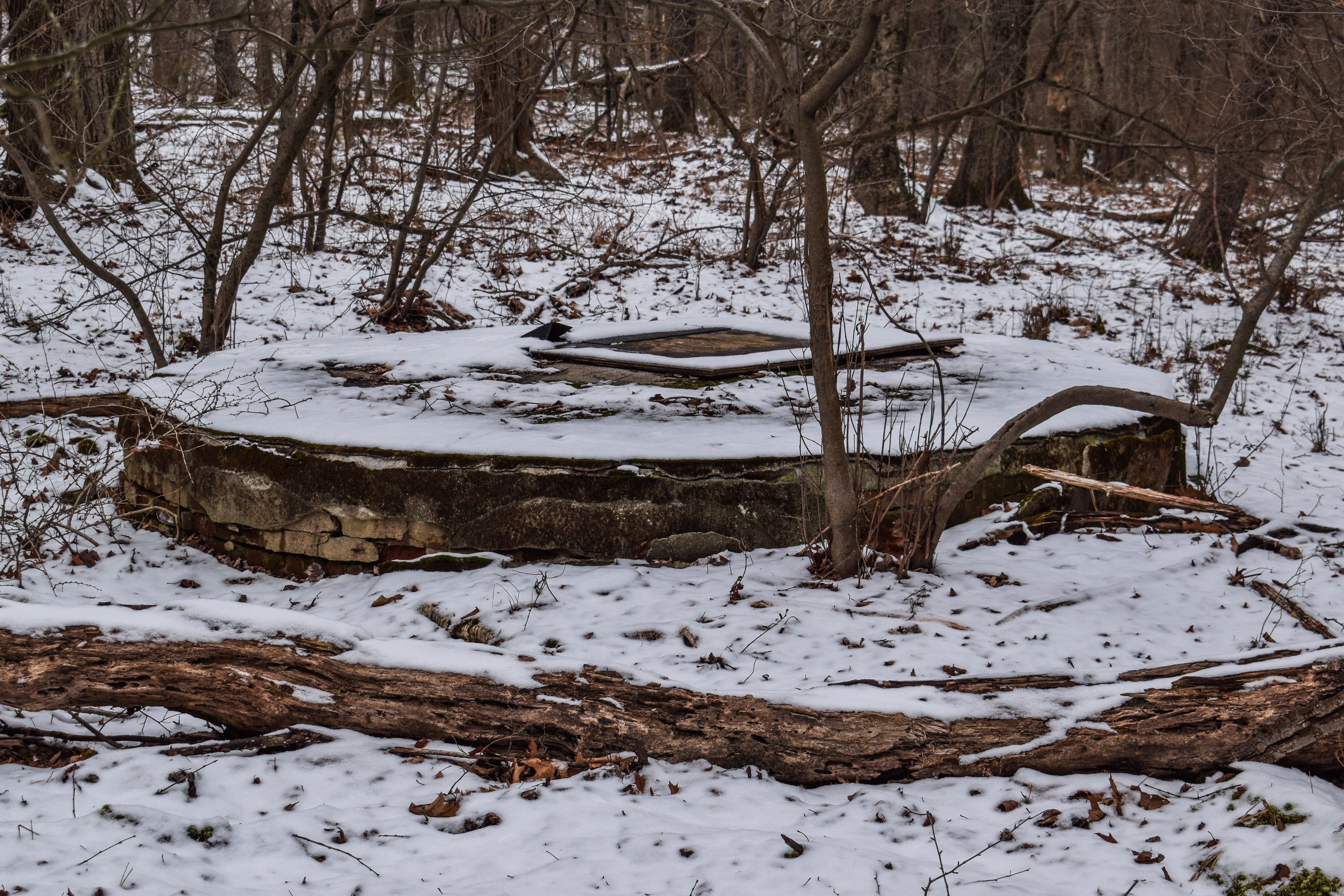
On the Border Path, I noticed an old well/cellar hole that I had never noticed before no more than 20 feet to the left of the trail - I went to check it out but the land around it was swampy and only partially frozen - a mystery! I continued onto the delightfully quiet Bartol Path, where the turn around point was not only clearly marked, but heavily posted for no tresspassing.

The Five Corners Path was a partial ice skating rink down by the Eustis/Hemeneway Hill Paths junction, but slow walking (and penguin walking) made it not a problem. There was another ice skating rink just before "Downtown Crossing" (1141). From Downtown Crossing, I continued onto Wolcott Path, and then onto Houghton Path.
Near the Skyline Trail, I entered the burned area, which was very... heavy. It reminded me a bit of the Firebird scene in Fantasia 2000 after the volcano erupts. I've hiked around many burned areas in this park, but this is by far the most severe I've seen. It still smelled a bit smoky, too. Even the dirt was burned. I wouldn't want to hike over here on a windy day for the forseeable future.

Down by Hillside Street, many trees have been cut down, assumedly so they don't fall onto the road over the next few weeks/months. Again, it was sad to see, but in this case, the pine chips did smell amazing!

My return trip started on Raccoon Hollow Path, which is still labaled as "Coon Hollow" on Hillside Street (the granite marker up at Eliot Circle has been changed to "Raccoon" in recent years). Raccoon Hollow Path followed the burned area boundary for a while and then veered away - it seemed like the stream helped contain the fire and prevent it from spreading westward. I continued along to Wildcat Notch Path, Puddle Path, and then finished my hike by following Wolcott Path back to the parking lot.

Step-by-Step
- Park at Trailside Museum north parking lot.
- Start hike by hiking to Summit Road, and then the spur path to Canton Ave.
- Return to Summit Road, and then turn left onto Wolcott Path (green blazes).
- Before 1085, turn left onto unmapped path to Carberry Path.
- At end, turn left onto Carberry Path.
- At terminus, turn around.
- At 1100, turn left onto Border Path (green blazes).
- At 1135, turn left onto Bartol Path.
- At terminus, turn around.
- At 1135, continue straight onto Five Corners Path (green blazes).
- At 1141, veer left onto Wolcott Path (yellow triangles).
- At 1147, turn right onto Houghton Path (yellow triangles).
- At Hillside Street, follow footpath to Raccoon Hollow Path.
- Turn right onto Raccoon Hollow Path.
- At 1120, green blazes join Raccoon Hollow Path.
- At 1092, veer right onto Wildcat Notch Path (green blazes).
- At 1103, turn left onto Puddle Path (green blazes).
- At 1085, turn left onto Wolcott Path (green blazes).
- Follow Wolcott Path back to car.
No comments:
Post a Comment