Sunday, August 25, 2024

Bayle Mountain (Ossipee Range)

Bayle Mountain (Ossipee Range)

Hike Type: Out-and-Back
Distance: 2.82 miles
Elevation: 883 feet
Time: 1 hours, 42 minutes (1 hour, 28 minutes moving)
Hiking Challenges: Ossipee 10

The Hike 
Sunday Funday! I'm really, either consciously or sub-consciously, trying to make the most of what's left of my summer. I decided I'd head back up to the Ossipees today to get two more peaks toward my Ossipee 10! I was up and out around 4:00am, hit EVERY SINGLE RED LIGHT in the city of Boston, hit up a disappointing Cumberland Farms (apparently there's three in Rochester, NH, and I picked the wrong one), got breakfast at a slightly less disappointing Dunkin, watched a nice sunrise from the drive, and had a lovely last few miles of driving on a dirt road before hitting the signed parking area for Bayle Mountain! The end of the road had a few narrow spots, but nothing too bad. The parking lot clearly asks for diagonal parking, which I appreciated. 

Outside the car it was a quiet, bug-free morning. I was the only car here, but that was not surprising considering the time of day. I had not used the bathroom yet which was worrisome, but otherwise I was doing good! 61 degrees on this morning, and I was off!


The hike starts by following the road a bit further, paralleing the Lovell River (quite pretty, I was a big fan), followed by a sharp turn onto an old, gated road. The road passes a small clearing (I assume from logging) and continues along with a decent amount of other roads joining and leaving - I stayed on the one that was most-defined and least-grassy no problem. 


The sun began to poke through the trees as the road meandered about, passing some impressive glacial erratics on the left before crossing a small bridge over a stream. As per usual, I took some spider webs to the face, too. On the positive, there were a lot of mushrooms all around!


Near a height-of-land on the road, the actual Bayle Mountain Trail is marked by a red blaze and cairn, leading left on a soft footpath that feels new. I noticed a wet-cardboard/distant wildfire smoke smell around here, but thankfully the skies above still looked clear with just a few clouds. It was so delightfully cool and quiet in these woods.


The Bayle Mountain Trail followed a spine as some birds started to wake up and start singing. Eventually, the spine fizzles out and the trail comes to a bouldery area where the real climb begins!


Higher up, there were some very obstructed tree views toward other Ossipee mountains - this would probably be beautiful (and a little sketchy in the footing) in the winter when leaves are down.


A few scrambles and slabs were in the upper sections before the trail starts to get more scrubby and flatten out. This little mountain definitely packed a punch! The suddenly super humid air didn't help, either. I passed the world's loudest woodpecker, too. 


The tree views became partial views, the trail became slabbier, and suddenly it opens up to a big summit area. The trail here is super hard to find - it was almost a "choose your own adventure" situation. The views themselves were fantastic, though! It was fun to see Mts. Shaw and Faraway, and then way further up into the whites (I particularly enjoyed seeing the Carter-Moriah range. The only sounds I could here from the summit were chirping insects and a rare car on route 16. I was so lucky to be fully alone. It was a bit hazy out, which explained the smell from before, but views were stunning regardless.


It was 70 degrees when I left the summit at 7:35am - a big difference from the trailhead! I noticed a good amount of drill holes around the summit area - maybe from survey work, or an old structure? I had to follow the AllTrails tract to stay on-trail up top, but once back into the woods it was smooth sailing. 


The crazy, evil red squirrels were waking up, along with their tretcherous counterparts, gnats. Once back on the spine I could hear all the little critters were now awake and off to work, and I knew I was getting close to the car when I could hear the Lovell River again. 


Back at the trailhead, I saw there was a new car, but I didn't see anyone so... who knows! Interestingly enough, it was still 61 degrees at the trailhead! Maybe the river kept the air cool? Again, who knows! I changed my clothes (to my dismay the clean shirt I brought was stinky...) and started the half-hour drive to the Mt. Shaw Trail trailhead to hike up the comically named Big Ball Mountain!


Step-By-Step
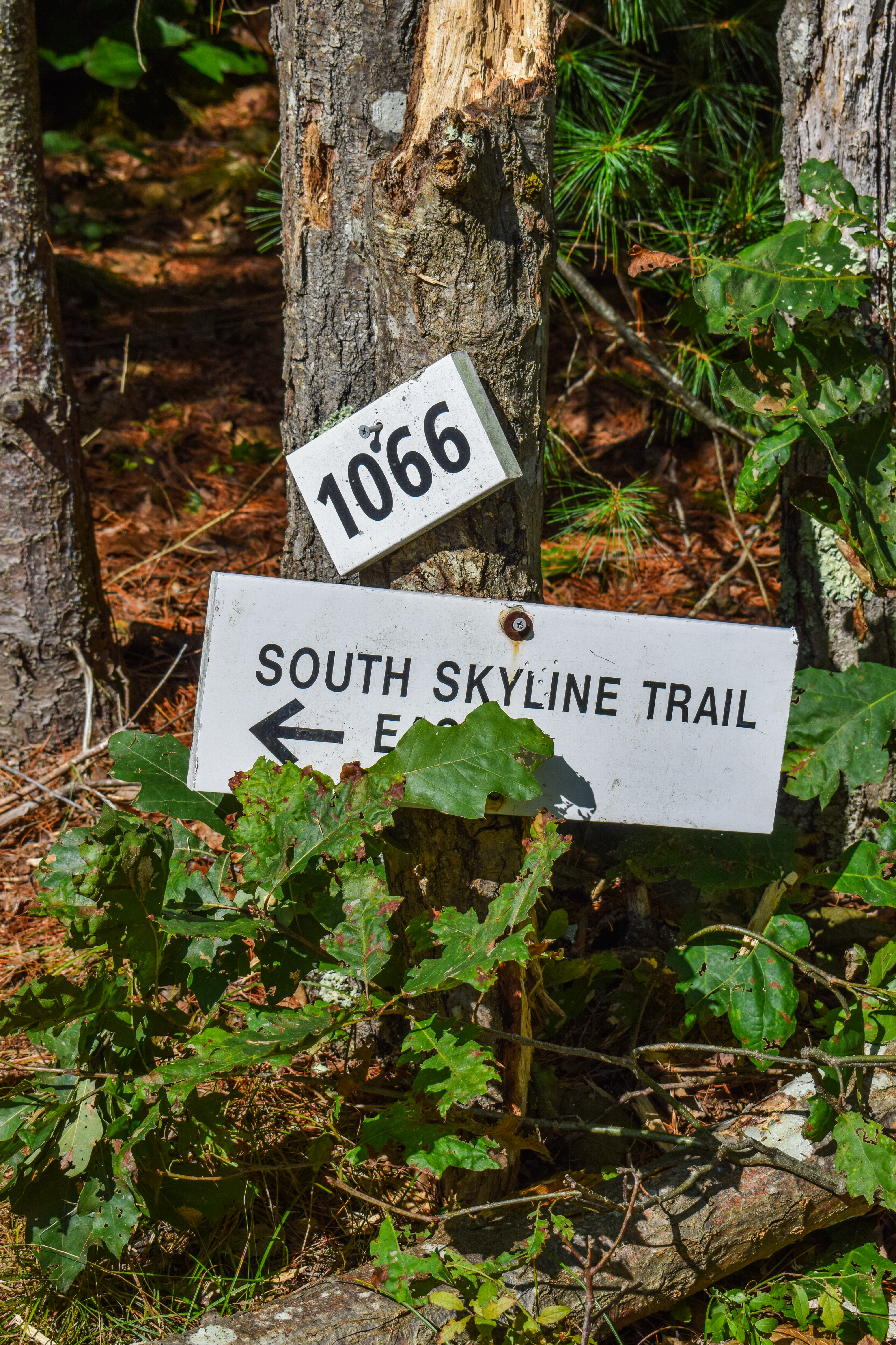
- Park at Bayle Mountain Trailhead parking area.
- Hike upstream on gravel road.
- At bridge, turn sharply right onto woods road through gate.
- Continue to follow the best-defined woods road.
- At cairn and red blaze, turn left onto Bayle Mountain Trail.
- Follow Bayle Mountain Trail to summit.
- At summit, turn around and retrace steps to car.

"Bayle Mountain (1,845 ft.)" from Southern New Hampshrie Trail Guide, 5th Ed. (2021)
This small, ledgy peak, which is almost in the center of the Ossipee Mtns. ring dike complex, offers excellent views in all directions from its bare summit, including an unusual and unique perspective on the higher summits of the range. In May 2015, a forest fire burned 275 acres on the mountain over a five-day period, but as of mid-2019 the upper slopes and summit had recovered beautifully, with only a few signs of the blaze remaining. The route to Bayle Mtn. consists of an approach on a snowmobile trail and a steep an drugged climb up the unofficial red-blazed Bayle Mtn. Trail.
        From NH 16, 2.4 mi. south of its junction with NH 25 in West Ossipee, follow Pine Hill Rd., a good gravel road, west for 3.3 mi., and then turn right onto Conner Pond Rd. In another 0.6 mi. turn right onto Marble Rd., narrow but sound, and drive 0.6 mi. to a signed, designated parking pull-off on the right, just before a bridge over Lovell River and directly opposite a cabin. Do not park in front of any gates or in any spot that obstructs the road.
        The route described below is entirely on private land and has been the subject of a dispute regarding access in the past. The landowner has graciously given permission for the description to appear in this guide. Please stay on the marked trail and respect the land; unauthorized trail maintenance is prohibited.

"Unofficial Bayle Mtn. Trails" from Southern New Hampshire Trail Guide, 5th Ed. (2021)
From the parknig pull-off, continue up Marble Rd. a very short distance and turn sharply right onto an unsigned snowmobile trail with an orange gate, just before the bridge over Lovell River. The wide trail, with good footing, leads northeast, then north, with minor ups and downs; old woods roads join from the left at 0.1 mi. and from the right at 0.4 mi. Bear right at a prominent fork (arrow) at 0.5 mi. At 0.7 mi., at a high spot, Bayle Mtn. Trail leaves left at a new location, 0.1 mi. south of its former trailhead (now closed); the entrance to the trail is marked by a cairn and small sign.
        This section of the route, on a footpath, is very lightly maintained and requires care to follow, especially in its middle portion and when leaving the summit. Pay close attention to the blazes, small cairns, and occasional flagging.
        Bayle Mtn. Trail ascends moderately northwest across the slope for 0.2 mi.; then it turns left at the base of a boulder field where the former route comes in on the right (in reverse, turn right here). Now marked with faded red blazes, the trail ascends steeply with rough footing, winding through an area of large glacial boulders. At 1.1 mi. it climbs a very steep, slippery ledge beside a large slab; an overgrown bypass route is on left. The main trail continues up through teh woods and across semi-open ledges, marked by small cairns. It reaches a high rock wall, scrambles up the right side, and then makes a short traverse along the edge of the wall (use caution). Above the wall, the trail levels briefly and then climbs moderately, breaking out into the open and ascending easily up broad ledges (not marked) to the bare summit at 1.4 mi.
        The stretch between entering onto the ledges and the summit is not marked, so hikers should make note of where they emerge from the woods onto an open ledge ramp. The trail leaves the summit by descending along the prominent ramp on the south side and then bearing right at a turn; a small cairn sits beside a dead tree stub several yards ahead.

Thursday, August 22, 2024

Mt. Monadnock via Cliff Walk, Smith Summit (Monadnock State Park)

Mt. Monadnock via Cliff Walk, Smith Summit (Monadnock State Park)

Distance: 6.08 miles
Elevation: 1,706 feet
Time: 5 hours, 4 minutes (4 hours moving)
Hike Type: Loop
Hiking Challenges: Monadnock Redliner (2x)

The Hike
Back on my favorite mountain! Summer is starting to wind down - my August marathon of a bachelorette party in Atlantic City directly into a family trip to the UK directly into teaching band camp is finally over, so Sarah, Adam, and I decided to head over to Mt. Monadnock for a truly lovely morning on the rock. We originally wanted to hike Mt. Moosilauke, but the timing wasn't going to work out with that big drive. We dropped Adam's daughter off at daycare and were off!

We landed at the Old Toll Road parking area just after 9:00am and got hiking 20 minutes later (after a few trips to the bathroom... I saw Pink last night at Gillette which was AMAZING, but I was not feeling my best afterwards!). We started up the wide, gravel Old Toll Road and quickly crossed paths with a car from the home at the top of the road (I am so jealous of their home). 


We passed some recent logging activity and continued up until we reached the junction with the Parker Trail. My goal for this hike was to bring Sarah and Adam on a less popular route of the mountain with ample views. We turned right onto the Parker Trail, climbed for a short moment, and then turned right again onto a nameless spur trail to a nice view. There is a "Parker Trail" sign right at this spur and the footpath is medium grown-in, but still easy to follow. Last time I was here this view was in a cloud, so I was delighted to see what it actually looked like! A highlight for me was seeing the Wapack Range - from North Pack Monadnock to Watatic. I've always seen these mountains from Mt. Monadnock but never actually knew what they were until hiking the Wapack Trail - fun!


After a short standing break we backtracked to the Parker Trail and continued on, now descending slightly. The woods here are very pretty, relatively open, and filled with ferns. After passing a few wet spots, we hit the junciton with the Cliff Walk, where it was time to start exerising again.


Right away the Cliff Walk starts to ascend, eventually getting steeper with a few scrambles and a ladder. Slowly, the woods begin to change from decidious to coniferous - my favorite part of this switch is when the footbed gets soft with pine needles. The steep climbing continues, eventually reaching the lovely view point from Hello Rock. We took a nice sit here to take in the views and to have a little snack.


The Cliff Walk is one of, if not my favorite trail on this mountain. It varies from steep scrambles to soft walking through woods and cliffs with endless views, only getting better with each step. The next good view is from Point Surprise at the Point Surprise Trail junction, followed by What Cheer Point, Black-Throated Blue Point, Ainsworth's Seat, and then the signed Thoreau's Seat. 


Continuing on, the Cliff Walk passes junctions for Thoreau Trail, Do Drop Trail, and Noble Trail, and then passes the "Wolf's Den" - which appeared to be a series of boulders. The Graphite Mine was next, but I did not notice it (I only know it exists by looking at the AMC map as I type this). 


Soon enough the Cliff Walk arrives and terminates at the fantastic view from Bald Rock. We took a nice sit and snack break here, watching people at the top of the mountain. We saw our first people of the day here! I was incredibly grateful to have had such a nice, quiet morning with friends, and I had to slowly start preparing to be around many more people soon enough. 


Now we were on the Smith Connecting Link, which initially dips back into some beautiful woods with a few unique stream crossings, untimately leading back out of the woods with some nice views toward the summit and back toward bald peak. We could see MANY people climbing up the White Dot, which was a bummer, but good to mentally prepare for.


The Smith Connecting Link terminates at the upper end of the White Cross, which soon terminates as well at the White Dot. From here, there is a slight descend into a wet area and then straight up slab climbing up to the top! We scooted past a large group of people, who were only a small part of a much larger group (most the group was waiting up top). 


I am grateful for new shoes and going up these slabs because I remember descending this one time and I was sketched out by the lack of stopping points if I slipped (also reminded myself that the lived-to-death ratio of people on this mountain/trail is in my favor). We continued to push up, got a bit winded, but summit fever was present and soon enough we were up at the top! It was breezy and chilly but overall delightful, minus the swarms of people (which again turned out to be just that one group). 


We found a sheltered nook to make some hot chocolate (thank you Sarah!) and relax for a bit. There were tadpoles in some of the pools of water at the summit which was fun to see! After some eavesdropping, it seems like the large group could have been a chuch/temple group and/or a religious university group. Not sure, but there was a sermon once everyone was on top and they took a photo of the "freshmen."


After a nice long break it was eventually time to descend (also the large group was coming our way to take more photos and we were all done). We followed signs for the Smith Summit Trial (mostly white dots, sometimes with "S" or "SS") and eventually started our descent - it was tricky to find a footpath in the summit area, so we just made sure to rock hop and not step on any plants. 


The Smith Summit Trail is steep and beautiful - endless views towards Vermont. We had to be careful to follow the blazes, which were frequent enough, beacuse the upper reaches were just open rock. Our descent continued through some steeper spots, some of which required a sit-and-scootch, and we eventually caught up with someone we had previously seen on Bald Peak - fun! 


The trail works its way back into the woods for a moment, but continually pops out into more open/slab/scrub. It passes a junction with the Amphitheatre Trail/Black Precipice, but we continued on, eventually coming to the rock formation known as The Tooth and soon after (with a short scramble), Monte Rosa, with its weather vane looking better than ever. We also caught up to a couple enjoying lunch there.


From Monte Rosa, we followed the Monte Rosa and then Fairy Spring Trail down, which had a Jurassic Park vibe to it. After a steeper section, we came to the beautiful Fairy Spring area, which had trickling water coming out of many different rocks into the mossy bed. Really beautiful to see and hear.


Further down the Fairy Spring Trail was the Fassett House Site, which I famously and accidentally christened a few years back thinking I was far off-trail... oops. Afterward, we continued onto the White Arrow Trail, past the Halfway House Site, and then back into the woods for the last time on the Old Halfway House Trail.


The Old Halfway House Trail feels long (just over a mile), but is a nice alternative to walking the Old Toll Road. Not much to say about this bit of trail, besides it being a nice walk in the woods. At this point, we were tired and hungry (Sarah did point out that we were only on mile five so there was no need to be THAT dramatic about being tired and hungry, but I disagree! I will happily get tired and hungry on the last mile of any hike that I do, regardless of length!). 

Soon enough we could see the parking lot, got changed, and headed to the Wachusett Brewery for lunch and a drink! I am always a little nervous hiking with new people because I never know how hiking styles will match up, but it was super fun to have Adam and I'm glad Sarah's foot is finally on the road to a full recovery (after she popped it off in a climbing gym fall). Tragically, I did have to zoom home because I had the honor of seeing Kristin Chenoweth in the Queen of Versailles last night!


Step-By-Step
- Park at Old Toll Road parking area ($15).
- Start hike on Old Toll Road.
- At jct. with Parker Trail, turn left onto Parker Trail.
- At spur near height-of-land (Parker Trail sign), turn left to a view spur.
- Turn around at view.
- Turn right to continue on Parker Trail.
- At next jct., turn left onto Cliff Walk.
- Continue on Cliff Walk to terminus at Bald Rock.
- At Bald Rock, continue onto Smith Connecting trail.
- At terminus, turn left onto White Cross.
- At terminus, continue onto White Dot.
- At summit, follow sign for Smith Summit.
- Descend via Smith Summit to Monte Rosa.
- At Monte Rosa, turn left onto Monte Rosa Trail.
- At jct., turn left onto Fairy Spring Trail.
- At terminus, continue onto White Arrow Trail.
- At terminus, continue onto Old Toll Road.
- At jct., turn right onto Cart Path.
- At jct., turn left onto Old Halfway House Trail.
- Return to car.
.

Wednesday, August 21, 2024

Skyline Loop via Trailside Museum (Blue Hills Reservation)

Skyline Loop via Trailside Museum (Blue Hills Reservation)

Distance: 4.49 miles
Elevation: 1,184 feet
Time: 1 hour, 47 minutes
Hike Type: Lollipop Loop
Hiking Challenges: 52 Hike Challenge 2024, Blue Hills Grid, Great Blue Hill Summits

The Hike
We're finally back! It was a lovely late-morning - 60 degrees and sunny (we were having "fake fall" in Boston). It was my first time back at the Blue Hills all summer and it felt good to be back! I was seeing Pink this afternoon, and I was officially breaking in my new hiking shoes (another pair of Merrell Moab 3s).


Right away I noticed that Eliot Tower construction signs were gone - was it open again?? The fall-like weather was delightful on the ascent and soon enough I was in the newly reopened tower! It even smelled new! They did a great job tidying up and securing the tower for years to come. They even added panoramic view guides in the terrace area. 


I continued onto the actual summit and saw a sign that they had to cut down some tall white pines that were interfering with the weather station - I found the remnants of the trees in the woods along the summit spur (the path that also leads to the top of the ski area). It smelled like a candle!


Continuing on, I also noticed there were new plaques along the Eliot Bridge (the circular ones that have been missing for years). I had to tighten the shoes since they were adjusting to my feet, and I was now on the descent. I made it up and down Wolcott without problem (minus some angry lungs, but it was not a problem). Downtown Crossing was quiet and so was Hemenway with its classic view.


One weird thing I've been dealing with is walking in such a way where my left foot kicks my right heel bump (I have no idea the actual term for this), causing a scab. I usually forget about it until I kick it, and I kicked it hard coming down Hemenway! I guess I need to relearn how to walk?


Another easy up on Hancock and I noticed the grassy regrowth was going strong on the burned areas! I made my way down, turned onto Hillside Street (they're still working on renovating the barn), and found one last Eliot Tower construction sign (a leftover) right at the Skyline South trailhead.

To no one's surprise, I was pretty gassed going up Houghton Hill, but what else is new? I also started planning tomorrow's hike with Adam and Sarah (due to timing and Adam having a child, we decided on Monadnock via less popular trails), and then I passed a women who loudly proclaimed "ITS FINALLY COOL ENOUGH TO HIKE!" - I agree, lady, I agree.


My body was feeling tired but it felt good to be back. I suffered through the final climb up Great Blue Hill again and had a nice, quick descent. When I landed, the parking lot was really starting to fill up, so I was happy to be down. Off to Pink (SHE WAS AMAZING)!


Step-By-Step
- Start hike from Trailside Museum parking on Eliot Path (red dots).
- At terminus, turn right onto Eliot Circle. 
- At next jct., turn left onto Summit Road.
- At next jct., turn right onto spur trail to Summit.
- Descend summit towards Skyline Trail South.
- Turn left onto Skyline Trail, and then right onto Skyline Trail South.
- Follow Skyline Trail South to Hillside St.
- At Hillside St., turn left onto Hillside St.
- After stables, turn left onto Skyline Trail North.
- Follow Skyline Trail North to Eliot Tower.
- At Eliot Tower, turn left onto Eliot Circle.
- At second jct., turn right to summit Great Blue Hill.
- Retract steps back to parking lot.


Tuesday, August 20, 2024

Pratt Farm Loop (Pratt Farm)

Pratt Farm Loop (Pratt Farm)

Distance: 3.00 miles
Elevation: 100 feet
Time: 1 hour, 17 minutes
Hike Type: Loop
Hiking Challenges: 52 Hike Challenge 2024

The Hike
This was a fun mini-renuion with Tracy, Kaitlyn, and Sara. I thought we were just going on a walk, but after we hit two miles of ups-and-downs in the dirt, I decided I'll call it a hike! There's not much info on Pratt farm online, but it was a really nice park with a bigger-than-expected trail network (with PLENTY of spider webs!). Tracy took us on a counter-clockwise loop around the majority of the park, past wetlands, bridges, forest, a large pond, and ending with an old ice pond. It was a lovely post-brunch hike!


Step-By-Step
- N/A due to there being no maps online :-).

Thursday, August 8, 2024

Arthur's Seat & St. Margaret's Loch (Holyrood Park)

Arthur's Seat & St. Margaret's Loch (Holyrood Park)

Distance: 3.63 miles
Elevation: 1,093 feet
Time: 1 hour, 56 minutes (1 hour, 44 minutes moving)
Hike Type: Loopty Loop
Hiking Challenges: 52 Hike Challenge 2024

The Hike
Wow! Okay, so the family had already done a couple days in London, a day/night in Blackburn (where we found my great-grandmother's grave site and scattered my grandmother's ashes), and now we were in Edinburgh, and I was immediately in love. Just from the walk from the Waverly train station to the Royal Mile I was immediately enamoured. The group of 9 were starting to branch off and do activities in smaller groups (which was a VERY good thing), so I was starting to think about what I wanted to do. I knew I wanted to see at least one show in the Fringe Festival (I ended up seeing three musicals: "I Wish You Well - They Gwyneth Paltrow Ski Trial Musical," "Diary of a Gay Disaster," and "SILENCE! The Musical - The Unauthorised Parody of The Silence of The Lambs"), and then I casually checked AllTrails and remembered that Scotland is BEAUTIFUL. We eventually made our way down the Royal Mile to our AirBnb, which was a few minute walk from Holyroodhouse Palace. From the AirBnb, we had truly a breathtaking view of "Arthur's Seat" in Holyrood Park, and I knew I had to climb it! I got up around 5:30am the next morning to start my adventure!

"Holyrood Park is a rare example of unimproved grassland. Effectively unchanged since its enclosure as a Royal Park in the 1500s, it is rich in plant species and also provides a home to a variety of important invertebrate, amphibian, mammal and bird species. To find such a wildlife haven in the heart of a capital city is remarkable.
Edinburgh’s landscape was forged in fire and carved by ice. The hard rock from which Holyrood Park and Arthur’s Seat were formed once flowed inside an ancient volcano that erupted 350 million years ago. It was shaped by great movements in the earth’s crust and sculpted by the power of Ice-Age glaciers and erosion.
The remarkable landscape that was left behind has provided a home for many people over the last 10,000 years. Hunter-gatherers scattered flint arrow heads across the park, Iron Age tribes raised great hill-forts on its peaks, medieval farmers cut terraces and furrows into its flanks and the stone for many of the city’s buildings was hewn from its quarries
The park is now surrounded by the city, providing Edinburgh’s citizens with a much loved escape from urban life." from park brochure.

All I had packed for this was a pair of sweatpants, a windbreaker, two plastic water bottles, and a can of Vodka Lemonade. Perfect! I also added some toilet paper into my bag, just in case (not needed). I was out the door just before 6am and it was 55 degrees and overcast with a breeze. It felt like fall, which was incredible coming off of a hot, sweaty July in New Jersey. There was a 0.4 mile walk from the AirBnb to the trailhead, which was honestly very fun. I walked past the palace, the parliment building, and a group of three drunk folks who were just finishing their night of partying! The sounds of morning owls/morning doves/some bird I am unfamiliar with echoed throughout the city as I walked up.


Soon enough I was at Holyrood Park and my hike began! The route I followed started on a paved path, but there were MANY side trails not on any official maps. I was truly enamoured from the second I entered the park by the stunning, grassy scenery. It almost felt alpine, even though it was a big grassland. It looked like most folks just hike to Arthur's Seat and back via the Summit Path, but I wanted to hike a loop across the Salisbury Crags first. Soon enough,  a paved side path diverged right that led up the crags. 


"Salisbury Crags" from scottish-places.info
"The cliff face of Salisbury Crags looks down on Edinburgh like a grand fortress. Situated in Holyrood Park, less than a half-mile (1 km) southeast of Princes Street, the Crags represent the glaciated remains of a Carboniferous sill, injected between sedimentary rocks which formed in a shallow sea some 340 million years ago. Glaciers sweeping outwards from the centre of Scotland have left a classic crag-and-tail, descending gently towards Arthur's Seat and Whinny Hill in the East. Salisbury Crags are of great significance in the development of modern geology. At Hutton's Section, the Edinburgh geologist James Hutton (1726-97) recognised that the rock now forming the Crags had been injected in a molten state. He was able to use this evidence to disprove the suggestion of the influential German, Abraham Werner, that all rocks had crystallised from a supposed primordial sea.
The hard dolerite which forms the crags was quarried for use as street cobble stones from the mid-17th C. on the authority of the Earls of Haddington who were hereditary keepers of Holyrood Park. The traveller Sarah Murray (1744 - 1811) visited in 1796 and wrote of these quarries "I saw vast heaps of the hard rock divided into small pieces, ready for shipping; and I was told great quantities of that crag were sent to London for paving the streets."
However, the use of explosives from the beginning of the 19th C. increased the level of extraction to the point that the citizens of the city complained the landmark was beginning to disappear. Legal action was taken in 1819, but it was not until 1831 that the matter was resolved when the House of Lords decreed that no more stone should be removed. In 1845, Thomas Hamilton, the 9th Earl of Haddington (1780 - 1858), was paid the astronomical sum of £30,000 to relinquish his office as Keeper of the Royal Park.
Gentlemen of the Scottish Enlightenment would walk along a track around the base of the crags to gain inspiration. Around 1820 this was formed into a good road, known as the Radical Road, so-named after Sir Walter Scott (1771 - 1832) promoted its creation to provide jobs for unemployed radical weavers. Charles Darwin followed in Hutton's footsteps examining the geology of the Crags in 1838. In 1846, the American abolitionist Frederick Douglass (1818-95) attempted to carve the slogan 'Send Back the Money' on Salisbury Crags. This was a protest against the Free Church of Scotland which had gained some of its early funding from slave owners based in the Southern states of the USA."

Right away the views were breathtaking. Behind me was a view toward Arthur's Seat and some sunrise colors over the ocean! I had no idea Edinburgh was so close to the water. This whole area was like a painting. At another fork, the trail veered right to travel along the edge of the crags. 


I took my sweatpants off at 0.4 miles into the hike and then came right to the edge of the crags where there was an incredible view of all of Edinburgh. Looking back at the photos, I'm still in awe. Some of the cliffs reminded me of the New Jersey palisades. Behind, the sun rays were peeking out and shining on the water.


While I was doing this, mom was awake looking for me from the AirBnb, but I think we just missed each other! Once I hit the high point of the crags, I met with some other tourists, took their picture, and then I continued along, beginning to descend, with a fantastic view of Arthur's Seat and Nether Hill ahead.


I briefly rejoined the original path and then turned left onto the Zig Zag Path, which followed old-looking stone steps, literally zig-zagging up the hillside. The grasses continued to blow in the wind while the morning owl/dove/bird/whatevers were LOUD in the nearby bushes. The path itself was fun and steep. There were a few other folks heading up, but the hike was still delightfully quiet. Sometimes the path was surrounded by grass, and other times it was surrounded by tall, thick bushes. 


Soon enough I made it to the top of Nether Hill and to no surprise, was complete awe-stricken. The view of the Salisbury Crags with Edinburgh behind were incredible. Arthur's Seat and Crow Hill looked other-worldly. There was a neat old foundation. And then I noticed another nearby mountain... with a ski slope?? Apparently there's an all-season ski area in Edinburgh! I wish I knew, because I definitely would have set aside time to play!


It was very windy up here but just amazing. I also took some time to admire the ocean with the other hills poking above the relatively flat landscape.


I meandered on random footpaths over to Crow Hill since it was right there, which had a bunch of "no metal detecting" signs. I hit the top, and then went back over to Nether Hill for my "sit and sip" break before hitting Arthur's Seat. 


The final bit up Arthur's Seat had a fun chimney-like scramble to the stunning 360-degree viewpoint.


"Arthur's Seat" from scottish-places.info
"The remains of a volcano that erupted under water during the Carboniferous period, Arthur's Seat is located within Holyrood Park in the centre of Edinburgh. Although only 250m (823 feet) in height, Arthur's Seat is a notable landmark, dominating the city. Known also as the Lion's Head, Arthur's Seat is the highest of a series of peaks which take the form of a crouched lion. Its summit is marked both by a white Ordnance Survey triangulation pillar and a geographical indicator. The indicator gives directions to prominent surrounding landmarks and is a replacement for the original positioned here in 1910, which was cast in bronze and designed by the noted surveyor John Mathieson (1855 - 1945).
Geologically Arthur's Seat comprises the remains of a basalt lava plug that choked the neck of a volcano which would have been active around 335 million years ago. The action of glaciation has cut into its heart, making it one of the most accessible exposures of an ancient volcano.
Two stony banks on the east side of the hill represent the remains of an Iron-Age hill-fort and a series of cultivation terraces are obvious above the road just beyond. In 1836, just below the summit, seventeen miniature wooden coffins each containing a carved figure were found in a small cave. Their existence has never been satisfactorily explained; associations with witchcraft have been suggested or perhaps they were memorial to the seventeen victims of the infamous William Burke (1792 - 1829) and William Hare (died c.1860)."


There were two monuments up top and thankfully just a few other people. A cruise ship was coming into port as I wask taking my millionth photo fo the morning. I was super glad that I decided to wait for the morning to do this hike, because it looked BUSY yesterday afternoon. 


The descent off of Arthur's Seat was steep for a very short bit then very easy. There were some beautiful yellow and purple flowers along the wide Summit Path. There were MANY more people coming up now around 7:30am.


I took a short spur path to St. Anthony's Chapel, which was very cool.

"St Anthony's Chapel" from informational plaque
"Prior to the 16th century, Holyrood Park was held by the Abbeys of Holyrood and Kelso. St. Anthony's Chapel stands in the part which probably belonged to Kelso Abbey. The origin and history of the chapel are obscure, but it was certainly built no later than the early 15th century, as in 1426 it is recorded that the Pope gave money for its repair. The chapel may have been linked to the Preceptory of St. Anthony, a skin hospice, which was based in Leith around this time. The last chaplain is recorded in 1581."

"St. Anthony's Chapel" from Historic Scotland
"St Anthony of Egypt was a hermit and one of the earliest monks. He is considered the founder and father of organised monasticism. This chapel, dedicated to his name, was built in the early 1400s. Records show that the Pope gave money for its repair in 1426." from Historic Scotland


I turned around from the chapel, descended on the Summit Path a bit further, and then turned right on another spur to St. Margaret's Loch - a nice pond full of waterfowl with a trail around the perimieter (this also provided a really neat view of the chapel!). 


"St. Margaret's Loch" from Historic Scotland
"Queen Victoria's husband Albert built this loch as part of improvements to the Park during her reign. It now provides a home for a large flock of non-breeding Mute Swan as well as other water birds such as Greylags, Coot, Moorhen, Tufted Duck and Mallard. Rarer bird visitors include Pochard, Little Grebe, Red-breasted Merganser, Common Sandpiper and Whooper Swan." from Historic Scotland

I saw my first trees of the day around the loch and many birds, some of which I don't think I've ever seen before! There were lots of runners down here, and just one other person enjoying the view from the loch. 


After my loop, I made my way back to the Summit Path and finished my descent, with a nice view of Holyrood Palace and Calton Hill. All I could think about is how much I can't wait to come back to Scotland after this hike!


Step-By-Step
- Start hike at Holyrood Park Car Park
- Cross the road, continue into park on paved path.
- At sign, veer right onto unmapped footpath along the ridge of Salisbury Crags.
- Follow path to descend Salisbury Crags to beginning of Zig Zag Path.
- Ascend Arthur's Seat via Zig Zag Path.
- Before summiting, check out Nether Hill and Crow Hill.
- Summit Arthur's Seat.
- Follow Summit Path down.
- Turn right onto spur to St. Anthony's Chapel.
- Retrace Steps.
- Turn right onto spur to St. Margaret's Loch.
- Follow path around St. Margaret's Loch clockwise.
- Return to Summit Path, return to car.

Thursday, August 1, 2024

Tourne Loop (4x) (Tourne County Park)

 Tourne Loop (4x) (Tourne County Park)

Distance: 5.21 miles
Elevation: 1,206 feet
Time: 1 hour, 42 minutes 
Hike Type: Lollipop Loop
Hiking Challenges: N/A

The Hike
Time for one more hike at the Tourne to wrap up this part of my summer! It was a cool 68 degrees and humid, and it was fun to see the sun rays through the trees facing a different direction (this is the first time I've been here in the morning all summer!). This was also the swan song for my hiking shoes - they were DONE. I wish I tracked them better on my Garmin app - I will make sure to do a better job for the new pair! 


I was really enjoying how different the "sound board" for the morning was different than the afternoon. Different bird sounds, different insect sounds, and different critter sounds. Overall, it was much quieter in the morning. I was feeling much better than the past couple of days, too. I saw more people than expected, but that was okay. I did have to deal with one dog who had no recall skills which was a bummer. I ended up picking up my pace for lap three to get ahead of a few people and their wild dogs. I also noticed the morning Tourne people were much friendlier than the afternoon folk, but still nowhere near "hiker friendly."

After this hike I'd be embarking on an exciting and TIRING next 18 days. August 1st-3rd I would be BACK in Atlantic City for a Bachelorette Party (and my birthday), August 3rd I would drive back to north Jersey and then fly to London for a trip to London, Blackburn, and Edinburgh, primarily to scatter my grandmother's ashes in her hometown, but also for some fun tourism. I would fly back on August 11th, land in NJ, drive to Boston, and then wake up early on August 12 for band camp through the 17th. My next true day of rest was a long ways away!


Step-By-Step
- Park at parking area on the Old Denville Side of McCaffrey Lane.
- Start hike on Yellow Dot trail from parking lot.
- At terminus, turn left onto Yellow trail to hike the loop.
- After four loops, return to car via Yellow Dot trail.