Mt. Whiteface & Mt. Passaconaway (White Mountain National Forest)
Distance: 12.22 miles
Elevation: 4,081 feet
Time: 9 hours, 31 minutes (7 hours 37 minutes moving)
Hike Type: Loop w/ Spur
Hiking Challenges: 52 Hike Challenge; New Hampshire 4000-footers; Terrifying 25; Summit Beer Society; Operation Alaska Benchmark Challenge
View of Mt. Whiteface from the parking lot.
The Hike
After three months, it was time to be back in the whites climbing next couple 4000-footers! I'm back hiking with Sarah, and I made it to her new place just before 4:00am. I was an advanced level of sleepy, but having a friend to chat with kept me going (and a Celcius). We made it to Hooksett after 5:00am, but they had no breakfast sandwiches and I did not have to poop - two tragedies. Sarah did get a pack of cider doughnuts, which helped the cause. We enjoyed the beautiful, crystal clear sunrise from the highway, the mist on the lakes, and then early morning sun on the nearby mountains. After missing a few turns, we made out way onto Ferncroft Road and found the parking lot, which already had a fantastic view of the nearby peaks, all illuminated in a luxurious gold. I kiosk from the parking lot provided some information on the area and local legend, Kate Sleeper:
"The Sandwich Range of the White Mountain began attracting visitors in the late 1800's. Most traveled by trail on newly extended rail route and stayed in hotels and boardinghouses, while others build summer homes and became active in their local communities"
"One who came to stay was Katherine "Kate" Sleeper. She had a vision of economic growth for Wonalancet - the promotion of outdoor activities by providing guest lodging, and especially the development of local hiking trails. In the summer of 1891, Miss Sleeper invited Appalachian Mountain Club (AMC) leaders and trail builders, Charles E. Fay and William H. Ladd to meet with local residents, and suggested that Wonalancet be a departure point for visitors climbing Mt. Passaconaway. Later that yeaer, Charles Fay and local farmers built Dicey's Mill trail."
"After several years of trail building, Kate Sleeper and her neighbors officially organized the WOnalancet Out Door Club (WODC) in 1892 to continue trail and shelter construction and maintenance. By the turn of the century, the WODC trail system was in place and even rivaled trails in teh popular northern Presidential Range."
"The White Mountain National Forest was established in 1911, and through efforts of the Wonalancet Out Door Club and others, much of the Sandwich Range became part of the National Forest in 1914. By 1929, there were 3,194 miles of connecting trails maintained by 49 clubs. In 1984, grassroots efforts by the WODC succeeded in getting much of the Sandwich Range included in the New Hampshire Wilderness Bill. Today, WODC continues its tasks of education and advocacy and its stewardship of the Sandwich Range and its trails."
Mt. Wonalancet from Ferncroft Road.
There were a few others in the parking lot: a couple that went into Old Mast Rd., a solo hiker who we would later befriend, and an older guy who slept in his truck and was cooking up a lovely breakfast for himself. As per usual, we dilly-dallied around, used the mid-teir porta potties, and got our hike started. I quickly realized I forgot to charge my phone in the car, and for some reason it was at 36%... yikes. Thankfully I always carry around an unnecessarily heavy battery bank for moments like this.
Looking back at the sun rising.
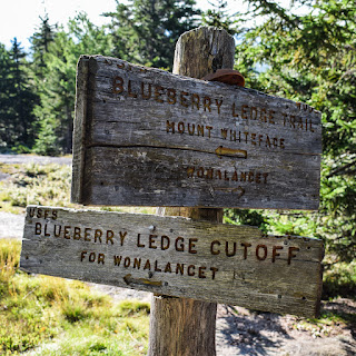
It was 47-degrees, and we started our hike by turning right back onto Ferncroft Road, following the bountiful signs pointing toward the trail, enjoying the beautiful golden hour all around us. The trail signs were made of wood with blue letters carved in, which was truly just fun! Especially because we were going to hike the blueberry ledge trail! There were fantastic views of Mt. Wonalancet in the foreground and Mt. Whiteface in the background.
We walked past some beautiful private properties, one of which had a roadside meadow growing in, full of flowers and "beetle leaves" - large-leafed plants that have been devoured by beetles. We followed Ferncroft Road to Squirrel Bridge Road, which I believe is where the Blueberry Ledge Trail officially starts? We crossed the Wonalancet River on the bridge and continued to follow the "Private Property," "No Bear Dogs," and "Trail ->" signs until we officially entered the woods.
Soon after entering the woods we crossed into the White Mountain National Forest and the Sandwich Range Wilderness. I took a photo of the sign, and Sarah jokingly pretented to eat the sign, and it took me painfully long to realize its because its "sandwich..." time to wake up! The trail started pretty easy through lovely woods with small elevation gains, and thankfully the solo hiker ahead of us was in charge of all the spiderwebs!
The blueberry ledges officially begin at the first mostly grown-in rock slab and continue to climb more moderately, but never anything ridiculous - it reminded me of the trail up the south side of Mt. Piper in the Belknaps. Toward the top of the ledges we finally started to get some peek-a-boo views, and then at the Blueberry Ledge/Blueberry Ledge Cutoff trail junction, there was a partial view of the Ossipees with a beautifully blue sky above. We also passed a white, fuzzy catepillas danging from a tree, which was fun. The ledges are officially over at this junction, but the real fun had just begun!
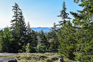
The trail dibs back into the woods where we were greeted with many stone steps and toads. We took a snack break at the partially obstructed "Wonalancet Outlook" (unsigned), and then continued on. Our next landmark was the comical junction with the Tom Wiggin Trail, which had "not recommended, steep and loose" on the official trail sign. The trail conitnued to gain, more steeply now, after the junction, and the "terrifying" part of the trail begins at the first scramble.
Uniquely, there are holes in the grainte where wooden steps used to be. I remember reading somewhere online that the steps were installed, but a local was mad so he cut them off - which may or may not be real. [UPDATE: I read a forum on View From the Top - the steps were removed in 1994 after years of rot, and were deemed unnecessary to replace https://www.vftt.org/threads/ladder-on-the-blueberry-ledge-trail-to-whiteface.45869/]. This was the first of three-ish trickier scrambles muddled in many other easier ones.
I was nervous about the scrambles after my Carter Ledge Experience, but it turns out this trail was all the fun of the Carter Ledge Trail, but without the scary section! With each scramble came better and better views - we got to enjoy views to Sandwich Dome, the Ossipees, the Squam Range, and the Belknaps on one side, and Mts. Paugus and Chocorua to the other. Really spectacular.
There was an additional view ~5 feet off trail that I fully scraped my shin getting to (on a tree branch, not a rock) that had an incredible of the unfortunately far away Mt. Passaconaway, with the Presiedntials on the left shoulder, and the Moats over the right shoulder, and into "The Bowl" - an area of Old Growth Forest.
"The southern portion of the RNA is pure spruce, and the lower elevations support pure hardwood stands. This RNA is one of the few accessible areas which still contains virgin forests with all of the principle timber types of the region. The Bowl is unique in that there is no recorded history of logging or fire in the area. Many trees are 400 years old or older. A relatively young class of red spruce (Picea rubens) on lower slopes dates from the great landslide of 1820. The state threatened squirrel-corn (Dicentra canadensis) is present (6-8 plants) along a perennial tributary to Wonalancet Brook. Lady slipper (Cypripedium sp.), a special concern species, was represented by a single specimen. Globally rare mosses (Philonotis yezoana, Cyrtomnium hymenophylloides) are found on ledges south of the Wiggin Trail." - USFS (https://www.fs.usda.gov/research/nrs/rnas/locations/bowl)
"Though there are no trails penetrating deep into the valley, samples of the magnificent old hardwood forest can be seen on the lower Tom Wiggin Trail and the middle of Dicey's Mill Trail. There are good views down into The Bowl from outlooks on the Blueberry Ledge Trail and Rollins Trail." - Steve Smith (http://mountainwandering.blogspot.com/2013/06/exploring-in-bowl-53013-i-chose-fine.html)
These views really showed how rugged the Sandwich Range is, just incredible. After that fantastic view there was a small chimney-like area (not scary at all, definitely fun) and then we came to what seemed like the final three blueberries of the season! There is truly nothing better than a free snack - and I typically don't even like blueberries!
We were at the final scramble and I disgruntedly yelled at the rock "uhm hello?!" and I hear a very kind voice from above go "uhhh hi?" and I was immediatlely mortified. I had to explain to this poor person that I was simply yelling at the rock and I am not mad at them. Thankfully, this is the hiker who took the spider webs down for us and we would play leap frog with for most of the day.
After a little more hiking we finally made it to the south summit where I got to make a second first impression with our friend while I thanked her for finding the summit disc - I didn't even know there was one! There were fantastic views from this summit area and we took a lovely break. We were even joined by a small, grey bird with a white belly who was just chilling with us.
From the south summit of Mt. Whiteface, we continued our hike on the Rollins Trail, which connects the Blueberry Ledge Trail/south summit to the Dicey's Mill Trail, below the summit of Mt. Passaconaway. The Rollins Trail descends briefly to a junction with the Kate Sleeper Trail, and then reascends to the north/true summit of Mt. Whiteface, marked with a cairn that Sarah and I walked right on past. Thankfully, we realized soon after so we could backtrack and boop the cairn.
Now, the rollercoaster begins. Up and down and up and down and down and down and up and down (more or less). There is an obstructed view towards the Osceolas before the first down, and then the Rollins Trail just drags on for what seems an eternity. After what felt like 39 years, we were rewarded with a great view back toward Mt. Whiteface (and all the lumps the Rollins Trail went up and over), and this started the end of the trail.
Soon after, the Rollins Trail terminates at the Dicey's Mill Trail, where we were reaching that level of "tired delusion" where we kept singing 4 seconds of random songs to each other ad nauseum. The Dicey's Mill Trail leads to the East Loop trail, which we decided to not take and make loop since we were tired, on a small time crunch (technically needed to be home at 7:00pm - but I was able to push it to 8:00pm), and the guidebook really did not convince us that the Walden Trail would be enjoyable in the slightest. The trailhead kiosk had the below quote about the creation of Dicey's Mill Trail:
"'Was it justifiable to love the mountain not less, but climbers more? As one of the limited number to whom its secrets have been revealed, was it or not a breach of confidence to plan for the wholesale invasion of its privacy, and to aid in making it a readily accessible peak, at least for such as are willing to do their own mountain climbing?' - Charles E. Fay (of building a new trail to the summit of Mt. Passaconaway)." - Appalachia, 1892
The East Loop junction is followed by an unmarked spur on the left to the site of Camp Rich, where there is supposed to be a privy. The trailhead kiosk had the below information about Camp Rich:
"With a new trail to the top of Mt. Passaconaway, a shelter near the top was desired. In 1891, AMC's Charles E. Fay and local residents built Passaconaway Lodge near the mountain's summit, to accommodate overnight hikers. Frequent repairs were necessary over the next several decades. Passaconaway Lodge was renamed in 1948 in memory of Edgar J. Rich, a dedicated community and WODC member who served as club president, acquired lands for the White Mountain National Forest, and mapped and constructed trails in the area. In 1953 and 1977, Camp Rich underwent major reconstruction. After the Sandwich Range Wilderness Area was established, maintenance work was limited and the shelter collapsed in 2000."
I wandered all around for a privy and did not find it, but somehow I truly didn't need to christen the woods, which was extremely out of character for me. We did our seperate businesses in the woods, and started the final push up toward Mt. Passaconaway. The trail itself was beautiful, with lots of moss and just a little bit of mud, and then it got pretty steep in the last 0.2 miles. Thankfully, the steep section tops out at a lovely obstructed view toward Mt. Hancock.
Now in our final stretch of the climb, the Dicey's Mill Trail terminates at an unmarked muddy spur path on the right to the true summit, which Sarah and I took, but thought we were wrong becuase there were no markings (apparently that's on purpose). The Walden Trail continues where the Dicey's Mill Trail terminates, and soon after, a sign pointing toward a view led to the left.
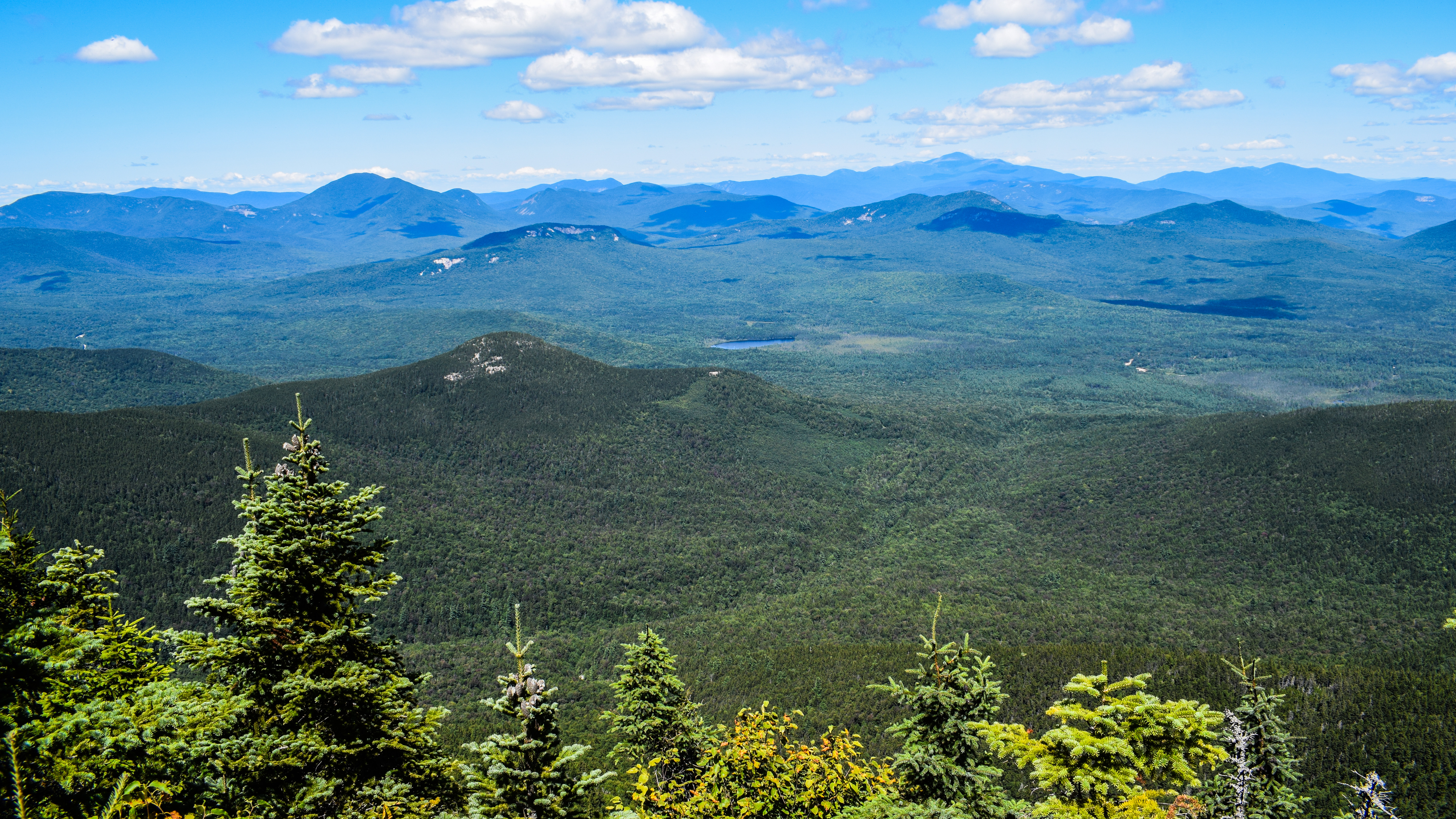
Unfortunately, the spur to the view was long (only 0.25 miles) trip down (only 200 feet). Just long enough for us to genuinely question if it would be worth it. It was also eroded, rooty, and muddy, so badly that Sarah's boot for torn open on a root. Thankfully, we soon learned that the trip down was worth it becuase the view was truly excellent. We found our friend enjoying her lunch with a few others. There were sweeping views from Franconia Ridge all the way to Mt. Chocorua, with the Presidentails front and center, all decorated with pixar-style clouds.
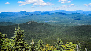
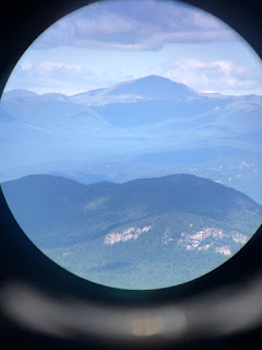
We took a nice long break there were I got to enjoy my peanut butter pretzles, costco pizza, and my reecess cups. We chatted on-and-off with the other people around us, comparing different peaks we've climbed, and learned about one couple who lives in Brooklyn, finished their ADK46, and are now tackling the NH48. The ADKer also carried a real pair of binoculars with her, which was super cool to look through, but I can't imagine carring that around! I particularly enjoyed getting to see Potash and Hedgehog from all the way up here, as I remember Mt. Passaconaway being a dominating part of their respective views. I played with PeakFinder a little bit now that my phone was fully charged again, and eventually we had to say our goodbyes and get a move on. [EDIT TO ADD: While reading "The 4000-Footers of the White Mountains: A Guide and History (Smith & Dickerman) I learned that the view is a part of an old abandoned trail called the "Downes Slide Trail." Additionally, 38 4000-footers are in view from this vantage point.]
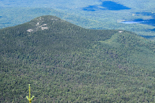
Potash Mountain.
Hedgehog Mountain.
The return trip honestly wasn't bad at all. I thought I had brought a Celcius for an energy boost, but instead apparently all I had was a White Mountain [hard] Lemonade... so I indulged in some civilized hiking. We went back to the true summit of Mt. Passaconaway to take our summit selfie, and then worked our way down to Camp Rich to find that privy!
Summit area.
I still didn't need a bathroom, but after eating a hearty lunch, and considering that I had yet to christen a bathroom, I figured it would be best to give it a good college try. I did find the privy, and it was seated upon the tallest hill in all the land. It was a beautiful thunderbox, and when I opened the lid 1,000 flies flew out. I quickly closed the lid and returned to the camp site so we could make our way down the mountain, humbly.
Our return trip down Dicey's Mill was actually rather gentle and uneventful, with a few scrambles higher up. We did pass what I believe to be a woman (40s/50s) and her mother (70s?) who were climbing up, and the woman quietly asked us how the rest of the trail is, and how close the Oliverian Brook was, and I told her far, and she was not thrilled. She explained she was worried about their pace, wouldn't be finishing until 10/11pm, and said she was trying to convince mom to stay another night. We told them Camp Rich isn't too far away and it's a lovely area, and I think that's what she landed on suggesting. The woman was definitely a seasoned hiker, just by her questions and her ADK hat, but we did feel bad. After, we also wondered what she meant by "another night," becuase Dicey's Mill terminates at a parking lot.
We hiked past a dead shrew(?) and eventually made our way and stopped at the East Branch of the Wonalancet Brook, which apparently the site of Dicey's Mill. I took time here to filter some water, and then learned my filter was clogged from the last time I used it (also I realized it definitely was frozen for most of the winter... whoops), so I borrowed Sarah's. We also took a minute to splash water in our faces and I poured some on my head which got us both wide awake! The water was very cold and it truly brought me back to life!
We crossed the brook on a wide log and kept on moving. Somewhere in here we apparently went through an old-growth forest, but we were sight-set on sitting down time. We passed the lower Tom Wiggin's junction, which comically also had the "not recommended. steep and loose." warning. I realized I never saw a warning like that on the bottom of a trail before! The next landmark was the wildernes area sign, and soon after an adorable footbridge over the Wonalancet River at the Blueberry Ledge Cutoff trail.
Some clouds were rolling in as we finished up the last mile of our hike, going past a beautiful private home and enjoying the view of Mt. Whiteface behind us. The farmlands around the parking area were buzzing with workers bailing hay, and once back at the car I finally took my poo! I went back into the portapotty after to change my clothes, closed the bathroom lid, and was greeted by TWO wolf spiders just chilling behind it. I RAN. I know they're friendly, but I am not. I changed outside the car, we enjoyed a cider doughnut, and made our way home! #20 and #21 = complete!
Step-By-Step
- Park at Ferncroft parking area.
- Walk out of parking lot and turn right onto Ferncroft Road.
- Officially start hike on Squirrel Bridge Road on the Blueberry Ledge Trail.
- Follow Blueberry Ledge Trail to the south summit of Mt. Whiteface.
- From the south summit, continue onto the Rollins Trail to the north summit of Mt. Whiteface (cairn).
- Continue on Rollins Trail.
- At terminus, turn left onto Dicey's Mill Trail.
- At terminus, turn left onto unmarked spur path to true summit of Mt. Passaconaway.
- Retrace steps, turn right onto Walden Trail.
- At next jct., turn left onto spur path to the view.
- Retrace steps to Dicey's Mill/Rollins junction.
- Continue on Dicey's Mill Trail down to Ferncroft Road and the parking area.
"Blueberry Ledge Trail" from AMC White Mountain Guide (31st Ed.) (2022)
This trail, opened in 1899, ascends Mt. Whiteface from the Ferncroft parking area (see Road Access, p. 399 for details), ending at a jct. with McCrillis and Rollins trails on the wide ledges of the lower south summit. Blueberry Ledge Trail is very scenic with excellent views, but the upper part is steep and requires some rock scrambling. Although rock steps have been drilled out in the ledges at some difficult spots, the wooden steps that were also installed on the steepest ledge on this trail have been removed. This trail is still one of the more challenging climbs in the White Mountains. It is particularly difficult on the descent, especially when wet, and is dangerous in icy conditions. Most of the trail is within the Sandwich Range Wilderness. The lower part is on private land; please be respectful.
From the parking area, return to Ferncroft Rd. and follow it northwest to Squirrel Bridge Rd. at 0.3 mi., where Dicey’s Mill Trail continues straight ahead. Blueberry Ledge Trail turns left across Squirrel Bridge, bears right in 30 yd. (sign: “Trails”), follows a private gravel road (avoid several branching driveways), and diverges left into the woods, where the road curves right to the last house. Here, at 0.5 mi., Pasture Path to Mt. Katherine leaves left. In 0.1 mi., Blueberry Ledge Trail joins an old road, and soon Blueberry Ledge Cutoff diverges right to follow the bank of Wonalancet River.
Blueberry Ledge Trail crosses into the WMNF and the Sandwich Range Wilderness, ascends easily, and at 0.9 mi. continues straight where McCrillis Path to Whiteface Intervale Rd. - not to be confused with McCrillis Trail to Mt. Whiteface - follows the old road sharply left. Blueberry Ledge Trail soon winds through a flat area and then ascends moderately through spruces. At 1.6 mi., the trail reaches the bottom of the semi-open Blueberry Ledges and climbs to the top of the ledges at 2.0 mi., where you have a restricted view of the Ossipee Range. Blueberry Ledge Cutoff rejoins here on the right at a cairn and sign, and Blueberry Ledge Trail reenters the woods at the upper left corner of the ledge.
The trail climbs gently through open hardwoods and then rises steeply, with many rock steps, past Wonalancet Outlook (limited views southeast) at 2.9 mi., to the top of the ridge. The trail drops slightly into a hollow and then ascends slightly to a jct. with Tom Wiggin Trail on the right at 3.2 mi. (On the descent, take the right fork, briefly heading east; Tom Wiggin Trail is the left fork, heading northeast.) Now Blueberry Ledge Trail climbs moderately then steeply, and swings sharply right at a southwest outlook on the left at 3.6 mi., where it abruptly approaches the edge of a steep cliff (may be dangerous if slippery). Just beyond here, the trail climbs a steep and difficult ledge, with holes remaining where wooden steps were once pinned to the rock. It then continues up the steep, rough, rocky ridge, with several fairly difficult scrambles, passing a series of excellent outlooks: first to the east, then tot he west looking across the “white face” cliff, and then two more to the east - the final and finest being a large, flat ledge overlooking the Bowl on the right at 3.8 mi. Blueberry Ledge Trail continues ascending steeply and ends at the back side of the ledges of the lower south summit. McCrillis Trail enters on the left from the ledges, and Rollins Trail continues north 0.3 mi. to the true summit of Mt. Whiteface and on toward Mt. Passaconaway. For views from the south ledges, swing left up a short scramble onto McCrillis Trail.
"Rollins Trail" from AMC White Mountain Guide (31st Ed.) (2022)
This trail runs along the high ridge that connects Mt. Whiteface to Mt. Passaconaway. Rollins Trail begins at a jct. with Blueberry Ledge and McCrillis trails on the open ledges of the south summit of Mt. Whiteface and ends on Dicey’s Mill Trail 0.2 mi. below the former site of Camp Rich. On the ridge of Mt. Whiteface, the trail has several ups and downs, and some sections are steep and rough. Rollins Trail is entirely within the Sandwich Range Wilderness.
Leaving the south ledges, Rollins Trail climbs over a wooded ledge with a glimpse ahead to Mt. Osceola and then descends sharply with several ledge scrambles ahead into the steep, narrow col between the true summit and the open south summit of Mt. Whiteface. It passes the jct. With Kate Sleeper Trail at the former site of Camp Shehadi (where camping is discouraged) on the left at 0.1 mi. From this col, Rollins Trail climbs north and then runs along the ridge crest to the wooded true summit (Cairn in 2021, but no official marking) of Mt. Whiteface at 0.3 mi. The trail continues along the narrow ridge, descending gradually, with occasional steep, rough pitches and several short ascents. There is a restricted view at 0.5 mi. and an outlook to the east across the Bowl at 0.7 mi. At 0.8 mi., after a sharp descent, an 80-yd. relocation to the left has bypassed a narrow traverse at the base of a ledge, beyond which Rollins Trail crosses over the next knob on the ridge and descends roughly to a col. At 1.3 mi., after a fairly significant ascent, there is an excellent open overlook over the Bowl. Rollins Trail then descends steadily, with several sharp turns near the bottom, to the broad, deep pass between Mts. Whiteface and Passaconaway. The trail runs east at easy grades across the pass with several minor ups and downs, passing a view of Mt. Whiteface at 2.0 mi; it then angels slightly upward around the southwest face of Mt. Passaconaway and descends slightly to meet Dicey’s Mill Trail.
"Dicey’s Mill Trail" " from AMC White Mountain Guide (31st Ed.) (2022)
This trail ascends Mt. Passaconaway from the Ferncroft parking area (see Road Access, p. 399, for details), with moderate grades and mostly good footing. It is a well-constructed trail with many rock steps and rock water bars. Opened in 1891, Dicey’s Mill Trail was the first trail to be build on the mountain. Most of the trail is in the Sandwich Range Wilderness. The lower part is on private land; please be respectful.
From the parking area, return to Ferncroft Rd. and turn right, following the gravel road northwest past Squirrel Bridge, where Blueberry Ledge Trail turns left onto Squirrel Bridge Rd. Follow the road straight ahead, pass a gate (not intended to keep out hikers) and a house in a large clearing, and bear left to continue on the road, which becomes an old logging road as it enters the woods. About 40 yd. before Dicey's Mill Trail enters the WMNF and the Sandwich Range Wilderness, at 0.8 mi., a marked path left (sign: “To Blueberry Ledge Cutoff”) crosses Wonalancet River on a footbridge to Blueberry Ledge Cutoff on the opposite bank. Soon Dicey’s Mill Trail swings right and becomes steeper, winding through an S-curve. The grade becomes easy again and continues through mature hardwoods, with a slight descent to the jct. on the left with Tom Wiggin Trail at 1.9 mi. At 2.3 mi., Dicey’s Mill Trail crosses the east branch of the river near the site of Dicey’s Mill. Across the stream, the trail passes on the left of a large boulder and begins a long ascent, angling up the side of a ridge, following an old logging road at a moderate grade through hardwoods and then conifers, with occasional minor descents and glimpses of the steep-sided Wonalancet Ridge rising on the opposite side of the valley. At the ridgetop, 3.7 mi., Rollins Trail from Mt. Whiteface enters on the left. Above this jct., many improvements - rock steps and water bars and wooden check steps - were made in 2021 to mitigate erosion. Dicey's Mill Trail then climbs through a rough and wet section, eases and crosses a small brook, and reaches a jct. at 3.9 mi., where East Loop bears right.
[...].
From the East Loop jct., Dicey’s Mill Trail bears left and in 60 yd. passes the former site of Camp Rich (25 yd. Left on an unmarked side trail; tentsite and privy). The trail climbs moderately via wide switchbacks, then ascends steeply for 0.2 mi. to a restricted northwest outlook. Here, Dicey’s Mill Trail turns right and meets Walden Trail in another 20 yd. (sign). The wooded summit is 40 yd. Right on a spur path, and Walden Trail leads ahead, passing a spur path left to the excellent north outlook and reach the east outlook in 90 yd.