Thursday, January 11, 2024

Long Pond, Reservoir Trail, Skyline Trail Loop (Middlesex Fells Reservation)

Long Pond, Reservoir Trail, Skyline Trail Loop (Middlesex Fells Reservation)

Distance: 3.59 miles
Elevation: 315 feet
Time: 1 hour, 23 minutes
Hike Type: Lollipop Loop
Hiking Challenges: 52 Hike Challenge 2024


The Hike
First hike of 2024! I was trapped in Arlington until 8pm this night due to parent-teacher conferences, so I made use of the Middlesex Fells Reservation being so close and headed over for an afternoon hike. Right out of the car I could smell the woods which truly filled my soul, and then the loud call of an owl echoed through the trees. The trail from the Long Pond parking area climbed a few stairs, followed an old paved road, and then I turned left to follow the yellow blazes around an interpretive trail.


I do love an interpretive trail, even though it kind of take you out of the "one with nature" aspect. I find it fun to learn about the history and nature of the area. The trail was expectedly wet after the snow and rain, and there were MANY pinecones on the ground with trace remnants of ice.


It appeared that this area used to be blazed in pink, and then the trail comes up to Long Pond. Here, it got a bit confusing. It appears there was a reroute however many years ago - a spur trail skirts the edge of the pond with old yellow blazes, but the newer yellow blazes stay on the main trail. I took the spur, which led to a great view of the mostly-frozen pond. 


I was bummed that I forgot my camera, but thankfully my new iPhone 14 Pro takes very nice photos. Heading away from Long Pond, I passed way too many doggy-poo bags, which was disappointing, and then passed another dog who did not have a strong recall or a leash, which was... a problem. 


I wiggled my way over to the Reservoir Trail, which was a nice change of pace from the wide old roads I'd been hiking on. The terrain resembles the Skyline Trail, but its much gentler, nice and scenic without views, and had a squishy ground due to the wetness.


The Reservoir Trial got near the reservoir, but never close enough for a good photo. I'm still confused about the rules here - I saw people hiking on the trails that were marked "no access." Is it an informal no tresspassing? Is it a rule that people just ignore? I want to know becuase they look gorgeous but I don't want to tempt fate!


I eventually continued my way past a thousand grey squirrels and to the Skyline Trail. The sun was setting from behind the trees, which set a nice orange glow through the natural windows. Eventually, I made my way back to Molly's Spring Road, and then back to my car for conferences! It was a soft, but lovely start to the 2024 hiking year. 


Long Pond Nature Trail Information (Kiosks I passed)
The Long Pond Nature Trail
Several of the twelve stations on the nature trail present a natural community, an interdependent group of plants and animals that share environmental requirements and occur together in nature. Three stations offer examples of change following a disturbance: the cabin site, the Lightning Tree Window Path, and the secret garden. Two stations note differing responses in open, sunny locations. Two woodland stations, the pine and deciduous forests, explore differing forest ecosystems. The swamp, the vernal pool, and Long Pond present three contrasting water-based communities. This trail is also the subject of a small book, Brief Walking Guide to the Long Pond Nature Trail. Follow the yellow blazes along the trail.

#2 Meadow
A meadow is a sunny, moise, open area. If this meadow were not mowed every few years, it would quickly fill in with pioneer trees. In this sunny, damp area you will find many plants, including sedges, goldenrod, daisies, gill-over-the-ground, and dandelions. These plants, as do all green plants, use photosynthesis to make their own food from sunlight. Meadow voles, shrews, crickets, and many other insects make their homes here. Earthworms tunnel underground, aerating the soft soil. The plants and creatures in this natural community depend upon each other for food, shelter, and pollination.

#3 Pine Forest
In 1900-1920, these pines were planted on what was then an open sunny rise. Now, these tall pines shade the forest floor and admit too little sun for new pines to flourish. The Canada mayflower, a small plant with heart-shaped leaves, white flowers, and red berries, is one of the few plants which tolerates the shade and the acid soil created by the disintegrating pine needles. In addition to light and moisture, components of soil help determine which plants will thrive in an area.

#4 Tennis Court
In the early 1900s a tennis court was secretly built here in an era when sports play on Sundays was discouraged. Although the plants are trimmed back only occasionally, the growth in the open area is quite sparse. While star grass and bluets have taken hold, the clay base may still impede easy growth of more deep-rooted seedlings. Encircling the site you will see several different species of trees and shrubs. Near this sign, look for the bristly locust, a shrub with bristly seed pods and stems and delicate pinkish-purple flowers blooming in late spring.

#5 Deciduous Woodland Path
The deciduous trees of the oak/hickory forest support a community of creatures which rely on this forest for their food and shelter. A forest has horizontal layers; each layer has its own habitat and inhabitants. Oaks and hickories dominate the sunny canopy, providing food and shelter for gray squirrels and blue jays. Saplings of trees found in the canopy and small trees such as the hop hornbeam and sassafras grow in the light-dappled understory. Hop hornbeams can be recognized by the loose, thin strips of bark on their trunks. Beneeath the understory is the shrub layer; low-bush blueberry and wildflowers grow close to the ground. 

#6 The Pond
Take the narrow path to your left out to the end of the peninsula. That is a good place for observing life in Long Pond. Look for painted turtles sunning themselves on logs, as well as polliwogs, frogs, and mallard ducks. On the surface of the pond, note green algae and the broad leaves of water lillies; they offer shelter and food for the aquatic creatures in the pond. Different horizontal levels in the pond afford different habitats, whether on the surface of the water, on underwater stems and leaves, or in mud and organic debris on the bottom.
        Drab, wingless insects, in their nymph stages, live in the mud at the pond bottom an dlater emerge as colorful dragonflies an ddamselflies which dart and hover over the pond. These insects form an important link in the pond food chain by eating mosquitoes and in turn may become a tasty morsel for a bullfrog. Every plant and creature is part of a food web made up on many different food chains.

#7 The Swamp
Beyond the small outflow pipe from the pond, the water spreads and creates a wetland. Several decades ago, the area was a sunny, wet marsh with cattails and other sun-loving plants. Because of the growth of trees and shrubs, this wetland has now changed to a shady, wet swamp.
        A noticeable plant in this swamp is the skunk cabbage with its large, broad, green leaves. Its tiny flowers bloom very early in the spring within a purple hood. The strong odor of the flowers attracts insects to pollinate them.
        Red maple is a dominant tree in many swamps in New England. It buds, flowers, seeds, twigs, and fall leaves are red. Its seeds are eaten by chipmunks and a few birds, while its leaves are food for many insects.

#9 Indian Lookout Rock
From the top of the rock, enjoy the view across the Town of Winchester. Imagine Native Americans in the 1630s looking across the valley which was their home. Their last leader, a female sachem, sold this land to the English settlers in 1639.
        During the great Ice Age 20,000 years ago, the surface of this granite bedrock was both rounded and deeply grooved by frozen rocks in the underside of the massive, moving glacier. These grooves, or striations, are oriented northwest to southeast, which is the direction in which the mass of ice pressed southward as it grew. Even now, after thousands of years and weathering of these surfaces, we can still feel the long, shallow grooves on the rocky slope. On the grassy side of the slope, the rock is still rough were the glacier plucked pieces away.


Step-By-Step
- Park at Long Pond parking area.
- Enter woods on path.
- At B4-3, turn left onto Molly's Spring Road  (yellow dot). 
- At B4-2, turn left to continue to follow yellow dots. 
- At B4-1, turn right to continue to follow yellow dots. 
- At B3-11, turn left onto Cranberry Pool Path (yellow dots).
- After B3-10, turn right onto unmapped path with some yellow dots along Lond Pond.
- At terminus, turn right onto Cranberry Pool Path (yellow dots). 
- At B3-8, turn left onto path to follow yellow dots.
- At B3-10, turn left onto Cranberry Pool Path (yellow dots). 
- Continue to follow yellow dots to Hillcrest Parkway.
- Continue to follow yellow dots to B3-3. 
- At B3-3 turn left onto Wyman Path. 
- At B3-5, turn right onto path.
- Continue straight onto Reservoir Trail.
- At B5-3, turn right onto trail.
- At B5-2, turn right onto Mountain Bike Loop.
- At B4-14, turn right onto Skyline Trail.
- At B4-4, turn left onto Molly's Spring Road. 
- At B4-3, turn left to return to car.

Wednesday, January 10, 2024

New Year, basically the same goals!

It's currently January 10th, and I haven't been out in the woods at all this year! That's equal parts a bummer, but okay. Between a busy start to the year, weird weather, and the good ol' 4:30pm sunsets, I haven't been able to find much time (that should change this weekend thankfully). I wrote some 2024 hiking goals down in a physical journal, but I wanted to take a moment to reflect more deeply on this past year.

Patches (in order)

1. Operation Alaska Benchmark Challenge (Bronze) - completed on January 4th accidentally on Whipple Hill in Lexington. I didn't receive a patch for this, as it appears that the owner has discontinued the challenge. I've flirted with reaching out to him and offer to take it over, but we'll see... I'm still slowly working towards the silver and gold patches, though! 

2. Sunset Six - completed on April 3rd, and I have the Blue Hills to thank for this one! The one good thing about earlier sunsets is that I can do a hike, watch the sunset, and still be home by 6:00pm. The next one I need in this series is the Sunrise Six, which is just harder to do since bed is warm and cozy.

3. Wachusett Trail Tracer - completed April 9th. This was a repeat from last year's Wachusett Redliner. The creator changed the name and made a different patch, so I had to do it again of course! I really like this mountain. I might go for it again this spring with or without a patch. Completed in three hikes, 20.35 miles total, and 4,675 feet total.

4. Old Rag Mountain - completed April 20th. This is a commemorative patch for a VERY fun and difficult hike in Shenandoah National Park. Never have I ever scrambled as much as I had on this mountain!

5. Summit Beer Society - completed August 28th. A silly, fun one. My biggest patch to date!

6. Northeast Kingdom Mountain Challenge - completed September 4th. Really proud of this one! I realy enjoyed the journey through these very different mountains - some much more enjoyable than others! Completed in 19 hikes, 78.59 miles total, and 22,063 feet total.

7. Monadnock Redliner - completed September 14th. Also very proud of this one! I love this mountain so much, and I feel a deep sense of belonging when hiking on the trails - kind of like hiking with an old friend even when I'm alone? It's hard to describe. I also just love knowing that I've hiked all of the trails. I will DEFINITELY be repeating this one! Completed in 10 hikes (with a few repeats), 68.02 miles total, and 20,376 feet total.

8. 52 Hike Challenge 2023 - completed December 29th. My annual accountability patch - try to hike four times each month to keep it consistent. Yay!

Other Progresses

1. 52 With a View: I added 14(!) peaks to this list in 2023! I only have 10 more peaks, and I need to decide if I want to really go full steam ahead to complete the list, or turn my focus to the 48 so I can get fancy and finish both lists in one hike (if I go this route, it'll be Moriah-Shelburne Moriah). Time will tell!

2. New Hampshire 48 4000-Footers: I added 11(!) peaks to this list in 2023 - including my first solo 4000-footers (Field, Willey, and Tom)! I'm halfway through my list and am really hoping to add a bunch more in 2024 - including a first winter ascent??

3. Vermont 5 4000-Footers: A short list I recently started! Emma moved up near Burlington, so when she was working I hiked Abraham and Ellen (great hike, a bit long for an out-and-back, but that's okay), and we hiked Mansfield. Only need Killington and Camel's Hump! I think if I get the chance to hike any this winter, I'll go for a repeat to informally work on the winter 5 list, since it is very attainable.

4. The Blue Hills! I'm very close to finishing my second round of the 125-Mile Club and the Winter Trace - both should likely be done by the end of February. Informally, I've been working on a series of unofficial challenges that I keep acting like I'm going to make patches for: The Blue Hills Grid, 500 and 1,000 milers, and Great Blue Hill Summits (Bronze-50, Silver-100, Gold-250). I decided to make the Grid for when I was bored of doing a tracing challenge (aka avoiding the Quarries), the Great Blue Summits for when I just needed to get a workout in and wanted to be rewarded even if I already hit the specific trail(s) in question, and the 500/1000 just to commemmorate achievement (I'm just a few miles away from 500!). 

Goals for 2024

1. Hike 100 hikes, 500 miles, 100,000 feet. 

2. Continue progress on NH48 and 52WAV - let's say 10 hikes devoted to these lists.

3. Complete the VT5. 

4. Complete Blue Hills 500-Miles, 125-Mile Club round two, and Winter Trace.

5. 52 Hike Challeng 2024.

6. Complete the Sunrise Six Challenge (only three sunrises I can do that!).

7. Hike Mt. Monadnock at least one time. 

7. Complete the Castle in the Clouds Explorer Patch (only one more hike, exclusing the closed trails). 

8. Commit to some summer challenge when in NJ - TBD. 

In summary...

I am very proud of my self!!! I am stronger, healthier, and in love with mountains. I also love patches, but they are truly just a bonus (even if a really fun bonus...). I have never regretted going on a hike, even in the worst of conditions, so I am happy I have these seperate goals to help me stay motivated even when the couch beckons my name. As always, I'm sure my list of goals will evolve and change throughout the year, but I am excited for what's in store!

Friday, December 29, 2023

Ober Road to Cliff Pond Loop (Nickerson State Park)

Ober Road to Cliff Pond Loop (Nickerson State Park)

Distance: 2.68 miles
Elevation: 117 feet
Time: 1 hour, 9 mintues
Hike Type: Loop
Hiking Challenges: N/A

The Hike
Time for the second hike of the day! I was definitely fixated on exploring more of these woods, so this time I headed out with Louise and Linda the greyhound. We followed Ober Road south to the old gravesite, and then followed an unmapped, narrow trail to Ober Trail. Our plan was to follow this to Cliff Pond, which was easy going on a paved path. Cliff Pond looked beautiful from the beach we landed at!


The return trip started on an unmapped trail to the fire tower (which is not climbable - sad!), and then we rejoined the Deer Park Trail to Middle Trail, where we continued to admire the lichen. The greens were likely standing out since the trees were wet. Soon enough we were back on Ober Road, and back to the house. Short and sweet!


Step-By-Step
- Start hike in back yard of Airbnb toward Ober Road.
- Turn right onto Ober Road.
- Veer left onto narrow footpath toward Ober Trail. 
- Cross Deer Park Road, continue on paved path.
- Turn left onto footpath toward parking area for Cliff Pond, enjoy!
- Join Cliff Pond Trail, moving clockwise.
- At junction, turn left onto unmapped trail toward Fire Tower.
- Trail terminates at tower on Deer Park Road, walk toward Dump Station, then onto Deer Park Trail traveling northward.
- At second jucntion, turn left onto Middle Trail.
- At terminus, turn left onto Ober Trail.
- At unmapped trail, turn right onto Ober Road.
- Follow Ober Road back to Airbnb backyard. 

Ober Road to Cedar Trail Loop (Nickerson State Park)

Ober Road to Cedar Trail Loop (Nickerson State Park)

Distance: 3.11 miles
Elevation: 141 feet
Time: 1 hour, 3 mintues
Hike Type: Loop
Hiking Challenges: N/A

The Hike
It's officially the week where no one knows what day it is - a few friends and I have a soft tradition of getting a house on the cape for a few days, and this years house's back yard was Nickerson State Park! I took two adventures in here on this day. The first was early in the morning with my umbrella, as it was raining on-and-off. Our back yard backed onto Ober Road of the state park, which I followed northward, past a very loud rooster, over some horse tracks and poo, and across a neat power cut.


Ober Road then crosses the Cape Cod Rail Trail, which I followed to Nickerston State Park headquarters. There are A LOT of trails that are not on the map, but most were on AllTrails, so I let my phone guide me. I didn't really have a plan for this walk, just meandering in a general loop-like fashion, so this kind of worked out for me. I took an unmapped path that had a singular blue-acord blaze? It then met up with Ober Road, which led to Deer Park Trail, both of which were paved.


I was stunned by how much lichen were in these woods. Curious about what the story is with the lichen - is it good, neutral, or bad for the trees? What exactly are they? I'm sure someday I'll find out. I only passed a few people on this morning adventure, which was lovely.


I later made my way to the Cedar Trail, which was also paved. I get why paced paths are good - accessibility and all, but I always prefer soft dirt. I did walk past a dangling slug which was FASCINATING. Couldn't tell if it was on purpose or if it was dead and just... drooling?


The Cedar Trail led to the Ober Trail, which then led to an unmapped trail that went past a very old grave site, then back to Ober Road, and finally back to the Airbnb. A lovely morning walk!


Step-By-Step
*Note: There are MANY unmapped trails in Nickerson State Park. 
- Access Ober Rd. via backyard of Airbnb house.
- Hike north-east along Ober Rd.
- Turn right onto Cape Cod Rail Trail.
- At trail kiosk, hike on unmapped trail toward Ober Trail.
- At terminus, turn left onto Ober Trail. 
- At next jct., turn right onto Deer Park Trail.
- At next jct., veer left onto Cedar Trail.
- At terminus, turn left onto Ober Trail.
- At next, unmapped junction, turn right onto trail.
- Turn right onto Ober Road, return to Airbnb.

Tuesday, December 26, 2023

Pyramid Mtn. & Tripod Rock via Green/Orange (Pyramid Mountain Natural Historic Area)

Pyramid Mtn. & Tripod Rock via Green/Orange (Pyramid Mountain Natural Historic Area)

Distance: 5.03 miles
Elevation: 673 feet
Time: 1 hour, 40 mintues
Hike Type: Lollipop Loop
Hiking Challenges: 52 Hike Challenge

The Hike
Time to hike off the Christmas cookies! I had a few ideas for this day - I wanted to hit the water gap, but I did not wake up early enough to do so without insane crowds (grateful for Google's feature where it tells you how busy a certain location is in real time), so I decided to go for another classic and hit Pyramid Mountain from the Boonton Ave field, so at least part of my hike would be in solitude. It was a cloudy day, temperatures in the low 40s, I was in shorts and a long sleeve base layer (a lesson I learned after my last jaunt in the Blue Hills), and forgot my camera - classic! I was the only one in the parking lot, and got right to it!

The Green Trail was covered in packed leaves with a few washed out spots from the crazy rain storm of recent. I was very happy with my decision to take this route - I only saw one mountain biker and a few squirrels the whole stretch. I would also like to note - this was the last day I had my iPhone 8, who's camera violently shook whenever I tried to take a photo, hence the blurry photos.


Once on the Orange Trail I noticed the air smelled like a cloud. There were very small patches of blue sky peeking through the cloud cover. The temperature was nice for exercisse. I enjoyed the lovely views of the Taylortown Reservoir and passed a small amount of people, including six swans flying around the water! I was grateful for how dry the trail was (minus one wet patch).


Once Orange terminated, I continued onto Blue where I started power hiking to get past the crowds of people - most of which took the hint and let me pass without too much awkward close-hiking. The stretch of the Blue Trail from the sharp turn to the summit is a nice workout, especially while power hiking, and I enjoyed the view from the lookout.


From the summit to Tripod Rock I passed a few more handfuls of people which thankfully dissipated after I passed Tripod Rock. I admittedly was on my phone a bunch during this hike so I needed to break out the trusty power bank. The rest of my return trip was peaceful and lonely in the good way (is there a word for this?). 


Step-By-Step
- Park at Boonton Ave Field.
- Follow Green Trail along north side of the field area.
- Enter park at trail kiosk, continuing on Green.
- At terminus, turn left onto Orange Trail.
- At terminus, continue straight/left on Blue.
- At next junction, turn sharply right to conitnue on Blue.
- At next junction, turn right to continue on Blue.
- Summit Pyramid Mountain, continue on Blue. 
- At next junction, continue left onto Blue-Dot.
- At Tripod Rock, continue on Blue-Dot.
- At terminus, continue straight/right onto Orange.
- At next junction, turn left onto Green.
- Return to car.

Sunday, December 17, 2023

Mt. Monadnock via Pumpelly Trail (Monadnock State Park)

Mt. Monadnock via Pumpelly Trail (Monadnock State Park)

Distance: 8.92 miles
Elevation: 2,005 feet
Time: 6 hours, 39 minutes (5 hours, 50 minutes moving)
Hike Type: Out-and-Back
Hiking Challenges: 52 Hike Challenge, Monadnock Redliner (2x)

The Hike
Sarah and I planned to hike on this day but the weather looked suspect at best. We flirted with Cardigan, but decided to save that one for a day when we actually have a view, so it was off to my favorite mountain, Mt. Monadnock! This would be my first time back on the mountain after finishing my redline, officially kicking off my second round! 5:00am wake up, scooped up Sarah at 5:20, and after a stop at the fabled Wichendon Cumberland Farms, we made it to the trailhead just around 8:00am. 


I haven't been on the full Pumpelly Trail since a comically windy day in 2016, and truly this day wouldn't be much different. Temperatures were in the mid 30s at the trailhead, and I was breaking out my new Kestrel 2000 Anenometer, which measures ambient temp, wind chill temps, and wind speed. 

The first bit of trail was easy through a lovely, leafy hardwood forest with trace amounts of ice and a thankfully dry trail. There were a good amount of old stone walls in these woods, and, according to the guidebook, the trail goes over "Oak Hill," which I do remember thinking "this is going to be annoying on the return." Nothing steep, just an up and down. 


The trail meandered on easily through the lovely woods, turned a corner, and then IMMEDIATELY switched over to steep climbing. The steep section begins at some iced over stone steps, and then continues through a more eroded area. The woods here are beautifully mossy, and there were a couple side paths on the left to obstructed views. We were glad we took one, because it would turn out to be the only view of the day. 


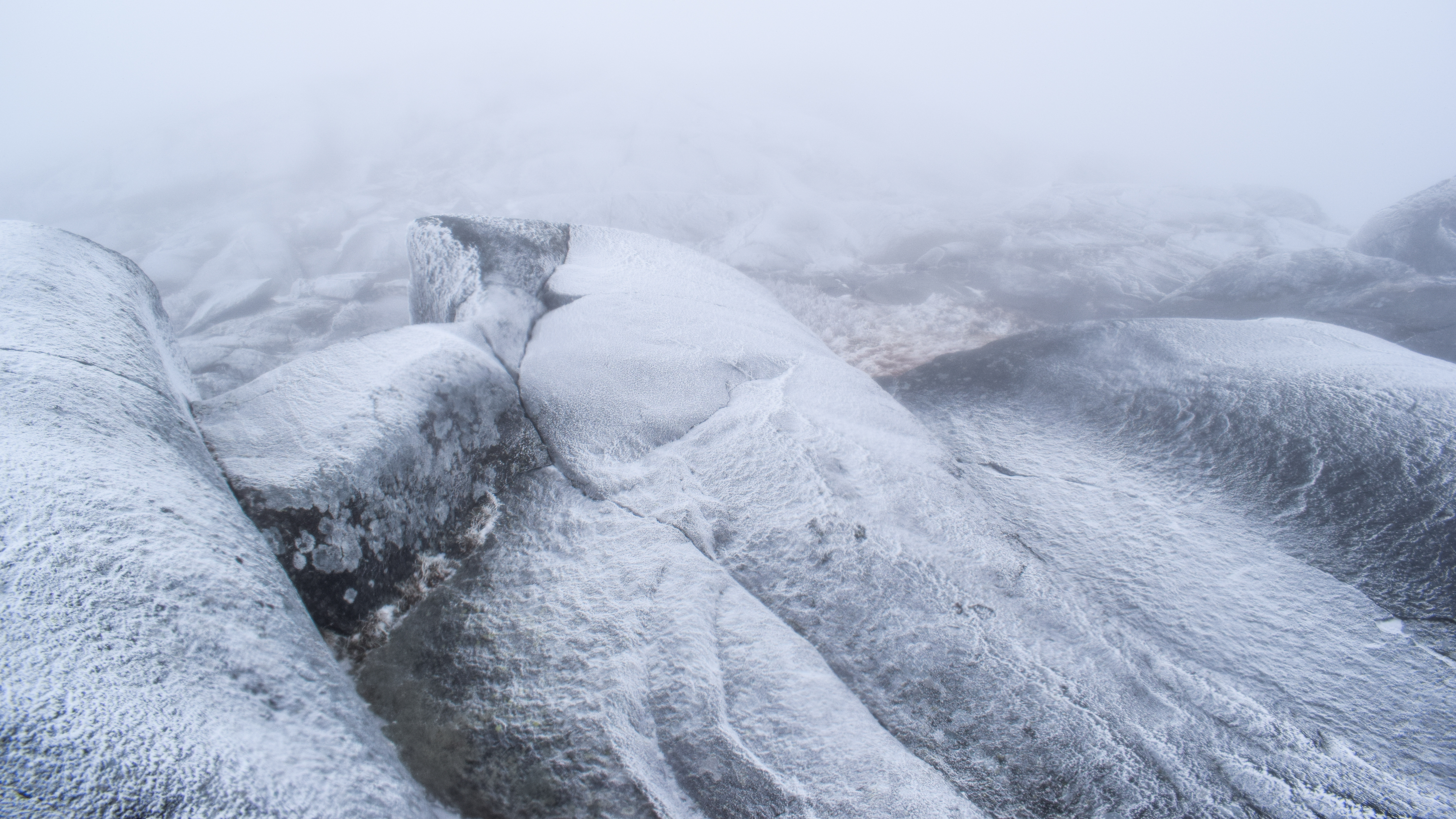
Continuing on, the trail continues to climb steeply, slowly breaking out into the open ledges. The views of being inside a cloud were... fun? The actual most exciting part was stumbling upon what we call "crispy trees" - trees with a coating of snow or rime ice. 


The ledges alternated between bone dry to very wet to incredibly slippery, which made for a slow, interesting ascent. Sarah and I chatted for a bit about if we were making the right choice continuing on - we decided to keep on going and just take our time. In our favor, I know this mountain very well, and if worse came to absolute worse, we could have descended via the Dublin Trail and done a road schlep back to the car. 


We passed a group of people who were equally cautious about the slippery terrain - they even offered us a ride if we needed one (they were traversing from Pumpelly to Dublin with a car spot), which was really kind. The trail meandered in and out of the open, with some scrambling up and down, which was actually really fun! The trail, even in the clouds, was absolutely stunning. 


The crispy trees increased in numbers after the junction with the Cascade Link Trail, and thankfully the trail conditions... improved(?) too. The footing was much better, but the wind was much wilder. The clouds were thick and both my camera lens and Sarah's glasses were constantly fogging up, which made things even more exciting! We check in with each other again, and mutually decided we were good to keep going on. We really lucked out on the temperatures - the ambient was hovering around 32 degrees, and wind was gusting between 15-20mph, which all in all, wasn't the worst.


The trees were mostly iced over once we hit the junction with the Spellman Trail - and the massive rock, the Sarcophagus, looked stunning in her winter glory. By now, the trail grade was much easier, sans the occasional scramble. 


Our spikes went on just for a moment to climb an icy slab before the Red Spot junction, but quickly came off again. The rocks were covered in rime ice again and footing was getting slippery, but we kept bare-booting it for the time being.


From the Red Spot junction to the summit, we were officially in the thick of it. Winds blowing at 35mph, maybe 20 feet of visibility at best. We took our time, making sure to follow cairns carefully and knowing where we're coming from. The rocks got very slippery toward the top, so we made the decision to put on our spikes, even if they were going to get chewed up (it was the right call). 


Everything was painted in a stunning dusting of snow and ice as the winds howled. As I'm writing this, my voice is still a little hoarse from trying to talk through it! The scenery was absolutely stunning, almost as if we were on a well-lit moon. 


We slowly and excitedly made our way to the summit benchmark, took our selfie, embraced the wild winds, and then hastily worked our way out of there. We found a few more people heading up to the summit from all directions as we carefully worked our way back down - even passing the group from before!


Our spikes stayed on from the summit to the icy ledge from before, which really chewed up my nice Hillsounds (I left my rock spikes in the car by accident... fool), but it was definitely the right call. We descending into a sag where we took a nice snack break, only moving again because we got chilly with our soaking wet bodies.


While in our "snack sag" we noticed the ice was starting to be blown off the trees, making it kind of snow, but more aggressively? We continued our descent of the mountain, occasionally climbing, but usually descending, and were delighted to notice that the slippery rocks have melted! Footing was great for our trip down, and the views were... the same. I didn't take any more photos from this point on since my camera (and body) was soaked. We were surprised how steeply the descent felt! We remembered the first steep section, but apparently most of the climb up the ridge was pretty steep. Was passed a number of other hikers heading up the mountain before the real storm hit, and it wasn't until we were back in the woods at the top of the first steep section where we took our second break for hot chocolate!


When Sarah and I were on our last hike up Mt. Kearsarge, all I wanted was hot chocolate, so I brought my JetBoil, some extra water, hot chocolate, and a nip of Bailey's that Sarah got me for this one. I knew we likely wouldn't be able to make it up at the summit, but we truly found the perfect sitting rock for our second, long break. 


Afterwards, we continued our final steep descent, and then made it to the floor below the ridge, for an easy last 1.8 miles back to the car. We put out gear away, lamented at the fact that my watch died, and the SECOND we started to drive away, it began to rain! Sarah said that this is the first time she's really felt accomplished to summit in a mountain in quite some time - and I fully agree with her! It was a unique, great day on my favorite mountain.

Step-By-Step
- Start hike on the Pumpelly Trail.
- Summit Mt. Monadnock.
- Return to car via Pumpelly Trail.


"Mt. Monadnock (3,170 ft.)" from Southern New Hampshire Trail Guide, 5th Ed. (2021)
Mt. Monadnock, also called Grand Monadnock (and listed as Monadnock Mtn. on USGS maps), rises in the towns of Jaffrey and Dublin, about 10 mi. north of the New Hampshire - Massachusetts border. This isolated mountain towers 1,500 to 2,000 ft. above the surrounding country, visible from most of the prominent viewpoints in central New England. Monadnock is an Abenaki word thought to mean "mountain that stands alone," though its exact meaning - and spelling - has been subject of some debate. As a result of the mountain's prominence and popularity, geologists use the term "monadnock" in a general sense to describe an isolated mountain that rises far above the surrounding terrain. (The Harvard geography professor William Morris Davis originally suggested this usage in 1894. Webster's International Directory accepted it in 1900, and the Encyclopedia Britannica did so in 1910.) The bedrock of Mt. Monadnock is primarily layered schist and quartzite - metamorphic rocks thought to be about 400 million years old. In some outcroppings, prominent folds are visible. These rocks are highly resistant to erosion. Many signs of glaciation can be seen on the mountain, including a number of glacial striae (scratches made in the bedrock as boulders were dragged along the base of the ice sheet). 
        The summit of Mt. Monadnock commands exceptionally extensive and distant views; Mt. Washington is sometimes visible on very clear days. Two prominent southern crags are noteworthy: Monte Rosa (2,515 ft.) on the southwest ridge and Bald Rock (2,626 ft.) on the south ridge. On the northeast side is the long Pumpelly Ridge.
        Combining rugged mountain scenery, a relatively short and moderate ascent (compared with major peaks in the White Mtns.), and convenient access from the population centers of southern New England, Mt. Monadnock is reputedly the third most frequently climbed mountain in the world, after Tai Shan in China and Mt. Fuji in Japan; it is estimated that 100,000 people climb it each year, with the highest numbers coming during foliage season in October.
        Despite the relative ease of access, do not underestimate Mt. Monadnock, particularly if you are unused to mountain trails. All routes of ascent involve at least 1,700 ft. of elevation gain, and many trails are rocky and rugged, with some ledge scrambling. The vast expanses of open ledge on the upper slopes, which provide the panoramic vistas that make this mounatin so attractive to visitors, can also be very slippery in wet or icy conditions (and slick even when dry), and hazardous in thunderstorms. Above treeline, trails can be difficult to follow when clouds cover the mountain; at such times, hikers must follow markings carefully to avoid encountering dangerous cliffs in an attempt to descend off-trail. In any weather, descending hikers must take extra care to follow the correct trail or end up miles away from the intended trailhead. On the open ledges, trail names are painted on the rock at intersections. Many trails may be very icy in late fall, winter, and early spring (depending on weather), at which times traction devices are required for safe passage. Treat any water source before drinking.
        Major trails reach the summit from several directions, and there is a network of connecting and secondary trails on the east, south, and west sides of the main peak. The most popular trailhead is at Monadnock State Park Headquarters, located at the end of Poole Rd., on the southeast side of the mountain. The headquarters also has large parking areas (open year-round), picnic grounds, restrooms, a park store, a small visitor center, and a campground. The park has an admission fee year-round. For driving directions, see the descriptions for White Dot Trail, perhaps the busiest route on the mountain.
        A network of trails on the southwest and south sides deteriorated badly after a fire in 1954 destroyed a hotel called the Half Way House, where many amateur trail builders had their base of operations, but most of these trails have been restored by the dedicated efforts of state park personnel and volunteers. It is possible to ascend Mt. Monadnock in relative solitude on these attractive trails, particularly on weekdays. White Arrow Trail - the most direct route to the summit on this side - and many other trails, including attractive circuit trips, begin near the Half Way House Site, an open, grassy clearing on the west flank of Mt. Monadnock's south ridge at about 2,100 ft. Direct routes to this site are provided by a foot trail - Old Half Way House Trail - and by a former toll road, now closed to public vehicular use but open for hikers. (Note: Yield to vehicles approaching or leaving the private residence near the top.) The trail and road both leave a parking area (sign: "Old Toll Rd. parking, fee charged") on NH 124 near the height-of-land (the highest point on a given trail, ridge, or road), 5.3 mi. west of the major intersection in the center of Jaffrey and about 4 mi. east of Troy. (At the busiest times, on the weekends and during summer, this lot may be filled to capacity.) From the parking area, Old Toll Rd., a gravel road, climbs 1.2 mi. and 600 ft. in elevation to the old hotel site. Parker Trail joins the road at 0.6 mi., 1.5 mi. from its trailhead at the state park headquarters. The maintained part of the road ends at 1.1 mi., where a driveway diverges right to a private house; just beyond here, Old Halfawy House Trail joins from the left. The final 0.1 mi. to the hotel site follows the eroded old roadbed.
        The upper 500 ft. of the mountain is open ledge, bared by a series of forest fires. Early eyewitness reports from European settlers indicate that the summit of the mountain was heavily forested, with Bald Rock being the only prominent bare ledge. Farmers frequently set firest to clear the lower slopes for pasture, and around 1800 a major fire of unknown origin burned for about two weeks, greatly damaging the firests on the upper part of the mountain. A second major fire occurred around 1820 and lasted for a number of days, fanned by wind and drought conditions. It burned with an intensity the consumed even the soil, reducing the upper part of the mountain to bare, sterile rock. Since then, small subalpine plants, shrubs, and trees have lodged themselves in cracks and crannies, creating pockets of soil and beginning the process that, if left undisturbed, will restore the  mountain forest in a few millennia. Many rare subalpine plants around teh summit are found nowhere else south of the White Mtns.
        The first English-language recorded ascent of the mountain was in 1725, when Captain Samuel Willard and a company of 14 rangers climbed it from the south and "campt on ye top." Visitors from outisde the immediate vicinity began to arrive at about the same time as the last of the great fires, and by 1850 Mt. Monadnock was established as a major attraction for New Englanders. Due to the proximity of the mountain to Concord, Massachusetts, where the transcendentalist literary movement and its deep interest in nature developed around the writers Ralph Waldo Emerson and Henry David Thoreau, Mt. Monadnock attained almost sacred status and was immortalized in the works of these notable writers and others. Mt. Monadnock probably bears more historical trails, former trails, ruins, and named minor features than any other mountain in New England, including Mt. Washington. Details about the mountain's storied history are found in Annals of the Grand Monadnock, by Allen Chamberlain (who served as both councillor of exploration and president of AMC in the early 1900s and edited earlier versions of the AMC Monadnock trail map), originally published in 1926. An interesting history is Monadnock: More Than a Mountain, by Craig Brandon, published by Surry Cottage Books. The Monadnock Guide, by Henry I. Baldwin, was originally published by the Forest Society and has been reissued by Surry Cottage Books. It provides historical background, as well as extensive information about the natural history of the mountain.
        Land protection on Mt. Monadnock began in the 1880s, when the selectmen of the town of Jaffrey set aside a tract for public ownership and protection. Over the years, local citizens and conservation groups, led by the Forest Society, have averted several decelopment threats. In 1987, the mountain was designated a National Natural Landmark. The public reservation on the mountain now comprises more than 5,000 contiguous acres and includes conservation and public lands owned by the Forest Society; the towns of Dublin, Jaffrey, and Troy, the Monadnock Conservancy; the Nature Conservancy; the New England Forestry Foundation; and the New Hampshire Department of Resources and Economic Development. Recreation use is managed by the NHDP in conjunction with the Monadnock Advisory Commission. 
        Note: Camping is not permitted anywhere on Mt. Monadnock, except at the state park campgrounds. By New Hampshire state law, dogs or other pets are not allowed anywhere on the mountain, along the trails, or in the campgrounds.
        The Mt. Monadnock trail syste is shown on this book's AMC Southern New Hampshire Trail Map (Map 1), and Mt. Monadnock is covered by the USGS Monadnock Mtn., Troy, Dublin, and Marlborough quadrangles. Also shown on the AMC map are 25 points of interest - historical and natural features that can be seen along the trails - described below. On the state park's trail map, the following are designated as "main trails": Dublin, Pumpelly, Cascade Link, Birchtoft, Red Spot, White Dot, White Cross, Lost Farm, Parker, White Arrow, Old Half Way House, and Marlboro. These are well trod and, in general, well marked and easy to follow. The other trails described here are designated as "footpaths" on the state park map, and while some are well marked, they may require considerable care to follow.

"Pumpelly Trail" from Southern New Hampshire Trail Guide, 5th Ed. (2021)
This is the longest and most strenuous direct route to the summit of Mt. Monadnock, but the upper half is very scenic. It was laid out in 1884 by Raphael Pumpelly, a professor, geologist, archaeologist, adventurer, and summer resident of Dublin. Follow NH 101 (Main St.) west from the flagpole in Dublin 0.4 mi. then turn left onto Lake Rd. (sign). The trail turns left off the road in another 0.4 mi., opposite a log cabin on a pond and 75 yd. east of where Lake Rd. reaches the pond's shore; the trail sign is set back in the woods. There is no designated parking area, and space is limited; hikers must park along the side of the road, observing posted parking regulations and taking care not to block emergency-vehicle access. The first 1.5 mi. of this trail is on private land with a trail easement.
        This mostly unblazed (white where there are blazes) trail follows a woods road for 120 yd., turns right onto a narrow path through a stone-wall (arrow), then turns left onto another woods road (in reverse: arrows) at 0.2 mi. It crosses Oak Hill at 0.7 mi. and continues with gradual ups and downs, becoming a footpath. At 1.8 mi. it turns sharply left and begins the rather steep and rough ascent of the north end of Pumpelly Ridge. The trail zigzags up and emerges on the first semi-open ledges on the shoulder of the mountain at 2.2 mi., almost exactly halfway to the summit. From here the trail is rugged and rocky, running near the ridge crest with many minor ups and downs, but it offers excellent views from bare ledges. At 3.0 mi. Cascade Link enters on the left, ascending from the Monadnock State Park Headquarters trail network on the eastern slopes. Stay on Pumpelly Trail to pass near the bare top of Town Line Peak (2,884 ft.; near the boundary of Dublin and Jaffrey) and descend to a junction at 3.7 mii., where steep Spellman Trail meets Pumpelly Trail on the left. Just beyond this point, the trail climbs past the Sarcophagus, a huge rectangular boulder on the right. From here the trail, marked by large cairns, runs mostly on open ledge, where many glacian striations are plainly visible. It soon passes a small alpine meadow and at 4.0 mi. reaches a junction with Red Spot Trail on the left (large cairn and sign). (Red Spot Trail connects Pumpelly Trail with Cascade Link on the lower east slope of the mountain.) Pumpelly Trail drops into a little gap with steep, ledgy wally then slimbs out and comes completely into the open. It now takes a winding route over steep ledges to the summit at 4.4 mi., passing several small alpine pools; follow the cairns carefully in this section.
        Descending, the trail runs nearly due east; look for a ledge with "Pumpelly Trail" and a large white arrow painted on it. A few cairns lie along the first 200 yd., and hikers must take care to locate the first one. Many of the cairns are rather small, and this trail could be quite difficult to follow down from the summit in the fog.

Tuesday, December 12, 2023

Quarries Pipe Line, Crags, Southern Quarries (Blue Hills Reservation)

Quarries Pipe Line, Crags, Southern Quarries (Blue Hills Reservation)

Distance: 0.71 miles // 5.61 miles
Elevation: 29 feet // 531 feet
Time: 15 minutes // 2 hours, 5 minutes
Hike Type: Redlining Loop
Hiking Challenges: 125 Mile Challenge (2x)

The Hike (Part 1)
My first mental health day of the year, and BOY did I need it! Temperatures were in the mid-30s and I went to the Blue Hills with a relatively open plan to hit the St. Moritz Ponds the remaining Quincy trails, and the wild quarries area. The sun was shining, and off I went! 


I started by hitting the bit of trail that terminates north of the rink, which was drier than expected and passed an abandoned ballfield (which is the second abandoned ballfield in this reservation). The junction between the two ponds was WET WET and basically impassible, which was a bummer, but made sense after all the rain. I hike the other area trails heading toward 4205, until I saw that the footbridge there was also flooded out. Instead of suffer through, I decided I'd finish this side of St. Moritz, then drive over to Wampatuck Road and continue my journey with a comical game of connect-the-dots. 


The Hike (Part 2)
After a quick drive, I was back in action! I continued where the Skyline Trail enters the St. Moritz area, hiking the network of trails there. The skies were still beautiful and I realized if I needed to take off my fleece (I would) that I would look like a blueberry... whoops! I've never had to pay attention to a map so closely now that my original plan had flopped and I was truly winging it (happy to report from the future that I did not accidentally orphan any trails!). There was a nice footbridge along the Firepit path, then a spooky cage (which I believe is for the water pipeline), and then a firepit - how appropriate! 


I continued my wiggling and landed up at the top of the hill above 4205 where there were some concrete foundations - I wonder if this is where the old ski jump used to be? [EDIT: According to the Friends of Blue Hills website, I am right!]. It was getting too warm for a fleece but too cold for a t-shirt, so I made a note to always use a long-sleeve this time of year just to cover the elbows. 


With my sweaty back in fully glory, I continued across Wampatuck Road to get the sections of trail I still needed over there. I love how stick season shows how rugged the terrain is over here. Trails were generally dry... except for when they weren't. I missed a turn on the Pipe Line and hiked up a well-cascading stream at 4153, which also reminds me I really need to get waterproof, uninsulated boots for wet seasons. 

The trail was short and steep up to the crags, and then I meandered my way over to the map-less Babel Rock, which provided a surprisingly nice view of the ponds. I made my way to the official Quarries Foot Path and whispered a hail mary to myself... I've only had rough luck over here before. I did remember reading that DCR planned to blaze the foot path, but it appears that has not happened yet. 


The area where the DCR map says "Quarries Foot" was blazed with orange flagging tape, which was a godsend, and the trail on the northern side of it was only recognizable for the first half. I saw a few people in the distance and fought to avoid them - I was not emotionally ready to say hellos to strangers who were likely struggling to find the trail too, and eventually threw in the towel once I made it to a the boulder wall the leads down to Bunker Hill Lane. I was happy that I began to connect some more dots of the area, but I was getting frustrated, and a mental health day is no time to feel frustration. I will also add that the litter in the area is TRULY impressive... how often do how many people party out here?


I made my way out via Bunker Hill Lane and then followed the sidewalk along Wampatuck Road on the St. Moritz side and noticed that the ponds were flowing over the spillway, which also made sense. I made my way back to my car, and now really only have 2-4 hikes left on my 125-mile club 2nd time patch! The rest of the quarries, Brookwood, the Braintree Triangle, and of course, the Ponkapoag Boardwalk.


Step-By-Step (Part 1)
- Park at Shea Rink.
- Start hike by turning left onto Willard St.
- After the rink, turn left into the woods onto trail (concrete marker: St. Moritz Ponds).
- At Skyline Trial, hike a few feet toward 4220, but turn around since its flooded.
- Follow Skyline Trail to Minichiello Path, then turn around.
- Turn left onto Winter Carnival Path.
- At terminus, turn right onto Minichiello Path (green dot).
- At flooded trail, turn around. 
- At terminus, continue right onto Skyline Trail to return to car.

Step-By-Step (Part 2)
- Park at 4214 on Wampatuck Road. 
- Cross road to hike western side of St. Moritz Ponds.
- At 4220, turn left onto trail.
- At road, turn around.
- At 4220, continue straight-ish to continue on Water Pipe Line.
- At next jct., turn sharply right onto Murphy Path.
- At 4220, turn right onto Skyline Trail.
- Connect to the flooded section, turn around.
- Before 4220, turn left onto Firepit Path.
- At terminus, turn left onto Water Pipe Line.
- At 4205, turn left onto Minichiello Path (green dot).
- At flooded section, turn around. 
- At 4205, turn right onto Water Pipe Line (green dot).
- At next jct., turn sharply left onto Murphy Path.
- At next jct., turn left onto Ski Jump Path.
- At 4205, turn right onto Water Pipe Line (green dot).
- At 4202, turn right onto Murphy Path.
- At jct. with Ski Jump Path, turn around. 
- At next jct., turn left onto Obbatinewat Path.
- At terminus, turn right onto Water Pipe Line (green dot).
- Follow Water Pipe Line (green dot) to Wampatuck Road.
- Cross Wampatuck Road.
- Continue hike on Indian Camp Path (green dot). 
- Just before 4135, turn sharply right onto Crag Trail.
- At 4153, turn right onto trail (labeled as Crags Foot Path on FBH, but not DCR Map).
- Just before 4155, turn left onto Skyline Trail.
- In col between Crags and Rattlesnake Hill, turn left onto trail.
- At terminus, turn right onto Green-Dot (labeled as either Crags Footpath or Quarry Trail). 
- Before 4151, turn left onto small spur.
- At terminus, turn right onto trail.
- At 4151, turn right onto Green-Dot.
- At 4174, turn right onto Skyline Trail.
- At next jct., turn left onto trail.
- At terminus, turn right onto Shawmut Trail.
- At Wampatauck Road, turn around.
- At terminus, turn right onto Quarries Trail (green dot).
- Cross Wampatuck Road.
- Continue on Quarries Trail (green dot). 
- At terminus, turn left onto Skyline Trail.
- Cross Wampatuck Road again, say hello to car, reenter woods, and turn right onto unmapped trail over Babel Rock.
- At 4223, turn left onto Quarries Foot Path.
- Do your absolute best to hike as many trails as possible in the quarries area before giving up, scrambling down some granite blocks, and landing at 4235.
- At 4235, exit woods and walk along Bunker Hill Lane.
- Turn right onto Wampatuck Road. 
- Follow sidewalk back to car.