Tuesday, April 25, 2023

Ponkapoag Loop, Prescott, No Name (Blue Hills Reservation)

Ponkapoag Loop, Prescott, No Name (Blue Hills Reservation)

Hike Type: Loop with a quick zigzag
Distance: 5.23 miles
Elevation: 318 feet
Time: 1 hour, 58 minutes 
Hiking Challenges: Blue Hills 125 Mile Club (2x)


The Hike
First post-vacation hike! I absolutely loved my hikes in Shenandoah, but I was excited to be back in the Blue Hills. I didn't want to work too hard on this day since it was the first day back at school, so I headed over to Ponkapoag for a nice loop with a few bonus trails. I parked right off of exit 3 and got right to it, after letting the DCR ranger leave through the gate for the day (I've never seen anyone go in or out of the gate before, exciting! I also noticed that my pack was comically lighter than it was in Shenandoah, which makes sense. A lot less water and no stove, plus my spikes are officially out.

The hike started on the green-balzed Ponkapoag Trail, but I soon turned left onto the Prescott Foot Path. I didn't realize this was the Prescott Foot Path, but then I noticed a few old orange blazes, and it added up once I checked with the map! I also saw a slug on a tree, which was fun. The weather was chilly, but warm in the sun when the breeze stopped. I ended up taking my sweatshirt off at the end of Prescott Foot Path.

I then meandered my way to the No Name Path, where I wandered back toward Ponkapoag Trail, criss-crossing the Prescott Foot Path halfway through. There was a small spur, likely made my mountain bikers, to a large rock and onward off of this trail. Once back on Ponkapoag Trail, I could help but noticed the many side trails on the right leading to the shoreline. It looks like they have been recently brushed, too. I guess they're not official, but someone's maintaining them. Continuing onto the Acton Path, I couldn't help but notice how green the woods were getting, especialy the skunk cabbage in the wetter areas. 

Now approaching the AMC Cabins, I was already feeling tired from being back at school (future Matthew note: I was in fact pretty sick at this point and didn't know it yet - not COVID, some form of cold that was brutal), so I decided this would just be a loop with no more funny business. The bugs were out and about and there was more and more skunk cabbage. I think I might want to stay in one of the AMC cabins one day for funsies... maybe. 

The trail before the golf spurs (before 5216) was impressively wet, and the water was high near the dam. I spent a lot of time near the dam - the birds were plentiful and I ACTUALLY REMEMBERED MY ZOOM LENS. It definitely gave me the energy I needed to continue on. The golf course is also officially open for the season, I was charged at by someone's dog who was off-leash, and before I knew it, I was on the Hogdon Foot Path, going past a deer enclosure, and back at my car! A good first hike back, but now I'm going to be sick for the rest of the week... at least I tried!

Step-By-Step
- Park on I-93 exit 3 for Ponkpoag Trail.
- Start hike along Ponkapoag Trail (green blazes).
- At 5322, turn left onto Prescott Foot Path.
- At 5343, turn left onto Ponkapoag Trail.
- At 5344, turn left onto No Name Trail.
- At 5311, turn left onto Ponkapoag Trail (green blazes).
- At 5241, turn left to continue on Ponkapoag Trail (green blazes).
- At 5343, continue straight onto Acton Path (green blazes).
- Continue following green blazes along Acton Path.
- At 5175, turn right onto Redman Farm Path (green blazes). 
- At 5218, turn left onto Hogdon Foot Path.
- At 5320, turn left onto Ponkapoag Trail (green blazes).
- Complete hike at car.


Thursday, April 20, 2023

Old Rag Mountain (Shenandoah National Park)

Old Rag Mountain (Shenandoah National Park)

Hike Type: Loop
Distance: 9.54 miles
Elevation: 2595 feet
Time: 6 hours, 5 minutes (5 hours, 1 minutes moving) 
Hiking Challenges: Summit Beer Society


The Hike
The most anticipated adventure of our trip - a hike up Old Rag Mountain! I didn't take any notes during this one, but took a comical amount of photos. Our drive from Bear Church Rock to our hotel in Winchester provided some nice views of the mountain, which just increased our excitement. The drive to the trailhead also has great views that kept us going on the early morning. The trailhead is apparently new in the past few years, with two composting toilets, plenty of parking, and a ranger to scan our day use reservations and park pass. The forecasted high was 84 degreen, there wasn't a cloud in the sky, we took care of all our early morning hiking chores, made great use of the toilets, scanned our passes, and got to hiking!


The hike started off crossing a lovely bridge and then a gentle climb with some more moderate sections than yesterday's hike. The leaves were just as beautiful as yesterday and there were occasional spring flowers and really interesting Umbrella Magnolias. There were occasional views of Old Rag and the surrounding mountains through the trees, and there was a beautiful Black Swallowtail butterfly on an azalea flower. There was a partial view on top of a wabbly boulder partway up, but the real views started around the first scramble (you'll know when you've made it!). The first scramble was fun, either shimmying up a ~4.5ft deep crack or leaping up and ducking under an overhanging rock, and led to some spectacular views of Old Rag, the surrounding mountains, and the distant valleys. The bugs were out, but not bothersome, and the light greens and yellows of the springtime trees were breathtaking, all while the views up to the summit were daunting. 


This view is labeled as the "false summit" (I'd more call it a knob, it's clear you're not at the top), and it's the kickstart for one of the more ridiculous scrambling sections I've done on a hike. There is some meandering up and down, under and over, and of course, in between rocks, and then a deep descent into a crack between two massive boulders (instead of a blaze, there is just an arrow that points straight down). There were lots of butt scootches, swearing, and "how on earth do we get there?" comments, but this was absolutely the most fun part. The packs had to come off a few times, and there were a few more stable moments where we were able to catch our breaths.


A favorite spot was rock cave/tunnel (not claustrophobic) where the temperature was easily 20-30 degrees cooler than it was outside, followed by a lovely view, then followed by a bizarre staircase-type area with a massive rock wedged between the walls. One obstacle after another! There was one particularly difficult section for me, as a beefy guy, where you essentially had to give a rock a big hug and hurdle yourself up and over... That was the hardest section for me, and I made it! We were trailed by a tall solo hiker with only a fanny pack (we later overheard him say he would rather fall off the mountain than hike with a full pack... okay) who told us he spent two years not being able to walk so he's ready for this hike. Interesting fella!


Pain aside, the scrambles were so fun (and not yet over!). Our hands and knees were scraped up, but we continued on. Thankfully, the views kept getting better and better! Unfortunately, everytime we caught a view of the actual summit, we felt like it never got closer! A comically narrow passageway marked the begininng of the end in my opinion. You essentailly pop out like a praire dog onto the scrambly ridge walk. There was one final difficult scramble over a large drop (someone on AllTrails called it a leap of faith, and I agree!), but the rest of the scrambles were more fun and less terrifying. 


The trail settles down near the summit, and eventaully comes to the beautiful "Old Rag Mountain Summit ->" sign, with the spiderweb network of spur trails leading to views in all direction and one last comical pile of giant rocks. The views were incredible with the budding trees and hazy horizon. There was a "summit brick" ontop o fthe tallest rock that I did not want to tempt fate climbing, but the tall hiker who spent years not walking did go up and said "haha this asshole. It says "good job making it to the top!" which made me giggle. We took in a few views, and decided to have our summit beverages and snacks at the shelter, not knowing if we would have any scrambles down.


The summit marked the end of the brutal Ridge Trail and the beginning of the Saddle Trail. The trip down was ridiculously easier, with gentle grades and easy footing. We stopped at the Byrd Shelter which had an enclosed picnic table where we took our long break. I personally decided to skip the backpacking meal so I could drink the extra water I brought, but we still had a great break. The trail to the Old Rag Shelter was beautiful with views to the left, moderately descending. I had to get ahead of the group since my thighs were burning trying to move slowly (here we learned that my friend Chris does fast uphill and slow downhill, I do the opposite). 


The trail levels out at the Old Rag Shelter. Emma was super excited to use the privy that was there, but to her dismay it was MESSY. Lots of crusted poo and garbage... they all ended up peeing in the woods. The shelter itself was nicer than the Byrd Shelter, with room for a few more people to have a snack break. This shelter also marked the terminus of the Saddle Trail and the beginning of the Old Rag Fire Road, which was a much wider trail and rather featureless. We did see a garter snake! 


We departed the Old Rag Fire Road and joined the Weakley Hollow Fire Road at "Post Office Junction" (signed). It reads:
Community Central
This location was once the sight of a small mountain community. Here residents shopped, socialized, and attended church and school. When Shenandoah National Park was established in 1935, residents were relocated making way for the hiking trails you enjoy today. As you explore, please help preserve history by not disturbing evidence of former human use and respecting those who still live in this area. 

Meet the Postman
W.A. Brown was the Old Rag postmaster and storekeeper. A community leader, Brown lived next door to the post office and store. Reisdents picked up their mail, visited, and bought basics like coffee, sugar, and five-cent sodas. 

The trip from Post Office Junction is even easier, continuing along wide fire roads with gradual descents. There were a couple of nice cascades on either side of the trail along the Brokenback Run (excellent name), one large vehicular bridge, and lots of very tall trees. Near the terminus there is a series of four lovely footbridges crossing the stream, which has washed out the road. We crossed paths with a juvenile eastern rat snake, which was truly almost cute!


The final stretch of our hike was deciding to follow the paved road down instead of hiking the Ridge Access Trail (not sure if that was technically allowed, but I did NOT want to climb up any more elevation! It seems like this route used to be part of the actual trail before the Ridge Access Trail was opened (old blazes), and it links to another trail down the road. We were DELIGHTED to make it back to the parking area, where we changed out clothes, used the bathroom, and set forth to the best place to get a reward... Taco Bell!


Step-By-Step 
- Park at trailhead and ranger station (this location has changed in recent years, we used "Old Rag Circuit Hike" on Google Maps). 
- Start hike along blue-blazed Ridge Trail.
- Follow ridge trail to false summit knob, and then begin the strenuous scrambles.
- Summit Old Rag Mountain.
- Descend via Saddle Trail
- At Old Rag Shelter (the second shelter), continue right onto Old Rag Fire Road.
- At junction, turn right onto Weakley Hollow Fire Road.
- At next junction, continue straight through gate onto VA Route 600.
- Follow pavement to parking area.


Wednesday, April 19, 2023

Bear Church Rock (Shenandoah National Park)

Bear Church Rock (Shenandoah National Park)

Hike Type: Out-and-Back w/ Spur
Distance: 8.59 miles
Elevation: 2346 feet
Time: 5 hours, 1 minutes (4 hours, 34 minutes moving) 
Hiking Challenges: Summit Beer Society


The Hike
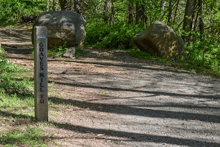
After a great night in Atlantic City and a few days in Washington D.C./Alexandria, VA, we made the hour-and-a-half drive to Shenandoah National Park for our first of two hikes! We parked at the end of Graves Road at the Graves Mill Trailhead in a gravel lot, slowly got our bags in order, and started our hike around 9:45am! The Graves Mill Trail is blazed in yellow and follows the Rapidan River, winding along the banks and into the woods, with one eroded section that will likely collapse into the river after a few intense storms. 


The first junction is a half-mile in, and we were introduced to the Shenandoah trail markers - a concrete obelisk with a metal band near the top, with trail signage and distances embedded into the metal. Here, we turned left onto the Staunton River Trail, which parallels the Staunton River... I think. There are also the names "Garth Spring Run" and "Wilson Run" on Google Maps, and there's little information that I can easily find on Google. Whatever its called, it was beautiful! [EDIT: When I checked the USGS Topo Map, I found the Wilson Run is a minor/seasonal stream that the trail crosses, and eventually joins the Staunton River. Same with Garth Spring Run, but that one is much higher up and my hike did not cross it.] A great, relatively easy trail. There were two great cascades along the trail and some beautiful woods. One cascade had some man-made infastructure, but I couldn't figure out what it could be. [EDIT: I just did a Facebook search on the "Shenandoah National Park Hikers" group and found this: "They’ve added some stuff since I was last there. I’m guessing both setups are related to water quality. This has been a long-term study by Virginia Tech since the Flood of 1995 wiped out 100% of the fish population and made huge changes to the stream bed of the Staunton River."]. There were also some old stone walls/foundations which were cool to see. I'd love to find out what/who used to be there!


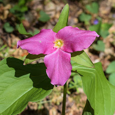
We admired the trilliums and other blooming flowers, continued to be in awe that there were leaves on the trees (compared to the bare sticks we still have in New England), and eventually hit the Jones Mountain Trail junction. This is where the climb began! The trail immediately got steeper and the sweat started pouring. It was nothing crazy steep, but we had gotten used to the gentler grades down below! There is an excellent tunnel of mountain laurel near the junction with the Jones Mountain Cabin - I wish it was in bloom!


There is a gentle, then steep descent to the shelter, with one small view off-trail. The view will definitely diminish as the leaves grow in, but it was a welcomed break! The final descent to the cabin was steep and we were DEVISTATED to learn that the privy was locked! Absolutely heartbreaking. We did our best to leave no trace in the woods, took a snack break, explored the exterior of the cabin, and then got right back to work.


The climb up from the cabin was painful, but quick, and then we had the final push up the Jones Mountain Trail. The trail was realtively steep, but nothing ever ridiculous. The trail was beautiful, with a green ground-cover and narrow footbead. The leaves reverted to buds higher up, and before we knew it we were at the incredible Bear Church Rock viewpoint! 


The view was spectacular of surrounding mountains, drainages, and even Old Rag in the distance! There was a wide-open viewpoint that we were delighted to have all to ourselves. We spent a solid half-hour up top enjoying our time (and snacks). We made it a mission to take a nice, long break on this hike, so we brought along some of our Ready Wise backpacking meals and my JetBoil so we could have some good warm food, and be forced to chill out up top. I will say, I was disappointed with the Breakfast Skillet - it was unsightly, which isn't much of an issue, but the meal was also dissatisfying. The Mountain House is much better in my opinion. 


Our return trip was straightforward and easy - only passing one other hiker near the top and one mom/daughter duo near the bottom. There were lots of beautiful flowers, LOTS of green leaves, and I was in awe of the tall trees. Are they actually taller down here, are they just older, or am I delusional? Not sure, but I loved it! We took our time getting cleaned up, and eventually started the long drive to Winchester where our new home would be for the next few days. 


Step-By-Step
- Park at Graves Mill Trail trailhead (end of Graves Road; "Rapidan River (lower section) on Google Maps).
- Start hike along yellow-blazes Graves Mill Trail.
- At junction, turn left onto blue-blazed Staunton River Trail.
- At junction, turn left onto blue-blazed Jones Mountain Trail.
- At junction, turn left onto Jones Mountain Trail.
- At junction, continue left onto Jones Mountain Cabin Spur.
- At cabin, turn around.
- At junction, turn sharply left onto Jones Mountain Trail.
- Arrive at Bear Church Rock.
- Retrace steps, skipping the Cabin Spur, back to trailhead.


"Rapidan River" from Wikipedia
"The Rapidan River begins west of Doubletop Mountain in Shenandoah National Park where the Mill Prong meets the Laurel Prong at Rapidan Camp, approximately 3 miles (4.8 km) south of Big Meadows. The river defines the border of Orange County with Culpeper and Madison Counties. Sections of the lower Rapidan River are preserved by a conservation easement.[2] The Rapidan River was the scene of severe fighting in the American Civil War, and historic sites such as Ely's Ford, Chancellorsville, Brandy Station, Kelly's Ford, and the Battle of the Wilderness are nearby."

"Jones Mountain Cabin" from Potomac Appalachian Trail Club
"Built by moonshiner, Harvey Nichols, this chestnut log cabin is located in the Central Section of SNP. Access the cabin by a strenuous 3.8 mile hike-in from the park boundary at Graves Mill. This the longest hike-in of all PATC cabins and, as a result, this cabin is only recommended for experienced backpackers. There, you will find a main floor complete with 2 bunks, an eating area, counter space, and a wood stove for heat. Find a loft space for up to 7 mattresses and a large covered porch in the front. Hikers can explore the trail system in SNP. Nearby Jones Mountain Trail leads to a spectacular view at Bear Church Rock. Note that firewood should be used conservatively, and outdoor fires are not permitted per park regulations. Be prepared to pay the park entrance fee."

Wednesday, April 12, 2023

AMC Path, Buck Hill, Monatiquot Path (Blue Hills Reservation)

AMC Path, Buck Hill, Monatiquot Path (Blue Hills Reservation)

Hike Type: Kind of a Figure 8
Distance: 4.46 miles
Elevation: 538 feet
Time: 1 hour, 44 minutes 
Hiking Challenges: Blue Hills 125 Mile Club (2x)


The Hike
Another after school ramble in the Blue Hills - the last before I head on vacation to Atlantic City, Washington D.C., and Shenandoah National Park! I was feeling tired, a think a bit of work burnout, exhaustion, and hiking burnout. The bugs didn't help. Either way, it was a beautiful, warm day, and my journey started on the Forest Path, and then along the Headquarters Path over to the old school house, which for some reason always has horse poop lying about. Once I hit MA-28, I backtracked and took the lovely AMC Footpath all the way up to the top of Buck Hill. I think this is my second favorite way to climb Buck - the first being the Fern Springs Foot Path (third probably being Skyline from the Houghton side, fourth the long NEMBA Trail, and last skyline from MA-28, but I will say I've never gone up from 28, it just seems awful). 

The sun was hot up on top of Buck Hill, but there was an occasional breeze that felt great. I had a hard time finding the Fern Spring Foot Path at first due to the network of unofficial trails, but once I found it I made my way into the mysteriously beautiful burnt forest, and then continued my meander to Fells Path, Pig Rock, Bugbee, and finally Monatiquot and Pipe Line. The Pipe Line is impressively hilly in this area. Then I had a short burst of Old 128 before Monatiquot, and it looked like instead of ripping up the asphalt of Old 128, they just buried it under I-93. The Monatiquot Path ascends and parallels the highway for a bit, which made for some unique hiking, and the second half of the trail veered away and was actually quite lovely, even though I fully inhaled a bug. 

My legs were feeling heavy, I was really excited for a change of pace and scenery with break coming up soon. My return trip along the Forest Path was realtively quick and easy, minus the short section of Skyline that I had been missing that was annoyingly steep, but I got it! Soon enough I was back in my car and on my way home for a shower and horizontal time. 

Step-By-Step
- Park at Forest Path Trailhead. 
- Start hike along Forest Path.
- At 2175, turn left onto Headquarters Path, hike to terminus with spur, turn around.
- At junction, turn left onto AMC Footpath.
- Summit Buck Hill.
- Continue onto Fern Spring Foot Path.
- At 2162, turn right onto Buck Hill Trail.
- At 2152, turn sharply left onto Fells Path.
- At 2149, turn left onto Pig Rock Path.
- At 2172, continue left onto Bugbee Path.
- At 2190, continue straight onto Monatiquot Path.
- At next junction, turn right onto Pipe Line.
- At terminus, turn right onto Old Route 128.
- Near 2150, turn around.
- Continue onto Monatiquot Path, hiking spurs.
- At 2190, turn right onto Bouncing Brook Path.
- At next junction, continue onto Forest Path.
- At next junction, turn left onto Skyline Trail.
- At 2210, turn right onto Buck Hill Trail.
- At terminus, continue onto Forest Path, return to car.


Tuesday, April 11, 2023

Hancock, Hemenway, Bermuda Triangle (Blue Hills Reservation)

Hancock, Hemenway, Bermuda Triangle (Blue Hills Reservation)

Hike Type: Kind of a Figure 8
Distance: 5.56 miles
Elevation: 988 feet
Time: 2 hours, 8 minutes 
Hiking Challenges: Blue Hills 125 Mile Club (2x)


The Hike
Spring is springing! 75 degrees and sunny for this after school hike. I parked in my favorite spot, crossed the road, and started my hike on the Wolcott Path, who had a considerable amount of loose rocks that I forgot about that made footing annoying. My feet were already hurting, which happened about this time last year, too. It might be time for some new insoles - I tried some last summer and I think they worked well? I think my winter boots are better for my feet so I forget about insoles until I transition to just my hiking shoes. 

Turning onto the Hancock Hill Path, I was delighted to see that it was bone dry (compared to the literal pond I had to get through last time! There were a few bugs out, but only midly annoying. I wiggled my way around the Circle Trail, and then worked my way towards the Base Path and ultimately Chestnut Run Path (disappointed to see that the mysterious blue chair on the Circle Trail was gone!). I reminded myself that I don't need another photo of the chimney along the Chestnut Run, and admired the swaying trees above in the wind. This hike wasn't very eventful, but just a good ramble in the woods. 

I noticed that time was moving slower in my brain than usual - maybe just becuase April break is coming up and I'm beat, but I continued on. I hit all the trails around the east side of Hancock, and determined the Hancock Trail is calf steep, not thigh steep, and that those are two distinctly different genres of steep.

I got lucky crossing Unquity Road, and made my way into the almost sepia-toned forest of the Bermuda Triangle between Unquity Rd., Chickatawbut Rd., and Hillside St. After getting those trails, I crossed Hillside St. and joined the Tucker Hill Path over to the Skyline Trail, which I took back to my car. A mentally slow, calm afternoon in the Blue Hills. I'm glad vacation is coming up soon, I need a break in many different kind of ways. 

Step-By-Step
- Park at Reservation HQ.
- Start hike along Wolcott Path. 
- At 1160, turn right onto Hancock Hill Path.
- At 1172, turn left onto Skyline Trail.
- At next junction, hike Circle Trail circle, and continue along Circle Trail.
- At 1185, turn left onto Base Path.
- At 1183, turn right onto Base Path Connector.
- At 1191, turn left onto Chestnut Run Path.
- At 1175, turn right onto Border Path.
- At 1214, turn around.
- At 1165, turn left onto Base Path Connector. 
- At 1183, turn right onto Base Path.
- At 1182, turn right onto Jeffries Trail.
- At 1154 (triangle), turn sharply left onto Hemenway Hill Path.
- At 1178, turn left onto Breakneck Ledge Path.
- At 1190, turn left onto Circle Trail.
- At 1185, turn right onto Base Path (hit spur to 1204).
- At 1203, hike to road and back.
- Back at 1203, turn left onto Chestnut Run Path.
- At terminus, turn left onto Unquity Road.
- At trailhead, turn left onto Hancock Trail.
- At 1201, turn right onto Hancock Hill Path.
- At 1204 (triangle), turn right onto Breakneck Ledge Path.
- At next junction, turn right onto Pipsissewa Path.
- At terminus, carefully cross Unquity Road and follow right.
- Enter woods on left onto Unquity Path.
- At terminus, turn left onto Hillside St. 
- Turn left into woods, hike trail, turn around and retract steps.
- Cross Hillside St., enter woods, cross Headquarters Path.
- Continue onto Tucker Hill Path.
- After 2072, turn right onto Skyline Trail. 
- Complete hike!


Sunday, April 9, 2023

Mt. Wachusett via Summit Road, Old Indian, Donborow (Wachusett Mountain State Reservation)

Mt. Wachusett via Summit Road, Old Indian, Donborow (Wachusett Mountain State Reservation)

Hike Type: Loop w/ 1 Spur
Distance: 5.85 miles
Elevation: 1138 feet
Time: 3 hours, 32 minutes (2 hours, 46 minutes moving)
Hiking Challenges: Wachusett Trail Tracer, Sunrise Six


The Hike
The weather was supposed to be nice, sun shining, minimal clouds, and I was feeling brave, so I decided to do my first real sunrise hike (i.e., starting in the pitch black) - at least mostly real. I guess I didn't hike up on any trails... It counts! I made it to to the Donbrowo Trailhead at 4:45am, all by myself. It was below freezing, but no wind, which was welcomed. I got all my pre-hike chores done as another car pulled in. I couldn't get over how dark it was! I told myself to not be a baby. Off I go!


I followed the Summit Road all the way to the top, and it was still very closed for the season. The lower summit road had a good amount of blowdowns, and the skislopes still enveloped parts of it. The snow was hard packed ice on the slops, making spikes mandatory. It was very peaceful, yet spooky. I thought about taking Old Indian up, but decided the road in the dark was a big enough step for this day (also it would have turned the hike into a big loop versus an out and back). There were STEEP banks along the slopes crossing Down Summit Road - I'm so glad I decided to get a pair of Hillsounds so my Kahtoolas can be used as rock spikes. All throughout the forest there were sounds of running water from the melting slopes.


The first colors started to appear around 5:10am, and was very grumpy that I actually brought my zoom lens with me, but left it in the car. I was surprised to come across the Harlow Overlook, guess I missed it on the map - what a great view! I enjoyed the early colors from the overlook before continuing on. The weather was actually great for hiking - I had to shed a layer as I was starting to sweat. A perk of the road walk is that it never gets too steep!


I finally made it to the summit around 5:35am and it was a balmy 26 degrees with minimal wind. There was one other person who may have camped up here, but it was unclear. I got my spot on the tower and opened up my Cumberland Farms Hot Chocolate - brutal. It was like someone put a single Hersey Kiss in a cup of boiling water. It's FINE. Thankfully it was still super hot - thank you Yeti! I was reminded that it was Easter Sunday when a large group arrived around 5:45 with light-up flashing bunny ears, and this officially marked the end of my quiet morning. More and more people arrived as the sky got brighter and brighter. The colors continued to brighten with every passing minute, and I had to put my puff on becuase it was getting chilly. There was someone skiing down already before sunrise, and it was LOUD skiing. The second loudest thing was an old man giving an Easter sermon from the top. More and more people showed up and then the sun broke above the horizon! It was just beautiful, and nice to have a bit of lizard time finally. I took a bunch of photos and then made my way down to beat the crowds.


I was shocked and delighted how dry Old Indian was, with just a few patches of avoidable ice (that I didn't realize was ice until I was slipped up). I also saw my first mountain chicken of the season (grouse)! It was nice to be alone again as I worked my way down. My knee was starting to act up, but thankfully it never got worse than a dull pain. There was a red concrete block in the ground in an area that might have been the old growth area? Not sure, but the woods were beautiful. There were a good amount of blowdowns, but thankfully all avoidable, and there were at least five different woodpeckers getting their breakfast high up in the soon-to-be budding canopy. I did get the fateful tummy rumble near the terminus, but it went away... for now...


I passed Balance Rock and went onto the SOAKED Bolton Pond Trail. Some a**hat left their dog's poop bag in balance rock, which was just annoying. I dodged blowdowns and deep puddles on Bolton Pond Trail, while other times I just walked through the stream that was apparently the trail. The pond itself was beautiful with a family of ducks swimming about, and the drainage was FLOWING. I encountered my first spiderwebs of the season on the final bit of the trail, before hitting the terminus, admiring a cool Jeep, and retracing my steps, where I got whipped HARD by a stick. 


I followed the uneventful Balance Rock Trail to the ski lodge and prayed for a bathroom (I was unsuccessful). I did enjoy some of the people skinning up to ski down, since the mountain closed for skiing yesterday. I followed the side of the Easy Rider magic carpet and dipped back into the woods on the Donbrowo Trail. There were a couple spurs to the right that showed a nice view of Monadnock, and some old cellar holes and a large chimney. I had to POOP though, verbally yelling at my colon to suck it back in. There were a good amount of easy blowdowns toward the end, and finally made it to my car without having an accident! Even more impressively, I made it all the way to Cumbies. A great morning!


Step-By-Step
- Park at Donbrowo Trailhead.
- Hike along Summit Road.
- Turn left onto Down Summit Road.
- Turn right onto Summit Road.
- Summit Mt. Wachuett.
- Descend via Old Indian Trail.
- Cross Balance Rock Road, continue onto Balance Rock Trail.
- At Balance Rock, turn left onto Bolton Pond Trail.
- At terminus, turn around. 
- At Balance Rock, continue left onto Balance Rock Trail.
- Walk around Ski Area deck to Easy Rider magic carpet trail.
- Walk up along magic carpet.
- Continue to the right of the woods and then into the woods along the Donbrowo Trial.
- Hike Donbrowo Trail to car.


"Old Indian Trail" from Massachusetts Trail Guide, 11th, Ed. (2021)
This steep, rocky trail ascends the north slope of Wachusett Mtn. It begins on Balance Rock Rd. (closed to vehicular traffic), opposite the terminus of Balance Rock Trail. To reach the trailhead, begin at the parking area for Balance Rock Trail, which is to the north of the ski lodge off Mile Hill Rd. Alternatively, park on Bolton Rd. and climb to the trailhead on Bolton Pond Trail. Old Indian Trail leaves the road on the south side and proceeds through mixed hardwoods and pines. Semuhenna Trail enteres right at 0.2 mi. At 0.4 mi., Old Indian Trail diagonally crosses a ski trail, reenters the woods, and passes under a ski lift at pole 12. The trail goes across Up Summit Rd., begins to climb gradually, traverses an intermittent stream, and then climbs steeply to a jct. with West Side Trail. Old Indian Trail continues steeply upward on stone steps and zigzags over rocks, crossing a ledge that on a clear day offers a view of Mt. Monadnock and Mt. Greylock. Here the route passes through an unusual grove of stunted old-growth forest. A few hundred above this point, Old Indian Trail levels off and climbs gradually ot the summit, ending at the beacon tower on the north side.

"Balance Rock Trail" from Massachusetts Trail Guide, 11th, Ed. (2021)
This trail begins at the edge of the ski area parking lot on Mtn. Rd., about 1.2 mi. north of the reservation visitor center. Follow an old woods road for about 0.3 mi. before turning onto a woods path, which soon reaches Balance Rock, a glacial erratic. The path continues a few hundred feet farther to Balance Rock Rd. (closed to vehicles). Across the road, Old Indian Trail continues toward the summit.

Saturday, April 8, 2023

Fowl Meadow (Blue Hills Reservation)

Fowl Meadow (Blue Hills Reservation)

Hike Type: Lollipop Loop & Spaghetti
Distance: 8.63 miles
Elevation: 226 feet
Time: 2 hours, 59  minutes 
Hiking Challenges: 52 Hike Challenge, Blue Hills 125 Mile Club


The Hike
A beautiful day with a light chill to the air, just under 50 degrees with plenty of sunshine, it was finally time to head back to Fowl Meadow and tackle the Indian Path! The parking lot displayed faint spring colors, which truly just made me eager for green, and I spent the beginning portion of my adventure reminding myself to have an open mind - the best case is that I get all of Fowl Meadow in one swoop, but also any day out in the woods is a good day. I was surprised to see so many cars at the parking lot, but then I noticed there was a soccer game going on across the street, so I think a few people were over there. I also applied my first coating of bug spray for the year! Thankfully either it worked well or there weren't any bugs out.


I wandered around the small trails near the parking area before starting my hike down Burma Road, where the birds were abundant and singing loudly! The weather had been pretty dry for the past few days, and the trail reflected that, which made me hopeful for easy water crossings! The beauty of Burma Road was only broken by two unleashed dogs running up to me at two separate times... why can't people either train their dogs or leash them?


I am always in awe of the tall trees along the Fowl Meadow Path - feels almost like being back in time? I also always find humor that intersection 6009 isn't on the map, but that's just the child in me. I hiked that weird spur and continued on until I hit the Neponset River, and then started the schlep down Indian Path!


I was delighted to see that the first crossing was low and only had a few inches of standing water. The thousand sticks someone laid over this crossing might be helpful? If anything it just confused me - I tried to see which sections looked the strongest and shimmied my way across. The trail itself is actually quite nice - a little claustrophobic, but very scenic as it winds along the riverbank. The winding is occasionally interrupted by a high water outlet/inlet - I ended up counting ~12, and all were bone dry except for the first! There were two tricky blowdowns, the first was an "under" and the second an "over." The back half of the trail had a few eroded sections along the steep banks, but the ground felt solid. An piece or orange flagging tape marks where the trail veers back towards Burma Road (the Indian Path unofficially continues on, but I was on a mission!), and I was delighted to 1) check Indian Path off my list again and 2) escape the subtle claustrophobia of plants tickling my ankles!


I hiked to the end of Burma and then worked my way back toward the Fowl Meadow Path. The fleece came off here, but the wind was still chilly. I really apprecaited how the scenery continually changed along the road, and I saw my first snake of the season! Now onto the eastern side of Burma Road, I was delighted to see that the Swamp Trail was passable, and only a little prickly. The pollening was DEFINITELY getting started as the trees continued to bud and slowly add color back onto their branches. I was blown away by how many birds there were! I really wish that I had brought my zoom lens with me. 


The next and final main challenge was the Field Path... I'm really not sure why it's still even considered a trail. There were lots of bugs at ground level, but they never bothered me thankfully. I am forever grateful for the person who put the flagging tape along the Field Path - it's an awful trail, but now easier to follow! Just after passing under an old, large blowdown (like a tunnel), there are some old items (large barrel?) that I'm curious as to how they got there... maybe remnants of planned highway construction? Maybe someday I'll retire and write a book about Blue Hills curios. 


More fascinating, are the piles of garbage at the actual abandoned highway exit. There is a couch that has seen much better days off to the side, piles of ripped up concrete (why did they bother ripping up only some of the concrete? Maybe property reasons?), and a nice pile of old flooring with a few appliances. What? Interesting, nonetheless.


Now back into the woods, I found myself wishing there was a "Welcome to the Skyline Trail" sign, or something. The beginning feels very lackluster, and maybe that's just becasue of its inaccessibility, but I would still appreciate it! There is a very small cairn, at least. The first blaze is a little ways along the trail, and the trail in this area is pretty nasty with highway litter and runoff. Further in the woods, there is an impressive stone wall that acts as an intersection marker for the footpath to the end of Royall Street, the unnamed trail to Royall Street, the Skyline Trail toward Green Street, and an unmapped trail back toward Fowl Meadow (I think this used to connect to Orchard Trail, but not sure. 


Once I hit Green Street, I turned around and started the slog back to the car! I followed the Orchard Trail, hit the spur at 6106, and followed the unmapped trail that bypasses the Swamp Trail. Using the Seek app, I learned that the super sharp prickers that are now blooming are Japanese Barberries - evil! My feet were starting to get mad at me toward the end of this suprisingly successful hike. I only passed a few people on my exit via Burma Road, and almost forgot to get the spur toward the trailhead! That would have been a bummer. Fowl Meadow: complete!


Step-By-Step
- Park at Burma Road.
- Hike trails around trailhead, including flooded path of Burma Road.
- Hike Burma Road.
- At 6005, turn right onto Fowl Meadow Path.
- At 6009 (not on map), turn left onto trail.
- Where path begins to fizzle out, turn around.
- At 6009, turn left onto Fowl Meadow Path.
- At terminus, turn left onto Indian Path.
- At terminus, turn right onto Burma Road.
- At terminus, turn around and hike Burma Road.
- At 6005, turn right onto Fowl Meadow Path.
- At next jct., turn right onto Swamp Trail.
- At 6105, turn onto Green Hill Path.
- At 6103, veer right onto Field Path.
- At 6102, turn left onto Green Hill Path.
- At 6103, turn around. 
- At 6101, continue onto abandoned road, always veering left.
- Continue onto Skyline Trail.
- At 6600, turn around.
- At stone wall, turn left to hike spur to Royall St., turn around.
- At stone wall, turn left onto Skyline Trail.
- At terminus, continue  to retrace steps on abandoned road. 
- At 6101, continue into woods.
- At 6102, turn right onto Orchard Trail. 
- At 6104, continue right onto Green Hill Path.
- At 6106, turn right to hike trail.
- When close to back yards, turn around.
- At 6106, turn right onto Green Hill Path.
- At green trail marker, continue on path.
- At next junction, turn left onto continuation of Fowl Meadow Path.
- Continue straight onto Fowl Meadow Path.
- At 6005, turn right onto Burma Road, hike to car (hit spur to Brush Hill Road).