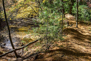
Tuesday, October 31, 2023

Skyline Loop (w/ Hancock) via Trailside Museum (Blue Hills Reservation)

Skyline Loop (w/ Hancock) via Trailside Museum (Blue Hills Reservation)

Distance: 5.04 miles
Elevation: 1,206 feet
Time: 2 hours, 3 minutes
Hike Type: Lollipop Loop-ish
Hiking Challenges: Blue Hills Grid, Great Blue Hill Summits


The Hike
Time for my favorite fitness hike - on Halloween! I was curious how crowds would be on this day, and thankfully most people were out trick-or-treating! The drive from school was absolutely brutal and to no surprise I had to pee quite terribly, but I did my best, got suited up, and started hiking on a stunning, crisp, clear, 50-degree day. 


My legs knew right away that it had been a mintue since I had done a bigger hike (not implying that this is a big hike in the slightest), so it felt like slow going. I took the spur just before the Eliot Path crosses the auto road to enjoy the view and noticed that the grasses have been mowed/grazed down, for what I assume is in anticipation of the upcoming ski season!


Up top it was clear that some people had broken into the fencing surrounding the Eliot Tower as it is being renovated, which is frustrating, but I guess expected. I summited Big Blue and then skirted around to start the trek from Big Blue to Hancock Hill. I passed a few people and got two "beautiful day outside!"s. I decided to stray from the Skyline Trail to take the Hancock Trail (or whatever herd path I was on... its a shame it's so messy over there) to see that stunning view, and I was VERY pleased with the result! A beautiful golden hour on the late-autumnal trees. 


While descending the confusing path I passed someone and I was truly surprised - I've never run into someone in this area before! He was also holding a DSLR, so I understood why. We exchanged pleasantries and continued our seperate ways. It was a quick jaunt back to the Skyline along the Hancock Hill Path, but I noticed my thighs were starting to cramp, so I decided to skip Hillside St. and take the back way to Houghton Hill... until I forgot how to get there and ended up on Hillside St. anyway... whoops!


The climp up Houghton wasn't my finest performance but still lightyears better than how it used to be - I'm very proud of myself for that! I've been doing this loop for at least 3ish years now and it's extremely clear how much my fitness has improved since I started. 

On top of Houghton Hill I realized that the sun now sets at 5:40 and its... 5:30... another whoops! I picked up the pace, accepting that I would likely be finishing in the dark. If anything, the sunset was stunning through the trees! I enjoyed my walk over the new footbridge over the wetlands near the Blue Hills River headwaters. I made it to the base of the final steep push right at sunset, so I did get to enjoy the beautiful colors overhead as I slogged along.


I hit the summit of Big Blue for my second time and then went to descend via the ski slope where I ran into at least 1,000 bunnies! More like four, but still four more than I had ever seen before in this area! I cut back onto the Eliot Path at the view spur after the Summit Road, and the final bit of excitement I had was hearing what I think was a Great Horned Owl give its classic "hoo" as I saw the light of the parking lot draw nearer. It was 43-degrees back at the car, I was chilly, and it was now time for Costco!


Step-By-Step
- Park at ski area/trailside museum parking area.
- Start hike on Eliot Path (red dot). 
- At 1055, turn right onto Eliot Circle.
- At Summit Road, turn left and summit Great Blue Hill.
- From summit, follow footpath toward 1066.
- At Skyline Trail/Eliot Circle, contiinue counter-clockwise.
- At 1063, turn right onto Skyline Trail North.
- Follow Skyline Trail.
- At first junction after 1170, veer left/straight to join Hancock Trail.
- Follow Hancock Trail to terminus.
- At terminus, turn sharply right onto Hancock Hill Path.
- At 1172, turn left onto Skyline Trail.
- At Hillside Street, turn right.
- Turn right onto Skyline Trail South from Hillside Street.
- Follow Skyline Trail South to 1066.
- Continue left on Skyline Trail/Eliot Circle.
- At immediate next junction, turn right to summit Great Blue Hill. 
- Follow footpath to the northwest, arriving at the top of the ski area.
- Follow "Upper Patriots Path" ski slope.
- Turn right into woods after descending the headwall.
- Follow path to Eliot Path.
- Descend Eliot Path to parking area.


Wednesday, October 25, 2023

Fox Hill, Short, Old Furnace Brook Paths (Blue Hills Reservation)

Fox Hill, Short, Old Furnace Brook Paths (Blue Hills Reservation)

Distance: 4.18 miles
Elevation: 358 feet
Time: 1 hour, 15 minutes
Hike Type: Loopty Loop
Hiking Challenges: 125-Mile Club (2x); Blue Hills Grid


The Hike
This Wednesday afternoon hike was brought to you by annoyingly slow roads and a generalized crankiness. It took be over an hour to get from Arlington to the Skyline Trail crossing on Chickatawbut Road, and then I had to sit and wait for a bit to change since a mother and her child were arguing on opposite sides of the road (each with a dog in hand) right in front of my car. I forgot to bring shorts so I had to hike in my sweatpants on an obsurdly hot day (78 degrees in late October!), but eventually I snapped out of my rage and got moving.

I had to shorten my goals for the day since I was starting about 45 minutes later than anticipated, so my new goal was to finish up the trails on the western half of the Quarries section. My brain was able to turn off for much of this hike, which was more than appreciated, and honestly, quite needed. I made my way to the Pipe Line and then to the Fox Hill Path (the connection was comically overgrown, but the footbed was still clear), and made my way up and over Fox Hill, which was truly covered in crickets!


Once back down, my next goal was to head toward Little Dome and hike the trails around it (for time, I decided I could summit another day), which thankfully were all open this time! There were a good amount of leaves on the ground which made for some satisfying walking as I wiggled to the Short and Old Furnace Brook paths, quickly, I might add, since the head had also woken up the mosquitos. 


From there I made my way to the Furnace Brook Trail, which was longer than I had mentally expected, but very lovely. From there, I continued my oblong wiggle back to my car, and then sped home. Not my finest day in the woods, but I do maintain that any day spent in the Blue Hills is better than sitting at home!

Step-By-Step
- Park where the Skyline Trail crosses Chickatawbut Road.
- Enter woos along Skyline Trail and veer left onto unnamed path.
- At 4131, turn left onto Crag Trail.
- At turn, continue straight onto Pipe Line. 
- Turn left onto Pipe Line.
- At second junction, turn left onto unnamed path and hike toward 4131. 
- At 4131, turn around. 
- Back at Pipe Line, turn left.
- Continue to follow path to the Fox Hill Path.
- At 4102, turn left onto Indian Camp Path (green dot).
- At 4091, turn left onto Crags Foot Path.
- At 4066, turn right onto Pipe Line.
- At gas plant, walk in between the fenced-in pipes, turning right, and reenter woods.
- Follow unnamed path.
- At terminus, turn right to Sawcut Notch Path. 
- At 4083, turn left onto Crags Foot Path.
- At 4124, turn left onto Short Path.
- At 4133, turn right onto Sawcut Notch Path.
- At 4180, turn right onto Old Furnace Brook Path.
- At 4145, turn right onto Crags Foot Path.
- At 4142, turn left onto Furnace Brook Trail.
- At 4120, turn left onto Indian Camp Path.
- At 4135, turn right onto Pipe Line.
- At next junction, veer left onto Crag Trail.
- Return to car.


Monday, October 23, 2023

Ponkapoag Extremeties Loop (Blue Hills Reservation)

Ponkapoag Extremeties Loop (Blue Hills Reservation)

Distance: 5.64 miles
Elevation: 282 feet
Time: 1 hour, 51 minutes
Hike Type: Loop w/ Spurs
Hiking Challenges: 125-Mile Club (2x)


The Hike
Keeping my Ponkapoag momentum going with my final section in this area, a hike I have dubbed the "Ponkapoag Extremities Loop" - the main loop around the pond, but also hitting all the little spur trails I've avoided with my previous trips. The only trail I would be missing on this hike was the boardwalk, which will have to happen another day when water levels are lower or the pond is frozen solid. The drive down from work was slow and painful and I desperately had to pee once I parked, so I spent no time dawdling and got right to work! 

It was cloudy a chilly, but overall a nice afternoon. There used to be an small spur path on the right of the trail that connects the parking area to the Acton Path that been officially closed (with signs), which I found interesting. I've always been curious why some parts are selected and not others. I enjoyed the view near Fisherman's Beach and realized I forgot to bring my printed map... again. Thankfully, I remembered which trails I needed. 


The yellow leaves were looking excellent on the Acton Path and there was a surprising blowdown patch about a half mile-ish down the trail. The Pipe Line spur to Canton Street was in surprisingly good shape, and the little spur trail that connects the Pipe Line spur to 5355 was unsurprisingly rough and clearly unused. 


The Pipe Line that continues past 5355 was a bit brutal with its stench and mud, but I made it through mostly unscathed! I hiked down Hemlock Road toward Turner Road and ran into a man sitting on a log aggressively staring into the void, so I let him do his thing and continued my journey in a different direction. 


At this point in my journey I was feeling hungry and knew I had a Costco trip after I finished, so I simply could not stop thing about a slice of ridiculously cheesey Costco pizza. I kept on wiggling about until I was back at the Ponkapoag Trail/Redman Farm Path junction, where I noticed a massive erratic off-trail. There were a few other paths off the trail that aren't on the map, many of which are on older maps that I do want to explore someday. Today, however, I was on a mission!


I continued along to the YMCA camp and surrounding trails, which was a bit spooky and devoid of life. There were some fun signs at their pool about how its not allowed to enter the pool with communicable diseases, which... makes sense?


There were some people taking photos at the boardwalk entrance, and I really did think about asking if they ventured in, but I had no desire to make small talk... another day! I hit a few spider webs on the Dorchester Trail and saw a couple golfers. On a day when I'm not on a time crunch I want to explore this area of the golf course to get a nice photo of Big Blue.


The bugs were out as the day turned into evening, and there were plentiful clouds, but they were all beautiful. The view from the dam was stunning as just a few patches of sunlight illuminated trees across the way... and then I was brought right back to reality when I nearly stepped in horse poop. 


The last bit of my hike was the spur paths to the southeastern golf courses. I noticed some old green blazes which was interesting, and spooked a family of deer that were munching on dinner on the green. It was a little tricky finding the trail back into the woods once I crossed the golf course, but once I did find the entrance it was smooth sailing back to the car!


Step-By-Step
*NOTE: The current 2020 DCR Map and the FBH Website disagree with what is and isn't the Acton Path. I am using the DCR Map for these instructions.
- Park at Fisherman's Beach Parking.
- Start hike by following path to Fisherman's Beach from parking lot. 
- Retrace steps to 5321, turn left onto Acton Path (green dot).
- At next junction, continue to follow Acton Path (green dot).
- At next junction, turn sharply right onto Pipe Line.
- At someone's back yard, retrace steps.
- Back at Acton Path, stay to the right and join unnamed path on right.
- At 5355, turn right onto Pipe Line.
- At 5395, continue straight to finish hiking Pipe Line.
- At terminus, retrace steps.
- At 5395, turn left onto Hemlock Road.
- At terminus, turn around.
- At 5395, continue straight onto Hemlock Road.
- At split, veer left to 5401.
- At 5401, turn right and hike other side of split (Vose Path), eventually returning to 5401.
- At 5401 again, continue straight on Hemlock Road.
- At 5384, turn left onto Fire Trail.
- At 5365, turn right onto Acton Path (green dot).
- At 5343, continue straight onto Ponkapoag Trail (green dot).
- At 5421, continue straight onto Redman Farm Path (green dot).
- At 5176, hike network of trails around YMCA Camp and Ponkapoag Boardwalk (not the boardwalk).
- Continue on Redman Farm Path (green dot).
- At 5174, turn right onto Dorchester Trail.
- At golf course, turn around.
- At split, take right fork to return to Redman Farm Path (green dot).
- At 5175, turn left onto Acton Path (green dot).
- At 5216, turn right onto unnamed path.
- At terminus, follow the edge of the woods around the golf course, staying to the left.
- Cross the golf course and reenter woods to hike other unnamed path.
- Return and turn right onto Acton Path (green dot) to complete hike.


Sunday, October 22, 2023

Ponkapoag East (Blue Hills Reservation)

Ponkapoag East (Blue Hills Reservation)

Distance: 5.98 miles
Elevation: 315 feet
Time: 2 hours, 7 minutes
Hike Type: Tracing Loop
Hiking Challenges: 125-Mile Club (2x); 52 Hike Challenge 2023

The Hike
It was a beautiful, crisp Sunday morning. I was somehow still sick, and I made my way to the cursed Donovan Elementary School to hike the trails of the Ponkapoag East area. I was greeted by an elderly man watching his elderly dog wander the parking lot (unconcerned), and quickly got my adventure started!


There were plenty of fresh needles on the ground, which made for very comfortable walking. There was a slight breeze in the air which provided a chilly start, but (as per usual), I would soon warm up no problem. I started by following Meadow Road toward Reed Street and then took an unmapped trail westward to connect to the other unnamed trail. There was LOTS of horse poop in this area (and as I would later realize, for most of this hike.


The ground was soft from the weekend rain. I took the spur to Fawn Circle until I was basically in someone's back yard, and then hiked the very interesting network of small, connected trails on the west side of Meadow Road. The woods were beautiful, yet confusing, with interesting geology, wet pools, and overall structure of the landscape.


I made my way over to the Horse Bridge and hiked that section of the Pipeline toward MA-24, which was overgrown but not wet, which I was trilled with! Once I was back at the junction to the horse bridge, three massive horses (with people on them) walked past me onto the bridge, so I decided I'd save that for later. I continued onto the Wannamanhunt Path, which had some rusty "artifacts" in the immediate woods, but then turned into a gentle, lovely, featureless meander. 


The Wannamanhunt Path terminates at MA-24 (I assume an old crossing - maybe it used to connect to Madden Road?), and then I crossed the Pipe Line and continued onto Middle Road, which was a spookier trail. I know this goes around a former Nike Ajax Missle Site, and I read on Facebook that it is "explorable," but I saw a cop car through the trees and throught to myself "not today." The trail parallels an old, rusted fence, with a few "artifacts" in the woods.


Middle Road terminates at Middle Street (paved), and then continues onto an unnamed/unmapped trail that continues to follow the fence, and eventually links up with the Smith Trail. I hiked the Smith Trail, hit the Pipe Line spur to I-93, and then worked my way over toward horse bridge and then the Pasture Road area, which was... a mess.


The trails around Pasture Road were actually lovely. It was fun to see the abandoned baseball field, the non-abandoned one, and the horse stables, but Pasture Road itself was covered in horse poop and deep, wet mud. I passed four horses here as well, which I guess was cool?


Once that section was complete, I had a quick journey back to my car at Donovan. There were a good amount of hikers, bikers, and horseback riders out, but thankfully the trails never felt too crowded, and I was thirlled to have completed another big section of my map!


Step-By-Step
- Park Donovan Elementary School
- Start hike on spur trail from parking lot to Meadow Road (trail map).
- Hike to 5420 and then turn right onto unmapped math.
- At terminus, turn left onto unnamed path.
- At terminus, turn around. 
- At next junction, turn left onto Ladybug Path.
- Once near someone's back yard, turn around.
- Back at original junction, turn left to finish the unnamed path.
- At terminus, veer left onto Meadow Road.
- Soon after, hike the confusing, scenic, network of trails on the left.
- After surviving and only getting slightly lost, continue hike along Meadow Road.
- At 5413, turn left onto Pipe Line.
- At terminus, turn around.
- Just past 5413, turn left onto Wannamanhunt Path.
- At terminus, turn left onto Middle Road.
- At terminus (cairn, fence at Rt. 24), turn around.
- Cross Pipe Line and continue hiking along Middle Road.
- At terminus, cross Middle Street, and continue on unmapped path.
- At terminus, turn right onto Smith Trail.
- Hike Smith Trail to terminus, turn around.
- At 5425, turn right onto Pipe Line.
- At terminus, turn around.
- At 5421, turn left onto Pequimmit Trail.
- At terminus, turn around.
- At 5421, turn left onto Pipe Line.
- At 5413, turn right onto Randolph Path and onto bridge over Rt. 24.
- Turn around on bridge and hike to 5414.
- At 5414, turn left onto Pasture Road.
- At 5424, turn right onto unnamed path.
- At terminus, turn right onto unnamed path.
- Follow trail until its terminus at Pasture Road.
- Back at Pasture Road, turn right onto Pasture Road.
- At 5440, turn around.
- At junction, turn left onto unnamed path.
- At next junction, turn right onto unnamed path (the one you've already hiked).
- At 5424, turn left onto Pasture Road.
- At 5414, turn left onto Meadow Road, return to car.


Thursday, October 19, 2023

Duck Pond Foot Path, Ponkapoag Path, AMC Cabins (Blue Hills Reservation)

Duck Pond Foot Path, Ponkapoag Path, AMC Cabins (Blue Hills Reservation)

Distance: 4.15 miles
Elevation: 344 feet
Time: 1 hour, 27 minutes
Hike Type: Tracing Loop
Hiking Challenges: 125-Mile Club (2x); 52 Hike Challenge 2023


The Hike
Emotionally, I really needed my most recent hike. I'm starting to feel inspired to really dig back into the Blue Hills and finish my second round of the 125-mile club, which is a fun feeling! I ususally struggle in October/November due to how overwhelming life is in the fall - seeing the dust settle in on the school year, noticing the days getting shorter, and of course, marching band! It should also be noted that I am still not fully recovered from my Baldfaces Cold (my new name for it). My goal for this hike was to clean up my tracing of the northeast-ish corner of the Ponkapoag area. I had my long, trafficky drive from school, nearly peed myself getting suited up while for some reason every other car at the trailhead had a human in it, left my printed map at school, and got the party started!


The woods are in a beautiful state of autumn now, and I am BIG fan! The sun on the yellow trees casted a warm glow on the forest floor, and it was raining orange pine needles on the No Name Path, covering up the freshly-deposited horse poop. I passed an impressive erratic around 3580, and then went searching for the unnamed tral that criss-crosses the Ponkapoag Path (it starts just after the AMC kiosk). 


I did some wiggling on the far-east side, and then made my way back to the cabins, that had a beautiful scent of campfire - it looked like one cabin was occupied. The view from the dock was absolutely stunning, and so shockingly different from just a few days ago! The sun was brilliantly illuminating the foliage as the water gently rippled in a slight breeze - aboslutely stunning. 


In the cabin area, what is and isn't a mapped trail is generally confusing, but I think I found all of them?? There were a few orange paint spots with green flagging tape, but I have no idea if that's realated to hiking or anything. If anything, the woods were absolutely beautiful, and I think I would like to stay in the cabins some day!


I slowly made my way back, and only about 100ft from the parking area, I ran into the hungriest deer! He popped up from the log he was snacking on to lick his lips and stare at me, and then would get right back to work. Thinking ahead, I have two more hikes in this area (minus the boardwalk which will happen when it happens....): Ponkapoag East and a hike I've mentally dubbed "Ponkapoag Extremities" (the YMCA paths, golf course paths, and a few in the southeast corner). Really feeling the momentum and I hope it keeps up!


Step-By-Step
- Park at Ponkapoag Trail (Exit 3 off of I-93)
- Start hike on Ponkapoag Trail.
- At 5322, turn left onto Prescott Foot Path
- At 5330, turn left onto No Name Path.
- At 5344, turn left onto Ponkapoag Trail.
- At 5371, turn right onto Swamp Path.
- At 5380, turn left onto Duck Pond Foot Path.
- At 5383, turn right onto Three Pines Path.
- At 5385, turn right onto Hemlock Road.
- At 5384, turn right onto Fire Trail.
- At 5363, turn left onto Acton Path.
- At AMC Kiosk, turn left onto unnammed trail.
- Continue straight past Ponkapoag Path.
- At terminus, veer left onto Randolph Path.
- At 5401, turn left onto Hemlock Road.
- At 5362, turn left onto Ponkapoag Path.
- At 5361, hike the network of trails around the AMC Cabins.
- After completing the AMC Trails, find yourself back on the Acton Path.
- At 5370, continue straight/right onto Swamp Path.
- At 5371, turn left onto Ponkapoag Trail.
- At 5344, turn right onto No Name Path.
- At 5311, turn right onto Ponkapoag Trail.
- Follow Ponkapoag Trail back to car.


Monday, October 16, 2023

Madden Road, Randolph Path, AMC Cabins (Blue Hills Reservation)

Madden Road, Randolph Path, AMC Cabins (Blue Hills Reservation)

Distance: 4.20 miles
Elevation: 302 feet
Time: 1 hour, 40 minutes
Hike Type: Lollipop Loop
Hiking Challenges: 125-Mile Club (2x); 52 Hike Challenge 2023


The Hike
Unfortunately, I'm still sick from my Baldfaces hike. Fortunately, there's ways to still hike in the Blue Hills without over-exerting myself! Sarah asked about hiking, and I needed some trails in the North/East side of Ponkapoag, so we met up after school and got right to it!


The first leg of our hike was from the parking area off of Exit 3, which we had to ourselves, to Duck Pond. The Prescott Foot Path and No Name Paths were both lovely, dry trails with leaves and needles on the ground. Madden Road was equally as lovely, but wider. We saw a few mountain bikers in this area following some of the many unmapped trails. I'm always curious why DCR decides to put some trails on the map and not others (and when they make the decision to omit certain trails, why not formally close them?). 


Continuing on, we turned onto the spur to Duck Pond, which was narrower than the surrounding trails, and led to the muddy banks of the pond. A view of the pond was obstructed by some mangrove-looking plants, but with a bit of maneuvering, we were able to get at least a unique view. The fall colors were beginning to really pop!


From Duck Pond, we followed Hemlock Road to the bridge, and then the Randolph Path all the way to the AMC Cabins. 


The goal was just to hike the perimeter trail today, and I could save the inner trails for another day. The southern side of the perimeter trail leads past a pavillion and a rack of chained-up canoes, and then, with some careful rock stepping, a marvelous view of Ponkapoag Pond, which was eeriely still on this day. Looking left we could see ominous clouds with just a sliver of golden light shining through, and Great Blue Hill loomed on the right, surrounded by lovely fall colors. The clouds, leaves, and mirror-like water were really putting on a show!


We continued down the path, ultimately taking a long break at the fishing dock near the northern corner of the perimeter trail, and wow - I've never been so stunned by a low-elevation pond before! I couldn't get over how reflective the water was and how dramatic the clouds and lighting were. We only started moving when we noticed the water started to... sparkle. The rain was definitely approaching!


Our last stop was at the northern corner of the perimeter trail where we took a few final photos of the pond, which was no longer reflective as the rain had fully entered the area. 


Our return trip was quick, chilly, and wet. The woods were absolutely stunning, even in the soaking rain. Another great day in the woods!


Step-By-Step
- Park at Ponkapoag Trail (Exit 3 off of I-93)
- Start hike on Ponkapoag Trail.
- At 5322, turn left onto Prescott Foot Path
- At 5330, turn left onto No Name Path.
- At 5344, turn left onto Ponkapoag Trail.
- At unsigned junction, turn left onto Madden Road. 
- Follow Madden Road, follow logical footpath (many other paths).
- Turn right onto Three Pines Path.
- At 5383, continue left onto Three Pines Path.
- At 5382, turn left onto Jones Link.
- At 5381, turn around.
- At 5382, turn right onto Three Pines Path.
- At 5385, turn left to hike spur to Duck Pond.
- At Duck Pond, turn around. 
- At 5385, turn left onto Hemlock Road.
- At 5401, turn left onto Randolph Path/bridge.
- Halfway across MA-24, turn around.
- Continue straight through 5401, veering left (not turning left) on Randolph Path.
- At 5360, turn left onto Acton Path.
- At 5332, turn right to hike trail around AMC Cabins.
- At 5364, turn left onto Acton Path.
- At 5343, turn slightly right onto Prescott Foot Path.
- At 5322, turn right onto Ponkapoag Trail to return to car.