Ponkapoag East (Blue Hills Reservation)
Distance: 5.98 miles
Elevation: 315 feet
Time: 2 hours, 7 minutes
Elevation: 315 feet
Time: 2 hours, 7 minutes
Hike Type: Tracing Loop
Hiking Challenges: 125-Mile Club (2x); 52 Hike Challenge 2023
The Hike
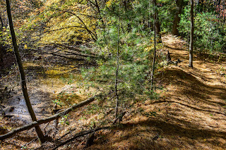
It was a beautiful, crisp Sunday morning. I was somehow still sick, and I made my way to the cursed Donovan Elementary School to hike the trails of the Ponkapoag East area. I was greeted by an elderly man watching his elderly dog wander the parking lot (unconcerned), and quickly got my adventure started!
There were plenty of fresh needles on the ground, which made for very comfortable walking. There was a slight breeze in the air which provided a chilly start, but (as per usual), I would soon warm up no problem. I started by following Meadow Road toward Reed Street and then took an unmapped trail westward to connect to the other unnamed trail. There was LOTS of horse poop in this area (and as I would later realize, for most of this hike.
The ground was soft from the weekend rain. I took the spur to Fawn Circle until I was basically in someone's back yard, and then hiked the very interesting network of small, connected trails on the west side of Meadow Road. The woods were beautiful, yet confusing, with interesting geology, wet pools, and overall structure of the landscape.
I made my way over to the Horse Bridge and hiked that section of the Pipeline toward MA-24, which was overgrown but not wet, which I was trilled with! Once I was back at the junction to the horse bridge, three massive horses (with people on them) walked past me onto the bridge, so I decided I'd save that for later. I continued onto the Wannamanhunt Path, which had some rusty "artifacts" in the immediate woods, but then turned into a gentle, lovely, featureless meander.
The Wannamanhunt Path terminates at MA-24 (I assume an old crossing - maybe it used to connect to Madden Road?), and then I crossed the Pipe Line and continued onto Middle Road, which was a spookier trail. I know this goes around a former Nike Ajax Missle Site, and I read on Facebook that it is "explorable," but I saw a cop car through the trees and throught to myself "not today." The trail parallels an old, rusted fence, with a few "artifacts" in the woods.
Middle Road terminates at Middle Street (paved), and then continues onto an unnamed/unmapped trail that continues to follow the fence, and eventually links up with the Smith Trail. I hiked the Smith Trail, hit the Pipe Line spur to I-93, and then worked my way over toward horse bridge and then the Pasture Road area, which was... a mess.
The trails around Pasture Road were actually lovely. It was fun to see the abandoned baseball field, the non-abandoned one, and the horse stables, but Pasture Road itself was covered in horse poop and deep, wet mud. I passed four horses here as well, which I guess was cool?
Once that section was complete, I had a quick journey back to my car at Donovan. There were a good amount of hikers, bikers, and horseback riders out, but thankfully the trails never felt too crowded, and I was thirlled to have completed another big section of my map!
Step-By-Step
- Park Donovan Elementary School
- Start hike on spur trail from parking lot to Meadow Road (trail map).
- Hike to 5420 and then turn right onto unmapped math.
- At terminus, turn left onto unnamed path.
- At terminus, turn around.
- At next junction, turn left onto Ladybug Path.
- Once near someone's back yard, turn around.
- Back at original junction, turn left to finish the unnamed path.
- At terminus, veer left onto Meadow Road.
- Soon after, hike the confusing, scenic, network of trails on the left.
- After surviving and only getting slightly lost, continue hike along Meadow Road.
- At 5413, turn left onto Pipe Line.
- At terminus, turn around.
- Just past 5413, turn left onto Wannamanhunt Path.
- At terminus, turn left onto Middle Road.
- At terminus (cairn, fence at Rt. 24), turn around.
- Cross Pipe Line and continue hiking along Middle Road.
- At terminus, cross Middle Street, and continue on unmapped path.
- At terminus, turn right onto Smith Trail.
- Hike Smith Trail to terminus, turn around.
- At 5425, turn right onto Pipe Line.
- At terminus, turn around.
- At 5421, turn left onto Pequimmit Trail.
- At terminus, turn around.
- At 5421, turn left onto Pipe Line.
- At 5413, turn right onto Randolph Path and onto bridge over Rt. 24.
- Turn around on bridge and hike to 5414.
- At 5414, turn left onto Pasture Road.
- At 5424, turn right onto unnamed path.
- At terminus, turn right onto unnamed path.
- Follow trail until its terminus at Pasture Road.
- Back at Pasture Road, turn right onto Pasture Road.
- At 5440, turn around.
- At junction, turn left onto unnamed path.
- At next junction, turn right onto unnamed path (the one you've already hiked).
- At 5424, turn left onto Pasture Road.
- At 5414, turn left onto Meadow Road, return to car.


No comments:
Post a Comment