Wednesday, April 30, 2025

Great Blue Hill; Wolcott, Unquity, & Chestnut Run Paths (Blue Hills Reservation)

Great Blue Hill; Wolcott, Unquity, & Chestnut Run Paths (Blue Hills Reservation)

Hike Type: Figure-8 Loopty Loops
Distance: 6.64 miles
Elevation: 928 feet
Time: 2 hours, 10 minutes
Hiking Challenges: Great Blue Hill Summits; Trail Trace the Blue Hills

The Hike 
Day 3 in a row! I had a midly painful drive after school (Wednesdays are my later days, which is stinks). I was eventually hiking at 4:15pm on another hot day with a breeze and POLLEN. The goal today was to hit the summit and then trace around some trails in the Great Blue Hill area that I needed, hoping to hit all of the ones I needed!


I hiked the random paths near the north parking area at the Trailside Museum and then went up Eliot Path, which was again filled with more leaves than before! Bugs and families were out, but all were bearable to hike past. A morning dove cheered me on as I reached the summit, and I was surprised to see more cars than usual up top. 

On the initial descent, I used the Seek app to observe a Bear Oak, which was a scrubby oak with red leaves and danging pollen, which was really cool! I hiked past the Eliot Tower, where a child was having a meltdown, and then continued down Skyline North, which had some flowering trees that the app couldn't fully pinpoint. There were also tons of singing birds out and one screaming red squirrel.


The swamp near 1103 was at least two feet lower than last time I was over here, but still offering wonderful reflections. My Nalgene was warm, but bearable, and I continued to hike at a heightened pace to escape the bugs. This time of year I always catch myself daydreaming of hiking bigger mountains up north, but then I'm reminded about the miserable conditions up there right now with rotting monorails, and I'm brought back to reality.

I spun around the triangle at 1121, completing the Rotch Path, and headed up Wolcott Path towards Downtown Crossing. I continued to now descend on Wolcott Path, admiring the aggressively blue skies, and made an easy crossing of Hillside Street before turning left onto Headquarters Path on the Houghton side. This stretch of trail kind of stinks - following a busy road with loose gravel, but what must be done must be done!

Once back in the woods, I hiked past some lesser periwinkle and worked my way to Unquity Path, which is a hidden gem surrounded by loud, busy roads. I had to cross Unquity Road, which took a minute, and then turned right to find my next trail. The road walk was short, but stinky. The woods immediately after were cool and lovely. I did a loop around the trail ends in this area and then worked my way to Chestnut Run Path, which had a wonderful golden glow from the sun.


I made my way over to Border Path, which was the end of the thinking portion of the hike! I did stick out my tongue to habitually lick my lips at one point, and a gnat landed right on the tip, and then I unknowingly brought it into my mouth like a frog, which was a solid bummer, but other than that, it was a nice return! I played some Pokemon Go and did another test of the messed up trail distance signs:

1. "Trailside Museum 0.25 Miles" when my watch was at 5.78 miles.
2. "Trailside Museum 0.5 Miles" when my wach was at 6.26 miles.
3. Arrived at Trailside Museum when my watch was at 6.61 miles.
Findings: 0.25 sign is 0.83 miles away; 0.5 sign is 0.35 miles away.


I loved hiking past the old trees near the end of Wolcott Path, and soon enough I was back at the car and headed home for a shower, food, and some sleep!


Step-by-Step
- Start hike from Trailside Museum north parking on Wolcott Path (green dots).
- At jct., veer right.
- At jct., turn left and follow unnamed path to Summit Road.
- At Summit Road, turn right.
- At jct., turn left onto Canton Ave. spur path.
- At Canton Ave., turn around.
- At Summit Road, turn right.
- At spur to parking lot, turn left.
- At parking lot, hike back to Wolcott Path.
- A few feet into woods, follow herd path to trail around Trailside Musuem.
- At Eliot Path, turn left onto Eliot Path.
- At 1055, turn right onto Eliot Circle.
- At Summit Road, turn left onto Summit Road.
- At next jct., turn right and summit Great Blue Hill.
- From summit, follow path east toward 1066.
- At terminus, turn left onto Eliot Circle/Skyline Trail.
- At 1063, turn right onto Skyline Trail North.
- At 1092, turn left onto Wildcat Notch Path.
- At 1103, turn left onto Puddle Path.
- At 1105, turn right onto Samoset Path.
- At 1100, turn righ tonto Wolcott Path.
- At next jct., veer right.
- At next jct., turn left onto Wildcat Notch Path.
- At 1115, turn right onot Wolcott Path.
- At 1122, turn left onto Rotch Path.
- At 1121, turn around.
- At 1122, turn left onto Wolcott Path.
- At terminus, cross Hillside St.
- After crossing, turn left onto Headquarters Path.
- Hike spurs to road, then turn right onto White Pine Path.
- At next jct., turn right onto Tucker Hill Path.
- At terminus, turn left onto Headquarters Path.
- At next jct., turn right to cross road.
- Continue onto Unquity Path.
- Cross Unquity Road, turn left.
- Reenter woods on Pipsissewa Path.
- Hike past 1204, turn turn left onto Base Path.
- At 1203, continue onto spur to parking lot.
- Turn right onto Unquity Road.
- Turn right onto Hancock Trail.
- At 1217, turn left onto Chestnut Run Path.
- At terminus, turn right onto Unquity Road.
- At jct., turn right onto Pipsissewa Path.
- At second jct., turn right onto Hemenway Hill Path.
- At 1203, turn left onto Chestnut Run Path.
- At 1191, turn left onto Base Path Connector.
- At 1183, turn right onto Base Path.
- At terminus, turn left onto Chestnut Run Path.
- At 1175, turn left onto Border Path.
- At 1100, turn right onto Wolcott Path.
- Follow Wolcott Path back to car.

Tuesday, April 29, 2025

Great Blue to Hancock Hills; Border & Wolcott Paths (Blue Hills Reservation)

Great Blue to Hancock Hills; Border & Wolcott Paths (Blue Hills Reservation)

Hike Type: Loop
Distance: 4.17 miles
Elevation: 794 feet
Time: 1 hour, 53 minutes
Hiking Challenges: Great Blue Hill Summits; Trail Trace the Blue Hills

The Hike 
It's Tuesday and I was hiking with Sarah again! We met after school and did our usual zoom up Eliot Path. It was 78 degrees out, which felt HOT hot. The sun was shining strong and there was a nice breeze. There was also the classic yellow hue of springtime pollen in the air which was... fine. Sarah was feeling a bit gassed, so we decided we'd make our way over to Hancock Hill via the Skyline Trail and then assess if we wanted to continue on Skyline or pivot to something else!


Great Blue to Hancok was nice. Sarah and I yapped about skiing and weddings, and we were soon greeted with a wonderful breeze to dry off our sweat-soaked shirts on Hancock Hill. We decided to skip the second half of Skyline and head down Hancock Trail, which has my favorite views in the reservation. Someone had recently gone in and spray-painted new yellow blazes to mark the correct footpath, which was appreciated. There were some tent catepillars around and just wonderful views to Boston, the ocean, the islands, and other Blue Hills. We descended down, making our way to Base Path Connector (I told her if we're ditching the Skyline Trail we gotta get a few trail segments I needed for my map), where Sarah tragically stepped in dog poop! She washed it off in a brook with a stick, and then we continued on.


The return trip was along Border and Wolcott Paths, keeping it nice and easy. Only hinderance was the bugs! They were officially back out with a vengeance - mostly zooming into our ears, noses, and eyes. Brutal. We picked up the pace and soon made it back to the car! We ended the hike as any good friends would, with a limp-wrist handshake, since we were both wet with sweat, but a firm handshake was too formal.


Step-by-Step
- Start hike from Trailside Museum parking on Eliot Path (red dots).
- At terminus, turn right onto Eliot Circle. 
- At next jct., turn left onto Summit Road.
- At next jct., turn right onto spur trail to Summit.
- Descend summit towards Skyline Trail South.
- Turn left onto Skyline Trail, and then right onto Skyline Trail North.
- At Hancock Hill, continue left onto Hancock Trail.
- At terminus, turn left onto Hancock Hill Path.
- At terminus, turn left onto Base Path.
- At 1183, turn left onto Base Path Connector.
- At 1165, turn left onto Border Path.
- At 1100, turn right onto Wolcott Path.
- Follow Wolcott Path to north parking area. 
- Follow sidewalk on left back to car.

Monday, April 28, 2025

Skyline Loop via Trailside Museum (w/ Sonya) (Blue Hills Reservation)

Skyline Loop via Trailside Museum (w/ Sonya) (Blue Hills Reservation)

Hike Type: Lollipop Loop
Distance: 3.97 miles
Elevation: 1,145 feet
Time: 1 hour, 28 minutes
Hiking Challenges: Great Blue Hill Summits

The Hike 
After a wonderful April break, it was back to the real world. I headed down to the Trailside Museum south parking area after school for a classic Skyline Loop. The trailhead was busy, and a dog ran out of its car at me, but at least it was a warm 76 degree, sunny day! I got started right away, accidentally forgetting my camera in the car. I blasted up Eliot Path, was drenched in sweat once at Eliot Circle, and made it to the summit of Great Blue Hill in no time! The fencing had been removed around the flagpole, allowing access to the highest point outside of the observatory again!

I took a big swig of my warm Nalgene and continued along, passing a couple hiking up Wolcott Hill with a Trader Joe's pag, implying they were hoping for a picnic? They wandered into the burnt woods before noticing me continuing on the trail, which I think got them back on. 

I passed and crossed paths with many more people and a couple of off-leash dogs (side-eye...) and enjoyed how the trail was noticeably more green than the last time I wandered here. From the viewpoints on Hemenway and Hancock, I especially enjoyed seeing the springtime greens (even if they're the color of vomit) coming in all around. The tent catepillars were also hard at work on Hancock.

Down at Hillside Street, I was horrified to find out that the porta potty had been moved from the stables to the Bugbee Path trailhead across the street! This is completely fine in case of an emergency, but not worth the extra effort for a little urination, in my opinion. The lesser periwinkles at the base of Skyline South were absolutely thriving and my legs were screaming (as per usual) heading up Houghton Hill. I passed a women who hocked the most incredible lougie and made my way back up to Great Blue Hill. 

I made the executive (and correct) decision to follow the ski trails down. It was so wonderfully clear out - Wachusett, Watatic, Monadnock, and the Pack Monadnocks were all clearly in view. I was following a few people and their (off-leash) dog on Sonya, but it was still a wonderful walk. Once at the car, I threw the towel down on my driver's side seat and ZOOMED to Costco for my rotisserie chicken!


Step-by-Step
- Start hike from Trailside Museum parking on Eliot Path (red dots).
- At terminus, turn right onto Eliot Circle. 
- At next jct., turn left onto Summit Road.
- At next jct., turn right onto spur trail to Summit.
- Descend summit towards Skyline Trail South.
- Turn left onto Skyline Trail, and then right onto Skyline Trail North.
- At Hillside St., turn right onto Hillside St.
- After stables, turn right onto Skyline Trail South.
- Follow Skyline Trail South to Eliot Circle.
- At jct., turn right to summit Great Blue Hill.
- From summit, descend to ski area.
- Follow Patriots and Sonya down.
- Near bottom turn on Sonya, turn right back onto Eliot Path.
- Retrace steps to car.

Saturday, April 26, 2025

Skiing Jay Peak

Skiing Jay Peak
Saturday, April 26th, 2025

Runs: 13
Distance: 13.15 miles
Elevation: 13,156 feet
Max Speed: 28.4 mph
Avg. Speed: 13.7 mph
Moving Time: 59 minutes, 27 seconds
Total Time: 4 hours, 46 minutes, 28 seconds

Time for another silly day at Jay! It was the day of the Ski Patrol Banquet and weather was looking dismal! I drove seperately from team patrol since we'd be spending the night at the Hotel Jay and I'd be driving home the next morning from the mountain, but we arrived at the same time, and I followed them into the patrol room like a puppy dog looking for it's mom (in this case, my mom is a pass for the day). Patrol went on about how silly conditions were, and more importantly that there was no way back to Tramside from the Flyer, Bonnie, or Tram. The only way to get to and from is via Queens Highway/Perry Merril. It was also supposed to rain for the 69th weekend in a row... classic! Once they went out for trail check I went up to the fully empty Bullwheel to slowly boot up.


Snow Report
April 26th | 7:40am
7/9 spinning today, Village Chair and Stateside carpet are closed. To no one's surpise, the Saturday trent of crappy weather continues. Rainy and windy today, but the forecast looks like winter's going to dig deep for one more last-second half-court short to bring accumulating snow for Sunday. TK's final installment for the 24+25 season has all the details. Our groomers are out there working thei rmagic and keeping what they can together, but it's a race againt the clock (and the weather) for skiable terrain, so come get it while you still can.
A few operations updates to pass along. Beginning Monday, operations will be out of Stateside base only as weather and terrain permit. On Monday, ticket prices will drop to $59 for all ages if purchased onsite, or $49 if purchaed online. Closing day for Rusch Park will also be on Sunday.

Runs 1-2
Run 1: Taxi Quad - Queen's Highway
[0.72 mi; 2:31; 525 ft; 27.4 mph max; 17.2 mph avg]
Run 2: Metro Quad - Interstate
[0.60 mi; 2:17; 505 ft; 26.2 mph max; 15.6 mph avg]

My first plan of attack was to get over to Tramside to hit the Tram so I could ski my beloved Vermonter before the season ends. The silliness started by watching patrol knock over a snowmobile, and then the gates at Taxi weren't working because "they plugged it in wrong." Queen's Highway was slushy and fun with just a few death cookies hiding about. The lower stretch was visually dysmal but skied completely fine, with a few new bumps, too!

The Tram wasn't open yet (not even the queue), so I hopped on the Metro for lap #2, which was down Interstate. Interstate mostly had good coverage, except for one bottle neck to make things exciting! Afterwards, the Tram was open, and I was the first (and only) person on!

Runs 3-4
Run 3: Tram - Vermonter - Angel's Wiggle - Paradise Meadows
[1.63 mi; 7:52; 1,808 ft; 27.9 mph max; 12.4 mph avg]
Run 4: Bonaventure Quad - Northway - Angel's Wiggle - Hell's Crossing - Paradise Meadows
[1.44 mi; 5:10; 1,378 ft; 24.6 mph max; 16.8 mph avg]

It was so silly having the Tram all to myself. After a stupidly busy season, I was one of what felt like a dozen skiers on the mountain. It was EXCELLENT. It was WINDY, too. From the top, I walked down to where the snow started and had a great run down Vermonter, which was still a little scrapy. No views, sadly, because the cloud ceiling was low, but I had a good time! My legs were cooking, though. I look forward to one day actually remembering how to ski properly right away instead of taking 3-5 laps to pull it together. From Vermonter, I went down Angel's Wiggle to Paradise Meadows, which was actually in fantastic condition (I remember last year it was NOT in great condition this weekend). 

Run #4 was up the Bonnie and down a similar way, just over to Hell's Crossing, which was in less-than-stellar shape, but still nice. I followed this down to the Jet, which comically still had no line (the lifties were sitting in the shack it was so un-busy.

Runs 5-7
Run 5: Jet Triple - The Jet
[0.72 mi; 3:27; 1,168 ft; 24.0 mph max; 12.5 mph avg]
Run 6: Jet Triple - Haynes - Mont l'Entripede
[0.75 mi; 3:38; 1,168 ft; 27.3 mph max; 12.4 mph avg]
Run 7: Jet Triple - Derick Hot Shot - Haynes - Mont l'Entripede
[0.79 mi; 4:59; 1,142 ft; 25.2 mph max; 9.5 mph avg]

Run #5 was down the Jet, which because of the rain, was MUCH scrapier/icier than I had wanted. #IceCoast, I guess... I did make it down fine, and got a PR on Strava, so that counts for something, I guess! My next run was down Haynes and Mont l'Entripede, which was in a similar glacial state with a few bare patches. Run #7 was bold. I had a fantastic time on Derick Hot Shot with Sarah a few weeks ago, and I knew it wouldn't be in as good a shape, but oof. It started with a massive dirt patch and ~6 feet of snow on the edge to wiggle down, and the bumps were only soft for the top 2", the rest of them were completly frozen. Not fair! My skis did pop off after poorly navigating a bump, but I did NOT fall! I quickly bailed and worked my way down Haynes and Mont l'Entripede a second time at the first opportunity. Next season, Derick... Next season...

Runs 8-9
Run 8: Jet Triple - Montrealer - Catwalk - Angel's Wiggle - Paradise Meadows
[1.11 mi; 4:26; 1,135 ft; 28.4 mph max; 15.0 mph avg]
Run 9: Taxi Quad - Queen's Highway 
[0.91 mi; 5:48; 538 ft; 27.6 mph max; 9.4 mph avg]

After my next ride up the Jet, I stopped in the patrol shack to dry off and play some Bananagrams with Emma and Patrol Sarah. At this point in the day, it hadn't rained too much, but it was aggressively misty out. Thankfully, I was not cold when outside, and the patrol shack was HOT. I hung up my gear to dry and smoked them in our game. I also called the hotel to ask when the earliest check-in time would be, and got a series of rude responses. I first called the Jay Peak reservations number. I said something along the lines of "Hi! I'm skiing right now and spending the night for the ski patrol banquet. I just wanted to ask if you'd know when the earliest I could check in would be?" and her response was along the lines of "well, check out was 46 minutes ago, so a while." I said "that makes sense! Thank you! Is there a number I can call to contact the front desk directly?" and she said "no" and hung up. Not nice! I know it was a silly question, but come on!

...also there was a number for the front desk. Thankfully, the ski patrol shack has every extension available. I called and was met with a similar level of dismissive sass, but was offered to do a "soft check-in," so when the room was ready we could get right there. I'm not saying we deserved special treatment for ski patrol, but they could have been nicer...

Anyway, after winning Bananagrams and failing at phone calls, I got back to skiing! It was raining a bit more now, and I was pretty soggy after Run #8, which brought me down Montrealer, Angel's Wiggle, and Paradise Meadows (the last of which I Strava PR'd). I went back on the Taxi to Queen's Highway so I could do my soft check-in!

Run 10
Run 10: Tram - Northway - Paradise Meadows
[2.05 mi; 9:34; 1,821 ft; 25.9 mph max; 12.9 mph avg]

The soft check-in was a nicer experience than the phone calls, but he was still annoyed that I was there. When I asked for a second parking pass he said "I guess, why not!" in a very upset tone. Not sure what that was all about... I also had no way to transport the parking passes back to our cars in a dry manner, but I was NOT going to ask the front desk for any more favors. I took the emergency plastic ponco out of my pocket and wrapped up the parking passes before heading to the Tram.

This was going to be another Tram ride for one until two others joined, and then Patroler Jess joined, too! I love Jess. She's one of the lead volunteers and I decided last year that she was one of my best friends (she cheered me on as I cried skiing down Haynes). We chatted the whole ride up which was just a delight. At the top, she went into the patrol shack and I deicided I'd hit the full Northway. It was raining proper now, which was a solid bummer. Emma had also mentioned that there was some walking required for upper Northway... I thought she meant skating. Nope. I skied off the tippy top (ROUGH condition) and had to pop off my skis at the mixing bowl top shack to walk to the Bonnie before continuing my trip down. I followed this group of maybe 20 year olds who were NOT ready for the conditions. The Lower Northway wasn't in too bad of a shape, just a little scrapy, which was welcome after my past experienes. I had another great run off Paradise Meadows, and then back to the Jet to rejoin my patrollers.

Runs 11-13
Run 11: Jet Triple - Montrealer - Northway - Purgatory - Angel's Wiggle - Paradise Meadows
[1.13 mi; 4:21; 1,135 ft; 28.2 mph max; 15.6 mph avg]
Run 12: Taxi Quad - Queen's Highway
[0.75 mi; 3:04; 525 ft; 24.9 mph max; 14.7 mph avg]
Run 13: Metro Quad - Perry Merril Ave - Chalet Meadows
[0.54 mi; 2:18; 315 ft; 23.2 mph max; 14.1 mph avg]

Just kidding! I was sopping wet at this point and wanted to start wrapping up my day. I followed Montrealer down to Purgatory, which skied surprisingly well, and then down to Stateside to catch the Taxi for a final Queen's Highway. I was WET wet. My final run for the day was up the Metro and down Perry Merril/Chalet Meadows, since I hadn't skied them yet for the day. Team patrol had wrapped up by this point, so we all changed and met in the patrol room to get the slideshow ready!

We eventually drove over to Tramside and Patrol Sarah was able to check into her room, which had a wonderful balcony overlooking the Tramside area. Our room still wasn't ready... We made some pregame drinks and wandered over to the International Room to help set up, but they had just finished... oops! Emma went to check again and the new person at the front desk said "I'm so sorry I don't know what's taking so long, let me find you a clean room" and we had a room! The room was big with a balcony over the parking lot, it was perfect! We spent the next couple of hours showering, drinking, taking photos, and getting ready for the party!

The banquet was so much fun (80s Prom themed!) and I truly just love celebrating people's achievements, even if I have no idea who they are. Emma pregamed a little too intensely, so I had to give her a "come to Jesus" talk and she went on water for over an hour (I am proud of her!). The night continued, dancing ensued, and really a great time was had by all! Both Emma and Patrol Sarah's dresses ripped throughout the night, which made for a very funny walk back to the room, if you know what I mean.

The next morning was NOT great. I got advil from the CVS vending machine downstairs, Sarah puked a few times, and Emma did not wake up until it was time to leave. We somehow made it down the mountain to the Jay Village Inn for a brunch where we just giggled at how much we were suffering, followed by a longgggg drive home. This was such a fun, silly weekend! Oh, and a fun thing to add, it snowed ALL DAY at Jay once we left. It flurried on our way to the JVI, SNOW snowed during brunch, and it didn't turn to rain until I was almost in New Hampshire - crazy! Silly!

Friday, April 25, 2025

Hadley Mountain Fire Tower (Adirondack Park)

Hadley Mountain Fire Tower (Adirondack Park)

Hike Type: Out and Back
Distance: 3.44 miles
Elevation: 1,535 feet
Time: 1 hour, 38 minutes (1 hour, 30 minutes moving)
Hiking Challenges: ADK 29er, Adirondack Firetower Challenge, Operation Alaska Benchmark Challenge

The Hike
It was now the second weekend of April break, and I was in New Jersey, but had to end my day in northern Vermont. I spent some time looking at ways to break up the drive, and landed at the Hadley Mountain Fire Tower on the edge of the Adirondack Park! The drive from NJ to the trailhead was long but easy, and I made it to the empty trailhead just before 7:30am. It was a crisp 48 degrees with a few bugs hovering about, but overall all was good! The access road was dirt and narrow but in good condition. I took care of my Code Yellow just off the parking lot, feared a Code Brown, pulled it together, and got to my adventure!

I chose to be bold and start cold, which was a good move (as always), as I immediately started sweating as the trail got right to work. I had a bit of hip chafing from yesterday's hike in Harriman, but it wasn't burning too badly. Skies were overcast as I climbed up to the trail register that was missing a writing implemenet. 


The trail continued past the register on a wide, eroded trail. The dark, dense forest opened up to a young hardwood area where I noticed a #2 on a tree - maybe this is an interpretive trail? (Yes! You can download the brochure from https://hadleymtfiretower.org/). The #2 was in reference to bear marking on the trees. 

I enjoyed the smell of warm, wet forest as the trail began to climb more steeply. I misssed #3 (bedrock) but did notice marker #4 (natural sculptures). There were lots of small critters around the forest floor doing their morning chores and I enjoyed some hazy tree views behind me. The trail bends at a signed arrow, crosses a creek, and arrives at marker #5 (stream crossing). 

The trail was well-blazed in red and I was sweaty! I climbed up what was the beginning of MANY slabs, which at this moment were wet, but not slippery. I was worrying about the descent, but I'd let that be a later problem. I noticed a tree view to some undercast in the distance and also some early spring budding (as opposed to the almost-leaves of Harriman State Park). 


The slabs got a bit dicier and eventually, the trail turned off of the slabs and continued on steep, rocky footing (which was a welcome change). I zig-zagged through another ledgy spot and climbed up an adorable, ~3ft tall chimney. I felt one single rain drop as the trail continued to rise up to the col between Hadley Mountain and it's neighbor peak (#6 - The Resting Rock on Panther Pass). 


Once in the col, which I guess is also known as Panther Pass, I enjoyed a heavenly walking break before the trail narrowed and began to climb again. The climbing now was much easier as I collected spider webs and continued to fear what my stomach was capable of (remember the Code Brown scare from earlier? It's back!). I passed marker #7 ("Pioneer" White Birch - the first trees to grow after a forest fire) and enjoyed the sound of woodpeckers hard at work.

The trail climbed through a rocky notch and turned left at marker #8 ("Sharp Turn Left!") before steepening in a grassy, ledgy area, which led to a wonderful tree view to a lake. This was followed by another wonderufl walking break and another ledge view to nearby mountains. It even smelled like a pine candle up here - I was so happy.


The climbing became easy at this point as I soon arrived at the old warden's cabin and privy (with a spooky little cave, too). There was a quick scramble and push to the true summit, which was mostly open with wonderful views, the tower, a USGS disc, and a summit bolt. 


The tower climb wasn't too awful and the cabin was open with a small ladder that was terrifying, but worth the extra emotional push. The views north were exceptional, but I couldn't make out the Catskills due to clouds. The tower was marker #10 (Top and the Tower!) and I had missed #9, but it was at the cabin and cave. 

I took a bunch of photos and then started my descent right at the one-hour mark. I was thrilled to have encountered absolutely zero signs of winter, and I was back at Panther Pass in 15 minutes! On a side note, I really love hiking in New York specifically because you can tell which trail plackards are new and which are old - I find it super fun!


I significantly slowed down on the wet slabs further down and did NOT fall. I did my best to be good and avoid going off-trail, but a few stretches were too dangerous with the moss and moisture to go straight through. The lower slabs, which were dry, were an absolute dream! Soon enough I was back at the car, solidifying that this was a zero-person hike! It was now 60 degrees, and I was on my way to Vermont! I soon drove past a porcupine on the access road followed by some turkeys. Just after, on Eddy Road, I got a great view of Hadley Mountain. The rest of my drive to and over Lake Champlain was just beautiful.


Step-by-Step
- Start hike on Hadley Mountain Trail (red blazes).
- Summit Hadley Mountain, climb fire tower, return to car.

Thursday, April 24, 2025

Tom Jones & Dutch Doctor Shelters via R-D and Victory Trails (Harriman State Park)

Tom Jones & Dutch Doctor Shelters via R-D and Victory Trails (Harriman State Park)

Hike Type: Figure 8 Loop
Distance: 8.90 miles
Elevation: 1,601 feet
Time: 3 hours, 38 minutes (3 hours, 30 minutes moving)
Hiking Challenges: Harriman Shelter Challenge, Harriman Trail Challenge

The Hike
Time to (hopefully) finish the Harriman Shelter Challenge! Yesterday, I saw Boop! on Broadway, so no hiking, but now everyone in my New Jersey family was working, and I had a few hours to kill. I accidentally added 15 minutes to my drive by thinking I could skip my exit off of I-87 to use the bathroom at the new Sloatsburg Service Plaza, but that was clearly a mistake... The plaza was beautiful, though! I slowly worked my way to the Ramapo-Dunderburg Trail crossing parking on Kanawauke Road, got suited up, greeted the woman parked next to me who was finishing up her hike, and got right to work!


Unfortunately, the gnats were ABUNDANT. I guess that's just one of the joys of springtime! It was a warm-feeling 60 degrees out, and I soon applied my first helping of bug spray for the season. I climbed along a partial reroute of the Ramapo-Dunderberg Trail up Tom Jones Mountain, which then continued up some steep, open slabs with views behind. The trees had early spring buds, and I was catching plenty of spider webs.


Like much of Harriman State Park, the woods were wide open. This climb was short, but mighty, and I was soon out of breath and at the summit! There were views all around through the spaced-out trees. It felt like a wonderful summer morning.


After the summit, the Ramapo-Dunderberg Trail scrambled down and then I joined a short spur trail to the Tom Jones Shelter. I noticed a black snake about 20 feet off-trail in the grass, just slithering about. There was a wonderful view from the shelter (the second best, in my opinion, after West Mountain). The only sounds I could hear were the birds and I could make out part of a lake down below. What a beautiful morning!


Now I was back on the Ramapo-Dunderberg Trail for a while. I passed some catepillar tents as I descended Tom Jones Mountain. I noticed a stone living room-type structure through the trees on the descent, and I had a nice view to Parker Cabin Mountain, which was my next stop.


In the col, I passed the Victory Trail, which I would hike much later in the day. The Ramapo-Dunderberg Trail crossed an easy creek and began to gently ascend Parker Cabin Mountain, which had more characteristic, open woods. I caught a nice view back to Tom Jones from a false summit, and found two more snakes as I hopped off of the false summit. They were both black and I assume the same kind as the first. I thought rat snakes, but not 100% sure. 


The trail gently climbed and mellowed out at the summit, which was open and grassy with view through the trees - it was so pretty up here.


The Triangle Trail briefly joined in another open area and then split off - I followed the Ramapo-Dunderberg Trail on the left, which was now grassier and less defined as it descended. There was a heavenly breeze that added at least a year to my life, too. I caught some ledge views on the way down. 


I was enjoying the delightful weather as the trail began to steeply descend into the woods, where the white cross trail crossed. After meandering for a bit, the Ramapo-Dunderberg Trail next crossed the white bar trail, wiggled through some unproblematic mud in a Mountain Laurel grove, and then began to climb to Black Ash Mountain (#1?- it's unclear if this or the next peak was Black Ash Mountain, as the official NYDEC map labels both as such... kinda). 


The Ramapo-Dunderberg Trail arrived at a rugged summit followed by a small scramble down in a generally rugged area, but it soon chilled out and became wonderfully grassy. Something wet fell on my face here, but I chose to ignore it. The descent continued to be pretty, grassy, and rolling, and then crossed under some power/telephone lines that were a little too close to my head for comfort!


After crossing under the lines I came to my first new trail of the day! The Blue Disc Trail traversed over a really neat rock dam with a pond on the left (featuring some ducks and a goose) and a stream down below on the right. A steep ascent followed up Black Ash Mountain part two (I need to check the Harriman Trails book to figure out if they're both called Black Ash Mountain). There were nice tree views back towards Black Ash 1 and Parker Cabin, and after some huffing and puffing I made it to the top! The summit slabs were open and dry and provided wonderful views.


I began to descend with the humming of I-87 in the background while I got my first bug-in-eye of the season. The trail worked its way to another section of slabs with wonderful views - curiously named Claudius Smith's Dens. 


After the Blue Disc Trail turns left at the dens, I continued left and joined the Tuxedo-Mt. Ivy Trail, which gradually descended for a while. I was back in the woods, which was welcomed as I did not have on any sunscreen and I was feeling crispy! There were plentiful woodpeckers overhead and eventually the trail began to skirt around a swampy area.


In this area, I hit my 4 mile/halfway point for the day, entered a field of loose rocks, and got another bug in my eye. The trail began to slightly ascend, but I didn't even notice until I was out of breath. The trail climbed up and over a pretty knoll as I applied some more bug spray since I had a cloud of gnats overhead.


The Tuxedo-Mt. Ivy Trail crossed a few small streams, and soon I turned onto White Bar, where I was assaulted by more bugs. On the plus side, the final shelter of my challenge was on this trail! Yay! A short spur led to the shelter, but I didn't explore much, as someone was setting up their tent.


This started a long series of hiking through mountain laurel groves. White Bar went through one, I got covered in spider webs, and then there was more after I turned onto Triangle Trail. There was an unmarked path on the right (I assume it goes to a camp on Sebago), and then more mountain laurel. I began to feel a bit claustrophobic as critters scurried around on the leaves on the ground. The trail briefly opened back up, but then soon descended back into more mountain laurel!


I finally got a little reward as the trail neared Lake Sebago. There was another unmarked trail on the right, and later a little spur to the shoreline where I saw some fish! I also saw some turtles, but scared them off - sorry!


Another unmarked trail continued along Lake Sebago as the Triangle Trail turned up and away, rising up and over a low ridge, and then right back into a mountain laurel tunnel with fresh spider webs! On the plus side, this tunnel had some small purple flowers on the ground! The trail rose to a second knob and then Lake Skemonto came into view. 


The Triangle Trial soon came to a short spur to a great viewpoint of the lake. I could see a bunch of turtles enjoying the sun, a couple ducks swimming about, and a goose simply hanging out. I could hear bullfrogs, too. A little ways away there was another viewpoint of the same area, which was just delightful. I had also noticed a lot of dry, furry animal poop on rocks. Maybe it belonged to foxes or coyotes?


After the wonderful lake view... I was back into a mountain laurel tunnel. There was an easy rock hop across a swamp that drained into the lake, and then I was officially on the Victory Trail - my final trail of the day! I was greeted by a delightful breeze and many birds singing overhead. There were tree views to the lake on the right and an unmarked connecting spur trail to Triangle on the left. It also seemed like part of this trail used to be paved?


There were some wild sounds coming from the lake - I assume bullfrogs, and I soon came up to the overhead cables again! The Victory Trail followed these cables for a bit - acting like an access road (I think it is the access road). The trail crossed under the lines to turn and rise away from the lake before circling around a really pretty meadow where I saw another black snake! This one was wet, so I'm guessing a water snake? The gnats had also returned in this section, so I kept it moving.


The Victory Trail wound around the meadow, intersecting with a few other gravel and then paved paths, eventually leaving the meadow in an area with some fire damage. I noticed a building through the woods, I guess belonging to the camp. Next was an old foundation on the left as the Victory Trail crossed under the wires again, just before turning off of the access road and back onto a foot trail. 


The trail continued past some impressive rock formations on the right and then I crossed paths with my first person fo the day! It took 7.42 miles and 3 hours, 8 minutes - I was delighted to be alone for so long. I ventured into yet another mountain laurel grove, but thankfully a shorter one than before, and then it became more rugged in an area with a few wild turkeys. The Victory Trail crossed a few streams and then passed the Ramapo-Dunderberg Trail, officially concluding the larger part of this figure-8 loop. 

The final stretch of Victory Trail hopped along stone steps in a muddy section filled with black birds in the air and then went back into ANOTHER mountain laurel tunnel, and then soon enough I was back on Kanawauke Road!


The road walk was short but also a bit of a bummer, especially after having so much wonderful time in the woods. I counted 15 motorcycles on my short road walk. On the left, there was a wonderful beaver meadow, and soon enough I was back at the car! It was now a toasty 75 degrees, and I was so happy to be able to trust rocks again after my Monadnock hike. Oh, and I was also happy to have completed another challenge!


Step-by-Step
- Park at R-D Trailhead on Kanawauke Road.
- Start hike on Ramapo-Dunderberg Trail (south).
- At jct., turn left onto Blue Disc Trail.
- At jct., turn left onto Tuxedo-Mt. Ivy Trail.
- At jct., turn left onto White Bar Trail.
- At jct., continue onto Triangle Trail.
- At jct., turn right onto Victory Trail.
- At terminus, turn right onto Kanawauke Road.
- Follow Kanawauke Road back to car.

Tuesday, April 22, 2025

Bald Peak, Mt. Monadnock, & Monte Rosa via Royce Trail (Gap Mountain Reservation/Monadnock State Park)

Bald Peak, Mt. Monadnock, & Monte Rosa via Royce Trail (Gap Mountain Reservation/Monadnock State Park)

Hike Type: Lollipop Loop
Distance: 9.61 miles
Elevation: 2,848 feet
Time: 6 hours, 1 minute (5 hours, 30 minutes moving)
Hiking Challenges: Monadnock Redliner 2

The Hike
I had a good night's sleep after finishing the Friends of the Wapack trails yesterday, and today's goal was to continue working on my second trace of the Monadnock trails! I was up at 6:00am and was immediately greeted with a crash on I-95, which wasn't a great start. I had to stop at the Leominster Cumberland Farms for a code yellow (read as: use the bathroom) before driving to the Metacomet-Monadock/Royce Trail trailhead at Gap Mountain Reservation to mix things up (I didn't want to pay the $15 or do the road walk to Royce from the Old Toll parking area). I was the only car at the trailhead and soon got booted up and ready to explore!


[8:12am - Start of Hike on Metacomet-Monadnock/Royce Trail]
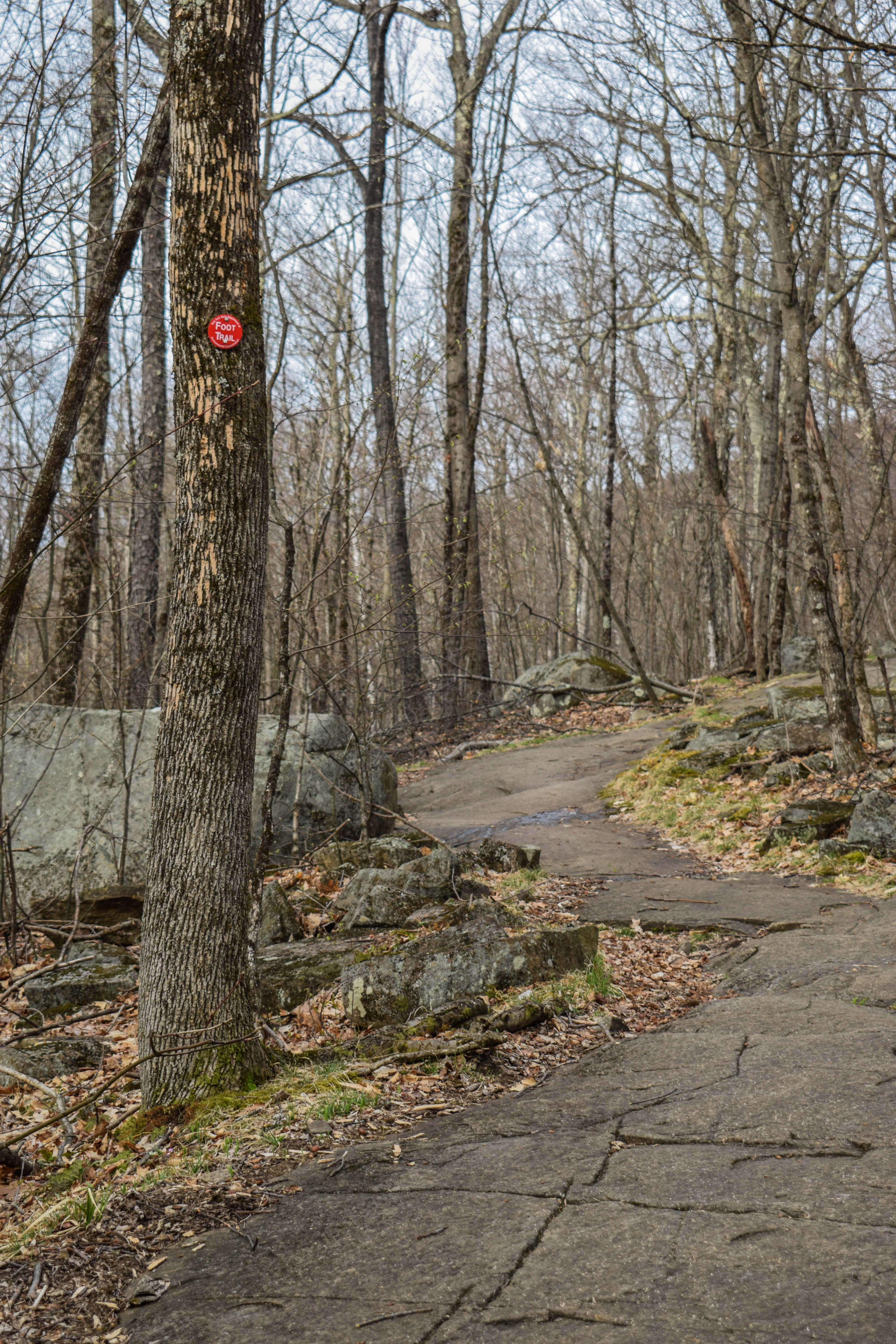
The woods were wet and foggy (just like most of my drive), but beautiful. I noticed blue diamond blazes along with the standard white M-M blazes, turns out the diamonds are for the WMT (Wantastiquet-Monadnock Trail; https://wmtcoalition.org/). I do remember looking this up the last time I hiked on the Royce Trail, but had forgotten all about it!


I was delighted to have worn my waterproof boots, as parts of this trail were muddy with the moisture in the air. I crossed a stream in a pretty, mossy area, noticing many pondskimmers below. I then came up to tons of big, mossy boulders that the trail weaves through and around. I noticed the cloud ceiling was comically low, but I was hoping that much of the fog would burn off by view-time, especially since I was taking the long way up.


The trail became a bit more rugged and crossed a land boundary blazed in red, followed by another fun, bouldery area. The trail then entered a logging area labeled as "Logging haul road across trail ahead" and "SAFETY ZONE; No tresspassing, no shooting."

After the safety zone, I could make out the sounds of NH-124. This stretch of trail was definitely longer than I was mentally prepped for, but it was a delight! I spooked a family of deer, crossed a couple more streams, entered "Society for the Protection of New Hampshire Forest" land, crossed a stone wall, and then made my way across the busy-but-not-impossible-to-cross NH-124!


[8:34am - Crossing Rt. 124]
The entrance to the Metacomet-Monadnock/Royce Trail on the other side of NH-124 was very well blazed with WMT diamonds, white rectangles, blue NH state property paint, NH state land boundary plackards, and a no pets sign. There was an easy-to-get-around blowdown just after reentering the woods, and I was off! The trail hugged the state land boundary and crossed a stone wall, climbing at very easy grades. My sleeves were officially rolled up, though!


The Royce Trail neared a brook on the left in a blowdown area and later crossed a lovely, mossy stream. I also saw my first two red efts of the season!


The trail crosses another stone wall and officially entered the clouds, but the sun was really trying to break through. I hit a few spider webs as I continued to easily gain elevation, and eventually, I saw somoe patches of blue sky! The trail then steepens to a short plateau, where it crosses with Cart Path.


After crossing with Cart Path, the Royce Trail crosses another stream with a log that houses a collection of broken glass and pottery, presumably from the old Halfway Hosue. The grade steepened again, the sun was now shining, and soon enough I was at the terminus at the Monte Rosa and White Arrow Trails!


[9:12am - White Arrow Trail]
I had a very short descent on the White Arrow Trail, which was wide and eroded to the Halfway House site.


[9:14am - Halfway House Site]
First, I noticed an area with a possibly missing plaque (let me check previous photos... no, I do not have any photos of the area unfortunately). I also noticed that there has been some trimming of the view to open things up. Sadly, whatever the view was, it was still behind a cloud! The clouds were interesting at this point, as I personally was in the sun, but there were clouds all around me. I admired some of the old graffiti and then the Moses Spring (which was much larger than I remembered!) before chugging some Nuun and continuing my journey!


[9:19am - Hello Rock Trail]
This started the "most indirect way to the summit" portion of my hike. I wanted to hit all five of the Halfway House-to-Cliff Walk trails. This started with the delightful, but slippery Hello Rock Trail. The woods were wet and soggy but beautiful. I think I could make out every possible shade of green. The footbed was a little obscure at times, but I was able to follow no problem. Closer to Hello Rock, I reentered the cloud, but the sun rays were shining through, putting on a really spectacular show.


The trail continued like a gentle rollercoaster on a soft footbed. I kept taking photos of the sun rays and almost went off-trail at a blowdown with a trail arrow attached. Soon enough, I was on the Cliff Walk!


[9:29am - Cliff Walk]
The Cliff Walk, one of, if not my favorite trail on the mountain, was misty, but no longer foggy. There was a breeze that made my sopping wet body a little chilly. Some big flies had woken up at this point and were buzzing in the sun, but not enought to be a nuissance. The trail climbed up to Point Surprise, a wonder, WARM, viewpoint. The fog was still around the vallies, so the Wapack Range was fully hidden. The sign for Point Surprise was just back in the woods high up on a tree.


[9:36am - Point Surprise Trail]
From here, I started my descent on Point Surprise Trail, which had a muddy start. The woods were foggy again with the really cool sun rays shining through, and I was occasional pelted by raindrops when a breeze would hit the trees. There was a moderate initial descent followed by a walking break, a small rise, and then the descent continued, all on a delightfully soft footbed. There was one more little rise, one more descent, and then I was back at the junction!


[9:42am - Thoreau Trail]
Halfway House climb #2 was up the Thoreau Trail, which really started to get my hamstrings and glutes fired up. I was deeply in my classic "I love this mountain" mode (this would fade later) as I climbed up, back into a cloud, then along a slippery, rocky spine, and eventually opening up at Thoreau's Seat, which is pretty overgrown at this point.


[9:53am - Cliff Walk]
I turned left onto another stretch of the wonderful, fun Cliff Walk. More fog had burned off with just some rolling clouds in the area. I scrambled up a brief moment of open blue sky along slippery rocks and soon made it to the Do Drop Trail.


[9:58am - Do Drop Trail]
Do Drop is the first stretch of trail that I would not label as "wonderful." I remembered having a tough time last time I hiked it, and this round was more of the same. The woods were spooky and I lost the trail early on in my descent. I more or less just followed the GPS track on super soft ground and hoped I wouldn't plummet to my untimely death! Eventually, I found it again and continued down along an eroded footbed, which was unfortuantely an improvement! There were a couple of guiding arrows near the bottom, but other than that, no blazes at all, which made things challenging to naviate. 


[10:08am - Side Foot Trail]
Next up was a short stint on the Side Foot Trail, which was a welcome reprive after Do Drop. So far in this hike, I'd been having plenty of fun, but I was happy to I only had one more side trail left! The trail conditions were remarkably better than Do Drop - even featuring some stone steps! I could hear wood frogs in a nearby vernal pool, and soon enough, it was time for another climb!


[10:12am - Noble Trail]
Noble Trail got right to business with its climb. It was similarly difficult to follow at points, with one particularly tricky steep, slippery spot. My legs were on FIRE and I stopped frequently to check my GPS (and to catch my breath). Slow and steady I moved, eventually being rewarded with a lovely breeze higher up. There was a brief scramble before the trail broke out into the scrub, and the sunny immediately brought me back to life. The rocks in the sun were bone dry, and I caught my first glimpse at the top, which was almost out of the clouds!


[10:22am - Cliff Walk]
Now I just had a short walk on Cliff Walk before my break at Bald Peak. It was beautiful and sunny with a cool breeze now. I was a little chilly with the wet shirt, but I knew I could shelter from the wind at Bald Peak and use the sun to dry out some. Cliff Walk brought me back into the woods, eventually scrambling up to the open summit of Bald Peak!


[10:28am - Bald Peak]
I had a lovely break at Bald Peak. The summit of Mt. Monadnock was in and out of the clouds. The Wapack Range was now mostly in view in the distance. I could make out (and hear) some folks working their way up the White Dot Trail. It was just lovely. I enjoyed some honey roasted pisachio, plenty of liquid, and took a quick scenic pee. It was also fun to see Gap Mountain! It was chilly in the wind, so once I was up, I was immediately moving again!


[10:39am - Smith Connecting Trail]
I continued onto Smith Connecting Trail, which descends along slabs into the col between Bald Peak and Mt. Moandnock, with Mt. Monadnock towering ahead - really such a fantastic view. There were nice views to Monte Rosa on the left as well. Eventually, the descend leads back into some beautiful woods, which were much warmer now that I was out of the wind. The trail turns away at the junction with Amphitheatre Trail junction, which is uniquely marked with four dots and a plus sign - not sure why.


[10:47am - Amphitheatre Trail]
Soon after the curious junction there was a rusted, metal disc nailed to a tree. I would guess an old blaze? Curious. The Amphitheatre Trail continues briefly in the woods before opening up on some beautiful, slanted slabs with partial views to the summit. Last time I was on this trail was during a rain storm, so this was a nice change of pace!


[10:50am - Side Foot Trail Joins]
The Side Foot Trail then joins and coincides while a volture was circling overhead - yikes! The trail skirted around a steep drop and then climbed some more, providing a nice view to Gap Mountain. 


[10:54am - Junction w/ White Arrow Trail]
Amphitheatre Trail briefly turned right onto White Arrow and then left off of it ~10 feet later before entering a really cool ledgy area. After, the trail reentered the woods and descended over steep, wet, slippery rocks. This pattern of ledge - wet woods - ledge continued for a bit, almost always with a nice view, though. Eventually, I descended on some dry open slabs and came to what I must assume is the black precipice before reentering the woods for a final time.


[11:06am - Smith Summit Trail]
Now it was finally time to summit Mt. Monadnock! At the Amphitheatre's terminus, I turned right onto the Smith Summit Trail, which would steeply bring me to the top. At first, I ventured through some more wet, slippery woods and over some trickling streams, and then I began to really ascend. I couldn't help but think about how crazy it was that the first two times I took this trail was via descent, and one time it was even raining. It's a rough trail!


There were great views the whole time and some fun scrambles (and gustier wind) higher up. It was now 52 degrees with 5-15mph winds, and one gust up to 20 mph. I hit the final, trickier scramble and made it to the summit area with views in almost all directions! All I had left was a few scrambly climbs to the tippy top.


[11:30am - Summit of Mt. Monadnock]
To no surprise, there were a decent amount of people, especially families, up top. It was windy and chilly, so I didn't plan to stick around. I found the two USGS discs that I know about - for a while I thought there were three, but after going through my photos a dozen times, it seems like only two! The views were amazing, to no surprise, but I was soon on my way to Jim's Junction!


[11:33am - Dublin/Marlboro Trails]
I followed the sign for the Dublin/Marlboro Trails and (aside from the summit) passed my first people of the day! The trial was wet, but not a problem at all. This whole area above "treeline" is just stunning.


[11:40am - Jim's Junction/Marlboro Trail]
I was feeling good at Jim's Junction, so I decided I'd take another break down at the junction with Marian Trail later. The sun was now behind the clouds, taking away some of the beloved warmth from before. My descent was slow and scrambly, as this trail gets comically steep (still better than descending on Do Drop). The steepness calmed down in a stunning mossy forest before coming to a ledge with views to Haystack Mountain, Stratton Mountain, Bromley Mountain, and Mt. Ascutney (I love this time of year when I can see the snow on the ski slopes still). 


It was now even cloudier and I had my first decent slip and fall of the day! Smashed my left hip into a rock - ouch. Thankfully, I was fine, and it doesn't actually count as a fall becuase my bum didn't touch the ground! The Marlboro Trail continued a rough descent through a crack in a rock and eventually opens up to a few slabby stretches marked with cairns.


At the junction with Marian Trail, I took a quick break to recouperate after my fall, eat some pistachios and a protein bar, and simply chill. This break actually saved my life, because I was considering cutting the hike short, but I was BACK. Next stop: Monte Rosa!


[12:09pm - Marian Trail]
I had similar, rough memories of the Marian Trail, specifically in regards to footing. The Marian Trail hikes past some cool, overhanging rock formations - they looked like you could just slot them right out from one another. Then, my memory was validated as true, as I had to descend on some large, slippery boulders, and then... SPLAT. Another slip and fall on my right hip - ouch! I had some colorful language escape from my mouth after this one, but I was still fine thankfully. 


From this point, the trail unfortunately just got rockier and slipperier (is that a word?). I was brought to sitting-and-scootching to avoid another catastrophe. On the bright side, the sun came out for the first time in about an hour, so that was a win! There was a beautiful stream crossing in the mossy woods, which was followed by a very pretty stretch. I was definitely on low-energy and low-excitement after my falls, but the beauty of the woods definitely helped to keep me going.


I continued a descent in an area with some slippery side-hilling, which I did remember being rough last time. That led to a small view and then turned into more pretty woods with GOOD FOOTING! Finally!


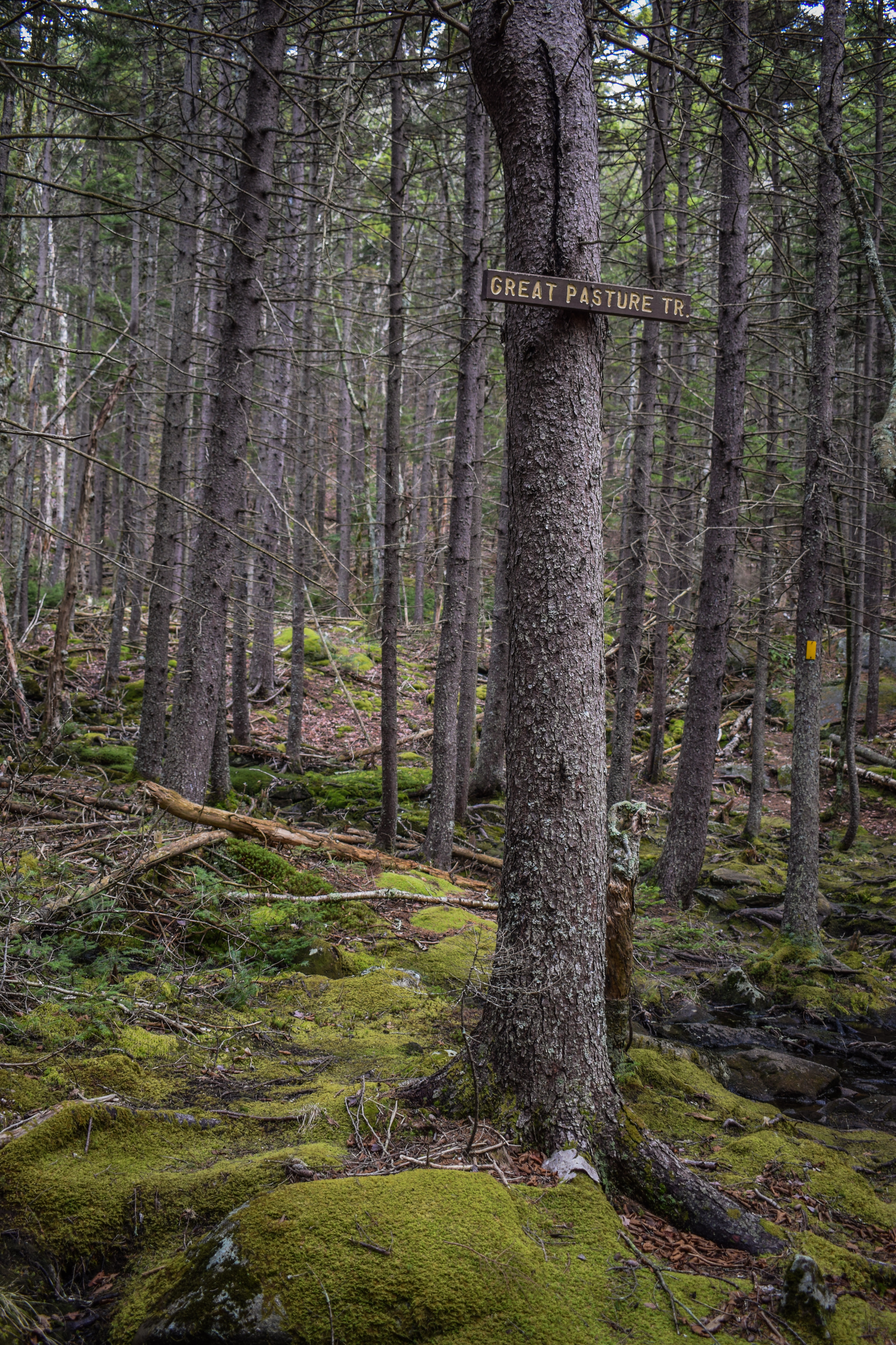
I passed some kind of recent mammal poop (the Seek app was not helpful) and then I think I heard it move in a grassy area just off-trail - exciting! I was NOT going to f- around and find out, though, so I kept it moving. I noticed an old herd path on the right just before the Great Pasture/Mossy Brook junction, not sure where it goes.


[12:43pm - Great Pasture Trail]
Last time I was on the Great Pasture Trail, I was descending, and I remember it being DUMB steep. The Great Pasture Trail began at the three way junction in a wet area with Marian and Mossy Brook Trails. It is blazed with yellow rectangles, and the footbed was similarly obscure to Nobel and Do Drop, but the blazes helped immensely! 


The trailbed soon got extremely rooty and then it got rockier and steeper. I did miss a turn, but quickly realized when the footbed got soft and got back on it. This trail did the thing that steep trails do where they pretend to have switchbacks, but they moreso just zigzag steeply up the mountain. It got STEEP, but I was very happy to be ascending versus descending. 


The Great Pasture Trail eventually opened up to a ledge with views to the summit. The trail was now mostly marked by spaced out cairns - I was just happy to be back on grippy rocks! I got a view out into southern Vermont, where I could now see Killington and Okemo! After some more climbing I, to quote my notes, "finally found that damn weathervane." I think it's time to start my return trip!


[12:58pm - Monte Rosa]
[12:59pm - Smith Summit Trail]
I did not stay at Monte Rosa for even a second. I continued on the confusing descent along Smith Summit Trail to The Tooth. I did get a little too confident on my foot placements though and slipped again, but I did NOT fall nor did I smash my left hip into a rock, so that's a win!


[1:02pm - Smith Bypass]
The Smith Bypass trail was short and sweet with some rocky footing, but all manageable. I had one final slip of the day, but I did catch myself... with my phone screen hitting a rock. It's hard to catch a break! I had my phone out to make sure I got on the Monte Rosa Trail and not the Fairy Spring Trail at the junction. So frustrating!


[1:08pm - Monte Rosa Trail]
The Monte Rosa continued to descend in steep woods. Thankfully, it was warm, sunny, and dry. I eventually crossed paths with my second group of people for the day! They were very nice and had a dog. They asked if they were on the Monte Rosa Trail, I said yes, they asked if this path goes to the summit, I said yes, assuming they meant the summit of Monte Rosa. In hindsight, they might have meant the tippy top, which we were nowhere nearby... They asked if they were far, I told them not distance-wise, but they were far [from Monte Rosa] elevation wise, and they got a chuckle. They then told me they were looking for Cart Path, but couldn't find it... I hope they made it through okay!


The Monte Rosa continued to plummet after this interaction, eventually crossing a lovely footbridge and terminating at the junction with White Arrow and Royce.

[1:19pm - Metacomet-Monadnock/Royce Trail]
I had originally planned to descend via Halfway House or Toll Road, but I really didn't want to walk along NH-124, so back on Royce I went! I noticed some old machinery in the woods between White Arrow and Royce, but I was too far for a photo. I also heard what sounded like yardwork, maybe coming from the private residence. The sun was starting to feel hot, which felt amazing. My brain was on low-thinking-energy as I continued my descent.


I stepped through a few muddy puddles and noticed that the waterproofing on my boots wasn't as strong as it once was. I zoned out for a while, but came back when I started to cross some streams and neared the road. I passed some yellow flowers that I noticed hadn't bloomed as of the morning, but were now proudly on display. I soon entered state land, crossed a rock wall, and then I was at NH-124!


[1:51pm - Crossing Rt. 124]
I had another easy crossing of NH-124, passed an old M+M Trail Marker, and was back in the woods. My brain turned off for this stretch again, which was kind of nice. I crossed the steams, entered the safety zone, passed the boulders, and eventaully made it back to the parking lot!


[2:13pm - End of Hike]
There was one other car at the parking lot, but no people to be seen. I was TIRED. My heart wanted to hit Gap Mountain, too, but my body was all done. Plus, I had to wake up super early the next day to drive to NJ to see Boop! on Broadway (very fun show). Besides my hip pain, another great day on my favorite mountain!


Step-by-Step
- Park at Gap Mountain Reservation North parking area.
- Start hike on parking lot spur to Metacomet-Monadnock Trail/Royce Trail (blue diamond).
- At jct., turn left onto Metacomet-Monadnock/Royce Trail (white rectangle). 
- Cross NH-124, continue on Metacomet-Monadnock/Royce Trail (white rectangle).
- At terminus, turn right onto White Arrow Trail (white arrow).
- At Halfway House Site, follow spur trail to Hello Rock/Point Surprise/Thoreau Trails.
- At jct., turn right onto Hello Rock Trail (unblazed).
- At terminus, turn left onto Cliff Walk (white diamonds/white Cs).
- At jct., turn left onto Point Surprise Trail (unblazed).
- At terminus, turn right onto Thoreau Trail (unblazed).
- At terminus, turn left onto Cliff Walk (white diamonds/white Cs).
- At jct., turn left onto Do Drop Trail (unblazed).
- At terminus, turn right onto Side Foot Trail (white rectangles).
- At jct., turn right onto Noble Trail (unblazed).
- At terminus, turn left onto Cliff Walk (white diamonds/white Cs).
- Summit Bald Rock.
- Continue onto Smith Connecting Trail (yellow Ss)
- At jct., turn left onto Amphitheatre Trail (yellow rectangles).
- At terminus, turn right onto Smith Summit Trail (white dots/white Ss).
- Summit Mt. Monadnock.
- Descend via Dublin/Marlboro Trail (white Ds/Ms).
- At Jim's Junction, turn left onto Marlboro Trail (white Ms).
- At jct., turn left onto Marian Trail (yellow dots).
- At jct., turn left onto Great Pasture Trail (yellow rectangles).
- Summit Monte Rosa.
- Continue on Smith Summit Trail (white dots/white Ss).
- At jct., turn right onto Smith Bypass.
- At jct., continue straight onto Monte Rosa Trail.
- At jct., continue straight/right onto Metacomet-Monadnock/Royce Trail (white rectangles).
- Retrace steps back to car.