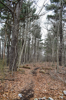
Braintree Triangle (Blue Hills Reservation)
Distance: 1.67 miles
Elevation: 49 feet
Elevation: 49 feet
Time: 33 minutes
Hike Type: Out-and-Back, Lollipop Loop
Hiking Challenges: 52 Hike Challenge 2024; 125-Mile Challenge (2x)
Hike Type: Out-and-Back, Lollipop Loop
Hiking Challenges: 52 Hike Challenge 2024; 125-Mile Challenge (2x)
The Hike
It's time to officially complete the Friends of Blue Hills 125-Mile Challenge for the second time! (Thankfully they have a second round patch!) It was a cool morning at 32 degrees. I had a slow start to my day and didn't get to the trailhead until after 11am. There were a few cars at the trailhead, and I got right to work!
I started on the Hemlock Path as an out-and-back, which doubled as my breakfast time becuase I realized I also forgot to eat breakfast... whoops! The Kirkland protein bar fueled my easy walk to I-93 and back. I really like the end of this trail - full of old artfacts like bricks, bottles, and some road infrastructure.
The surrounding wetlands were partially frozen and the walk along Old Route 128 was peaceful. I even noticed the sun was trying to break through the clouds for the first time in over a week! Once on the Elm and Winnemoiset Paths I found myself imagining what this area must have been like when it was still a part of the reservation - before the construction of I-93. It's really neat to think about!
Soon enough, I was on my return trip, and my challenge was over! All in all I hiked 172.08 miles and 19,976 feet of gain for this challenge over 32 different hikes. It was fun to revisit areas of the reservation I hadn't been to in a long time, and even more fun to "rediscover" areas that I had fully forgotten about. Moving forward, I'm going to continue working on AMC's Winter Trace (which is what I'll be doing in no less than 30 minutes), the Blue Hills Grid, Great Blue Summits, and tracking miles hiked in the reservation as I work toward 1,000 (I recently hit 500!).
Step-By-Step
- Start hike by walking across Old Route 128 and continuing along Hemlock Path.
- At terminus (I-93), turn around.
- Back at Old Route 128, hike west on Old Route 128.
- At 5611, turn right onto Elm Path.
- At terminus, turn left onto Winnemoiset Path.
- Follow loop, bearing left, back to Old Route 128.
- Return to car.


No comments:
Post a Comment